
Homerton Hill N. Cist
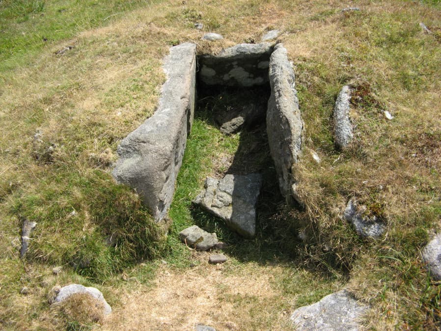
Photo taken on 15-07-2018
Database entries
OS Map: SX 56132 90651
OS Source: Garmin
Butler OS: SX56169065
HER: MDV12884
Megalithic Portal: 45808
PMD: Homerton Hill
Alternate name: Homerton Hill N.
Short Name: CT Homerton N
Butler map: 43.15
Butler Vol 5: p.177 & Fig.119
Dixon Cist #: 151
DPD page: 157
Exist: Yes
Record: Unique
Record Source: Butler
Hut Class: No
Cist Class: Yes
Cairn Class: Yes
Dimensions (m): 3.5 x 0.3 C
Lidar: SX 56132 90651
Guide Map: 4
Nearest Bus Stop: Sourton Windard Terrace (3.6 km) [Route: 118]
Nearby sites: SX 56132 90651
Notes
Butler Homerton Hill N. Vol. 2. Map 43.15 (diagram Vol. 5. p.177). A small, disturbed cairn containing three edge set stones of a cist ... The turf covered cairn measures 3.5 x 3.1m and 0.3m max. height. The top and north side of the mound has been disturbed exposing the three in situ cist stones. The cist measures 0.8 x 0.6m and 0.3mdeep. It is now open to the north. A large stone lying flush with the ground lies immediately north east of the cairn and probably represents the missing endstone or the coverstone. Lethbridge diagram p.156 and photos p157.References
These are selected references with an emphasis on out of copyright sources linked as PDFs. For more detailed references try any linked HER or PMD record above.
- Butler, Jeremy, Dartmoor Atlas of Antiquities, vol.2: The North, (1991)
- Butler, Jeremy, Dartmoor Atlas of Antiquities, vol.5: The Second Millennium B.C., (1997)
- Lethbridge, William D., Discover Preshistoric Dartmoor, (2015)
- Newman, Phil, Archaeological Sites within Okehampton Training Area, Southwest Landscape Investigations (2014)