
Scad Brook Enclosed Settlement
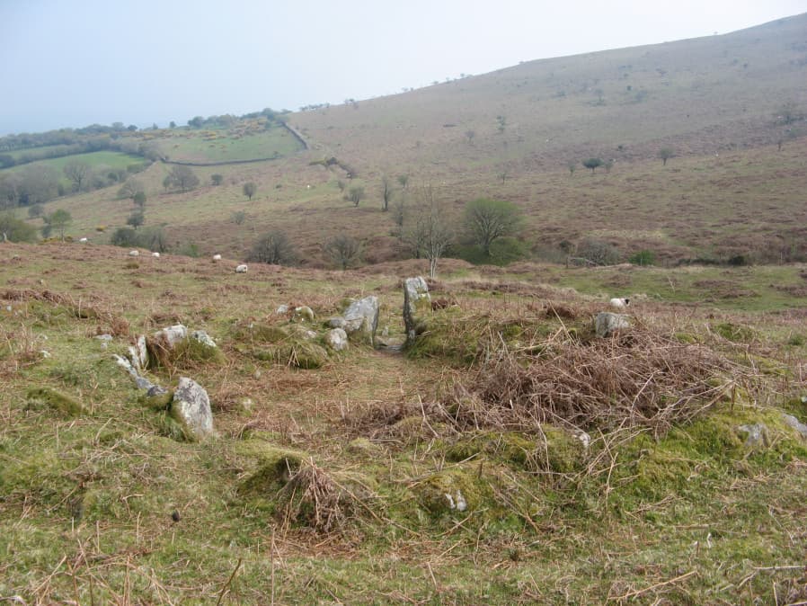
Photo taken on 22-04-2019
Database entries
OS Map: SX 66681 59973
OS Source: Google
HER: MDV2913
Megalithic Portal: 45573
Alternate name: Scad Brook
Short Name: ES Scad Brook
DPD page: 81
Exist: Yes
Record: Unique
Record Source: PDW
Hut Class: No
Lidar: SX 66681 59973
Guide Map: 58
Nearest Bus Stop: South Brent Pool Park (4.5 km) [Route: 38]
Nearby sites: SX 66681 59973
Notes
Sub-circular enclosure approximately 1.25 hectares in area containing eleven hut circles ranging from 3.5 metres to 10 metres in diameter, with entrances facing south-east and many of the walls standing up to a metre high. The most complete hut has been excavated and re-instated with walls faced with orthostats and an entrance with jambs. Lethbridge p.81References
These are selected references with an emphasis on out of copyright sources linked as PDFs. For more detailed references try any linked HER or PMD record above.
- Lethbridge, William D., Discover Preshistoric Dartmoor, (2015)