
Saddlesborough Stone Ring Cairn Circle
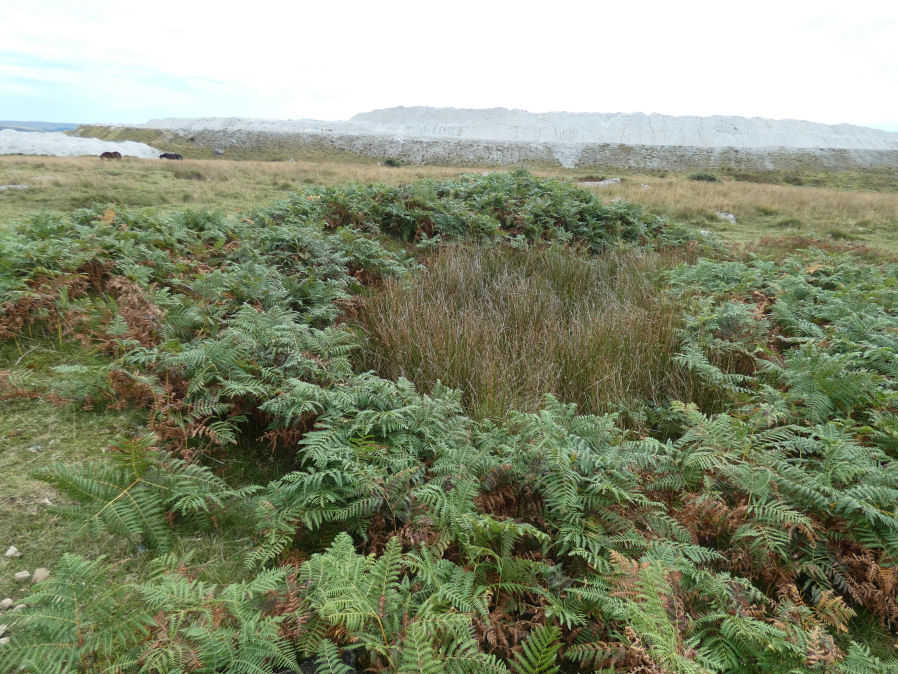
Photo taken on 12-09-2022
Database entries
OS Map: SX 5587 6321
OS Source: Butler
Butler OS: SX55876321
HER: MDV2433
Megalithic Portal: 45840
Alternate name: Saddlesborough Summit
Short Name: RC Saddlesboro
Butler map: 48.3
Turner: A45
Exist: Yes
Record: Unique
Record Source: Butler
Hut Class: No
Cairn Class: Yes
Dimensions (m): 19.0 x 0.3
Lidar: SX 5587 6321
Guide Map: 53
Nearest Bus Stop: Wotter Methodist Church (1.7 km) [Route: 59]
Nearby sites: SX 5587 6321
Notes
"Stone ring with an annular bank. The interior is part infilled with small stones and boulders to 0.3 meters or less below the bank top. This cairn measures 15.5 meters in diameter, with a bank 1.3 meters wide and 0.4 meters high. The interior has been dug into. Situated on a level summit."The two entries SiteID=545 and SiteID=1472 are probably correct but the area is disturbed by tin workings and further confirmation is required that the correct features have been identified in the field (in terms of photos - visit 12 Sep 2022). Grid references not updated due to doubt about ID.
References
These are selected references with an emphasis on out of copyright sources linked as PDFs. For more detailed references try any linked HER or PMD record above.
- Butler, Jeremy, Dartmoor Atlas of Antiquities, vol.3: The South-West, (1994)
- Fletcher, M. + Probert, S., Shaugh Moor, Devon: An Archaeological Survey, 3, Royal Commission on the Historical Monuments of England Report (1998)
- Turner, J.R., Ring Cairns, stone circles and related monuments on Dartmoor, D.A.S.P. No.48 pp.27-86 (1990)
- Wainwright G. J. , Fleming A. and Smith K., The Shaugh Moor Project: First Report, Proceedings of the Prehistoric Society , Volume 45 , December 1979 , pp. 1 - 33 (1979)