
Shell Top Chambered Cairn
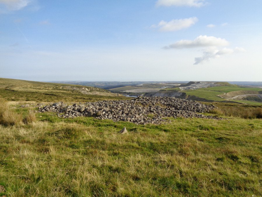
Photo taken on 25-08-2017
Database entries
OS Map: SX 58690 63517
OS Source: Google
Butler OS: SX58676350
HER: MDV2411
Megalithic Portal: 45852
Alternate name: Tory Brookhead 3
Short Name: CN ToryBrook 3
Butler map: 51.7.3
Grinsell: SHAUGH PRIOR 39
DPD page: 59
Exist: Yes
Record: Unique
Record Source: Butler
Hut Class: No
Cist Class: Maybe
Cairn Class: Yes
Dimensions (m): 25 x 18 x 1.4
Lidar: SX 58690 63517
Guide Map: 53
Nearest Bus Stop: Lee Moor Clearview (2.9 km) [Route: 59]
Nearby sites: SX 58690 63517
Notes
"A Bronze Age round cairn on a well drained south west facing slope. The cairn mound measures 26 metres by 24 metres and stands up to 1.2 metres high. The centre is much disturbed, with many hollows, up to 1m deep, which have been interpreted as chambers, but are most probably modern windbreak shelters. Two small satellite cairns lie immediately to the north west." Lethbridge suggests a chambered cairn, see photos Lethbridge p.59-60 Chambered Cairn - diagram p.59References
These are selected references with an emphasis on out of copyright sources linked as PDFs. For more detailed references try any linked HER or PMD record above.
- Butler, Jeremy, Dartmoor Atlas of Antiquities, vol.3: The South-West, (1994)
- Grinsell, L.V., Dartmoor Barrows, Devon Archaeological Society Proceedings No.36 (1978)
- Lethbridge, William D., Discover Preshistoric Dartmoor, (2015)
- Rowe, Samuel, A Perambulation of Dartmoor (3rd Edition), (1896)
- Worth, R. Hansford, The Erme, Yealm and Torry part 1, T.P.I. Vol.11 part 1 pp.173-183 (1892)
- Worth, R.N., A Hut Cluster on Dartmoor [at Shell Top, Lee Moor], T.D.A. Vol.22 pp.237-239 (1890)