
Hawk's Tor Rock Shelter
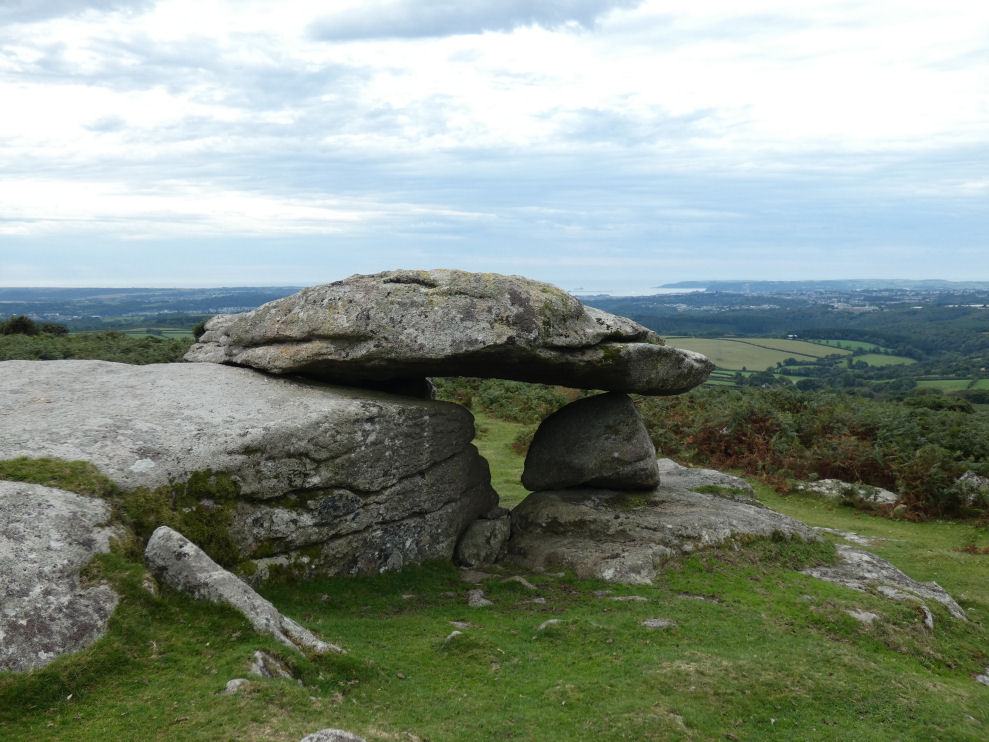
Photo taken on 12-09-2022
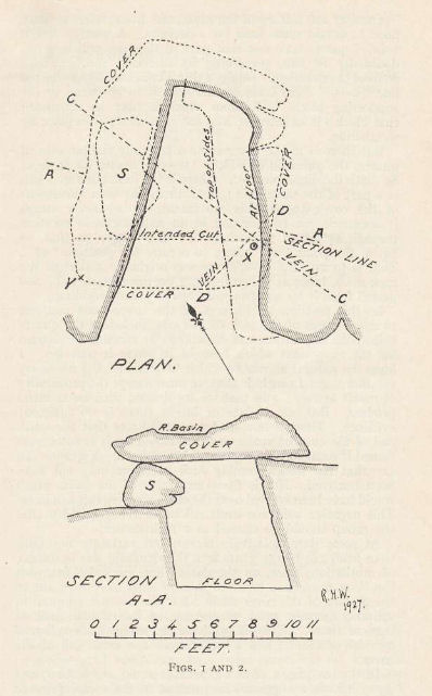
Plan by RHW. Barrow Report 60. TDA Vol.73 1941
Database entries
OS Map: SX 55348 62514
OS Source: HER
HER: MDV2504
Megalithic Portal: 45856
PMD: Hawk's Tor - Possible Chambered Tomb
Alternate name: Hawk's Tor
Short Name: RS HawksTor
Grinsell: List A SHAUGH PRIOR 2
DPD page: 56
Exist: Yes
Record: Unique
Record Source: Grinsell
Hut Class: No
Barrow Report: 60
Lidar: SX 55348 62514
Guide Map: 54
Nearest Bus Stop: Wotter Methodist Church (1.0 km) [Route: 59]
Nearby sites: SX 55348 62514
Notes
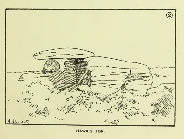
Natural feature Hawk's Tor rock shelter - resembles tomb. "At the summit stands a rock shelter, v shaped in plan with a coverstone. Rowe referred to it as a cromlech. R. N. Worth called it a natural grouping of rocks. Mr. Beckerlegge on examining the coverstone, found a similar vein of quartz in the coverstone as in the rocks of the v shaped shelter, but running in a different direction. The coverstone must have been levered or swung in an anti-clockwise direction through an angle of 90 degrees to make a shelter of what was previously an opening between two vertical walls of rock". Might be prehistoric, could be from Roman period or later. Lethbridge p.54-6 Hawk's Tor Cromlech / Rock Shelter - diagram p.55, photo p.56. See also: The Modern Antiquarian.The following is a sketch by R.H Worth The Moorland Plym (1890). Detailed analysis by R.H. Worth in Barrow Report 60 in which he concludes the cover has been rotated.
References
These are selected references with an emphasis on out of copyright sources linked as PDFs. For more detailed references try any linked HER or PMD record above.
- Fletcher, M. + Probert, S., Shaugh Moor, Devon: An Archaeological Survey, 3, Royal Commission on the Historical Monuments of England Report (1998)
- Grinsell, L.V., Dartmoor Barrows, Devon Archaeological Society Proceedings No.36 (1978)
- Lethbridge, William D., Discover Preshistoric Dartmoor, (2015)
- Worth, R. Hansford, The Moorland Plym, T.P.I. Vol.10 Part 3 p.294 (1890)
- Worth, R. Hansford, Barrow Report 60, T.D.A. Vol.73 pp.51-59 (1941)
- Worth, R.N., Barrow Report 4, T.D.A. Vol.14 (1882)
- Worth, R.N., Barrow Report 12, T.D.A. Vol.22 pp.49-52 (1890)