
Hembury Castle (Buckfast) Fort
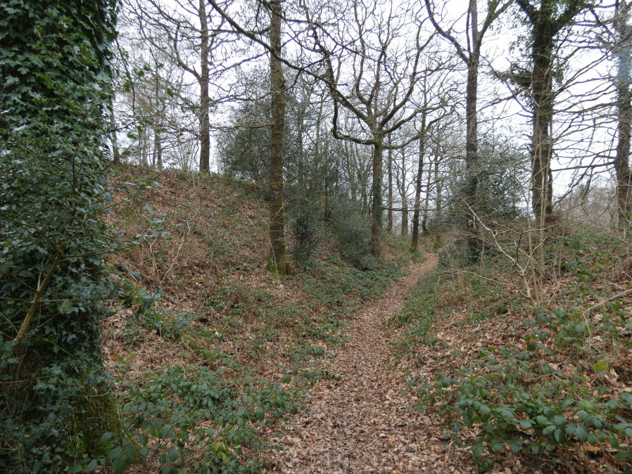
Photo taken on 29-01-2023
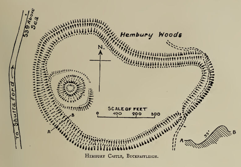
Plan: J.C. Wall in Ancient Earthworks (1906)
Database entries
PDW coverage: Dartmoor Resource: Table of Devon Iron Age Forts
OS Map: SX 72608 68455
OS Source: Google
HER: MDV7776
Megalithic Portal: 34692
Alternate name: Hembury Castle
Short Name: FT HembCastle
Exist: Yes
Record: Unique
Record Source: PDW
Hut Class: No
Lidar: SX 72608 68455
Guide Map: 45
Nearest Bus Stop: Buckfast Higher Mill Lane (2.3 km) [Route: 88]
Nearby sites: SX 72608 68455
Notes
"Hembury castle. Ia hill fort with medieval castle within. Hill fort in hembury woods, south east of holne. A camp situated on the summit with a good view to the south and east. The main camp consists of an irregular area surrounded by a fosse and vallum with a small rampart on the outer side of the fosse. The height from the top of the vallum to the bottom of the fosse is between 25-30 feet, and the area is about 7 acres. On the west side near the ditch is a mound about 30m in diameter and about 20 feet high. This is surrounded by a level platform with a scarped edge descending to the level of the interior of the camp. This may be of a later date than the main ramparts. A bronze celt and some sling stones have been found within the area of the camp. The whole is on an enclosed moor with some trees growing on the area of the mound (ancient monuments)."Grinsell [Folklore 1976]: A hill-fort, the defence of which was left to ladies who ‘welcomed the enemy, took them to their beds, and stabbed them all in the night’. Brown 1964, 148.
References
These are selected references with an emphasis on out of copyright sources linked as PDFs. For more detailed references try any linked HER or PMD record above.
- Amery, P. F. S., Some hitherto unrecorded Hill Fortresses near Ashburton, T.D.A. Vol.6 Part 1 pp.261-265 (1873)
- Fox, Aileen, Prehistoric hillforts in Devon, (1996)
- Gerrard, Sandy, English Heritage Book of Dartmoor: Landscapes Through Time, (1997)
- Grinsell, L.V., Grinsell, Folklore of Prehistoric Sites in England, (1976)
- Pilkington-Rogers, C. W., The Date of the Dartmoor Antiquities, T.D.A. Vol.64 pp.379-388 (1932)
- Silvester, R., The Relationship of First Millennium Settlement to the Upland Areas of the South West., D.A.S.P. No.37 pp.178-179 (1979)
- Wall, J. Charles, Ancient Earthworks, The Victoria History of the County of Devon: v. 1 pp.573-630 (1906)
- Wilkinson J. Gardner, British Remains on Dartmoor, Journal Brit. Arch. Assoc. xviii. pp.22-53, 111-133. (1862)