
Wooston Castle Fort
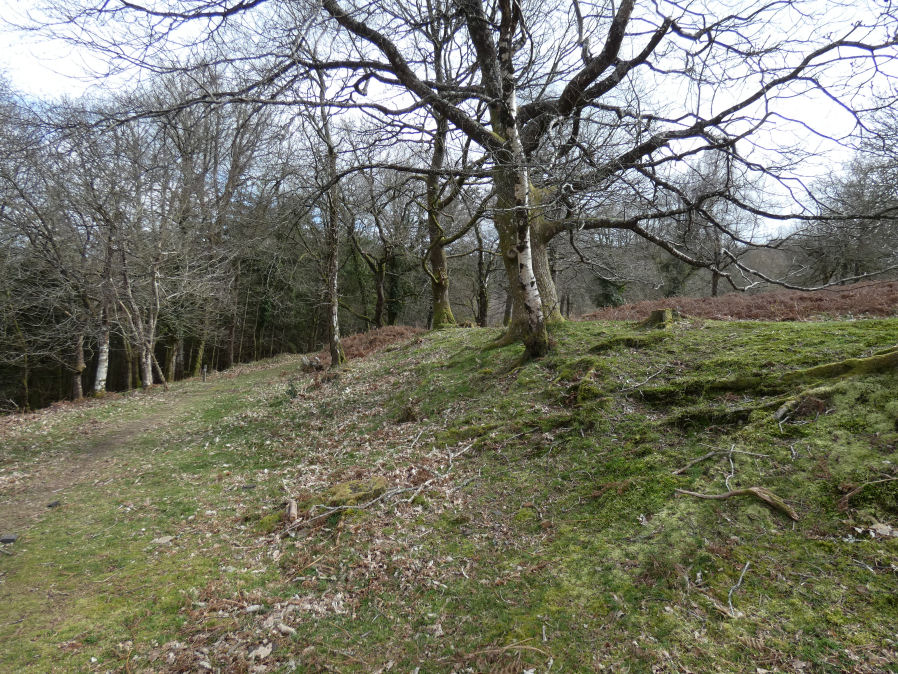
Photo taken on 26-03-2026
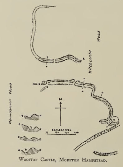
Plan: J.C. Wall in Ancient Earthworks (1906)
Database entries
PDW coverage: Dartmoor Resource: Table of Devon Iron Age Forts
OS Map: SX 76486 89673
OS Source: Google
HER: MDV8292
Megalithic Portal: 7767
Alternate name: Wooston Castle
Short Name: FT:Wooston
Exist: Yes
Record: Unique
Record Source: PDW
Hut Class: No
Lidar: SX 76486 89673
Guide Map: 14
Nearest Bus Stop: Drewsteignton Square (4.2 km) [Route: 173]
Nearby sites: SX 76486 89673
Notes
HER: Wooston Castle comprises a defensive enclosure approached through a series of outworks which extend for up to 200 metres from east to west. From south to north the whole complex covers some 500 metres, at the northern extremity the defences lie within 50 metres of a precipitous drop to the River Teign. Excavation in 2018 revealed information on the construction of the ditches and banks but found no dateable evidence to confirm the assumed Iron Age date of the site.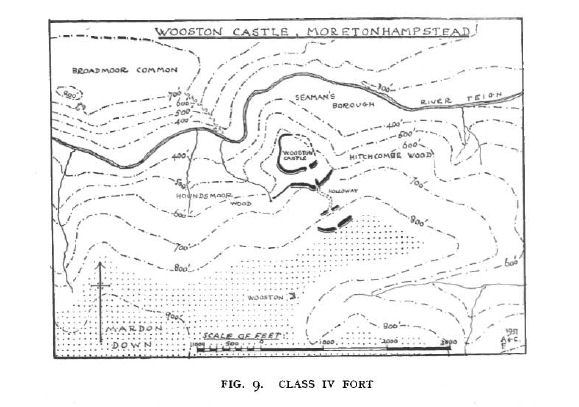
Fox (1952): Class IV. Multivallate forts with wide-spaced lines of defence on promontory sites.
Wooston Castle on the south bank of the Teign near Moretonhampstead, Devon, is a structure that resembles the hill-slope forts in certain ways, yet its peculiar plan and situation demand it be assigned to a separate category. The whole fort lies on sloping ground between Mardon Down and the edge of a precipitous fall to the river, running in a wooded gorge, 250 ft below. Thus, whilst the inner zone has good natural defences on the north, the fort as a whole is at a disadvantage in relation to the plateau.
The innermost zone is probably a complete enclosure 1 on the end of the bluff jutting into the gorge. The second enclosure is defined by a bank and ditch, stronger than the inner one, drawn across the neck and with its ends resting on the steep scarps in the manner of a promontory fort; the western end has been extended by a slighter bank along the edge of a re-entrant in the gorge as far as the spring head. Two more outer zones are indicated by short lengths of earthwork aligned long the contour, 100 to 200 ft higher up the hillside: these may have been extended by palisades, as has been conjectured at Milber or Llanmadog.
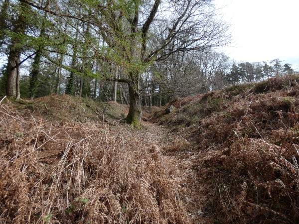
The whole fort is entered steeply downhill through simple gaps in the two outer lines of ramparts. The way between the second and third lines is a remarkable hollow-way which winds downhill in an S curve, deepening as it goes. The entry to the second enclosure has a characteristic knobbled rampart end on the west side and a well marked inturn on the east. The entry to the inner most zone is again a simple gap.
Dated to 2nd-1st century BC by comparison with similar earthworks which have been excavated.
The author visited this site with Steve Szypko on 26/03/26. It is an impressive set of earthworks and we used Gerrard's plan on p.67 to navigate around the site. The extent of the earthworks is quite remarkable with a section south of the road. The photo below shows the hollow-way described by Fox.
References
These are selected references with an emphasis on out of copyright sources linked as PDFs. For more detailed references try any linked HER or PMD record above.
- Fox, Aileen, Hill-Slope Forts and Related Earthworks in South-West England and South Wales, Archaeological Journal Vol 109 (1952)
- Fox, Aileen, Prehistoric hillforts in Devon, (1996)
- Gerrard, Sandy, English Heritage Book of Dartmoor: Landscapes Through Time, (1997)
- Newman, Phil, The Field Archaeology of Dartmoor, (2011)
- Pilkington-Rogers, C. W., The Date of the Dartmoor Antiquities, T.D.A. Vol.64 pp.379-388 (1932)
- Rowe, Samuel, A Perambulation of Dartmoor (3rd Edition), (1896)
- Silvester, R., The Relationship of First Millennium Settlement to the Upland Areas of the South West., D.A.S.P. No.37 pp.178-179 (1979)
- Wall, J. Charles, Ancient Earthworks, The Victoria History of the County of Devon: v. 1 pp.573-630 (1906)
- Wilkinson J. Gardner, On Ancient British Walls, Journal Brit. Arch. Assoc. xvii. pp.1-14. (1861)
- Wilkinson J. Gardner, British Remains on Dartmoor, Journal Brit. Arch. Assoc. xviii. pp.22-53, 111-133. (1862)
- Worth, R. Hansford, Stray notes on the Teign Valley, T.D.A Vol.78 pp.161-170 (1946)