
The Trendle Fort
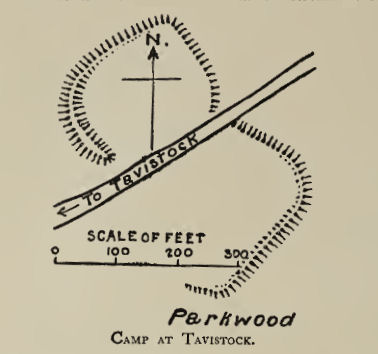
Plan: J.C. Wall in Ancient Earthworks (1906)
Database entries
PDW coverage: Dartmoor Resource: Table of Devon Iron Age Forts
OS Map: SX 49067 75341
OS Source: Google
HER: MDV3829
Megalithic Portal: 62492
Alternate name: The Trendle
Short Name: FT:The Trendle
Exist: Yes
Record: Unique
Record Source: HER
Hut Class: No
Lidar: SX 49067 75341
Nearest Bus Stop: Tavistock Bus Station (2.0 km) [Route: 55,56,98,118,171(20/07/26 to 19/09/26)]
Nearby sites: SX 49067 75341
References
These are selected references with an emphasis on out of copyright sources linked as PDFs. For more detailed references try any linked HER or PMD record above.
- Wall, J. Charles, Ancient Earthworks, The Victoria History of the County of Devon: v. 1 pp.573-630 (1906)
- Worth, R. Hansford, Prehistoric Tavistock, T.D.A. Vol.79 pp.125-128 (1947)