
Blackbury Camp Fort
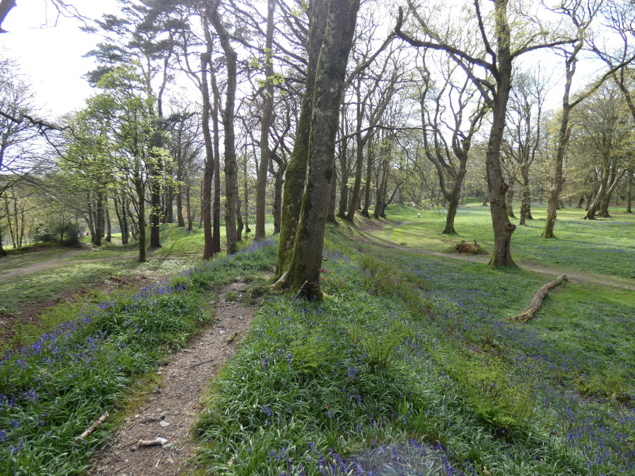
Photo taken on 18-04-2024
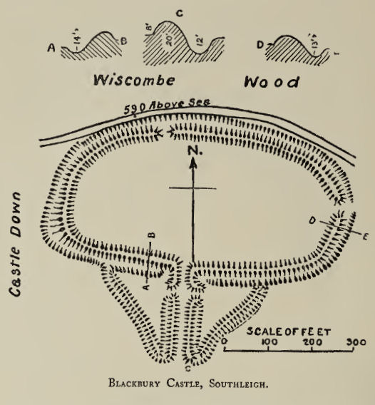
Plan: J.C. Wall in Ancient Earthworks (1906)
Database entries
PDW coverage: Dartmoor Resource: Table of Devon Iron Age Forts
OS Map: SY 18733 92357
OS Source: Google
HER: MDV10840
Megalithic Portal: 14788
Alternate name: Blackbury Camp
Short Name: FT Blackbury
Exist: Yes
Record: Unique
Record Source: Fox
Hut Class: No
Lidar: SY 18733 92357
Nearby sites: SY 18733 92357
Notes
"Blackberry Castle. Iron Age. This is a splendid univallate hillfort with a massive flint built rampart and deep outer ditch. On the south side is the original entrance, which is slightly out-turned and originally contained a timber gateway which was probably bridged. To this entrance was added a triangular outer defence or barbican which was never completed. The present gaps in the north, west and east are recent. The site, which is in the care of the Department of the Environment, is in a beech plantation, clear of undergrowth. It was excavated by the Devon Archaeological Society between 1952 and 1954, under the direction of Mr. A. N. Young and Miss E. Richardson."The author visited on 18th April 2024 and hopefully the photo has captured how beautiful this site can be with bluebell cover in the spring.
References
These are selected references with an emphasis on out of copyright sources linked as PDFs. For more detailed references try any linked HER or PMD record above.
- Fox, Aileen, Prehistoric hillforts in Devon, (1996)
- Hutchinson, P. O., On the Hill Fortresses, Tumuli, and some other Antiquities of Eastern Devon, Journal of the British Archaeological Association Vol.18 pp.53-66 (1862)
- Kirwan, Rev. R., Notes on the Pre-historic Archaeology of East Devon. Part 4., T.D.A. Vol.4 pt 2 pp.641-653 (1871)
- Wall, J. Charles, Ancient Earthworks, The Victoria History of the County of Devon: v. 1 pp.573-630 (1906)