
Stalldown Cairn Circle
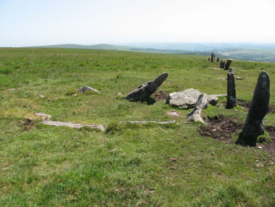
Photo taken on 30-06-2015

Plan by RHW Retaining circles associated with stone rows Dartmoor (1941)
Database entries
PDW coverage: Dartmoor Site: Stalldown Stone Row
OS Map: SX 63244 62423
OS Source: Garmin
Butler OS: SX63246241
HER: MDV4300
Megalithic Portal: 3474
PMD: Staldon Stone Row
Alternate name: Stalldown stone row
Short Name: CC Staldon 1
Butler map: 54.18.1
Grinsell: CORNWOOD 21
Turner: D26
DPD page: 68
Exist: Yes
Record: Unique
Record Source: Butler
Hut Class: No
Cairn Class: Yes
Dimensions (m): 5.0 x 0
Lidar: SX 63244 62423
Guide Map: 56
Nearest Bus Stop: Cornwood Crossways (5.2 km) [Route: 59]
Nearby sites: SX 63244 62423
Notes
Cairn in middle of length of stone row. "The northern part of the row is aligned precisely in the centre of the cairn circle, both of which would therefore seem part of the original design. The cairn is not visible from the south end of the southern extension of the row. This extension consists of four general alignments more of which focus on the cairn circle, and the northern end of the extension is tangential to the west side of the circle. These factors, and the larger size of the stones in the northern extension of the row, suggest two phases of construction." Butler Cairn 1 (Vol 3 54.18). Turner Type Diii 'Ring Setting with Central reduced to subsoil level or paved'.References
These are selected references with an emphasis on out of copyright sources linked as PDFs. For more detailed references try any linked HER or PMD record above.
- Baring-Gould, Sabine, Fourth Report of the Dartmoor Exploration Committee, T.D.A. Vol.29 pp.145-65 (1897)
- Brailsford, J. W, Bronze Age Stone Monuments of Dartmoor, Antiquity Volume 12, Number 48 pp.444-63 (1938)
- Butler, Jeremy, Dartmoor Atlas of Antiquities, vol.4: The South-East, (1993)
- Davidson, C. & Seabrook, R., Stone rings on south-east Dartmoor, D.A.S.P. No.31 (1973)
- Grinsell, L.V., Dartmoor Barrows, Devon Archaeological Society Proceedings No.36 (1978)
- Lethbridge, William D., Discover Preshistoric Dartmoor, (2015)
- Newman, Phil, The Upper Erme Valley Dartmoor National Park Devon An Archaeological Survey, Southwest Landscape Investigations (2018)
- Turner, J.R., Ring Cairns, stone circles and related monuments on Dartmoor, D.A.S.P. No.48 pp.27-86 (1990)
- Worth, R. Hansford, Retaining circles associated with stone rows Dartmoor, T.D.A. Vol.73 pp.227-38 (1941)