
Wedlake E.2 Stone Ring Cairn Circle
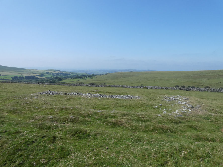
Photo taken on 13-08-2025
Database entries
OS Map: SX 54448 77684
OS Source: Google
Butler OS: SX54447767
HER: MDV4184
Alternate name: Wedlake E.2
Short Name: RC Wedlake E2
Butler map: 31.18.2
Grinsell: PETER TAVY 34a
Exist: Yes
Record: Unique
Record Source: Butler
Hut Class: No
Cairn Class: Yes
Dimensions (m): 18.0 x 0.4
Lidar: SX 54448 77684
Guide Map: 24
Nearest Bus Stop: Merrivale Dartmoor Inn (3.2 km) [Route: 98,171(20/07/26 to 19/09/26)]
Nearby sites: SX 54448 77684
Notes
HER: A very fine ring cairn is located on the western side of Langstone Moor overlooking the Colly Brook and Whittor to the north. It consists of an 18 metre diameter ring of small stones, now turf covered, enclosing a mainly flat area strewn with loose stones. The bank, which has been disturbed on the south-west quadrant, stands approximately 0.5 metres high.The remains of what must have been an impressive large cairn lie on a fairly steep north-west facing hillslope in virtually clitter-free open moorland. It measures 17.0m in overall diameter, 0.5m in height and is apparently composed entirely of small stones.
Newman (2003) cairn 14: A very fine ring cairn (14) is located on the western side of Langstone Moor overlooking the Colly Brook and Whittor to the north. It consists of an 18m diameter ring of small stones, now turf covered, enclosing a mainly flat area strewn with loose stone. The bank, which has been disturbed on the south-west quadrant stands to approximately 0.5m high.
References
These are selected references with an emphasis on out of copyright sources linked as PDFs. For more detailed references try any linked HER or PMD record above.
- Butler, Jeremy, Dartmoor Atlas of Antiquities, vol.2: The North, (1991)
- Grinsell, L.V., Dartmoor Barrows, Devon Archaeological Society Proceedings No.36 (1978)
- Newman, Phil, The Langstone Moor Stone Circle, Peter Tavy, Devon and its Prehistoric Environs, English Heritage (2003)