
Guide to the Monuments on Langstone Moor
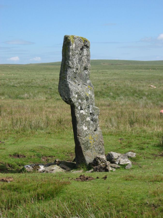
Table of Ritual and Burial Monuments on Langstone Moor
The following table lists the records currently in this Guide Map. For an explantion of the Guide Maps and a table of all 62 Guide Maps, follow this link: Guide List Table. Introductory text will be added to each guide list in coming years (it is a large task). Notes on duplication and omissions will appear below the table once checks have been finalised.
To see the table below listed with just sites with no photos i.e. unvisited/unconfirmed sites, click on this link: List of sites with no photos (click here to show all)
Langstone Moor Guide Map
Guidance for walkers: The monuments featured in this database are archaeological treasures and need to be protected and preserved - please do not disturb any sites. Please check access and firing times before visiting sites, not all sites listed are on open access land. Firing ranges and boundaries of open access areas are marked on the OL28 OS Dartmoor Explorer map. Please stick to the country code and consider giving support to the numerous agencies that help to keep Dartmoor a fabulous natural and historic environment!
List of Ritual and Burial Monuments on Langstone Moor
Langstone Moor Settlement
OS Map: SX 55500 77900
HER record: MDV4219
Megalithic Portal: 17507
ShortName: ST Langstone
Butler map: 30.2
Notes: HER: A complex hut settlement of at least 35 hut circles covering 4.7 hectares with many huts contained within small enclosures on Langstone Moor. 35 hut circles were positively identified with three possible hut circles and four very doubtful features. At least seven of the previously identified huts were found to be bulges in enclosure walls with no signs of having ever been huts. There is a group of seven hut circles to the west of the main settlement. This group includes one hut with an inner partition, two with only partial remains and a slight ring of stones which may be the remains of a hut circle.
Nearby sites: SX55507790
Langstone Moor E. Enclosure
OS Map: SX 55899 77734
HER record: MDV46974
ShortName: EN Langstone E
Butler map: 30.2
Notes: HER: Two adjoining enclosures are shown on the English Heritage survey of 2003 as being open to the south-east. The ruined walls are constructed from large blocks of granite. At the point where the two semicircles join is a small rectangular structure around 4.4 metres by 2 metres which may be the remains of a hut or shelter.
Nearby sites: SX55907773
Langstone Moor E. Reported Cist
OS Map: SX 56075 78007
HER record: MDV61771
PMD: Langstone Moor E.
ShortName: CT Langstone E
Butler map: 30.2
Butler Vol 5: p.173 & Fig.113
Notes: HER: Possible cist. Three stones, consisting of two end slabs and one side slab, set against a large natural boulder. Traces of surrounding mound. May be a tinners cache.
Nearby sites: SX56087801
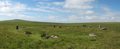
Langstone Moor Stone Circle
OS Map: SX 55638 78204
HER record: MDV4226
Megalithic Portal: 1062
PMD: Langstone Moor Stone Circle
ShortName: SC Langstone
Butler map: 30.10
DPD page: 14
Turner: G10
Notes: The Langstone standing stone and also the stone circle were used for target practice by American troops who were stationed nearby during the Second World War. Bullet holes can be seen on the Langstone standing stone and the circle was sadly smashed to smithereens. The Langstone Moor Stone circle had been restored in 1894 when all of the stones were re-erected in their original socket holes.
Nearby sites: SX55647820
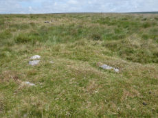
Langstone Moor 1 Cairn
OS Map: SX 55733 78124
HER record: MDV4594
ShortName: CN Langstone 1
Butler map: 30.10.1
Grinsell: PET 40
Notes: DEC Report (1898):No. 1. 336 feet from the centre of the stone circle in an E.S.E. direction is a wasted barrow, 15 feet in diameter. There are the remains of a circle of stones surrounding it. The usual pit, 2 feet wide and 1 foot 10 inches deep, dug in the "calm," was found, but no kistvaen. This contained no trace of the interment, nor even a particle of charcoal.
Nearby sites: SX55737812

Langstone Moor 2 Cist
OS Map: SX 55732 78111
HER record: MDV4593
Megalithic Portal: 45786
PMD: Near Langstone Moor Stone circle
ShortName: CT Langstone 2
Butler map: 30.10.2
Grinsell: PET 39
Notes: HER: One of two round cairns aligned north-east to south-west south-east of the Langstone stone circle. Cairn measures 6 metres in diameter and stands up to 0.4 metres high. A shallow hollow in the centre of the mound is probably the result of a partial excavation carried out by the Dartmoor Barrow Committee which revealed a small cist containing charcoal and bones. Removed to Plymouth City Museum.
Nearby sites: SX55737811
Langstone Moor 3 Cairn
OS Map: SX 55705 78105
HER record: MDV69494
ShortName: CN:Langstone 3
Butler map: 30.10.3
Grinsell: PET 40a
Notes: DEC Report (1898): No. 3. Small barrow very much ruined. The internment hole in the "calm" was 18 inches square and 12 inches deep. It contained nothing but soil.
Nearby sites: SX55717811
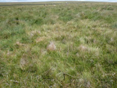
Langstone Moor 4 Cairn
OS Map: SX 55612 78163
HER record: MDV4595
ShortName: CN Langstone 4
Grinsell: PET 41a
Notes: Newman: Small cairn to the south-west of the stone circle on Langstone Moor shown on the English Heritage survey of 2003.
Nearby sites: SX55617816
Langstone Moor (c.6) Cairnfield Master
OS Map: SX 55500 77700
HER: No record found
ShortName: CN:Langstone M
Butler map: 30.1
Notes: Butler depicts 4 cairns(?) in Fig. 30.2 (1991) p. 68. This record originates from Butler and is marked here as a duplicate - see the individual records it relates to.
Nearby sites: SX55507770
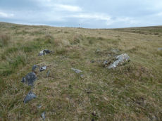
Langstone Moor 5 Clearance Cairn
OS Map: SX 55507 77772
HER record: MDV46976
ShortName: CN Langstone 5
Notes: Originally identified as another hut circle, this feature was surveyed in 2003 and recorded as one of a line of three clearance cairns. [See also SiteID=6919]. Butler depicts 4 cairns(?) in Fig. 30.2 (1991) p. 68. Newman (2203) depicts 3 clearance cairns on Fig 9.
Nearby sites: SX55517777
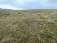
Langstone Moor 6 Clearance Cairn
OS Map: SX 55497 77766
HER record: MDV46977
ShortName: CN Langstone 6
Notes: Originally identified as another hut circle, this feature was surveyed in 2003 and recorded as one of a line of three clearance cairns. See also SiteID=6919. Butler depicts 4 cairns(?) in Fig. 30.2 (1991) p. 68. Newman (2203) depicts 3 clearance cairns on Fig 9.
Nearby sites: SX55507777
Langstone Moor 7 Clearance Cairn
OS Map: SX 55510 77760
HER record: MDV46978
ShortName: CN:Langstone 7
Notes: Originally identified as another hut circle, this feature was surveyed in 2003 and recorded as one of a line of three clearance cairns. See also SiteID=6919
Nearby sites: SX55517776
Langstone Moor 8 Clearance Cairn
OS Map: SX 55500 77710
HER record: MDV46975
ShortName: CN:Langstone 8
Notes: Originally identified as another hut circle, this feature may be a clearance cairn. Location of scheduled area is slightly too far to the south-east; the 2003 survey places this feature at SX5545 7773.
Nearby sites: SX55507771
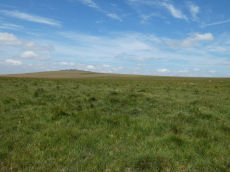
Langstone Moor 9 Peat Stack
OS Map: SX 55246 78024
HER record: MDV12812
ShortName: CN Langstone 9
Grinsell: B:PET 40b
Notes: Previously thought to have been a barrow. Redefined as a peat stack in the 1990s.
Nearby sites: SX55247801
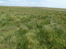
Langstone Moor 10 Peat Stack
OS Map: SX 55211 77927
HER record: MDV12813
ShortName: CN Langstone10
Grinsell: B:PET 40c
Notes: Probably peat stacks as shown by hole in B:PET 40b
Nearby sites: SX55217793
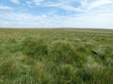
Langstone Moor 11 Peat Stack
OS Map: SX 55155 77831
HER record: MDV12814
ShortName: CN Langstone11
Grinsell: B:PET 40d
Notes: Probably peat stacks as shown by hole in B:PET 40b.
Nearby sites: SX55167783
Langstone Moor 12 Clearance Cairn
OS Map: SX 54780 77890
HER record: MDV56597
ShortName: CN:Langstone12
Notes: HER: A low, stony mound situated on a NW facing slope overlooking the Colly Brook. This turf-covered mound of small stones stands to a maximum height of 0.35m. It is"comma"-shaped, with an oval head 6.2m by 4.4m, and a tail on the downhill side 3.2m by 2.3m. There is a slight depression in the main part. It is possibly a damaged cairn with original dimensions in the order of 7.6m by 6.2m.
Nearby sites: SX54787789
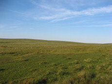
Langstone Moor Stone Ring Cairn Circle
OS Map: SX 54843 77922
HER record: MDV48862
Megalithic Portal: 45833
ShortName: RC Langstone
Turner: A22
Notes: HER: A semi-circular bank, possibly the remains of a ring cairn.1.4 to 2m wide, 0.4m high. Composed of small + medium sized stones now largely turf-covered. It fades at each end of a near-perfect semi-circle of 14.9m internal diam. There is a low stone pile, 0.2m high, in se quadrant.
Nearby sites: SX54847792
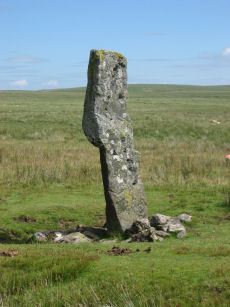
Langstone Moor Standing Stone
OS Map: SX 55023 78742
HER record: MDV4225
Megalithic Portal: 17504
PMD: Langstone Moor Standing Stone
ShortName: SS Langstone
Butler map: 30.12
Butler Vol 5: p.230
DPD page: 13
Notes: The Langstone standing stone is 2.76m high and can be seen from some distance. It was restored in its original socket in 1893. The Langstone is close to a stone row consisting of very small stones. The Langstone standing stone and also the stone circle were used for target practice by American troops who were stationed nearby during the second world. Bullet holes can be seen on the Langstone standing stone. Lethbridge pp.13-14. Breton (p.17) The stone is composed of local gabbro, and was formerly prostrate, but His Grace the Duke of Bedford has re-erected it in its original socket-hole.
Nearby sites: SX55027874
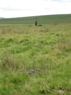
Langstone Moor Stone Row
OS Map: SX 55022 78851
HER record: MDV4223
Megalithic Portal: 2016
The Stone Rows of GB: Langstone Moor
PMD: Langstone Moor I Stone Row
ShortName: SR Langstone
Butler map: 30.12
DPD page: 14
Notes: "A single stone row stands on Launceston (Langstone). Moor circa 330 feet in length, probably longer when complete. There are now only 18 stones, the largest of which stands only 18 inches above ground. At the north end are the remains of a barrow, now reduced to little more than a rubble ring. At the south end is the standing stone known as the 'Langstone', from which the moor probably takes its name. The stone was re-erected in 1893 and stands to a height of 9 feet 3 inches."
Nearby sites: SX55027885
Langstone Moor Stone Row Reported Cairn
OS Map: SX 55040 78850
HER: No record found
ShortName: CNxLangstoneSR
Butler map: 30.12
Grinsell: PET 41
Notes: Butler, referring to the claims of the Dartmoor Exploration Committee of a second Langstone Moor stone row and associated cairn says "A line of slabs is indeed visible along one side of it [a bank of stones] but the cairn appears to be merely a pile of stones from the bank to allow the passage of the Peter Tavy branch of the Lich Way".
Nearby sites: SX55047885
Langstone Moor 2 Stone Row
OS Map: SX 54945 78842
HER record: MDV4107
PMD: Langstone Moor 2
Alternate name: Langstone Moor II Stone Row
ShortName: SR:Langstone 2
Butler map: 30.12
Notes: "Reave running from north - south on the eastern slopes of Whittor close to the Langstone Stone Row." Breton (p.17): Nearly parallel to it, and 60 yds away was another row.
Nearby sites: SX54957884
Langstone Moor 3 Stone Row
OS Map: SX 55100 78800
HER: No record found
The Stone Rows of GB: Langstone Moor 3
PMD: Langstone Moor 3
Alternate name: Langstone Moor III Stone Row
ShortName: SR:Langstone 3
Butler map: 30.12
Notes: R.N. Worth Still further from the Launceston row to the eastward there are a few stones in line just above the surface, which may be the remnants of another. NB. This record and quote originates from the Bill Radcliffe PMD entry.
Nearby sites: SX55107880
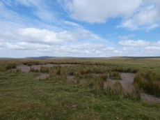
Langstone Moor Ancient Pool
OS Map: SX 55026 78879
HER record: MDV127215
ShortName: PO Langstone
Notes: HER: A pool measuring 28 by 24 metres. One of over 40 such 'sacred' pools identified on Dartmoor that are thought to have potentially been designed during the prehistoric period. Lies at the northern end of a stone row. May be on the site of a cairn
NB. HER entry implies this could be the same as the Butler reported cairn at the end of the stone row. On this website this is currently listed as a separate entry Langstone Moor Stone Row Reported Cairn (no HER entry). The diagram page 77 (fig 30.8) shows both a mound and a pit. Could this be the pit distinct from the cairn? Breton (p.17): The Langstone was formerly the end of a stone row, composed of quite small stones, running in a direction N. and S. from a pool that occupies the site of a destroyed cairn.. The author visited 25/07/2026. The pool was dry but clearly separate from the cairn.
Nearby sites: SX55037888
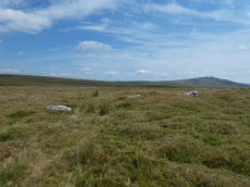
Langstone Reave Reported Cairn
OS Map: SX 54940 78840
HER record: MDV49510
ShortName: CN LangReave
Grinsell: PET 28
Notes: Remains of a turf covered cairn which is in a very mutilated condition due to the construction of a cart track through it
Nearby sites: SX54947884
White Barrow Cairn
OS Map: SX 56852 79309
HER record: MDV4214
ShortName: CN:WhiteBarrow
Butler map: 30.13
Grinsell: LYD 31
Notes: HER: A turf-covered round cairn situated immediately next to the Lichway on the crest of a ridge between Cocks Hill and Lynch Tor. The cairn mound measures 19.7 metres in diameter and stands up to 1.4 metres high on the north side and 0.7 metres high on the south. A shallow hollow in the centre of the mound suggests partial early excavation or robbing. The outer edges of the mound survive as a buried feature below deep peat deposits.
Nearby sites: SX56857931
Cocks Hill W. Cairn
OS Map: SX 56185 79154
HER record: MDV4599
ShortName: CN:CocksHill W
Butler map: 30.14
Grinsell: PET 38
Notes: HER: Cairn of 16.0 metres diameter by 0.8 metres high to the south-west of 'White Barrow' which has been badly damaged
Nearby sites: SX56197915
Dead Lake Foot Settlement
OS Map: SX 56430 78190
HER record: MDV4202
ShortName: ST:DeadLake
Butler map: 30.1
Butler Vol 5: p.95
Notes: HER: Small hut settlement located on the west bank of the River Walkham consisting of ten hut circles, a small circular stone feature and a short curved fragment of wall to the north. Similar to the Langstone Moor settlement but huts are small with smaller interiors and crudely built walls with no apparent facing stones. Likely to have been a seasonally occupied camp, perhaps a group of sheilings used in summer months. No evidence of enclosure.
Nearby sites: SX56437819
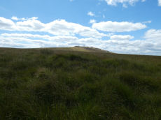
Greena Ball 1 Peat Stack
OS Map: SX 56830 77880
HER record: MDV4597
ShortName: CN?Greena Ba1
Butler map: 30.16.1
Grinsell: LYD 35
Notes: field investigation suggests that the features are more likely to be peat stacks of uncertain date
Nearby sites: SX56837788
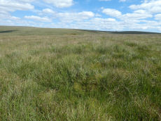
Greena Ball 2 Peat Stack
OS Map: SX 56850 77820
HER record: MDV4228
ShortName: CN?Greena Ba2
Butler map: 30.16.2
Notes: field investigation suggests that the features are more likely to be peat stacks of uncertain date
Nearby sites: SX56857782
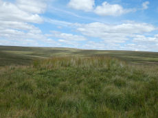
Greena Ball 3 Peat Stack
OS Map: SX 56890 77840
HER record: MDV4229
ShortName: CN?Greena Ba3
Butler map: 30.16.3
Grinsell: LYD 36
Notes: field investigation suggests that the features are more likely to be peat stacks of uncertain date
Nearby sites: SX56897784
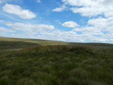
Greena Ball 4 Peat Stack
OS Map: SX 56940 77830
HER record: MDV4587
ShortName: CN?Greena Ba4
Butler map: 30.16.4
Grinsell: LYD 37
Notes: field investigation suggests that the features are more likely to be peat stacks of uncertain date
Nearby sites: SX56947783
Roos Tor (c.20) Cairnfield Master
OS Map: SX 54060 77110
HER record: MDV48247
ShortName: CN:Roos Tor M
Butler map: 31.7
Notes: Cairn cemetry - see individual records for cairns. This master record is marked as a duplicate.
Nearby sites: SX54067711
Roos Tor 1 Reported Cairn
OS Map: SX 54050 77170
HER record: MDV48248
ShortName: CN?Roos Tor 1
Butler map: 31.7
Notes: HER: Ovoid in shape, cairn measures 3.3 metres by 2.1 metres by 0.2 metres high. Part of a cairnfield 400m south-east of Wedlake Farm forming part of the settlement on the north-west slope of Roos Tor
Nearby sites: SX54057717
Roos Tor 2 Reported Cairn
OS Map: SX 54060 77150
HER record: MDV48249
ShortName: CN?Roos Tor 2
Butler map: 31.7
Notes: HER: Cairn measures 4 metres in diameter, height 0.7 metres. Part of cairnfield 400 metres south-east of Wedlake Farm forming part of the settlement on the north-west slope of Roos Tor.
Nearby sites: SX54067715
Roos Tor 3 Reported Cairn
OS Map: SX 54060 77130
HER record: MDV48250
ShortName: CN?Roos Tor 3
Butler map: 31.7
Notes: HER: Ovoid in shape, cairn measures 4.5 metres by 3.5 metres by 0.7 metres high. Part of cairnfield 400 metres south-east of Wedlake Farm forming part of the settlement on the north-west slope of Roos Tor.
Nearby sites: SX54067713
Roos Tor 4 Reported Cairn
OS Map: SX 54070 77110
HER record: MDV48251
ShortName: CN?Roos Tor 4
Butler map: 31.7
Notes: HER: Ovoid in shape, cairn measures 3.5 metres by 3 metres by 0.7 metres high. Part of cairnfield 400 metres south-east of Wedlake Farm forming part of the settlement on the north-west slope of Roos Tor.
Nearby sites: SX54077711
Roos Tor 5 Reported Cairn
OS Map: SX 54080 77110
HER record: MDV48252
ShortName: CN?Roos Tor 5
Butler map: 31.7
Notes: HER: Ovoid in shape, cairn measures 5 metres by 3 metres by 0.3 metres high. Part of cairnfield 400 metres south-east of Wedlake Farm forming part of the settlement on the north-west slope of Roos Tor.
Nearby sites: SX54087711
Roos Tor 6 Reported Cairn
OS Map: SX 54120 77160
HER record: MDV48253
ShortName: CN?Roos Tor 6
Butler map: 31.7
Notes: Ovoid in shape, cairn measures 5 metres by 3 metres by 0.6 metres high. Part of cairnfield 400 metres south-east of Wedlake Farm forming part of the settlement on the north-west slope of Roos Tor.
Nearby sites: SX54127716
Roos Tor 7 Reported Cairn
OS Map: SX 54110 77170
HER record: MDV48254
ShortName: CN?Roos Tor 7
Butler map: 31.7
Notes: HER: Ovoid in shape, cairn measures 4 metres by 3 metres by 0.6 metres high. Part of cairnfield 400 metres south-east of Wedlake Farm forming part of the settlement on the north-west slope of Roos Tor.
Nearby sites: SX54117717
Roos Tor 8 Reported Cairn
OS Map: SX 54120 77200
HER record: MDV48255
ShortName: CN?Roos Tor 8
Butler map: 31.7
Notes: HER: Ovoid in shape, cairn measures 3.7 metres by 2.3 metres by 0.6 metres high. Part of cairnfield 400 metres south-east of Wedlake Farm forming part of the settlement on the north-west slope of Roos Tor.
Nearby sites: SX54127720
Roos Tor 9 Reported Cairn
OS Map: SX 54110 77200
HER record: MDV48256
ShortName: CN?Roos Tor 9
Butler map: 31.7
Notes: HER: Ovoid cairn. Part of cairnfield 400 metres south-east of Wedlake Farm forming part of the settlement on the north-west slope of Roos Tor.
Nearby sites: SX54117720
Roos Tor 10 Reported Cairn
OS Map: SX 54120 77180
HER record: MDV48257
ShortName: CN?Roos Tor10
Butler map: 31.7
Notes: HER: Ovoid cairn of 4 metres by 2 metres by 0.6 metres high. Part of cairnfield 400 metres south-east of Wedlake Farm forming part of the settlement on the north-west slope of Roos Tor.
Nearby sites: SX54127718
Roos Tor 11 Reported Cairn
OS Map: SX 54090 77210
HER record: MDV48258
ShortName: CN?Roos Tor11
Butler map: 31.7
Notes: HER: Ovoid in shape, cairn measures 5 metres by 3 metres by 0.2 metres high. Part of cairnfield 400 metres south-east of Wedlake Farm forming part of the settlement on the north-west slope of Roos Tor.
Nearby sites: SX54097721
Roos Tor 12 Reported Cairn
OS Map: SX 54140 77200
HER record: MDV48259
ShortName: CN?Roos Tor12
Butler map: 31.7
Notes: HER: Cairn of 0.8 metres high obscured by soil buildup against upslope side. Part of cairnfield 400 metres south-east of Wedlake Farm forming part of the settlement on the north-west slope of Roos Tor.
Nearby sites: SX54147720
Roos Tor 13 Reported Cairn
OS Map: SX 54110 77110
HER record: MDV48260
ShortName: CN?Roos Tor13
Butler map: 31.7
Notes: HER: Ovoid cairn of 9.5 metres by 4.9 metres by 1 metre high made up of two adjoining sub-circular mounds. Part of cairnfield 400 metres south-east of Wedlake Farm forming part of the settlement on the north-west slope of Roos Tor.
Nearby sites: SX54117711
Roos Tor 14 Reported Cairn
OS Map: SX 54110 77190
HER record: MDV48262
ShortName: CN?Roos Tor14
Butler map: 31.7
Notes: HER: Cairn of 5.3 metres diameter by 1 metre high with a central hollow and kerb on the south side. Part of cairnfield 400 metres south-east of Wedlake Farm forming part of the settlement on the north-west slope of Roos Tor
Nearby sites: SX54117719
Roos Tor 15 Reported Cairn
OS Map: SX 54130 77190
HER record: MDV48263
ShortName: CN?Roos Tor15
Butler map: 31.7
Notes: HER: Ovoid cairn of up to 0.7 metres high with its size and shape obscured by a buildup of soil. Part of cairnfield 400 metres south-east of Wedlake Farm forming part of the settlement on the north-west slope of Roos Tor.
Nearby sites: SX54137719
Roos Tor 16 Reported Cairn
OS Map: SX 54100 77210
HER record: MDV48264
ShortName: CN?Roos Tor16
Butler map: 31.7
Notes: HER: Cairn of 6 metres diameter by 1 metre high. Part of cairnfield 400 metres south-east of Wedlake Farm forming part of the settlement on the north-west slope of Roos Tor.
Nearby sites: SX54107721

Roos Tor N.W. Settlement
OS Map: SX 53900 77200
HER record: MDV4104
Megalithic Portal: 17509
ShortName: ST RoosTorNW
Butler map: 31.7
Notes: HER: Hut circle settlement and field system to the south-east of Wedlake with seventy one hut circles of between 2 to 7 metres diameter with walls between 0.8 to 2 metres wide by 1.5 metres high and several small enclosures
Nearby sites: SX53907720
Wedlake Enclosed Settlement
OS Map: SX 53974 77769
HER record: MDV4106
ShortName: ST:Wedlake
Butler map: 31.9
Butler Vol 5: p.95
Notes: HER: Hut circle settlement to the north-east of Wedlake Farm and to the west of the Colly Brook with four incomplete enclosures and at least fifteen hut circles.
Nearby sites: SX53977777
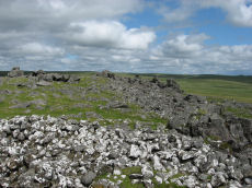
White Tor (Whittor) Neolithic Enclosure
OS Map: SX 54230 78670
HER record: MDV4101
Megalithic Portal: 17506
ShortName: NE White Tor
Butler map: 31.13
DPD page: 13
Notes: Neolithic tor enclosure. "A camp on the summit of White Tor formed by a double wall, now in ruinous condition. Both walls appear to have been 10 to 11 feet thick, the outer wall being 4 to 4 1/2 feet high, the inner 6 to 7 feet high. The distance between the walls varies between 10 and 40 feet. The entrances are to the east, where access is easier, they are not opposite and are protected by the spur walls. Within the camp are four hut circles and three possible hut shelters, and two northern circles (numbers 5 and 6 on plan) are joined by a short wall." See also, Legendary Dartmoor: Dartmoor's White Tor Neolithic Settlement. See also Dartmoor Tor Enclosures Project.
Nearby sites: SX54237867
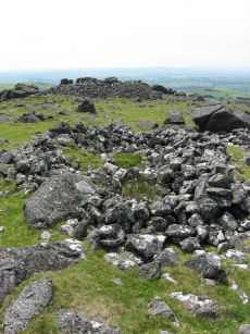
White Tor Fort
OS Map: SX 54246 78678
HER record: MDV4101
Megalithic Portal: 17506
ShortName: FT White Tor
DPD page: 13
Notes: The White Tor camp is a Neolithic Enclosure which was once assumed to have been repurposed as an Iron Age fort. There used to be a separate HER entry to this end but this has been removed as the consensus now is that it is predominantly a Neolithic feature.
Nearby sites: SX54257868
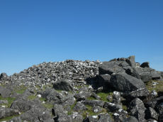
White Tor Summit Cairn
OS Map: SX 54220 78638
HER record: MDV4147
ShortName: CN WhiteTorSum
Butler map: 31.13
Grinsell: PET 22
Notes: "Cairn in white tor camp. Large cairn in sw portion of the camp. Many hundreds of cartloads of stones are here lying piled up like a cairn against one of the rock outcrops on the summit."
Nearby sites: SX54227864
Cudlipptown Down 1 Cairn
OS Map: SX 53524 79061
HER record: MDV56602
ShortName: CN Cudlipp 1
Butler map: 31.16.1
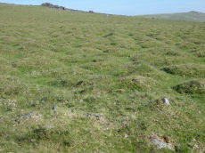
Notes: Cairn is in foreground of photo. NMR C - Butler lists 2 cairns NMR Lists 4. "4 small cairns situated on a slight slope, on the line of a parallel reave, on cudlipptown down. Their origin and function are obscure but they appear to post-date the reave." ...
Nearby sites: SX53527906
Cudlipptown Down 2 Cairn
OS Map: SX 53507 79052
HER record: MDV56602
ShortName: CN Cudlipp 2
Butler map: 31.16.2
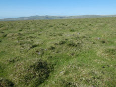
Notes: NMR B - Butler lists 2 cairns NMR Lists 4. "4 small cairns situated on a slight slope, on the line of a parallel reave, on cudlipptown down. Their origin and function are obscure but they appear to post-date the reave." ... "'a' sx53387898.2m by 1.6m wide, 0.3m high. Partly turf-covered small and medium-size stones forming a low, near circular cairn. 'b' sx53497904.5.6m by 5m wide, 0.4m high. A roundish, flat-topped cairn of small-medium sized, partly turf-covered stones. There appears to be some disturbance, possibly a narrow trench, running from the cairn centre to the n edge. 'c' sx53517905.3.1m diam, 0.35m high. Otherwise very similar to 'b'. 'd' sx53557907.2m diam by 0.3m high (nmr, citing Pattison)."
Nearby sites: SX53517905
Cudlipptown Down N. Reported Cairn
OS Map: SX 53370 79460
HER record: MDV133726
ShortName: CN?Cudlipp N
Butler map: 31.17
Notes: Butler: "an isolated stony mound is probably a burial cairn".
Nearby sites: SX53377946
Wedlake E.1 Cairn
OS Map: SX 54288 77561
HER record: MDV4183
ShortName: CN Wedlake E1
Butler map: 31.18.1
Grinsell: PET 34b
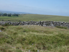
Notes: HER: Cairn bisected by a stone-faced newtake wall, consisting on the uphill side of a turf-covered rather amorphous stony mound with a small pit near the centre, measuring 13 metres by 6 metres. The lower part, now evident as a robbed, semi-circular turf-covered stony bank, measures overall 13 metres by 9 metres.
Nearby sites: SX54297756
Wedlake E.2 Stone Ring Cairn Circle
OS Map: SX 54448 77684
HER record: MDV4184
ShortName: RC Wedlake E2
Butler map: 31.18.2
Grinsell: PET 34a
Notes: HER: A very fine ring cairn is located on the western side of Langstone Moor overlooking the Colly Brook and Whittor to the north. It consists of an 18 metre diameter ring of small stones, now turf covered, enclosing a mainly flat area strewn with loose stones. The bank, which has been disturbed on the south-west quadrant, stands approximately 0.5 metres high.
Nearby sites: SX54457768
Wedlake E.3 Cairn
OS Map: SX 54521 77400
HER: No record found
ShortName: CN-Wedlake E3
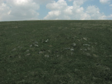
Notes: Possible cairn located and photographed on 29 May 2016 and added to listings June 2019. It appears to be a cairn and the GPS location is some distance from any known recorded cairns - although Wedlake E1 and Wedlake E2 are not far. This is being listed as a reported cairn and only another site visit will throw more light on this. Revisited 13/08/25 and there is no doubt this is a cairn. Changed from reported cairn to cairn.
Nearby sites: SX54527740
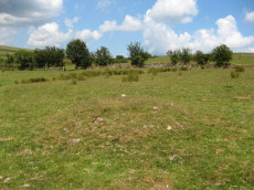
Wedlake Farm Cairn
OS Map: SX 53893 77408
HER record: MDV33612
ShortName: CN WedlakeFarm
Notes: "Small turf covered cairn, 5m diameter, 0.5m high, near centre of field". HER grid reference is 6 digit so location could be more that 100 metres out. UPDATE: The author walked along the bridal path near Wedlake Farm on 14/07/19 and a cairn was seen some distance from the HER grid reference SX 538 774 at SX 53893 77408. It seems very likely that this is the site - see photo. This record now uses the new grid reference. Now listed as "cairn" rather than "reported cairn".
Nearby sites: SX53897741
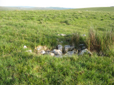
Langstone Moor S.1 Cairn
OS Map: SX 54836 77640
HER record: MDV4117
ShortName: CN Langston S1
Butler map: 31.19.1
Grinsell: PET 33
Notes: Newman "Fairly large, flat-topped stony cairn (18) which was excavated by the Dartmoor Exploration Committee in 1899, 970 metres south-west of the stone circle. A flat stone was found but no other material retrieved. Disturbance caused by the diggers is visible on the west side of the mound."
Nearby sites: SX54847764
Langstone Moor S.2 Cairn
OS Map: SX 54838 77646
HER record: MDV4116
Megalithic Portal: 35802
ShortName: CN Langston S2
Butler map: 31.19.2
Grinsell: PET 34
Notes: HER: Round cairn measuring 6.5 metres in diameter and standing up to 0.4 metres high. A shallow hollow in the centre of the mound suggests previous robbing or partial excavation. A slab of stone set on edge within the central hollow may be the remnants of a cist.
Nearby sites: SX54847765
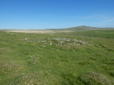
White Tor S.S.E.1 Cairn
OS Map: SX 54339 78370
HER record: MDV4182
ShortName: CN White SSE1
Butler map: 31.20.1
Grinsell: PET 30
Notes: HER: The westernmost cairn of a group of three set close together. Mound measures 11.9 metres in diameter and stands up to 0.9 metres high. A stone kerb composed of small boulders defines the outer edge of the mound. A hollow in the centre of the mound and a trench cut into the western side are probably the result of the nineteenth-century partial excavation.
Nearby sites: SX54347837
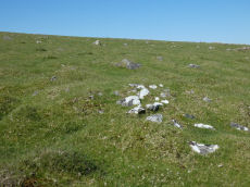
White Tor S.S.E.2 Cairn
OS Map: SX 54356 78359
HER record: MDV4181
ShortName: CN White SSE2
Butler map: 31.20.2
Grinsell: PET 32
Notes: HER Southernmost cairn of a group of three partially excavated by the Dartmoor Exploration Committee in 1899. This cairn measures 4.7 metres in diameter and is 0.5 metres high. Has a central hollow indicating the location of the earlier partial excavation. Forms part of a widely dispersed group of at least fourteen cairns on the southern and eastern slopes of White Tor.
Nearby sites: SX54367836
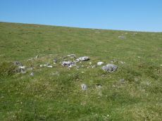
White Tor S.S.E.3 Cairn
OS Map: SX 54355 78379
HER record: MDV4180
ShortName: CN White SSE3
Butler map: 31.20.3
Grinsell: PET 31
Notes: HER Northernmost cairn of a group of three. Measures 4.6 metres in diameter and stands up to 0.5 metres high. Partially excavated by the Dartmoor Exploration Committee in 1899 and this work revealed central pits containing ashes, charcoal and flints. Centre of the mound contains a hollow indicating the location of the earlier partial excavation. Forms part of a widely dispersed group of at least fourteen cairns on the southern and eastern slopes of White Tor.
Nearby sites: SX54367838
White Tor S.S.E.4 Reported Cairn
OS Map: SX 54320 78580
HER record: MDV4144
ShortName: CN?White SSE4
Butler map: 31.20.4
Grinsell: PET 23
Notes: HER: A disturbed round cairn on the south slopes of White Tor. Originally noted in 1899 Transactions report, but could not be positively identified by the Ordnance Survey (1950/1978) or Grinsell (1978) or Gerrard (1992). Cairn was found in 1987 and has been included in surveys of the range in the early 2000s and 2018.. Butler NGR: SX 5431 7858
Nearby sites: SX54327858
White Tor S.S.E.5 Reported Cairn
OS Map: SX 54480 78250
HER record: MDV4180
ShortName: CN?White SSE5
Butler map: 31.20.5
Notes: Butler SSE cairn 5. This is south of the track. Butler in the description refers to one cairn south of the track but lists two (also cairn 6). Two appear on Map 30. One of the two listed in his table of cairns is marked as excavated by the DEC, the other is not. Yet another small cairn accompanied by some rubble banks lies closer to the river to the south-east (to the se of the other SSE group). The author looked for this cairn on 27th May 2022 and was unable to find it. NMR SX 54517823 Butler SX 54487825
Nearby sites: SX54487825
White Tor S.S.E.6 Reported Cairn
OS Map: SX 54360 78200
HER record: MDV4182
ShortName: CN?White SSE6
Butler map: 31.20.6
Notes: Butler SSE cairn 6. This is south of the track. Butler in the description refers to one cairn south of the track but lists two (also cairn 5). Two appear on Map 30. One of the two listed in his table of cairns is marked as excavated by the DEC, the other is not. "Yet another small cairn accompanied by some rubble banks lies closer to the river to the south-east" (to the se of the other SSE group). The author looked for this cairn on 27th May 2022 and was unable to find it. NMR SX 54397826 Butler SX 54367820
Nearby sites: SX54367820
White Tor S.S.E.7 Cairn
OS Map: SX 54688 78177
HER record: MDV56606
ShortName: CN:White SSE7
Butler map: 31.20.7
Notes: HER: A turf covered stony mound set on a gentle south facing slope of rough grassland. It measures 6.4 metres diameter and 0.6 metres high and may have been built on a platform around the southern side. Several stones protrude around the perimeter but there would appear to be no kerb as such. Apart from the slight robbing in the south the mound appears to be intact.
Nearby sites: SX54697818
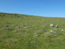
White Tor S.S.E.8 Cairn
OS Map: SX 54348 78421
HER record: MDV69503
ShortName: CN White SSE8
Notes: "Small disturbed flat-topped stony mound measuring between 4.2 and 5.9 metres, lies approximately 30 metres to the north of the group of three cairns on the south slope of Whittor. Surveyed in 2003". This cairn is recored by Phil Newman in reports dated 2003 and 2018. The current author visited on 27th May 2022 and the photo is presumably the site in question. It is so runinous and amorphous that initially I was not it is just natural but it is clearly a cairn. The HER gives the NGR as SX 54345 78413 - this is at SX 54348 78421 about 8 metres to the north.
Nearby sites: SX54357842

White Tor S.S.E.9 Cairn
OS Map: SX 54386 78481
HER record: MDV69504
ShortName: CN White SSE9
Notes: "Small cairn lying approximately 60 metres to the north-north-east of the group of three cairns on the south slope of Whittor. Although severely altered it is certainly likely to have been a cairn. Surveyed in 2003." reported by Phil Newman in survey of 2003 .
Nearby sites: SX54397848
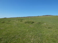
White Tor S.S.W.1 Long Cairn
OS Map: SX 54023 78321
HER record: MDV4179
ShortName: CN White SSW1
Butler map: 31.21.1
Grinsell: PET 29a
Notes: The Dartmoor Exploration Committee (Report 6 1899) describes investigating 3 cairns in this location. The damaged remains are difficult today to interpret. Many authors suggest that the long cairn consists of two or more of these cairns. The current author visited this location on 27th May 2022 with just the knowledge that there were 3 reported cairns. I photographed a very likely cairn, namely, the long cairn (Butler 1). A semi-circular bank (Butler 3) and a faint mound around a natural rock (Butler 2). I noted at the time of the visit that both 2 and 3 are possible but doubtful cairns. I did not have the Butler account with me at the time I photographed and logged these. Looking now at Butler's account it looks like he reached the same conclusions and the entries here follow Butler with similar doubt on Butler 2 and Butler 3.
Nearby sites: SX54027832
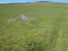
White Tor S.S.W.2 Cairn
OS Map: SX 54038 78328
HER record: MDV4179
ShortName: CN White SSW2
Butler map: 31.21.2
Grinsell: PET 29
Notes: The Dartmoor Exploration Committee (Report 6 1899) describes investigating 3 cairns in this location. The damaged remains are difficult today to interpret. Many authors suggest that the long cairn consists of two or more of these cairns.
Nearby sites: SX54047833
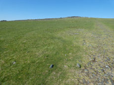
White Tor S.S.W.3 Cairn
OS Map: SX 54006 78293
HER record: MDV4179
ShortName: CN White SSW3
Butler map: 31.21.3
Grinsell: PET 29b
Notes: The Dartmoor Exploration Committee (Report 6 1899) describes investigating 3 cairns in this location. The damaged remains are difficult today to interpret. Many authors suggest that the long cairn consists of two or more of these cairns.
Nearby sites: SX54017829
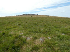
White Tor Stone Ring Cairn Circle
OS Map: SX 54597 78701
HER record: MDV4164
Megalithic Portal: 35804
Alternate name: White Tor E.1 Stone Ring Cairn Circle
ShortName: RC White E1
Butler map: 31.22.1
Grinsell: PET 24
Turner: A26
Notes: See also duplicate 439800. Turner A26. Butler White Tor E.1. "Round cairn 340 metres east of White Tor summit. This monument includes a round cairn situated on a gentle south-east facing slope overlooking the valley of the River Walkham. The cairn mound measures 6m in diameter and stands up to 0.4m high. A hollow in the centre of the mound measuring 3m in diameter and 0.3m deep is the result of a partial excavation carried out by the Dartmoor Exploration Committee in 1899. This work recovered a perforated stone. A kerb of small stones defines the outer edge of the mound."
Nearby sites: SX54607870
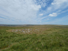
White Tor Long Cairn E.2 Cairn
OS Map: SX 54606 78667
HER record: MDV4163
ShortName: CN White E2
Butler map: 31.22.2
Grinsell: PET 25
Notes: Long cairn - formerly thought to be two separate cairns. Pet 25 & Pet 26 (HER 4163 & 12793). See also the record marked as a duplicate that is the eastern part of the monument: White Tor E.3 Cairn.
Nearby sites: SX54617867
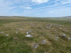
White Tor E.3 Cairn
OS Map: SX 54611 78669
HER record: MDV12793
ShortName: CN White E3
Butler map: 31.22.3
Grinsell: PET 26
Notes: Long cairn - formerly thought to be two separate cairns. Pet 25 & Pet 26 (HER 4163 & 12793). This record is marked as a duplicate for that reason see: See SiteID=1201 HER(4163) for coverage. The photo above is the eastern section of the long cairn.
Nearby sites: SX54617867
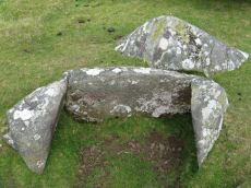
Langstone Moor Cist
OS Map: SX 54699 78695
HER record: MDV4118
Megalithic Portal: 35807
PMD: White Tor E.
Alternate name: White Tor E.4 Cist
ShortName: CT White E4
Butler map: 31.22.4
Butler Vol 5: p.174 & Fig.114
DPD page: 13
Grinsell: PET 27
Barrow Report: 55
Notes: Butler White Tor E.4. Vol. 2. Map 31.22 (diagram Vol. 5. p.174).
Nearby sites: SX54707870
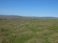
White Tor N.W.1 Cairn
OS Map: SX 53725 79009
HER record: MDV4139
ShortName: CN White NW1
Butler map: 31.23.1
Grinsell: PET 20
Notes: "An oval, flat-topped cairn set on a gently sloping natural plateau of rough grassland with panoramic views in most directions. It is constructed of consolidated small stones and is now predominantly turf-covered. It measures 9m E-W by 8m transversely and is 0.7m high on the N (downhill) side and 0.3m on the S (uphill) side. Only two contiguous earthfast stones of the probable kerb are now evident on the N side. The excavation trench which lies E-W centrally across the cairn is about 1m wide; a second, faint trench is visible at right angles"
Nearby sites: SX53737901
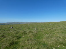
Cudlipptown Down Embanked Cairn Circle
OS Map: SX 53732 78949
HER record: MDV13252
Megalithic Portal: 45608
Alternate name: White Tor N.W.2 Embanked Cairn Circle
ShortName: CC White NW2
Butler map: 31.23.2
Butler Vol 5: p.188 & Fig.130
Grinsell: PET 21
Turner: B5
Notes: "A ring cairn set at the eastern end of a natural gently sloping plateau of rough grassland generally devoid of stones. It measures about 11m diameter inside a turf-covered bank, composed generally of smallish stones, which is about 2.2m wide and has a maximum height of 0.4m on the E. It has been mutilated and spread in the south-east and the west. Several stones, are evident, two probably set in the inner face but the rest are apparently part of the bank of even part of the outer face. Two in the east on the uphill side appear to form an entrance but this is possibly due to mutilation. The interior appears to have been levelled and is 0.2m above the ground to the W. There is no evidence of any internal features or a ditch"
Nearby sites: SX53737895
White Tor N.W.3 Cairn
OS Map: SX 53773 78847
HER record: MDV28516
ShortName: CN:White NW3
Butler map: 31.23.3
Notes: "A cairn is situated at the nw extremity of a plateau. The cairn is in poor condition and measures 3.4m x 2.5m and 0.3m high. A reave passes the cairn at a distance of 4m and it is possible that the stones represent gathering for the reave construction or even clearance though there is no defined field system in the area ". Current author was unable to find this cairn on visit on 27th May 2022. There does seem to be something on satellite imagery. For a time this record had a Lat & Lon that converts to SX 58390 64590 which is 94 metres away to the North east - whether thi swas the feature seen on staellite was not recorded. I have rolled back to the HER grid reference.
Nearby sites: SX53777885
White Tor N.W.4 Reported Cairn
OS Map: SX 53780 79133
HER record: MDV56603
ShortName: CN:White NW4
Butler map: 31.23.3
Notes: A small cairn attached to the side of a reave oriented E to W (see SX 57 NW 85), and situated on a slight slope on Cudlipptown Down. It measures 2.8m N to S by 2.5m and is 0.5m high. It is composed of medium sized stones (up to 0.2m diameter) now partly turf-covered.
Formerly marked as a duplicate of White Tor N.W.3 MDV28516 but that has a grid reference 300 metres away so probably an error. It is now presumed to be a separate unique feature.
Nearby sites: SX53787913
Page last updated 10/12/24