
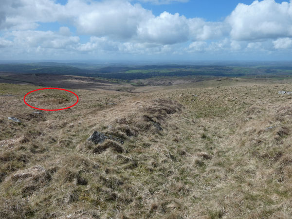
Hare Tor N.2 Reported Cairn
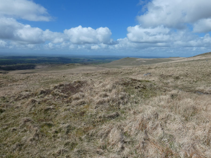
Photo taken on 18-04-2026
Channels in the hillside. This feature can be seen in the background on the LHS of the photo 18/04/2026
Database entries
OS Map: SX 55069 84462
OS Source: Garmin
Butler OS: SX55098446
HER: MDV131976
Alternate name: Hare Tor N.2
Short Name: CN?Hare Tor N2
Butler map: 32.20.2
Exist: Yes
Record: Unique
Record Source: Butler
Hut Class: No
Dimensions (m): 10.0 x 1.0
Lidar: SX 55069 84462
Guide Map: 16
Nearest Bus Stop: Dartmoor Inn (3.8 km) [Route: 118]
Nearby sites: SX 55069 84462
Notes
HER: A probable target butt of fairly recent origin, situated on a steep W-facing slope at SX55068446. It is a broad but short curvilinear bank a maximum 1.6m high with a slot in the downhill side.This record originates from the cairn listed by Butler as Hare Tor N.2. Butler: A heather covered companion [to Hare Tor N.1] 120 m downhill to the south-west. About a third of the material has been removed from its eastern side but it is still a substantial monument.
The author visited this site on 18/04/2026 with Steve Szpyko. We both concluded this was a modern feature and pssibly the result of either tin workings or the military.The HER entry suggests a target Butt.
Butler states that Multiple tracks have been worn deep into the hillside between this cairn [Hare Tor N.1] and a heather covered companion [Hare Tor N.2]. These "tracks" look like gullies and can be seen in the photo below. We discussed the possibility they could have been channels created by the tinners and perhaps this feature is a related earthwork. Either way it is not a prehistorc cairn.
References
These are selected references with an emphasis on out of copyright sources linked as PDFs. For more detailed references try any linked HER or PMD record above.
- Butler, Jeremy, Dartmoor Atlas of Antiquities, vol.2: The North, (1991)
- Newman, Phil, Archaeological Sites within Willsworthy Training Area, Dartmoor National Park, Devon, Southwest Landscape Investigations (2019)