
White Hill S.W. Cairn Alignment

Photo taken on 18-04-2026
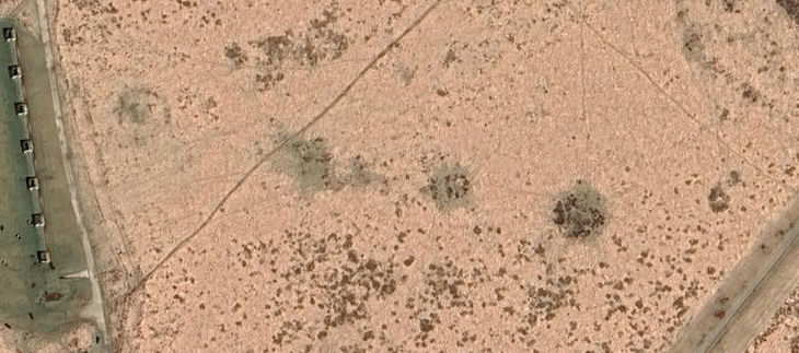
The linear arrangement of cairns can be seen on satellite imagery.
Database entries
OS Map: SX 52941 83690
OS Source: Garmin
Butler OS: SX52948368
HER: MDV50152
Megalithic Portal: 45821
Alternate name: White Hill S.W.
Short Name: CR WhiteHiSW
Exist: Yes
Record: Unique
Record Source: Butler
Hut Class: No
Cairn Class: Yes
Lidar: SX 52941 83690
Guide Map: 15
Nearest Bus Stop: Dartmoor Inn (2.2 km) [Route: 118]
Nearby sites: SX 52941 83690
Notes
A linear arrangement of 6 large cairns. Another two result in an L-shape. Butler: The cairn cemetery to the south-west of White Hill includes eight cairns laid out in an L-shape. Three were excavated by Baring-Gould in around 1888. Despite their comparatively large size he only found a shallow pit dug into the subsoil at the centre of each containing charcoal and ashes.An alignment of cairns, see photo. Butler Cairns 1-6: SX52948369, SX53008367, SX53058366, SX53098365, SX53148365, SX53158366.
References
These are selected references with an emphasis on out of copyright sources linked as PDFs. For more detailed references try any linked HER or PMD record above.
- Baring-Gould, Sabine, Tenth Report of the Dartmoor Exploration Committee, T.D.A. Vol.37 pp.141-145 (1905)
- Butler, Jeremy, Dartmoor Atlas of Antiquities, vol.2: The North, (1991)
- Grinsell, L.V., Dartmoor Barrows, Devon Archaeological Society Proceedings No.36 (1978)
- Turner, J.R., Ring Cairns, stone circles and related monuments on Dartmoor, D.A.S.P. No.48 pp.27-86 (1990)