
Royal Hill, Central Platform Cairn Circle and Cist
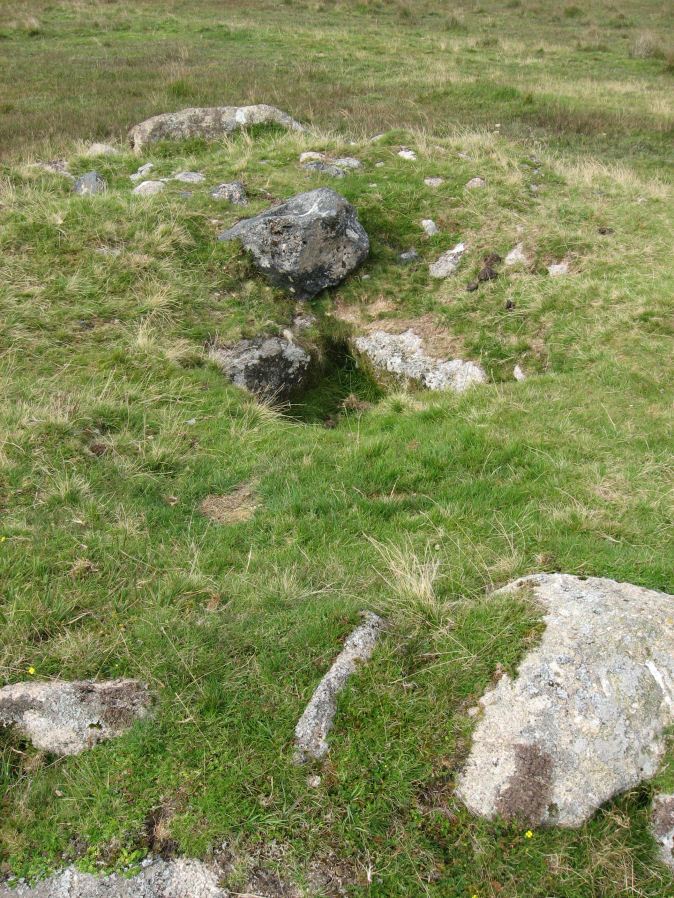
Photo taken on 13-09-2014
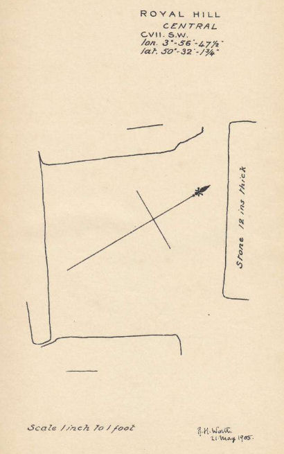
Plan by RHW. Barrow Report 27. TDA Vol.40 1908
Database entries
OS Map: SX 62082 72334
OS Source: Google
Butler OS: SX62087232
HER: MDV6304
Megalithic Portal: 34960
PMD: Royal Hill E.
Alternate name: Royal Hill E.4
Short Name: CT RoyalHill 4
Butler map: 65.5.4
Dixon Cist #: 23
Grinsell: LYDFORD 89
Turner: E21
DPD page: 98
Exist: Yes
Record: Unique
Record Source: Butler
Hut Class: No
Cist Class: Yes
Cairn Class: Yes
Barrow Report: 27 47
Dimensions (m): 5.5 x 0.6 C
Lidar: SX 62082 72334
Guide Map: 39
Nearest Bus Stop: Two Bridges Hotel (3.8 km) [Route: 98,171,172]
Nearby sites: SX 62082 72334
Notes
"The cairn has an overall diameter of about 7.5m in diameter, and 0.6m high, with a flattish top. There are traces of an inner kerb 4.5m in diameter, and an outer one 5.7m across comprising boulders and slabs, the largest 1.5m long, 0.6m high, and 0.2m thick. The interior of the central cist is about 0.8m square with four stones up to 0.25m thick and 0.6m deep but the southern one overlaps the sides, is 1m long, and gives the cist its NW to SE alignment. This and the two end stones incline inwards; the northern one inclines slightly outwards. There is no cover stone." Lethbridge diagram p.97 Cist B, photo p.98. Turner E21 - listed as Royal Hill (N) [n.b. we have a south, central & north - N being a different cist]. Butler Royal Hill E. 4 (Cairn 4 - diagram p.233) - Vol. 4. Map 65.5. Breton p.19.References
These are selected references with an emphasis on out of copyright sources linked as PDFs. For more detailed references try any linked HER or PMD record above.
- Breton, Henry Hugh, The Heart of Dartmoor, (1926)
- Burnard, Robert, Notes on Dartmoor Kistvaens, T.D.A. Vol.22 pp.200-207 (1890)
- Butler, Jeremy, Dartmoor Atlas of Antiquities, vol.4: The South-East, (1993)
- Grinsell, L.V., Dartmoor Barrows, Devon Archaeological Society Proceedings No.36 (1978)
- Turner, J.R., Ring Cairns, stone circles and related monuments on Dartmoor, D.A.S.P. No.48 pp.27-86 (1990)
- Worth, R. Hansford, Barrow Report 27, T.D.A. Vol.40 pp.84-85 (1908)
- Worth, R. Hansford, Barrow Report 47, T.D.A. Vol.60 pp.77-78 (1928)