
Halstock Standing Stone
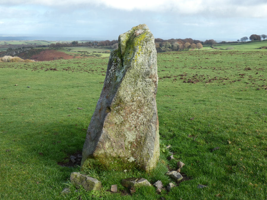
Photo taken on 02-11-2025
Database entries
OS Map: SX 60461 93334
OS Source: Garmin
HER: MDV13056
Alternate name: Halstock
Short Name: SS Halstock
Exist: Yes
Record: Unique
Record Source: Sandy
Hut Class: No
Dimensions (m): 1.4 m
Lidar: SX 60461 93334
Guide Map: 2
Nearest Bus Stop: Okehampton Railway Station (2.2 km) [Route: 118,306,6A]
Nearby sites: SX 60461 93334
Notes
HER: Small standing stone north of East Bowden, near three prehistoric cairns. Gerrard p.63: There are possible standing stones at Halstock and Butterdon Down. Two of the cairns (East Bowden 2 and 3) align on the stone.This site was brought to the attention of the author by Steve Szypko as mentioned in Gerrard's book as a possible prehistoric standing stone. It could be a modern rubbing stone but it's context close to three possible prehistoric cairns (East Bowden 1-3 SiteID=4047,4048,4049) gives credence to this being a prehistoric feature. Nearby are two parallel field banks, possible reaves. However, these features are also close to the deserted medieval settlement west of Halstock Wood (HER: MDV13058) at SX 605 933 which give an alternative context as medieval.
References
These are selected references with an emphasis on out of copyright sources linked as PDFs. For more detailed references try any linked HER or PMD record above.
- Gerrard, Sandy, English Heritage Book of Dartmoor: Landscapes Through Time, (1997)