
Hameldon Cist
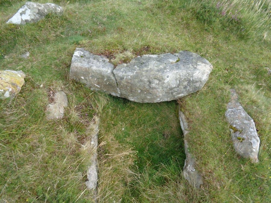
Photo taken on 19-08-2017
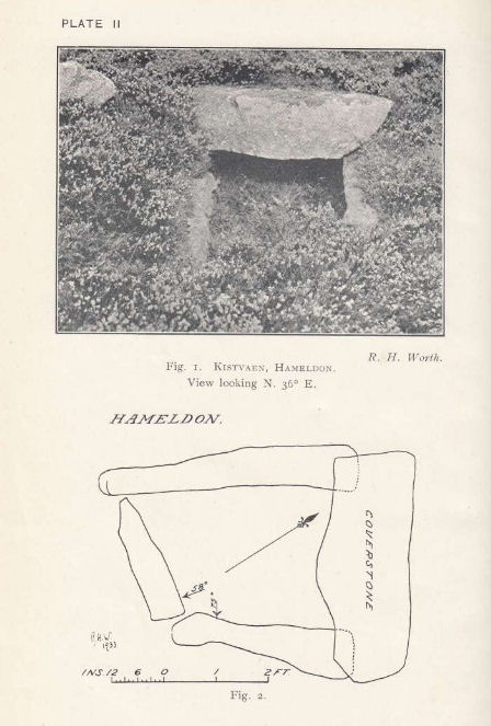
Plan by RHW. Barrow Report 54. TDA Vol.67 1935
Database entries
OS Map: SX 71008 78345
OS Source: Garmin
Butler OS: SX71027834
HER: MDV7519
Megalithic Portal: 16636
PMD: Hamel Down S.
Alternate name: Hamel Down S.
Short Name: CT Hameldon
Butler map: 20.15
Butler Vol 5: p.178 & Fig.120
Dixon Cist #: 60
Grinsell: WIDECOMBE IN THE MOOR 7
DPD page: 129
Exist: Yes
Record: Unique
Record Source: Butler
Hut Class: No
Cist Class: Yes
Cairn Class: Yes
Barrow Report: 54
Dimensions (m): c.10.0 x 0.5 C
Lidar: SX 71008 78345
Guide Map: 29
Nearest Bus Stop (Minor): Widecombe in the Moor Car Park (2.3 km) [Route: 271]
Nearest Bus Stop (Major): Warren House Inn (4.4 km) [Route: 171]
Nearby sites: SX 71008 78345
Notes
Precise location originally unsurveyed but given approximately by Worth as SX 71257908. This may explain the large discrepancy between the NMR position and that given by Butler and in the HER. Three sides of the cist are visible with the fourth having sunken below the earth. The capstone is incomplete and only partly covers the cavity. Lethbridge diagram p129 and photo top p.129. Butler Hamel Down 15 (S) - Vol. 1. Map 20.15 (Cairn 15 p.149, diagram Vol 5. p.178).References
These are selected references with an emphasis on out of copyright sources linked as PDFs. For more detailed references try any linked HER or PMD record above.
- Butler, Jeremy, Dartmoor Atlas of Antiquities, vol.1: The East, (1991)
- Butler, Jeremy, Dartmoor Atlas of Antiquities, vol.5: The Second Millennium B.C., (1997)
- Grinsell, L.V., Dartmoor Barrows, Devon Archaeological Society Proceedings No.36 (1978)
- Worth, R. Hansford, Barrow Report 54, T.D.A. Vol.67 pp.77-80 (1935)