
Lakehead Hill 6 (Newtake) Ring Setting Cairn and Cist
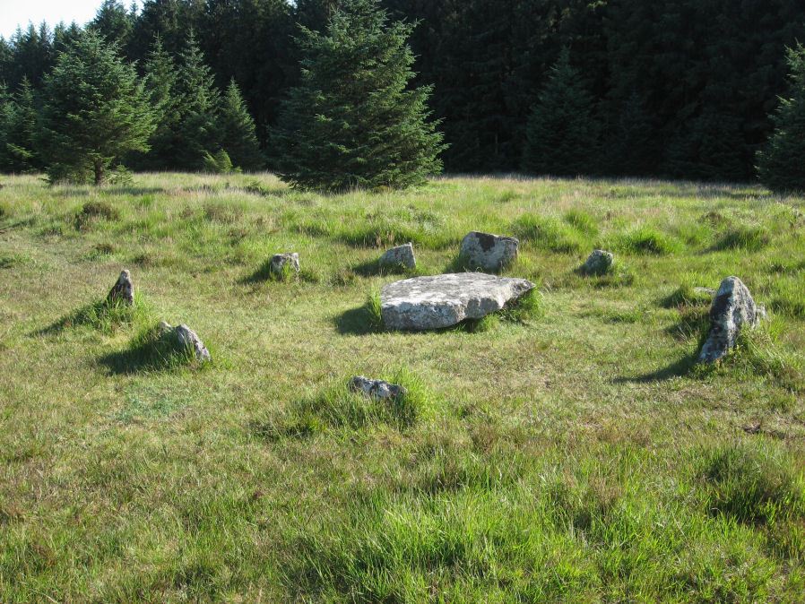
Photo taken on 22-07-2012
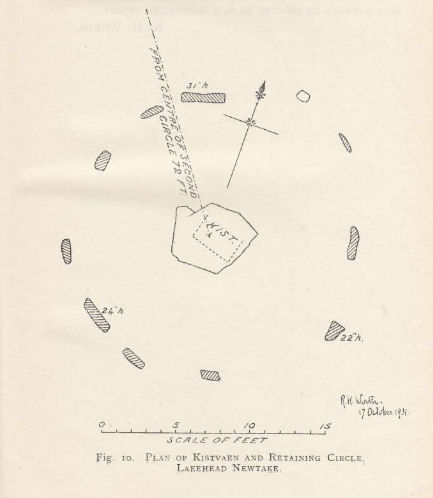
Plan by RHW. Barrow Report 54. TDA Vol.67 1935
Database entries
PDW coverage: Dartmoor Site: Lakehead Hill
OS Map: SX 64363 77475
OS Source: Google
Butler OS: SX64367747
HER: MDV5842
Megalithic Portal: 24365
PMD: Lakehead Hill Central
Alternate name: Lakehead Hill 6
Short Name: CT Lakehead 6
Butler map: 27.19.6
Dixon Cist #: 64
Grinsell: LYDFORD 56
Turner: D10
DPD page: 117
Exist: Yes
Record: Unique
Record Source: Butler
Hut Class: No
Cist Class: Yes
Cairn Class: Yes
Barrow Report: 54 56
Dimensions (m): 5.6 C
Lidar: SX 64363 77475
Guide Map: 28
Nearest Bus Stop: Postbridge Bellever (1.6 km) [Route: 98]
Nearby sites: SX 64363 77475
Notes
Further coverage on Lakehead Hill page. Lethbridge diagram p.114 and photo bottom p.117. Dixon #64. Bar Rep 54. Butler Lakehead Hill (Cairn 6) - Vol. 2. Map 27.19.6 (diagrams pp.48-52). HER: On a gentle slope near the summit of Lakehead Hill is a ring cairn and cist. The cairn measures 6.9 metres in diameter and contains a central cist. The cist protrudes 0.4 metres above the surrounding ground surface and is covered by a capstone measuring 1.7 metres long, 1.28 metres wide and 0.15 metre thick. DEC Report 3: A second small kistvaen within a circle exists on the west side of Lake Head Hill, and was examined, but nothing was found in it. The circle about it is tolerably complete and the stone chest has lost only one of the side-stones ; but it is very small. Apparently a small stone row led from it. Near the kistvaen is a circle of stones enclosing a cairn, but no kistvaen. From the circle perhaps a stone row led away east, but only three stones remain in line.Photo by RHW. Barrow Report 54. TDA Vol.67 1935.

References
These are selected references with an emphasis on out of copyright sources linked as PDFs. For more detailed references try any linked HER or PMD record above.
- Baring-Gould, Sabine, Third Report of the Dartmoor Exploration Committee, T.D.A. Vol.28 pp.174-199 (1896)
- Butler, Jeremy, Dartmoor Atlas of Antiquities, vol.2: The North, (1991)
- Grinsell, L.V., Dartmoor Barrows, Devon Archaeological Society Proceedings No.36 (1978)
- Lethbridge, William D., Discover Preshistoric Dartmoor, (2015)
- Turner, J.R., Ring Cairns, stone circles and related monuments on Dartmoor, D.A.S.P. No.48 pp.27-86 (1990)
- Worth, R. Hansford, Barrow Report 54, T.D.A. Vol.67 pp.77-80 (1935)
- Worth, R. Hansford, Barrow Report 56, T.D.A. Vol.69 pp.75-109 (1937)