
Sharpitor (N) or Peek Hill Platform Cairn Circle and Cist
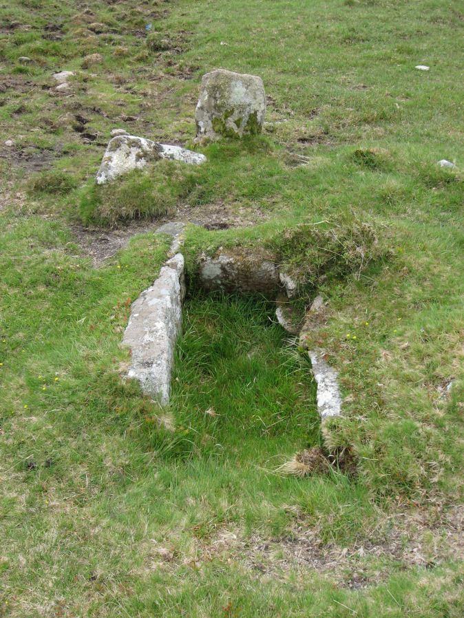
Photo taken on 25-05-2015
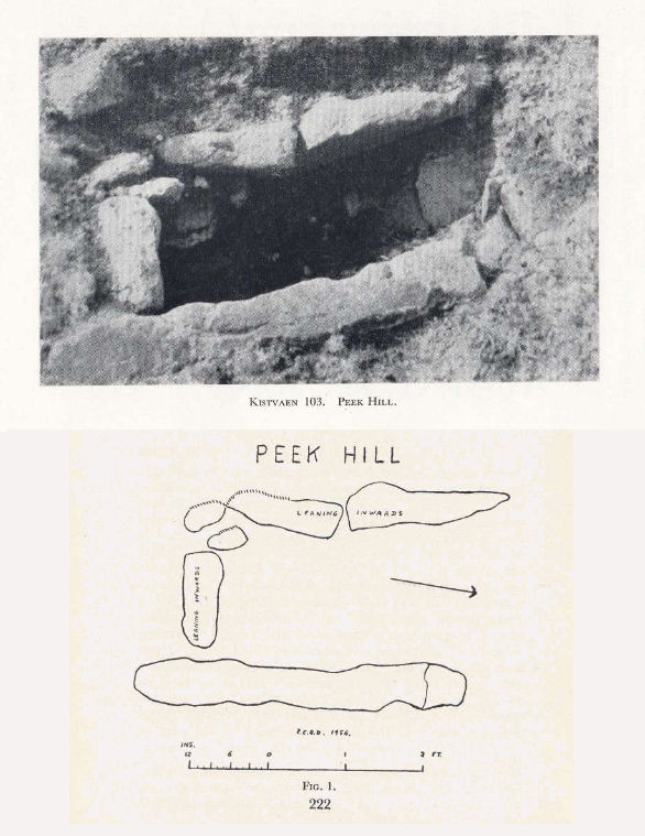
Plan by CEBD. Barrow Report 72. TDA Vol.88 1956
Database entries
PDW coverage: Dartmoor Walk: Sharpitor area Stone Rows and Cists
OS Map: SX 55839 70693
OS Source: Google
Butler OS: SX55837068
HER: MDV3769
Megalithic Portal: 1246
PMD: Peek Hill
Alternate name: Sharpitor N.
Short Name: CT Peek Hill
Butler map: 45.12
Dixon Cist #: 103
Grinsell: WALKHAMPTON 21
Turner: E41
DPD page: 22
Exist: Yes
Record: Unique
Record Source: Butler
Hut Class: No
Cist Class: Yes
Cairn Class: Yes
Barrow Report: 72
Dimensions (m): 4.0 x 0.2 C
Lidar: SX 55839 70693
Guide Map: 38
Nearest Bus Stop: Walkhampton Memorial (3.5 km) [Route: 55,56]
Nearby sites: SX 55839 70693
Notes
Bar Rep. 72 (TDA Vol 88 p.222). Butler Sharpitor N. - Vol. 3. Map 45.12 (diagram p.45 & photo p.84).Copyright for photos and plans from Barrow Reports 71-73 belong to the Dixon estate. Reproduced here with kind permission.
References
These are selected references with an emphasis on out of copyright sources linked as PDFs. For more detailed references try any linked HER or PMD record above.
- Breton, Henry Hugh, Beautiful Dartmoor And Its Interesting Antiquities, (1990)
- Butler, Jeremy, Dartmoor Atlas of Antiquities, vol.3: The South-West, (1994)
- Davidson, C. & Seabrook, R., Stone rings on south-east Dartmoor, D.A.S.P. No.31 (1973)
- Dixon, C.E.B., Barrow Report 71, T.D.A. Vol.85 pp.176-177 (1953)
- Dixon, C.E.B., Barrow Report 72, T.D.A. Vol.88 pp.222-224 (1956)
- Fox, Aileen, 20th Report on Archaeology and Early History, T.D.A. Vol.85 pp.171-2 (1953)
- Grinsell, L.V., Dartmoor Barrows, Devon Archaeological Society Proceedings No.36 (1978)
- Lethbridge, William D., Discover Preshistoric Dartmoor, (2015)
- Newman, Phil, An Archaeological Survey of an area of Walkhampton Common, Dartmoor National Park, Devon, Southwest Landscape Investigations (2019)
- Turner, J.R., Ring Cairns, stone circles and related monuments on Dartmoor, D.A.S.P. No.48 pp.27-86 (1990)
- Worth, R. Hansford, The Stone Rows of Dartmoor Part 1, T.D.A. Vol.78 pp.285-316 (1946)
- Worth, R.N., The Stone Rows of Dartmoor - Part 3, T.D.A. Vol.26 pp.296-307 (1894)