
Lower Glasscombe Cist
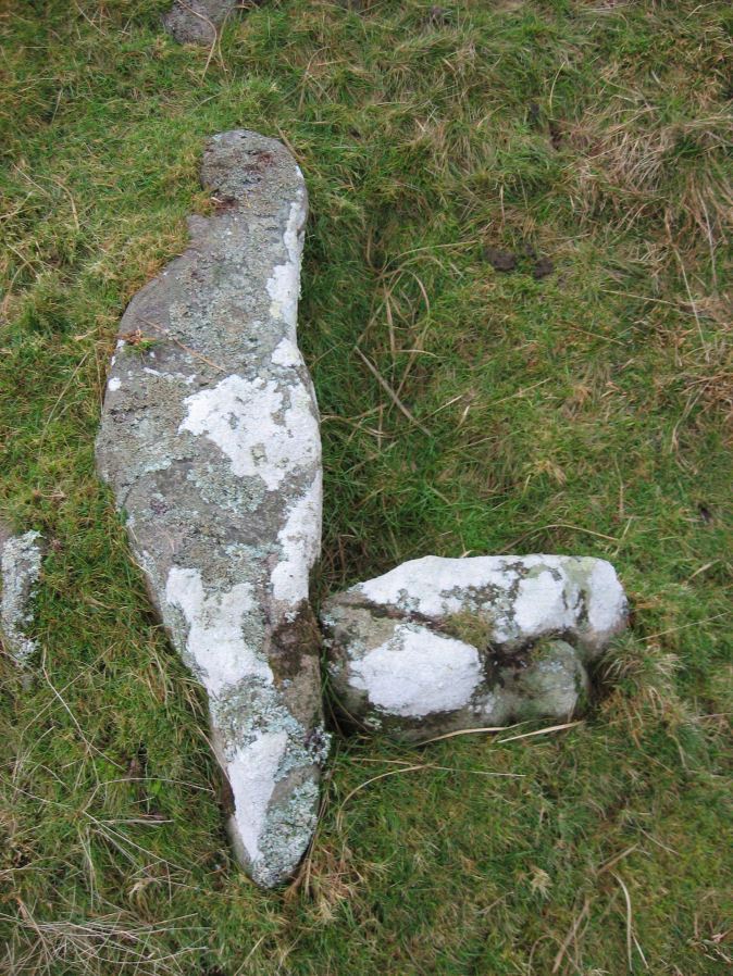
Photo taken on 12-01-2016
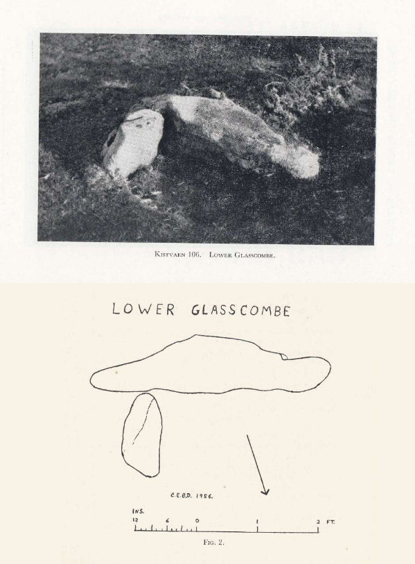
Plan by CEBD. Barrow Report 72. TDA Vol.88 1956
Database entries
PDW coverage: Dartmoor Walk: The Neolithic tombs of Cuckoo Ball & Corringdon Ball
OS Map: SX 66506 60502
OS Source: Google
Butler OS: SX66496052
HER: MDV5652
Megalithic Portal: 45761
PMD: Lower Glasscombe
Alternate name: Glaze Meet
Short Name: CT Lower Glass
Butler map: 56.3
Dixon Cist #: 106
Grinsell: UGBOROUGH 11
DPD page: 81
Exist: Yes
Record: Unique
Record Source: Butler
Hut Class: No
Cist Class: Yes
Cairn Class: Yes
Barrow Report: 72
Dimensions (m): c.4.0 x 0.1 C
Lidar: SX 66506 60502
Guide Map: 57
Nearest Bus Stop: South Brent Pool Park (4.8 km) [Route: 38]
Nearby sites: SX 66506 60502
Notes
"There is a very slight trace of a mound and scattered rocks indicate the remains of a cairn ... Only one sidestone and one endstone now remain with the coverstone lying 11 feet away to the south-east. Overall dimensions of the coverstone are 49 inches by 24 inches". Lethbridge Scad Brook cist p.81 Butler Glaze Meet - Vol. 4. Map 56.3 (diagram p.85).Copyright for photos and plans from Barrow Reports 71-73 belong to the Dixon estate. Reproduced here with kind permission.
References
These are selected references with an emphasis on out of copyright sources linked as PDFs. For more detailed references try any linked HER or PMD record above.
- Butler, Jeremy, Dartmoor Atlas of Antiquities, vol.4: The South-East, (1993)
- Dixon, C.E.B., Barrow Report 72, T.D.A. Vol.88 pp.222-224 (1956)
- Grinsell, L.V., Dartmoor Barrows, Devon Archaeological Society Proceedings No.36 (1978)
- Lethbridge, William D., Discover Preshistoric Dartmoor, (2015)