
Cullever Steps Ring Setting Cairn and Cist
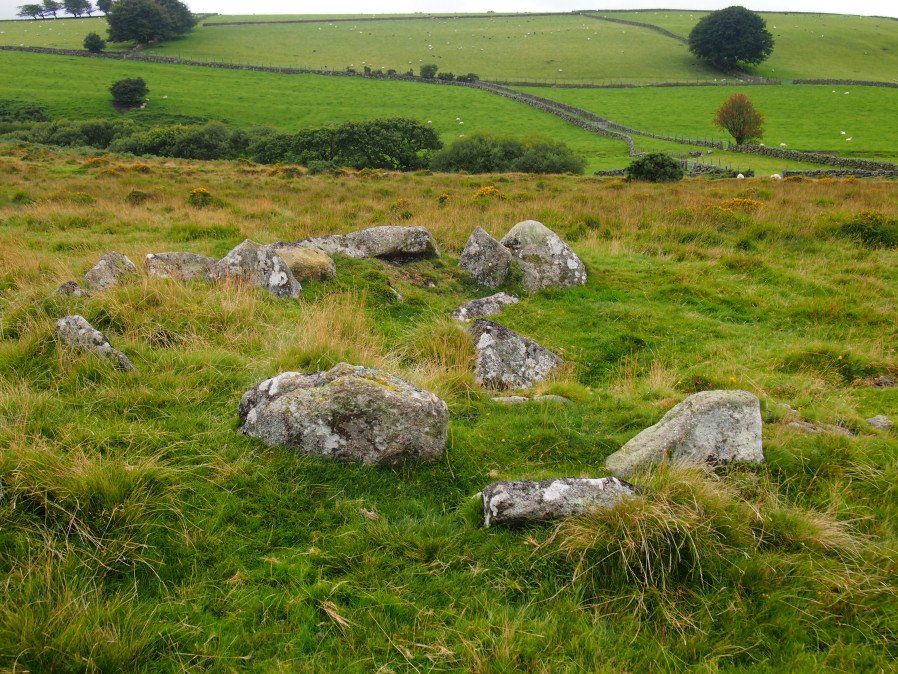
Photo taken on 04-09-2016
Database entries
OS Map: SX 60787 91954
OS Source: Garmin
Butler OS: SX60789195
HER: MDV6867
Megalithic Portal: 17956
PMD: Cullever Steps
Alternate name: Cullever Steps
Short Name: CT Cullever
Butler map: 40.14
Butler Vol 5: p.181 & Fig.123
Dixon Cist #: 138
Grinsell: BELSTONE 2
Turner: D11
Exist: Yes
Record: Unique
Record Source: Butler
Hut Class: No
Cist Class: Yes
Cairn Class: Yes
Dimensions (m): c.4.5 x 0.4 C?
Lidar: SX 60787 91954
Guide Map: 2
Nearest Bus Stop (Minor): Belstone Car Park (3.0 km) [Route: 670]
Nearest Bus Stop (Major): Okehampton Railway Station (3.0 km) [Route: 118,306,6A]
Nearby sites: SX 60787 91954
Notes
"A Bronze Age ring cairn situated below Belstone Tor within the valley of the East Okement River. The cairn survives as a 0.5 metre high bank surrounding a 4.1 metre diameter internal area. The bank around the southern and eastern side of the cairn is faced on both sides with edge set stones. A large flat stone lying on the south western part of the ring bank may represent a displaced cist coverstone. The overall dimensions of the cairn are 9.5 metres east to west by 8.5 metres north to south." Butler Vol. 2. Map 40.14 (diagram Vol. 5. p.181).References
These are selected references with an emphasis on out of copyright sources linked as PDFs. For more detailed references try any linked HER or PMD record above.
- Burnard, Robert, Notes on Dartmoor Kistvaens, T.D.A. Vol.22 pp.200-207 (1890)
- Butler, Jeremy, Dartmoor Atlas of Antiquities, vol.2: The North, (1991)
- Butler, Jeremy, Dartmoor Atlas of Antiquities, vol.5: The Second Millennium B.C., (1997)
- Grinsell, L.V., Dartmoor Barrows, Devon Archaeological Society Proceedings No.36 (1978)
- Newman, Phil, Archaeological Sites within Okehampton Training Area, Southwest Landscape Investigations (2014)
- Prowse, Arthur B., Notes on the Neighbourhood of Taw Marsh, North Dartmoor, T.D.A. Vol.22 pp.185-199 (1890)
- Turner, J.R., Ring Cairns, stone circles and related monuments on Dartmoor, D.A.S.P. No.48 pp.27-86 (1990)