
Joan Ford's Newtake Stone Row
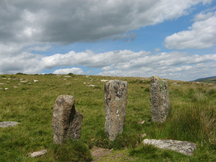
Photo taken on 21-07-2020
Database entries
OS Map: SX 63183 71987
OS Source: Garmin
HER: MDV6375
Megalithic Portal: 1985
The Stone Rows of GB: Joan Fords Newtake
PMD: Joan Ford's Newtake
Alternate name: Joan Ford's Newtake
Short Name: SR Joan Fords
Exist: Yes
Record: Unique
Record Source: SRGB
Hut Class: No
Lidar: SX 63183 71987
Guide Map: 39
Nearest Bus Stop: Two Bridges Hotel (4.9 km) [Route: 98,171,172]
Nearby sites: SX 63183 71987
Notes
Stone Rows of Great Britain states: A probable single stone row measuring 7.27m long, including at least three large-sized upright orthostats and two recumbent slabs situated on a gentle south east facing slope. The stones stand up to between 1.55m and 1.23m high, arranged in height order with the tallest at the east. The row is orientated ENE to NSW and has restricted views of several skyline cairns and surrounding landscape. Breton (p.19) ... just above the river are 3 large monoliths in a row; do they form the end of a stone row, or are they part of a vanished linhay? Both the late Mr. Robert Burnard and Mr. R. Hansford Worth told me they did not know what they are, and neither do I. All we can say is the stones are there.References
These are selected references with an emphasis on out of copyright sources linked as PDFs. For more detailed references try any linked HER or PMD record above.
- Breton, Henry Hugh, The Heart of Dartmoor, (1926)
- Worth, R.N., The Stone Rows of Dartmoor - Part 3, T.D.A. Vol.26 pp.296-307 (1894)