Assycombe Double Stone Row
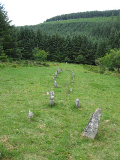
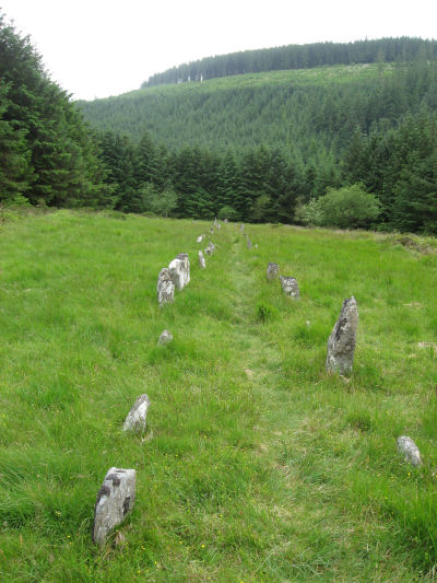
These photos are of Assycombe double stone row (SX66058260 Butler Vol. 2. Map 35; 19). This row is located in a clearing within Fernworthy Forest and can be reached by entering through the gate located at SX66078190. When discovered this row was on open moorland long before the forestation of the area. The row has some similarities with the Hurston Ridge stone row. The two are just over 1km apart and are both headed by a menhir at the uphill end and a blocking stone at the other.
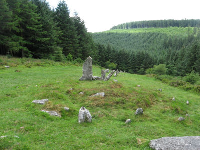
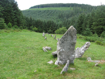
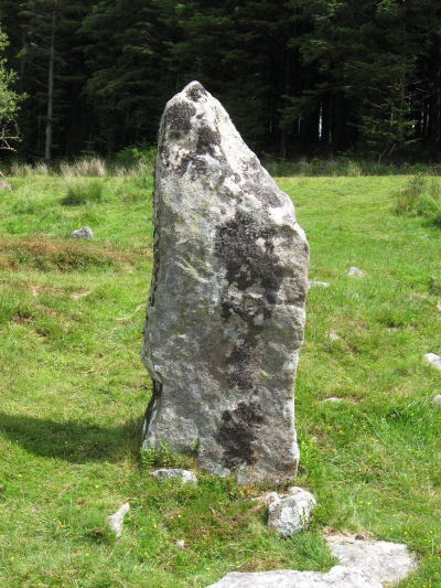
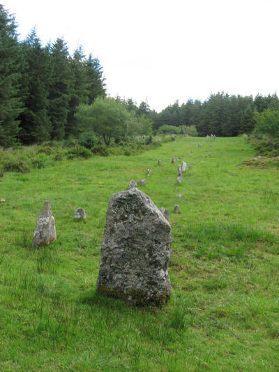
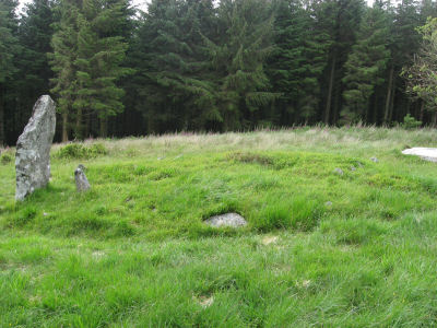
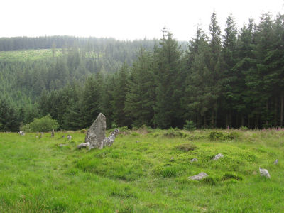
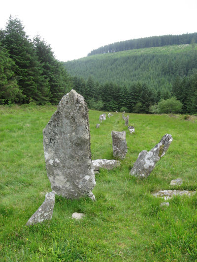
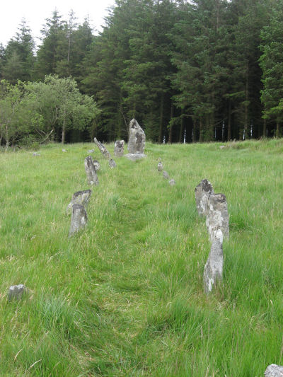
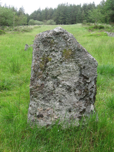
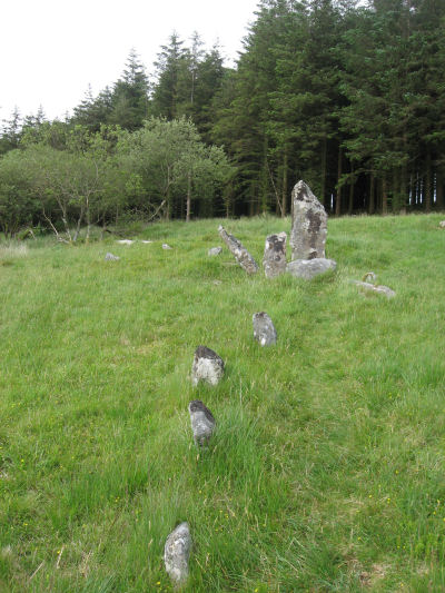
The top of the stone row, the North-East end, is terminated with a cairn and a large menhir, 2m high, and the row descends 120m downhill ending with a large blocking slab. A number of the stones of this row were restored by Baring-Gould in 1894 shortly after the row was discovered. The menhir and some of the larger stones at the top of the row were restored. These can be seen in a photo taken by Robert Burnard shortly after they were restored. It is particularly interesting to see this early image long before the forestation of the area. The blocking stone was also re-erected during the restoration as described by Burnard:
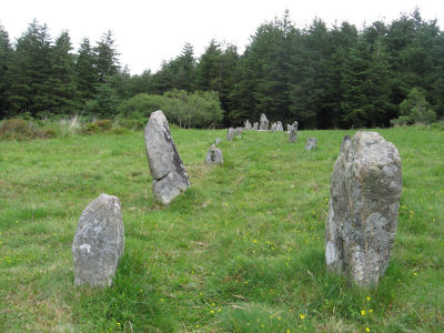
Stone row, on western slope of Assycombe Hill, which lies N.W. of Warren House Inn, distant about 14 miles from the latter. (See Sheet 69, N.E., 6" new Survey of Dartmoor.') The row, which starts from a ruined cairn, consists of 84 standing stones, and extends 800 feet E. and W., running in two rows down the hill towards Assycombe. It terminates towards the W. in a stone lying prone, 5' 9" long. 2½' wide. The avenue is from 5' to 6' wide, inner measurement. The stones composing the row are 18" high, and down to 6". (The Stone Rows of Dartmoor - Part 1 T.D.A. Vol. 24 p.389)
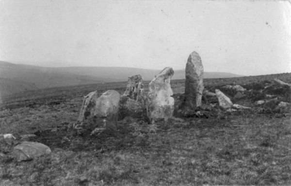
Photo: The Assycombe Stone Row showing 5 restored stones Source: Dartmoor Pictorial Records - Robert Burnard
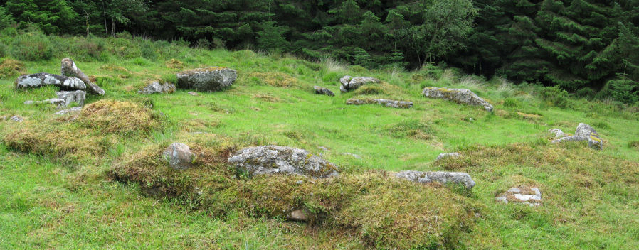
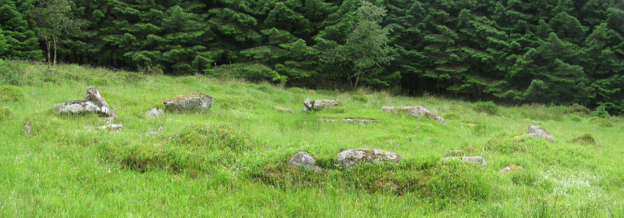
There is a hut circle in good condition within 10 feet of the stone row to the south. Worth and his colleagues in the Dartmoor Exploration Committee pointed out that this suggests the possibility that the hut circle and the stone row are of a similar age or that the hut circle was built at a time when stone rows were still a venerated tradition.
Further investigation of the row at Assycombe by the Rev. S. Baring Gould and Mr R. Burnard, has yielded very important results, which I give in Mr Baring Gould's own words: "The stones themselves are small, hardly any bigger than one man might carry, except at the head by the cairn and circle, where are 'three boys', one 7 ft, 6 in high, and the other two about 4 ft 6 in. But the important feature is this - the double row ones close, within 10 ft, of a hut circle, and I believe not one stone has been cribbed from the 'avenue' towards the construction of the hut or vice versa. Consequently it is certain that both are contemporary. (The Stone Rows of Dartmoor - Part 3 T.D.A. Vol. 26 p.298)
Today we still lack solid dating for these monuments which are all considered to date from the early Bronze Age onwards. If anything the rows are considered to generally predate the hut circles but the Dartmoor Exploration Committee were probably correct to say that those building later settlements did so respecting the earlier culture. It would have been so much easier to rob stones as building materials but they didn't in these cases. Worth in this report goes on to mention the earlier 1871 report by Spence Bate that refers to the case where the enclosure wall of a settlement on Brown Heath merges into the Hook Lake stone row. In modern terms there is no way such housing developments would get planning permission being so close to old monuments but on the other hand the builders did not damage the monuments and choose to get their building materials from further afield. It suggests a combination of pragmatism and veneration. It is certainly true that much more damage was done to stone rows in the historic period especially by the creation of the plantations at Fernworthy and Bellever. [For more on the damage to archaeology see coverage here: Lakehead Hill.
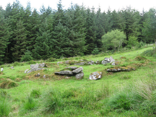
Photo: Hut Circle near the Assycombe Stone Row
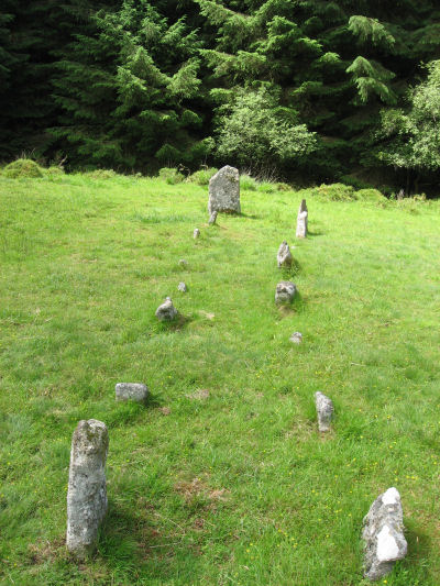
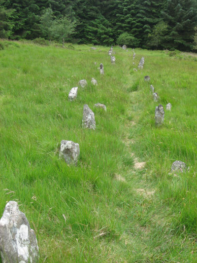
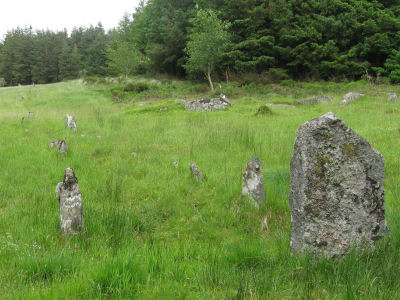
The distance between the rows fluctuates widely between 1.0m and 1.6m. Baring Gould wrote about the irregularity of the row having located the socket holes during the restoration of the row. The report quoted above continues:
Though the stones are so insignificant, the lines are singularly perfect in number of stones, but also singularly irregular, so much so that it is puzzling to account for the carelessness in getting the stones in line. We found every pit hole with triggers, and half the stones fallen flat on their faces and buried from 6 in. to 1 ft. 6 in. under turf and peat. (The Stone Rows of Dartmoor - Part 3 T.D.A. Vol. 26 p.298)
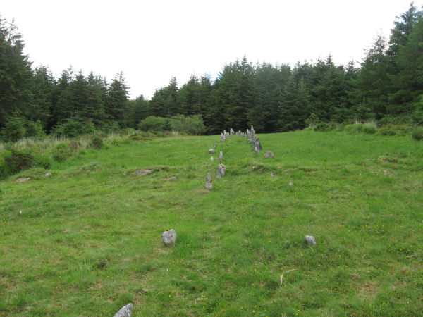
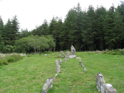
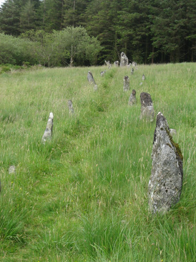
Photo: The Assycombe Stone Row crossed by a reave
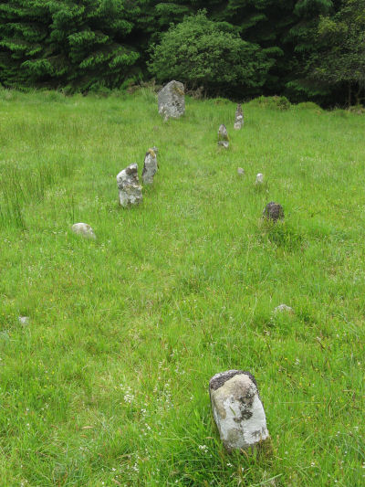
This row has one of the steepest ascents uphill of any Dartmoor row. Half way along the row is crossed by a north-south reave as can be seen in the photo above. The cairn at the E end is in line with the N of the two rows. It measures 8.4m in diameter and is 0.6m high. It contains a large quantity of stone; two stones in the centre, set at right angles to each other around a hollow, suggest that it once held a cist.
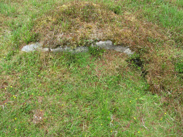
Photo: The Assycombe Stone Row terminal cairn contains a probable cist
There are two sets of photos below. The first were taken on the 1st July 2012 and the second on the 25th July 2015. The photos by the author above were also taken on 25th July 2015.
See also: Guide to Dartmoor Stone Rows
Bibliography & references
Bate, C Spence On the Prehistoric Antiquities of Dartmoor The Journal of the Royal Anthropological Institute of Great Britain and Ireland (1872) originally published T.D.A. Vol. 4 pp.491-5515 (1871)
Burnard, Robert Dartmoor Pictorial Records (Devon Books, 1986)
Butler, J. Dartmoor Atlas of Antiquities: Vol. 2. - The North (Devon Books, 1991)
Worth, R.N., The Stone Rows of Dartmoor - Part 1, T.D.A. Vol. 24 pp.387-417 (1892)
Worth, R.N., The Stone Rows of Dartmoor - Part 3, T.D.A. Vol. 26 pp.296-307 (1894)
Assycombe Double Stone Row - Photos 2012
The photos below start with the cairn and the NE terminal stone and follow the row downhill towards the blocking stone. There is a hut circle which can be seen in the background of one of the last photos and this photo is followed by a wide view of the hut circle. The photos are then taken ascending back up the hill. The cairn can be made out in the last photo just beyond the terminal stone. These photos were taken on the 1st July 2012.

Assycombe Double Stone Row - Photos 2015
The photos start with the cairn. The multiple rings around the cairn can be seen clearly here. The photos looking along the row show how drastically the spacing can vary which is clearly an original feature. This row was built for appearance and not for precision. The merged wide photo is of the hut circle. The last two photos are of the menhir looking upwards (NE) and the blocking stone looking down the row (SW). These photos were taken on the 25th July 2015 - as were some used within the article above.