
Prehistoric sites within 5km of SX 50253 79579
Guidance for walkers: The monuments featured in this database are archaeological treasures and need to be protected and preserved - please do not disturb any sites. Please check access and firing times before visiting sites, not all sites listed are on open access land. Firing ranges and boundaries of open access areas are marked on the OL28 OS Dartmoor Explorer map. Please stick to the country code and consider giving support to the numerous agencies that help to keep Dartmoor a fabulous natural and historic environment!
About the database listings: In all listings clicking on the photo or the site name will open a page for the site with a larger photo and further details from the database. The database now has over 6680 records covering nearly all publicly listed sites on Dartmoor including around 4800 round houses. This level of detail is of interest to archaeologists but tends to swamp listings of sites more likely to be of interest for walkers. For this reason, the listings default to around 550 core sites only. These are the stone circles, stone rows and the ring cairns listed by Turner. The default search radius is 2 km. The controls below the map can be used to start a new search by entering a 6- or 8-digit reference (without the prefix "SX"). The search radius can be specified and you can add incremental Display layers of detail on top of the core sites. If using a more detailed layer you will need to decrease the search radius to avoid getting hundreds of search results.
- Core sites Default listing of core sites consisting of stone circles & rows and some of the major ring cairns.
- Plus cairns adds approx. 1000 cairns and other minor sites not included in the core listings but excluding round houses.
- Plus round houses adds approx. 4800 round houses.
- Plus non-sites adds in the records for sites that no longer exist or are not prehistoric sites.
- Plus duplicates adds records excluded as duplicates. Those maybe duplicate records in external listings (e.g. the Historic Environment Records). For example, some sites have been identified as cairns in some listings and interpreted as round houses in other listings and both records appear.
These listings have incorporated, matched up and merged all of the records from all of the major archaeological listings including: Worth, Grinsell, Turner, Butler, Bill Radcliffe, Sandy Gerrard, Megalithic Portal, the National Monument Records and the Historic Environment Records. The author would like to thank Bill, Sandy, the lovely people both at Megalithic Portal (especially Anne Tate who did an amazing job to link listings) and at ACE Archaeology for collaborative work over the years to synchronise and correct listings across the various websites which now interlink. A culmination of years of work the final merger of cairn records took 3 months of cross referencing in 2017 the result being a snapshot of the records at that time. This data has in turn been refined since by field work and research. The round house data was supplied by Sandy Gerrard. Grid references are in order of accuracy: from Google Earth satellite, if visible and found, from a Garmin GPS reading, if visited by the author and from the literature otherwise. Individual site pages will state the source of the grid reference and provide satellite imagery. If a site listing lacks a photo it has not yet been visited by the author in which case the grid reference is from the literature.
Currently the database only includes sites which can be represented by a grid reference. Reaves are not included as they require GIS shape technology which is beyond the current capability of this system. To see the sources for the records, look at the tables on the resources menu. The database listings can also be viewed on a Google map and downloaded as GPS datasets for Garmin devices.
Corrections, or any feedback or suggestions are very welcome, email: info@dartmoorwalks.org.uk.
NOTE: Clicking on the icons for each monument in the map will give the name of the site. You can zoom in and out and drag the map around.
List of sites within 5km of SX 50253 79579
Black Hill Stone Ring Cairn Circle
OS Map: SX 522 824
HER: MDV53274
ShortName: RC:BlackHill
Notes: NGR is 6 digit from HER. HER: A very low banked ring cairn, positioned on the top of a fairly flat-topped hill, about 400 meters south of the ring cairn known as ‘Ring O’ Bells’. The cairn bank measures approximately 16 meters diameter externally and is 0.30 meters maximum in height (at the south-west segment) and is scarcely discernible at the north-east segment.
Nearby sites: SX 522 824
Distance: 3.43km

White Hill S.W. Cairn Alignment
OS Map: SX 52941 83690
HER: MDV50152
Megalithic Portal: 45821
ShortName: CR WhiteHiSW
Notes: A linear arrangement of 6 large cairns. Another two result in an L-shape. Butler: The cairn cemetery to the south-west of White Hill includes eight cairns laid out in an L-shape. Three were excavated by Baring-Gould in around 1888. Despite their comparatively large size he only found a shallow pit dug into the subsoil at the centre of each containing charcoal and ashes.
Nearby sites: SX 52941 83690
Distance: 4.91km
Bagga Tor Cairn
OS Map: SX 5479 8041
HER: MDV12863
ShortName: CN:Bagga Tor
Notes: "Probable prehistoric cairn apparently composed mostly of small stones. There is a possibility of a raised circular bank of stone on its s and e sides. Robbed on w side. Maximum diameter 14.0m, height 1.5m"
Nearby sites: SX 5479 8041
Distance: 4.61km

Brent Tor Fort
Prehistoric Dartmoor Walks: Dartmoor Resource: Table of Devon Iron Age Forts
OS Map: SX 471 804
HER: MDV1669
Megalithic Portal: 28169
ShortName: FT Brent Tor
Notes: HER: Iron Age hillfort at Brent Tor, with an incomplete rampart enclosing the north and eastern sides of the tor. The hill was subsequently used by the abbots of Tavistock as the site for Brentor parish church. Additional earthworks within the area enclosed by the rampart may represent the site of a medieval fair and post-medieval quarrying or mining.
Nearby sites: SX 471 804
Distance: 3.26km
Brent Tor A Ancient Pool
OS Map: SX 46543 80335
HER: MDV127195
ShortName: PO:Brent Tor A
Notes: Greeves: Brent Tor pool A measures around 40 by 30m. One of over 40 such 'sacred' pools identified on Dartmoor (or just outside the boundary of the National Park) that are thought to have potentially been designed during the prehistoric period
Nearby sites: SX 46543 80335
Distance: 3.79km
Brent Tor B Ancient Pool
OS Map: SX 46610 80291
HER: MDV127199
ShortName: PO:Brent Tor B
Notes: Greeves: Brent Tor pool B measures around 50 by 40m. One of over 40 such 'sacred' pools identified on Dartmoor (or just outside the boundary of the National Park) that are thought to have potentially been designed during the prehistoric period
Nearby sites: SX 46610 80291
Distance: 3.71km
Brent Tor C Ancient Pool
OS Map: SX 46648 80267
HER: MDV127200
ShortName: PO:Brent Tor C
Notes: Greeves: Brent Tor pool C measures around 40 by 35m. One of over 40 such 'sacred' pools identified on Dartmoor (or just outside the boundary of the National Park) that are thought to have potentially been designed during the prehistoric period
Nearby sites: SX 46648 80267
Distance: 3.67km
Brent Tor D Ancient Pool
OS Map: SX 46679 80226
HER: MDV127201
ShortName: PO:Brent Tor D
Notes: Greeves: Brent Tor pool D measures around 28 by 25m. One of over 40 such 'sacred' pools identified on Dartmoor (or just outside the boundary of the National Park) that are thought to have potentially been designed during the prehistoric period
Nearby sites: SX 46679 80226
Distance: 3.63km
Burnford Common E Cairn
OS Map: SX 4815 7927
HER: MDV22747
ShortName: CN:Burnford E
Notes: HER quoting Greeves: One of two probable prehistoric cairns almost 1.2 kilometres west-north-west of Burnford Farm. A low ring cairn, about 50.0 metres east of the south-east corner of a modern enclosure. A low ring bank survives but this has been cut through on the north side by a ditch running east-west. Maximum external diameter is approximately 15.0 metres.
Nearby sites: SX 4815 7927
Distance: 2.13km
Burnford Common W Cairn
OS Map: SX 4814 7927
HER: MDV22746
ShortName: CN:Burnford W
Notes: Greeves quoted on HER: One of two probable prehistoric cairns close by the highest piece of rough ground almost 1.5 kilometres west-north-west of Burnford Farm. This, the most westerly cairn lies immediately east of the south-east corner of a modern enclosure. It appears to have been heavily robbed on its north side and cut through by an east-west ditch on the south. Original maximum diameter approximately 20.0 metres.
Nearby sites: SX 4814 7927
Distance: 2.14km
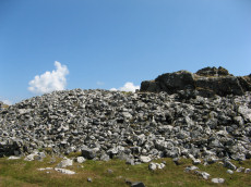
Cox Tor Stone Ring Cairn Circle
OS Map: SX 53060 76190
HER: MDV4151
Megalithic Portal: 32104
Alternate name: Cox Tor Summit Stone Ring Cairn Circle
ShortName: RC CoxTor 3
Butler map: 31.1.3
Grinsell: PET 37a
Turner: A59
Notes: "Cox tor, ring cairn. The outcrop of granite on the summit is surrounded by an ancient wall, enclosing a space of about 21m in diameter, built of small stones. Pillaged and part used in erection of the cairn for the 1887 jubilee."
NB. The NMR listings had two entries for this feature. The entry SiteID=3229 referred to NMR entry SX 57 NW 132 (Monument Number 919075) which was a duplicate. As the NMR listings are no longer public our entry SiteID=3229 has been deleted.
Nearby sites: SX 53060 76190
Distance: 4.40km

Cox Tor Ancient Pool
OS Map: SX 53635 76205
HER: MDV26281
ShortName: PO Cox Tor
Notes: "Previously recorded from aerial photographs as a possible quarry. Marked as 'pond' on modern mapping and is one of the examples suggested by Greeves (2019) to potentially have Prehistoric origins."
Nearby sites: SX 53635 76205
Distance: 4.78km
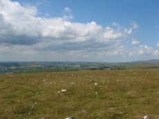
Cox Tor (NE) Stone Ring Cairn Circle
OS Map: SX 53047 76430
HER: MDV4127
Megalithic Portal: 32104
Alternate name: Cox Tor N.6 Stone Ring Cairn Circle
ShortName: RC CoxTor 6
Butler map: 31.1.6
Grinsell: PET 36
Turner: A51
Notes: "Narrow ridge of north-south outcropping rock measuring 10 metres in diameter, surrounded by circular stoney bank 4 metres wide, 0.8 metres high. 1890 excavation showed it to consist of an outer bank with central infill of loose stones and earth. No trace of burials or artefacts." "Cox Tor. Smaller of two adjacent cairns. Lies 12.5 metres south-east of larger one (see related record). Similar in shape, though smaller; diameter 8.23 metres. Construction of centre was loose, much earth being mingled with the stone. Nothing found and no pit in the "calm". (Baring-Gould - fifth report of the DEC) Breton p.16 Two very curious ring cairns; one has a diameter of 55ft and the other 27ft.
Nearby sites: SX 53047 76430
Distance: 4.21km
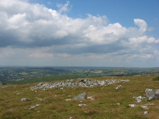
Cox Tor (NW) Stone Ring Cairn Circle
OS Map: SX 53024 76424
HER: MDV4128
Megalithic Portal: 32104
Alternate name: Cox Tor N.5 Stone Ring Cairn Circle
ShortName: RC CoxTor 5
Butler map: 31.1.5
Grinsell: PET 35
Turner: A48
Notes: Breton p.16 Two very curious ring cairns; one has a diameter of 55ft and the other 27ft.
Nearby sites: SX 53024 76424
Distance: 4.20km
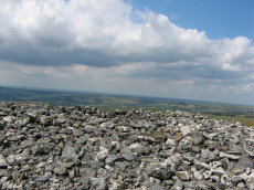
Cox Tor N.4 Cairn
OS Map: SX 53032 76347
HER: MDV4191
ShortName: CN CoxTor 4
Butler map: 31.1.4
Grinsell: PET 37
Notes: HER: Oval cairn of 23.8 metres by 28.2 metres by 1.2 metres high lying 160 metres to the north of Cox Tor
Nearby sites: SX 53032 76347
Distance: 4.26km
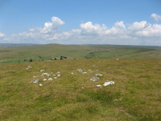
Cox Tor N.7 Cairn
OS Map: SX 53053 76495
HER: MDV49710
ShortName: CN CoxTor 7
Butler map: 31.1.7
Notes: HER: Small mutilated cairn of 5.8 metres in diameter and 0.5 metres high lying 300 metres north of Cox Tor
Nearby sites: SX 53053 76495
Distance: 4.17km
Cox Tor N.E. Settlement
OS Map: SX 536 765
HER: MDV4105
Megalithic Portal: 17508
ShortName: ST:CoxTorNE
Notes: Details via Megalithic Portal.
Nearby sites: SX 536 765
Distance: 4.55km
Cox Tor S.E.10 Clearance Cairn
OS Map: SX 531 761
HER: MDV49831
ShortName: CN?CoxTor10
Notes: HER (1987): SX 5321 7618. An oval cairn situated on a slight slope SE of Cox Tor. It is composed of small and medium size stones (up to 0.2m diameter) forming a mound 4.6m by 4m and 0.35m to 0.45m high. There is a flattish top 2m across. No formal constructional details are visible. This cairn is similar to another situated 45m to the SW (see SX 57 NW 94). Its small size might suggest a connection with clearance; there are hut circles in the vicinity (see SX 57 NW 40, 141).
Nearby sites: SX 531 761
Distance: 4.50km
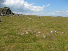
Cox Tor S.E.8 Cairn
OS Map: SX 53206 76138
HER: MDV28512
ShortName: CN CoxTor 8
Butler map: 31.1.8
Notes: Butler lists a pair of two small cairns south of the tor; cairn 8 at SX 5316 7613 and cairn 9 at SX 5318 7614.
Nearby sites: SX 53206 76138
Distance: 4.53km
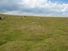
Cox Tor S.E.9 Cairn
OS Map: SX 53228 76174
HER: MDV4108
ShortName: CN CoxTor 9
Butler map: 31.1.9
Notes: Butler lists a pair of two small cairns south of the tor; cairn 8 at SX 5316 7613 and cairn 9 at SX 5318 7614. The author visited this area and found two possible cairns that could match the pair are located around 30-40 metres to the north-east. These match very closely to the NGR given by the the HER for SX 53210 76180 (HER 28512) and SX 53203 76131 (56607).
Nearby sites: SX 53228 76174
Distance: 4.52km

Cox Tor Tor Cairn Stone Ring Cairn Circle
OS Map: SX 53012 76012
HER: MDV50062
ShortName: RC CoxTor 2
Notes: A well preserved Tor cairn approximately 21m in diameter encloses a small, unamed tor 180m SSW of Cox Tor. It comprises a ring of large to medium stones approximately 7m in width which are piled around a natural outcrop. The stones are of a fairly uniform size and most are not earth-fast. To the immediate NE a stretch of low turf-covered rubble walling 1.2m wide, 0.4m high and 15m in length connects two outcrops - it is probably of prehistoric origin but its function is obscure..
Nearby sites: SX 53012 76012
Distance: 4.51km
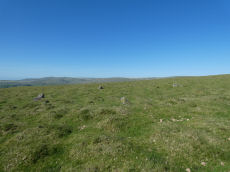
Cudlipptown Down Embanked Cairn Circle
OS Map: SX 53732 78949
HER: MDV13252
Megalithic Portal: 45608
Alternate name: White Tor N.W.2 Embanked Cairn Circle
ShortName: CC White NW2
Butler map: 31.23.2
Butler Vol 5: p.188 & Fig.130
Grinsell: PET 21
Turner: B5
Notes: "A ring cairn set at the eastern end of a natural gently sloping plateau of rough grassland generally devoid of stones. It measures about 11m diameter inside a turf-covered bank, composed generally of smallish stones, which is about 2.2m wide and has a maximum height of 0.4m on the E. It has been mutilated and spread in the south-east and the west. Several stones, are evident, two probably set in the inner face but the rest are apparently part of the bank of even part of the outer face. Two in the east on the uphill side appear to form an entrance but this is possibly due to mutilation. The interior appears to have been levelled and is 0.2m above the ground to the W. There is no evidence of any internal features or a ditch"
Nearby sites: SX 53732 78949
Distance: 3.54km
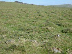
Cudlipptown Down 1 Cairn
OS Map: SX 53524 79061
HER: MDV56602
ShortName: CN Cudlipp 1
Butler map: 31.16.1
Notes: Cairn is in foreground of photo. NMR C - Butler lists 2 cairns NMR Lists 4. "4 small cairns situated on a slight slope, on the line of a parallel reave, on cudlipptown down. Their origin and function are obscure but they appear to post-date the reave." ...
Nearby sites: SX 53524 79061
Distance: 3.31km
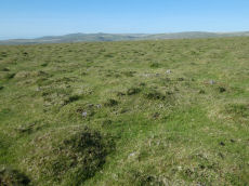
Cudlipptown Down 2 Cairn
OS Map: SX 53507 79052
HER: MDV56602
ShortName: CN Cudlipp 2
Butler map: 31.16.2
Notes: NMR B - Butler lists 2 cairns NMR Lists 4. "4 small cairns situated on a slight slope, on the line of a parallel reave, on cudlipptown down. Their origin and function are obscure but they appear to post-date the reave." ... "'a' sx53387898.2m by 1.6m wide, 0.3m high. Partly turf-covered small and medium-size stones forming a low, near circular cairn. 'b' sx53497904.5.6m by 5m wide, 0.4m high. A roundish, flat-topped cairn of small-medium sized, partly turf-covered stones. There appears to be some disturbance, possibly a narrow trench, running from the cairn centre to the n edge. 'c' sx53517905.3.1m diam, 0.35m high. Otherwise very similar to 'b'. 'd' sx53557907.2m diam by 0.3m high (nmr, citing Pattison)."
Nearby sites: SX 53507 79052
Distance: 3.30km
Cudlipptown Down N. Reported Cairn
OS Map: SX 5337 7946
HER: MDV133726
ShortName: CN?Cudlipp N
Butler map: 31.17
Notes: Butler: "an isolated stony mound is probably a burial cairn".
Nearby sites: SX 5337 7946
Distance: 3.12km
Down Pool Ancient Pool
OS Map: SX 52285 82404
HER: MDV127205
ShortName: PO:Down Pool
Notes: "Down Pool, Black Hill (Mary Tavy) measures 23 by 24m One of over 40 such 'sacred' pools identified on Dartmoor that are thought to have potentially been designed during the prehistoric period"
Nearby sites: SX 52285 82404
Distance: 3.48km

Gibbet Hill 1 Stone Ring Cairn Circle
OS Map: SX 49975 80875
HER: MDV22751
Megalithic Portal: 45828
ShortName: RC GibbetHill1
Grinsell: MAR 1
Notes: "A stone ring, probably the remains of a ring cairn, 430 metres south-west of Gibbet Hill summit. This site is on the local list of Nationally Important Dartmoor sites. Dimensions noted by Greeves as approximately 22 metres in external diameter with the ring bank being a maximum of approximately 7.0 metres wide by approximately 0.5 metres in height."
Photo and annotated photo reproduced with kind permision by Steve Grigg. Copyright remains with Steve. See also coverage on Dartmoor Explorations: Gibbet Hill Mine.
Nearby sites: SX 49975 80875
Distance: 1.33km

Gibbet Hill 2 Stone Ring Cairn Circle
OS Map: SX 50298 81148
HER: MDV3202
ShortName: RC GibbetHill2
Notes: "A barrow was recorded somewhere near the summit of Gibbet Hill in 1891. Greeves recorded two ring cairns here in 1993 one of which is likely to be the same feature. This ring cairn lies around 20 metres west of the trig point. The cairn has a disturbed ring bank and measures about 18 metres in diameter."
This record was missing and added after correspondence from Steve Grigg on 22/11/2024. Photo and annotated photo reproduced with kind permision by Steve Grigg. Copyright remains with Steve. See also coverage on Dartmoor Explorations: Gibbet Hill Mine.
Nearby sites: SX 50298 81148
Distance: 1.57km

Gibbet Hill 3 Stone Ring Cairn Circle
OS Map: SX 50349 81183
HER: MDV124454
Alternate name: Gibbet Hill 3 Stone Ring Cairn Circle
ShortName: RC GibbetHill3
Notes: "Recorded in 1993 by Greeves around 40 metres north-east of the trig point at the summit of the hill. A cairn in the form of a very slight sunken ring about 15 metres in diameter."
This record was missing and added after correspondence from Steve Grigg 22/11/2024. Photo and annotated photo reproduced with kind permision by Steve Grigg. Copyright remains with Steve. See also coverage on Dartmoor Explorations: Gibbet Hill Mine.
Nearby sites: SX 50349 81183
Distance: 1.61km
Gibbet Hill 4 Cairn
OS Map: SX 496 808
HER: MDV124453
ShortName: CN:GibbetHill4
Notes: Well-preserved small, low cairn, visible within a firebreak of mown vegetation. Measures approximately 9 - 10 metres in diameter and a maximum height of 0.3 - 0.4 metres. It is slightly dished in the centre. Small stones are visible as part of its make-up.
Nearby sites: SX 496 808
Distance: 1.38km
Heathfield 1 Reported Cairn
OS Map: SX 4543 7965
HER: MDV3837
ShortName: CN:Heathfld 1
Grinsell: LAM 1
Notes: Grinsell:Barrow with flattish top in rough pasture. Possibly ditched. 21 metres diameter, 0.8 metres high. HER: Bowl barrow, 22 metres diameter and 0.7 metres high, with surrounding ditch. An outlier of the round barrow cemetery at Heathfield to the east.
Nearby sites: SX 4543 7965
Distance: 4.82km
Heathfield 10 Reported Cairn
OS Map: SX 4634 7942
HER: MDV3836
ShortName: CN:Heathfld10
Grinsell: LAM 10
Notes: Grinsell: Round barrow located in pasture, 20 metres diameter, 0.4 metres high.
Nearby sites: SX 4634 7942
Distance: 3.92km
Heathfield 2 Reported Cairn
OS Map: SX 4567 7963
HER: MDV3835
ShortName: CN:Heathfld 2
Grinsell: LAM 2
Notes: Grinsell: Barrow with flattish top situated in rough pasture. Possibly ditched. 23 metres diameter, 1.0 metres high. HER: Bowl barrow situated on a prominent upland ridge, part of a round barrow cemetery, the other components of which lie to the west, east and southeast. The barrow also straddles a parish boundary. Circular flat-topped mound whch measured 24.9 metres in diameter and up to 1.0 metres high. The surrounding quarry ditch from which material to construct the mound was derived is visible to the north, east and west where is measures up to 4.1 metres wide and 0.1 metres deep. Some possible slight traces of ridge and furrow representing medieval farming practice are evident across the mound and in the surrounding heath.
Nearby sites: SX 4567 7963
Distance: 4.58km
Heathfield 3 Reported Cairn
OS Map: SX 4599 7960
HER: MDV3844
ShortName: CN:Heathfld 3
Grinsell: LAM 3
Notes: Grinsell: Round barrow with possible ditch situated in rough pasture. 18.0 metres diameter, 0.8 metres high. HER: On a flattish hilltop, a flat-topped platform barrow, 20.0 metres in diamter and 0.7 metres igh. Traces of ditch no visible on ground. In good condition, grass covered, but crossed by narrow rig and furow. No finds were made.
Nearby sites: SX 4599 7960
Distance: 4.26km
Heathfield 4 Reported Cairn
OS Map: SX 4605 7958
HER: MDV3845
ShortName: CN:Heathfld 4
Grinsell: LAM 4
Notes: Grinsell: Round barrow with possible ditch, situated in rough pasture.
HER: Large bowl barrow (B), 20.0 metres diameter, 1.0 metres high. In fairly good condition, turf-covered with slight traces of surrounding ditch. A small rabbit scrape in the west side reveals the materials with which the barrow was constructed to be a dark loam containing fragments of fine-grained sandstone and white spar. Other details: Barrow B.
Nearby sites: SX 4605 7958
Distance: 4.20km
Heathfield 5 Reported Cairn
OS Map: SX 4613 7959
HER: MDV3846
ShortName: CN:Heathfld 5
Grinsell: LAM 5
Notes: Grinsell: Round barrow in rough pasture with possible ditch. 25 metres diameter, 1.3 metres high.
HER: Round barrow, possibly a bell barrow, 24.5 metres diameter and 1.3 metres high.
Nearby sites: SX 4613 7959
Distance: 4.12km
Heathfield 6 Reported Cairn
OS Map: SX 4616 7960
HER: MDV3847
ShortName: CN:Heathfld 6
Grinsell: LAM 6
Notes: Grinsell: Round barrow, east part removed to build walls which meet near the centre. Diameter 22 metres, height 1.4 metres. Possibly the beacon.
Nearby sites: SX 4616 7960
Distance: 4.09km
Heathfield 7 Reported Cairn
OS Map: SX 4624 7959
HER: MDV12636
ShortName: CN:Heathfld 7
Grinsell: LAM 7
Notes: Grinsell: Round barrow on waste ground at Heathfield. 16 metres diameter, 0.7 metres high.
HER: Low flat-topped mound covered by turf and bushes. 17 metres diameter at the base, 11 metres at the top. 0.35 metres high. Small test pit in the top revealed layers of wood ash on grey clay with charcoal beneath which, at a depth of 0.4 metres was found yellow clay presumed to be the subsoil.
Presence of ash has been suggested as evidence that this was the beacon and not the more prominent cairn 6.
Nearby sites: SX 4624 7959
Distance: 4.01km
Heathfield 8 Reported Cairn
OS Map: SX 4621 7941
HER: MDV3848
ShortName: CN:Heathfld 8
Grinsell: LAM 8
Notes: Grinsell: Gorse-covered round barrow. Appearance of raised central area may be due to disturbance followed by vegetation growth. 21.0 metres diameter, 1.0 metres high.
Nearby sites: SX 4621 7941
Distance: 4.05km
Heathfield 9 Reported Cairn
OS Map: SX 4626 7950
HER: MDV3856
ShortName: CN:Heathfld 9
Grinsell: LAM 9
Notes: Grinsell: Round barrow located in rough pasture. 22.0 metres diameter, 0.7 metres high.
HER: Flat-topped platform barrow on hilltop within an area of enclosed common. 25.0 metres diameter and 0.8 metres high, the southeast side cut back about 4.0 metres for the removal of earth and stone. A ditch 1.8 metres wide and 0.1 metres deep can be traced around the northern half accompanied by a slight bank forming a rim at the perimeter of the mound. This is approximately 1.7 metres wide and 0.1 metres high and appears to be a later addition (possibly for a tree ring) In fair condition. No finds.
Nearby sites: SX 4626 7950
Distance: 3.99km
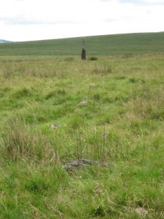
Langstone Moor Stone Row
Prehistoric Dartmoor Walks: Dartmoor Site: Langstone Moor Stone Circle, Stone Row & Settlements
OS Map: SX 55022 78851
HER: MDV4223
Megalithic Portal: 2016
The Stone Rows of GB: Langstone Moor
PMD: Langstone Moor I Stone Row
ShortName: SR Langstone
Butler map: 30.12
DPD page: 14
Notes: "A single stone row stands on Launceston (Langstone). Moor circa 330 feet in length, probably longer when complete. There are now only 18 stones, the largest of which stands only 18 inches above ground. At the north end are the remains of a barrow, now reduced to little more than a rubble ring. At the south end is the standing stone known as the 'Langstone', from which the moor probably takes its name. The stone was re-erected in 1893 and stands to a height of 9 feet 3 inches."
Nearby sites: SX 55022 78851
Distance: 4.82km
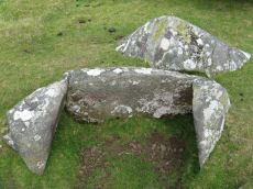
Langstone Moor Cist
Prehistoric Dartmoor Walks: Dartmoor Site: Langstone Moor Stone Circle, Stone Row & Settlements
OS Map: SX 54699 78695
HER: MDV4118
Megalithic Portal: 35807
PMD: White Tor E.
Alternate name: White Tor E.4 Cist
ShortName: CT White E4
Butler map: 31.22.4
Butler Vol 5: p.174 & Fig.114
DPD page: 13
Grinsell: PET 27
Barrow Report: 55
Notes: Butler White Tor E.4. Vol. 2. Map 31.22 (diagram Vol. 5. p.174).
Nearby sites: SX 54699 78695
Distance: 4.53km
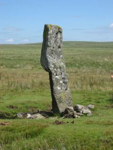
Langstone Moor Standing Stone
Prehistoric Dartmoor Walks: Dartmoor Site: Langstone Moor Stone Circle, Stone Row & Settlements
OS Map: SX 55023 78742
HER: MDV4225
Megalithic Portal: 17504
PMD: Langstone Moor Standing Stone
ShortName: SS Langstone
Butler map: 30.12
Butler Vol 5: p.230
DPD page: 13
Notes: The Langstone standing stone is 2.76m high and can be seen from some distance. It was restored in its original socket in 1893. The Langstone is close to a stone row consisting of very small stones. The Langstone standing stone and also the stone circle were used for target practice by American troops who were stationed nearby during the second world. Bullet holes can be seen on the Langstone standing stone. Lethbridge pp.13-14. Breton (p.17) The stone is composed of local gabbro, and was formerly prostrate, but His Grace the Duke of Bedford has re-erected it in its original socket-hole.
Nearby sites: SX 55023 78742
Distance: 4.84km
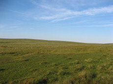
Langstone Moor Stone Ring Cairn Circle
Prehistoric Dartmoor Walks: Dartmoor Site: Langstone Moor Stone Circle, Stone Row & Settlements
OS Map: SX 54843 77922
HER: MDV48862
Megalithic Portal: 45833
ShortName: RC Langstone
Turner: A22
Notes: HER: A semi-circular bank, possibly the remains of a ring cairn.1.4 to 2m wide, 0.4m high. Composed of small + medium sized stones now largely turf-covered. It fades at each end of a near-perfect semi-circle of 14.9m internal diam. There is a low stone pile, 0.2m high, in se quadrant.
Nearby sites: SX 54843 77922
Distance: 4.88km
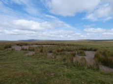
Langstone Moor Ancient Pool
OS Map: SX 55026 78879
HER: MDV127215
ShortName: PO Langstone
Notes: HER: A pool measuring 28 by 24 metres. One of over 40 such 'sacred' pools identified on Dartmoor that are thought to have potentially been designed during the prehistoric period. Lies at the northern end of a stone row. May be on the site of a cairn
NB. HER entry implies this could be the same as the Butler reported cairn at the end of the stone row. On this website this is currently listed as a separate entry Langstone Moor Stone Row Reported Cairn (no HER entry). The diagram page 77 (fig 30.8) shows both a mound and a pit. Could this be the pit distinct from the cairn? Breton (p.17): The Langstone was formerly the end of a stone row, composed of quite small stones, running in a direction N. and S. from a pool that occupies the site of a destroyed cairn.. The author visited 25/07/2026. The pool was dry but clearly separate from the cairn.
Nearby sites: SX 55026 78879
Distance: 4.82km
Langstone Moor 12 Clearance Cairn
OS Map: SX 5478 7789
HER: MDV56597
ShortName: CN:Langstone12
Notes: HER: A low, stony mound situated on a NW facing slope overlooking the Colly Brook. This turf-covered mound of small stones stands to a maximum height of 0.35m. It is"comma"-shaped, with an oval head 6.2m by 4.4m, and a tail on the downhill side 3.2m by 2.3m. There is a slight depression in the main part. It is possibly a damaged cairn with original dimensions in the order of 7.6m by 6.2m.
Nearby sites: SX 5478 7789
Distance: 4.83km
Langstone Moor 2 Stone Row
OS Map: SX 54945 78842
HER: MDV4107
PMD: Langstone Moor 2
Alternate name: Langstone Moor II Stone Row
ShortName: SR:Langstone 2
Butler map: 30.12
Notes: "Reave running from north - south on the eastern slopes of Whittor close to the Langstone Stone Row." Breton (p.17): Nearly parallel to it, and 60 yds away was another row.
Nearby sites: SX 54945 78842
Distance: 4.75km
Langstone Moor 3 Stone Row
OS Map: SX 551 788
The Stone Rows of GB: Langstone Moor 3
PMD: Langstone Moor 3
Alternate name: Langstone Moor III Stone Row
ShortName: SR:Langstone 3
Butler map: 30.12
Notes: R.N. Worth Still further from the Launceston row to the eastward there are a few stones in line just above the surface, which may be the remnants of another. NB. This record and quote originates from the Bill Radcliffe PMD entry.
Nearby sites: SX 551 788
Distance: 4.91km
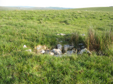
Langstone Moor S.1 Cairn
OS Map: SX 54836 77640
HER: MDV4117
ShortName: CN Langston S1
Butler map: 31.19.1
Grinsell: PET 33
Notes: Newman "Fairly large, flat-topped stony cairn (18) which was excavated by the Dartmoor Exploration Committee in 1899, 970 metres south-west of the stone circle. A flat stone was found but no other material retrieved. Disturbance caused by the diggers is visible on the west side of the mound."
Nearby sites: SX 54836 77640
Distance: 4.98km
Langstone Moor S.2 Cairn
OS Map: SX 54838 77646
HER: MDV4116
Megalithic Portal: 35802
ShortName: CN Langston S2
Butler map: 31.19.2
Grinsell: PET 34
Notes: HER: Round cairn measuring 6.5 metres in diameter and standing up to 0.4 metres high. A shallow hollow in the centre of the mound suggests previous robbing or partial excavation. A slab of stone set on edge within the central hollow may be the remnants of a cist.
Nearby sites: SX 54838 77646
Distance: 4.98km
Langstone Moor Stone Row Reported Cairn
OS Map: SX 5504 7885
ShortName: CNxLangstoneSR
Butler map: 30.12
Grinsell: PET 41
Notes: Butler, referring to the claims of the Dartmoor Exploration Committee of a second Langstone Moor stone row and associated cairn says "A line of slabs is indeed visible along one side of it [a bank of stones] but the cairn appears to be merely a pile of stones from the bank to allow the passage of the Peter Tavy branch of the Lich Way".
Nearby sites: SX 5504 7885
Distance: 4.84km
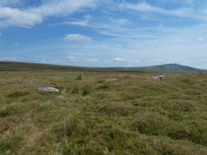
Langstone Reave Reported Cairn
OS Map: SX 5494 7884
HER: MDV49510
ShortName: CN LangReave
Grinsell: PET 28
Notes: Remains of a turf covered cairn which is in a very mutilated condition due to the construction of a cart track through it
Nearby sites: SX 5494 7884
Distance: 4.74km
Lower Watervale Farm, E. of Cairn
OS Map: SX 51077 83635
HER: MDV3220
ShortName: CN:Lower Wat1
Grinsell: BTOR 1
Notes: Remains of a barrow of earth and stone bisected by a modern wall at its south eastern extreme. Not discernible on Google Earth but Lidar data (1m DSM data) suggests there is a structure at around SX 51077 83635 bisected by a wall - this is close to SX 5107 8363 given by Grinsell.
Nearby sites: SX 51077 83635
Distance: 4.14km
Nattor Down 1 Cairn
OS Map: SX 5390 8267
HER: MDV27786
ShortName: CN:Nattor 1
Butler map: 32.2.1
Notes: HER: Cairn of 13.2 metres diameter by 0.9 metres high on the south-west flank of Nattor Down. This cairn is badly damaged and spread
Nearby sites: SX 5390 8267
Distance: 4.78km
Nattor Down 2 Cairn
OS Map: SX 5366 8253
HER: MDV103594
ShortName: CN:Nattor 2
Butler map: 32.2.2
Notes: HER: Cairn of 10 metres diameter by 0.8 metres high 440 metres north-west of Nattor Farm
Location
Nearby sites: SX 5366 8253
Distance: 4.51km
Nattor Down 3 Reported Cist
OS Map: SX 53933 82864
HER: MDV3224
PMD: Nattor Down 3
ShortName: CN:Nattor 3
Butler map: 32.2.3
Grinsell: PET 12
Notes: NMR A. "A weighty flat slab, partly turf covered, may perhaps be the cover of a cist." (Butler Vol. 2 p.99)
Nearby sites: SX 53933 82864
Distance: 4.93km
Nattor Down 7 Cairn
OS Map: SX 53690 82747
HER: MDV103593
ShortName: CN:Nattor 7
Nearby sites: SX 53690 82747
Distance: 4.67km
Nattor Down 8 Cairn
OS Map: SX 53837 82957
HER: MDV103595
ShortName: CN:Nattor 8
Nearby sites: SX 53837 82957
Distance: 4.93km
Ring of Bells Stone Ring Cairn Circle
OS Map: SX 5214 8287
HER: MDV3221
Megalithic Portal: 45837
ShortName: RC:RingofBells
Grinsell: MAR 2
Turner: A34
Notes: "Ring cairn with entrance. Stone ring 13m internal diam, with bank 1.5m wide and 0.3m high.3m wide entrance on ese side. Flag pole has been sited here"
Nearby sites: SX 5214 8287
Distance: 3.79km
Roos Tor 1 Reported Cairn
OS Map: SX 5405 7717
HER: MDV48248
ShortName: CN?Roos Tor 1
Butler map: 31.7
Notes: HER: Ovoid in shape, cairn measures 3.3 metres by 2.1 metres by 0.2 metres high. Part of a cairnfield 400m south-east of Wedlake Farm forming part of the settlement on the north-west slope of Roos Tor
Nearby sites: SX 5405 7717
Distance: 4.50km
Roos Tor 10 Reported Cairn
OS Map: SX 5412 7718
HER: MDV48257
ShortName: CN?Roos Tor10
Butler map: 31.7
Notes: HER: Ovoid cairn of 4 metres by 2 metres by 0.6 metres high. Part of cairnfield 400 metres south-east of Wedlake Farm forming part of the settlement on the north-west slope of Roos Tor.
Nearby sites: SX 5412 7718
Distance: 4.55km
Roos Tor 11 Reported Cairn
OS Map: SX 5409 7721
HER: MDV48258
ShortName: CN?Roos Tor11
Butler map: 31.7
Notes: HER: Ovoid in shape, cairn measures 5 metres by 3 metres by 0.2 metres high. Part of cairnfield 400 metres south-east of Wedlake Farm forming part of the settlement on the north-west slope of Roos Tor.
Nearby sites: SX 5409 7721
Distance: 4.51km
Roos Tor 12 Reported Cairn
OS Map: SX 5414 7720
HER: MDV48259
ShortName: CN?Roos Tor12
Butler map: 31.7
Notes: HER: Cairn of 0.8 metres high obscured by soil buildup against upslope side. Part of cairnfield 400 metres south-east of Wedlake Farm forming part of the settlement on the north-west slope of Roos Tor.
Nearby sites: SX 5414 7720
Distance: 4.56km
Roos Tor 13 Reported Cairn
OS Map: SX 5411 7711
HER: MDV48260
ShortName: CN?Roos Tor13
Butler map: 31.7
Notes: HER: Ovoid cairn of 9.5 metres by 4.9 metres by 1 metre high made up of two adjoining sub-circular mounds. Part of cairnfield 400 metres south-east of Wedlake Farm forming part of the settlement on the north-west slope of Roos Tor.
Nearby sites: SX 5411 7711
Distance: 4.58km
Roos Tor 14 Reported Cairn
OS Map: SX 5411 7719
HER: MDV48262
ShortName: CN?Roos Tor14
Butler map: 31.7
Notes: HER: Cairn of 5.3 metres diameter by 1 metre high with a central hollow and kerb on the south side. Part of cairnfield 400 metres south-east of Wedlake Farm forming part of the settlement on the north-west slope of Roos Tor
Nearby sites: SX 5411 7719
Distance: 4.54km
Roos Tor 15 Reported Cairn
OS Map: SX 5413 7719
HER: MDV48263
ShortName: CN?Roos Tor15
Butler map: 31.7
Notes: HER: Ovoid cairn of up to 0.7 metres high with its size and shape obscured by a buildup of soil. Part of cairnfield 400 metres south-east of Wedlake Farm forming part of the settlement on the north-west slope of Roos Tor.
Nearby sites: SX 5413 7719
Distance: 4.55km
Roos Tor 16 Reported Cairn
OS Map: SX 5410 7721
HER: MDV48264
ShortName: CN?Roos Tor16
Butler map: 31.7
Notes: HER: Cairn of 6 metres diameter by 1 metre high. Part of cairnfield 400 metres south-east of Wedlake Farm forming part of the settlement on the north-west slope of Roos Tor.
Nearby sites: SX 5410 7721
Distance: 4.52km
Roos Tor 2 Reported Cairn
OS Map: SX 5406 7715
HER: MDV48249
ShortName: CN?Roos Tor 2
Butler map: 31.7
Notes: HER: Cairn measures 4 metres in diameter, height 0.7 metres. Part of cairnfield 400 metres south-east of Wedlake Farm forming part of the settlement on the north-west slope of Roos Tor.
Nearby sites: SX 5406 7715
Distance: 4.52km
Roos Tor 3 Reported Cairn
OS Map: SX 5406 7713
HER: MDV48250
ShortName: CN?Roos Tor 3
Butler map: 31.7
Notes: HER: Ovoid in shape, cairn measures 4.5 metres by 3.5 metres by 0.7 metres high. Part of cairnfield 400 metres south-east of Wedlake Farm forming part of the settlement on the north-west slope of Roos Tor.
Nearby sites: SX 5406 7713
Distance: 4.53km
Roos Tor 4 Reported Cairn
OS Map: SX 5407 7711
HER: MDV48251
ShortName: CN?Roos Tor 4
Butler map: 31.7
Notes: HER: Ovoid in shape, cairn measures 3.5 metres by 3 metres by 0.7 metres high. Part of cairnfield 400 metres south-east of Wedlake Farm forming part of the settlement on the north-west slope of Roos Tor.
Nearby sites: SX 5407 7711
Distance: 4.55km
Roos Tor 5 Reported Cairn
OS Map: SX 5408 7711
HER: MDV48252
ShortName: CN?Roos Tor 5
Butler map: 31.7
Notes: HER: Ovoid in shape, cairn measures 5 metres by 3 metres by 0.3 metres high. Part of cairnfield 400 metres south-east of Wedlake Farm forming part of the settlement on the north-west slope of Roos Tor.
Nearby sites: SX 5408 7711
Distance: 4.55km
Roos Tor 6 Reported Cairn
OS Map: SX 5412 7716
HER: MDV48253
ShortName: CN?Roos Tor 6
Butler map: 31.7
Notes: Ovoid in shape, cairn measures 5 metres by 3 metres by 0.6 metres high. Part of cairnfield 400 metres south-east of Wedlake Farm forming part of the settlement on the north-west slope of Roos Tor.
Nearby sites: SX 5412 7716
Distance: 4.56km
Roos Tor 7 Reported Cairn
OS Map: SX 5411 7717
HER: MDV48254
ShortName: CN?Roos Tor 7
Butler map: 31.7
Notes: HER: Ovoid in shape, cairn measures 4 metres by 3 metres by 0.6 metres high. Part of cairnfield 400 metres south-east of Wedlake Farm forming part of the settlement on the north-west slope of Roos Tor.
Nearby sites: SX 5411 7717
Distance: 4.55km
Roos Tor 8 Reported Cairn
OS Map: SX 5412 7720
HER: MDV48255
ShortName: CN?Roos Tor 8
Butler map: 31.7
Notes: HER: Ovoid in shape, cairn measures 3.7 metres by 2.3 metres by 0.6 metres high. Part of cairnfield 400 metres south-east of Wedlake Farm forming part of the settlement on the north-west slope of Roos Tor.
Nearby sites: SX 5412 7720
Distance: 4.54km
Roos Tor 9 Reported Cairn
OS Map: SX 5411 7720
HER: MDV48256
ShortName: CN?Roos Tor 9
Butler map: 31.7
Notes: HER: Ovoid cairn. Part of cairnfield 400 metres south-east of Wedlake Farm forming part of the settlement on the north-west slope of Roos Tor.
Nearby sites: SX 5411 7720
Distance: 4.53km

Roos Tor N.W. Settlement
OS Map: SX 539 772
HER: MDV4104
Megalithic Portal: 17509
ShortName: ST RoosTorNW
Butler map: 31.7
Notes: HER: Hut circle settlement and field system to the south-east of Wedlake with seventy one hut circles of between 2 to 7 metres diameter with walls between 0.8 to 2 metres wide by 1.5 metres high and several small enclosures
Nearby sites: SX 539 772
Distance: 4.35km
Smeardon Down Reported Cairn
OS Map: SX 5228 7814
HER: MDV12800
ShortName: CN:Smeardon 1
Butler map: 31.11
Notes: HER: A cairn prominently situated on the summit of Smeardon Down of 12 metres by 10.7 metres and 0.8 metres high within the prehistoric settlement and field system. A section of wall extends from the cairn for 42 metres to the west
Nearby sites: SX 5228 7814
Distance: 2.49km
South Longridge Wood Fort
Prehistoric Dartmoor Walks: Dartmoor Resource: Table of Devon Iron Age Forts
OS Map: SX 49705 83870
HER: MDV1666
ShortName: FT:Longridge S
Nearby sites: SX 49705 83870
Distance: 4.33km
Standon Farm W Reported Cairn
OS Map: SX 5408 8155
HER: MDV19430
ShortName: CN:StandonFarm
Nearby sites: SX 5408 8155
Distance: 4.30km
Standon Hill Ring Setting Cairn and Cist
OS Map: SX 54739 81371
HER: MDV20155
Megalithic Portal: 45794
PMD: Standon Down
Alternate name: Standon Hill W. Ring Setting Cairn and Cist
ShortName: CT:StandonW 1
Butler map: 32.17
Butler Vol 5: p.182 & Fig.124
Grinsell: PET 15
Turner: D15
Notes: Doubtful cist. "A disturbed cairn measuring 5.2m N to S by 6.0m and standing a maximum of 0.3m high. Eight large upright slabs and boulders, up to 0.6m high, lie on the fringe of the mound to create a substantial retaining circle. There is no evidence to suggest the presence of a cist though is seems likely that the interior of the cairn has been used as a repository for cleared stone. A large number of relatively recent clearance cairns lie in the immediate area." Butler Standon Hill W - Vol. 2. Map 32.17 (diagram Vol. 5. p.182).
Nearby sites: SX 54739 81371
Distance: 4.83km
Standon Hill W. 2 Clearance Cairn
OS Map: SX 547 813
HER: MDV131997
ShortName: CN:StandonW 2
Notes: HER: A scattered group of stone clearance cairns visible as amorphous heaps of various sizes composed of portable granite stones and boulders. Probably clearance of post medieval origin. The cairns which are up to 2.5m in diameter and 0.3m high are spread randomly across a fairly steep SW-facing hillslope. They lie amidst broad linear bands of exposed clitter and shallow erosion gullies; few well-worn paths cut through these linear features.
Nearby sites: SX 547 813
Distance: 4.77km
The Trendle Fort
Prehistoric Dartmoor Walks: Dartmoor Resource: Table of Devon Iron Age Forts
OS Map: SX 49067 75341
HER: MDV3829
Megalithic Portal: 62492
ShortName: FT:The Trendle
Nearby sites: SX 49067 75341
Distance: 4.40km
Wedlake Enclosed Settlement
OS Map: SX 53974 77769
HER: MDV4106
ShortName: ST:Wedlake
Butler map: 31.9
Butler Vol 5: p.95
Notes: HER: Hut circle settlement to the north-east of Wedlake Farm and to the west of the Colly Brook with four incomplete enclosures and at least fifteen hut circles.
Nearby sites: SX 53974 77769
Distance: 4.14km
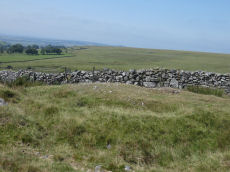
Wedlake E.1 Cairn
OS Map: SX 54288 77561
HER: MDV4183
ShortName: CN Wedlake E1
Butler map: 31.18.1
Grinsell: PET 34b
Notes: HER: Cairn bisected by a stone-faced newtake wall, consisting on the uphill side of a turf-covered rather amorphous stony mound with a small pit near the centre, measuring 13 metres by 6 metres. The lower part, now evident as a robbed, semi-circular turf-covered stony bank, measures overall 13 metres by 9 metres.
Nearby sites: SX 54288 77561
Distance: 4.51km
Wedlake E.2 Stone Ring Cairn Circle
OS Map: SX 54448 77684
HER: MDV4184
ShortName: RC Wedlake E2
Butler map: 31.18.2
Grinsell: PET 34a
Notes: HER: A very fine ring cairn is located on the western side of Langstone Moor overlooking the Colly Brook and Whittor to the north. It consists of an 18 metre diameter ring of small stones, now turf covered, enclosing a mainly flat area strewn with loose stones. The bank, which has been disturbed on the south-west quadrant, stands approximately 0.5 metres high.
Nearby sites: SX 54448 77684
Distance: 4.60km
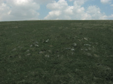
Wedlake E.3 Cairn
OS Map: SX 54521 77400
ShortName: CN-Wedlake E3
Notes: Possible cairn located and photographed on 29 May 2016 and added to listings June 2019. It appears to be a cairn and the GPS location is some distance from any known recorded cairns - although Wedlake E1 and Wedlake E2 are not far. This is being listed as a reported cairn and only another site visit will throw more light on this. Revisited 13/08/25 and there is no doubt this is a cairn. Changed from reported cairn to cairn.
Nearby sites: SX 54521 77400
Distance: 4.79km
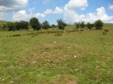
Wedlake Farm Cairn
OS Map: SX 53893 77408
HER: MDV33612
ShortName: CN WedlakeFarm
Notes: "Small turf covered cairn, 5m diameter, 0.5m high, near centre of field". HER grid reference is 6 digit so location could be more that 100 metres out. UPDATE: The author walked along the bridal path near Wedlake Farm on 14/07/19 and a cairn was seen some distance from the HER grid reference SX 538 774 at SX 53893 77408. It seems very likely that this is the site - see photo. This record now uses the new grid reference. Now listed as "cairn" rather than "reported cairn".
Nearby sites: SX 53893 77408
Distance: 4.24km
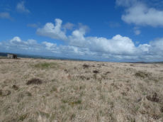
White Hill S.W.1 Stone Ring Cairn Circle
OS Map: SX 52941 83690
HER: MDV21078
Megalithic Portal: 45821
ShortName: RC WhiteHiSW 1
Butler map: 32.22.1
Grinsell: PET 1
Turner: A8
Notes: HER: Cairn of 15 metres diameter with a bank 3.5 metres wide by 0.5 metres high within cairn cemetery to the south-west of White Tor. Central hollow 6 metres long by 1.7 metres wide by 0.3 metres deep and The earthwork appears as a raised internal platform measuring 15m in diameter surrounded by a circular bank 3.5m wide and 0.5m high. A shallow hollow in the centre of the internal area suggests robbing or partial early excavation.
Nearby sites: SX 52941 83690
Distance: 4.91km
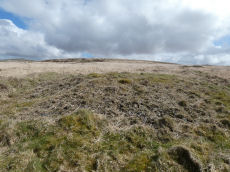
White Hill S.W.2 Cairn
OS Map: SX 53000 83671
HER: MDV21079
ShortName: CN WhiteHiSW 2
Butler map: 32.22.2
Grinsell: PET 2
Barrow Report: 10 13
Notes: HER quoting Gerrrard: Flat topped round cairn. Diameter 13m, height 0.8m. Trench, 0.8m wide, 0.15m deep extends SW-NE through centre of mound. Probably result of partial excavation by Baring Gould in 1888 which produced a pan or basin containing ashes and charcoal. The N side of the mound has seen limited damage. Part of a cairn alignment.
Nearby sites: SX 53000 83671
Distance: 4.93km
White Hill S.W.3 Cairn
OS Map: SX 53018 83670
HER: MDV21083
PMD: White Hill W.
ShortName: CN:WhiteHiSW 3
Butler map: 32.22.3
Grinsell: PET 3
Barrow Report: 10
Notes: Radcliffe suggests this could be the cairn excavaed by Baring-Gould in 1888 to reveal a "A sort of rude domed kist". Part of the linear arrangement of cairns. Author visited on 18/04/2026 and missed this cairn as it is very close to S.W.2 and not obvious to make out as a distinct feature.
Nearby sites: SX 53018 83670
Distance: 4.94km
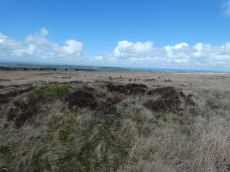
White Hill S.W.4 Cairn
OS Map: SX 53048 83661
HER: MDV21080
ShortName: CN WhiteHiSW 4
Butler map: 32.22.4
Grinsell: PET 4
Barrow Report: 10 13
Notes: HER: Round cairn of 10 metres diameter by 0.9 metres high within cairn cemetery on the south-west side of White Hill. A central hollow of 4 metres diameter by 0.6 metres deep is probably the result of the 1888 excavation
Nearby sites: SX 53048 83661
Distance: 4.95km
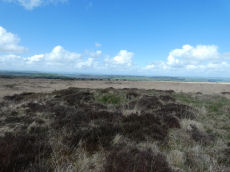
White Hill S.W.5 Cairn
OS Map: SX 53095 83650
HER: MDV21081
ShortName: CN WhiteHiSW 5
Butler map: 32.22.5
Grinsell: PET 5
Barrow Report: 10 13
Notes: HER: Cairn of 13 metres diameter by 0.5 metres high within cairn cemetery on the south-west side of White Hill. A central hollow 3 metres long by 1 metre wide by 0.1 metres deep is probably the result of the 1888 excavation, which revealed a pan or basin containing ashes and charcoal. The ditch has been infilled over the years, but survives as 2.5 metres ring of enhanced grass growth.
Nearby sites: SX 53095 83650
Distance: 4.96km
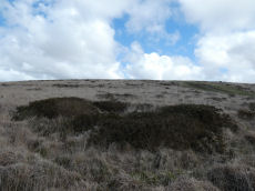
White Hill S.W.6 Cairn
OS Map: SX 53137 83644
HER: MDV21082
ShortName: CN WhiteHiSW 6
Butler map: 32.22.6
Grinsell: PET 5a
Notes: HER: Cairn of 10 metres diameter by 0.4 metres high within cairn cemetery on the south-west side of White Hill. A central hollow 3 metres long by 2.5 metres wide by 0.3 metres deep is probably the result of the 1888 excavation which revealed a pan or basin containing ashes and charcoal
Nearby sites: SX 53137 83644
Distance: 4.98km
White Hill S.W.9 Cairn
OS Map: SX 53006 83658
HER: MDV17699
ShortName: CN:WhiteHiSW 9
Notes: The southern of three closely spaced round cairns, circa 4.5 metres diameter, 0.3 metres high. Grid refrence SX 53006 83658 is from Google Earth comparing with the other two cairns, it can't be seen so it is an estimate. The HER grid reference is a 14m to the south.
Nearby sites: SX 53006 83658
Distance: 4.92km
White Hill W.1 Cairn
OS Map: SX 52604 83808
HER: MDV46981
ShortName: CN:WhiteHiW 1
Notes: HER: Two cairns forming part of the cairnfield on the western slope of White Hill. Two cairns aligned east-west. The western cairn is ovoid, 4.0 metres long, 2.7 metres wide, 0.25 metres high. The eastern cairn is sub-circular, 5.0 metres in diameter, 0.55 metres high.
Nearby sites: SX 52604 83808
Distance: 4.84km
White Hill W.10 Cairn
OS Map: SX 52724 83839
HER: MDV133836
ShortName: CN:WhiteHiW10
Nearby sites: SX 52724 83839
Distance: 4.92km
White Hill W.11 Cairn
OS Map: SX 52719 83834
HER: MDV133837
ShortName: CN:WhiteHiW11
Nearby sites: SX 52719 83834
Distance: 4.92km
White Hill W.12 Cairn
OS Map: SX 52693 83823
HER: MDV133838
ShortName: CN:WhiteHiW12
Nearby sites: SX 52693 83823
Distance: 4.90km
White Hill W.13 Cairn
OS Map: SX 52708 83802
HER: MDV133839
ShortName: CN:WhiteHiW13
Nearby sites: SX 52708 83802
Distance: 4.88km
White Hill W.14 Cairn
OS Map: SX 52674 83838
HER: MDV133840
ShortName: CN:WhiteHiW14
Nearby sites: SX 52674 83838
Distance: 4.90km
White Hill W.15 Cairn
OS Map: SX 52666 83874
HER: MDV133841
ShortName: CN:WhiteHiW15
Nearby sites: SX 52666 83874
Distance: 4.93km
White Hill W.16 Cairn
OS Map: SX 52672 83859
HER: MDV133842
ShortName: CN:WhiteHiW16
Nearby sites: SX 52672 83859
Distance: 4.92km
White Hill W.17 Cairn
OS Map: SX 52664 83850
HER: MDV133843
ShortName: CN:WhiteHiW17
Nearby sites: SX 52664 83850
Distance: 4.90km
White Hill W.18 Cairn
OS Map: SX 52651 83848
HER: MDV133845
ShortName: CN:WhiteHiW18
Nearby sites: SX 52651 83848
Distance: 4.90km
White Hill W.19 Cairn
OS Map: SX 52629 83833
HER: MDV133846
ShortName: CN:WhiteHiW19
Nearby sites: SX 52629 83833
Distance: 4.87km
White Hill W.2 Cairn
OS Map: SX 52592 83808
HER: MDV46981
ShortName: CN:WhiteHiW 2
Notes: HER: Two cairns forming part of the cairnfield on the western slope of White Hill. Two cairns aligned east-west. The western cairn is ovoid, 4.0 metres long, 2.7 metres wide, 0.25 metres high. The eastern cairn is sub-circular, 5.0 metres in diameter, 0.55 metres high.
Nearby sites: SX 52592 83808
Distance: 4.83km
White Hill W.20 Cairn
OS Map: SX 52602 83857
HER: MDV133847
ShortName: CN:WhiteHiW20
Nearby sites: SX 52602 83857
Distance: 4.88km
White Hill W.21 Cairn
OS Map: SX 52610 83858
HER: MDV133847
ShortName: CN:WhiteHiW21
Nearby sites: SX 52610 83858
Distance: 4.89km
White Hill W.22 Cairn
OS Map: SX 52612 83871
HER: MDV133847
ShortName: CN:WhiteHiW22
Nearby sites: SX 52612 83871
Distance: 4.90km
White Hill W.23 Cairn
OS Map: SX 52643 83856
ShortName: CN:WhiteHiW23
Notes: The HER master record for the western cairn cemetery (HER=MDV3248) has a list of grid references for the cairns. Four of those don't have corresponding HER records and two of the HER records appear to be duplicates. MDV133843 is duplicated by MDV133844 and MDV133846 is duplicated by MDV133848. This record is one of the four NGRs without and HER record.
Nearby sites: SX 52643 83856
Distance: 4.90km
White Hill W.24 Cairn
OS Map: SX 52659 83836
ShortName: CN:WhiteHiW24
Notes: The HER master record for the western cairn cemetery (HER=MDV3248) has a list of grid references for the cairns. Four of those don't have corresponding HER records and two of the HER records appear to be duplicates. MDV133843 is duplicated by MDV133844 and MDV133846 is duplicated by MDV133848. This record is one of the four NGRs without and HER record.
Nearby sites: SX 52659 83836
Distance: 4.89km
White Hill W.25 Cairn
OS Map: SX 52676 83867
ShortName: CN:WhiteHiW25
Notes: The HER master record for the western cairn cemetery (HER=MDV3248) has a list of grid references for the cairns. Four of those don't have corresponding HER records and two of the HER records appear to be duplicates. MDV133843 is duplicated by MDV133844 and MDV133846 is duplicated by MDV133848. This record is one of the four NGRs without and HER record.
Nearby sites: SX 52676 83867
Distance: 4.93km
White Hill W.26 Cairn
OS Map: SX 52545 83925
ShortName: CN:WhiteHiW26
Notes: The HER master record for the western cairn cemetery (HER=MDV3248) has a list of grid references for the cairns. Four of those don't have corresponding HER records and two of the HER records appear to be duplicates. MDV133843 is duplicated by MDV133844 and MDV133846 is duplicated by MDV133848. This record is one of the four NGRs without and HER record.
Nearby sites: SX 52545 83925
Distance: 4.91km
White Hill W.3 Cairn
OS Map: SX 52647 83808
HER: MDV46982
ShortName: CN:WhiteHiW 3
Nearby sites: SX 52647 83808
Distance: 4.86km
White Hill W.4 Cairn
OS Map: SX 52556 83808
HER: MDV46983
ShortName: CN:WhiteHiW 4
Nearby sites: SX 52556 83808
Distance: 4.82km
White Hill W.5 Cairn
OS Map: SX 52583 83794
HER: MDV46984
ShortName: CN:WhiteHiW 5
Nearby sites: SX 52583 83794
Distance: 4.82km
White Hill W.6 Cairn
OS Map: SX 52497 83862
HER: MDV133832
ShortName: CN:WhiteHiW 6
Nearby sites: SX 52497 83862
Distance: 4.84km
White Hill W.7 Cairn
OS Map: SX 52489 83846
HER: MDV133833
ShortName: CN:WhiteHiW 7
Nearby sites: SX 52489 83846
Distance: 4.82km
White Hill W.8 Cairn
OS Map: SX 52747 83860
HER: MDV133834
ShortName: CN:WhiteHiW 8
Nearby sites: SX 52747 83860
Distance: 4.95km
White Hill W.9 Cairn
OS Map: SX 52733 83855
HER: MDV133835
ShortName: CN:WhiteHiW 9
Nearby sites: SX 52733 83855
Distance: 4.94km
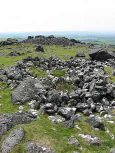
White Tor Fort
Prehistoric Dartmoor Walks: Dartmoor Site: White Tor Fort
OS Map: SX 54246 78678
HER: MDV4101
Megalithic Portal: 17506
ShortName: FT White Tor
DPD page: 13
Notes: The White Tor camp is a Neolithic Enclosure which was once assumed to have been repurposed as an Iron Age fort. There used to be a separate HER entry to this end but this has been removed as the consensus now is that it is predominantly a Neolithic feature.
Nearby sites: SX 54246 78678
Distance: 4.09km
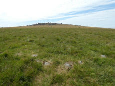
White Tor Stone Ring Cairn Circle
OS Map: SX 54597 78701
HER: MDV4164
Megalithic Portal: 35804
Alternate name: White Tor E.1 Stone Ring Cairn Circle
ShortName: RC White E1
Butler map: 31.22.1
Grinsell: PET 24
Turner: A26
Notes: See also duplicate 439800. Turner A26. Butler White Tor E.1. "Round cairn 340 metres east of White Tor summit. This monument includes a round cairn situated on a gentle south-east facing slope overlooking the valley of the River Walkham. The cairn mound measures 6m in diameter and stands up to 0.4m high. A hollow in the centre of the mound measuring 3m in diameter and 0.3m deep is the result of a partial excavation carried out by the Dartmoor Exploration Committee in 1899. This work recovered a perforated stone. A kerb of small stones defines the outer edge of the mound."
Nearby sites: SX 54597 78701
Distance: 4.43km
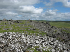
White Tor (Whittor) Neolithic Enclosure
Prehistoric Dartmoor Walks: Dartmoor Site: White Tor Fort
OS Map: SX 5423 7867
HER: MDV4101
Megalithic Portal: 17506
ShortName: NE White Tor
Butler map: 31.13
DPD page: 13
Notes: Neolithic tor enclosure. "A camp on the summit of White Tor formed by a double wall, now in ruinous condition. Both walls appear to have been 10 to 11 feet thick, the outer wall being 4 to 4 1/2 feet high, the inner 6 to 7 feet high. The distance between the walls varies between 10 and 40 feet. The entrances are to the east, where access is easier, they are not opposite and are protected by the spur walls. Within the camp are four hut circles and three possible hut shelters, and two northern circles (numbers 5 and 6 on plan) are joined by a short wall." See also, Legendary Dartmoor: Dartmoor's White Tor Neolithic Settlement. See also Dartmoor Tor Enclosures Project.
Nearby sites: SX 5423 7867
Distance: 4.08km
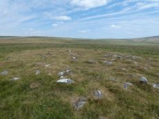
White Tor E.3 Cairn
OS Map: SX 54611 78669
HER: MDV12793
ShortName: CN White E3
Butler map: 31.22.3
Grinsell: PET 26
Notes: Long cairn - formerly thought to be two separate cairns. Pet 25 & Pet 26 (HER 4163 & 12793). This record is marked as a duplicate for that reason see: See SiteID=1201 HER(4163) for coverage. The photo above is the eastern section of the long cairn.
Nearby sites: SX 54611 78669
Distance: 4.45km
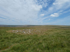
White Tor Long Cairn E.2 Cairn
OS Map: SX 54606 78667
HER: MDV4163
ShortName: CN White E2
Butler map: 31.22.2
Grinsell: PET 25
Notes: Long cairn - formerly thought to be two separate cairns. Pet 25 & Pet 26 (HER 4163 & 12793). See also the record marked as a duplicate that is the eastern part of the monument: White Tor E.3 Cairn.
Nearby sites: SX 54606 78667
Distance: 4.45km
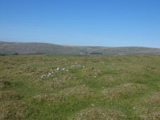
White Tor N.W.1 Cairn
OS Map: SX 53725 79009
HER: MDV4139
ShortName: CN White NW1
Butler map: 31.23.1
Grinsell: PET 20
Notes: "An oval, flat-topped cairn set on a gently sloping natural plateau of rough grassland with panoramic views in most directions. It is constructed of consolidated small stones and is now predominantly turf-covered. It measures 9m E-W by 8m transversely and is 0.7m high on the N (downhill) side and 0.3m on the S (uphill) side. Only two contiguous earthfast stones of the probable kerb are now evident on the N side. The excavation trench which lies E-W centrally across the cairn is about 1m wide; a second, faint trench is visible at right angles"
Nearby sites: SX 53725 79009
Distance: 3.52km
White Tor N.W.3 Cairn
OS Map: SX 53773 78847
HER: MDV28516
ShortName: CN:White NW3
Butler map: 31.23.3
Notes: "A cairn is situated at the nw extremity of a plateau. The cairn is in poor condition and measures 3.4m x 2.5m and 0.3m high. A reave passes the cairn at a distance of 4m and it is possible that the stones represent gathering for the reave construction or even clearance though there is no defined field system in the area ". Current author was unable to find this cairn on visit on 27th May 2022. There does seem to be something on satellite imagery. For a time this record had a Lat & Lon that converts to SX 58390 64590 which is 94 metres away to the North east - whether thi swas the feature seen on staellite was not recorded. I have rolled back to the HER grid reference.
Nearby sites: SX 53773 78847
Distance: 3.60km
White Tor N.W.4 Reported Cairn
OS Map: SX 53780 79133
HER: MDV56603
ShortName: CN:White NW4
Butler map: 31.23.3
Notes: A small cairn attached to the side of a reave oriented E to W (see SX 57 NW 85), and situated on a slight slope on Cudlipptown Down. It measures 2.8m N to S by 2.5m and is 0.5m high. It is composed of medium sized stones (up to 0.2m diameter) now partly turf-covered.
Formerly marked as a duplicate of White Tor N.W.3 MDV28516 but that has a grid reference 300 metres away so probably an error. It is now presumed to be a separate unique feature.
Nearby sites: SX 53780 79133
Distance: 3.56km
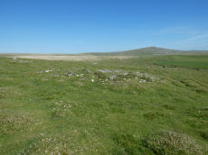
White Tor S.S.E.1 Cairn
OS Map: SX 54339 78370
HER: MDV4182
ShortName: CN White SSE1
Butler map: 31.20.1
Grinsell: PET 30
Notes: HER: The westernmost cairn of a group of three set close together. Mound measures 11.9 metres in diameter and stands up to 0.9 metres high. A stone kerb composed of small boulders defines the outer edge of the mound. A hollow in the centre of the mound and a trench cut into the western side are probably the result of the nineteenth-century partial excavation.
Nearby sites: SX 54339 78370
Distance: 4.26km
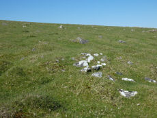
White Tor S.S.E.2 Cairn
OS Map: SX 54356 78359
HER: MDV4181
ShortName: CN White SSE2
Butler map: 31.20.2
Grinsell: PET 32
Notes: HER Southernmost cairn of a group of three partially excavated by the Dartmoor Exploration Committee in 1899. This cairn measures 4.7 metres in diameter and is 0.5 metres high. Has a central hollow indicating the location of the earlier partial excavation. Forms part of a widely dispersed group of at least fourteen cairns on the southern and eastern slopes of White Tor.
Nearby sites: SX 54356 78359
Distance: 4.28km
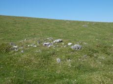
White Tor S.S.E.3 Cairn
OS Map: SX 54355 78379
HER: MDV4180
ShortName: CN White SSE3
Butler map: 31.20.3
Grinsell: PET 31
Notes: HER Northernmost cairn of a group of three. Measures 4.6 metres in diameter and stands up to 0.5 metres high. Partially excavated by the Dartmoor Exploration Committee in 1899 and this work revealed central pits containing ashes, charcoal and flints. Centre of the mound contains a hollow indicating the location of the earlier partial excavation. Forms part of a widely dispersed group of at least fourteen cairns on the southern and eastern slopes of White Tor.
Nearby sites: SX 54355 78379
Distance: 4.27km
White Tor S.S.E.4 Reported Cairn
OS Map: SX 5432 7858
HER: MDV4144
ShortName: CN?White SSE4
Butler map: 31.20.4
Grinsell: PET 23
Notes: HER: A disturbed round cairn on the south slopes of White Tor. Originally noted in 1899 Transactions report, but could not be positively identified by the Ordnance Survey (1950/1978) or Grinsell (1978) or Gerrard (1992). Cairn was found in 1987 and has been included in surveys of the range in the early 2000s and 2018.. Butler NGR: SX 5431 7858
Nearby sites: SX 5432 7858
Distance: 4.19km
White Tor S.S.E.5 Reported Cairn
OS Map: SX 5448 7825
HER: MDV4180
ShortName: CN?White SSE5
Butler map: 31.20.5
Notes: Butler SSE cairn 5. This is south of the track. Butler in the description refers to one cairn south of the track but lists two (also cairn 6). Two appear on Map 30. One of the two listed in his table of cairns is marked as excavated by the DEC, the other is not. Yet another small cairn accompanied by some rubble banks lies closer to the river to the south-east (to the se of the other SSE group). The author looked for this cairn on 27th May 2022 and was unable to find it. NMR SX 54517823 Butler SX 54487825
Nearby sites: SX 5448 7825
Distance: 4.43km
White Tor S.S.E.6 Reported Cairn
OS Map: SX 5436 7820
HER: MDV4182
ShortName: CN?White SSE6
Butler map: 31.20.6
Notes: Butler SSE cairn 6. This is south of the track. Butler in the description refers to one cairn south of the track but lists two (also cairn 5). Two appear on Map 30. One of the two listed in his table of cairns is marked as excavated by the DEC, the other is not. "Yet another small cairn accompanied by some rubble banks lies closer to the river to the south-east" (to the se of the other SSE group). The author looked for this cairn on 27th May 2022 and was unable to find it. NMR SX 54397826 Butler SX 54367820
Nearby sites: SX 5436 7820
Distance: 4.33km
White Tor S.S.E.7 Cairn
OS Map: SX 54688 78177
HER: MDV56606
ShortName: CN:White SSE7
Butler map: 31.20.7
Notes: HER: A turf covered stony mound set on a gentle south facing slope of rough grassland. It measures 6.4 metres diameter and 0.6 metres high and may have been built on a platform around the southern side. Several stones protrude around the perimeter but there would appear to be no kerb as such. Apart from the slight robbing in the south the mound appears to be intact.
Nearby sites: SX 54688 78177
Distance: 4.65km
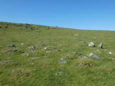
White Tor S.S.E.8 Cairn
OS Map: SX 54348 78421
HER: MDV69503
ShortName: CN White SSE8
Notes: "Small disturbed flat-topped stony mound measuring between 4.2 and 5.9 metres, lies approximately 30 metres to the north of the group of three cairns on the south slope of Whittor. Surveyed in 2003". This cairn is recored by Phil Newman in reports dated 2003 and 2018. The current author visited on 27th May 2022 and the photo is presumably the site in question. It is so runinous and amorphous that initially I was not it is just natural but it is clearly a cairn. The HER gives the NGR as SX 54345 78413 - this is at SX 54348 78421 about 8 metres to the north.
Nearby sites: SX 54348 78421
Distance: 4.26km

White Tor S.S.E.9 Cairn
OS Map: SX 54386 78481
HER: MDV69504
ShortName: CN White SSE9
Notes: "Small cairn lying approximately 60 metres to the north-north-east of the group of three cairns on the south slope of Whittor. Although severely altered it is certainly likely to have been a cairn. Surveyed in 2003." reported by Phil Newman in survey of 2003 .
Nearby sites: SX 54386 78481
Distance: 4.28km
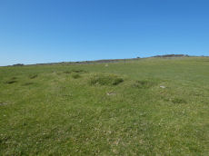
White Tor S.S.W.1 Long Cairn
OS Map: SX 54023 78321
HER: MDV4179
ShortName: CN White SSW1
Butler map: 31.21.1
Grinsell: PET 29a
Notes: The Dartmoor Exploration Committee (Report 6 1899) describes investigating 3 cairns in this location. The damaged remains are difficult today to interpret. Many authors suggest that the long cairn consists of two or more of these cairns. The current author visited this location on 27th May 2022 with just the knowledge that there were 3 reported cairns. I photographed a very likely cairn, namely, the long cairn (Butler 1). A semi-circular bank (Butler 3) and a faint mound around a natural rock (Butler 2). I noted at the time of the visit that both 2 and 3 are possible but doubtful cairns. I did not have the Butler account with me at the time I photographed and logged these. Looking now at Butler's account it looks like he reached the same conclusions and the entries here follow Butler with similar doubt on Butler 2 and Butler 3.
Nearby sites: SX 54023 78321
Distance: 3.97km
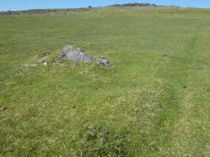
White Tor S.S.W.2 Cairn
OS Map: SX 54038 78328
HER: MDV4179
ShortName: CN White SSW2
Butler map: 31.21.2
Grinsell: PET 29
Notes: The Dartmoor Exploration Committee (Report 6 1899) describes investigating 3 cairns in this location. The damaged remains are difficult today to interpret. Many authors suggest that the long cairn consists of two or more of these cairns.
Nearby sites: SX 54038 78328
Distance: 3.99km
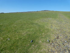
White Tor S.S.W.3 Cairn
OS Map: SX 54006 78293
HER: MDV4179
ShortName: CN White SSW3
Butler map: 31.21.3
Grinsell: PET 29b
Notes: The Dartmoor Exploration Committee (Report 6 1899) describes investigating 3 cairns in this location. The damaged remains are difficult today to interpret. Many authors suggest that the long cairn consists of two or more of these cairns.
Nearby sites: SX 54006 78293
Distance: 3.97km
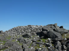
White Tor Summit Cairn
OS Map: SX 54220 78638
HER: MDV4147
ShortName: CN WhiteTorSum
Butler map: 31.13
Grinsell: PET 22
Notes: "Cairn in white tor camp. Large cairn in sw portion of the camp. Many hundreds of cartloads of stones are here lying piled up like a cairn against one of the rock outcrops on the summit."
Nearby sites: SX 54220 78638
Distance: 4.08km