
Guide to the Monuments on Okehampton Camp

Table of Ritual and Burial Monuments on Okehampton Camp
The following table lists the records currently in this Guide Map. For an explantion of the Guide Maps and a table of all 62 Guide Maps, follow this link: Guide List Table. Introductory text will be added to each guide list in 2025. Notes on duplication and omissions will appear below the table once checks have been finalised.
Notes on possible duplications and omissions
Moor Gate 2 This entry is listed on the website but the author is skeptical that it is anything other than a modern feature, hence, "reported cairn". Quote: It looks modern and is being listed as a clearance cairn of uncertain date. Not listed elsewhere. There is no corresponding record on the HER and it may not qualify for inclusion on the HER.PS. These notes are to assist untangling complicated records and are neither permanent nor a criticism of the HER who do a fantastic job! The author finds it easier to systematically work through these records (2000+ of them) and add these notes, which are then to be communicated with the HER, if appropriate, it is a pragmatic way of dealing with lots of data without continually stopping and starting.
Okehampton Camp Guide Map
Guidance for walkers: The monuments featured in this database are archaeological treasures and need to be protected and preserved - please do not disturb any sites. Please check access and firing times before visiting sites, not all sites listed are on open access land. Firing ranges and boundaries of open access areas are marked on the OL28 OS Dartmoor Explorer map. Please stick to the country code and consider giving support to the numerous agencies that help to keep Dartmoor a fabulous natural and historic environment!
List of Ritual and Burial Monuments on Okehampton Camp
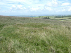
Halstock Down Cairnfield Master
OS Map: SX 59590 92140
HER record: MDV58789
ShortName: CN:Halstock M
Notes: HER: A cluster of 34 small clearance cairns and fragments of an apparently contemporary field system lie on the western flank of Halstock Down adjacent to the military ring road. The cairns vary in size from 1.7 metres to 6.9 metres in diameter and stand between 0.25 and 0.6 metres high. The majority (25) of these features are sub-circular, the remainder being definitely ovoid or linear in plan. One example is square. Bank fragments are now thought to be from the later prehistoric or even historic period and may not indicate fields
Nearby sites: SX59599214
Halstock Down 1 Cairn
OS Map: SX 59740 92230
HER record: MDV60252
ShortName: CN:Halstock 1
Notes: HER : SX 5974 9223 three cairns forming part of a cairnfield and irregular aggregate field system 800m s of moorgate farm.
Nearby sites: SX59749223
Halstock Down 2 Cairn
OS Map: SX 59740 92140
HER record: MDV60253
ShortName: CN:Halstock 2
Notes: HER: SX 5974 9214 A cairn forming part of a cairnfield and irregular aggregate field system 800m south of Moorgate Farm. Diameter measures 4m, height 0.3m.
Nearby sites: SX59749214
Halstock Down 3 Stone Ring Cairn Circle
OS Map: SX 59760 92180
HER record: MDV60254
ShortName: RC:Halstock 3
Notes: HER: A severely damaged cairn lies on the south west flank of Halstock Down 65 metres above the military ring road. All that remains is a stony fringe 1.2 to 1.6 metres wide and 0.4 metres high indicating an original diameter of around 20 metres for this feature. The interior of the cairn has been removed down to the old ground surface which has been further disturbed by later pits.
Also In the southern field is a circular bank measuring up to 3m wide and 0.6m high surrounding a 17.5m diameter internal area. The ring bank has been cut in four places by military pits and others in the vicinity further confuse the situation. Despite this, it is clear that this earthwork represents the site of a ring cairn.
Nearby sites: SX59769218
Halstock Down 4 Stone Ring Cairn Circle
OS Map: SX 59700 92300
HER record: MDV22786
ShortName: RC:Halstock 4
Notes: HER: Vis=10/9/1979 (os) a circular bank of small stones 4.8m diameter, 1.5m wide and 0.2m high with a 4.0m break in the nw. Situated on high ground in an area which appears to have been cleared at some time and put to pasture. The position seems too exposed for a hut yet there is virtually no stone in the central space. Possibly a robbed cairn. A second cropmark 20.0m to the sw is a depression caused by military activity (os).
Nearby sites: SX59709230
Halstock Down 5 Cairn
OS Map: SX 59590 92140
HER record: MDV60257
ShortName: CN:Halstock 5
Notes: HER: Cairn measures 6.1 metres in diameter, height 0.7 metres. Central pit measuring 3 metres by 2.5 metres by 0.15 metres deep. Grass and heather covered.
Historic England: Two mounds lying south west of the field system may represent funerary cairns. The first one lies at NGR SX 59599214 and survives as a 0.7m high and 6.1m diameter mound with a small central pit. The second cairns lies a short distance to the south west at SX 59579212 and measures 5.8m high by 0.6m high. See also Halstock Down 6
Nearby sites: SX59599214
Halstock Down 6 Cairn
OS Map: SX 59570 92120
HER record: MDV60258
ShortName: CN:Halstock 6
Notes: HER: Cairn measures 5.8 metres in diameter, height 0.6 metres. Central pit measuring 0.8 metres by 0.8 metres by 0.1 metres deep. Grass and heather covered mound. Path passes close to eastern side of mound. Robbing pit situated on western side of mound.
Historic England: Two mounds lying south west of the field system may represent funerary cairns. The first one lies at NGR SX 59599214 and survives as a 0.7m high and 6.1m diameter mound with a small central pit. The second cairns lies a short distance to the south west at SX 59579212 and measures 5.8m high by 0.6m high. See also Halstock Down 5
Nearby sites: SX59579212
Halstock Down 7 Reported Cist
OS Map: SX 59840 92240
HER record: MDV60255
ShortName: CT:Halstock 7
Notes: Cairn and cist 830m S of moorgate farm. Update 13/12/2024 This was formerly listed as Moorgate Farm and marked here as a duplicate. Name changed to East Bowden 6 as appears to be part of that group. The HER record states "Location needs checking against Okehampton survey data.". The location on the HER record is nearly 0.8 km South of the Moor gate 1 record (MDV70198). East Bowden 3 (MDV60254) is around 100 metres away but has no reported cist. This suggests it may NOT be a duplicate and as such this record has been restored.
Nearby sites: SX59849224
Halstock Down 8 Stone Ring Cairn Circle
OS Map: SX 59570 92120
HER record: MDV58788
ShortName: RC:Halstock 8
Notes: HER: is=28/3/1998 (greeves) prehistoric ring cairn immediately on w side of rough track about 90m n of point where track joins tarmac road. External diam is c.22m-25m. The ring bank is c.4m wide where best preserved (on nw side) by c.0.4m high (max).
Nearby sites: SX59579212
Black Down Cairn
OS Map: SX 58463 92328
HER record: MDV61330
ShortName: CN BlackDown 1
Butler map: 42.5
Notes: "The monument includes a round cairn situated on Black Down on a narrow shelf on a steep east facing slope overlooking the valley of the Moor Brook. The cairn measures 8m in diameter and stands up to 0.8m high. A hollow in the centre of the mound represents the site of an early investigation. A further narrow trench cut next to the north western side of the mound is probably the result of historic military interference."
Nearby sites: SX58469233
Black Down W. Platform Cairn Circle and Cist
OS Map: SX 57398 91540
HER record: MDV61332
Megalithic Portal: 45801
PMD: Black Down
ShortName: CT:BlackDown W
Butler map: 42.6
Butler Vol 5: p.58 & Fig.35
Notes: Not located at SX 57409153 on 28/08/16. Butler SX57389153. NMR SX57469153."The cairn is 6 metres in diameter and 0.7 metres in height. The cist is 0.9 metres long with 2 end stones in the original position. Remains of a kerb are visible around the north west edge of the mound". 1.6km east of Higher Bowden. nb. Not listed by Turner - assigned as "Platform Circle" type cairn due to description in NMR. "A flat-topped cairn". Butler Black Down W. Vol. 2. Map 42.6 (diagram Vol 5. p.58).
Nearby sites: SX57409154
Okehampton Camp Road 1 Cairn
OS Map: SX 59152 93540
HER record: MDV20156
ShortName: CN CampRoad 1
Grinsell: OKE 6
Notes: A small, largely turf-covered cairn, 12 metres north to south by 11.3 metres, standing up to 0.6 metres high.
Nearby sites: SX59159354
Okehampton Camp Road 2 Reported Cairn
OS Map: SX 59060 93400
HER record: MDV67976
ShortName: CN:CampRoad 2
Notes: HER: An earthen mound, now heavily disturbed, is most probably the remains of a prehistoric barrow. It lies on the edge of marshy ground in a slight natural silted floodplain. It measures 20m by 18m and a maximum 0.8m high. The inner core has been dug into - perhaps the product of an unrecorded excavation. Spoil from this digging has been dumped o the southern crest and edges of the mound. Apart from three small boulders on the SE side there is no visible trace of stone in the turf-covered mound.
Nearby sites: SX59069340
Moor Gate 1 Reported Cairn
OS Map: SX 59350 93705
HER record: MDV70198
ShortName: CN-MoorGate 1
Notes: "A low stony mound 13m in diameter and 0.6m high lies on the edge of a marshy area 150m S of the cattle grid on the Halstock track. Much of the cairn's stony fabric protrudes through a thin covering of soil and the top possesses a distinct lip around its edge. The crest of this feature has been used as a site for a cattle feeder which has resulted in the erosion of much of the former turf covering and the creation of the lip around the top on the mound. There is no trace of a cist or kerb."
Nearby sites: SX59359371
Moor Gate 2 Reported Cairn
OS Map: SX 59208 93696
HER: No record found
ShortName: CN-MoorGate 2
Notes: Author encountered this mound not far from the Moor Gate cairn. It looks modern and is being listed as a clearance cairn of uncertain date. Not listed elsewhere.
Nearby sites: SX59219370
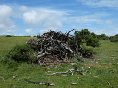
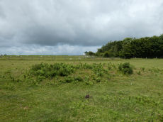
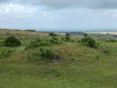
East Hill Clearance Cairn
OS Map: SX 59770 93820
HER record: MDV20457
ShortName: CN East Hill
Barrow Report: 17
Notes: NMR suggests "Post medieval clearance". The photo is presumably of this site. It was taken not long after the platinum jubilee celebrations in 2022 when a number of beacons were contructed on Dartmoor. The assumption is this was built up on top of the clearance cairn but the quantity of material obscures whether or not there is a mound there. No other obvious clearance cairn could be found in the vicinity suggesting this is it. THE HER gives the location as SX 59770 93820 and this is at SX 59746 93844. As this identification is not certain the grid reference will be left as that given by the HER.
Nearby sites: SX59779382
A30 Embankment 3 Reported Cairn
OS Map: SX 59590 94320
HER record: MDV63879
ShortName: CNxA30Embank 3
Notes: Destroyed or still there?
Nearby sites: SX59599432
A30 Embankment 4 Reported Cairn
OS Map: SX 59250 94250
HER record: MDV63878
ShortName: CNxA30Embank 4
Notes: Destroyed or still there?
Nearby sites: SX59259425
A30 Embankment 5 Reported Cairn
OS Map: SX 57880 93620
HER record: MDV63872
ShortName: CNxA30Embank 5
Notes: Destroyed or still there?
Nearby sites: SX57889362
Okehampton Castle Reported Cairn
OS Map: SX 57800 93960
HER record: MDV70193
ShortName: CN?Oke Castle
Nearby sites: SX57809396
Sourton Down 1 Reported Cairn
OS Map: SX 54590 91910
HER record: MDV4771
ShortName: CN?SourtonDn1
Grinsell: B:SOU 1
Notes: Square? Thought to be Roman or later. A Civil War redoubt situated 750 metres south east of East Linnacombe in an elevated position overlooking Dartmoor and the valley of the River Thrushel. The earthwork was possibly erected in 1642 to guard the Cornish side of Okehampton. The monument survives as a double ditched, square-shaped enclosure with a square central platform measuring 13.9 metres across by 0.7 metres high, topped by a slight bank up to 3.6 metres wide and 0.2 metres high. Surrounding the platform is a 2 metre wide and 0.2 metre deep ditch, beyond which is a second bank 1.8 metres wide and 0.2 metres high and a second ditch up to 2.4 metres wide and 0.3 metres deep. Scheduled. Previously listed here as Roebuck Hotel reported cairn.
Nearby sites: SX54599191
Sourton Down 2 Reported Cairn
OS Map: SX 54500 91800
HER record: MDV63865
ShortName: CN:SourtonDn2
Notes: HER: Two stone clusters of 2 metre diameter. One predominantly quartzite to the north and the other predominantly schist or slate to the east.
Nearby sites: SX54509180
Page last updated 10/12/24