
Guide to the Monuments on Buckfastleigh
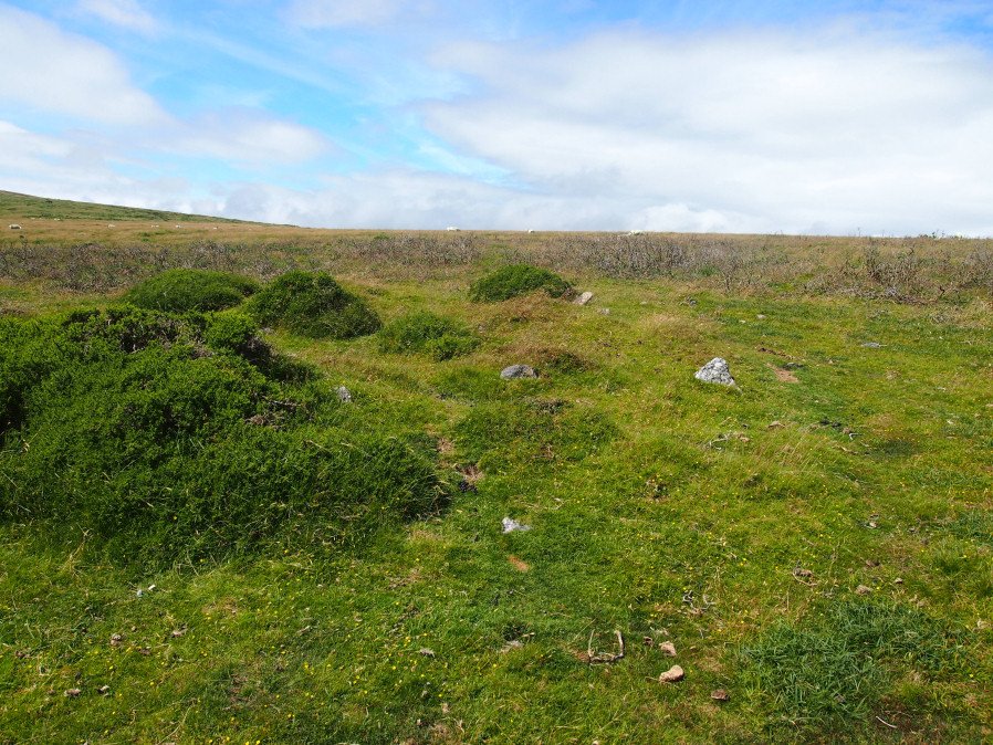
Table of Ritual and Burial Monuments on Buckfastleigh
The following table lists the records currently in this Guide Map. For an explantion of the Guide Maps and a table of all 62 Guide Maps, follow this link: Guide List Table. Introductory text will be added to each guide list in 2025. Notes on duplication and omissions will appear below the table once checks have been finalised.
Buckfastleigh Guide Map
Guidance for walkers: The monuments featured in this database are archaeological treasures and need to be protected and preserved - please do not disturb any sites. Please check access and firing times before visiting sites, not all sites listed are on open access land. Firing ranges and boundaries of open access areas are marked on the OL28 OS Dartmoor Explorer map. Please stick to the country code and consider giving support to the numerous agencies that help to keep Dartmoor a fabulous natural and historic environment!
List of Ritual and Burial Monuments on Buckfastleigh
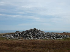
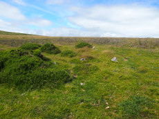
Pupers Rock Stone Ring Cairn Circle
OS Map: SX 67281 67376
HER record: MDV5219
Megalithic Portal: 45845
Alternate name: Pupers Hill Summit Stone Ring Cairn Circle
ShortName: RC Pupers Rock
Butler map: 58.9
DPD page: 89
Grinsell: DEA 1
Turner: A58
Notes: HER: A natural outcrop some 10.0m across and 2.0m high, encompassed by a mass of small stones. Most are piled to the west of the outcrop but overall they form a cairn 16.0m in diameter and 1.0m high. On the southern side the precise perimeter is difficult to determine since a spread of stone on the surface extends for a further 8.0 metres. This site is on the local list of Nationally Important Dartmoor sites.. Turner: Ring cairn incorporating a large flat-topped granite outcrop. The stone ring measures 17 meters in diameter internally with 2.5 meter wide bank 0.6 meters high. There are the remains of a stone circle, around 1.0 meter high within the outcrop.
Nearby sites: SX67286738
Inner Pupers Stone Ring Cairn Circle
OS Map: SX 67566 67421
HER record: MDV13205
Megalithic Portal: 45847
PMD: Inner Pupers
ShortName: RC InnerPupers
Butler map: 58.9
DPD page: 89
Grinsell: BUC 6
Turner: A60
Notes: HER: The rock outcrop known as Inner Pupers is encompassed by a cairn of 13.0 meters overall diameter. It takes the shape of a platform 0.4 meters high around the rock, with a rim 1.5 meters wide and a further 0.4 meters high. Of small stones, with further 'natural' slabs protrude through. NB. This feature is very visible on Google Satellite.
Nearby sites: SX67576742

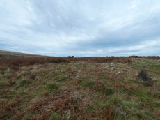
Pupers Hill 1 Cairn
OS Map: SX 67391 67441
HER record: MDV13191
ShortName: CN PupersHill1
Notes: Robinson R A barrow lying between Puper’s Rock and Inner Pupers. A low circular mound lying on fairly level ground in an area of turf and heather, visible due to the difference in heather growth on the mound. The mound is flat topped, measuring 0.5 meters high and 4.5 meters in diameter north-south, but only 3.0 meters east-west. There is a well-defined kerbstone concealed by heather and probing of the mound shows it to have been stone built. At the centre a cavity extends downwards beside a flat slab of stone set on edge around 0.6 meters long, lying east-west, which may represent the remains of a cist.
The author visited this on 13 July 2024 and there is indeed a clear cavity into this cairn.
Nearby sites: SX67396744
Pupers Hill 2 Cairn
OS Map: SX 67830 67067
HER record: MDV67607
ShortName: CN:PupersHill2
Notes: Greeves: An apparently undisturbed prehistoric flat-topped cairn approximately 5.0 meters in diameter by up to 0.5 meters high located to the south of 'Kit's Stone' on the track from 'Lud Gate' to 'Huntingdon Warren'. The author found this cairn on 02/08/2025 and the grid reference has been updated as it was a it inaccurate! No photos unfortunately.
Nearby sites: SX67836707

Pupers Hill E Reported Cairn
OS Map: SX 67800 67380
HER record: MDV13190
ShortName: CN?PupersHillE
Butler map: 58.9
Notes: HER: Cairn east of Puper's Rock and Inner Pupers. Heath-covered peaty mound of 8.0 metres diameter and 0.5 metres high.. Butler: Pupers Hill 'E' cairn at SX 67806738 of 6.5 metres diameter by 0.5 metres high is an unremarkable mound which seems to have escaped the cairn diggers, the smooth rounded surface showing no sign of interference.
Nearby sites: SX67806738
Snowdon 1 Cairn
OS Map: SX 66898 68171
HER record: MDV5221
ShortName: CN Snowdon 1
Butler map: 58.10.1
Grinsell: BUC 4
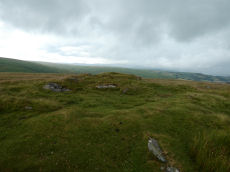
Notes: The most southerly of a line of four cairns. Visible on Google earth. HER: Cairn with a diameter of 23.3m and 1m high and is constructed of boulders, of all sizes and has been heavily disturbed, especially on its east side, where a modern marker cairn, 1.5 m high and 3m diameter has been erected Grinselll: Cairn, hollow towards centre, crowned by modern stone heap, measuring 24.0 meters in diameter, and 1.0 meter in height. Butler: Southernmost of four cairns on Snowdon, this is the largest and is composed of a loosely piled mass of medium-sized stones. There are traces of an outer rim surrounding the pitted and hollowed interior and the cairn may have originally been more structured as the tops of some vertically set slabs are visible within the body of the mound which seem to form part of an inner ring. One block 0.8 metres high which is particularly noticeable within the western side of the mound is likely to have originally have stood on the margin.
Nearby sites: SX66906817
Snowdon 2 Cairn
OS Map: SX 66871 68281
HER record: MDV5220
ShortName: CN Snowdon 2
Butler map: 58.10.2
Grinsell: BUC 3
Notes: One of a line of four cairns. Visible on Google earth. HER: Round platform cairn, 16.5 m diameter and 11m high, and has been badly mutilated by the erection of a modern marker cairn, 1.5 m high and 3m diameter with a shelter upon it. This site is on the local list of Nationally Important Dartmoor sites. Butler: 18 metres diameter by 1.2 metres high. This cairn has a deep central pit and is slightly smaller than its southern neighbour. It is crowned with a modern stone heap.
Nearby sites: SX66876828
Snowdon 3 Cairn
OS Map: SX 66846 68395
HER record: MDV5222
ShortName: CN Snowdon 3
Butler map: 58.10.3
Grinsell: BUC 2
Notes: One of a line of four cairns. Visible on Google Earth. HER: The remains of a cairn of 16 metres diameter and 1.1 metres high constructed of turf covered boulders. It is in good condition except for a small central disturbance and a modern marker cairn, 0.8 m high and 1 m diameter. Butler: This cairn retains its shape better than the others, with fewer stones exposed and more shallow pitting.
Nearby sites: SX66856840
Snowdon 4 Cairn
OS Map: SX 66878 68562
HER record: MDV13203
ShortName: CN Snowdon 4
Butler map: 58.10.4
Grinsell: BUC 1
Notes: One of a line of four cairns. Butler: This cairn is the northernmost of four cairns on Snowdon and is ill-defined, blending into the slope of the hillside but apparently little interfered with.
Nearby sites: SX66886856
Holne Lee 1 Cairn
OS Map: SX 67847 69575
HER record: MDV5200
ShortName: CN:Holne Lee 1
Butler map: 58.11.1
Grinsell: HOL 9
Notes: HER: A round cairn, overall diameter 22.5 metres with a central platform, 7 metres diameter and 0.6 metres high, surrounded by a rim, 7.8 metres average width and 0.9 metres high. Butler: deformed by a saucer shaped depression in the surface now turfed over and comparatively smooth, the product of some ancient excavation.
Nearby sites: SX67856958
Holne Lee 2 Cairn
OS Map: SX 67884 69583
HER record: MDV13208
ShortName: CN:Holne Lee 2
Butler map: 58.11.2
Grinsell: HOL 10
Notes: HER: Grinsell (1978) described an additional cairn 'D' here, 10.0m. in diameter and 0.6m. high with a hollow in or near the centre. The Royal Commission Holne survey (1997) records this possible feature as 'somewhat enigmatic'; while from some aspects it resembles a cairn, it is probably the debris from a prospecting pit allied to the nearby extensive tinworking remains. Gerrard: One of 5 cairns on Holne Lee situated 2 kilometres south-west of Fore Stoke. Round cairn. Measures 9.5m by 7.8m. Central pit 4.4m by 2.9m. The mound is orientated at 340 degrees. The structure now looks like a rectangular building rather than a cairn. On balance, however, given its location it is more likely to represent a cairn. Butler: trenched and hollowed out to ground level.
Nearby sites: SX67886958
Holne Lee 3 Cairn
OS Map: SX 67921 69599
HER record: MDV5201
ShortName: CN:Holne Lee 3
Butler map: 58.11.3
Grinsell: HOL 11
Notes: HER: Round cairn, overall diameter 19.8m, is of similar form to A. having a central platform 8.7m diameter and 0.6m high, surrounded by a rim, 5.5m average width and 1.0m high. Gerrard: One of 5 cairns on Holne Lee situated 2 kilometres south-west of Fore Stoke. Round cairn. Diameter 21m, height 1.3m. Central pit 6m by 6m by 0.3m deep. Robbing pit is slightly east of the mound centre. Old animal burrows within the pit. Rushes in the pit, grass, gorse, bilberry and heather elsewhere.
Nearby sites: SX67926960
Holne Lee 4 Cairn
OS Map: SX 67992 69641
HER record: MDV5202
ShortName: CN:Holne Lee 4
Butler map: 58.11.4
Grinsell: HOL 12
Notes: HER: Oval cairn, 12 metres by 11 metres overall and 0.9 metres high with a regular central depression, 6 metres diameter and 0.9 metres deep. The surround is noticeably dipped to the east-south-east on the long axis, where it is only 0.6 metres high. The even turf cover of the stones and the regular profile suggest that this cairn has not been disturbed and maintains its original form as a hollow top cairn.
Nearby sites: SX67996964
Holne Lee 5 Cairn
OS Map: SX 68495 69805
HER record: MDV5198
ShortName: CN:Holne Lee 5
Butler map: 58.11.5
Grinsell: HOL 16
Notes: HER: One of two cairns of probable Bronze Age date on Holne Lee. Cairn has an overall diameter of 18.5m and is constructed of small boulders and comprises a central mound, 12.8m diameter, 0.9m high, which has been extensively disturbed. It is immediately surrounded by a ring, 2.9m thick and 0.5m high resulting in a cairn of embankment bowl type.
Nearby sites: SX68506981
Holne Lee 6 Cairn
OS Map: SX 68490 69820
HER record: MDV13209
ShortName: CN:Holne Lee 6
Butler map: 58.11.6
Grinsell: HOL 16a
Notes: HER: Oval cairn, 16 metres by 14 metres and 0.6 metres high. The central area (11 metres to 13 metres diameter) is very disturbed, with a small, off centre mound 0.6 metres high. The cairn has a rim 1.5 metres wide and 0.5 metres high, with a south-west facing gap, 2 metres wide. There is a single orthostat set into the rim on its east arc. Butler: Originally an outer bank seems to have surrounded a raised interior but this has become badly disordered and further damage has been caused to the edges by the well worn tracks approaching uphill from the ford across the Mardle
Nearby sites: SX68496982
Holne Lee Stone Ring Cairn Circle
OS Map: SX 68656 69919
HER record: MDV5199
Megalithic Portal: 45836
Alternate name: Holne Lee 7 Stone Ring Cairn Circle
ShortName: RC Holne Lee 7
Butler map: 58.11.7
Grinsell: HOL 17
Turner: A32
Notes: HER: One of two cairns of probable Bronze Age date on Holne Lee. Cairn is 21 metres in diameter and is constructed of small boulders, and consists of a platform 14 metres diameter and about 0.2m high, with a perimeter rim average thickness 3.5m and 0.5m high. There is a gap, 4.3m wide, facing north north-east.
Nearby sites: SX68666992
Holne Lee 8 Cairn
OS Map: SX 68690 69930
HER record: MDV13198
ShortName: CN:Holne Lee 8
Butler map: 58.11.8
Grinsell: HOL 18
Notes: HER: A disturbed cairn 9.0 metres in diameter lies on the northern tip of Holne Lee overlooking Venford reservoir. Now standing 0.4 metres high this feature has suffered severe disturbance to its centre.
Nearby sites: SX68696993
Holne Lee 9 Cairn
OS Map: SX 67767 69497
HER record: MDV61446
ShortName: CN:Holne Lee 9
Notes: HER: A small stoney cairn lies on the summit of Two Barrows Hill some 60m SW of three large skyline cairns. Some small stones protrude through the turf-covered mound which measures 4.8m N to S by 4.1m. It stands a maximum of 0.3m high. There is no trace of a cist or kerb. NB. Formerly listed as Holne Lee 11 but changed to 9.
Nearby sites: SX67776950
Mardle Embanked Cairn Circle
OS Map: SX 67526 69359
HER record: MDV5308
Megalithic Portal: 3374
Alternate name: Mardle Valley 1 Embanked Cairn Circle
ShortName: CC Mardle 1
Butler map: 58.12.1
Turner: B11
Notes: Turner: Embanked stone circle; an annular bank of earth and/or stone with an inner edge of orthostats. Much disturbed. Internal diam 6.5m with bank 1.2m wide and 0.4m high. This cairn has a very interesting structure appearing to be multiple circles of stones similar to the cairns at Corringdon Ball. This structure is difficult to capture in a photograph as the stones are small and the site much disturbed.
Nearby sites: SX67536936
Mardle Valley 2 Cairn
OS Map: SX 67610 69220
HER record: MDV5203
ShortName: CN:Mardle 2
Butler map: 58.12.2
Grinsell: HOL 13
Notes: HER quoting Gerrard: Round cairn. Diameter 8m, height 0.4m. A small trench leading in from the north-west is 1.5m long by 1m wide and 0.2m deep.
This cairn has been cleared of vegetation by the DPA in September 2025 and the author visited shortly afterwards on 02/10/2025. Of the 4 cairns cleared this one I was unable to locate with certainty but I was lacking time for a thorough search. I had probably located it but was uncertain I had correctly identified it. It maybe more obvious when the bracken has died back.
Nearby sites: SX67616922
Mardle Valley 3 Cairn
OS Map: SX 67727 69038
HER record: MDV5204
ShortName: CN Mardle 3
Butler map: 58.12.3
Grinsell: HOL 14
Notes: HER: Round cairn measures 8.5m diameter and 0.5m high. It has a rectangular trench, 2.3m by 1.6m and 0.3m deep dug into its centre.
This cairn has been cleared of vegetation by the DPA in September 2025 and the author visited shortly afterwards on 02/10/2025. Photos added and grid references updated.
Nearby sites: SX67736904
Mardle Valley 4 Cairn
OS Map: SX 67627 68957
HER record: MDV24792
ShortName: CN Mardle 4
Butler map: 58.12.4
Grinsell: HOL 15
Notes: HER quoting Gerrard: Round cairn. Diameter 9.8m, height 0.7m. A flat topped stoney mound with several hollows. A small number of edge set stones around the periphery may represent the remnants of a kerb.
This cairn has been cleared of vegetation by the DPA in September 2025 and the author visited shortly afterwards on 02/10/2025. Photos added and grid references updated.
Nearby sites: SX67636896
Mardle Valley 5 Cairn
OS Map: SX 67790 68890
HER record: MDV62034
ShortName: CN:Mardle 5
Butler map: 58.12.5
Notes: HER: Ovoid feature measuring 4.5 metres north to south by 5.2 metres and stands 1.1 metres high. An amorphous hollow roughly 1.0 metres in diameter is situated in the centre of the mound.
Visit by author 02/10/2025 to look for this site. Unable to locate cairns 5-8 due to dense vegetation cover. This site might be easier to locate when the bracken has died back more in the winter or early spring.
Nearby sites: SX67796889
Mardle Valley 6 Cairn Circle
OS Map: SX 67810 68720
HER record: MDV5307
ShortName: CN:Mardle 6
Butler map: 58.12.6
Notes: HER: Oval cairn, 16 metres by 14 metres and 0.6 metres high. The central area (11 metres to 13 metres diameter) is very disturbed, with a small, off centre mound 0.6 metres high. The cairn has a rim 1.5 metres wide and 0.5 metres high, with a south-west facing gap, 2 metres wide. There is a single orthostat set into the rim on its east arc.
Visit by author 02/10/2025 to look for this site. Unable to locate cairns 5-8 due to dense vegetation cover. This site might be easier to locate when the bracken has died back more in the winter or early spring.
Nearby sites: SX67816872
Mardle Valley 7 Cairn
OS Map: SX 67920 68550
HER record: MDV5214
ShortName: CN:Mardle 7
Butler map: 58.12.7
Grinsell: BUC 5
Notes: HER: Round cairn measuring approximately 9 metres in diameter (around 0.6 metres high), almost on the summit of hill east of the River Mardle. It is constructed of small boulders and the centre has been disturbed.
Visit by author 02/10/2025 to look for this site. Unable to locate cairns 5-8 due to dense vegetation cover. This site would appear to be located in widespread dense gorse which is head height - impossible to investigate.
Nearby sites: SX67926855
Mardle Valley 8 Cairn
OS Map: SX 67780 68760
HER record: MDV62033
ShortName: CN:Mardle 8
Notes: HER: One of two, possibly three, hut circles on the moderate west-facing slope above the left bank of the River Mardle. This third, possible, hut consists of coursed boulder and rubble walls 0.6m wide and 0.5m high enclose a roughly circular area 2.0m in diameter with a possible entrance in the south side. It is not certain whether this is a small hut circle or an elaborate clearance cairn relating to the medieval or later exploitation of this area.
Visit by author 02/10/2025 to look for this site. Unable to locate cairns 5-8 due to dense vegetation cover. This site might be easier to locate when the bracken has died back more in the winter or early spring.
Nearby sites: SX67786876
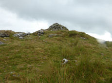
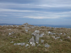
Ryders Hill Cairn
OS Map: SX 65982 69068
HER record: MDV5223
ShortName: CN:Ryders Hill
Butler map: 58.13
Butler Vol 5: p.162 & Fig.101
Grinsell: HOL 8
Notes: HER: Large platform cairn, 30.5 m diameter and on average 1.0 m high is turf covered and in good condition, except for the erection of Petre's Bound Stone, a modern boundary stone, and an Ordnance Survey triangulation pillar upon it. It lies on the broad level summit of Ryder's Hill.
Nearby sites: SX65986907
Huntingdon Barrow Cairn
OS Map: SX 66217 66912
HER record: MDV5235
Megalithic Portal: 45571
Alternate name: Heap of Sinners Cairn
ShortName: CN:Huntingdon
Butler map: 58.14
DPD page: 87
Grinsell: LYD 103
Barrow Report: 65
Notes: HER: 'Huntingdon Barrow' or 'Heap of Sinners' cairn north of Huntingdon Warren. A large cairn measuring 22 metres in diameter with an average height of 1.4 metres. It is constructed of large boulders but has been mutilated by the erection of marker cairns and shelters on it
Nearby sites: SX66226691
Crad Hole Ring Cairn Circle
OS Map: SX 67210 66500
HER record: MDV129288
ShortName: CC:Crad Hole
Butler map: 58.2
Notes: HER: Crad Hole Ring cairn at SX67216650 with a 'central piller'. Feature '4' at 'Crad Hole Ring' is a pair of huts the larger of which has been converted into a cairn of 7.5 metres diameters by 0.6 metres high with a small pillar in the centre.
Nearby sites: SX67216650
Crad Hole Ring 2 Cairn
OS Map: SX 67210 66500
HER record: MDV5260
ShortName: CC:CradHole2
Notes: HER: Roughly circular group of stones on Hickaton Hill, north-east of a Bronze Age hut circle settlement. May possibly be the remains of two concentric circles of stones, 8-10 meters in diameter.
These two circles include one that has been covnverted into a cairn, see separate record for Crad Hole Ring.
Nearby sites: SX67216650
Hembury Castle (Buckfast) Fort
OS Map: SX 72608 68455
HER record: MDV7776
Megalithic Portal: 34692
Alternate name: Hembury Castle Fort
ShortName: FT HembCastle
Notes: "A hill fort with medieval castle within. Hill fort in Hembury woods, south east of Holne. A camp situated on the summit with a good view to the south and east."
Nearby sites: SX72616846
Warmacombe 1 Clearance Cairn
OS Map: SX 68590 67740
HER record: MDV5180
ShortName: CN:Warmacombe1
Notes: HER: One of three mounds thought to be clearance dumps. Reported in the 1970s as having been removed; 'nothing archaeological' was found.
Nearby sites: SX68596774
Warmacombe 2 Clearance Cairn
OS Map: SX 68470 67560
HER record: MDV5181
ShortName: CN:Warmacombe2
Notes: HER: One of three mounds that appear to be clearance cairns. Reported in the 1970s as being largely removed, only a general spread remains.
Nearby sites: SX68476756
Warmacombe 3 Clearance Cairn
OS Map: SX 68560 67390
HER record: MDV5182
ShortName: CN:Warmacombe3
Notes: HER: One of three mounds that appear to be clearance cairns. Reported in the 1970s as being largely removed, only a general spread remains.
Nearby sites: SX68566739
Holne Ridge Reported Cairn
OS Map: SX 66000 69000
HER record: MDV5251
ShortName: CN:HolneRidge
Notes: HER: Holne Ridge, tumulus indicated by Ordnance Survey, while making the 6 inch map. NB. This description is so vague as to be of no use. For this reason this record is being marked as a duplicate to exclude it from most listings. It is only included for completeness of HER records.
Nearby sites: SX66006900
Gibby Coombe Cairnfield Master
OS Map: SX 68200 68900
HER record: MDV62227
ShortName: CN:Gibby
Notes: HER: Historic cairnfield north-west of Gibby Coombe. A scatter of around 70 small cairns lying within two large fields. These cairns are the result of clearance of surface stone.
Nearby sites: SX68206890
Page last updated 10/12/24