
Prehistoric sites within 5km of SX 74196 69686
Guidance for walkers: The monuments featured in this database are archaeological treasures and need to be protected and preserved - please do not disturb any sites. Please check access and firing times before visiting sites, not all sites listed are on open access land. Firing ranges and boundaries of open access areas are marked on the OL28 OS Dartmoor Explorer map. Please stick to the country code and consider giving support to the numerous agencies that help to keep Dartmoor a fabulous natural and historic environment!
About the database listings: In all listings clicking on the photo or the site name will open a page for the site with a larger photo and further details from the database. The database now has over 6680 records covering nearly all publicly listed sites on Dartmoor including around 4800 round houses. This level of detail is of interest to archaeologists but tends to swamp listings of sites more likely to be of interest for walkers. For this reason, the listings default to around 550 core sites only. These are the stone circles, stone rows and the ring cairns listed by Turner. The default search radius is 2 km. The controls below the map can be used to start a new search by entering a 6- or 8-digit reference (without the prefix "SX"). The search radius can be specified and you can add incremental Display layers of detail on top of the core sites. If using a more detailed layer you will need to decrease the search radius to avoid getting hundreds of search results.
- Core sites Default listing of core sites consisting of stone circles & rows and some of the major ring cairns.
- Plus cairns adds approx. 1000 cairns and other minor sites not included in the core listings but excluding round houses.
- Plus round houses adds approx. 4800 round houses.
- Plus non-sites adds in the records for sites that no longer exist or are not prehistoric sites.
- Plus duplicates adds records excluded as duplicates. Those maybe duplicate records in external listings (e.g. the Historic Environment Records). For example, some sites have been identified as cairns in some listings and interpreted as round houses in other listings and both records appear.
These listings have incorporated, matched up and merged all of the records from all of the major archaeological listings including: Worth, Grinsell, Turner, Butler, Bill Radcliffe, Sandy Gerrard, Megalithic Portal, the National Monument Records and the Historic Environment Records. The author would like to thank Bill, Sandy, the lovely people both at Megalithic Portal (especially Anne Tate who did an amazing job to link listings) and at ACE Archaeology for collaborative work over the years to synchronise and correct listings across the various websites which now interlink. A culmination of years of work the final merger of cairn records took 3 months of cross referencing in 2017 the result being a snapshot of the records at that time. This data has in turn been refined since by field work and research. The round house data was supplied by Sandy Gerrard. Grid references are in order of accuracy: from Google Earth satellite, if visible and found, from a Garmin GPS reading, if visited by the author and from the literature otherwise. Individual site pages will state the source of the grid reference and provide satellite imagery. If a site listing lacks a photo it has not yet been visited by the author in which case the grid reference is from the literature.
Currently the database only includes sites which can be represented by a grid reference. Reaves are not included as they require GIS shape technology which is beyond the current capability of this system. To see the sources for the records, look at the tables on the resources menu. The database listings can also be viewed on a Google map and downloaded as GPS datasets for Garmin devices.
Corrections, or any feedback or suggestions are very welcome, email: info@dartmoorwalks.org.uk.
NOTE: Clicking on the icons for each monument in the map will give the name of the site. You can zoom in and out and drag the map around.
List of sites within 5km of SX 74196 69686
Cold Cross East Reported Cairn
OS Map: SX 73999 74292
HER: MDV30642
ShortName: CN Cold Cross
Butler map: 10.
Butler Vol 5: p.54 & Fig.32
Nearby sites: SX 73999 74292
Distance: 4.61km
Buckland Common 1 Reported Cairn
OS Map: SX 73772 73930
ShortName: CN-Buckland 1
Butler map: 10.
Notes: Linear arrangement of mounds incorporated into boundary. Could be prehistoric cairns.
Nearby sites: SX 73772 73930
Distance: 4.27km
Buckland Common 2 Reported Cairn
OS Map: SX 73742 73865
HER: MDV30646
ShortName: CN Buckland 2
Butler map: 10.
Notes: HER: "A flattened and spread round cairn straddles the parish boundary between Buckland and Ashburton. A boundary stone is set into the cairn."
Nearby sites: SX 73742 73865
Distance: 4.20km
Buckland Common 3 Reported Cairn
OS Map: SX 73588 73559
ShortName: CN?Buckland 3
Butler map: 10.8
Notes: Linear arrangement of mounds incorporated into boundary. Could be prehistoric cairns.
Nearby sites: SX 73588 73559
Distance: 3.92km
Buckland Common 4 Reported Cairn
OS Map: SX 73587 73556
ShortName: CN?Buckland 4
Butler map: 10.8
Notes: Linear arrangement of mounds incorporated into boundary. Could be prehistoric cairns.
Nearby sites: SX 73587 73556
Distance: 3.92km
Buckland Beacon Cairn
OS Map: SX 73510 73118
HER: MDV7977
ShortName: CN BuckBeacon
Butler map: 10.
Grinsell: B:BITM 1
Notes: HER referring to Newman: Buckland Beacon, probable tor cairn. The tor outcrop is surrounded by small, turf-covered stones indicating a possible tor cairn. Condition is mostly stable but subject to visitor erosion. SX73500 73100.
Nearby sites: SX 73510 73118
Distance: 3.50km
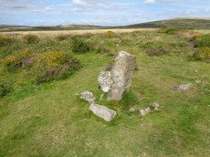
Brake Corner 1 Cairn
OS Map: SX 7022 7170
HER: MDV8030
ShortName: CN?Brake 1
Butler map: 11.1.1
Turner: A17
Notes: Hut circle at brake corner. HER: A circular enclosure bounded by a bank consisting of small stone. Part of the interior has been filled in with cleared field stones. there is no trace of an entrance. Certain identification of the feature as a hut circle could not be made. No orthostats are visible and the construction using small stones is unusual for a hut. The exposed situation on the crest of a spur is more appropriate to a cairn but the walling, at best about 0.4 m. high, appears too regular for a cairn rim
Nearby sites: SX 7022 7170
Distance: 4.46km
Brake Corner 2 Reported Cairn
OS Map: SX 7018 7168
ShortName: CN?Brake 2
Butler map: 11.1.2
Notes: Possible hut circle.
Nearby sites: SX 7018 7168
Distance: 4.48km
Buckland Ridge (N) Cairn
OS Map: SX 73579 73510
HER: MDV30631
ShortName: CN:Buckland 5
Turner: A47
Nearby sites: SX 73579 73510
Distance: 3.87km
Welstor Common Cairn
OS Map: SX 73739 73009
HER: MDV112763
ShortName: CN:Welstor
Nearby sites: SX 73739 73009
Distance: 3.36km
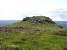
Ausewell Rocks W. Cairn
OS Map: SX 73477 71753
HER: MDV7988
ShortName: CN:Ausewell W
Grinsell: ASH 2
Barrow Report: 41
Notes: "diameter 18.0m, crude stone wall around cairn obviously modern survives as a semi circular enclosure on west side of cairns flat top."
Nearby sites: SX 73477 71753
Distance: 2.19km
Ausewell Rocks E. Cairn
OS Map: SX 73548 71735
HER: MDV8019
ShortName: CN:Ausewell E
Grinsell: ASH 3
Barrow Report: 41
Nearby sites: SX 73548 71735
Distance: 2.15km
Buckland Beacon Ancient Pool
OS Map: SX 73558 73260
HER: MDV127202
ShortName: PO:BuckBeacon
Notes: "A pool measuring 10.5 by 9.5m. One of over 40 such 'sacred' pools identified on Dartmoor that are thought to have potentially been designed during the prehistoric period. Lies near a cairn." NB. Nearby is Turner A13 ring cairn.
Nearby sites: SX 73558 73260
Distance: 3.63km
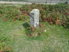
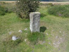
Buckland Ridge (S) Stone Ring Cairn Circle
OS Map: SX 7357 7324
HER: MDV30630
Megalithic Portal: 45827
Alternate name: Buckland Common 5 Stone Ring Cairn Circle
ShortName: RC:BucklandRid
Butler map: 10.9
Turner: A13
Notes: Linear arrangement of mounds incorporated into boundary. Could be prehistoric cairns. Turner A13. No NMR record. "Robbed cairn. Stone ring is 13m inside diameter bank 1.80m wide and 50cms high, much of the bank on the eastern side has been destroyed. The central area has been disturbed, modern stone wall running north to south through the eastern section of the stone ring."
Nearby sites: SX 7357 7324
Distance: 3.61km
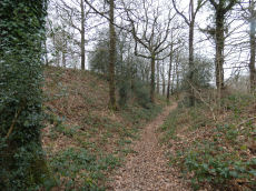
Hembury Castle (Buckfast) Fort
Prehistoric Dartmoor Walks: Dartmoor Resource: Table of Devon Iron Age Forts
OS Map: SX 72608 68455
HER: MDV7776
Megalithic Portal: 34692
Alternate name: Hembury Castle Fort
ShortName: FT HembCastle
Notes: "Hembury castle. Ia hill fort with medieval castle within. Hill fort in hembury woods, south east of holne. A camp situated on the summit with a good view to the south and east. The main camp consists of an irregular area surrounded by a fosse and vallum with a small rampart on the outer side of the fosse. The height from the top of the vallum to the bottom of the fosse is between 25-30 feet, and the area is about 7 acres. On the west side near the ditch is a mound about 30m in diameter and about 20 feet high. This is surrounded by a level platform with a scarped edge descending to the level of the interior of the camp. This may be of a later date than the main ramparts. A bronze celt and some sling stones have been found within the area of the camp. The whole is on an enclosed moor with some trees growing on the area of the mound (ancient monuments)."
Grinsell [Folklore 1976]: A hill-fort, the defence of which was left to ladies who ‘welcomed the enemy, took them to their beds, and stabbed them all in the night’. Brown 1964, 148.
Nearby sites: SX 72608 68455
Distance: 2.01km
Holne Chase Castle Fort
Prehistoric Dartmoor Walks: Dartmoor Resource: Table of Devon Iron Age Forts
OS Map: SX 72437 71979
HER: MDV7996
Megalithic Portal: 62571
ShortName: FT:HolneChase
Notes: "A slight univallate hillfort situated on the north facing side of Holne Chase overlooking the River Dart. The hillfort survives as an oval enclosure measuring 120m long by 96m wide internally, defined by a single rampart and ditch with a counterscarp bank present to the north east, west and south west. It has two entrances, a simple gap to the south east and an inturned entrance to the south west."
Nearby sites: SX 72437 71979
Distance: 2.89km