
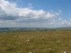
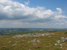
Prehistoric sites within 5km of SX 54878 75177
Guidance for walkers: The monuments featured in this database are archaeological treasures and need to be protected and preserved - please do not disturb any sites. Please check access and firing times before visiting sites, not all sites listed are on open access land. Firing ranges and boundaries of open access areas are marked on the OL28 OS Dartmoor Explorer map. Please stick to the country code and consider giving support to the numerous agencies that help to keep Dartmoor a fabulous natural and historic environment!
About the database listings: In all listings clicking on the photo or the site name will open a page for the site with a larger photo and further details from the database. The database now has over 6680 records covering nearly all publicly listed sites on Dartmoor including around 4800 round houses. This level of detail is of interest to archaeologists but tends to swamp listings of sites more likely to be of interest for walkers. For this reason, the listings default to around 550 core sites only. These are the stone circles, stone rows and the ring cairns listed by Turner. The default search radius is 2 km. The controls below the map can be used to start a new search by entering a 6- or 8-digit reference (without the prefix "SX"). The search radius can be specified and you can add incremental Display layers of detail on top of the core sites. If using a more detailed layer you will need to decrease the search radius to avoid getting hundreds of search results.
- Core sites Default listing of core sites consisting of stone circles & rows and some of the major ring cairns.
- Plus cairns adds approx. 1000 cairns and other minor sites not included in the core listings but excluding round houses.
- Plus round houses adds approx. 4800 round houses.
- Plus non-sites adds in the records for sites that no longer exist or are not prehistoric sites.
- Plus duplicates adds records excluded as duplicates. Those maybe duplicate records in external listings (e.g. the Historic Environment Records). For example, some sites have been identified as cairns in some listings and interpreted as round houses in other listings and both records appear.
These listings have incorporated, matched up and merged all of the records from all of the major archaeological listings including: Worth, Grinsell, Turner, Butler, Bill Radcliffe, Sandy Gerrard, Megalithic Portal, the National Monument Records and the Historic Environment Records. The author would like to thank Bill, Sandy, the lovely people both at Megalithic Portal (especially Anne Tate who did an amazing job to link listings) and at ACE Archaeology for collaborative work over the years to synchronise and correct listings across the various websites which now interlink. A culmination of years of work the final merger of cairn records took 3 months of cross referencing in 2017 the result being a snapshot of the records at that time. This data has in turn been refined since by field work and research. The round house data was supplied by Sandy Gerrard. Grid references are in order of accuracy: from Google Earth satellite, if visible and found, from a Garmin GPS reading, if visited by the author and from the literature otherwise. Individual site pages will state the source of the grid reference and provide satellite imagery. If a site listing lacks a photo it has not yet been visited by the author in which case the grid reference is from the literature.
Currently the database only includes sites which can be represented by a grid reference. Reaves are not included as they require GIS shape technology which is beyond the current capability of this system. To see the sources for the records, look at the tables on the resources menu. The database listings can also be viewed on a Google map and downloaded as GPS datasets for Garmin devices.
Corrections, or any feedback or suggestions are very welcome, email: info@dartmoorwalks.org.uk.
NOTE: Clicking on the icons for each monument in the map will give the name of the site. You can zoom in and out and drag the map around.
List of sites within 5km of SX 54878 75177

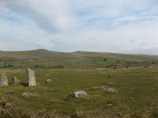
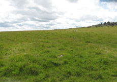
Cox Tor Tor Cairn Stone Ring Cairn Circle
OS Map: SX 53012 76012
HER: MDV50062
ShortName: RC:CoxTor 2
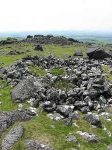
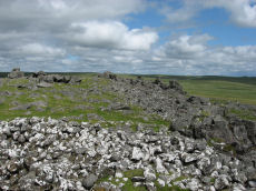
Notes: A well preserved Tor cairn approximately 21m in diameter encloses a small, unamed tor 180m SSW of Cox Tor. It comprises a ring of large to medium stones approximately 7m in width which are piled around a natural outcrop. The stones are of a fairly uniform size and most are not earth-fast. To the immediate NE a stretch of low turf-covered rubble walling 1.2m wide, 0.4m high and 15m in length connects two outcrops - it is probably of prehistoric origin but its function is obscure..
Nearby sites: SX 53012 76012
Distance: 2.04km
Langstone Moor S.2 Cairn
OS Map: SX 54838 77646
HER: MDV4116
Megalithic Portal: 35802
ShortName: CN Langston S2
Butler map: 31.19.2
Grinsell: PET 34
Notes: "Two round barrows on Peter Tavy Great Common. (A) SX54847764 A flat topped stony mound, probably a cairn, about 12m E-W by 11m transversely and of 0.6m maximum height. There is no apparent kerb and the edges are ill-defined. It is predominantly turf-covered but a small area of stones is exposed in the NW quadrant presumably the site of the 1899 excavation.(B) SX54887765 Located 45m ENE of 'A' or probable cairn visible as a turf covered mound about 5m in diameter and 0.3m high. No kerb is evident and the centre has been disturbed. The mounds are both quite prominently situated on the summit of a gently domed ridge of rough grassland which is generally devoid of surface stone." Previously listed on HER as 4120 - presumably deleted as a duplicate of 4116.
Formerly listed here as Roos Tor N. That naming has been dropped as it appears as part of a pair with Langstone Moor S.1
Nearby sites: SX 54838 77646
Distance: 2.47km
White Tor S.S.W.1 Long Cairn
OS Map: SX 54023 78321
HER: MDV4179
ShortName: CN White SSW1
Butler map: 31.21.1
Grinsell: PET 29a
Notes: The Dartmoor Exploration Committee (Report 6 1899) describes investigating 3 cairns in this location. The damaged remains are difficult today to interpret. Many authors suggest that the long cairn consists of two or more of these cairns. The current author visited this location on 27th May 2022 with just the knowledge that there were 3 reported cairns. I photographed a very likely cairn, namely, the long cairn (Butler 1). A semi-circular bank (Butler 3) and a faint mound around a natural rock (Butler 2). I noted at the time of the visit that both 2 and 3 are possible but doubtful cairns. I did not have the Butler account with me at the time I photographed and logged these. Looking now at Butler's account it looks like he reached the same conclusions and the entries here follow Butler with similar doubt on Butler 2 and Butler 3.
Gerrard: "cairn forming part of widely dispersed group of at least 14. Cairn mound measures 15m long by 6m wide and stands up to 1m high. A shallow hollow in the northern end of the mound measures 3m long by 1.5m wide and 0.15m deep and at the southern end another hollow measuring 1.5m long by 1m wide and 0.2m deep has been identified. These hollows are probably the result of a partial excavation carried out by the dartmoor exploration committee in 1899. This work revealed a pit containing ashes and charcoal. Grinsell has suggested that this cairn is two joined mounds, but without excavation this hypothesis cannot be tested. Two other doubtful mounds have been identified in close proximity to this cairn. These may be the remnants of two further cairns excavated by the dartmoor exploration committee, though there is not sufficient visible evidence to confirm this identification"
Nearby sites: SX 54023 78321
Distance: 3.26km
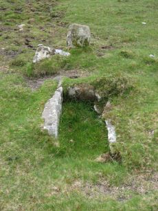
Barn Hill Cist
OS Map: SX 53318 74558
HER: MDV14685
Megalithic Portal: 45785
PMD: Barn Hill
Alternate name: Barn Hill S. Cist
ShortName: CT Barn Hill 1
Butler map: 44.10.3
DPD page: 15
Grinsell: WHI 3
Notes: "The cairn mound measures 5.7 metres in diameter and stands up to 0.2 metres high. The cist lies slightly south of the cairn's centre and survives as a 0.98 metre long by 0.6 metre wide and 0.3 metre deep stone-lined pit".
Barrow Report 39 refers to a posible cist on the northern side of Barn Hill and this is a different feature on the southern side. The Barrow Report refers to MDV4114.
Butler Barn Hill S. - Vol. 3. Map 44.10.3. (diagram p.34). Previously listed with an inaccurate grid reference. Now confirmed at SX 53318 74558.
Nearby sites: SX 53318 74558
Distance: 1.68km
Black Tor (Stanlake) Stone Row
Prehistoric Dartmoor Walks: Dartmoor Walk: Sharpitor area Stone Rows and Cists
OS Map: SX 56988 71381
HER: MDV4994
Megalithic Portal: 1771
The Stone Rows of GB: Black Tor Stanlake
PMD: Black Tor Stanlake Stone Row
ShortName: SR Stanlake
Butler map: 45.14
DPD page: 24
Notes: "A Bronze Age Stone Row lies just inside, and is partly buried by, a substantial field boundary. The row extends from SX57217155 to SX57007137, some 294m long and includes at least 57 visible stones. Its north-eastern end is denoted by a substantial blocking stone and its lower south-western end by three funerary cairns. The row can be seen as three distinct parts forming the whole. The northern part includes 39 stones, the central group of 8 stones is separated from the northern row by a 66.2m wide gap whilst the southern group is on a slightly different alignment to the others. The row is unusual in that the blocking stone is at the upper end and a cairn lies at the lower end." Lethbridge diagram and photo p.24.
Nearby sites: SX 56988 71381
Distance: 4.34km
Cox Tor Stone Ring Cairn Circle
OS Map: SX 53060 76190
HER: MDV4151
Megalithic Portal: 32104
Alternate name: Cox Tor Summit Stone Ring Cairn Circle
ShortName: RC CoxTor 3
Butler map: 31.1.3
Grinsell: PET 37a
Turner: A59
Notes: "Cox tor, ring cairn. The outcrop of granite on the summit is surrounded by an ancient wall, enclosing a space of about 21m in diameter, built of small stones. Pillaged and part used in erection of the cairn for the 1887 jubilee."
NB. The NMR listings had two entries for this feature. The entry SiteID=3229 referred to NMR entry SX 57 NW 132 (Monument Number 919075) which was a duplicate. As the NMR listings are no longer public our entry SiteID=3229 has been deleted.
Nearby sites: SX 53060 76190
Distance: 2.08km

Cox Tor Ancient Pool
OS Map: SX 53635 76205
HER: MDV26281
ShortName: PO:Cox Tor
Notes: "Previously recorded from aerial photographs as a possible quarry. Marked as 'pond' on modern mapping and is one of the examples suggested by Greeves (2019) to potentially have Prehistoric origins."
Nearby sites: SX 53635 76205
Distance: 1.61km
Cox Tor (NE) Stone Ring Cairn Circle
OS Map: SX 53047 76430
HER: MDV4127
Megalithic Portal: 32104
Alternate name: Cox Tor N.6 Stone Ring Cairn Circle
ShortName: RC CoxTor 6
Butler map: 31.1.6
Grinsell: PET 36
Turner: A51
Notes: "Narrow ridge of north-south outcropping rock measuring 10 metres in diameter, surrounded by circular stoney bank 4 metres wide, 0.8 metres high. 1890 excavation showed it to consist of an outer bank with central infill of loose stones and earth. No trace of burials or artefacts." "Cox Tor. Smaller of two adjacent cairns. Lies 12.5 metres south-east of larger one (see related record). Similar in shape, though smaller; diameter 8.23 metres. Construction of centre was loose, much earth being mingled with the stone. Nothing found and no pit in the "calm". (Baring-Gould - fifth report of the DEC) Breton p.16 Two very curious ring cairns; one has a diameter of 55ft and the other 27ft.
Nearby sites: SX 53047 76430
Distance: 2.22km
Cox Tor (NW) Stone Ring Cairn Circle
OS Map: SX 53024 76424
HER: MDV4128
Megalithic Portal: 32104
Alternate name: Cox Tor N.5 Stone Ring Cairn Circle
ShortName: RC CoxTor 5
Butler map: 31.1.5
Grinsell: PET 35
Turner: A48
Notes: Breton p.16 Two very curious ring cairns; one has a diameter of 55ft and the other 27ft.
Nearby sites: SX 53024 76424
Distance: 2.23km
Cox Tor N.E. Settlement
OS Map: SX 536 765
HER: MDV4105
Megalithic Portal: 17508
ShortName: ST:CoxTorNE
Notes: Details via Megalithic Portal.
Nearby sites: SX 536 765
Distance: 1.84km
Cudlipptown Down Embanked Cairn Circle
OS Map: SX 53732 78949
HER: MDV13252
Megalithic Portal: 45608
Alternate name: White Tor N.W.2 Embanked Cairn Circle
ShortName: CC White NW2
Butler map: 31.23.2
Butler Vol 5: p.188 & Fig.130
Grinsell: PET 21
Turner: B5
Notes: "A ring cairn set at the eastern end of a natural gently sloping plateau of rough grassland generally devoid of stones. It measures about 11m diameter inside a turf-covered bank, composed generally of smallish stones, which is about 2.2m wide and has a maximum height of 0.4m on the E. It has been mutilated and spread in the south-east and the west. Several stones, are evident, two probably set in the inner face but the rest are apparently part of the bank of even part of the outer face. Two in the east on the uphill side appear to form an entrance but this is possibly due to mutilation. The interior appears to have been levelled and is 0.2m above the ground to the W. There is no evidence of any internal features or a ditch"
Nearby sites: SX 53732 78949
Distance: 3.94km
Devil's Elbow Platform Cairn Circle
OS Map: SX 58192 72708
HER: MDV14310
Megalithic Portal: 36761
PMD: Devil's Bridge
Alternate name: Hart Tor N. Platform Cairn Circle
ShortName: PC:DevilsElbow
Butler map: 46.1
Butler Vol 5: p.168 & Fig.107
Grinsell: WAL 10
Turner: E5
Notes: Ring cairn consisting of a circle of close set stones: almost a kerb circle, interior flat and no sign of cist. Diameter 8m, height 0.3m. HER: Ring cairn to the north-east of the settlement to the north of Hart Tor recorded in the 19th century as containing a 'dilapidated kistvaen'
Nearby sites: SX 58192 72708
Distance: 4.13km

Goadstone Pond Ancient Pool
OS Map: SX 55706 70663
HER: MDV28232
ShortName: PO:GoadsStone
Notes: "Pool on the summit of the hill near a stone row. Some of the stones from the double stone row appear to have been lost in the pool. Previously incorrectly identified from aerial photograph as an enclosure. One of over 40 pools on Dartmoor thought to have originated in the Prehistoric period."
Worth and Butler refer to this as Goatstone Pool. There is a very interesting discussion of both the origin of the name and of the cairns and stone rows on DartmoorCam: Sharpitor. See also Legendary Dartmoor: Dartmoor's Goadstone
Nearby sites: SX 55706 70663
Distance: 4.59km
Hart Tor N. Settlement
OS Map: SX 5816 7243
HER: MDV3791
Megalithic Portal: 36762
ShortName: ST:HartTorN
Nearby sites: SX 5816 7243
Distance: 4.28km
Hart Tor North Stone Row
Prehistoric Dartmoor Walks: Dartmoor Site: Hart Tor Stone Row & Cairn Circle
OS Map: SX 57708 71708
HER: MDV4896
Megalithic Portal: 1973
The Stone Rows of GB: Hart Tor North
PMD: Harter N Stone Row
ShortName: SR Hart Tor N
Butler map: 46.5.1
DPD page: 25
Notes: Butler Row 1. There are two cairns close by on the lower slopes of Hart Tor. One has an associated single stone row and the other has an associated double stone row - they diverge at an angle of 18 degrees. The double row consists of 93 stones and is much longer, around 122m in length [Gerrard], and extends all the way down to the River Meavy in the valley below. This row is fairly well preserved although it is crossed by a tinners ditch about a third of the way down its length and again by a leat a third of the way from the lower end. The structure was planned by Wilkinson in 1859 who states that the row is "terminated by a large monolith, now fallen, measuring about 25 feet long by 2 feet and 3 inches". Sadly this stone has long since disappeared. The row has pairs of stones which are spaced fairly accurately 1.9m apart along the rows, the rows being at a constant 1.7m separation. The cairn circle is 9.3m across and consists of 14 tall slabs some of which have fallen. Detailed survey of site in Hart Tor Stone Rows & Cairns, Meavy Valley Archaeology. Site Report No.9 - Sandy Gerrard (1999). See also: Sea Views at Hart Tor, The Stone Rows and Cairns at Hart Tor Dartmoor Part One and The Stone Rows and Cairns at Hart Tor Dartmoor Part Two
Nearby sites: SX 57708 71708
Distance: 4.48km

Hart Tor North Encircled Cairn
Prehistoric Dartmoor Walks: Dartmoor Site: Hart Tor Stone Row & Cairn Circle
OS Map: SX 57718 71716
HER: MDV49460
Megalithic Portal: 978
PMD: Harter N Stone Row
Alternate name: Hart Tor double stone row Encircled Cairn
ShortName: EC Hart Tor N
Butler map: 46.5
Butler Vol 5: p.39 & Fig.16
DPD page: 25
Grinsell: WAL 12
Turner: F12
Notes: The cairn circle is 9.3m across and consists of 14 tall slabs some of which have fallen. Wilkinson noticed concentric stone circles - which can't be seen today although there is clearly an inner circular mound. NMR A.
Nearby sites: SX 57718 71716
Distance: 4.48km
Hart Tor South Stone Row
Prehistoric Dartmoor Walks: Dartmoor Site: Hart Tor Stone Row & Cairn Circle
OS Map: SX 57720 71698
HER: MDV4895
Megalithic Portal: 1974
The Stone Rows of GB: Hart Tor South
PMD: Harter S Stone Row
ShortName: SR Hart Tor S
Butler map: 46.5.1
DPD page: 25
Notes: Butler Row 2. The single row consists of 16 stones and is 56.4m long, although Gerrard suggests it was probably once much longer. The single row leads to a cairn which does not have a retaining circle. The cairn which has been robbed measures 7.4m in diameter and up to 0.75m high. For early description of both rows and the now missing menhir, see: Wilkinson J. Gardner, British Remains on Dartmoor, Journal Brit. Arch. Assoc. xviii. pp.22-53 (1862). Detailed survey of site in Hart Tor Stone Rows & Cairns, Meavy Valley Archaeology. Site Report No.9 - Sandy Gerrard (1999). See also notes for Hart Tor North Stone Row. Sea Views at Hart Tor, The Stone Rows and Cairns at Hart Tor Dartmoor Part One and The Stone Rows and Cairns at Hart Tor Dartmoor Part Two
Nearby sites: SX 57720 71698
Distance: 4.49km
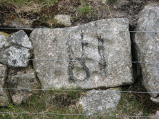
Holmingbeam Cup Stone
OS Map: SX 59488 75233
HER: MDV12807
Megalithic Portal: 10606
ShortName: CS Holmingbeam
DPD page: 107
Notes: "Mortar stone of uncertain date incorporated into the eastern boundary wall of Long Plantation. It was formerly, erroneously, recorded as a cup-marked stone." The stone is upside down in wall by road side and has the figure 18 painted on it. Lethbridge diagram and photo p.107
Nearby sites: SX 59488 75233
Distance: 4.61km
Ingra Tor Cist
Prehistoric Dartmoor Walks: Dartmoor Walk: Sharpitor area Stone Rows and Cists
OS Map: SX 55874 72093
HER: MDV4983
Megalithic Portal: 45735
PMD: Ingra Tor
Alternate name: lngra Tor Cist
ShortName: CT Ingra Tor
Butler map: 45.16
DPD page: 19
Grinsell: WAL 9
Barrow Report: 56
Notes: Butler Vol. 3. Map 45.16 (diagram p.51).
Breton (p.12): About 300 yds E. of Ingra tor is a fine kistvaen which has not been disturbed, except that a portion of the capstone has been broken off. [...] Three men from the farm near by about 1910 tried to raise the capstone with crowbars, but they failed to move it ; however, they broke off the piece that is broken.
Nearby sites: SX 55874 72093
Distance: 3.24km
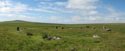
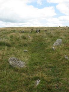
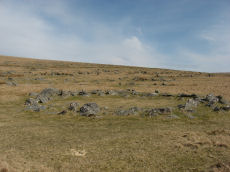
Langstone Moor Stone Circle
Prehistoric Dartmoor Walks: Dartmoor Site: Langstone Moor Stone Circle, Stone Row & Settlements
OS Map: SX 55638 78204
HER: MDV4226
Megalithic Portal: 1062
PMD: Langstone Moor Stone Circle
ShortName: SC Langstone
Butler map: 30.10
DPD page: 14
Turner: G10
Notes: The Langstone standing stone and also the stone circle were used for target practice by American troops who were stationed nearby during the Second World War. Bullet holes can be seen on the Langstone standing stone and the circle was sadly smashed to smithereens. The Langstone Moor Stone circle had been restored in 1894 when all of the stones were re-erected in their original socket holes. Today only 3 stones remain intact with 10 having been destroyed and the rest overturned during World War Two. The debris of the former stones remain in place. Pre-war photos give a sense of how spectacular this site used to be. The original restored circle consisted of 16 stones in a 20.9m circle. The original survey by the Dartmoor Exploration Committee suggested that there might have originally been a secondary concentric circle consisting of elvan rather than granite stones although the evidence for this today is unclear (see Extract from the Second Report of the D.E.C.). Breton (p.18): It was discovered as recently as 1894. Not a single stone was then standing, but fortunately none had been taken away or even mutilated. The Duke of Bedford kindly allowed the stones to be re-erected, and supplied the men to do the work, which was directed by the Rev S. Baring-Gould and Mr. Robert Burnard. It has 16 stones, and its diameter is about 60 ft. There was originally another circle outside this one, of which only two or three stones remain. Further coverage can be found on Legendary Dartmoor: Dartmoor's Prehistoric Langstone Moor. Lethbridge p14, diagram p13.
Nearby sites: SX 55638 78204
Distance: 3.12km
Langstone Moor Stone Ring Cairn Circle
Prehistoric Dartmoor Walks: Dartmoor Site: Langstone Moor Stone Circle, Stone Row & Settlements
OS Map: SX 54843 77922
HER: MDV48862
Megalithic Portal: 45833
ShortName: RC Langstone
Turner: A22
Notes: HER: A semi-circular bank, possibly the remains of a ring cairn.1.4 to 2m wide, 0.4m high. Composed of small + medium sized stones now largely turf-covered. It fades at each end of a near-perfect semi-circle of 14.9m internal diam. There is a low stone pile, 0.2m high, in se quadrant.
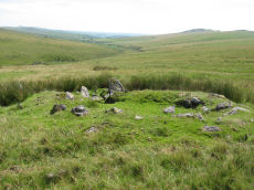
The author visited this site on 25/06/2018. A semi circular group of periglacial mounds can indeed be seen. The author on that occasion concluded that what appears to be a ring cairn is in fact simply the natural arrangement of the mounds. Re-visited on 13/08/2025 and the appearance looked very much like a ring cairn. This feature is also listed by some authors Mortar Emplacement 12
Nearby sites: SX 54843 77922
Distance: 2.75km
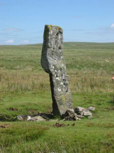
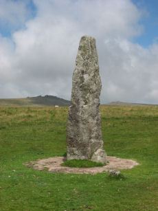
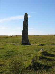
Langstone Moor Standing Stone
Prehistoric Dartmoor Walks: Dartmoor Site: Langstone Moor Stone Circle, Stone Row & Settlements
OS Map: SX 55023 78742
HER: MDV4225
Megalithic Portal: 17504
PMD: Langstone Moor Standing Stone
ShortName: SS Langstone
Butler map: 30.12
Butler Vol 5: p.230
DPD page: 13
Notes: The Langstone standing stone is 2.76m high and can be seen from some distance. It was restored in its original socket in 1893. The Langstone is close to a stone row consisting of very small stones. The Langstone standing stone and also the stone circle were used for target practice by American troops who were stationed nearby during the second world. Bullet holes can be seen on the Langstone standing stone. Lethbridge pp.13-14. Breton (p.17) The stone is composed of local gabbro, and was formerly prostrate, but His Grace the Duke of Bedford has re-erected it in its original socket-hole.
Nearby sites: SX 55023 78742
Distance: 3.57km
Langstone Moor Ancient Pool
OS Map: SX 55026 78879
HER: MDV127215
ShortName: PO:Langstone
Notes: HER: A pool measuring 28 by 24 metres. One of over 40 such 'sacred' pools identified on Dartmoor that are thought to have potentially been designed during the prehistoric period. Lies at the northern end of a stone row. May be on the site of a cairn
NB. HER entry implies this could be the same as the Butler reported cairn at the end of the stone row. On this website this is currently listed as a separate entry SiteID=1164 (no HER entry). The diagram page 77 (fig 30.8) shows both a mound and a pit. Could this be the pit distinct from the cairn? Breton (p.17): The Langstone was formerly the end of a stone row, composed of quite small stones, running in a direction N. and S. from a pool that occupies the site of a destroyed cairn.
Nearby sites: SX 55026 78879
Distance: 3.70km
Langstone Moor Settlement
OS Map: SX 555 779
HER: MDV4219
Megalithic Portal: 17507
ShortName: ST Langstone
Butler map: 30.2
Notes: Details via Megalithic Portal.
Nearby sites: SX 555 779
Distance: 2.79km
Langstone Moor Cist
Prehistoric Dartmoor Walks: Dartmoor Site: Langstone Moor Stone Circle, Stone Row & Settlements
OS Map: SX 54699 78695
HER: MDV4118
Megalithic Portal: 35807
PMD: White Tor E.
Alternate name: White Tor E.4 Cist
ShortName: CT White E4
Butler map: 31.22.4
Butler Vol 5: p.174 & Fig.114
DPD page: 13
Grinsell: PET 27
Barrow Report: 55
Notes: Butler White Tor E.4. Vol. 2. Map 31.22 (diagram Vol. 5. p.174).
Nearby sites: SX 54699 78695
Distance: 3.52km
Langstone Moor Stone Row
Prehistoric Dartmoor Walks: Dartmoor Site: Langstone Moor Stone Circle, Stone Row & Settlements
OS Map: SX 55022 78851
HER: MDV4223
Megalithic Portal: 2016
The Stone Rows of GB: Langstone Moor
PMD: Langstone Moor I Stone Row
ShortName: SR Langstone
Butler map: 30.12
DPD page: 14
Notes: "A single stone row stands on Launceston (Langstone). Moor circa 330 feet in length, probably longer when complete. There are now only 18 stones, the largest of which stands only 18 inches above ground. At the north end are the remains of a barrow, now reduced to little more than a rubble ring. At the south end is the standing stone known as the 'Langstone', from which the moor probably takes its name. The stone was re-erected in 1893 and stands to a height of 9 feet 3 inches." Lethbridge p14, diagram p13. Breton (p.17): The Langstone was formerly the end of a stone row, composed of quite small stones, running in a direction N. and S. from a pool that occupies the site of a destroyed cairn.
Nearby sites: SX 55022 78851
Distance: 3.68km
Langstone Moor 2 Cist
Prehistoric Dartmoor Walks: Dartmoor Site: Langstone Moor Stone Circle, Stone Row & Settlements
OS Map: SX 55736 78120
HER: MDV4593
Megalithic Portal: 45786
PMD: Near Langstone Moor Stone circle
ShortName: CT Langstone 2
Butler map: 30.10.2
Grinsell: PET 39
Notes: The cist is now housed in the Plymouth City Museum. Butler Langstone Moor 2 - Vol. 2. Map 30.10. 129
Nearby sites: SX 55736 78120
Distance: 3.07km
Leeden Hill Standing Stone
Prehistoric Dartmoor Walks: Dartmoor Walk: Sharpitor area Stone Rows and Cists
OS Map: SX 56015 71286
HER: MDV28499
Megalithic Portal: 45567
PMD: Leeden Hill Standing Stone
ShortName: SS Leeden Hill
Butler map: 45.
Notes: Possibly a prehistoric standing stone but may also be a much later marker since there are at least three similar stones in a line towards Ingra Tor set out at wide intervals as if to mark a boundary
Nearby sites: SX 56015 71286
Distance: 4.05km
Leeden Tor Stone Row
Prehistoric Dartmoor Walks: Dartmoor Walk: Sharpitor area Stone Rows and Cists
OS Map: SX 56522 71474
HER: MDV50223
Megalithic Portal: 2020
The Stone Rows of GB: Leeden Tor
PMD: Leeden Tor Stone Row
ShortName: SR Leeden Tor
Butler map: 45.15
DPD page: 23
Notes: "BA cairn and stone row. The scrappy remains of a single stone row now 165m long descend from a badly battered cairn on the south-east slopes of Leeden Tor. The cairn is about 6m across with a large central pit and partial retaining circle. At least 14 stones remain in a line, four only still earthfast and the rest either flat or buried. Stone pits record the loss of some of the stones". Lethbridge p23, diagram p.24. See also: Sea Views at Leeden Tor
Nearby sites: SX 56522 71474
Distance: 4.05km
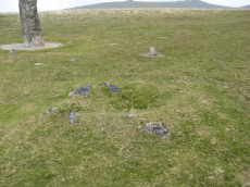
Merivale (S) Encircled Cairn
OS Map: SX 55368 74602
HER: MDV3759
Megalithic Portal: 52014
The Stone Rows of GB: Merrivale 4
PMD: Merrivale Menhir
Alternate name: Merrivale 6 (near standing stone) Encircled Cairn
ShortName: EC Merrivale 6
Butler map: 44.8.6
Grinsell: WAL 6
Turner: F19
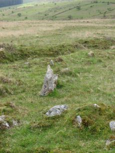
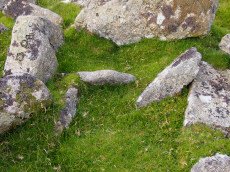
Notes: The cairn now turf-covered with an excavation pit in the centre, has a diameter of 2.4m. and a height of 0.1m. The excavation pit can be seen in the photo. A very irregular "circle" of stones can be seen around this cairn. Turner F19.
Nearby sites: SX 55368 74602
Distance: 0.76km
Merrivale Stone Circle
Prehistoric Dartmoor Walks: Dartmoor Site: Merrivale Ceremonial Complex [Photo Set 2]
OS Map: SX 55361 74641
HER: MDV4998
Megalithic Portal: 116
PMD: Merrivale Stone Circle
ShortName: SC Merrivale
DPD page: 17
Turner: G14
Notes: "A stone circle with a diameter of 20.0m. measured from northeast to southwest and 18.0m from northwest to southeast. It is formed by eleven stones spaced between 2.7m and 6.7m. apart and from 0.3m. to 0.5m. high. Three of the stones are of post type and eight are upright slabs. An additional stone, 7.5m. from the northeast side and 0.3m high, is angled towards the circle and may be quite unassociated". According to Breton (p.14) It formerly contained a kistvaen. No other accounts make this claim but the DEC report does mention shallow pits. Baring Gould states: Examination of some depressions in the surface of the turf found several pits dug to a depth of 12 - 18 inches in one of which was a flint flake. These had apparently been the socket holes for standing stones which had been removed to serve as gate posts or reused in the construction of a new-take wall nearby. See also Legendary Dartmoor: Merrivale Ceremonial Complex. Lethbridge pp.16-18, diagram 16.
Nearby sites: SX 55361 74641
Distance: 0.72km
Merrivale Standing Stone
Prehistoric Dartmoor Walks: Dartmoor Site: Merrivale Ceremonial Complex [Photo Set 2]
OS Map: SX 55359 74599
HER: MDV53395
Megalithic Portal: 115
PMD: Merrivale Standing Stone
ShortName: SS Merrivale
Butler map: 44.8.4
DPD page: 17
Notes: "Two Bronze Age standing stones with a disturbed cairn and a number of small earth fast stones. Located in open generally clitter-free moorland. Only one of the two stones still stands; it is 3.2 metres high and tapers from the base which is 0.7 by 0.5 metres in section. Whether the stone was once the focus or terminus of a stone rows is uncertain. The second stone is now fallen, it is 2.2 metres long, up to 0.4 metres wide and 0.3 metres thick. An adjacent 0.3 metre deep pit may be its socket hole. "
Nearby sites: SX 55359 74599
Distance: 0.75km
Merrivale Settlement
Prehistoric Dartmoor Walks: Dartmoor Site: Merrivale Ceremonial Complex [Photo Set 2]
OS Map: SX 555 749
HER: MDV4897
Megalithic Portal: 1520
ShortName: ST Merrivale
DPD page: 18
Notes: Merrivale Prehistoric Settlement is a partially enclosed stone hut circle settlement, including at least thirty six hut circles and four separate enclosures. Lethbridge pp.16-18, diagram p.16.
Nearby sites: SX 555 749
Distance: 0.68km
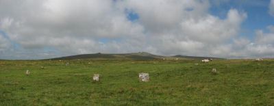
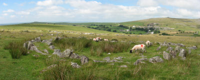
Merrivale Ceremonial Complex
Prehistoric Dartmoor Walks: Dartmoor Site: Merrivale Ceremonial Complex [Photo Set 2]
OS Map: SX 5545 7479
HER: MDV14795
Megalithic Portal: 2046
PMD: Merrivale
ShortName: CX Merrivale
DPD page: 16
Notes: The Merrivale Ceremonial Complex consists of a stone circle a large menhir and two double stone rows and burial cairns. See also: Legendary Dartmoor: Merrivale Ceremonial Complex. Lethbridge pp.16-18, diagram p.16.
Grinsell [Folklore 1976]: Formerly called the Potato Market or the Plague Market, perhaps from a time when goods were brought here for sale when the plague was raging in Tavistock. Bray 1879, letter ix; Crossing 1912/65, 94, note.
Nearby sites: SX 5545 7479
Distance: 0.69km
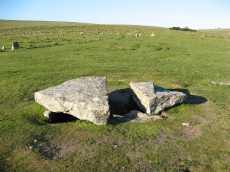
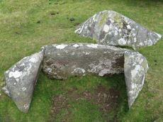
Merrivale Cist
Prehistoric Dartmoor Walks: Dartmoor Walk: Merrivale Complex
OS Map: SX 55490 74770
HER: MDV3738
Megalithic Portal: 10465
PMD: Merrivale
Alternate name: Merrivale 7 Cist
ShortName: CT Merrivale 7
Butler map: 44.8.7
DPD page: 18
Grinsell: WAL 5
Notes: HER: A very fine Bronze Age cist which measures internally 2.2 metres long by 0.9 metres wide and up to 0.8 metres deep. The triangular-shaped slab which forms the massive cover stone is up to 2.1metres wide and averages 0.4 metres thick; a central part has been removed by stone cutters revealing the water-filled cist and a broken fragment of the coverslab.
Breton (p.14): The capstone was mutilated by a farmer in 1860, who cut a gate post out of the middle of it.
See also, Legendary Dartmoor: The Merrivale Kist. Lethbridge pp.16-18, diagram p.16. Butler Vol. 3. Map 44.8.7 (diagram of location in ceremonial complex p.24, diagram of cist p.31).
Nearby sites: SX 55490 74770
Distance: 0.73km
Merrivale Embanked Cairn Circle and Cist
OS Map: SX 55360 74747
HER: MDV4997
Megalithic Portal: 10503
PMD: Merrivale SW.
Alternate name: Merrivale 8 Embanked Cairn Circle and Cist
ShortName: CT Merrivale 8
Butler map: 44.8.8
Grinsell: WAL 1
Turner: B2
Notes: "The excavation of 1851 seems to have been thorough, completely destroying structural remains of both the cairn and the 'cist or inner circle',. There is now a circular turf covered area, 18.0m. in diameter, with random stones protruding through the surface. Off centre there is a hollow, 7.0m. by 4.0m. and 0.5m. deep." Butler Merrivale Vol. 3. Map 44.8.8 (pp.30-1).
Nearby sites: SX 55360 74747
Distance: 0.65km
Merrivale (Menhir 1) Stone Row
Prehistoric Dartmoor Walks: Dartmoor Site: Merrivale Ceremonial Complex [Photo Set 1]
OS Map: SX 55361 74592
HER: MDV53397
Megalithic Portal: 3388
The Stone Rows of GB: Merrivale 4
PMD: Merrivale Menhir I Stone Row
Alternate name: Merrivale 4 Stone Row
ShortName: SR Mer Menhir
Butler map: 44.8.4
DPD page: 17
Notes: Butler Row 4. Prehistoric Monuments of Dartmoor website Menhir 1. "Stone row 4 is now a trivial affair [Butler] of 3 small slabs aligned towards a squarish block near the base of the standing stone. This area has suffered some damage over the past century. There were 5 stones in 1895, the missing one presumably accounted for by the pit which has appeared between the upper stones. This may well be the site of the cairn, C4, at the head of the rows recorded by Rowe but not included in the plans of Lukis or Worth. Nor is there much surviving from the circle of slabs around the menhir depicted in Bray's plan and recorded by Spence Bate in 1871, or the nearby cist which he excavated, C5. The Exploration Committee excavated at both ends of the row but no more socket holes were found and they concluded that this short alignment was complete." Lethbridge pp.16-18, diagram p.16.
Nearby sites: SX 55361 74592
Distance: 0.76km
Merrivale A Stone Row
Prehistoric Dartmoor Walks: Dartmoor Site: Merrivale Ceremonial Complex [Photo Set 1]
OS Map: SX 55541 74809
HER: MDV14797
Megalithic Portal: 2044
The Stone Rows of GB: Merrivale 1
PMD: Merrivale A Stone Row
Alternate name: Merrivale 1 Stone Row
ShortName: SR MerrivaleA
Butler map: 44.8.1
DPD page: 16
Notes: Worth Merrivale A. Butler Merrivale 1. "Two Bronze Age double stone rows and associated cairns are located on open moorland. The rows are oriented roughly east to west and are almost parallel, being 25 metres between centres at their eastern ends increasing to 32 metres at the west. A leat still used to convey water to Hillside Stables separates the two monuments and flows to within 2 metres of the northern row. A single row (see SX 57 SE 115) runs roughly south-west from a small cairn at SX 55397476, some 4.75 metres south of the south row." Lethbridge pp.16-18, diagram p.16.
Nearby sites: SX 55541 74809
Distance: 0.76km
Merrivale B Stone Row
Prehistoric Dartmoor Walks: Dartmoor Site: Merrivale Ceremonial Complex [Photo Set 1]
OS Map: SX 55567 74788
HER: MDV14795
Megalithic Portal: 117
The Stone Rows of GB: Merrivale 2
PMD: Merrivale B Stone Row
Alternate name: Merrivale 2 Stone Row
ShortName: SR MerrivaleB
Butler map: 44.8.2
DPD page: 16
Notes: Butler Merrivale 2. Worth Merrivale B. For description see Merrivale A. Lethbridge pp.16-18, diagram p.16.
Nearby sites: SX 55567 74788
Distance: 0.79km
Merrivale C Stone Row
Prehistoric Dartmoor Walks: Dartmoor Site: Merrivale Ceremonial Complex [Photo Set 1]
OS Map: SX 55394 74761
HER: MDV5001
Megalithic Portal: 3391
The Stone Rows of GB: Merrivale 3
PMD: Merrivale C Stone Row
Alternate name: Merrivale 3 Stone Row
ShortName: SR MerrivaleC
Butler map: 44.8.3
DPD page: 17
Notes: Butler Merrivale 3. Worth Merrivale C. "A stone row and a small cairn lie to the south of the double stone rows in close-cropped moorland turf. The cairn located at the northern end and slightly off-centre to the row, measures 3.2m across and up to 0.5m high. An 0.3m deep central pit opens out on the southern side. There is no obvious kerb or cist but a transverse slab, the terminal slab of the row, is set within the south side of the mound. The existence of this slab suggest that the row pre-dates the mound. The stone row extends for 41.7m in a southerly direction to an upright stone (SX553774720). However, during the English Heritage 1999 survey a further stone was located on the same alignment beyond this stone indicating an overall length for the row of at least 60m. The new partially buried stone at SX55337484 is visible as a rounded stone 0.15m across; it is similar to others in the row. A total of six upright stones, six stones protruding through the turf and about ten slight depressions, now indicate this 60m long alignment. The transverse stone within the cairn is 0.5m by 0.4 and 0.15m thick. The two adjacent in line slabs are 0.6m 0.3m by 0.15m and 0.3 by 0.2 and 0.2m thick respectively. The other large stone (SX55377472) is 0.5 by 0.4 and up to 0.4m thick. The other stones are up to 0.15m high." Lethbridge pp.16-18 Row C, diagram p.16.
Nearby sites: SX 55394 74761
Distance: 0.66km
Merrivale double row B (centre) Encircled Cairn and Cist
Prehistoric Dartmoor Walks: Dartmoor Walk: Merrivale Complex
OS Map: SX 55442 74779
HER: MDV14796
Megalithic Portal: 3389
PMD: Merrivale S row
Alternate name: Merrivale double row 2 centre Encircled Cairn and Cist
ShortName: CT Merrivale 2
Butler map: 44.8.2
DPD page: 17
Grinsell: WAL 4
Turner: F20
Notes: Butler Merrivale double row 2, (centre) - Vol. 3. Map 44.8.1 (diagram p.27). Lethbridge pp.16-18, diagram p.16.
Nearby sites: SX 55442 74779
Distance: 0.69km
Merrivale NE Cairn Circle
Prehistoric Dartmoor Walks: Dartmoor Site: Merrivale Ceremonial Complex [Photo Set 1]
OS Map: SX 55548 74817
HER: MDV29078
Megalithic Portal: 3390
The Stone Rows of GB: Merrivale 1
PMD: Merrivale A Stone Row
Alternate name: Merrivale double row 1 (east end) Cairn Circle
ShortName: CC Merrivale 1
Butler map: 44.8.1
Notes: At the eastern end (of the northern stone row) there is a blocking stone and beyond it a number of earthfast and loose slabs which seem to represent a former kerb or circle about 5.6m. in diameter. The blocking stone is part of the circle with two or possibly three earthfast slabs on end, three recumbent slabs, and four other post or slab stones which are much displaced or entirely unconnected. The stones are spaced at about 2.0m. intervals; uprooted slabs are from 0.3m. square to 0.4m. by 0.5m., earthfast stones 0.1m. high. There is no sign of a cairn or cist.
Nearby sites: SX 55548 74817
Distance: 0.76km
Merrivale North Embanked Cairn Circle
OS Map: SX 55340 74845
HER: MDV3757
Megalithic Portal: 10502
Alternate name: Merrivale 10 Embanked Cairn Circle
ShortName: CC Merrivale10
Butler map: 44.8.10
Turner: B8
Notes: "Turner describes this site as an embanked stone circle; an annular bank of earth and/or stones with an inner edge of orthostats. Internal diameter is 8.0 meters with a bank 0.8 meters wide and 0.3 meters high. Much disturbed." Turner B8.
Nearby sites: SX 55340 74845
Distance: 0.57km

Mis Tor Farm Embanked Cairn Circle
OS Map: SX 56927 75953
HER: MDV15372
Megalithic Portal: 45609
Alternate name: Little Mis Tor S.E. Embanked Cairn Circle
ShortName: CC:MisTor Farm
Butler map: 30.17
Butler Vol 5: p.163 & Fig.104
Grinsell: LYD 37a
Turner: B13
Notes: HER Base of ancient tumulus, about 20m in diameter, may have formed a bound of the ancient boundary between Lydford and Walkhampton (Prowse). Butler: Little Mis Tor SE cairn at SX56927595 of 22.0 metres diameter by 0.4 metres high. This large but low cairn has suffered some trenching around the eastern side. An outer bank 22 metres across surrounds a level interior rising to a small mound at the centre on which are lying several small stones. The few slabs visible within the bank show that it was built with inner and outer faces around a rubble core.
Nearby sites: SX 56927 75953
Distance: 2.19km

Pew Tor (N side) Ancient Pool
OS Map: SX 53354 73597
HER: MDV127216
ShortName: PO Pew Tor
Notes: "A pool measuring 28 by 14m. One of over 40 such 'sacred' pools identified on Dartmoor that are thought to have potentially been designed during the prehistoric period."
Nearby sites: SX 53354 73597
Distance: 2.20km
Raddick Hill Enclosed Settlement
Prehistoric Dartmoor Walks: Dartmoor Walk: Sharpitor area Stone Rows and Cists
OS Map: SX 57636 71495
HER: MDV3748
Megalithic Portal: 36404
ShortName: ES:RaddickHill
DPD page: 26
Notes: "A Bronze Age enclosed hut circle settlement. The remains lie on a northerly hillslope and now comprise a D-shaped enclosure wall of boulders and stones containing about twelve hut circles. A small D-shaped enclosure is attached to the uphill south-east side. The northern part of the settlement has been effaced by a tinner's cliff, part of the Hart Tor Brook streamworks. This well preserved settlement now lies under low bilberry bushes."
Nearby sites: SX 57636 71495
Distance: 4.60km

Roos Tor N.W. Settlement
OS Map: SX 539 772
HER: MDV4104
Megalithic Portal: 17509
ShortName: ST:RoosTorNW
Notes: Details via Megalithic Portal. Photo is of round house SiteID=8089
Nearby sites: SX 539 772
Distance: 2.25km
Routrundle North Enclosed Settlement
Prehistoric Dartmoor Walks: Dartmoor Walk: Sharpitor area Stone Rows and Cists
OS Map: SX 55384 71860
HER: MDV105688
Megalithic Portal: 45577
ShortName: ES:Routrundl N
Notes: Routrundle North Pound: "Broadly oval enclosure, 58 by 48 metres diameter. Part of the south-west perimeter is represented by a stony scarp 0.5 metres high, elsewhere it comprises a stone spread of similar height upon which is a modern field wall."
Nearby sites: SX 55384 71860
Distance: 3.36km
Routrundle south Enclosed Settlement
Prehistoric Dartmoor Walks: Dartmoor Walk: Sharpitor area Stone Rows and Cists
OS Map: SX 55262 71735
HER: MDV3775
Megalithic Portal: 45578
ShortName: ES:Routrundl S
Notes: Routrundle South Pound: "A roughly oval field with diameters of 58.0 metres by 64.0 metres and a modern perimeter wall 1.5 metres high. There are no obvious footings of a previous wall but the plan and size (0.25 hectares) suggest that it is the fossilization of a prehistoric enclosure similar to that 250 metres to the north-east."
Nearby sites: SX 55262 71735
Distance: 3.46km
Sharpitor (N) or Peek Hill Platform Cairn Circle and Cist
Prehistoric Dartmoor Walks: Dartmoor Walk: Sharpitor area Stone Rows and Cists
OS Map: SX 55839 70693
HER: MDV3769
Megalithic Portal: 1246
PMD: Peek Hill
Alternate name: Sharpitor N. Platform Cairn Circle and Cist
ShortName: CT Peek Hill
Butler map: 45.12
DPD page: 22
Grinsell: WAL 21
Turner: E41
Barrow Report: 72
Notes: Bar Rep. 72 (TDA Vol 88 p.222). Butler Sharpitor N. - Vol. 3. Map 45.12 (diagram p.45 & photo p.84).
Copyright for photos and plans from Barrow Reports 71-73 belong to the Dixon estate. Reproduced here with kind permission.
Nearby sites: SX 55839 70693
Distance: 4.59km
Sharpitor E. Stone Row
Prehistoric Dartmoor Walks: Dartmoor Walk: Sharpitor area Stone Rows and Cists
OS Map: SX 56171 70819
HER: MDV4991
Megalithic Portal: 2117
The Stone Rows of GB: Sharpitor North East
PMD: Sharpitor E Stone Row
Alternate name: Sharpitor NE Stone Row
ShortName: SR Sharp NE
Butler map: 45.13
DPD page: 21
Notes: Described by Worth as "Sharpitor, foot of eastern slope". Listed by Butler as Sharpitor N.E. (which can be confused with another alleged row). "A stone row, with a cairn at the west end at SX 56147078, extends almost due west for 26.0m. to SX 56167078. The cairn, mutilated and amorphous, is now approximately 6.7m in diameter and 0.3m. high at its maximum. There are nine stones in the row, including three pairs, with an additional stone which seems to be displaced, all between 0.1m. and 0.3m. high. The east end of the row is terminated by a reave (SX 67 SE 91) which has cut across and evidently destroyed any westward extension." Lethbridge pp.20-22.
Nearby sites: SX 56171 70819
Distance: 4.55km
Sharpitor N.W. 1 Stone Row
Prehistoric Dartmoor Walks: Dartmoor Walk: Sharpitor area Stone Rows and Cists
OS Map: SX 55665 70617
HER: MDV3762
Megalithic Portal: 2118
The Stone Rows of GB: Sharpitor North West 1
PMD: Sharpitor Summit N Stone Row
Alternate name: Sharpitor NW 1 Stone Row
ShortName: SR Sharp NW1
Butler map: 45.12.1
DPD page: 21
Barrow Report: 66
Notes: "The double stone row is in poor shape. Both terminals have survived fixing its length at 113m from the blocking stone to the centre of the cairn. The cairn (4.5 x 0.3) has lost its retaining circle and has been dug into in the centre. The other end of the row is well defined by a pair of larger slabs in the line of the rows followed by a central cross-set blocking stone 1.2m long that has been tipped backwards and is partly overgrown. The stones seemed to have increased in size nearer the cairn. Unusually the highest point on the ground is not at the cairn end but near the centre of the rows as they cross the summit of the ridge". Lethbridge pp.20-22. See also: Sea Views at Sharpitor NW 1. Breton p.27 The stone row, which starts from a cairn, passes through the south end of the pond, and terminates some distance below in a small circle of seven stones. About 320 yds due east of the circle, and only 40 yds. from the road, is another stone row which has been mutilated. It is only about 30 yds long and starts from a ruined circle.
Nearby sites: SX 55665 70617
Distance: 4.63km

Sharpitor N.W. 2 Stone Row
Prehistoric Dartmoor Walks: Dartmoor Walk: Sharpitor area Stone Rows and Cists
OS Map: SX 55687 70600
HER: MDV3761
Megalithic Portal: 2119
The Stone Rows of GB: Sharpitor North West 2
PMD: Sharpitor Summit S Stone Row
Alternate name: Sharpitor NW 2 Stone Row
ShortName: SR:Sharp NW2
Butler map: 45.12.2
DPD page: 21
Notes: "A BA single stone row oriented NE - SW at a very slight angle to the north-east end of the adjacent double stone row. The large scale survey dated 1980 shows a total of thirty stones whilst in 1994 it was reported that only about 10 stones can be identified with certainty and half of these are either buried or just showing. The row is partially obscured by moorland grass and the area is heavily disturbed by grazing animals and walkers tracks. The extent of the row is unclear and there is no ground evidence of an associated cairn or a blocking stone. Heavy wear and tear of the fragile peat cover has caused many natural moorland stones to be exposed on the line of the row". Lethbridge pp.20-22. See also: Sea Views at Sharpitor NW 2 Breton p.27 The stone row, which starts from a cairn, passes through the south end of the pond, and terminates some distance below in a small circle of seven stones. About 320 yds due east of the circle, and only 40 yds. from the road, is another stone row which has been mutilated. It is only about 30 yds long and starts from a ruined circle.
Nearby sites: SX 55687 70600
Distance: 4.65km
Sharpitor W. (Peek Hill) Cairn Circle
Prehistoric Dartmoor Walks: Dartmoor Walk: Sharpitor area Stone Rows and Cists
OS Map: SX 55056 70751
HER: MDV5011
Megalithic Portal: 52566
PMD: Sharpitor W Stone Row
Alternate name: Sharpitor W. stone row Cairn Circle
ShortName: CC Sharpitor W
Butler map: 45.11
DPD page: 20
Grinsell: WAL 18
Notes: "The cairn lies on a gentle sw slope ne of horseyeatt farm, with a stone row see sx57se/141 running sw from it. The cairn is about 7m in diameter and 0.6m height, partly turf-covered, with a central hollow. The visible set stones within the cairn suggest two or three underlying concentric stone circles. These stones have a maximum height of 0.2m and are predominantly set with their long axes tangential to the circle". Lethbridge pp.19-20, diagram p.19.
Nearby sites: SX 55056 70751
Distance: 4.43km
Sharpitor W. (Peek Hill) Stone Row
Prehistoric Dartmoor Walks: Dartmoor Walk: Sharpitor area Stone Rows and Cists
OS Map: SX 55058 70748
HER: MDV12831
Megalithic Portal: 2120
The Stone Rows of GB: Sharpitor West
PMD: Sharpitor W Stone Row
Alternate name: Sharpitor W Stone Row
ShortName: SR Sharpitor W
Butler map: 45.11
DPD page: 20
Notes: Butler: Sharpitor W, Worth: Peek Hill. Near Horseyeat Farm. "BA stone row and cairn. The 132m long row has 47 upright stones and the low cairn is 8.4m in diameter. Both monuments lie under dense bracken cover; gorse vegetation has obscured part of the row". Lethbridge pp.19-20, diagram p.19, photo p.20 Horseyeat Farm stone row. See also: Sea Views at Sharpitor West
Nearby sites: SX 55058 70748
Distance: 4.43km
Stanlake Cist
Prehistoric Dartmoor Walks: Dartmoor Walk: Sharpitor area Stone Rows and Cists
OS Map: SX 56430 70859
HER: MDV3746
Megalithic Portal: 45755
PMD: Stanlake W.
Alternate name: Leeden Tor S.2 Cist
ShortName: CT LeedenTor 2
Butler map: 45.13.2
Grinsell: WAL 23
Barrow Report: 56 66
Notes: Butler Leeden Tor S. 2 - Vol. 3. Map 45.13 (diagram p.47).
Nearby sites: SX 56430 70859
Distance: 4.59km
Thornworthy 2 Cist
OS Map: SX 59015 73471
HER: MDV6613
Megalithic Portal: 15453
PMD: Thornworthy
ShortName: CT Thornworth
Butler map: 35.22
Butler Vol 5: p.64 & Fig.42
DPD page: 137
Grinsell: CHA 3
Turner: E39
Barrow Report: 56
Notes: Located at the High Moorland Visitor Centre at Princetown. There were two cists at Thornworthy and both were excavated. This record refers to the second slightly smaller cist. This was removed after the excavation and given to the care of William Pengelly (see account 1880) of the Torquay Natural History Society and re-erected at Torquay Museum. The cist is now located in the Jack Wigmore Garden (also known as the Dartmoor Conservation Garden). It can be accessed by walking a very short distance down from the mini roundabout outside the centre down the Yelverton Road (Plymouth Hill). A gate on the right hand side behind the visitors centre gives access to the garden. See also: Thornworthy Cist. Butler Vol. 2. Map 35.22 p.169, see also diagram Vol. 5. p.64.
Nearby sites: SX 59015 73471
Distance: 4.47km
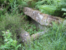
Vixen Tor Cist
OS Map: SX 54244 74404
HER: MDV3596
Megalithic Portal: 29932
PMD: Vixen Tor
Alternate name: Vixen Tor 1 Cist
ShortName: CT Vixen Tor 1
Butler map: 44.10.1
DPD page: 15
Grinsell: WHI 2
Barrow Report: 39
Notes: "Cist and possible remains of a barrow. The east and south sides of the cist lean inwards and the north end is slightly defective. The cover stone seems to have been in two parts and it leans against the south corner of the cist. There appears to be traces of a retaining circle of barrows, three stones only, in radius of 3.0m from the centre of the cist. The condition is good. The original dimensions would, however, appear to have been 1.219m x 533mm. One side stone is 1.524m in length, and the other is over 1.372m in length. The present depth below the top of the side stones is 330mm, but excavation would probably prove this to be at least twice this." Vixen Tor has been fenced off by the current landowner. Butler Vol. 3. Map 44.10.1 (diagram p.34). Plan by Butler (1993) shows the capstones to the side. The two stones forming the capstone must have been replaced since then. See also: Legendary Dartmooor: Vixen Tor and Vixen Tor Forbidden
Nearby sites: SX 54244 74404
Distance: 1.00km
Walkhampton Enclosed Settlement
Prehistoric Dartmoor Walks: Dartmoor Site: Walkhampton and Yes Tor Bottom Settlements
OS Map: SX 56772 72867
HER: MDV4964
Megalithic Portal: 45325
ShortName: ES Walkhampton
Notes: "Hut circles 550m s of foggintor quarries. A very fine settlement, set within a well built and substantial enclosure wall, enclosing an area of some 1.0ha. Five hut circles occur within the enclosure varying between 6-10m in diam ... Outside the enclosure to the w are five further huts of similar dimensions - again one of these shows sign of alteration. Under moorland grass." The site was excavated in 1897 by Burnard and Baring-Gould.
Nearby sites: SX 56772 72867
Distance: 2.99km
Whitchurch Common (N) Stone Ring Cairn Circle
OS Map: SX 53020 75005
HER: MDV4115
Megalithic Portal: 3535
Alternate name: Whitchurch Common N. Stone Ring Cairn Circle
ShortName: RC Whitchurch1
Turner: A41
Notes: Hut Circle or ring cairn? "Ring cairn with entrance. Stone ring 5.5m internal diam, with bank 1.5m wide and 0.4m high.2.5m wide entrance on ssw side" " A hut with an internal diam of 5.8m and walling 1.5m wide and 0.4m high; there is an entrance gap in the sw. This is evidently grinsell's cairn and worth's barrow.(broadly it is on the n slope of barn hill as stated by worth, but locally on the sw slope). While the structure might in isolation be construed as a cairn, the lack of any internal stone, the consistently smooth angle of the inner face of the wall and the presence of other huts and a field system militate against the worth and grinsell classifications"
Nearby sites: SX 53020 75005
Distance: 1.87km
Whitchurch Down (Warrens Cross) Ancient Pool
OS Map: SX 51153 73688
HER: MDV127230
ShortName: PO:Whitchurch
Notes: "A pool measuring 38 by 18m. One of over 40 such 'sacred' pools identified on Dartmoor that are thought to have potentially been designed during the prehistoric period."
Nearby sites: SX 51153 73688
Distance: 4.01km
White Tor Stone Ring Cairn Circle
OS Map: SX 54597 78701
HER: MDV4164
Megalithic Portal: 35804
Alternate name: White Tor E.1 Stone Ring Cairn Circle
ShortName: RC White E1
Butler map: 31.22.1
Grinsell: PET 24
Turner: A26
Notes: See also duplicate 439800. Turner A26. Butler White Tor E.1. "Round cairn 340 metres east of White Tor summit. This monument includes a round cairn situated on a gentle south-east facing slope overlooking the valley of the River Walkham. The cairn mound measures 6m in diameter and stands up to 0.4m high. A hollow in the centre of the mound measuring 3m in diameter and 0.3m deep is the result of a partial excavation carried out by the Dartmoor Exploration Committee in 1899. This work recovered a perforated stone. A kerb of small stones defines the outer edge of the mound."
Nearby sites: SX 54597 78701
Distance: 3.54km
White Tor Fort
Prehistoric Dartmoor Walks: Dartmoor Site: White Tor Fort
OS Map: SX 54246 78678
HER: MDV4101
Megalithic Portal: 17506
ShortName: FT White Tor
DPD page: 13
Notes: The White Tor camp is a Neolithic Enclosure which was once assumed to have been repurposed as an Iron Age fort. There used to be a separate HER entry to this end but this has been removed as the consensus now is that it is predominantly a Neolithic feature.
HER quoting Newman: Previously thought to have been an Iron Age 'camp' by early investigators, the stone enclosure on Whittor is now thought to be a Neolithic tor enclosure.
This record is being retained here but marked as a duplicate of the Neolithic entry, see White Tor (Whittor) Neolithic Enclosure.
Nearby sites: SX 54246 78678
Distance: 3.56km
White Tor (Whittor) Neolithic Enclosure
Prehistoric Dartmoor Walks: Dartmoor Site: White Tor Fort
OS Map: SX 5423 7867
HER: MDV4101
Megalithic Portal: 17506
ShortName: NE White Tor
Butler map: 31.13
DPD page: 13
Notes: Neolithic tor enclosure. "A camp on the summit of White Tor formed by a double wall, now in ruinous condition. Both walls appear to have been 10 to 11 feet thick, the outer wall being 4 to 4 1/2 feet high, the inner 6 to 7 feet high. The distance between the walls varies between 10 and 40 feet. The entrances are to the east, where access is easier, they are not opposite and are protected by the spur walls. Within the camp are four hut circles and three possible hut shelters, and two northern circles (numbers 5 and 6 on plan) are joined by a short wall." See also, Legendary Dartmoor: Dartmoor's White Tor Neolithic Settlement. See also Dartmoor Tor Enclosures Project.
Nearby sites: SX 5423 7867
Distance: 3.55km
Yellowmeade Farm Cist
OS Map: SX 56350 74465
HER: MDV5002
Megalithic Portal: 45778
PMD: Yellowmeade Farm NW.
Alternate name: Yellowmeade 1 Cist
ShortName: CT Yellowm Fm1
Butler map: 44.1.1
DPD page: 18
Grinsell: WAL 7
Barrow Report: 67
Notes: Butler Yellowmeade 1 - Vol. 3. Map 44.1 (diagram p.17).
Nearby sites: SX 56350 74465
Distance: 1.64km