
Prehistoric sites within 5km of SX 71919 76847
Guidance for walkers: The monuments featured in this database are archaeological treasures and need to be protected and preserved - please do not disturb any sites. Please check access and firing times before visiting sites, not all sites listed are on open access land. Firing ranges and boundaries of open access areas are marked on the OL28 OS Dartmoor Explorer map. Please stick to the country code and consider giving support to the numerous agencies that help to keep Dartmoor a fabulous natural and historic environment!
About the database listings: In all listings clicking on the photo or the site name will open a page for the site with a larger photo and further details from the database. The database now has over 6680 records covering nearly all publicly listed sites on Dartmoor including around 4800 round houses. This level of detail is of interest to archaeologists but tends to swamp listings of sites more likely to be of interest for walkers. For this reason, the listings default to around 550 core sites only. These are the stone circles, stone rows and the ring cairns listed by Turner. The default search radius is 2 km. The controls below the map can be used to start a new search by entering a 6- or 8-digit reference (without the prefix "SX"). The search radius can be specified and you can add incremental Display layers of detail on top of the core sites. If using a more detailed layer you will need to decrease the search radius to avoid getting hundreds of search results.
- Core sites Default listing of core sites consisting of stone circles & rows and some of the major ring cairns.
- Plus cairns adds approx. 1000 cairns and other minor sites not included in the core listings but excluding round houses.
- Plus round houses adds approx. 4800 round houses.
- Plus non-sites adds in the records for sites that no longer exist or are not prehistoric sites.
- Plus duplicates adds records excluded as duplicates. Those maybe duplicate records in external listings (e.g. the Historic Environment Records). For example, some sites have been identified as cairns in some listings and interpreted as round houses in other listings and both records appear.
These listings have incorporated, matched up and merged all of the records from all of the major archaeological listings including: Worth, Grinsell, Turner, Butler, Bill Radcliffe, Sandy Gerrard, Megalithic Portal, the National Monument Records and the Historic Environment Records. The author would like to thank Bill, Sandy, the lovely people both at Megalithic Portal (especially Anne Tate who did an amazing job to link listings) and at ACE Archaeology for collaborative work over the years to synchronise and correct listings across the various websites which now interlink. A culmination of years of work the final merger of cairn records took 3 months of cross referencing in 2017 the result being a snapshot of the records at that time. This data has in turn been refined since by field work and research. The round house data was supplied by Sandy Gerrard. Grid references are in order of accuracy: from Google Earth satellite, if visible and found, from a Garmin GPS reading, if visited by the author and from the literature otherwise. Individual site pages will state the source of the grid reference and provide satellite imagery. If a site listing lacks a photo it has not yet been visited by the author in which case the grid reference is from the literature.
Currently the database only includes sites which can be represented by a grid reference. Reaves are not included as they require GIS shape technology which is beyond the current capability of this system. To see the sources for the records, look at the tables on the resources menu. The database listings can also be viewed on a Google map and downloaded as GPS datasets for Garmin devices.
Corrections, or any feedback or suggestions are very welcome, email: info@dartmoorwalks.org.uk.
NOTE: Clicking on the icons for each monument in the map will give the name of the site. You can zoom in and out and drag the map around.
List of sites within 5km of SX 71919 76847
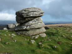
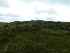
Rippon Tor 3 Reported Cist
OS Map: SX 74698 75537
HER: MDV7434
PMD: Rippon Tor Summit
ShortName: CN RipponTor 3
Butler map: 5.5.3
Grinsell: ILS 2
Notes: NMR Cairn 'B' at SX 7474 7547 has been considerably mutilated in the eastern quadrant where it is barely 0.5m. high; otherwise it is up to 3.0m. high. Butler states "Composed of small stones except for a large slab lying at the edge, this is probably the site of the cist referred to by Crossing as almost covered by turf, though he makes no mention of the cairn.
Nearby sites: SX 74698 75537
Distance: 3.07km
Rippon Tor 4 Cairn
OS Map: SX 74724 75501
HER: MDV13721
ShortName: CN RipponTor 4
Butler map: 5.5.4
Grinsell: ILS 3
Notes: HER: One of a pair of large cairns to the south-east of Rippon Tor. It is located on a reave but probably predates it. It is an amorphous and much disturbed cairn of 20 metres diameter, which, due to interference, now has an uneven profile.
Nearby sites: SX 74724 75501
Distance: 3.11km
Rippon Tor 5 Cairn
OS Map: SX 74750 75479
HER: MDV7433
ShortName: CN RipponTor 5
Butler map: 5.5.5
Grinsell: ILS 4
Notes: HER: One of a pair of large cairns south-east of Rippon Tor. It is located on a reave but probably predates it. A much spread and turf-covered cairn of up to 25 metres diameter, 87 metres south-east of Rippon Tor outcrop.
Nearby sites: SX 74750 75479
Distance: 3.14km
Lower Horridge 1 Cairn
OS Map: SX 75505 75151
HER: MDV8100
ShortName: CN:Lower Hor1
Butler map: 5.6.1
Grinsell: ILS 7
Nearby sites: SX 75505 75151
Distance: 3.97km
Lower Horridge 2 Cairn
OS Map: SX 75527 75127
HER: MDV8101
ShortName: CN:Lower Hor2
Butler map: 5.6.2
Grinsell: ILS 8
Nearby sites: SX 75527 75127
Distance: 4.00km
Halsanger Clearance Cairn
OS Map: SX 7445 7522
HER: MDV7548
ShortName: CN:Halsanger
Butler map: 5.7
Grinsell: ASH 1
Nearby sites: SX 7445 7522
Distance: 3.01km
Horridge Common 1 Reported Cairn
OS Map: SX 75722 74552
HER: MDV62331
ShortName: CN?Horridge 1
Butler map: 6.1
Notes: Butler refers to a cairn amongst the huts within the Horridge Common enclosed settlement. THE HER has this feature listed as a round house but the entry does mention Butler's description as a cairn. See also duplicate record for the round house entry SiteID=6686 (HER=62331)
Nearby sites: SX 75722 74552
Distance: 4.44km
Horridge Common 2 Cairn
OS Map: SX 75650 74950
HER: MDV8217
ShortName: CN:Horridge 2
Butler map: 6.3
Grinsell: ILS 9
Nearby sites: SX 75650 74950
Distance: 4.19km
Chinkwell Tor Cairn
OS Map: SX 7293 7825
HER: MDV20168
ShortName: CN:Chinkwell
Butler map: 7.3
Grinsell: WID 10
Turner: A63
Nearby sites: SX 7293 7825
Distance: 1.73km
Rippon Tor 6 Cairn
OS Map: SX 74667 75560
HER: MDV51161
ShortName: CN:RipponTor 6
Notes: HER: Small cairn south of Rippon Tor cairn and immediately contiguous to scatter from it. Diam 4.0 metres, height 0.45 metres.
Nearby sites: SX 74667 75560
Distance: 3.03km
Rippon Tor 7 Clearance Cairn
OS Map: SX 74554 75384
HER: MDV106805
ShortName: CN:RipponTor 7
Nearby sites: SX 74554 75384
Distance: 3.01km
Top Tor 2 Cairn
OS Map: SX 73545 76555
HER: MDV7457
ShortName: CN:Top Tor 2
Butler map: 9.7.2
Grinsell: WID 12
Notes: NMR A
Nearby sites: SX 73545 76555
Distance: 1.65km
Top Tor 3 Cairn Circle
OS Map: SX 73657 76472
HER: MDV7456
ShortName: CN:Top Tor 3
Butler map: 9.7.3
Butler Vol 5: p.46 & Fig.25
Barrow Report: 53
Notes: NMR B "One of a group of three, recognisable mainly by four large in situ boulders which represent the remains of a substantial retaining circle. However, much of the fabric has been removed leaving only a faint, roughly circular earthwork of 9.5 metres diameter."
Nearby sites: SX 73657 76472
Distance: 1.78km
Rippon Tor 8 Clearance Cairn
OS Map: SX 74491 75483
HER: MDV106807
ShortName: CN:RipponTor 8
Nearby sites: SX 74491 75483
Distance: 2.91km
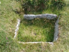
Wittaburrow 2 Reported Cairn
OS Map: SX 73358 75201
ShortName: CN?Wittaburr 2
Butler map: 9.9.2
Notes: Butler: "A low mound of stones 5.0 m across and 0.3 m high, with a square pit at the centre lies 30 m to the south-east [of Wittaburrow]". Not listed on NMR or HER.
Nearby sites: SX 73358 75201
Distance: 2.19km
Blackslade Ford 1 Reported Cairn
OS Map: SX 73701 75120
HER: MDV20169
ShortName: CN:Blackslad 1
Butler map: 10.
Grinsell: WID 24
Nearby sites: SX 73701 75120
Distance: 2.48km
Blackslade Ford 2 Reported Cairn
OS Map: SX 73630 75197
HER: MDV7534
ShortName: CN:Blackslad 2
Butler map: 10.7
Butler Vol 5: p.54 & Fig.31
Nearby sites: SX 73630 75197
Distance: 2.38km
Blackslade Ford 3 Cairn
OS Map: SX 7379 7498
HER: MDV30638
ShortName: CN:Blackslad 3
Butler map: 10.
Nearby sites: SX 7379 7498
Distance: 2.64km
Blackslade Ford 4 Cairn
OS Map: SX 73827 74872
HER: MDV30634
ShortName: CN Blackslad 4
Butler map: 10.
Nearby sites: SX 73827 74872
Distance: 2.75km
Cold Cross East Reported Cairn
OS Map: SX 73999 74292
HER: MDV30642
ShortName: CN Cold Cross
Butler map: 10.
Butler Vol 5: p.54 & Fig.32
Nearby sites: SX 73999 74292
Distance: 3.29km
Buckland Common 1 Reported Cairn
OS Map: SX 73772 73930
ShortName: CN-Buckland 1
Butler map: 10.
Notes: Linear arrangement of mounds incorporated into boundary. Could be prehistoric cairns.
Nearby sites: SX 73772 73930
Distance: 3.46km
Buckland Common 2 Reported Cairn
OS Map: SX 73742 73865
HER: MDV30646
ShortName: CN Buckland 2
Butler map: 10.
Notes: HER: "A flattened and spread round cairn straddles the parish boundary between Buckland and Ashburton. A boundary stone is set into the cairn."
Nearby sites: SX 73742 73865
Distance: 3.50km
Buckland Common 3 Reported Cairn
OS Map: SX 73588 73559
ShortName: CN?Buckland 3
Butler map: 10.8
Notes: Linear arrangement of mounds incorporated into boundary. Could be prehistoric cairns.
Nearby sites: SX 73588 73559
Distance: 3.69km
Buckland Common 4 Reported Cairn
OS Map: SX 73587 73556
ShortName: CN?Buckland 4
Butler map: 10.8
Notes: Linear arrangement of mounds incorporated into boundary. Could be prehistoric cairns.
Nearby sites: SX 73587 73556
Distance: 3.69km
Buckland Beacon Cairn
OS Map: SX 73510 73118
HER: MDV7977
ShortName: CN BuckBeacon
Butler map: 10.
Grinsell: B:BITM 1
Notes: HER referring to Newman: Buckland Beacon, probable tor cairn. The tor outcrop is surrounded by small, turf-covered stones indicating a possible tor cairn. Condition is mostly stable but subject to visitor erosion. SX73500 73100.
Nearby sites: SX 73510 73118
Distance: 4.05km
Yar Tor N.E.1 Cairn
OS Map: SX 68014 74182
HER: MDV14377
ShortName: CN:Yar Tor N 1
Butler map: 14.11
Grinsell: WID 19
Notes: HER: Barrow north-east of Yar Tor on Corndon Down; located at the northern end of the stone row. Within area of Dartmeet parallel reave system and later prehistoric fields / enclosures. The north cairn comprises vegetation covered mound of earth, slightly ovoid in shape, 6 metres by 6.3 metres by 1 metres high.
Nearby sites: SX 68014 74182
Distance: 4.73km
Yar Tor E.1 Clearance Cairn
OS Map: SX 6815 7384
HER: MDV21514
ShortName: CN?Yar Tor E 1
Butler map: 14.11.1
Grinsell: WID 21a
Notes: HER 21514 includes two possibe cairs, maybe clearance cairns. WID 21a and WID 21b
Nearby sites: SX 6815 7384
Distance: 4.82km
Yar Tor E.2 Clearance Cairn
OS Map: SX 6815 7383
HER: MDV21514
ShortName: CN?Yar Tor E 2
Butler map: 14.11.2
Grinsell: WID 21b
Notes: HER 21514 includes two possibe cairs, maybe clearance cairns. WID 21a and WID 21b
Nearby sites: SX 6815 7383
Distance: 4.83km
Grendon Farm (Hill W of) Cairn Circle
OS Map: SX 6805 7835
HER: MDV6008
ShortName: CN:GrendonFarm
Grinsell: WID 1a
Notes: HER: Cairn located on highest point of hill west of Grendon Farm, measuring 12 metres in diameter, composed of small stones overgrown with gorse and heather. Disturbed on the eastern side.
Nearby sites: SX 6805 7835
Distance: 4.15km
Sherwell Reported Cairn
OS Map: SX 6838 7455
ShortName: CN?Sherwell
Butler map: 15.1
Notes: Butler: "A small cairn lies within a neighbouring field, obviously trenched with the stones thrown downhill". Not listed on NMR or HER.
Nearby sites: SX 6838 7455
Distance: 4.22km
Yar Tor (SE of) Clearance Cairn
OS Map: SX 6815 7381
HER: MDV21514
ShortName: CN?Yar Tor SE
Grinsell: WID 21c
Nearby sites: SX 6815 7381
Distance: 4.84km
Corndon Tor 2 Cairn
OS Map: SX 68601 74158
HER: MDV16727
ShortName: CN:CorndonTor2
Butler map: 15.4.2
Grinsell: WID 18
Barrow Report: 56 62
Notes: HER: On the main outcrop of Corndon Tor is a possible tor cairn (south of MDV6387). Stones piled around the base of the outcrop may be remains of cairn which has been much disturbed and is now very spread and fragmentary The cairn overlies a reave which runs up to the tor, a shelter has been built against the tor very recently using stone from the cairn. Maximum diameter 27.2m.
The Google satellite imagery shows that this feature has the clear appearance of a tor cairn.
Nearby sites: SX 68601 74158
Distance: 4.27km
Rowden Down Reported Cairn
OS Map: SX 6993 7602
HER: MDV12961
ShortName: CN?Rowden Dn
Grinsell: WID 23
Notes: Hut circle or ring cairn
Nearby sites: SX 6993 7602
Distance: 2.15km
Corndon Down 1 Cairn
OS Map: SX 68678 74766
HER: MDV6385
ShortName: CN:CorndonDn 1
Butler map: 15.5.1
Grinsell: WID 17
Barrow Report: 56 62
Notes: HER: Large stone cairn; one of a pair approximately 530m north of Corndon Tor. The eastern cairn comprises a stony mound standing to over 2m high with a flattish top surface which has been badly disturbed by recent building of shelters. One very pronounced example is in centre of the cairn and appears recent. A reave, part of the Dartmeet system, touches the cairn tangentially on the west side but is not covered by it.
Nearby sites: SX 68678 74766
Distance: 3.85km
Corndon Down 2 Cairn
OS Map: SX 68579 74731
HER: MDV6386
ShortName: CN:CorndonDn 2
Butler map: 15.5.2
Grinsell: WID 16
Barrow Report: 56 62
Notes: HER: Large stone cairn; one of a pair approximately 530m north of Corndon Tor. A mound of loose stone over 2m high in places. Upper surface extensively disturbed and undulating caused by interference, including recent shelter building.
Nearby sites: SX 68579 74731
Distance: 3.95km
Lower Cator Clearance Cairn
OS Map: SX 68420 75800
HER: MDV26442
ShortName: CN?Lower Cator
Butler map: 17.2
Notes: Round House reused as a clearance cairn. Butler. A cairn, with a trench across the centre, lies at the middle of a field between these huts, trimmed to a pear shape by ploughing around the edges.
HER quoting Butler: Lower Cator Prehistoric setlement includes this hut circle with a diameter of circa 6 metres with its lower half filled with clearance stones. a few slabs surround this hut. Other details: Map 17, Site 2.
Nearby sites: SX 68420 75800
Distance: 3.65km
Riddon Corner Reported Cairn
OS Map: SX 6714 7636
HER: MDV64234
ShortName: CN?Riddon 2
Butler map: 18.2.7
Notes: Butler: The cairn at 7 (8.0 x 1.0 m), 5 m from the field wall and close to a reave, is probably prehistoric. A slight depression in its flat suface suggests it has been dug and a track cutting across the eastern edge has also caused some slight damage. A pile of stones in a similiar relationship to the next reave to the south is more likely to be clearance from the field.
HER entry: A turf-covered mound measuring 8.2 by 7.2 by 0.7 metres high. The mound bears some indications of disturbance. It is uncertain whether it is a barrow or the result of more recent field clearance.. Possibly visible on Lidar.
Nearby sites: SX 6714 7636
Distance: 4.80km
Riddon Ridge S.E. Reported Cist
OS Map: SX 6695 7635
PMD: Riddon Ridge 1
ShortName: CT:Riddon 3
Butler map: 18.2.8
Grinsell: LYD 67a
Barrow Report: 33
Notes: Butler: A few small set stones show around the edge of another [cairn] at 8 (5 x 0.4m) It appears to be untouched, too small to attract the attention of casual diggers. It is, however, approximately in the position of the cairn excavated by R. Burnard in 1914, who may have carefully replaced the stones he removed. His cairn was more compact before excavation (3.7 x 0.8) so if it is the same his restoration has allowed considerable spread. To his surprise, Burnard was not the first to investigate it, but he was still able to recover part of a pot, a flint, pieces of quartz and some charcoal contained within a stone-lined pit at the centre.. See Barrow Report 33. No specific HER entry but mentioned on MDV129868.
Nearby sites: SX 6695 7635
Distance: 4.99km
Corndon Down 3 Cairnfield Master
OS Map: SX 6879 7521
HER: MDV130667
ShortName: CN:CorndonDn 3
Notes: HER: Thirty-nine clearance cairns amid medieval fields on the east lower slopes of Corndon Down. The cairns comprise stony turf-covered, circular or elliptical heaps of between 2m and 5m across and up to 0.8m high. The majority of the cairns lie within a large abandoned newtake field (centred SX 6879 7521) which appears never to have been cultivated. The remainder are within smaller fields just to the east, one of which contains cultivation ridges.
Nearby sites: SX 6879 7521
Distance: 3.53km
Langworthy Reported Cairn
OS Map: SX 70668 77189
HER: MDV26861
ShortName: CN Langworth
Butler map: 19.3
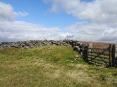
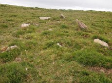
Notes: Listed by Butler but no cairn listed in HER or NMR. Maybe hut circle HER 26861. Visited by the author 15/09/19 as can be seen in the photo there is clearly a cairn here although it is in a very dilapidated state.
Nearby sites: SX 70668 77189
Distance: 1.30km

Kings Barrow Cairn
OS Map: SX 70927 81449
HER: MDV8743
ShortName: CN KingsBarrow
Butler map: 20.6
Grinsell: N.BOV 4
Notes: Large circular cairn. Largely grassed over but head-sized granite boulders visible. No remains of kerb visible, but there is a slight trace of an encircling ditch. The centre of the barrow has been robbed.
Nearby sites: SX 70927 81449
Distance: 4.71km
Buckland Ridge (N) Cairn
OS Map: SX 73579 73510
HER: MDV30631
ShortName: CN:Buckland 5
Turner: A47
Nearby sites: SX 73579 73510
Distance: 3.73km
Hamel Down S.E.1 Cairn
OS Map: SX 71455 78665
HER: MDV7520
ShortName: CN Hamel SE1
Butler map: 20.14.1
Grinsell: WID 8
Notes: NMR A. "Heather and gorse covered cairn. Mutilation in top and south face shows a construction of stones. No trace of ditch. On top of the mound is a modern boundary stone inscribed 'DS 1854 Old House'".
Nearby sites: SX 71455 78665
Distance: 1.88km
Hamel Down S.E.2 Cairn
OS Map: SX 71474 78507
HER: MDV7522
ShortName: CN Hamel SE2
Butler map: 20.14.2
Grinsell: WID 9
Notes: NMR B "Cairn on Hamel Down with diameter 10 metres by 0.3 metres high in poor condition with a trench driven across the centre." Some stones exposed or heaped on one side of the cairn.
Nearby sites: SX 71474 78507
Distance: 1.72km
Yar Tor Tor Enclosure
OS Map: SX 67849 74046
HER: MDV128748
ShortName: EN Yar Tor
Butler map: 14.8
Notes: HER quoting Newman: A Tor enclosure of uncertain date on the northern outcrop of Yar Tor. This enclosure is situated in a natural avenue between two outcrops with vertical faces on the north and south sides which has been blocked off at the western and eastern ends by artificial stone walls. The western interior is approximately level but slopes away on the eastern side down to the wall. The north and south sides of the enclosure comprise natural linear crags of up to 2.0m high reinforced in places by large boulders. The wall at the western end is 2.1m thick and consists of a stone revetted bank with stone rubble behind surviving up to 0.8m high. The wall is slightly curved in plan. On the eastern wall there are vestiges of stone facing still in place but it is mostly collapsed and spread up to 3m wide and 0.7m high much of the wall surviving only as a disturbed stony spread. There is a possible entrance in the east wall adjacent to the northern outcrop, in the form of an opening. There are no discernable interior features.
The main photo is taken looking down from on top of one of the outcrops. Butler's possible round house can be seen within the main photo but see also a close up from ground level.
Acknowledgement: The author was unaware of this site until a walk with Steve Szypko on 25/09/2025. This record has been added as a result.
Nearby sites: SX 67849 74046
Distance: 4.94km
Hamel Down W. Cairn
OS Map: SX 6997 7904
HER: MDV5991
ShortName: CN:Hamel W
Butler map: 20.
Nearby sites: SX 6997 7904
Distance: 2.93km
Heatree Down Cairn
OS Map: SX 72435 80255
HER: MDV8764
ShortName: CN:HeatreeDown
Butler map: 20.19
Grinsell: MAN 3
Notes: Cairn on Heatree Down, measuring 14.5 meters in diameter, and 0.6 meters high. The cairn itself has been disturbed by looting and is bumpy.
Nearby sites: SX 72435 80255
Distance: 3.45km
Welstor Common Cairn
OS Map: SX 73739 73009
HER: MDV112763
ShortName: CN:Welstor
Nearby sites: SX 73739 73009
Distance: 4.25km
Haytor Down N.3 Reported Cairn
OS Map: SX 76599 78154
HER: MDV8105
ShortName: CN-Haytor N3
Butler map: 2.6.3
Butler Vol 5: p.191 & Fig.134
Notes: One of group of 4 cairns - see Butler for diagram in Vol 1 and 5. Maybe medieval ditch. "Sited at SX76597814 on a gently sloping northern summit of the Haytor Down spur, is a circular ditch with a level interior and slight external bank. The well-defined ditch has a V profile and a diameter of 24m. It is 1.9m wide and survives to a depth of 0.6m. The external bank, where visible is approximately 1.5m wide. The southern quadrant has been overlain by a modern footpath. The unsilted appearance of the ditch suggests this is not a prehistoric feature."
Nearby sites: SX 76599 78154
Distance: 4.86km
Haytor Down N.4 Cairn
OS Map: SX 76545 78161
HER: MDV79704
ShortName: CN Haytor N4
Butler map: 2.6.4
Butler Vol 5: p.191 & Fig.135
Notes: One of group of 4 cairns - see Butler for diagram in Vol 1 and 5. "One of three cairns forming a linear group in the centre of the ridge to the east of Smallacombe Rocks. A large 17 metre diameter flat turfed mound with two orthostats on the circumference."
Nearby sites: SX 76545 78161
Distance: 4.81km
Hay Tor S.E.4 Cairn
OS Map: SX 76030 76598
HER: MDV103589
ShortName: CN:Hay Tor 4
Notes: A badly robbed out cairn on the southern ridge of Haytor Down - one of a group of four.
Nearby sites: SX 76030 76598
Distance: 4.12km
Hay Tor S.E.3 Cairn
OS Map: SX 76098 76550
HER: MDV103590
ShortName: CN:Hay Tor 3
Notes: "A badly disturbed Prehistoric cairn on the southern ridge of Haytor Down - one of a group of four."
Nearby sites: SX 76098 76550
Distance: 4.19km
Hay Tor S.E.2 Cairn
OS Map: SX 76181 76543
HER: MDV103591
ShortName: CN:Hay Tor 2
Notes: Prehistoric cairn which has been badly disturbed and robbed lies on the southern ridge of Haytor Down - one of a group of four
Nearby sites: SX 76181 76543
Distance: 4.27km

Corndon Tor 1 Cairn
OS Map: SX 68588 74227
HER: MDV6387
Megalithic Portal: 22982
ShortName: CN:CorndonTor
Butler map: 15.4.1
Barrow Report: 56 62
Notes: HER: Cairn on the summit of Corndon Tor, to the north of the main outcrop, comprising a large stony mound, constructed from moorstone with a truncated cone profile and no turf cover. Remains of a possible second cairn are located to the south on the outcrop.
Nearby sites: SX 68588 74227
Distance: 4.24km
Chittleford Hill Reported Cairn
OS Map: SX 725 754
HER: MDV7469
ShortName: CN:Chittlefo1
Notes: Possible site of a Neolithic barrow found in the field walls by the roadside near the top of Chittleford Hill. A very large orthostat, or shiner (sic), standing here which may have been a capstone. Nearby fields called "Shelstone Lay" point to the existence of a cromlech. Also the walls of the field contain a large number of very large slabs and pillar-like stones such as might have formed a megalthic tomb.
Nearby sites: SX 725 754
Distance: 1.56km
Hayter S. Cairn
OS Map: SX 75631 76810
HER: MDV40740
ShortName: CN:Hayter S.1
Butler map: 1.8
Nearby sites: SX 75631 76810
Distance: 3.71km
Emsworthy Rocks E.1 Cairn
OS Map: SX 7528 7682
HER: MDV78669
ShortName: CN:Emsworthy 1
Butler map: 1.9.1
Notes: HER refers to two cairns
Nearby sites: SX 7528 7682
Distance: 3.36km
Emsworthy Rocks E.2 Cairn
OS Map: SX 7533 7684
HER: MDV78669
ShortName: CN:Emsworthy 2
Butler map: 1.9.2
Notes: HER refers to two cairns
Nearby sites: SX 7533 7684
Distance: 3.41km
West Emsworthy Quarry Cairn
OS Map: SX 75784 77745
HER: MDV78602
ShortName: CN:West Emsw
Butler map: 1.10
Nearby sites: SX 75784 77745
Distance: 3.97km
Haytor Chambered Tomb
OS Map: SX 75766 76409
HER: MDV61778
ShortName: CN HaytorTomb
Butler map: 1.f
Butler Vol 5: p.158 & Fig.97
Notes: Haytor chambered tomb to the west of the Haytor track. Circular mound circa 4 metres diameter surrounds a rectangular chamber, circa 3 metres by 1.4 metres, tapering slightly towards one end, partially filled with soil. One of pair of larger slabs at entrance on downhill edge of mound has collapsed inwards, the other stands c irca 1 metre above interior. Most of slabs forming sides of chamber appear in place but capstones have been removed. Entrance oriented south of east.
Nearby sites: SX 75766 76409
Distance: 3.87km
Black Hill 1 Cairn
OS Map: SX 76213 78605
HER: MDV8044
ShortName: CN BlackHill 1
Butler map: 2.5.1
Grinsell: MAN 19
Notes: Butler refers to around twelve cairns at this location, most of which are quite insignificant. The four largest are still well defined and measure approximately 16.5 meters in diameter.
Nearby sites: SX 76213 78605
Distance: 4.64km
Black Hill 2 Cairn
OS Map: SX 76169 78687
HER: MDV8042
ShortName: CN BlackHill 2
Butler map: 2.5.2
Grinsell: MAN 18
Notes: Butler refers to around twelve cairns at this location, most of which are quite insignificant. The four largest are still well defined and measure approximately 16.5 meters in diameter.
Nearby sites: SX 76169 78687
Distance: 4.63km
Black Hill 3 Cairn
OS Map: SX 76153 78735
HER: MDV8043
ShortName: CN BlackHill 3
Butler map: 2.5.3
Grinsell: MAN 17
Notes: Butler refers to around twelve cairns at this location, most of which are quite insignificant. The four largest are still well defined and measure approximately 16.5 meters in diameter.
Nearby sites: SX 76153 78735
Distance: 4.64km
Black Hill 5 Cairn
OS Map: SX 76285 78989
HER: MDV8046
ShortName: CN BlackHill 5
Butler map: 2.5.5
Grinsell: MAN 15
Notes: "A cairn at SX76297898 (note slight variation) with a maximum height at the rim of 0.5 meters with a probable retaining stone in the west. The centre of the cairn has been dug out. Other details: Plan."
Nearby sites: SX 76285 78989
Distance: 4.86km
Black Hill 6 Reported Cairn
OS Map: SX 76175 78642
ShortName: CN:BlackHill 6
Butler map: 2.5.6
Notes: The HER lists Black Hill 1-5. Butler lists several more, see fig. 2.2 Vol 1 p.28
Nearby sites: SX 76175 78642
Distance: 4.62km
Black Hill 7 Reported Cairn
OS Map: SX 7619 7896
ShortName: CN:BlackHill 7
Butler map: 2.5.7
Notes: The HER lists Black Hill 1-5. Butler lists several more, see fig. 2.2 Vol 1 p.28
Nearby sites: SX 7619 7896
Distance: 4.77km
Black Hill 8 Reported Cairn
OS Map: SX 7617 7895
ShortName: CN BlackHill 8
Butler map: 2.5.8
Notes: The HER lists Black Hill 1-5. Butler lists several more, see fig. 2.2 Vol 1 p.28
Nearby sites: SX 7617 7895
Distance: 4.74km
Black Hill 9 Reported Cairn
OS Map: SX 7615 7866
ShortName: CN:BlackHill 9
Butler map: 2.5.9
Notes: The HER lists Black Hill 1-5. Butler lists several more, see fig. 2.2 Vol 1 p.28. Grid reference is estimated on Google Earth by comparison to Butler's diagram.
Nearby sites: SX 7615 7866
Distance: 4.60km
Black Hill 10 Reported Cairn
OS Map: SX 76102 78655
ShortName: CN BlackHill10
Butler map: 2.5.10
Notes: The HER lists Black Hill 1-5. Butler lists several more, see fig. 2.2 Vol 1 p.28. Grid reference is estimated on Google Earth by comparison to Butler's diagram.
Nearby sites: SX 76102 78655
Distance: 4.56km
Black Hill 11 Reported Cairn
OS Map: SX 76167 78646
HER: MDV26562
ShortName: CN:BlackHill11
Butler map: 2.5.11
Notes: The HER lists Black Hill 1-5. Butler lists several more, see fig. 2.2 Vol 1 p.28. Grid reference is estimated on Google Earth by comparison to Butler's diagram.
Nearby sites: SX 76167 78646
Distance: 4.61km
Black Hill 12 Reported Cairn
OS Map: SX 76167 78676
ShortName: CN:BlackHill12
Butler map: 2.5.12
Notes: The HER lists Black Hill 1-5. Butler lists several more, see fig. 2.2 Vol 1 p.28. Grid reference is estimated on Google Earth by comparison to Butler's diagram.
Nearby sites: SX 76167 78676
Distance: 4.63km
Haytor Down N.2 Cairn
OS Map: SX 76626 78145
HER: MDV8106
ShortName: CN Haytor N2
Butler map: 2.6.2
Butler Vol 5: p.191 & Fig.133
Grinsell: ILS 6
Notes: One of group of 4 cairns - see Butler for diagram in Vol 1 and 5.
Nearby sites: SX 76626 78145
Distance: 4.88km
Bagtor Wood Reported Cairn
OS Map: SX 75830 74967
HER: MDV62344
ShortName: CN?BagtorWood
Butler map: 4.3
Butler Vol 5: p.202 & Fig.146
Notes: Ruined hut or cairn at the centre of ovoid enclosure. Was obscured by vegetation at the time of the survey.
Nearby sites: SX 75830 74967
Distance: 4.34km
Hay Tor S.E.1 Cairn
OS Map: SX 76265 76521
HER: MDV103592
ShortName: CN:Hay Tor 1
Butler map: 4.4
Notes: A once substantial cairn of 22 metres diameter. The fabric has been heavily robbed though traces of a kerb survive.
Nearby sites: SX 76265 76521
Distance: 4.36km
Haytor Down Cairn
OS Map: SX 76337 78318
HER: MDV8104
ShortName: CN:Haytor Down
Grinsell: ILS 5
Notes: "A very flat and ruinous cairn sited near the Three Parishes Stone at SX76347831. Its position coincides with a reave which occupies the parish boundary and seems to respect the position of the cairn."
Nearby sites: SX 76337 78318
Distance: 4.66km
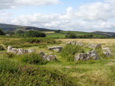
Rippon Tor 2 Stone Ring Cairn Circle
OS Map: SX 74677 75563
HER: MDV51162
ShortName: RC RipponTor 2
Butler map: 5.5.2
Turner: A62
Notes: HER: A small cairn close to the tor which appears to have been a ring cairn surrounding a small free-standing granite outcrop. Butler: a small natural rock pillar about 2m high and 10m from C1, surrounded at the base by a ring of small stones (7.2 x 0.5 m) and, perhaps significantly, in line with the cairns.
Nearby sites: SX 74677 75563
Distance: 3.04km
Berry Pound
OS Map: SX 71325 80349
HER: MDV8754
ShortName: PD:Berry
Notes: Berry Pound a Prehistoric enclosure on Hamel Down
Nearby sites: SX 71325 80349
Distance: 3.55km
Black Hill 4 Cairn
OS Map: SX 76281 78963
HER: MDV8045
Megalithic Portal: 26733
ShortName: CN:BlackHill 4
Butler map: 2.5.4
Grinsell: MAN 16
Notes: "One of five cairns on Black Hill, all in a damaged condition." "Cairn with modern stoneheap at north end. Diameter 17.0 meters, height 0.7 meters."
Nearby sites: SX 76281 78963
Distance: 4.85km
Black Hill A (Manaton) Ancient Pool
OS Map: SX 76188 78885
HER: MDV127184
ShortName: PO:BlackHillA
Notes: "The pool at Black Hill measures 10-11m. One of over 40 such 'sacred' pools identified on Dartmoor that are thought to have potentially been designed during the prehistoric period."
Nearby sites: SX 76188 78885
Distance: 4.73km
Black Hill B (Manaton) Ancient Pool
OS Map: SX 76171 78465
HER: MDV127185
ShortName: PO:BlackHillB
Notes: "The second pool at Black Hill (B) is interesting as it possesses a double ring bank enclosing a distinct sunken hollow. Externally the feature is about 20 metres in diameter, and the pool hollow about 10 metres. Compared with the King’s Stables pool and earthwork at Navan, County Armagh which is about 25 metres in diameter x 3.5 metres deep, dating to around 1000 BC (although this feature has a shallower form). One of over 40 such 'sacred' pools identified on Dartmoor that are thought to have potentially been designed during the prehistoric period, and may have been used to deposit votive items, although these Dartmoor examples may have alternative significance as designed prehistoric elements in the landscape. Many are located on ridge tops and in conjunction with cairns, stone rows and other prehistoric features. Further research may well reveal more about these interesting features."
Nearby sites: SX 76171 78465
Distance: 4.55km
Blackaton Down N. Cairn
OS Map: SX 70683 79094
HER: MDV7413
Megalithic Portal: 16633
ShortName: CN Blackaton N
Butler map: 20.12.1
Butler Vol 5: p.193 & Fig.137
Grinsell: WID 4
Notes: The earthwork remains of two Bronze Age cairns. 'B' is a cairn 42 feet in diameter and 3 feet high. Cairn with small hollow towards centre. Butler Volume 1 Map 20.12.
Nearby sites: SX 70683 79094
Distance: 2.56km
Blackaton Down S. Cairn
OS Map: SX 70732 79047
HER: MDV7412
Megalithic Portal: 16634
ShortName: CN:Blackaton S
Butler map: 20.12.2
Butler Vol 5: p.192 & Fig.136
Grinsell: WID 5
Notes: ['A' SX 7073 7904]. Tumuli on saddle, 'A' is 40 feet in diameter with a rim 1 ft. high. One of pair of cairns, this one is concave or "saucer" shaped. Butler Volume 1 Map 20.12.
Nearby sites: SX 70732 79047
Distance: 2.50km
Blackaton Newtake (Hameldown) Ancient Pool
OS Map: SX 70785 78973
HER: MDV7527
ShortName: PO:Hameldown
Notes: Previously recorded as a possible cairn (was listed here as Hameldown 2 Reported Cairn), although identification noted later as 'doubtful' - water filled depression with a few surface stones. Identified as one of the 40+ 'sacred pool' sites on the moor, possibly dating from the Prehistoric period.
Nearby sites: SX 70785 78973
Distance: 2.41km
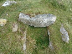
Blackslade Down Cist
OS Map: SX 73416 75519
HER: MDV7437
Megalithic Portal: 32071
PMD: Blackslade Down
ShortName: CT Blackslade
Butler map: 9.8
Butler Vol 5: p.47 & Fig.26
DPD page: 129
Grinsell: WID 14
Barrow Report: 53 56
Notes: Butler Vol. 1. Map 9.8 (photo on p.61, diagram Vol. 5. p.47). Lethbridge diagram p.129 and photo bottom p.129.
Grinsell [Folklore 1976], Widecombe cist: Opened by a former parson of Widecombe, whose house was destroyed by an explosion the following night. Crossing 1911, 20.
Nearby sites: SX 73416 75519
Distance: 2.00km
Bonehill Down Ancient Pool
OS Map: SX 73282 77812
HER: MDV127194
ShortName: PO:BonehillDn
Notes: "The pool on Bonehill Down measures 12 by 6m. One of over 40 such 'sacred' pools identified on Dartmoor that are thought to have potentially been designed during the prehistoric period."
Nearby sites: SX 73282 77812
Distance: 1.67km
Broad Barrow Stone Ring Cairn Circle
OS Map: SX 70577 79908
HER: MDV20787
Megalithic Portal: 16630
Alternate name: Broad Burrow Stone Ring Cairn Circle
ShortName: RC BroadBarrow
Butler map: 20.9
Butler Vol 5: p.166 & Fig.106
Grinsell: MAN 10
Turner: A46
Notes: "Infilled ring cairn. Stone ring 14 metres diameter internally with bank 2.5 metres wide and 0.4 metres high. Infilled to 0.25 metres below bank top." Butler Volume 1 Map 20.9.
Nearby sites: SX 70577 79908
Distance: 3.34km
Buckland Beacon Ancient Pool
OS Map: SX 73558 73260
HER: MDV127202
ShortName: PO:BuckBeacon
Notes: "A pool measuring 10.5 by 9.5m. One of over 40 such 'sacred' pools identified on Dartmoor that are thought to have potentially been designed during the prehistoric period. Lies near a cairn." NB. Nearby is Turner A13 ring cairn.
Nearby sites: SX 73558 73260
Distance: 3.94km
Buckland Ridge (S) Stone Ring Cairn Circle
OS Map: SX 7357 7324
HER: MDV30630
Megalithic Portal: 45827
Alternate name: Buckland Common 5 Stone Ring Cairn Circle
ShortName: RC:BucklandRid
Butler map: 10.9
Turner: A13
Notes: Linear arrangement of mounds incorporated into boundary. Could be prehistoric cairns. Turner A13. No NMR record. "Robbed cairn. Stone ring is 13m inside diameter bank 1.80m wide and 50cms high, much of the bank on the eastern side has been destroyed. The central area has been disturbed, modern stone wall running north to south through the eastern section of the stone ring."
Nearby sites: SX 7357 7324
Distance: 3.97km
Cator Pound
Prehistoric Dartmoor Walks: Dartmoor Site: Cator Pound
OS Map: SX 6730 7765
HER: MDV6009
Megalithic Portal: 34961
ShortName: PD Cator Pound
Notes: HER: Cator pound, widecombe. In his survey of widecombe made about 1750, dean milles describes 'a very considerable circle of stones on the n part of the western down on a farm called cator and on an eminence called whitehill'; he gives the diameter as 58 paces and says it consisted 'chiefly of large stones mowst of which rise about 4 feet above ye ground. This circle consists now of about 30 stones but there are spaces where several more stood, half the number are fallen; the rest are either erect or on their sides'.
Nearby sites: SX 6730 7765
Distance: 4.69km
Cator Common Embanked Cairn Circle
Prehistoric Dartmoor Walks: Dartmoor Site: Cator Pound
OS Map: SX 67426 78001
HER: MDV5978
Megalithic Portal: 52173
ShortName: CC CatorCommon
Butler map: 18.4
Grinsell: WID 1
Turner: B3
Notes: HER: Cairn, hollow towards centre. Retaining circle of c.28 upright slabs, mostly turned inwards. Diameter 18.0m, height 0.6m. Breton p.41
Nearby sites: SX 67426 78001
Distance: 4.64km

Cator Common Platform Cairn Circle and Cist
OS Map: SX 67118 77510
HER: MDV5987
Megalithic Portal: 45793
PMD: Pizwell Bridge
Alternate name: Pizwell Bridge Platform Cairn Circle and Cist
ShortName: CT Pizwell 1
Butler map: 18.5
Butler Vol 5: p.171 & Fig.110
Grinsell: WID 2
Turner: E10
Notes: "Pizwell Bridge cairn of circa 5m diameter by 0.5m high is to be found about 10m below the road in an unusual position near the base of the hill. Three retaining slabs form an arc around one side with another just under the turf. The top of a slab near the centre with a pit alongside might be one side of a cist. ". Butler Pizwell Bridge Vol. 1. Map 18.5 (diagram Vol 5. p.171). Possible central cist.
This feature can be seen from the road in the distance by a small tree but it is not on public access land and the area has a high fence surrounding it. The photo above was taken by Steve Szykpo and is reproduced with his kind permission.
Nearby sites: SX 67118 77510
Distance: 4.85km
Challacombe Down Cairn Circle
Prehistoric Dartmoor Walks: Dartmoor Site: Challacombe Down Triple Stone Row
OS Map: SX 6898 8084
HER: MDV49462
Megalithic Portal: 1819
PMD: Challacombe Down Stone Row
ShortName: CC Challacombe
Butler map: 24.3
Butler Vol 5: p.239 & Fig.169
Turner: G20
Notes: Dubious site - the current arrangement relates to stones placed during restoration of the stone row. See Worth (1953) p. 226 on how "nothing coherent" came of attempts to re-erect stones scattered to the west of the north end of the row which gave the appearance of a stone circle.
Nearby sites: SX 6898 8084
Distance: 4.96km
Challacombe Down Standing Stone
Prehistoric Dartmoor Walks: Dartmoor Site: Challacombe Down Triple Stone Row
OS Map: SX 69021 80723
HER: MDV6600
Megalithic Portal: 10092
PMD: Challacombe Stone Row
ShortName: SS Challacombe
Butler map: 24.3
DPD page: 126
Notes: The largest and most prominent blocking stone of the Dartmoor rows is to be found at the Challacombe triple row. Worth states that it is over 5 feet in width at the base and over 6 feet in height. Butler (Vol. 2) states that the terminal pillar is today 0.5m shorter than when it was measured in 1893.
Nearby sites: SX 69021 80723
Distance: 4.84km
Challacombe Down Stone Row
Prehistoric Dartmoor Walks: Dartmoor Site: Challacombe Down Triple Stone Row
OS Map: SX 69016 80718
HER: MDV6600
Megalithic Portal: 1819
The Stone Rows of GB: Challacombe Down
PMD: Challacombe Stone Row
ShortName: SR Challacombe
Butler map: 24.3
Butler Vol 5: p.239 & Fig.169
DPD page: 126
Notes: "Bronze Age triple stone row well marked and wider apart at the north, drawing nearer to the south where they meet a blocking stone of unusual size. The stones have suffered little in their restoration except that a stone in the middle row was turned to form a blocking stone for that row. The loose stones scattered to the west of the north end have been suggested to form a stone circle and additional rows but may be stones excavated from the north end of the stone row." Breton p.41-42
Nearby sites: SX 69016 80718
Distance: 4.84km
Cripdon Ancient Pool
OS Map: SX 73345 80335
HER: MDV127204
ShortName: PO:Cripdon
Notes: "The pool at Cripdon measures 24 by 14m One of over 40 such 'sacred' pools identified on Dartmoor that are thought to have potentially been designed during the prehistoric period"
Nearby sites: SX 73345 80335
Distance: 3.77km
Cripdon Down Reported Stone Row
OS Map: SX 735 808
HER: MDV130912
ShortName: SR:Cripdon
Notes: HER: Hemery (1983) records a stone row here, estimated at SX 735 808. Stone row, Cripdon Down. North-west of the hut circles depicted on the Ordnance Survey map (SX 78 SW 17) and west of the Cripdon Down summit pile is a single stone row, 120 yards long passing over the crest of the Down. At the northern end is a very large fallen slab (destroyed cist?). The lower, southern end has stones of a greater size than the majority, one 7 feet long could have former a blocking stone. The stones are evenly spaced and not generally large.
Nearby sites: SX 735 808
Distance: 4.26km
Dunstone Cup Stone
OS Map: SX 7167 7585
HER: MDV18864
Megalithic Portal: 45855
ShortName: CS:Dunstone
Notes: HER: Cup-marked stone at SX71677585, Dunstone. Dunstone Rock is a large, weathered undressed granite boulder aligned approximately due North-South. It is 2.4m long by 1.4m wide and 1.0m high. The surface has 13 cups which fall into two groups. Although some of the cups may be natural, Dunstone manor takes its name from this stone and is recorded in Domesday as "Dunestonetuna" suggesting a long tradition of importance attached to the stone. A tradition of paying rent money by placing money in the cups is recorded until recent times.
Nearby sites: SX 7167 7585
Distance: 1.03km
Foales Arrishes Settlement
OS Map: SX 737 758
HER: MDV7415
Megalithic Portal: 4623
ShortName: ST:FoalesArris
Notes: HER: A hut settlement with 8 hut circles, set within parallel reaves on Blackslade Down, including the enclosure known as Foale’s Arrishes. The hut circles were contemporary with the reaves, being either attached to them or linked by shorter walls. The site is also notable for the later imposition of a rectangular stone enclosure, which incorporated some of the reave elements and hut circles. Excavated by the DEC in 1897. Breton p.78
Nearby sites: SX 737 758
Distance: 2.07km
Grimslake Platform Cairn Circle and Cist
OS Map: SX 70414 81166
HER: MDV8744
Megalithic Portal: 44533
The Stone Rows of GB: Grimslake Cist
PMD: Hookney Down
Alternate name: Grimslake Mire Platform Cairn Circle and Cist
ShortName: CT Grimslake
Butler map: 20.16
Butler Vol 5: p.219 & Fig.153
DPD page: 128
Grinsell: N.BOV 3
Turner: E18
Notes: Cairn with kerb circle and central cist. Lethbridge diagram p.127 and photo top p.128. Butler Grimslake Mire - Vol. 1. Map 20.16 (diagram p.147).
Nearby sites: SX 70414 81166
Distance: 4.57km
Grimslake Cist Reported Stone Row
OS Map: SX 70412 81154
HER: MDV8744
The Stone Rows of GB: Grimslake Cist
PMD: Grimslake Cist Stone Row
ShortName: SR Grimslake
Butler map: 20.16
Notes: The author visited this site on 21/06/24 and concluded there was no stone row but took a photo of some stones near the cairn and cist that are roughly linear but not convincing for a stone row. The Stone Rows of Great Britain website reached the same conclusion but with far more detail. This is not in my view a stone row. This site is now listed as "reported stone row" instead of a "stone row".
Nearby sites: SX 70412 81154
Distance: 4.56km
Grimspound Enclosed Settlement
Prehistoric Dartmoor Walks: Dartmoor Site: Grimspound Enclosed Settlement
OS Map: SX 70073 80909
HER: MDV8778
Megalithic Portal: 1344141065
ShortName: ES Grimspound
DPD page: 127
Notes: Probabaly the best known enclosed settlement on Dartmoor, within walking distance of Warren House Inn. "Prehistoric enclosed settlement with a substantial granite surrounding wall, containing 24 hut circles, as well as several 'pens' built into the enclosure wall, positioned in a valley between Hookney Tor and Hameldon. First planned by A. C. Shillibeer in 1829, this site was excavated by the Dartmoor Exploration Committee in 1894-5. Within the guardianship area managed by Dartmoor National Park Authority". Extensive notes on the HER record, see also coverage on Wikipedia and Legendary Dartmoor.
Nearby sites: SX 70073 80909
Distance: 4.46km
Hameldon Cist
OS Map: SX 71008 78345
HER: MDV7519
Megalithic Portal: 16636
PMD: Hamel Down S.
Alternate name: Hamel Down S. Cist
ShortName: CT Hameldon
Butler map: 20.15
Butler Vol 5: p.178 & Fig.120
DPD page: 129
Grinsell: WID 7
Barrow Report: 54
Notes: Precise location originally unsurveyed but given approximately by Worth as SX 71257908. This may explain the large discrepancy between the NMR position and that given by Butler and in the HER. Three sides of the cist are visible with the fourth having sunken below the earth. The capstone is incomplete and only partly covers the cavity. Lethbridge diagram p129 and photo top p.129. Butler Hamel Down 15 (S) - Vol. 1. Map 20.15 (Cairn 15 p.149, diagram Vol 5. p.178).
Nearby sites: SX 71008 78345
Distance: 1.75km
Hameldown Beacon Cairn
OS Map: SX 70830 78922
HER: MDV7435
Megalithic Portal: 16635
Alternate name: Hamel Down Beacon Cairn
ShortName: CN HamelBeacon
Butler map: 20.13
Butler Vol 5: p.166 & Fig.106
Grinsell: WID 6
Notes: A grass covered cairn which was alleged to have been used as a beacon in medieval period. Butler Volume 1 Map 20.13
Nearby sites: SX 70830 78922
Distance: 2.34km
Hameldown N.E. Stone Row
OS Map: SX 71481 80095
HER: MDV18865
Megalithic Portal: 6333472
The Stone Rows of GB: Hameldown
PMD: Berry Pound Stone Row
Alternate name: Hamel Down Stone Row
ShortName: SR Hamel NE
Butler map: 20.3
Notes: No NMR listing. HER record MDV18865. Described in Butler Volume 1 Map 20.3. To the south of Berry Pound is a small longhouse. "Within the abandoned field 250m south of the longhouse are the probable remains of a single row first recorded in 1983. Five or six stones remain in line up to 206m apart, the rest having been removed or buried when the field was ploughed."
Nearby sites: SX 71481 80095
Distance: 3.28km
Hameldown Tor Cairn
OS Map: SX 70318 80574
HER: MDV8768
Megalithic Portal: 16628
ShortName: CN HameldonTor
Butler map: 20.8
Butler Vol 5: p.166 & Fig.106
Grinsell: MAN 2
Turner: E54
Notes: Cairn on hameldown tor.(diam 14m. Heig 700mm)a denuded cairn with kerb of large stones on northern half only. Pillar and conical mound of small stones of evidently modern date. Remainder of kerb visible (11 stones). Remainder of cairn largely grassed over but head sized granite boulders visible (os trig. Point and recent mound of stones on top). Butler Volume 1 Map 20.8.
Nearby sites: SX 70318 80574
Distance: 4.06km
Hayne Down Reported Stone Row
OS Map: SX 74022 79974
HER: MDV130870
ShortName: SR:Hayne Down
Notes: Cunis, E, 2021, Identification of possible circle/row on Whitehorse Hill (Correspondence). (04/03/2021) Possibile cairn(s) and small stone row identified on Hayne Down. William Crossing mentions a cist 'near the southern group of summit rocks’ (reported by Butler in Vol. One) but cairn not mentioned therefore this may be a separate feature.
One stone standing prominently, another 2-3 noted in a linear arrangement from what looks like a round cairn at the north-western end. Grid Ref: SX74022 79974.
This is very unlikely to be the feature mentioned by Crossing. The current entry for that is located between the two tors and is nearly half a kilometer away. See: Hayne Down summit Reported Cist
Nearby sites: SX 74022 79974
Distance: 3.77km
Haytor Down Stone Ring Cairn Circle
OS Map: SX 7670 7811
HER: MDV48849
Megalithic Portal: 45820
Alternate name: Haytor Down N.1 Stone Ring Cairn Circle
ShortName: RC:Haytor N1
Butler map: 2.6.1
Butler Vol 5: p.190 & Fig.132
Turner: A7
Notes: "Ring cairn on Haytor Down. Stone ring 21.0 meters internal diameter, with bank 1.5 meters wide and 0.4 meters high. Modern entrance." One of group of 4 cairns - see Butler for diagram in Vol 1 and 5.
Nearby sites: SX 7670 7811
Distance: 4.95km
Haytor Down North A Ancient Pool
OS Map: SX 76269 78331
HER: MDV127210
ShortName: PO:HaytorDownA
Notes: "A pool measuring 18 by 14m. One of over 40 such 'sacred' pools identified on Dartmoor that are thought to have potentially been designed during the prehistoric period. Lies near a prehistoric reave and cairn."
Nearby sites: SX 76269 78331
Distance: 4.60km
Haytor Down North B Ancient Pool
OS Map: SX 76493 78182
HER: MDV127211
ShortName: PO:HaytorDownB
Notes: "A pool measuring around 5m. One of over 40 such 'sacred' pools identified on Dartmoor that are thought to have potentially been designed during the prehistoric period. Lies near a prehistoric cairn and enclosure."
Nearby sites: SX 76493 78182
Distance: 4.76km
Holne Chase Castle Fort
Prehistoric Dartmoor Walks: Dartmoor Resource: Table of Devon Iron Age Forts
OS Map: SX 72437 71979
HER: MDV7996
Megalithic Portal: 62571
ShortName: FT:HolneChase
Notes: "A slight univallate hillfort situated on the north facing side of Holne Chase overlooking the River Dart. The hillfort survives as an oval enclosure measuring 120m long by 96m wide internally, defined by a single rampart and ditch with a counterscarp bank present to the north east, west and south west. It has two entrances, a simple gap to the south east and an inturned entrance to the south west."
Nearby sites: SX 72437 71979
Distance: 4.90km
Hookney Tor Cairn
OS Map: SX 69905 81314
HER: MDV6611
Megalithic Portal: 34982
Alternate name: Hookney Tor summit Cairn
ShortName: CN HookneyTor
Butler map: 20.7
Grinsell: N.BOV 2
Notes: Tor cairn north of Hookney Tor and resembling a barrow in shape. Enough of the topsoil has been removed to show that the mound is a natural outcrop feature covered with turf and heather, enclosed on three sides by a broken turf and stone bank. A footpath approaching the west side has probably effaced the remainder of the circuit.
Nearby sites: SX 69905 81314
Distance: 4.90km
Houndtor Down Ancient Pool
OS Map: SX 74193 78601
HER: MDV127214
ShortName: PO:Houndtor
Notes: "A pool measuring around 50 by 17m. One of over 40 such 'sacred' pools identified on Dartmoor that are thought to have potentially been designed during the prehistoric period. Lies south of a prehistoric cairn."
Nearby sites: SX 74193 78601
Distance: 2.87km
Houndtor Down Ring Setting Cairn and Cist
OS Map: SX 74106 78772
HER: MDV7398
Megalithic Portal: 24187
PMD: Hound Tor
ShortName: CT Houndtor
Butler map: 8.6
Butler Vol 5: p.179 & Fig.121
DPD page: 151
Grinsell: MAN 13
Turner: D8
Barrow Report: 53 56
Notes: "A ring cairn surviving as a mound 6.5 metres in diameter and 0.15 metres high. It is defined, except on the west side, by a ring of at least 19 close set granite stones. In the centre of the cairn is a north to south orientated cist, with both end stones and the western side stone remaining visible.". Butler Vol. 1. Map 8.6 (diagram Vol. 5. p.179).
Nearby sites: SX 74106 78772
Distance: 2.91km
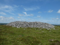
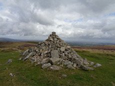
Rippon Tor Cairn
OS Map: SX 74664 75581
HER: MDV7539
Megalithic Portal: 17833
PMD: Rippon Tor Summit
Alternate name: Rippon Tor 1 Cairn
ShortName: CN RipponTor 1
Butler map: 5.5.1
Grinsell: ILS 1
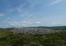
Notes: HER: A massive cairn on the summit of Rippon Tor, 28 metres in diameter and 4 metres high. One of four cairns in the vicinity. It is an approximately circular mound of granite boulders, with an overall spread of 27 metres. The top has been much altered and added to, and the central area hollowed; there is also the more recent addition of an Ordnance Survey trig pillar within the hollow. Condition is declining due to frequent interference by the public.
Nearby sites: SX 74664 75581
Distance: 3.02km
Saddle Tor Reported Cairn
OS Map: SX 75154 76343
ShortName: CN?SaddleTor1
Notes: Mound where flag-pole was sited. This site was asked about by Max Piper on a Dartmoor Facebook group on 20 Nov 2020. Max observed: atop Saddle Tor's eastern mass at SX 75154 76343, and at the very, very top. It appears to have utilised bedrock and is almost a ring cairn on the western side where broken rocks have been piled up. In the discussion that followed the consensus was that there had once been a flag pole sited here and that is the origin of this man-made mound. It is being added here as a "reported cairn" to help others trying to make sense of it. Thanks to Max for the grid reference and details. There are no entries on the HER for this feature.
Nearby sites: SX 75154 76343
Distance: 3.27km
Saddle Tor A Ancient Pool
OS Map: SX 75135 76534
HER: MDV127219
ShortName: PO:SaddleTorA
Notes: "A pool measuring 20m. One of over 40 such 'sacred' pools identified on Dartmoor that are thought to have potentially been designed during the prehistoric period. One of a group of three pools north-east of saddle Tor."
Nearby sites: SX 75135 76534
Distance: 3.23km
Saddle Tor B Ancient Pool
OS Map: SX 75172 76553
HER: MDV127220
ShortName: PO:SaddleTorB
Notes: "A pool measuring 16.5 by 14.5m. One of over 40 such 'sacred' pools identified on Dartmoor that are thought to have potentially been designed during the prehistoric period. One of a group of three pools north-east of saddle Tor."
Nearby sites: SX 75172 76553
Distance: 3.27km
Saddle Tor C Ancient Pool
OS Map: SX 75273 76526
HER: MDV127222
ShortName: PO:SaddleTorC
Notes: "A pool measuring 14 by 10m. One of over 40 such 'sacred' pools identified on Dartmoor that are thought to have potentially been designed during the prehistoric period. One of a group of three pools north-east of saddle Tor."
Nearby sites: SX 75273 76526
Distance: 3.37km

Seven Lords' Lands Encircled Cairn
OS Map: SX 74127 76237
HER: MDV7396
Megalithic Portal: 3454
PMD: Seven Lord's Lands
Alternate name: Sevon Lords Lands Encircled Cairn
ShortName: EC 7LordsLands
Butler map: 9.10
Butler Vol 5: p.51 & Fig.29
Grinsell: WID 13
Turner: F1
Barrow Report: 53
Notes: A cairn from 0.8m. to 1.2m. high, with a minor central excavation 0.5m. deep. The kerb retaining circle extends round the west and north quadrants.
Nearby sites: SX 74127 76237
Distance: 2.29km
Sherberton Common Reported Stone Row
OS Map: SX 69148 73346
HER: MDV6426
The Stone Rows of GB: Sherberton Common
PMD: Sherberton Common
ShortName: SR:SherberCom
Butler map: 11.6
Butler Vol 5: p.214
Notes: Sandy Gerrard (see link to SRGB): According R.N. Worth this is a double stone row that measured 68.6m long situated on a gently sloping south facing slope. According to him the row was destroyed in 1897 shortly after its discovery. The rows were described as being between 8 and 9 feet apart and included some contiguous stones. Jeremy Butler suggested that it was a passage similar to one surviving at Fernworthy Reservoir but he was unable to identify the site of the feature described by Worth (Butler, J., 1997, 214). Fresh fieldwork has identified the structure, which survives comparatively well and is clearly a passageway leading to a robbed roundhouse from a length of prehistoric rubble walling. The structure has only been partly robbed and several stones remain together with the original 1897 stone robbing pits.
Nearby sites: SX 69148 73346
Distance: 4.46km

Single Barrow Cairn
OS Map: SX 70576 79538
HER: MDV7487
Megalithic Portal: 16631
ShortName: CN SingleBarro
Butler map: 20.10
Butler Vol 5: p.23 & Fig.106
Grinsell: MAN 11
Notes: Round barrow, crowned by boundary stone dated 1854, and inscribed single burrow. Excavated 1873. Diameter 23 metres, height 1.0 metres. Butler Volume 1 Map 20.10.
Nearby sites: SX 70576 79538
Distance: 3.01km
Smallacombe Rocks Settlement
OS Map: SX 757 782
HER: MDV8055
Megalithic Portal: 31843
ShortName: ST:Smallacombe
Nearby sites: SX 757 782
Distance: 4.02km
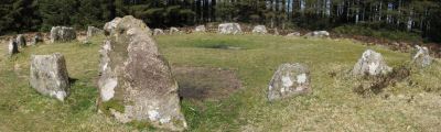
Soussons Common Ring Setting Cairn and Cist
Prehistoric Dartmoor Walks: Dartmoor Site: Soussons Cairn Circle
OS Map: SX 67516 78700
HER: MDV6013
Megalithic Portal: 1266
PMD: Soussons Plantation
Alternate name: Soussons Plantation S. Ring Setting Cairn and Cist
ShortName: CT Soussons Cm
Butler map: 24.2.6
DPD page: 124
Grinsell: MAN 9
Turner: D2
Barrow Report: 22 23 45 56
Notes: "A 28 feet diameter cairn circle with a central cist (plan). The tallest stone in the cairn circle is about 2 feet high." "This cist measures at least 1.3 metres long by 0.5 metres wide and when excavated in 1903 two coils of human hair were found". Lethbridge p.124. Butler Soussons Plantation S - Vol. 2. Map 24.2.6 (diagrams pp. 18-20). Breton p.41.
Nearby sites: SX 67516 78700
Distance: 4.78km
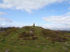
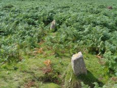
Top Tor Cairn
OS Map: SX 73574 76472
HER: MDV7455
Megalithic Portal: 32049
Alternate name: Top Tor 1 Cairn
ShortName: CN:Top Tor 1
Butler map: 9.7.1
Grinsell: WID 11
Notes: NMR C. "Cairns on Top Tor. Two inconspicuous cairns lie about 80 metres apart beside the track which follows the crest of the ridge on the north side of Top Tor. The cairn to the south is smaller at circa 7.5 metres diameter by 0.2 metres high and has a circle of ten slabs showing above the turf around the edge. This cairn has been reported to have a stone row running downhill to the north but the few earthfast slabs in this direction are no more numerous than elsewhere on the hillside and this seems unconvincing. Nearly 100 metres east of the southern cairn is an arc of three standing and two flat slabs representing about a quarter of a circle. The interior is quite flat except for a shallow trench but possibly the stones originally surrounded a cairn which has been completely removed. Other details: Map 9, Site 7."
Nearby sites: SX 73574 76472
Distance: 1.70km
Tunhill Rocks Settlement
OS Map: SX 732 758
HER: MDV7438
Megalithic Portal: 31984
ShortName: ST:TunhillRock
Nearby sites: SX 732 758
Distance: 1.65km
Two Barrows Stone Ring Cairn Circle
OS Map: SX 70654 79219
HER: MDV7409
Megalithic Portal: 16632
Alternate name: Two Barrows 1 Stone Ring Cairn Circle
ShortName: RC TwoBarrows1
Butler map: 20.11.1
Butler Vol 5: p.23 & Fig.106
Grinsell: MAN 12
Barrow Report: 21 56
Notes: "The northern barrow was excavated in 1872. It measures 40 feet in diameter and 4 1/2 feet high. A ring of stones encircled the barrow and in the centre was a small cairn. A cremation burial was found to the SE of the centre covered by five flat stones. With the cremation was the blade of a bronze dagger and a pommel made from amber with a decoration consisting of rows of gold pins" See: Bate, C Spence, Researches into Some Antient Tumuli on Dartmoor, T.D.A. Vol. 5 pp.549-58 (1872). Relevant Butler map Vol. 1. Map 20. Butler Volume 1 Map 20.11 Two Barrows 1. [N.b. Treated as Turner type Stone Ring Cairn circle from the description].
Nearby sites: SX 70654 79219
Distance: 2.69km
Two Barrows S Cairn
OS Map: SX 70663 79203
HER: MDV7411
Megalithic Portal: 16632
Alternate name: Two Barrows 2 Cairn
ShortName: CN TwoBarrows2
Butler map: 20.11.2
Butler Vol 5: p.23 & Fig.106
Grinsell: WID 3
Notes: Two Barrows 2. An oval, stony mound measuring 15.5m E-W and 10.5m N-S. It stands up to 1.1m high and was probably originally bowl-profiled. The N slope is spit by a narrow path and a N-S slope across the top of the barrow has caused minor damage. It appears to be unexcavated. The mounds is crossed by a maintained drystone field wall, approaching from the SE and turning W on the barrow. The wall is built over the mound and does not seem to have caused much damage. This barrow appears to have been a target point for a reave, Fleming's Hameldon South, approaching from the E and stopping 3.5m short of the mound. The reave line is continued W by the modern wall beyond the barrow. See also: Bate, C Spence, Researches into Some Antient Tumuli on Dartmoor, T.D.A. Vol. 5 pp.549-58 (1872). Butler Volume 1 Map 20.11
Nearby sites: SX 70663 79203
Distance: 2.67km
Wittaburrow Cairn
OS Map: SX 73353 75214
HER: MDV7537
Megalithic Portal: 32069
Alternate name: Wittaburrow 1 Cairn
ShortName: CN:Wittaburr 1
Butler map: 9.9.1
Grinsell: WID 15
Notes: "A large stony round cairn, south of Wittaburrow. The mound has a 25 metre diameter at base, but the structure has been much altered, probably robbed, and is now quite low in places. A ‘bite-shaped’ section is missing from the main mound on the south-eastern side where a smaller cairn, which is unlikely to be an original feature, stands within the original spread of the monument. Two large hollows have been dug into the main mound which, overall, survives in a very uneven state."
Nearby sites: SX 73353 75214
Distance: 2.17km
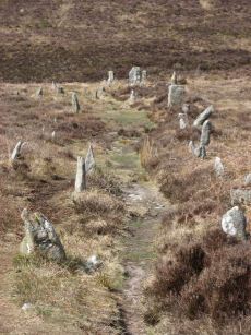
Yar Tor Stone Row
OS Map: SX 68177 73857
HER: MDV6459
Megalithic Portal: 2199
The Stone Rows of GB: Yar Tor
PMD: Yar Tor Stone Row
ShortName: SR Yar Tor
Butler map: 14.11
DPD page: 122
Barrow Report: 56
Notes: "The remains of a probable triple stone row with a cairn and cist at its south end and a barrow at its north. The row comprises stones set 2m apart and standing to a height of 0.3m. Some are concealed beneath the turf. The cairn measures 11m in diameter and 0.3m high with a central cist surrounded by a kerb. The barrow is 6m in diameter and 1m high". Lethbridge Corndon Triple Row pp.122-3. See also: Sea Views at Yar Tor Breton p.84
The author attempted to walk the stone row on 25/09/2025. The photo from 15/07/2016 shows the row in a grassy terrain but today the area is dense with gorse making most of the row buried and impassable.
Nearby sites: SX 68177 73857
Distance: 4.79km

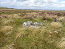
Yar Tor (Money Pit) Platform Cairn Circle and Cist
OS Map: SX 68181 73865
HER: MDV6460
Megalithic Portal: 1369
PMD: Money Pit
Alternate name: Money Pit Platform Cairn Circle and Cist
ShortName: CT Money Pit
Butler map: 14.11
Butler Vol 5: p.23 & Fig.4
DPD page: 122
Grinsell: WID 21
Turner: E51
Barrow Report: 56 62
Notes: "The south cairn is a very spread and slight earthwork with a centrally placed cist. Only the north and west side slabs of the cist remain in situ though a misplaced slab lies to one side of the chamber. Eleven slabs forming a kerb of approximately 3m surrounding the cist remain in situ. Several additional stones survive, protruding just above the surface of the flattened cairn, which are likely to be evidence of an outer circle with a diameter of approximately 11m". Lethbridge diagram p.122 and photo bottom p.122. Butler Money Pit - Vol. 1. Map 14.11 (photo on p.92, diagram pp.125-6).
Nearby sites: SX 68181 73865
Distance: 4.78km

Yar Tor Summit Cairn
OS Map: SX 67865 73943
HER: MDV6434
Megalithic Portal: 11065
Alternate name: Yar Tor summit Cairn
ShortName: CN:Yar Tor Sum
Butler map: 14.8
Grinsell: WID 20
Barrow Report: 56
Notes: "Large cairn (approximately 18.0 metres) built on the summit of Yar Tor; the stones have been rearranged to form a shelter. This cairn is aligned with a reave; part of the Dartmeet parallel reave system."
Nearby sites: SX 67865 73943
Distance: 4.99km