
Guide to the Monuments on Walkhampton and Sharpitor
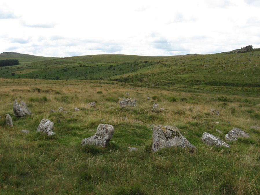
Table of Ritual and Burial Monuments on Walkhampton and Sharpitor
The following table lists the records currently in this Guide Map. For an explantion of the Guide Maps and a table of all 62 Guide Maps, follow this link: Guide List Table. Introductory text will be added to each guide list in 2025. Notes on duplication and omissions will appear below the table once checks have been finalised.
Walkhampton and Sharpitor Guide Map
Guidance for walkers: The monuments featured in this database are archaeological treasures and need to be protected and preserved - please do not disturb any sites. Please check access and firing times before visiting sites, not all sites listed are on open access land. Firing ranges and boundaries of open access areas are marked on the OL28 OS Dartmoor Explorer map. Please stick to the country code and consider giving support to the numerous agencies that help to keep Dartmoor a fabulous natural and historic environment!
List of Ritual and Burial Monuments on Walkhampton and Sharpitor
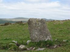
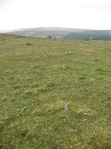
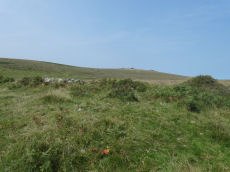
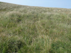
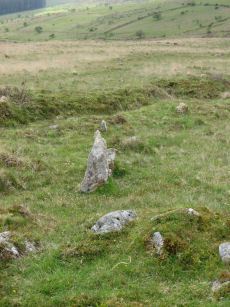
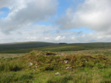
Leeden Hill Standing Stone
OS Map: SX 56015 71286
HER record: MDV28499
Megalithic Portal: 45567
PMD: Leeden Hill Standing Stone
ShortName: SS Leeden Hill
Butler map: 45.
Notes: Possibly a prehistoric standing stone but may also be a much later marker since there are at least three similar stones in a line towards Ingra Tor set out at wide intervals as if to mark a boundary
Nearby sites: SX56027129
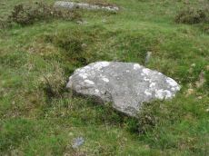
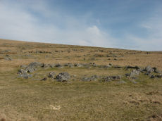
Sharpitor E.1 Cairn Circle & Cist
OS Map: SX 56292 70445
HER record: MDV51502
PMD: Leather Tor N.
ShortName: CT:Sharpitor 1
Butler map: 45.3.1
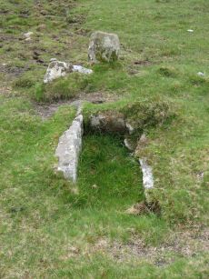
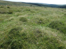
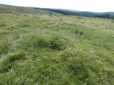
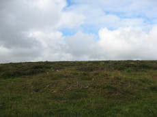
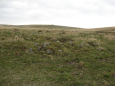
Notes: Cairn forming part of a cluster of four cairns. Mound measures 6 metres in diameter, and stands up to 0.8 metres high. Perimeter is defined by a kerb which survives partly as a buried feature. Centre of the cairn has been partially excavated to reveal a stone cist, oriented north-north-east by south-south-west. The interior of this cist measures 1.1 metres long, 0.6 metres wide and 0.3 metres deep. This is one of Butler's group of 4 cairns Sharpitor E.1-4. The NMR entry is duplicated at 964151.
Nearby sites: SX56297045
Sharpitor E.2 Cairn
OS Map: SX 56290 70420
HER record: MDV51503
ShortName: CN:Sharpitor 2
Butler map: 45.3.2
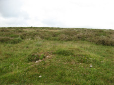
Notes: Southern cairn of a group of four cairns on Walkhampton Common. Measures 4.0 metres in diameter and is 0.7 metres high. This is one of Butler's group of 4 cairns Sharpitor E.1-4. The NMR entry is duplicated at 964151.
Nearby sites: SX56297042
Sharpitor E.3 Cairn
OS Map: SX 56290 70450
HER record: MDV51501
ShortName: CN:Sharpitor 3
Butler map: 45.3.3
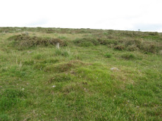
Notes: Northern cairn of a group of four cairns on Walkhampton Common. Measures 4.5 metres in diameter and stands up to 0.8 metres high. A number of retaining stones are visible around the north eastern perimeter of the mound, indicating the presence of a kerb, which survives largely as a buried feature. This is one of Butler's group of 4 cairns Sharpitor E.1-4. The NMR entry is duplicated at 964151.
Nearby sites: SX56297045
Sharpitor E.4 Cairn
OS Map: SX 56300 70430
HER record: MDV51504
ShortName: CN:Sharpitor 4
Butler map: 45.3.4
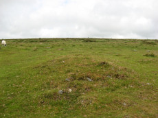
Notes: The eastern cairn of the group of four on Walkhampton Common. Mound measures 4.0 metres in diameter and stands up to 0.8 metres high. This is one of Butler's group of 4 cairns Sharpitor E.1-4. The NMR entry is duplicated at 964151.
Nearby sites: SX56307043
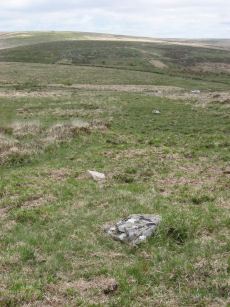
Burrator Wood Reported Cairn
OS Map: SX 57270 70280
HER record: MDV14311
ShortName: CN?BurratorWd
Grinsell: WAL 35
Notes: All are in a conifer plantation but are undoubtedly clearance cairns, probably of 18/19th century date when the area was enclosed.
Nearby sites: SX57277028
Stan Lake Platform Cairn Circle
OS Map: SX 56896 70285
HER record: MDV4996
Megalithic Portal: 45649
ShortName: PC:Stan Lake
Turner: E29
Notes: "much disturbed". Alleged cairn circle. NMR record states "At SX 56897029, a felled conifer currently obscures much of what appears to be a hut circle rather than a cairn, situated on a south-east slope near a valley bottom. (Identification as a cairn may have originated with H. Breton)." Idenitified as a round house in the HER. This record is marked as a duplicate as it replicates PWD record SiteID=8769.
Nearby sites: SX56907029
Burrow Park Clearance Cairn
OS Map: SX 56900 70350
HER record: MDV12838
ShortName: CN?Burrow Park
Notes: Clearance cairns?
Nearby sites: SX56907035
Sharpitor S.E. Reported Cairn
OS Map: SX 56181 70232
HER record: MDV28501
ShortName: CN:Sharp SE
Butler map: 45.4
Nearby sites: SX56187023
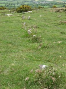
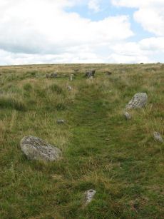
Sharpitor W. (Peek Hill) Stone Row
OS Map: SX 55058 70748
HER record: MDV12831
Megalithic Portal: 2120
The Stone Rows of GB: Sharpitor West
PMD: Sharpitor W Stone Row
Alternate name: Sharpitor W Stone Row
ShortName: SR Sharpitor W
Butler map: 45.11
DPD page: 20
Notes: Butler: Sharpitor W, Worth: Peek Hill. Near Horseyeat Farm. "BA stone row and cairn. The 132m long row has 47 upright stones and the low cairn is 8.4m in diameter. Both monuments lie under dense bracken cover; gorse vegetation has obscured part of the row". Lethbridge pp.19-20, diagram p.19, photo p.20 Horseyeat Farm stone row. See also: Sea Views at Sharpitor West
Nearby sites: SX55067075
Sharpitor W. (Peek Hill) Cairn Circle
OS Map: SX 55056 70751
HER record: MDV5011
Megalithic Portal: 52566
PMD: Sharpitor W Stone Row
Alternate name: Sharpitor W. stone row Cairn Circle
ShortName: CC Sharpitor W
Butler map: 45.11
DPD page: 20
Grinsell: WAL 18
Notes: "The cairn lies on a gentle sw slope ne of horseyeatt farm, with a stone row see sx57se/141 running sw from it. The cairn is about 7m in diameter and 0.6m height, partly turf-covered, with a central hollow. The visible set stones within the cairn suggest two or three underlying concentric stone circles. These stones have a maximum height of 0.2m and are predominantly set with their long axes tangential to the circle". Lethbridge pp.19-20, diagram p.19.
Nearby sites: SX55067075
Sharpitor W.1 Cairn
OS Map: SX 55093 70784
HER record: MDV5012
ShortName: CN:SharpitorW1
Butler map: 45.11.1
Grinsell: WAL 19
Notes: HER: A low cairn with a trench cut through it and now covered by bracken vegetation. Situated on a crest it affords impressive vistas over 270 degrees to the west. Recorded during fieldwork survey in 2007 and using geophysics in 2021, which detected possible ditch around this cairn, as well as suggesting the stone row might extend as far as this cairn.
Nearby sites: SX55097078
Sharpitor W.2 Cairn
OS Map: SX 55090 70650
HER record: MDV19964
ShortName: CN:SharpitorW2
Butler map: 45.11.2
Notes: Cairn in a group of three to the south-east of the stone row on Walkhampton Common. Only two were found in 2019.
Nearby sites: SX55097065
Sharpitor W.3 Cairn
OS Map: SX 55110 70660
HER record: MDV61947
ShortName: CN:SharpitorW3
Butler map: 45.11.3
Notes: HER: One of three cairn to the south-east of the stone row on Walkhampton Common the western of two cairns on eastern boundary of field system to the north-east of Horseyeatt
Nearby sites: SX55117066
Sharpitor W.4 Cairn
OS Map: SX 55120 70650
HER record: MDV61948
ShortName: CN:SharpitorW4
Butler map: 45.11.4
Notes: HER: One of three cairns to the south-east of the stone row on Walkhampton Common The eastern of two cairns on eastern boundary of field system to the north-east of Horseyeatt
Nearby sites: SX55127065
Sharpitor W.5 Cairn
OS Map: SX 55330 70550
HER record: MDV62016
ShortName: CN:SharpitorW5
Notes: "Cairn situated adjacent to a field system on Walkhampton Common. Dimensions of cairn: 0.7 metres high, 9.8 metres by 5 metres. Central pit 1 metres by 0.8 metres by 0.15 metres. Oval mound with stones protruding. Oriented east-west. Probably a cairn, though may be connected with nearby field system."
Nearby sites: SX55337055
Sharpitor W.6 Reported Cairn
OS Map: SX 55200 70390
HER record: MDV62014
ShortName: CN?SharpitorW6
Notes: HER: Cairn measures 5.8 metres in diameter, height 0.5 metres. Covered in grass and bracken. Lies 7 metres at 325 degrees from the west-north-western end of field system. May be a clearance cairn, but a funerary origin cannot be ruled out.
Nearby sites: SX55207039
Sharpitor W.7 Reported Cairn
OS Map: SX 55400 70550
HER record: MDV62015
ShortName: CNxSharpitorW7
Notes: a cairn built upon an earlier field system boundary bank
Nearby sites: SX55407055
Sharpitor N.W. 1 Stone Row
OS Map: SX 55665 70617
HER record: MDV3762
Megalithic Portal: 2118
The Stone Rows of GB: Sharpitor North West 1
PMD: Sharpitor Summit N Stone Row
Alternate name: Sharpitor NW 1 Stone Row
ShortName: SR Sharp NW1
Butler map: 45.12.1
DPD page: 21
Barrow Report: 66
Notes: "The double stone row is in poor shape. Both terminals have survived fixing its length at 113m from the blocking stone to the centre of the cairn. The cairn (4.5 x 0.3) has lost its retaining circle and has been dug into in the centre. The other end of the row is well defined by a pair of larger slabs in the line of the rows followed by a central cross-set blocking stone 1.2m long that has been tipped backwards and is partly overgrown. The stones seemed to have increased in size nearer the cairn. Unusually the highest point on the ground is not at the cairn end but near the centre of the rows as they cross the summit of the ridge". Lethbridge pp.20-22. See also: Sea Views at Sharpitor NW 1. Breton p.27 The stone row, which starts from a cairn, passes through the south end of the pond, and terminates some distance below in a small circle of seven stones. About 320 yds due east of the circle, and only 40 yds. from the road, is another stone row which has been mutilated. It is only about 30 yds long and starts from a ruined circle.
Nearby sites: SX55677062

Sharpitor N.W. 2 Stone Row
OS Map: SX 55687 70600
HER record: MDV3761
Megalithic Portal: 2119
The Stone Rows of GB: Sharpitor North West 2
PMD: Sharpitor Summit S Stone Row
Alternate name: Sharpitor NW 2 Stone Row
ShortName: SR:Sharp NW2
Butler map: 45.12.2
DPD page: 21
Notes: "A BA single stone row oriented NE - SW at a very slight angle to the north-east end of the adjacent double stone row. The large scale survey dated 1980 shows a total of thirty stones whilst in 1994 it was reported that only about 10 stones can be identified with certainty and half of these are either buried or just showing. The row is partially obscured by moorland grass and the area is heavily disturbed by grazing animals and walkers tracks. The extent of the row is unclear and there is no ground evidence of an associated cairn or a blocking stone. Heavy wear and tear of the fragile peat cover has caused many natural moorland stones to be exposed on the line of the row". Lethbridge pp.20-22. See also: Sea Views at Sharpitor NW 2 Breton p.27 The stone row, which starts from a cairn, passes through the south end of the pond, and terminates some distance below in a small circle of seven stones. About 320 yds due east of the circle, and only 40 yds. from the road, is another stone row which has been mutilated. It is only about 30 yds long and starts from a ruined circle.
Nearby sites: SX55697060
Sharpitor N.W. stone row Cairn
OS Map: SX 55669 70611
HER record: MDV14794
ShortName: CN Sharp NW
Butler map: 45.12
Grinsell: WAL 20
Notes: HER: Small disturbed cairn at the south-western end of the double stone row north-west of Sharpitor. Diameter up to 5 metres and height 0.3 - 0.4 metres. Possible ditch around cairn detected during geophysical survey in 2021.
Nearby sites: SX55677061
Sharpitor (N) or Peek Hill Platform Cairn Circle and Cist
OS Map: SX 55839 70693
HER record: MDV3769
Megalithic Portal: 1246
PMD: Peek Hill
Alternate name: Sharpitor N. Platform Cairn Circle and Cist
ShortName: CT Peek Hill
Butler map: 45.12
DPD page: 22
Grinsell: WAL 21
Turner: E41
Barrow Report: 72
Notes: Bar Rep. 72 (TDA Vol 88 p.222). Butler Sharpitor N. - Vol. 3. Map 45.12 (diagram p.45 & photo p.84).
Copyright for photos and plans from Barrow Reports 71-73 belong to the Dixon estate. Reproduced here with kind permission.
Nearby sites: SX55847069

Goadstone Pond Ancient Pool
OS Map: SX 55706 70663
HER record: MDV28232
ShortName: PO:GoadsStone
Notes: "Pool on the summit of the hill near a stone row. Some of the stones from the double stone row appear to have been lost in the pool. Previously incorrectly identified from aerial photograph as an enclosure. One of over 40 pools on Dartmoor thought to have originated in the Prehistoric period."
Worth and Butler refer to this as Goatstone Pool. There is a very interesting discussion of both the origin of the name and of the cairns and stone rows on DartmoorCam: Sharpitor. See also Legendary Dartmoor: Dartmoor's Goadstone
Nearby sites: SX55717066
Sharpitor E. Stone Row
OS Map: SX 56171 70819
HER record: MDV4991
Megalithic Portal: 2117
The Stone Rows of GB: Sharpitor North East
PMD: Sharpitor E Stone Row
Alternate name: Sharpitor NE Stone Row
ShortName: SR Sharp NE
Butler map: 45.13
DPD page: 21
Notes: Described by Worth as "Sharpitor, foot of eastern slope". Listed by Butler as Sharpitor N.E. (which can be confused with another alleged row). "A stone row, with a cairn at the west end at SX 56147078, extends almost due west for 26.0m. to SX 56167078. The cairn, mutilated and amorphous, is now approximately 6.7m in diameter and 0.3m. high at its maximum. There are nine stones in the row, including three pairs, with an additional stone which seems to be displaced, all between 0.1m. and 0.3m. high. The east end of the row is terminated by a reave (SX 67 SE 91) which has cut across and evidently destroyed any westward extension." Lethbridge pp.20-22.
Nearby sites: SX56177082
Sharpitor N.E. stone row Cairn
OS Map: SX 56146 70810
HER record: MDV50703
ShortName: CN Sharp NE1
Butler map: 45.13
Grinsell: WAL 21a
Barrow Report: 42
Nearby sites: SX56157081
Sharpitor N.E. Cairn
OS Map: SX 56198 70821
HER record: MDV14309
ShortName: CN Sharp NE2
Butler map: 45.13
Grinsell: WAL 22
Barrow Report: 42
Nearby sites: SX56207082
Leeden Tor S.1 Cairn
OS Map: SX 56327 70903
HER record: MDV19965
ShortName: CN LeedenTor 1
Butler map: 45.13.1
Nearby sites: SX56337090
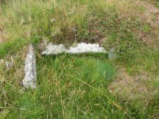
Stanlake Cist
OS Map: SX 56430 70859
HER record: MDV3746
Megalithic Portal: 45755
PMD: Stanlake W.
Alternate name: Leeden Tor S.2 Cist
ShortName: CT LeedenTor 2
Butler map: 45.13.2
Grinsell: WAL 23
Barrow Report: 56 66
Notes: Butler Leeden Tor S. 2 - Vol. 3. Map 45.13 (diagram p.47).
Nearby sites: SX56437086
Leeden Tor S.3 Cairn
OS Map: SX 56452 70842
HER record: MDV3747
ShortName: CN LeedenTor 3
Butler map: 45.13.3
Grinsell: WAL 24
Barrow Report: 66
Notes: NMR B
Nearby sites: SX56457084
Black Tor (Stanlake) Stone Row
OS Map: SX 56988 71381
HER record: MDV4994
Megalithic Portal: 1771
The Stone Rows of GB: Black Tor Stanlake
PMD: Black Tor Stanlake Stone Row
ShortName: SR Stanlake
Butler map: 45.14
DPD page: 24
Notes: "A Bronze Age Stone Row lies just inside, and is partly buried by, a substantial field boundary. The row extends from SX57217155 to SX57007137, some 294m long and includes at least 57 visible stones. Its north-eastern end is denoted by a substantial blocking stone and its lower south-western end by three funerary cairns. The row can be seen as three distinct parts forming the whole. The northern part includes 39 stones, the central group of 8 stones is separated from the northern row by a 66.2m wide gap whilst the southern group is on a slightly different alignment to the others. The row is unusual in that the blocking stone is at the upper end and a cairn lies at the lower end." Lethbridge diagram and photo p.24.
Nearby sites: SX56997138
Black Tor 1 stone row Cairn
OS Map: SX 56990 71383
HER record: MDV50268
The Stone Rows of GB: Black Tor Stanlake
ShortName: CN:BlackTor 1
Butler map: 45.14.1
Notes: The southern end of the Black Tor stone row is terminated by one large cairn (1) with two smaller and close by satellite cairns (2 & 3). See diagram in Butler Vol 3 p.49 and the photograph of the cairns on the Stone Row Of Great Britain site.
Nearby sites: SX56997138
Black Tor 2 Cairn
OS Map: SX 56993 71384
HER record: MDV50151
The Stone Rows of GB: Black Tor Stanlake
ShortName: CN:BlackTor 2
Butler map: 45.14.2
Notes: The southern end of the Black Tor stone row is terminated by one large cairn (1) with two smaller and close by satellite cairns (2 & 3). See also diagram in Butler Vol 3 p.49 and the photograph of the cairns on the Stone Row Of Great Britain site. (? See also: 1472559)
Nearby sites: SX56997138
Black Tor 3 Cairn
OS Map: SX 57000 71378
HER record: MDV50267
The Stone Rows of GB: Black Tor Stanlake
ShortName: CN:BlackTor 3
Butler map: 45.14.3
Notes: The southern end of the Black Tor stone row is terminated by one large cairn (1) with two smaller and close by satellite cairns (2 & 3). See also the diagram in Butler Vol 3 p.49 and the photograph of the cairns on the Stone Row Of Great Britain site. (? See also: 1472559)
Nearby sites: SX57007138
Black Tor 4 Cairn
OS Map: SX 56960 71310
HER: No record found
ShortName: CN:BlackTor 4
Butler map: 45.14.4
Notes: UPDATE 31/12/2022. The HER record MDV50264 that this record used to link to has been deleted. This record originates with Butler's listings and will be retained. Field work is required to determine which of these Black Tor cairns exist.
Nearby sites: SX56967131
Black Tor 5 Cairn
OS Map: SX 56960 71300
HER record: MDV50266
ShortName: CN?BlackTor 5
Butler map: 45.14.5
Notes: ? See aso: 1472559
Nearby sites: SX56967130
Black Tor 6-11 Cairn
OS Map: SX 57000 71300
HER record: MDV4992
ShortName: CN:BlackTor 6
Butler map: 45.14.6-11
Notes: ? See aso: 1472559
Nearby sites: SX57007130
Black Tor 12 (Site of) Reported Cist
OS Map: SX 57200 71800
HER record: MDV5022
PMD: Black Tor
ShortName: CT?BlackTor12
Butler map: 45.14.12
Grinsell: WAL 34
Notes: Baring-Gould A perfect cist between Black Tor and the road, which many years ago was broken up to mend the road
Nearby sites: SX57207180
Black Tor 13 Reported Cairn
OS Map: SX 56960 71300
HER record: MDV50265
ShortName: CN:BlackTor13
Notes: Duplicate: The HER description of this cairn is identical to the Black Tor 1 stone row cairn (HER 50268). The location however, is identical to Black Tor 5 (HER 50266) at SX 5696 7130. According to Butler there is a group of 3 cairns at the end of the stone row. Black Tor 1-3. A bit further south-west are some more cairns (4, 5, 6-11). This entry is an amalgam of 1 and 5.
Nearby sites: SX56967130
Leeden Tor Stone Row
OS Map: SX 56522 71474
HER record: MDV50223
Megalithic Portal: 2020
The Stone Rows of GB: Leeden Tor
PMD: Leeden Tor Stone Row
ShortName: SR Leeden Tor
Butler map: 45.15
DPD page: 23
Notes: "BA cairn and stone row. The scrappy remains of a single stone row now 165m long descend from a badly battered cairn on the south-east slopes of Leeden Tor. The cairn is about 6m across with a large central pit and partial retaining circle. At least 14 stones remain in a line, four only still earthfast and the rest either flat or buried. Stone pits record the loss of some of the stones". Lethbridge p23, diagram p.24. See also: Sea Views at Leeden Tor
Nearby sites: SX56527147

Leeden Tor stone row Cairn
OS Map: SX 56525 71482
HER record: MDV50220
ShortName: CN:LeedenRow
Butler map: 45.15
Notes: Damaged cairn at the north-western end of a probable stone alignment (MDV50223) on Walkhampton Common. On the line of an (apparently later) reave. The plan in Butler is helpful to finding and understanding this site. The author visited this feature on 15/08/2025 with Steve Szypko. The stone row cairn and the nearby gun emplacement are difficult to find. Following the stone row up and then heading a little west the circular depression for the nearby gun emplacement can be found. This in turn helps to locate the nearby stone row cairn.
Nearby sites: SX56537148
Leeden Tor S.E. Reported Cairn
OS Map: SX 56514 71479
HER record: MDV57040
ShortName: CNxLeeden SE
Butler map: 45.15
Notes: Butler lists as cairn but it is probably a gun emplacement. HER: Cairn, hut circle or gun emplacement to south-east of Leeden Tor at the west end of the stone row. Possible cairn of 7.0 metres diameter by 0.2 metres high originally identified in 1980 as a probable hut circle. When surveyed in 2007 this was changed to military gun emplacement. It comprises a circular flat area that is mostly enclosed by a low stony bank up to 0.6 metres high on the uphill side.
The author visited this feature on 15/08/2025 with Steve Szypko. The stone row cairn and this feature are difficult to find. Following the stone row up and then heading a little west the circular depression for this feature can be found. This in turn helps to find the nearby stone row cairn. This feature looks more like a gun emplacement.
Nearby sites: SX56517148
Ingra Tor Cist
OS Map: SX 55874 72093
HER record: MDV4983
Megalithic Portal: 45735
PMD: Ingra Tor
Alternate name: lngra Tor Cist
ShortName: CT Ingra Tor
Butler map: 45.16
DPD page: 19
Grinsell: WAL 9
Barrow Report: 56
Notes: Butler Vol. 3. Map 45.16 (diagram p.51).
Breton (p.12): About 300 yds E. of Ingra tor is a fine kistvaen which has not been disturbed, except that a portion of the capstone has been broken off. [...] Three men from the farm near by about 1910 tried to raise the capstone with crowbars, but they failed to move it ; however, they broke off the piece that is broken.
Nearby sites: SX55877209
Routrundle south Enclosed Settlement
OS Map: SX 55262 71735
HER record: MDV3775
Megalithic Portal: 45578
ShortName: ES:Routrundl S
Notes: Routrundle South Pound: "A roughly oval field with diameters of 58.0 metres by 64.0 metres and a modern perimeter wall 1.5 metres high. There are no obvious footings of a previous wall but the plan and size (0.25 hectares) suggest that it is the fossilization of a prehistoric enclosure similar to that 250 metres to the north-east."
Nearby sites: SX55267174
Routrundle North Enclosed Settlement
OS Map: SX 55384 71860
HER record: MDV105688
Megalithic Portal: 45577
ShortName: ES:Routrundl N
Notes: Routrundle North Pound: "Broadly oval enclosure, 58 by 48 metres diameter. Part of the south-west perimeter is represented by a stony scarp 0.5 metres high, elsewhere it comprises a stone spread of similar height upon which is a modern field wall."
Nearby sites: SX55387186
Devil's Elbow Platform Cairn Circle
OS Map: SX 58192 72708
HER record: MDV14310
Megalithic Portal: 36761
PMD: Devil's Bridge
Alternate name: Hart Tor N. Platform Cairn Circle
ShortName: PC:DevilsElbow
Butler map: 46.1
Butler Vol 5: p.168 & Fig.107
Grinsell: WAL 10
Turner: E5
Notes: Ring cairn consisting of a circle of close set stones: almost a kerb circle, interior flat and no sign of cist. Diameter 8m, height 0.3m.
Nearby sites: SX58197271
Raddick Hill W.1 Cairn
OS Map: SX 57550 70820
HER record: MDV4963
ShortName: CN:Raddick W1
Butler map: 46.3.1
Notes: Butler Raddick Hill W.1-7 has been split into 7 records.NMR: 8 cairns, see also 440321. See Butler Vol. 3 p56-7 fig 46.3 - group of cairns just north of enclosure C. The author visited this group of cairns on 22/07/19. On that occasion only 6 of these cairns were logged and the co-ordinates did not match up with the HER records. This record records the location of the group cairns and is a place holder for one of the missing cairns - the co-ordinates will be updated to match if and when found.
Nearby sites: SX57557082
Raddick Hill W.2 Cairn
OS Map: SX 57553 70832
HER record: MDV48476
ShortName: CN Raddick W2
Butler map: 46.3.2
Notes: Butler Raddick Hill W.1-7 has been split into 7 records.NMR: 8 cairns, see also 440321. See Butler Vol.3 p56-7 fig 46.3 - group of cairns just north of enclosure C. The author visited this group of cairns on 22/07/19. It is impossible to match up these cairns with these records. Butler gave just one grid reference for the group and the HER entries do not accurately transpose on to what is actually there on the ground. The grid references used for this group of records match the location of the site in the photo as recorded with a Garmin GPS device. The assignment/match with HER records is arbitrary and/or as good a match going by cairn size as the grid references are too inaccurate to match by location.
This cairn notably has a hole that matches a slab that was clearly displaced from it and is located near the cairn.
Nearby sites: SX57557083
Raddick Hill W.3 Cairn
OS Map: SX 57516 70834
HER record: MDV48474
ShortName: CN Raddick W3
Butler map: 46.3.3
Notes: Butler Raddick Hill W.1-7 has been split into 7 records.NMR: 8 cairns, see also 440321. See Butler Vol.3 p56-7 fig 46.3 - group of cairns just north of enclosure C. The author visited this group of cairns on 22/07/19. It is impossible to match up these cairns with these records. Butler gave just one grid reference for the group and the HER entries do not accurately transpose on to what is actually there on the ground. The grid references used for this group of records match the location of the site in the photo as recorded with a Garmin GPS device. The assignment/match with HER records is arbitrary and/or as good a match going by cairn size as the grid references are too inaccurate to match by location.
Nearby sites: SX57527083
Raddick Hill W.4 Cairn
OS Map: SX 57575 70857
HER record: MDV48475
ShortName: CN Raddick W4
Butler map: 46.3.4
Notes: Butler Raddick Hill W.1-7 has been split into 7 records.NMR: 8 cairns, see also 440321. See Butler Vol.3 p56-7 fig 46.3 - group of cairns just north of enclosure C. The author visited this group of cairns on 22/07/19. It is impossible to match up these cairns with these records. Butler gave just one grid reference for the group and the HER entries do not accurately transpose on to what is actually there on the ground. The grid references used for this group of records match the location of the site in the photo as recorded with a Garmin GPS device. The assignment/match with HER records is arbitrary and/or as good a match going by cairn size as the grid references are too inaccurate to match by location.
Nearby sites: SX57587086
Raddick Hill W.5 Cairn
OS Map: SX 57568 70875
HER record: MDV50705
ShortName: CN Raddick W5
Butler map: 46.3.5
Notes: Butler Raddick Hill W.1-7 has been split into 7 records.NMR: 8 cairns, see also 440321. See Butler Vol.3 p56-7 fig 46.3 - group of cairns just north of enclosure C. The author visited this group of cairns on 22/07/19. It is impossible to match up these cairns with these records. Butler gave just one grid reference for the group and the HER entries do not accurately transpose on to what is actually there on the ground. The grid references used for this group of records match the location of the site in the photo as recorded with a Garmin GPS device. The assignment/match with HER records is arbitrary and/or as good a match going by cairn size as the grid references are too inaccurate to match by location.
Nearby sites: SX57577088
Raddick Hill W.6 Cairn
OS Map: SX 57564 70895
HER record: MDV50745
ShortName: CN Raddick W6
Butler map: 46.3.6
Notes: Butler Raddick Hill W.1-7 has been split into 7 records.NMR: 8 cairns, see also 440321. See Butler Vol.3 p56-7 fig 46.3 - group of cairns just north of enclosure C. The author visited this group of cairns on 22/07/19. It is impossible to match up these cairns with these records. Butler gave just one grid reference for the group and the HER entries do not accurately transpose on to what is actually there on the ground. The grid references used for this group of records match the location of the site in the photo as recorded with a Garmin GPS device. The assignment/match with HER records is arbitrary and/or as good a match going by cairn size as the grid references are too inaccurate to match by location.
Nearby sites: SX57567090
Raddick Hill W.7 Cairn
OS Map: SX 57453 70724
HER: No record found
ShortName: CN Raddick W7
Butler map: 46.3.7
Notes: Butler Raddick Hill W.1-7 has been split into 7 records.NMR: 8 cairns, see also 440321. See Butler Vol.3 p56-7 fig 46.3 - group of cairns just north of enclosure C. The author visited this group of cairns on 22/07/19. It is impossible to match up these cairns with these records. Butler gave just one grid reference for the group and the HER entries do not accurately transpose on to what is actually there on the ground. The grid references used for this group of records match the location of the site in the photo as recorded with a Garmin GPS device. The assignment/match with HER records is arbitrary and/or as good a match going by cairn size as the grid references are too inaccurate to match by location.
UPDATE 02/01/2023 HER entry MDV50943 that this record used to link to has been deleted. The are new HER entries but they are too confusing to match up in any meaningful way.
Nearby sites: SX57457072
Raddick Hill W.8 Cairn
OS Map: SX 57355 70855
HER record: MDV5010
ShortName: CN:Raddick W8
Butler map: 46.3.8
Notes: NMR & Butler match. Grinsell 17a is a distance at 57477076 WAL 17a?
Nearby sites: SX57367086
Raddick Plantation 1 Cairn
OS Map: SX 57511 70303
HER record: MDV5008
ShortName: CN:Raddick P1
Butler map: 46.4.1
Notes: Matches NMR. Not clear on Grinsell he gives a grid reference 23m off at 57277028 Burator Wood (WAL 35) WAL 35?
Nearby sites: SX57517030
Raddick Plantation 2 Cairn
OS Map: SX 57508 70261
HER record: MDV48351
ShortName: CN:Raddick P2
Butler map: 46.4.2
Notes: sub-circular cairn, 5m diam, 0.2m high (mpp). Location? Butler's description suggests couldbe octed at SX 57847 70310.
Nearby sites: SX57517026
Raddick Hill (35m SW of cairn) Reported Cist
OS Map: SX 58050 71250
HER record: MDV21891
PMD: Raddick Hill
ShortName: CT?Raddick 1
Notes: (greeves + edwards) approx 35m sw of cairn at sx58107130 is the site of possible cist, showing side-, end- and coverstones all intact. Could conceivably be natural however
Nearby sites: SX58057125
Raddick Hill SE pound Cist
OS Map: SX 57712 70827
HER: No record found
PMD: Raddick Hill SE pound
ShortName: CT Raddick 2
Notes: Radcliffe: "Possible cist found by RH Bruce on 11th Feb 2016. A stone set vertically across a section of the pound wall, with another stone aligned with the wall, the two giving the appearance of a side and end of a cist. There are two large stones downslope within the pound, possibly another sidestone and capstone. The DNPA archaeologist happened to be on hand, and agreed it is a possible cist." Visited by author on 22/07/19 - looks very much like a cist embedded in a pound wall. There is no HER entry for this site, the enclosed settlement is HER record MDV4952.
Nearby sites: SX57717083
Raddick Hill (SW slope) Reported Cairn
OS Map: SX 57456 70752
HER record: MDV28494
ShortName: CN?Raddick 3
Grinsell: WAL 17a
Notes: This cairn was not identified in dense gorse vegetation. See also HER 48474
Nearby sites: SX57467075
Raddick Hill (exc. 1898) Reported Cist
OS Map: SX 58085 71305
HER record: MDV4962
ShortName: CT:Raddick 4
Grinsell: WAL 14a
Notes: Burnard's excavation. Not possible to match record hence this separate duplicate record. It is either WAL 14 or WAL 15. Burnard quotes four cairns See Raddick Hill Summit 1-4
Nearby sites: SX58097131
Raddick Hill (duplicate) Reported Cairn
OS Map: SX 57820 70980
HER record: MDV4951
ShortName: CN:Raddick 5
Grinsell: WAL 15a
Notes: Burnard quotes four cairns See Raddick Hill Summit 1-4
Nearby sites: SX57827098
Hart Tor North Stone Row
OS Map: SX 57708 71708
HER record: MDV4896
Megalithic Portal: 1973
The Stone Rows of GB: Hart Tor North
PMD: Harter N Stone Row
ShortName: SR Hart Tor N
Butler map: 46.5.1
DPD page: 25
Notes: Butler Row 1. There are two cairns close by on the lower slopes of Hart Tor. One has an associated single stone row and the other has an associated double stone row - they diverge at an angle of 18 degrees. The double row consists of 93 stones and is much longer, around 122m in length [Gerrard], and extends all the way down to the River Meavy in the valley below. This row is fairly well preserved although it is crossed by a tinners ditch about a third of the way down its length and again by a leat a third of the way from the lower end. The structure was planned by Wilkinson in 1859 who states that the row is "terminated by a large monolith, now fallen, measuring about 25 feet long by 2 feet and 3 inches". Sadly this stone has long since disappeared. The row has pairs of stones which are spaced fairly accurately 1.9m apart along the rows, the rows being at a constant 1.7m separation. The cairn circle is 9.3m across and consists of 14 tall slabs some of which have fallen. Detailed survey of site in Hart Tor Stone Rows & Cairns, Meavy Valley Archaeology. Site Report No.9 - Sandy Gerrard (1999). See also: Sea Views at Hart Tor, The Stone Rows and Cairns at Hart Tor Dartmoor Part One and The Stone Rows and Cairns at Hart Tor Dartmoor Part Two
Nearby sites: SX57717171
Hart Tor South Stone Row
OS Map: SX 57720 71698
HER record: MDV4895
Megalithic Portal: 1974
The Stone Rows of GB: Hart Tor South
PMD: Harter S Stone Row
ShortName: SR Hart Tor S
Butler map: 46.5.1
DPD page: 25
Notes: Butler Row 2. The single row consists of 16 stones and is 56.4m long, although Gerrard suggests it was probably once much longer. The single row leads to a cairn which does not have a retaining circle. The cairn which has been robbed measures 7.4m in diameter and up to 0.75m high. For early description of both rows and the now missing menhir, see: Wilkinson J. Gardner, British Remains on Dartmoor, Journal Brit. Arch. Assoc. xviii. pp.22-53 (1862). Detailed survey of site in Hart Tor Stone Rows & Cairns, Meavy Valley Archaeology. Site Report No.9 - Sandy Gerrard (1999). See also notes for Hart Tor North Stone Row. Sea Views at Hart Tor, The Stone Rows and Cairns at Hart Tor Dartmoor Part One and The Stone Rows and Cairns at Hart Tor Dartmoor Part Two
Nearby sites: SX57727170

Hart Tor North Encircled Cairn
OS Map: SX 57718 71716
HER record: MDV49460
Megalithic Portal: 978
PMD: Harter N Stone Row
Alternate name: Hart Tor double stone row Encircled Cairn
ShortName: EC Hart Tor N
Butler map: 46.5
Butler Vol 5: p.39 & Fig.16
DPD page: 25
Grinsell: WAL 12
Turner: F12
Notes: The cairn circle is 9.3m across and consists of 14 tall slabs some of which have fallen. Wilkinson noticed concentric stone circles - which can't be seen today although there is clearly an inner circular mound. NMR A.
Nearby sites: SX57727172
Hart Tor single stone row Cairn
OS Map: SX 57722 71707
HER record: MDV50150
ShortName: CN Hart Tor S
Butler map: 46.5
Grinsell: WAL 13
Notes: HER coords ar way off by 150m. NMR B
Nearby sites: SX57727171
Hart Tor S.W. Cairn
OS Map: SX 57569 71662
HER record: MDV3739
ShortName: CN HartTor SW1
Butler map: 46.5
Grinsell: WAL 11
Notes: turf covered with hollowed centre.
Nearby sites: SX57577166
Hart Tor (SW of) Reported Cairn
OS Map: SX 57602 71705
HER: No record found
ShortName: CN-HartTor SW2
Grinsell: B:WAL 11a
Notes: Just N of W end of stone row 22: cairn claimed by Rowe (1896, 191), considered a natural hillock. From a visit to the site on 18/5/19 it would appear to be natural although the side of the mound may be the result of earth works, or a cutting, perhaps from the historic period, it is not far from an area of stream working. Seems an unlikely prehistoric cairn.
Nearby sites: SX57607171
Meavy (W of) Cairn
OS Map: SX 57541 71732
HER record: MDV58104
ShortName: CN Meavy W
Notes: Cairn lying immediately w of the scarp formed by alluvial streamworking in the valley bottom. Survives as 4m diam mound standing up to 0.8m high. No sign of robbing. The HER gives a grid reference of SX 5750 7171 - there is nothing at that location and it is most probable that the record refers to the cairn in the photo located at SX 57541 71732.
Gerrard, s. /meavy valley archaeology/5(1997)14;fig 5.
Nearby sites: SX57547173
Raddick Hill Summit 1 Reported Cist
OS Map: SX 57820 70980
HER record: MDV4951
PMD: Raddick Hill 1
ShortName: CT:RaddickSu1
Butler map: 46.6.1
Grinsell: WAL 17
Barrow Report: 18
Notes: The smaller cairn was excavated and a cist was found. The side stones were sloping so as to form the cist and small stones formed the cover. The barrow was formed by small stones; the cist and the pit in the calm were filled with meat earth and mixed with charcoal. NMR 440137 B
Nearby sites: SX57827098
Raddick Hill Summit 2 Reported Cist
OS Map: SX 57835 70986
HER record: MDV4950
PMD: Raddick Hill 2
ShortName: CT RaddickSu2
Butler map: 46.6.2
Grinsell: WAL 16
Barrow Report: 18
Notes: Cairn with hollow towards centre, excavated nnw, had been previously robbed and capstone missing; large slab on se margin of mound may in fact be this capstone. NMR 440137 A
Nearby sites: SX57847099
Raddick Hill Cist
OS Map: SX 57929 71157
HER record: MDV4947
Megalithic Portal: 45777
PMD: Raddick Hill N.
Alternate name: Raddick Hill Summit 3 Cist
ShortName: CT RaddickSu3
Butler map: 46.6.3
DPD page: 26
Grinsell: WAL 15
Barrow Report: 18 31
Notes: One of a group of 4 cairns. Excavated by Burnard in 1899 - a small piece of corroded bronze, possibly a knife, was found. This almost perfect cist is now obscured by vegetation. Butler Raddick Hill Summit 3 - Vol. 3. Map 46.6. Grinsell Raddick Hill WALKHAMPTON 15 (listed as 14 but in the listings doubt is expressed between 14 and 15 - 15 matches the NMR account for bronze being found).
Nearby sites: SX57937116
Raddick Hill Summit 4 Cairn
OS Map: SX 58097 71314
HER record: MDV4962
ShortName: CN RaddickSu4
Butler map: 46.6.4
Grinsell: WAL 14
Barrow Report: 18
Notes: "cairn mound 7m diam, 1.2m high. A hollow in centre of the mound, measuring 2m long, 0.5m wide and 0.1m deep, suggests partial early excavation or robbing. The site is described by the dartmoor exploration committee as being the one in which a cist containing a piece of bronze was found. It is however more likely that sx57se/73 is the provenance of this find because that cairn more closely fits the description given in the excavation report (mpp). "
Nearby sites: SX58107131
Raddick Hill Summit 5 Reported Cairn
OS Map: SX 58087 71349
HER: No record found
ShortName: CN RaddickSu5
Barrow Report: 18
Notes: This mound was found by the author on 22/07/2019 when looking for the Raddick Hill Summit 4 cairn. This is approx 30 metres to the north and has a long oval shape. It looks like a cairn but does not appear in the HER listings. Could it be a possible long cairn?
Nearby sites: SX58097135
Raddick Hill Enclosed Settlement
OS Map: SX 57636 71495
HER record: MDV3748
Megalithic Portal: 36404
ShortName: ES:RaddickHill
DPD page: 26
Notes: "A Bronze Age enclosed hut circle settlement. The remains lie on a northerly hillslope and now comprise a D-shaped enclosure wall of boulders and stones containing about twelve hut circles. A small D-shaped enclosure is attached to the uphill south-east side. The northern part of the settlement has been effaced by a tinner's cliff, part of the Hart Tor Brook streamworks. This well preserved settlement now lies under low bilberry bushes."
Nearby sites: SX57647150
Devils Elbow (S of) Reported Cairn
OS Map: SX 58080 72640
HER record: MDV61719
ShortName: CT?DevilsElb 1
Notes: Possible cist; unconfirmed site. Source HER. Probably duplicate of CairnID 286 WAL 10
Nearby sites: SX58087264
Devils Elbow (S of) Reported Cairn
OS Map: SX 58080 72640
HER record: MDV61719
ShortName: CN?DevilsElb 2
Grinsell: B:WAL 10a
Notes: Rowe's 'cairn containing a dilapidated kistvaen', considered natural.
Nearby sites: SX58087264
Cramber Tor S.1-11 Reported Cairn
OS Map: SX 58400 70500
HER: No record found
ShortName: CNxCramberTor
Butler map: 46.7
Notes: Two irregular enclosures and fifteen associated clearance cairns on the southern slopes of Cramber Tor
Nearby sites: SX58407050
Hart Tor N. Settlement
OS Map: SX 58160 72430
HER record: MDV3791
Megalithic Portal: 36762
ShortName: ST:HartTorN
Nearby sites: SX58167243
Walkhampton Enclosed Settlement
OS Map: SX 56772 72867
HER record: MDV4964
Megalithic Portal: 45325
ShortName: ES Walkhampton
Notes: "Hut circles 550m s of foggintor quarries. A very fine settlement, set within a well built and substantial enclosure wall, enclosing an area of some 1.0ha. Five hut circles occur within the enclosure varying between 6-10m in diam ... Outside the enclosure to the w are five further huts of similar dimensions - again one of these shows sign of alteration. Under moorland grass." The site was excavated in 1897 by Burnard and Baring-Gould.
Nearby sites: SX56777287
Leeden Tor S.W. Reported Cairn
OS Map: SX 56200 71500
HER: No record found
ShortName: CNxLeeden SW
Notes: Breton p.12: In a cairn S.W. of Leeden Tor a large urn 1 ft. high was found some years ago, about 6 in. under the surface of the calm ground which had a spout and a handle. The cairn was taken away by road menders and unfortunately the urn was broken up.
This cairn is not mentioned by Butler but referring to the damage to the nearby Leeden Tor South settlement he states (p.36): Unfortunately this part of the hillside has been quarried on a small scale, probably soon after 1812 when the old road was turnpiked, resulting in numerous pits and trenches across the site.
Nearby sites: SX56207150
Page last updated 10/12/24