
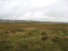
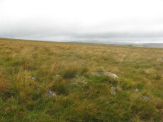
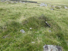
Prehistoric sites within 5km of SX 59038 73512
Guidance for walkers: The monuments featured in this database are archaeological treasures and need to be protected and preserved - please do not disturb any sites. Please check access and firing times before visiting sites, not all sites listed are on open access land. Firing ranges and boundaries of open access areas are marked on the OL28 OS Dartmoor Explorer map. Please stick to the country code and consider giving support to the numerous agencies that help to keep Dartmoor a fabulous natural and historic environment!
About the database listings: In all listings clicking on the photo or the site name will open a page for the site with a larger photo and further details from the database. The database now has over 6680 records covering nearly all publicly listed sites on Dartmoor including around 4800 round houses. This level of detail is of interest to archaeologists but tends to swamp listings of sites more likely to be of interest for walkers. For this reason, the listings default to around 550 core sites only. These are the stone circles, stone rows and the ring cairns listed by Turner. The default search radius is 2 km. The controls below the map can be used to start a new search by entering a 6- or 8-digit reference (without the prefix "SX"). The search radius can be specified and you can add incremental Display layers of detail on top of the core sites. If using a more detailed layer you will need to decrease the search radius to avoid getting hundreds of search results.
- Core sites Default listing of core sites consisting of stone circles & rows and some of the major ring cairns.
- Plus cairns adds approx. 1000 cairns and other minor sites not included in the core listings but excluding round houses.
- Plus round houses adds approx. 4800 round houses.
- Plus non-sites adds in the records for sites that no longer exist or are not prehistoric sites.
- Plus duplicates adds records excluded as duplicates. Those maybe duplicate records in external listings (e.g. the Historic Environment Records). For example, some sites have been identified as cairns in some listings and interpreted as round houses in other listings and both records appear.
These listings have incorporated, matched up and merged all of the records from all of the major archaeological listings including: Worth, Grinsell, Turner, Butler, Bill Radcliffe, Sandy Gerrard, Megalithic Portal, the National Monument Records and the Historic Environment Records. The author would like to thank Bill, Sandy, the lovely people both at Megalithic Portal (especially Anne Tate who did an amazing job to link listings) and at ACE Archaeology for collaborative work over the years to synchronise and correct listings across the various websites which now interlink. A culmination of years of work the final merger of cairn records took 3 months of cross referencing in 2017 the result being a snapshot of the records at that time. This data has in turn been refined since by field work and research. The round house data was supplied by Sandy Gerrard. Grid references are in order of accuracy: from Google Earth satellite, if visible and found, from a Garmin GPS reading, if visited by the author and from the literature otherwise. Individual site pages will state the source of the grid reference and provide satellite imagery. If a site listing lacks a photo it has not yet been visited by the author in which case the grid reference is from the literature.
Currently the database only includes sites which can be represented by a grid reference. Reaves are not included as they require GIS shape technology which is beyond the current capability of this system. To see the sources for the records, look at the tables on the resources menu. The database listings can also be viewed on a Google map and downloaded as GPS datasets for Garmin devices.
Corrections, or any feedback or suggestions are very welcome, email: info@dartmoorwalks.org.uk.
NOTE: Clicking on the icons for each monument in the map will give the name of the site. You can zoom in and out and drag the map around.
List of sites within 5km of SX 59038 73512
Blackbrook (Prowse) Reported Cist
OS Map: SX 6050 7384
HER: MDV6247
PMD: Blackabrook W.
ShortName: CT?Blackbrk 3
Notes: Prowse, A. B., 1901, The Antiquities of Ockery and Roundhill. An imperfect ring of stones five yards in diameter, which must at some time have encircled a kisvaen. Doubtful!
Nearby sites: SX 6050 7384
Distance: 1.50km
Littaford Tor E Cist
OS Map: SX 61846 76717
PMD: Littaford Tor E.
ShortName: CT Littaford 1
Notes: Radcliffe: "Long axis approx W-E . Stones visible on N ,E and S sides and some stone could be felt under grass on W side. Approx. 1m x 0.5m x 0.5m depth internally. No obvious sign of cairn mound. No obvious stonecutting in vicinity. TAP Greeves (pers. comm.) "
Nearby sites: SX 61846 76717
Distance: 4.26km
Blakey Tor Cairn
OS Map: SX 6115 7373
HER: MDV18419
PMD: Blakey Tor
ShortName: CN:Blakey Tor
Notes: Radcliffe, doubtful cist: Possibly the cairn referred to in an English Heritage Report and by Fletcher and Dunn in "Patterns of the Past", at SX 6115 7373, as a cairn having a "shallow depression in its top".
Nearby sites: SX 6115 7373
Distance: 2.12km
Raddick Hill SE pound Cist
OS Map: SX 57712 70827
PMD: Raddick Hill SE pound
ShortName: CT Raddick 2
Notes: Radcliffe: "Possible cist found by RH Bruce on 11th Feb 2016. A stone set vertically across a section of the pound wall, with another stone aligned with the wall, the two giving the appearance of a side and end of a cist. There are two large stones downslope within the pound, possibly another sidestone and capstone. The DNPA archaeologist happened to be on hand, and agreed it is a possible cist." Visited by author on 22/07/19 - looks very much like a cist embedded in a pound wall. There is no HER entry for this site, the enclosed settlement is HER record MDV4952.
Nearby sites: SX 57712 70827
Distance: 2.99km
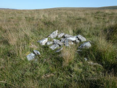
Meavy (W of) Cairn
OS Map: SX 57541 71732
HER: MDV58104
ShortName: CN Meavy W
Notes: Cairn lying immediately w of the scarp formed by alluvial streamworking in the valley bottom. Survives as 4m diam mound standing up to 0.8m high. No sign of robbing. The HER gives a grid reference of SX 5750 7171 - there is nothing at that location and it is most probable that the record refers to the cairn in the photo located at SX 57541 71732.
Gerrard, s. /meavy valley archaeology/5(1997)14;fig 5.
Nearby sites: SX 57541 71732
Distance: 2.33km
Raddick Hill W.2 Cairn
OS Map: SX 57553 70832
HER: MDV48476
ShortName: CN Raddick W2
Butler map: 46.3.2
Notes: Butler Raddick Hill W.1-7 has been split into 7 records.NMR: 8 cairns, see also 440321. See Butler Vol.3 p56-7 fig 46.3 - group of cairns just north of enclosure C. The author visited this group of cairns on 22/07/19. It is impossible to match up these cairns with these records. Butler gave just one grid reference for the group and the HER entries do not accurately transpose on to what is actually there on the ground. The grid references used for this group of records match the location of the site in the photo as recorded with a Garmin GPS device. The assignment/match with HER records is arbitrary and/or as good a match going by cairn size as the grid references are too inaccurate to match by location.
This cairn notably has a hole that matches a slab that was clearly displaced from it and is located near the cairn.
Nearby sites: SX 57553 70832
Distance: 3.06km
Raddick Hill W.3 Cairn
OS Map: SX 57516 70834
HER: MDV48474
ShortName: CN Raddick W3
Butler map: 46.3.3
Notes: Butler Raddick Hill W.1-7 has been split into 7 records.NMR: 8 cairns, see also 440321. See Butler Vol.3 p56-7 fig 46.3 - group of cairns just north of enclosure C. The author visited this group of cairns on 22/07/19. It is impossible to match up these cairns with these records. Butler gave just one grid reference for the group and the HER entries do not accurately transpose on to what is actually there on the ground. The grid references used for this group of records match the location of the site in the photo as recorded with a Garmin GPS device. The assignment/match with HER records is arbitrary and/or as good a match going by cairn size as the grid references are too inaccurate to match by location.
Nearby sites: SX 57516 70834
Distance: 3.08km
Raddick Hill W.4 Cairn
OS Map: SX 57575 70857
HER: MDV48475
ShortName: CN Raddick W4
Butler map: 46.3.4
Notes: Butler Raddick Hill W.1-7 has been split into 7 records.NMR: 8 cairns, see also 440321. See Butler Vol.3 p56-7 fig 46.3 - group of cairns just north of enclosure C. The author visited this group of cairns on 22/07/19. It is impossible to match up these cairns with these records. Butler gave just one grid reference for the group and the HER entries do not accurately transpose on to what is actually there on the ground. The grid references used for this group of records match the location of the site in the photo as recorded with a Garmin GPS device. The assignment/match with HER records is arbitrary and/or as good a match going by cairn size as the grid references are too inaccurate to match by location.
Nearby sites: SX 57575 70857
Distance: 3.03km
Peek Hill E.1 Cairn
OS Map: SX 5576 6995
HER: MDV28525
ShortName: CN:PeekHill E1
Nearby sites: SX 5576 6995
Distance: 4.84km
Raddick Hill W.5 Cairn
OS Map: SX 57568 70875
HER: MDV50705
ShortName: CN Raddick W5
Butler map: 46.3.5
Notes: Butler Raddick Hill W.1-7 has been split into 7 records.NMR: 8 cairns, see also 440321. See Butler Vol.3 p56-7 fig 46.3 - group of cairns just north of enclosure C. The author visited this group of cairns on 22/07/19. It is impossible to match up these cairns with these records. Butler gave just one grid reference for the group and the HER entries do not accurately transpose on to what is actually there on the ground. The grid references used for this group of records match the location of the site in the photo as recorded with a Garmin GPS device. The assignment/match with HER records is arbitrary and/or as good a match going by cairn size as the grid references are too inaccurate to match by location.
Nearby sites: SX 57568 70875
Distance: 3.02km
Raddick Hill W.6 Cairn
OS Map: SX 57564 70895
HER: MDV50745
ShortName: CN Raddick W6
Butler map: 46.3.6
Notes: Butler Raddick Hill W.1-7 has been split into 7 records.NMR: 8 cairns, see also 440321. See Butler Vol.3 p56-7 fig 46.3 - group of cairns just north of enclosure C. The author visited this group of cairns on 22/07/19. It is impossible to match up these cairns with these records. Butler gave just one grid reference for the group and the HER entries do not accurately transpose on to what is actually there on the ground. The grid references used for this group of records match the location of the site in the photo as recorded with a Garmin GPS device. The assignment/match with HER records is arbitrary and/or as good a match going by cairn size as the grid references are too inaccurate to match by location.
Nearby sites: SX 57564 70895
Distance: 3.00km
Raddick Hill W.7 Cairn
OS Map: SX 57428 70748
ShortName: CN Raddick W7
Butler map: 46.3.7
Notes: Butler Raddick Hill W.1-7 has been split into 7 records.NMR: 8 cairns, see also 440321. See Butler Vol.3 p56-7 fig 46.3 - group of cairns just north of enclosure C. The author visited this group of cairns on 22/07/19. It is impossible to match up these cairns with these records. Butler gave just one grid reference for the group and the HER entries do not accurately transpose on to what is actually there on the ground. The grid references used for this group of records match the location of the site in the photo as recorded with a Garmin GPS device. The assignment/match with HER records is arbitrary and/or as good a match going by cairn size as the grid references are too inaccurate to match by location.
UPDATE 02/01/2023 HER entry MDV50943 that this record used to link to has been deleted. The are new HER entries but they are too confusing to match up in any meaningful way.
Nearby sites: SX 57428 70748
Distance: 3.21km
Fox Tor Mire Cairn
OS Map: SX 618 701
HER: MDV12968
ShortName: CN:FoxTorMire
Grinsell: LYD 95a
Notes: On a gentle N slope is a peaty mound 3.5m in diameter and 0.3m high. On its W perimeter are two large earthfast stone 0.6m high. Several smaller ones protude through the peat near the centre indicating a stone content.
Nearby sites: SX 618 701
Distance: 4.39km
Ter Hill N.W.3 Reported Cairn
OS Map: SX 6289 7109
HER: MDV12969
ShortName: CN:Ter Hill 3
Grinsell: LYD 98a
Notes: A low turf-covered mound situated at SX 62887108 is probably the feature noted by both Fox and Grinsell. It lies in tall cotton grass on a south-west facing peat-covered hiislope in an area covered by low swellings, gullies and a marked accumulation of surface peat.
Nearby sites: SX 6289 7109
Distance: 4.55km
Black Tor 13 Reported Cairn
OS Map: SX 5696 7130
HER: MDV50265
ShortName: CN:BlackTor13
Notes: Duplicate: The HER description of this cairn is identical to the Black Tor 1 stone row cairn (HER 50268). The location however, is identical to Black Tor 5 (HER 50266) at SX 5696 7130. According to Butler there is a group of 3 cairns at the end of the stone row. Black Tor 1-3. A bit further south-west are some more cairns (4, 5, 6-11). This entry is an amalgam of 1 and 5.
Nearby sites: SX 5696 7130
Distance: 3.03km
Newleycombe Lake Cairn
OS Map: SX 5963 6983
HER: MDV52393
ShortName: CN:Newleycombe
Nearby sites: SX 5963 6983
Distance: 3.73km
Crockern Tor 2 Cairn
OS Map: SX 61262 75987
HER: MDV52777
ShortName: CN CrockernNW2
Nearby sites: SX 61262 75987
Distance: 3.33km
Littaford Tor 3 Cairn
OS Map: SX 61849 77048
HER: MDV52779
ShortName: CN Littaford3
Nearby sites: SX 61849 77048
Distance: 4.52km
Muddilake (N) Reported Cairn
OS Map: SX 62761 75202
HER: MDV48858
ShortName: CN?Muddilake 2
Turner: A37
Notes: Probable remains of a hut circle; this feature has previously been identified as a cairn. One of several associated with settlement site north of Muddilake Brook. Probably the second hut circle on NMR entry 442677
Nearby sites: SX 62761 75202
Distance: 4.09km
Joan Ford's Newtake N.1 Cairn
OS Map: SX 62970 72264
HER: MDV18389
Alternate name: Joan Ford's Newtake N.1 Cairn
ShortName: CN JoanFd N1
Butler map: 63.3
Nearby sites: SX 62970 72264
Distance: 4.13km
Joan Ford's Newtake N.2 Cairn Circle
OS Map: SX 63002 72332
HER: MDV54460
Alternate name: Joan Ford's Newtake N.2 Cairn Circle
ShortName: CN JoanFd N2
Butler map: 63.3
Notes: "A probable ring cairn situated on a slight NW slope. At least eight tin pits occur immediately to the E and S, and modern small stone clearance heaps are visible everywhere. The circular turf-covered stony bank is 12.2m in overall diameter, 2.0m wide and on average 0.4m high; a few stones protrude through the turf but there is no obvious trace of a kerb, slabs or boulders. Two or three modern clearance heaps lie on the bank and a gap on the N side with an adjacent corresponding pile of spoil is probably a recent mutilation" The photo shows one of the heaps on the bank which can just be seen.
Nearby sites: SX 63002 72332
Distance: 4.14km
Joan Ford's Newtake N.4 Clearance Cairn
OS Map: SX 62911 72319
HER: MDV18390
Alternate name: Joan Ford's Newtake N.4 Clearance Cairn
ShortName: CN JoanFd N4
Butler map: 63.3
Nearby sites: SX 62911 72319
Distance: 4.05km
Swincombe Ford Newtake 2 Reported Cairn
OS Map: SX 6331 7307
HER: MDV130278
ShortName: CN?Swincombe 2
Butler map: 63.5.2
Notes: Butler: "A short distance to the north is a smaller oval mound ... possibly a second burial cairn". Not listed on NMR or HER.
Nearby sites: SX 6331 7307
Distance: 4.29km
Round Hill S.1 Reported Cairn
OS Map: SX 6099 7415
HER: MDV6372
ShortName: CN?Roundhill S
Butler map: 65.1.4
Grinsell: LYD 77
Nearby sites: SX 6099 7415
Distance: 2.05km
Round Hill E.2 Reported Cairn
OS Map: SX 6161 7441
HER: MDV18229
ShortName: CN:RoundHillE2
Notes: HER quoting Quinnell: The earthwork noted by Greeves (1982) is at SX 61607440 on a triangular patch of moorland, effectively isolated by a silted stream course on the W and S and tinworkings to the E, with the West Dart to the N.
The feature consists of a circular turf-covered platform, 8.7m in diameter and 0.2m high, with a very slight E slope. Apart from the E quadrant it is enclosed by a bank 1.4m wide, 0.4m high externally and 0.2m high on the inner face. Probing suggests that the bank is wholly of turf. Outside is a ditch, 2m wide and 0.1m deep. Both bank and ditch are clear around the western half but fade to the E, where the extremity has been cut away by a tinner's trench.
Outside the earthwork a peaty soil overlies growan with very little stone. Constructionally it is unlike the round houses of the local open settlements, and Greeves may be correct with his suggestion that it could be a ring cairn. Its low lying situation, 1m higher than the bank of the West Dart, can be parallel by the cists alongside Blackbrook River (SX 67 SW 18).
See also duplicate entry for possible round house. Roundhill Round House
Nearby sites: SX 6161 7441
Distance: 2.72km
Cholake Head Cairn
OS Map: SX 61460 73070
HER: MDV6307
ShortName: CN:Cholake
Butler map: 65.2
Grinsell: LYD 87
Barrow Report: 27
Notes: HER: Turf-covered cairn lies on a broad slopping shelf on the E slopes of Royal Hill at 387m OD. Its diameter is approximately 5.2m by 4.9m and it has a maximum height of 0.5m a central pit is 2.5m across and 0.2m deep. Some stones and small orthostats protrude through the turf but there is no trace of a kerb or cist. Its relationship to a prehistoric wall (SX 67 SW 68), which extends from both the W and E sides of the cairn, is uncertain.
Nearby sites: SX 61460 73070
Distance: 2.46km
Round Hill S.E.4 Cairn Circle & Cist
OS Map: SX 6063 7396
HER: MDV6250
PMD: Roundhill Leat
ShortName: CN:RoundhilSE4
Butler map: 65.3.4
Grinsell: LYD 83
Notes: Prowse 1901. Cairn with retaining circle. Remnant of a small cairn enclosing portions of two kists side by side, level with the surface and nearly filled up with soil. Note - cists no longer visible.
Nearby sites: SX 6063 7396
Distance: 1.65km
Yellowmeade 2 Reported Cist
OS Map: SX 56460 74413
HER: MDV28491
ShortName: CN:Yellowm Fm2
Butler map: 44.1.2
Notes: HER: a cairn, of possibly prehistoric date measuring 3.3m across x 0.3m high, with no definite kerb but one recumbent slab stone on the east side. It is near a ruined hut circle and a newtake wall may indicate a collection heap for wall construction. Butler: Yellowmeade Cairn '2' at SX56467442 of 3.0 metres by 4.5 metres by 0.3 metres high. Oval mound lying a few metres from Hut Circle '9' which was obviously the source of its stones. Gerrard: Round cairn 4m by 3.5m by 0.5m high. Cist. Large number of large stones protruding. Several stones are edge set. Low grass cover.
Barrow Report 67 and Gerrard suggest this could be a cist.
Nearby sites: SX 56460 74413
Distance: 2.73km
Royal Hill E.2 Reported Cairn
OS Map: SX 6179 7195
HER: MDV130297
ShortName: CN?RoyalHill 2
Butler map: 65.5.2
Notes: Butler: A tiny satellite cairn inconspicuous some 30 m to the west has been exposed by turf cuters in the old ties across the summit. HER: Small Cairn '2' (Butler) on the summit of the south-eastern projection of Royal Hill
Nearby sites: SX 6179 7195
Distance: 3.16km
Royal Hill E.6 Cairn
OS Map: SX 6208 7257
HER: MDV28603
ShortName: CN:RoyalHill 6
Butler map: 65.5.6
Notes: HER: Turf-covered cairn is situated on a flat plain near the foot of the steep eastern slope of Royal Hill. It measures 5.7m in diameter, about 0.45m high and it has a central hollow approximately 1.5m in diameter and 0.3m deep in the top. On the northern side a few small ?upright stones, a maximum of 0.3m high, may mark the remnants of a kerb. There is no trace of a cist. Numerous small stone heaps, mostly dumped 19th century stone clearance material, are evident in the general vicinity
Nearby sites: SX 6208 7257
Distance: 3.18km
Merrivale Bridge E. Reported Cairn
OS Map: SX 557 752
HER: MDV61740
ShortName: CN:Merrivale20
Nearby sites: SX 557 752
Distance: 3.74km
Down Tor, SE of, Tor cairn Cairn
OS Map: SX 58105 69391
HER: MDV61957
ShortName: CN:DownTor 1
Notes: "6m by 5.8m by 0.4m high. Two parallel lines of edge set stones form the n side of the cairn. They lead from a large granite outcrop situated to the w. The inner line of stones survives as a 4.3m long by 0.8m wide line of at least 10 stones. The outer is 4m long and also includes at least 10 stones. The s side is denoted by 9 stones set on top of a large granite boulder. The e side includes a jumble of large stones, with others lying on the slope directly below. The w side is formed by the tor. The area enclosed by these features measures 6m wide at the w end, 2.8m wide at the e end and up to 4.3m long e-w."
Nearby sites: SX 58105 69391
Distance: 4.23km
Merrivale 12 Cairn
OS Map: SX 55640 74870
HER: MDV28493
ShortName: CN Merrivale12
Butler map: 44.8.12
Nearby sites: SX 55640 74870
Distance: 3.66km
Merrivale reave 13 Reported Cairn
OS Map: SX 55605 74758
HER: MDV4961
ShortName: CN-Merrivale13
Butler map: 44.8.13
Notes: Their form and positioning does not suggest either a prehistoric origin nor a sepulchral use. [N.B. This Butler entry Merrivale reave cairns 13 (1-5) has been separated into individual sites.]
Nearby sites: SX 55605 74758
Distance: 3.65km
North Hessary Tor 1 Cairn
OS Map: SX 57877 74224
HER: MDV5015
ShortName: CN:North Hes 1
Butler map: 44.9.1
Grinsell: WAL 8
Nearby sites: SX 57877 74224
Distance: 1.36km
Sharpitor W.5 Cairn
OS Map: SX 5533 7055
HER: MDV62016
ShortName: CN:SharpitorW5
Notes: "Cairn situated adjacent to a field system on Walkhampton Common. Dimensions of cairn: 0.7 metres high, 9.8 metres by 5 metres. Central pit 1 metres by 0.8 metres by 0.15 metres. Oval mound with stones protruding. Oriented east-west. Probably a cairn, though may be connected with nearby field system."
Nearby sites: SX 5533 7055
Distance: 4.75km
North Hessary Tor 2 Reported Cairn
OS Map: SX 5778 7432
HER: MDV131561
ShortName: CN?North Hes 2
Butler map: 44.9.2
Notes: Butler: A more likely xample of a burial cairn lies about 100m downhill [from the North Hessary Tor summit cairn] to the north, a very disurbed mound beside the road.
Nearby sites: SX 5778 7432
Distance: 1.50km
Vixen Tor 2 Cairn
OS Map: SX 54174 74459
HER: MDV35898
ShortName: CN Vixen Tor 2
Butler map: 44.10.2
Notes: This entry originates from Butler at SX 5417 7446. Previously this entry had been associated with a mound at SX 54115 74445 (photo and grid reference). On 14/10/24 the author visited this location with Steve Szypko and we concluded this was a misidentification. The photo above and the grid reference have been updated to the correct feature referred to by Butler. The second photo here is of the feature previously recorded as this cairn (photo 14/09/2020) at SX 54115 74445. It is possible they are both cairns.
The HER grid reference is SX 54130 74460
Nearby sites: SX 54174 74459
Distance: 4.96km
Sharpitor S.E. Reported Cairn
OS Map: SX 56181 70232
HER: MDV28501
ShortName: CN:Sharp SE
Butler map: 45.4
Nearby sites: SX 56181 70232
Distance: 4.35km
Peek Hill Summit 1 Cairn
OS Map: SX 55650 69959
HER: MDV63628
ShortName: CN:PeekHill 1
Butler map: 45.5.1
Notes: Two cairns - one not included by Butler
Nearby sites: SX 55650 69959
Distance: 4.91km
Cuckoo Rock 1 Cairn
OS Map: SX 5909 6881
HER: MDV3477
ShortName: CN:Cuckoo 1
Notes: UPDATE 31/12/2022. The 8 HER records MDV66371 - MDV66378 that these records were based on have since been deleted. The old NMR record has this entry:
Summary : Remains of a cairnfield and enclosure. The cairnfield contains at least sixteen circular and oval mounds, with five arranged in a single line along the contour. The enclosure, which incorporates two of the cairns, is defined by a rubble bank.
Centred at SX 590 687 are seven stony mounds in a boulder-free area some 90.0m by 130.0m. They average 3.0m in diameter and 0.7m high. Also visible is the fragmentary remains of a field
25.0m by 38.0m with rubble walling 0.8m wide and 0.3m high. It is fairly certain these are the mounds referred to by Breton. The general situation, construction and appearance of the mounds suggests that they are clearance. The period of the clearance is uncertain though the apparently prehistoric field wall has also been partly stripped out suggesting a late (19th century) date.
The mounds are at, SX 59096881, SX 59146880, SX 59136879, SX 59096879, SX 59096875, SX 59106874 and SX 59106873.
Surveyed at 1:10 000 on MSD. (2)
SX 59106878. Remains of a Bronze Age cairnfield and enclosure. The cairnfield contains at least nine circular and oval mounds, with five arranged in a single line along the contour. The enclosure, which incorporates two of the cairns, is defined by a rubble bank. A large stone set through the southern bank may represent the site of an original entrance. Scheduled. (3)
Sixteen small turf covered mounds, and a short length of bank have been recorded. The largest of the cairns is 3m diameter by 0.4m high. The bank is less than 1m wide by 0.2m high. There can be no certainty as to date for any of these features, though the existence of a nearby settlement suggests a prehistoric origin. (4)
Nearby sites: SX 5909 6881
Distance: 4.70km
Peek Hill Summit 2 Cairn
OS Map: SX 55623 69942
HER: MDV28529
ShortName: CN:PeekHill 2
Butler map: 45.5.2
Nearby sites: SX 55623 69942
Distance: 4.94km
Cuckoo Rock 2 Cairn
OS Map: SX 5912 6881
HER: MDV3477
ShortName: CN:Cuckoo 2
Notes: UPDATE 31/12/2022. The 8 HER records MDV66371 - MDV66378 that these records were based on have since been deleted. Summary : Remains of a cairnfield and enclosure. The cairnfield contains at least sixteen circular and oval mounds, with five arranged in a single line along the contour. The enclosure, which incorporates two of the cairns, is defined by a rubble bank. NB. See first of these records for further details.
Nearby sites: SX 5912 6881
Distance: 4.70km
Cuckoo Rock 3 Cairn
OS Map: SX 5908 6878
HER: MDV3477
ShortName: CN:Cuckoo 3
Notes: UPDATE 31/12/2022. The 8 HER records MDV66371 - MDV66378 that these records were based on have since been deleted. Summary : Remains of a cairnfield and enclosure. The cairnfield contains at least sixteen circular and oval mounds, with five arranged in a single line along the contour. The enclosure, which incorporates two of the cairns, is defined by a rubble bank. NB. See first of these records for further details.
Nearby sites: SX 5908 6878
Distance: 4.73km
Sharpitor W.1 Cairn
OS Map: SX 55093 70784
HER: MDV5012
ShortName: CN:SharpitorW1
Butler map: 45.11.1
Grinsell: WAL 19
Notes: HER: A low cairn with a trench cut through it and now covered by bracken vegetation. Situated on a crest it affords impressive vistas over 270 degrees to the west. Recorded during fieldwork survey in 2007 and using geophysics in 2021, which detected possible ditch around this cairn, as well as suggesting the stone row might extend as far as this cairn.
Nearby sites: SX 55093 70784
Distance: 4.80km
Cuckoo Rock 4 Cairn
OS Map: SX 5909 6875
HER: MDV3477
ShortName: CN:Cuckoo 4
Notes: UPDATE 31/12/2022. The 8 HER records MDV66371 - MDV66378 that these records were based on have since been deleted. Summary : Remains of a cairnfield and enclosure. The cairnfield contains at least sixteen circular and oval mounds, with five arranged in a single line along the contour. The enclosure, which incorporates two of the cairns, is defined by a rubble bank. NB. See first of these records for further details.
Nearby sites: SX 5909 6875
Distance: 4.76km
Sharpitor W.2 Cairn
OS Map: SX 5509 7065
HER: MDV19964
ShortName: CN:SharpitorW2
Butler map: 45.11.2
Notes: Cairn in a group of three to the south-east of the stone row on Walkhampton Common. Only two were found in 2019.
Nearby sites: SX 5509 7065
Distance: 4.88km
Cuckoo Rock 5 Cairn
OS Map: SX 5910 6874
HER: MDV3477
ShortName: CN:Cuckoo 5
Notes: UPDATE 31/12/2022. The 8 HER records MDV66371 - MDV66378 that these records were based on have since been deleted. Summary : Remains of a cairnfield and enclosure. The cairnfield contains at least sixteen circular and oval mounds, with five arranged in a single line along the contour. The enclosure, which incorporates two of the cairns, is defined by a rubble bank. NB. See first of these records for further details.
Nearby sites: SX 5910 6874
Distance: 4.77km
Sharpitor W.3 Cairn
OS Map: SX 5511 7066
HER: MDV61947
ShortName: CN:SharpitorW3
Butler map: 45.11.3
Notes: HER: One of three cairn to the south-east of the stone row on Walkhampton Common the western of two cairns on eastern boundary of field system to the north-east of Horseyeatt
Nearby sites: SX 5511 7066
Distance: 4.85km
Cuckoo Rock 6 Cairn
OS Map: SX 5910 6873
HER: MDV3477
ShortName: CN:Cuckoo 6
Notes: UPDATE 31/12/2022. The 8 HER records MDV66371 - MDV66378 that these records were based on have since been deleted. Summary : Remains of a cairnfield and enclosure. The cairnfield contains at least sixteen circular and oval mounds, with five arranged in a single line along the contour. The enclosure, which incorporates two of the cairns, is defined by a rubble bank. NB. See first of these records for further details.
Nearby sites: SX 5910 6873
Distance: 4.78km
Sharpitor W.4 Cairn
OS Map: SX 5512 7065
HER: MDV61948
ShortName: CN:SharpitorW4
Butler map: 45.11.4
Notes: HER: One of three cairns to the south-east of the stone row on Walkhampton Common The eastern of two cairns on eastern boundary of field system to the north-east of Horseyeatt
Nearby sites: SX 5512 7065
Distance: 4.85km
Cuckoo Rock 7 Cairn
OS Map: SX 5912 6878
HER: MDV3477
ShortName: CN:Cuckoo 7
Notes: UPDATE 31/12/2022. The 8 HER records MDV66371 - MDV66378 that these records were based on have since been deleted. Summary : Remains of a cairnfield and enclosure. The cairnfield contains at least sixteen circular and oval mounds, with five arranged in a single line along the contour. The enclosure, which incorporates two of the cairns, is defined by a rubble bank. NB. See first of these records for further details.
Nearby sites: SX 5912 6878
Distance: 4.73km
Sharpitor N.W. stone row Cairn
OS Map: SX 55669 70611
HER: MDV14794
ShortName: CN Sharp NW
Butler map: 45.12
Grinsell: WAL 20
Notes: HER: Small disturbed cairn at the south-western end of the double stone row north-west of Sharpitor. Diameter up to 5 metres and height 0.3 - 0.4 metres. Possible ditch around cairn detected during geophysical survey in 2021.
Nearby sites: SX 55669 70611
Distance: 4.45km
Cuckoo Rock 8 Cairn
OS Map: SX 5915 6879
HER: MDV3477
ShortName: CN:Cuckoo 8
Notes: UPDATE 31/12/2022. The 8 HER records MDV66371 - MDV66378 that these records were based on have since been deleted. Summary : Remains of a cairnfield and enclosure. The cairnfield contains at least sixteen circular and oval mounds, with five arranged in a single line along the contour. The enclosure, which incorporates two of the cairns, is defined by a rubble bank. NB. See first of these records for further details.
Nearby sites: SX 5915 6879
Distance: 4.72km
Sharpitor N.E. stone row Cairn
OS Map: SX 56146 70810
HER: MDV50703
ShortName: CN Sharp NE1
Butler map: 45.13
Grinsell: WAL 21a
Barrow Report: 42
Nearby sites: SX 56146 70810
Distance: 3.96km
Sharpitor N.E. Cairn
OS Map: SX 56198 70821
HER: MDV14309
ShortName: CN Sharp NE2
Butler map: 45.13
Grinsell: WAL 22
Barrow Report: 42
Nearby sites: SX 56198 70821
Distance: 3.91km
Leeden Tor S.1 Cairn
OS Map: SX 56327 70903
HER: MDV19965
ShortName: CN LeedenTor 1
Butler map: 45.13.1
Nearby sites: SX 56327 70903
Distance: 3.76km
Littaford Tor 2 Reported Cairn
OS Map: SX 61430 76490
HER: MDV52778
ShortName: CN Littaford 2
Butler map: 29.1
Notes: A large granite slab lies the W side and a boulder is exposed just N of the centre. These may be part of a distroyed cist, but the boulder is very irregular and looks like a natural stone in situ around which the cairn may have been built.
Nearby sites: SX 61430 76490
Distance: 3.82km
Leeden Tor S.3 Cairn
OS Map: SX 56452 70842
HER: MDV3747
ShortName: CN LeedenTor 3
Butler map: 45.13.3
Grinsell: WAL 24
Barrow Report: 66
Notes: NMR B
Nearby sites: SX 56452 70842
Distance: 3.72km
Black Tor 1 stone row Cairn
OS Map: SX 56990 71383
HER: MDV50268
The Stone Rows of GB: Black Tor Stanlake
ShortName: CN:BlackTor 1
Butler map: 45.14.1
Notes: The southern end of the Black Tor stone row is terminated by one large cairn (1) with two smaller and close by satellite cairns (2 & 3). See diagram in Butler Vol 3 p.49 and the photograph of the cairns on the Stone Row Of Great Britain site.
Nearby sites: SX 56990 71383
Distance: 2.95km
Black Tor 2 Cairn
OS Map: SX 56993 71384
HER: MDV50151
The Stone Rows of GB: Black Tor Stanlake
ShortName: CN:BlackTor 2
Butler map: 45.14.2
Notes: The southern end of the Black Tor stone row is terminated by one large cairn (1) with two smaller and close by satellite cairns (2 & 3). See also diagram in Butler Vol 3 p.49 and the photograph of the cairns on the Stone Row Of Great Britain site. (? See also: 1472559)
Nearby sites: SX 56993 71384
Distance: 2.95km
Royal Hill E.8 Cairn
OS Map: SX 6227 7130
HER: MDV78792
ShortName: CN?RoyalHill 8
Nearby sites: SX 6227 7130
Distance: 3.92km
Broad Hole S. Reported Cairn
OS Map: SX 5915 7824
HER: MDV49705
ShortName: CN:BroadHole S
Butler map: 29.14
Notes: HER has this listed as a hut circle. Butler describes as a cairn and NMR suggests possible capstone of a cist. Butler OS SX 5910 7824. NMR OS SX 5915 7824
Nearby sites: SX 5915 7824
Distance: 4.73km
Black Tor 3 Cairn
OS Map: SX 57000 71378
HER: MDV50267
The Stone Rows of GB: Black Tor Stanlake
ShortName: CN:BlackTor 3
Butler map: 45.14.3
Notes: The southern end of the Black Tor stone row is terminated by one large cairn (1) with two smaller and close by satellite cairns (2 & 3). See also the diagram in Butler Vol 3 p.49 and the photograph of the cairns on the Stone Row Of Great Britain site. (? See also: 1472559)
Nearby sites: SX 57000 71378
Distance: 2.95km
Black Tor 4 Cairn
OS Map: SX 5696 7131
ShortName: CN:BlackTor 4
Butler map: 45.14.4
Notes: UPDATE 31/12/2022. The HER record MDV50264 that this record used to link to has been deleted. This record originates with Butler's listings and will be retained. Field work is required to determine which of these Black Tor cairns exist.
Nearby sites: SX 5696 7131
Distance: 3.03km
Black Tor 5 Cairn
OS Map: SX 5696 7130
HER: MDV50266
ShortName: CN?BlackTor 5
Butler map: 45.14.5
Notes: ? See aso: 1472559
Nearby sites: SX 5696 7130
Distance: 3.03km
Black Tor 6-11 Cairn
OS Map: SX 570 713
HER: MDV4992
ShortName: CN:BlackTor 6
Butler map: 45.14.6-11
Notes: ? See aso: 1472559
Nearby sites: SX 570 713
Distance: 3.01km
Merrivale Bridge N. Reported Cairn
OS Map: SX 55256 75145
HER: MDV28518
ShortName: CN Merrivale22
Butler map: 30.7
Notes: Cairn or hut? "Recorded by Ordnance Survey (1979) as a hut, but Gerrard (1999) suggests it is a cairn. Feature measures 5.7 metres in diameter, height 0.6 metres. Kerb visible in places. Large numbers of rocks with quartz in them. Cairn lies 6 metres from field wall, which appears to kink around it." Visited 09/09/23 - a bit of a jumble of stones covered in vegetation. Identification of correct site not 100% certain but fits with mutilated cairn.
Nearby sites: SX 55256 75145
Distance: 4.12km

Leeden Tor stone row Cairn
OS Map: SX 56525 71482
HER: MDV50220
ShortName: CN:LeedenRow
Butler map: 45.15
Notes: Damaged cairn at the north-western end of a probable stone alignment (MDV50223) on Walkhampton Common. On the line of an (apparently later) reave. The plan in Butler is helpful to finding and understanding this site. The author visited this feature on 15/08/2025 with Steve Szypko. The stone row cairn and the nearby gun emplacement are difficult to find. Following the stone row up and then heading a little west the circular depression for the nearby gun emplacement can be found. This in turn helps to locate the nearby stone row cairn.
Nearby sites: SX 56525 71482
Distance: 3.23km
Raddick Hill W.1 Cairn
OS Map: SX 5755 7082
HER: MDV4963
ShortName: CN:Raddick W1
Butler map: 46.3.1
Notes: Butler Raddick Hill W.1-7 has been split into 7 records.NMR: 8 cairns, see also 440321. See Butler Vol. 3 p56-7 fig 46.3 - group of cairns just north of enclosure C. The author visited this group of cairns on 22/07/19. On that occasion only 6 of these cairns were logged and the co-ordinates did not match up with the HER records. This record records the location of the group cairns and is a place holder for one of the missing cairns - the co-ordinates will be updated to match if and when found.
Nearby sites: SX 5755 7082
Distance: 3.08km
Merrivale 18 Cairn
OS Map: SX 55280 74742
HER: MDV103582
ShortName: CN Merrivale18
Nearby sites: SX 55280 74742
Distance: 3.95km
Raddick Hill W.8 Cairn
OS Map: SX 57355 70855
HER: MDV5010
ShortName: CN:Raddick W8
Butler map: 46.3.8
Notes: NMR & Butler match. Grinsell 17a is a distance at 57477076 WAL 17a?
Nearby sites: SX 57355 70855
Distance: 3.15km
Merrivale 19 Cairn
OS Map: SX 55294 74727
HER: MDV103583
ShortName: CN Merrivale19
Nearby sites: SX 55294 74727
Distance: 3.94km
Raddick Plantation 1 Cairn
OS Map: SX 57511 70303
HER: MDV5008
ShortName: CN:Raddick P1
Butler map: 46.4.1
Notes: Matches NMR. Not clear on Grinsell he gives a grid reference 23m off at 57277028 Burator Wood (WAL 35) WAL 35?
Nearby sites: SX 57511 70303
Distance: 3.55km
Raddick Plantation 2 Cairn
OS Map: SX 57508 70261
HER: MDV48351
ShortName: CN:Raddick P2
Butler map: 46.4.2
Notes: sub-circular cairn, 5m diam, 0.2m high (mpp). Location? Butler's description suggests couldbe octed at SX 57847 70310.
Nearby sites: SX 57508 70261
Distance: 3.59km
Hart Tor single stone row Cairn
Prehistoric Dartmoor Walks: Dartmoor Site: Hart Tor Stone Row & Cairn Circle
OS Map: SX 57722 71707
HER: MDV50150
ShortName: CN Hart Tor S
Butler map: 46.5
Grinsell: WAL 13
Notes: HER coords ar way off by 150m. NMR B
Nearby sites: SX 57722 71707
Distance: 2.23km
Hart Tor S.W. Cairn
OS Map: SX 57569 71662
HER: MDV3739
ShortName: CN HartTor SW1
Butler map: 46.5
Grinsell: WAL 11
Notes: turf covered with hollowed centre.
Nearby sites: SX 57569 71662
Distance: 2.36km
Raddick Hill Summit 1 Reported Cist
OS Map: SX 5782 7098
HER: MDV4951
PMD: Raddick Hill 1
ShortName: CT:RaddickSu1
Butler map: 46.6.1
Grinsell: WAL 17
Barrow Report: 18
Notes: The smaller cairn was excavated and a cist was found. The side stones were sloping so as to form the cist and small stones formed the cover. The barrow was formed by small stones; the cist and the pit in the calm were filled with meat earth and mixed with charcoal. NMR 440137 B
Nearby sites: SX 5782 7098
Distance: 2.81km
Raddick Hill Summit 2 Reported Cist
OS Map: SX 57835 70986
HER: MDV4950
PMD: Raddick Hill 2
ShortName: CT RaddickSu2
Butler map: 46.6.2
Grinsell: WAL 16
Barrow Report: 18
Notes: Cairn with hollow towards centre, excavated nnw, had been previously robbed and capstone missing; large slab on se margin of mound may in fact be this capstone. NMR 440137 A
Nearby sites: SX 57835 70986
Distance: 2.80km
Raddick Hill Summit 5 Reported Cairn
OS Map: SX 58087 71349
ShortName: CN RaddickSu5
Barrow Report: 18
Notes: This mound was found by the author on 22/07/2019 when looking for the Raddick Hill Summit 4 cairn. This is approx 30 metres to the north and has a long oval shape. It looks like a cairn but does not appear in the HER listings. Could it be a possible long cairn?
Nearby sites: SX 58087 71349
Distance: 2.36km
Raddick Hill Summit 4 Cairn
OS Map: SX 58097 71314
HER: MDV4962
ShortName: CN RaddickSu4
Butler map: 46.6.4
Grinsell: WAL 14
Barrow Report: 18
Notes: "cairn mound 7m diam, 1.2m high. A hollow in centre of the mound, measuring 2m long, 0.5m wide and 0.1m deep, suggests partial early excavation or robbing. The site is described by the dartmoor exploration committee as being the one in which a cist containing a piece of bronze was found. It is however more likely that sx57se/73 is the provenance of this find because that cairn more closely fits the description given in the excavation report (mpp). "
Nearby sites: SX 58097 71314
Distance: 2.39km

Narrator Brookhead 2 Reported Cairn
OS Map: SX 59188 69452
HER: MDV3375
ShortName: CN Narrator 2
Butler map: 47.7.2
Notes: Butler: AT the base of Narrator Brookhead 1 on the west side are two tiny mounds nomore than 2.5m across containing upended slabs, miniature cairns like those at the foot of Giant's Basin.
NB. Butler gives a grid reference for these two satellite cairns at SX 5864 6931 which is the cairn circle attached to the stone row at the western end and not Narrator Brookhead 1. A rare mistake by Butler. Thanks to Steve Szypko for assistance in locating this cairn. NB. The HER entry for MDV3375 includes a reference to the Cairn 2 and Cairn 3 (no seprate record)
Nearby sites: SX 59188 69452
Distance: 4.06km

Narrator Brookhead 3 Reported Cairn
OS Map: SX 59190 69448
HER: MDV3375
ShortName: CN Narrator 3
Butler map: 47.7.3
Notes: Butler: AT the base of Narrator Brookhead 1 "on the west side are two tiny mounds nomore than 2.5m across containing upended slabs, miniature cairns like those at the foot of Giant's Basin". No entry in NMR or HER.
NB. Butler gives a grid reference for these two satellite cairns at SX 5864 6931 which is the cairn circle attached to the stone row at the western end and not Narrator Brookhead 1. A rare mistake by Butler. Thanks to Steve Szypko for assistance in locating this cairn. NB. The HER entry for MDV3375 includes a reference to the Cairn 2 and Cairn 3 (no seprate record)
Nearby sites: SX 59190 69448
Distance: 4.07km

Narrator Brookhead 5 Reported Cairn
OS Map: SX 59265 69451
HER: MDV132194
ShortName: CN Narrator 5
Butler map: 47.7.5
Notes: Butler: the overgrown remains of another [cairn] with two inner rings but no apparent retaining circle.
The feature in the photo and at the grid reference for this record is at SX 5927 6945. The grid reference given by Butler is SX 5926 6944. The feature looks like a cairn but doesn't match the description given by Butler very well. Is this a correct identification?
Nearby sites: SX 59265 69451
Distance: 4.07km
Hingston Hill Summit 2 Reported Cairn
OS Map: SX 58753 69483
HER: MDV130432
ShortName: CN-Hingston 2
Butler map: 47.12.2
Notes: Butler: "Another burial mound lies just over the crest 220 m to the north [of te Down Tor cairn and row], an inconspicuous mound at the centre close to a line of tinners' pits". No entry in NMR or HER.
Nearby sites: SX 58753 69483
Distance: 4.04km
Eylesbarrow 1 Cairn
OS Map: SX 59958 68627
HER: MDV4031
ShortName: CN Eylesbarr 1
Butler map: 47.15.1
Grinsell: WAL 33
Barrow Report: 12
Notes: Northern of the 2 large cairns
Nearby sites: SX 59958 68627
Distance: 4.97km

Eylesbarrow 2 Cairn
OS Map: SX 60001 68627
HER: MDV132199
ShortName: CN Eylesbarr 2
Butler map: 47.15.2
Notes: Butler: "Not unusually smaller cairns share the peaks withhe giants and two can be found east of th larger cairn (HER 4014) approximately in line with the reave. Recently added to HER. Thanks to Steve Szypko for assistance locating this feature on 31/10/24.
Nearby sites: SX 60001 68627
Distance: 4.98km

Eylesbarrow 3 Cairn
OS Map: SX 60061 68646
HER: MDV132200
ShortName: CN?Eylesbarr 3
Butler map: 47.15.3
Notes: Butler: "Not unusually smaller cairns share the peaks withhe giants and two can be found east of th larger cairn (HER 4014) approcimately in line with the reave. Recently added to HER. Thanks to Steve Szypko for assistance locating this feature on 31/10/24.
Nearby sites: SX 60061 68646
Distance: 4.97km
Blackbrook 1 Reported Cairn
OS Map: SX 6023 7387
HER: MDV6288
ShortName: CN:Blackbrk 1
Notes: In area of tin working.
Nearby sites: SX 6023 7387
Distance: 1.24km
Burrator 1 Cairn
OS Map: SX 57140 69311
HER: MDV12738
ShortName: CN:Burrator 1
Notes: HER: Round cairn. Mound measures 10 metres in diameter, stands up to 1 metre high and is situated within a post-medieval field.
Nearby sites: SX 57140 69311
Distance: 4.61km
Burrator 2 Clearance Cairn
OS Map: SX 571 692
HER: MDV130728
ShortName: CN:Burrator 2
Notes: HER: Post medieval cairn situated on a west-facing ridge overlooking Burrator Reservoir. The mound measures 10m in diameter it stands up to 1m high and is situated in a post-Medieval field. It lies within an area extensively mined for time and tin earthworks survive nearby..
See also MDV12738 which has a similiar description and is located not far away. See: Burrator 1 Cairn. This grid reference is accurate to within 100 meters - makes it a likely duplicate.
Nearby sites: SX 571 692
Distance: 4.73km
Deancombe Cairn
OS Map: SX 5770 6881
HER: MDV20592
ShortName: CN:Deancombe
Notes: HER: Prehistoric cairn? Probable prehistoric barrow lying in an area of tin workings just south of a track between Middleworth and Deancombe. It consists of a smooth low mound c.12m diameter with a small depression in the centre of it. Probing by J. Turner indicates that it may be of earth / turf construction.
Nearby sites: SX 5770 6881
Distance: 4.89km

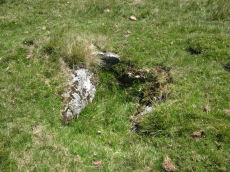
Merrivale Newtake Cist
OS Map: SX 55518 75832
HER: MDV102721
PMD: Merrivale Newtake
ShortName: CT Merrivale25
Notes: Greeves 2006 Very probable prehistoric cist set in a small cairn, with a discrete set slab on east side of cairn mound. The author visited 09/09/23 and while no cist stones were visible (could be covered) the site does look like a possible cist.
Nearby sites: SX 55518 75832
Distance: 4.22km
Raddick Hill (35m SW of cairn) Reported Cist
OS Map: SX 5805 7125
HER: MDV21891
PMD: Raddick Hill
ShortName: CT?Raddick 1
Notes: (greeves + edwards) approx 35m sw of cairn at sx58107130 is the site of possible cist, showing side-, end- and coverstones all intact. Could conceivably be natural however
Nearby sites: SX 5805 7125
Distance: 2.47km
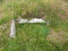
Bachelors Hall Reported Cist
OS Map: SX 60426 73665
HER: MDV18392
PMD: Bull Park
ShortName: CT-Bachelors
Notes: Greeves cairn and cist. Supposed cairn & cist poss natural feature. As can be seen in the photo this looks more like a natural feature.
Nearby sites: SX 60426 73665
Distance: 1.40km
Burrator Wood Reported Cairn
OS Map: SX 5727 7028
HER: MDV14311
ShortName: CN?BurratorWd
Grinsell: WAL 35
Notes: All are in a conifer plantation but are undoubtedly clearance cairns, probably of 18/19th century date when the area was enclosed.
Nearby sites: SX 5727 7028
Distance: 3.68km
Leeden Tor S.W. Reported Cairn
OS Map: SX 56200 71500
ShortName: CNxLeeden SW
Notes: Breton p.12: In a cairn S.W. of Leeden Tor a large urn 1 ft. high was found some years ago, about 6 in. under the surface of the calm ground which had a spout and a handle. The cairn was taken away by road menders and unfortunately the urn was broken up.
This cairn is not mentioned by Butler but referring to the damage to the nearby Leeden Tor South settlement he states (p.36): Unfortunately this part of the hillside has been quarried on a small scale, probably soon after 1812 when the old road was turnpiked, resulting in numerous pits and trenches across the site.
Nearby sites: SX 56200 71500
Distance: 3.48km
Royal Hill E. Cairn Cemetry A Clearance Cairn
OS Map: SX 6265 7227
HER: MDV18401
ShortName: CN:RoyalHillA
Notes: "Cairn A. The most northerly is crest-sited as you approach uphill from the south, with concave centre. Approximately 4.0 metres in diameter, Maximum height of 0.4 metres with a 2.0 metre length of wall attached to the south-west." Part of cairn cemetry consisting of 8 reported 8 cairns, see master record SiteID 4068 (MDV18401)
Nearby sites: SX 6265 7227
Distance: 3.82km
Royal Hill E. Cairn Cemetry B1 Clearance Cairn
OS Map: SX 6259 7223
HER: MDV18401
ShortName: CN:RoyalHillB1
Notes: Cairn B. 1st of line of cairns B-B2-B3-C. Part of cairn cemetry consisting of 8 reported 8 cairns, see master record SiteID 4068 (MDV18401) "The second cairn 33 metres to the south-west of A is 2.0 metres in diameter."
Nearby sites: SX 6259 7223
Distance: 3.78km
Royal Hill E. Cairn Cemetry B2 Clearance Cairn
OS Map: SX 62588 72218
HER: MDV18401
ShortName: CN:RoyalHillB2
Notes: Cairn B2. 2nd of line of cairns B-B2-B3-C. Part of cairn cemetry consisting of 8 reported 8 cairns, see master record SiteID 4068 (MDV18401)
Nearby sites: SX 62588 72218
Distance: 3.78km
Royal Hill E. Cairn Cemetry B3 Clearance Cairn
OS Map: SX 62584 72204
HER: MDV18401
ShortName: CN:RoyalHillB3
Notes: Cairn B3. 3rd of line of cairns B-B2-B3-C. Part of cairn cemetry consisting of 8 reported 8 cairns, see master record SiteID 4068 (MDV18401)
Nearby sites: SX 62584 72204
Distance: 3.78km
Royal Hill E. Cairn Cemetry C Clearance Cairn
OS Map: SX 6258 7219
HER: MDV18401
ShortName: CN:RoyalHillC
Notes: Cairn C. 4th of line of cairns B-B2-B3-C. Part of cairn cemetry consisting of 8 reported 8 cairns, see master record SiteID 4068 (MDV18401)
Nearby sites: SX 6258 7219
Distance: 3.78km
Royal Hill E. Cairn Cemetry D Clearance Cairn
OS Map: SX 6264 7221
HER: MDV18401
ShortName: CN:RoyalHillD
Notes: Cairn D. 1st of line of cairns D-E-F. Part of cairn cemetry consisting of 8 reported 8 cairns, see master record SiteID 4068 (MDV18401)
Nearby sites: SX 6264 7221
Distance: 3.83km
Royal Hill E. Cairn Cemetry E Clearance Cairn
OS Map: SX 62653 72215
HER: MDV18401
ShortName: CN:RoyalHillE
Notes: Cairn E. 2nd of line of cairns D-E-F. Part of cairn cemetry consisting of 8 reported 8 cairns, see master record SiteID 4068 (MDV18401)
Nearby sites: SX 62653 72215
Distance: 3.84km
Royal Hill E. Cairn Cemetry F Clearance Cairn
OS Map: SX 6267 7222
HER: MDV18401
ShortName: CN:RoyalHillF
Notes: Cairn F. 3rd of line of cairns D-E-F. Part of cairn cemetry consisting of 8 reported 8 cairns, see master record SiteID 4068 (MDV18401)
Nearby sites: SX 6267 7222
Distance: 3.85km
Foxtor Cross N.E. of Cairn
OS Map: SX 6193 6988
HER: MDV5095
PMD: Fox Tor Mires S.
ShortName: CT?FoxtorCross
Notes: [Presumably Foxtor not Foxton] Cist 54.9 meters south east of white stone in the wall. Area was over grown with high heather in 1917-1918, but the heather was burnt in 1920 and the cist was quite plain with capstone by north east side. The south west stone had gone. No trace of this antiquity could be found in 1950.
Nearby sites: SX 6193 6988
Distance: 4.64km
Muddilake Reported Cairn
OS Map: SX 62775 75096
HER: MDV5895
ShortName: CN?Muddilake 1
Grinsell: LYD 106
Turner: A38
Barrow Report: 58
Notes: Hut Circle - listed by Butler as a cairn. This is the second cairn that Worth mentions in Barrow Report 58. "A cairn, 4 feet in diameter, but so robbed as to be reducedto little more than a marginal ring".
Nearby sites: SX 62775 75096
Distance: 4.06km
Sharpitor E.3 Cairn
OS Map: SX 5629 7045
HER: MDV51501
ShortName: CN:Sharpitor 3
Butler map: 45.3.3
Notes: Northern cairn of a group of four cairns on Walkhampton Common. Measures 4.5 metres in diameter and stands up to 0.8 metres high. A number of retaining stones are visible around the north eastern perimeter of the mound, indicating the presence of a kerb, which survives largely as a buried feature. This is one of Butler's group of 4 cairns Sharpitor E.1-4. The NMR entry is duplicated at 964151.
Nearby sites: SX 5629 7045
Distance: 4.11km
Sharpitor E.1 Cairn Circle & Cist
OS Map: SX 56292 70445
HER: MDV51502
PMD: Leather Tor N.
ShortName: CT:Sharpitor 1
Butler map: 45.3.1
Notes: Cairn forming part of a cluster of four cairns. Mound measures 6 metres in diameter, and stands up to 0.8 metres high. Perimeter is defined by a kerb which survives partly as a buried feature. Centre of the cairn has been partially excavated to reveal a stone cist, oriented north-north-east by south-south-west. The interior of this cist measures 1.1 metres long, 0.6 metres wide and 0.3 metres deep. This is one of Butler's group of 4 cairns Sharpitor E.1-4. The NMR entry is duplicated at 964151.
Nearby sites: SX 56292 70445
Distance: 4.12km
Sharpitor E.2 Cairn
OS Map: SX 5629 7042
HER: MDV51503
ShortName: CN:Sharpitor 2
Butler map: 45.3.2
Notes: Southern cairn of a group of four cairns on Walkhampton Common. Measures 4.0 metres in diameter and is 0.7 metres high. This is one of Butler's group of 4 cairns Sharpitor E.1-4. The NMR entry is duplicated at 964151.
Nearby sites: SX 5629 7042
Distance: 4.14km
Sharpitor E.4 Cairn
OS Map: SX 5630 7043
HER: MDV51504
ShortName: CN:Sharpitor 4
Butler map: 45.3.4
Notes: The eastern cairn of the group of four on Walkhampton Common. Mound measures 4.0 metres in diameter and stands up to 0.8 metres high. This is one of Butler's group of 4 cairns Sharpitor E.1-4. The NMR entry is duplicated at 964151.
Nearby sites: SX 5630 7043
Distance: 4.12km
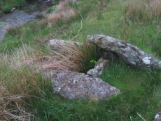
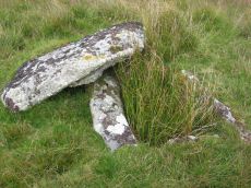
Crockern Tor 3 Reported Cist
OS Map: SX 61204 75824
ShortName: CT CrockernNW3
Notes: Possible cist reported by Nigel Rendle to Bill Radcliffe in 2008 NE of Crockern Farm. Bill comments Feb 2025 we were doubtful of it, as it is close to the path to Wistman's Wood, so how can it have been missed? But it looks good to me.. The author visited 25/09/2025 with Steve Szypko and these were my notes: there is an upright stone that looks like a possible displaced capstone and some other stones that could form a cist. This arrangement in itself is unconvincing but there is also a rectangular hole consistent with a cist. It is perhaps an unlikely but possible cist. NB. The grid reference has now been updated.
Nearby sites: SX 61204 75824
Distance: 3.17km
Beardown Platform Cairn Circle and Cist
OS Map: SX 60330 78092
HER: MDV14690
Megalithic Portal: 42853
PMD: Lydford Tor
Alternate name: Lydford Tor E. Platform Cairn Circle and Cist
ShortName: CT Beardown
Butler map: 29.17
Butler Vol 5: p.197 & Fig.140
DPD page: 109
Grinsell: LYD 41a
Turner: E27
Notes: "The cairn, 4.5 metres by 5.6 metres and 0.4 metres high has spread over the remains of a contiguous kerb 4.6 metres in diameter." ... "Three of the cist slabs lean inwards at the top, the fourth, east slab remains upright. The bottom of the cist contains several slabs. The coverstone is visible to the north west partially buried in the cairn." Lethbridge diagram p.107, photo top p.109. Butler Lydford Tor E Vol. 5. Map 29.17 (diagram Vol 5. p.197).
Nearby sites: SX 60330 78092
Distance: 4.76km
Beardown Farm Cist
OS Map: SX 604 754
HER: MDV5974
Megalithic Portal: 45789
PMD: Beardown Farm
ShortName: CTxBeardown Fm
Grinsell: LYD 46
Notes: The site is believed to have been destroyed many years ago Bray 1879 (included in listing as 130 in Grinsell list). Area is covered in Butler Vol 2 Map 29. "The remains of a cist surrounded by a rough pavement was examined by Mr Bray in September 1832 'two or three minutes walk north east of Beardown House' (at SX 604 754). Three stones of a four foot long cist stood six inches above ground level. A small piece of coarse pottery was found inside."
Nearby sites: SX 604 754
Distance: 2.33km
Black Tor (Stanlake) Stone Row
Prehistoric Dartmoor Walks: Dartmoor Walk: Sharpitor area Stone Rows and Cists
OS Map: SX 56988 71381
HER: MDV4994
Megalithic Portal: 1771
The Stone Rows of GB: Black Tor Stanlake
PMD: Black Tor Stanlake Stone Row
ShortName: SR Stanlake
Butler map: 45.14
DPD page: 24
Notes: "A Bronze Age Stone Row lies just inside, and is partly buried by, a substantial field boundary. The row extends from SX57217155 to SX57007137, some 294m long and includes at least 57 visible stones. Its north-eastern end is denoted by a substantial blocking stone and its lower south-western end by three funerary cairns. The row can be seen as three distinct parts forming the whole. The northern part includes 39 stones, the central group of 8 stones is separated from the northern row by a 66.2m wide gap whilst the southern group is on a slightly different alignment to the others. The row is unusual in that the blocking stone is at the upper end and a cairn lies at the lower end." Lethbridge diagram and photo p.24.
Nearby sites: SX 56988 71381
Distance: 2.96km
Blackabrook, East Cist
OS Map: SX 60528 73873
HER: MDV6252
Megalithic Portal: 45679
PMD: Blackabrook E.
Alternate name: Round Hill S.E.3 Cist
ShortName: CT Blackbrk E
Butler map: 65.3.3
DPD page: 104
Grinsell: LYD 82
Barrow Report: 31 44
Notes: "A well defined cist which has two stones supporting the slabs in the SE corner. The chamber measures 0.95m by 0.85m and about 0.4m deep. A turf-covered stony spread around the cist may be part of a robbed cairn." Lethbridge p.103 diagram Black Brook Cist(C), photo bottom p.104. Butler Round Hill S.E. 3 - Vol. 4. Map 65.3 (diagram of cists alongside the Blackbrook pp.230-1).
Nearby sites: SX 60528 73873
Distance: 1.53km
Blackabrook, South Cist
OS Map: SX 60524 73860
HER: MDV6254
Megalithic Portal: 45679
PMD: Blackabrook
Alternate name: Round Hill S.E.1 Cist
ShortName: CT Blackbrk S
Butler map: 65.3.1
DPD page: 103
Grinsell: LYD 80
Barrow Report: 31 44
Notes: "This cist with its displaced capstone lies on the edge of the river bank. Vestiges of the small surrounding cairn are now hidden under the turf. The chamber of the cist measures 1.25m by 0.55m and about 0.5m deep; the capstone is 1.5m long, 1.1m wide and 0.15m thick. The south stone has fallen outwards." Lethbridge p.103 diagram Black Brook Cist(A), photo p.103. Butler Round Hill S.E. 2. - Vol. 4. Map 65.3 (diagram of cists alongside the Blackbrook pp.230-1).
Nearby sites: SX 60524 73860
Distance: 1.53km
Blackabrook, West Cist
OS Map: SX 60522 73867
HER: MDV6253
Megalithic Portal: 45679
PMD: Blackabrook NW.
Alternate name: Round Hill S.E.2 Cist
ShortName: CT Blackbrk W
Butler map: 65.3.2
DPD page: 104
Grinsell: LYD 81
Barrow Report: 31 44
Notes: "The reed-filled cist is approximately 1.0m by 0.7m and about 0.2m deep. Peat has accumulated around the sides of the slabs but a few stones evident on the SW side may be part of a robbed cairn." Lethbridge p.103 diagram Black Brook Cist(B), photo p.104. Butler Round Hill S.E. 1 - Vol. 4. Map 65.3 (diagram of cists alongside the Blackbrook pp.230-1). Plan by R.H. Worth of in Barrow Report 31 includes plan of Blackabrook cairn group.
Nearby sites: SX 60522 73867
Distance: 1.53km
Blakey Tor (E) Cist
OS Map: SX 61312 73558
HER: MDV6245
Megalithic Portal: 28869
PMD: Blakey Tor E.
Alternate name: Blakey Tor E. Cist
ShortName: CT Blakey Tor
Butler map: 65.4
DPD page: 102
Grinsell: LYD 85
Barrow Report: 31 47
Notes: "A reed-filled cist is set well into the cairn on a NNW-SSE axis. The intact chamber measures internally 0.95m long, a maximum 0.65m wide and 0.45m deep; the longest side slab is 1.4m by 0.3m by 0.45m and largest end slab 0.55m by 0.2m by 0.4m. The coverstone against the NW side of the cist is roughly oval in shape and measures 1.7m by 1.3m and a maximum 0.25m thick." Lethbridge diagram p.102 Cist(B), photo p.102. Butler Vol. 4. Map 65.4 (diagram p.232).
Nearby sites: SX 61312 73558
Distance: 2.27km
Blakey Tor (W) Cist
OS Map: SX 61240 73551
HER: MDV6244
Megalithic Portal: 45772
PMD: Blakey Tor W.
Alternate name: Blakey Tor W. Cist
ShortName: CT BlakeyTor W
Butler map: 65.4
DPD page: 103
Grinsell: LYD 84
Notes: "The incomplete cist is oriented NW-SE. It measures about 0.85m long, 0.4m to 0.55m wide and 0.25m deep internally. The upright W side slab is 0.9m by 0.2m by 0.25m and the surviving end slab is 0.4m by 0.2m by 0.25m. The E side is formed by a flat-sided boulder which is c. 1.1m long, at least 0.6m thick and 0.25m high. The SE side is open. The coverstone is 1.7m by 0.7m by 0.4m and leans against the W side of the cist." Lethbridge diagram p.102 Cist(A), photo top p.103. Butler Blakey Tor W. - Vol. 4. Map 65.4 (diagram p.232).
Nearby sites: SX 61240 73551
Distance: 2.20km
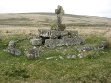
Childes Tomb Platform Cairn Circle and Cist
OS Map: SX 62577 70299
HER: MDV48907
Megalithic Portal: 15211
PMD: Childe's Tomb
ShortName: CT ChildesTomb
Butler map: 64.4
DPD page: 94
Grinsell: LYD 96
Turner: E33
Notes: "A much disturbed cairn, 9m in diameter and 0.3m high with a modern 'kerb' of blocks and slabs, 5.8m in diameter and 0.5m high, set upon the mound. At the centre is a well built cist 1.4m long, 0.5m wide and 0.6m deep. Over this is a two tier pedestal of eight well trimmed blocks, of three different lengths; a further half buried block lies S of the monument. Upon this is a replacement socket stone and cross, cut at Holne in 1885". Lethbridge diagram p.93, photo p.94. Butler Vol. 4. Map 64.4 (diagram p.220). Breton p.22-23
Nearby sites: SX 62577 70299
Distance: 4.78km
Crock of Gold Ring Setting Cairn and Cist
OS Map: SX 61286 73076
HER: MDV6308
Megalithic Portal: 14960
PMD: The Crock of Gold
ShortName: CT CrockofGold
Butler map: 65.2
DPD page: 101
Grinsell: LYD 86
Turner: D17
Barrow Report: 27 47 56
Notes: "The cairn, 7m in overall diameter and 0.3m high, has a flattish top with a retaining circle set 1m to 1.5m within the perimeter. This consists of six earthfast boulders, about 0.4m across and protruding a similar height above the cairn ... A central cist is oriented NW to SE. Internally it is 0.8m long, 0.4m wide at the NW end, 0.5m at the SE, and 0.7m deep. The side slabs are 1m long and respectively 0.15m and 0.25m thick; the end slabs, 0.5m long and 0.1m thick. The capstone, moved to the W, is 1.3m long, 1.1m wide and 0.15m thick and now rests against the kerb." Lethbridge diagram p.102 Cist(C), photo p.101. Butler Vol. 4. Map 65.2 (diagram p.229).
Nearby sites: SX 61286 73076
Distance: 2.29km
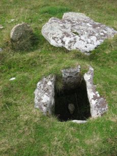
Crockern Tor Cist
OS Map: SX 61414 76055
HER: MDV57569
Megalithic Portal: 45816
PMD: Crockern Tor
Alternate name: Crockern Tor 1 Cist
ShortName: CT CrockernNW1
Butler Vol 5: p.32 & Fig.11
DPD page: 110
Notes: "Remains of a small cairn with cist on a moderate W slope in open grassland at SX 61407604 overlooking the West Dart in Crockern Newtake. It has been robbed heavily, leaving only one cist slab and fragments of the cairn material. The slab is restangular in side view and in section, firmly embedded on edge, measuring 1.2m long 0.48m high and 0.15m thick. It is aligned NW to SE." Butler Vol 5 p. 32. Lethbridge diagram and photo p.110.
Nearby sites: SX 61414 76055
Distance: 3.48km

Cuckoo Rock Cup Stone
OS Map: SX 58463 68712
HER: MDV133689
Megalithic Portal: 58581
ShortName: CS Cuckoo Rock
Notes: "There appear to be eight circular cupmarks on the south-west corner of Cuckoo Rock in the Deancombe valley; apparently in pairs. Three pairs are arranged horizontally with a smaller pair just above them arranged vertically. Six of the marks measure approximately 5cm diameter by 2cm deep. The remaining two marks measure approximately 2cm diameter by 1cm deep. The carver likely stood on a boulder situated below to mark the rock. Reported to archaeologist at Dartmoor National Park authority who has visited the site (21/11/2022) and agrees with potential interpretation."
Nearby sites: SX 58463 68712
Distance: 4.83km

Deancombe Valley Cup Stone
OS Map: SX 57638 69264
HER: MDV133691
ShortName: CS:Deancombe
Notes: "SX 57638 69264 Two discreet circular cupmarks of ‘classic’ type are visible on the top surface of a small granite rock which is situated close to the base of the vertical west face of a massive boulder (one of the largest in the Deancombe valley)."
Nearby sites: SX 57638 69264
Distance: 4.47km
Devil's Elbow Platform Cairn Circle
OS Map: SX 58192 72708
HER: MDV14310
Megalithic Portal: 36761
PMD: Devil's Bridge
Alternate name: Hart Tor N. Platform Cairn Circle
ShortName: PC:DevilsElbow
Butler map: 46.1
Butler Vol 5: p.168 & Fig.107
Grinsell: WAL 10
Turner: E5
Notes: Ring cairn consisting of a circle of close set stones: almost a kerb circle, interior flat and no sign of cist. Diameter 8m, height 0.3m. HER: Ring cairn to the north-east of the settlement to the north of Hart Tor recorded in the 19th century as containing a 'dilapidated kistvaen'
Nearby sites: SX 58192 72708
Distance: 1.17km
Down Tor Cairn
OS Map: SX 58642 69315
HER: MDV3440
Megalithic Portal: 27903
Alternate name: Hingston Hill Summit 1 Cairn
ShortName: CN Hingston 1
Butler map: 47.12.1
Grinsell: WAL 30
Notes: "cairn mound measures 15.5m in diam and stands up to 1.5m high. A t-shaped trench cutting into the centre of the mound suggests partial early excavation, though the results of the investigation are not known. This cairn forms part of a ritual complex of monuments including 3 cairns, a stone alignment and enclosure". Approx 70 m NW of the cairn circle at the end of the Down Tor stone row.
Nearby sites: SX 58642 69315
Distance: 4.22km
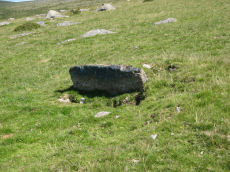
Down Tor Cist
OS Map: SX 58037 69293
HER: MDV3423
Megalithic Portal: 45757
PMD: Down Tor S.
Alternate name: Down Tor S. Cist
ShortName: CT Down Tor
Butler map: 47.5
DPD page: 28
Grinsell: WAL 26
Barrow Report: 67
Notes: Butler Down Tor S. Vol. 3. Map 47.5 (diagram p.67).
Nearby sites: SX 58037 69293
Distance: 4.34km
Down Tor N.E. (Eastern) Platform Cairn Circle and Cist
OS Map: SX 58397 69562
HER: MDV3499
Megalithic Portal: 52347
PMD: Down Tor N 3
Alternate name: Hingston Hill N.3 Platform Cairn Circle and Cist
ShortName: CT DownTorNE E
Butler map: 47.13.3
DPD page: 27
Grinsell: WAL 29
Turner: E34
Barrow Report: 73
Notes: Butler Hingston Hill N. 3. - Vol. 3. Map 47.13.3 (diagram p.73 OS SX58396955). Grinsell WALKHAMPTON 29 (OS 58276949 approx - same as HER MDV3499). Lethbridge p.27 Cist No.1.
Copyright for photos and plans from Barrow Reports 71-73 belongs to the Dixon estate. Reproduced here with kind permission.
Nearby sites: SX 58397 69562
Distance: 4.00km
Down Tor N.E. (Northern) Cist
OS Map: SX 58388 69568
HER: MDV3498
Megalithic Portal: 52348
PMD: Down Tor N 1
Alternate name: Hingston Hill N.1 Cist
ShortName: CT DownTorNE N
Butler map: 47.13.1
DPD page: 27
Grinsell: WAL 28
Barrow Report: 73
Notes: Butler Hingston Hill N. 1. - Vol. 3. Map 47.13.1 (diagram p.73 OS SX58386956). Grinsell (OS SX58256951 approx same as HER record MDV3498). Lethbridge p.27 Cist No.3.
Copyright for photos and plans from Barrow Reports 71-73 belongs to the Dixon estate. Reproduced here with kind permission.
Nearby sites: SX 58388 69568
Distance: 4.00km
Down Tor N.E. (Western) Cist
OS Map: SX 58386 69565
HER: MDV3497
Megalithic Portal: 45766
PMD: Down Tor N 2
Alternate name: Hingston Hill N.2 Cist
ShortName: CT DownTorNE W
Butler map: 47.13.2
DPD page: 27
Grinsell: WAL 27
Barrow Report: 73
Notes: Butler Hingston Hill N.2. - Vol. 3. Map 47.13.2 (diagram p.73, OS SX58376955). Grinsell (OS SX58246950 approx - same as the HER record MDV12715). Lethbridge p.27 Cist No.2.
Copyright for photos and plans from Barrow Reports 71-73 belong to the Dixon estate. Reproduced here with kind permission.
Nearby sites: SX 58386 69565
Distance: 4.00km
Dunnabridge Common Platform Cairn Circle and Cist
Prehistoric Dartmoor Walks: Dartmoor Site: Lakehead Hill
OS Map: SX 63585 75470
HER: MDV5952
Megalithic Portal: 37603
PMD: Smith Hill
Alternate name: Bellever Tor 9 Platform Cairn Circle and Cist
ShortName: CT Bellever 9
Butler map: 27.20.9
DPD page: 120
Grinsell: LYD 65
Turner: E37
Barrow Report: 58
Notes: Lethbridge Cist 3 diagram p.119 and photo bottom p.120. Butler Bellever Tor (Cairn 9) - Vol. 2. Map 27.20.9 (diagram p52-3). See also: Dartmoor Explorations: Antiquities of Black Newtake and Environs
Nearby sites: SX 63585 75470
Distance: 4.95km
Fox Tor Newtake, North Cist
OS Map: SX 62861 71177
HER: MDV6303
Megalithic Portal: 45677
PMD: Ter Hill N.
Alternate name: Ter Hill N.W.1 Cist
ShortName: CT FoxTorNew N
Butler map: 64.3.1
DPD page: 93
Grinsell: LYD 97
Barrow Report: 24 56
Notes: "The cist is 0.6m deep and 1.2m long, the NW end is 0.4m wide and SE end 0.6m wide; the NW end-slab, said by Burnard (1905)to be wedged in the bottom cannot be seen. The coverstone, resting on the NE side, is 1.6m by 1.3m at its extremeties". Lethbridge diagram (Cist A) and photo p.93. Butler Ter Hill N.W. 1 - Vol. 4. Map 64.3 (diagram p. 219).
Nearby sites: SX 62861 71177
Distance: 4.48km
Fox Tor Newtake, South Cist
OS Map: SX 62864 70964
HER: MDV6279
Megalithic Portal: 45678
PMD: Ter Hill S.
Alternate name: Ter Hill N.W.2 Cist
ShortName: CT FoxTorNew S
Butler map: 64.3.2
DPD page: 94
Grinsell: LYD 98
Barrow Report: 24 56
Notes: "The turf-covered cairn is, at maximum, 3.9m in diameter and 0.3m in height. The cist, oriented NW/SE, is approximately 1.3m by 0.55m, and 0.75m deep, and now almost hidden by the SW side stone which has fallen inwards. The NE end stone is not evident but an 0.7m high upright granite post retains part of the mound on this NE side. There is no trace of the coverstone". Lethbridge diagram p.93 (Cist B), top photos p.94. Butler Ter Hill N.W. 2 - Vol. 4. Map 64.3 (diagram p.219).
Nearby sites: SX 62864 70964
Distance: 4.60km
Foxtor Mires W. Platform Cairn Circle and Cist
OS Map: SX 60780 70484
HER: MDV12967
Megalithic Portal: 24008
PMD: Whiteworks
ShortName: CT FoxTorMireW
Butler map: 64.6
DPD page: 97
Turner: E19
Notes: "Seven large orthostats of the retaining circle remain in situ on the south and south-east side (see plan). The cist is entirely below ground level to a depth of 0.7m and measures 1.0m by 0.6m. The two endstones and two sidestones are visible; a stone which may be the coverstone lies on the ground to one side". Lethbridge diagram p.93, photos bottom p.97. Butler Foxtor Mires W. - Vol. 4. Map 64.6 (diagram p.222). Cairn with kerb circle, visible on N, E & W sides, with a central cist.
Nearby sites: SX 60780 70484
Distance: 3.49km

Goadstone Pond Ancient Pool
OS Map: SX 55706 70663
HER: MDV28232
ShortName: PO:GoadsStone
Notes: "Pool on the summit of the hill near a stone row. Some of the stones from the double stone row appear to have been lost in the pool. Previously incorrectly identified from aerial photograph as an enclosure. One of over 40 pools on Dartmoor thought to have originated in the Prehistoric period."
Worth and Butler refer to this as Goatstone Pool. There is a very interesting discussion of both the origin of the name and of the cairns and stone rows on DartmoorCam: Sharpitor. See also Legendary Dartmoor: Dartmoor's Goadstone
Nearby sites: SX 55706 70663
Distance: 4.38km
Goldsmith's Cross E.2. Ring Setting Cairn and Cist
OS Map: SX 61804 70321
HER: MDV6342
Megalithic Portal: 42707
PMD: Fox Tor Mires cairn
Alternate name: Goldsmith's Cross E.2 Ring Setting Cairn and Cist
ShortName: CT GoldsmithE2
Butler map: 64.5.2
DPD page: 95
Grinsell: LYD 95
Turner: D23
Notes: "West end stone of cist leans slightly inwards, otherwise a perfect cist measuring 0.75m NW-SE by 0.5m wide by 0.4m deep. Retaining circle of 7 stones averaging 0.4m high. No coverstone or barrow". Lethbridge diagram p.93, photo bottom right p.95 and on p.96. Turner D23 (Fox Tor Mire) - Proc Devon Arch Soc 48 (diagram p.45). Butler Goldsmith's Cross E. 2 - Vol. 4. Map 64.5 (Cairn 2 - diagram p.221).
Nearby sites: SX 61804 70321
Distance: 4.22km
Goldsmith's Cross S. Cist
OS Map: SX 61684 69872
HER: MDV5081
Megalithic Portal: 42708
PMD: Fox Tor Mires S 5
Alternate name: Goldsmiths Cross S. Cist
ShortName: CT Goldsmith S
Butler map: 64.5
DPD page: 97
Grinsell: LYD 100
Barrow Report: 46 56
Notes: "The remains of a cist lie some 80m E of the Whealam streamworks at SX 61666985, on gently sloping ground 50m S of the newtake wall. The remains consist of four granite slabs set into the ground, forming three sides of a trapezoidal structure. It measures 1.2m long and a maximum of 0.85m wide. The long side, unusually formed of two granite slabs, is oriented NW to SE. The maximum height which the stones protrude above the ground is 0.2m. The SW side of the structure is missing; there are no traces of a capstone or cairn". Lethbridge diagram p.93, text p.96, photo top p.97. Butler Goldsmith's Cross S. - Vol. 4. Map 64.5. (Cairn 4 - diagram p.221). Worth (1927) suggests the following description is of this cist. Breton (1926 p.22) About 1 m E. of Nun's Cross farm, on the W side of the dip formed by a lateral stream of the Strane (it is the first valley at W. foot of Fox Tor) are the remains of this kistvaen. A block of white spa will be seen in the wall which is one's companion from Nun's cross to Fox Tor. The kistvaen lies about 60 yds S.E. of he white spa and about 45 yds. in a direct line from the wall, and 100 yds E. of the stream.
.
Nearby sites: SX 61684 69872
Distance: 4.50km
Goldsmiths Cross E.1. Cist
OS Map: SX 61871 70395
HER: MDV61775
Megalithic Portal: 45806
PMD: Fox Tor Mires E.
Alternate name: Goldsmiths Cross E.1 Cist
ShortName: CT:GoldsmithE1
Butler map: 64.5.1
Notes: "Clear remains of cairn with cist. One side and one end stone of cist are in place. The western side stone may be beneath the turf, but the southern end stone and cover stone are missing. The internal dimensions of the cist are approximately 0.53 x 0.58 x 0.45 meters (1 foot 9 inches x 1 foot 11 inches x 1 foot 6 inches). Immediately around cist there was a backing of comparatively large flat stones.". Butler Goldsmith's Cross E. 1. Vol. 4. Map 64.5 (Cairn 1 - diagram p.221). There is no NMR for this site. There is an HER entry MDV61775 which matches precisely with the OS reference given by Butler. Butler describes: "The mound 0.1m high at best surrounds a slightly wedge-shaped cist of which only the sides, one composed of two stones, and an end are visible. The missing slab is probably buried in place".
Nearby sites: SX 61871 70395
Distance: 4.21km
Goldsmiths Cross E.3. Cist
OS Map: SX 61741 70204
HER: MDV6343
Megalithic Portal: 45748
PMD: Goldsmith's Cross
Alternate name: Goldsmiths Cross E.3 Cist
ShortName: CT:GoldsmithE3
Butler map: 64.5.3
DPD page: 95
Grinsell: LYD 94
Barrow Report: 58
Notes: "The NW sidestone, 0.8m long by 0.2m wide and the NE endstone 0.6m long, 0.15m wide are the only recognisable cist stones though it is possible that the SW side was formed by the two small slabs still visible and depicted by Worth. There is no coverstone". Lethbridge diagram p.93, photo bottom left p.95. Butler Goldsmith's Cross E.3. - Vol. 4. Map 64.5 (Cairn 3 - diagram p.221).
Nearby sites: SX 61741 70204
Distance: 4.27km
Hart Tor N. Settlement
OS Map: SX 5816 7243
HER: MDV3791
Megalithic Portal: 36762
ShortName: ST:HartTorN
Nearby sites: SX 5816 7243
Distance: 1.39km
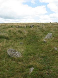
Hart Tor North Stone Row
Prehistoric Dartmoor Walks: Dartmoor Site: Hart Tor Stone Row & Cairn Circle
OS Map: SX 57708 71708
HER: MDV4896
Megalithic Portal: 1973
The Stone Rows of GB: Hart Tor North
PMD: Harter N Stone Row
ShortName: SR Hart Tor N
Butler map: 46.5.1
DPD page: 25
Notes: Butler Row 1. There are two cairns close by on the lower slopes of Hart Tor. One has an associated single stone row and the other has an associated double stone row - they diverge at an angle of 18 degrees. The double row consists of 93 stones and is much longer, around 122m in length [Gerrard], and extends all the way down to the River Meavy in the valley below. This row is fairly well preserved although it is crossed by a tinners ditch about a third of the way down its length and again by a leat a third of the way from the lower end. The structure was planned by Wilkinson in 1859 who states that the row is "terminated by a large monolith, now fallen, measuring about 25 feet long by 2 feet and 3 inches". Sadly this stone has long since disappeared. The row has pairs of stones which are spaced fairly accurately 1.9m apart along the rows, the rows being at a constant 1.7m separation. The cairn circle is 9.3m across and consists of 14 tall slabs some of which have fallen. Detailed survey of site in Hart Tor Stone Rows & Cairns, Meavy Valley Archaeology. Site Report No.9 - Sandy Gerrard (1999). See also: Sea Views at Hart Tor, The Stone Rows and Cairns at Hart Tor Dartmoor Part One and The Stone Rows and Cairns at Hart Tor Dartmoor Part Two
Nearby sites: SX 57708 71708
Distance: 2.24km

Hart Tor North Encircled Cairn
Prehistoric Dartmoor Walks: Dartmoor Site: Hart Tor Stone Row & Cairn Circle
OS Map: SX 57718 71716
HER: MDV49460
Megalithic Portal: 978
PMD: Harter N Stone Row
Alternate name: Hart Tor double stone row Encircled Cairn
ShortName: EC Hart Tor N
Butler map: 46.5
Butler Vol 5: p.39 & Fig.16
DPD page: 25
Grinsell: WAL 12
Turner: F12
Notes: The cairn circle is 9.3m across and consists of 14 tall slabs some of which have fallen. Wilkinson noticed concentric stone circles - which can't be seen today although there is clearly an inner circular mound. NMR A.
Nearby sites: SX 57718 71716
Distance: 2.23km
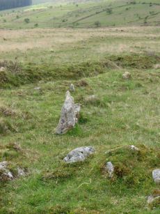
Hart Tor South Stone Row
Prehistoric Dartmoor Walks: Dartmoor Site: Hart Tor Stone Row & Cairn Circle
OS Map: SX 57720 71698
HER: MDV4895
Megalithic Portal: 1974
The Stone Rows of GB: Hart Tor South
PMD: Harter S Stone Row
ShortName: SR Hart Tor S
Butler map: 46.5.1
DPD page: 25
Notes: Butler Row 2. The single row consists of 16 stones and is 56.4m long, although Gerrard suggests it was probably once much longer. The single row leads to a cairn which does not have a retaining circle. The cairn which has been robbed measures 7.4m in diameter and up to 0.75m high. For early description of both rows and the now missing menhir, see: Wilkinson J. Gardner, British Remains on Dartmoor, Journal Brit. Arch. Assoc. xviii. pp.22-53 (1862). Detailed survey of site in Hart Tor Stone Rows & Cairns, Meavy Valley Archaeology. Site Report No.9 - Sandy Gerrard (1999). See also notes for Hart Tor North Stone Row. Sea Views at Hart Tor, The Stone Rows and Cairns at Hart Tor Dartmoor Part One and The Stone Rows and Cairns at Hart Tor Dartmoor Part Two
Nearby sites: SX 57720 71698
Distance: 2.24km
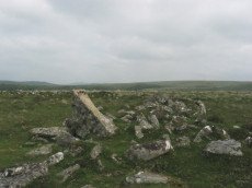
Hingston Hill Enclosed Settlement
OS Map: SX 59118 69477
HER: MDV3435
Megalithic Portal: 27901
ShortName: ES Down Tor
Butler map: 47.7
DPD page: 29
Notes: "Hingston hill pound, east of down tor, is a circular enclosure whose wall consists of large stones. Entrance is marked by a slab like stone which extends through the thickness of a wall. About 100m from the pound in a direction 15 s of e lies the centre of a cairn, c.18m in diameter at the base. The down tor stone row points to this cairn (Worth)". Lethbridge pp.27-29, diagram p.27. Listed as Narrator Brookhead Enclosure on Megalithic Portal.
Nearby sites: SX 59118 69477
Distance: 4.04km

Hingston Hill Cup Stone
OS Map: SX 58596 69210
HER: MDV133690
ShortName: CS Down Tor
Notes: "A flattish boulder recorded at SX 58595 69204, a short distance west of the north-south reave which lies west of the Down Tor stone row. The upper surface of this boulder is pitted over an area of at least 1m by 1m with numerous possible cupmarks. It is unlike any other boulder in the near vicinity."
Nearby sites: SX 58596 69210
Distance: 4.32km

Hingston Hill Chambered Cairn
Prehistoric Dartmoor Walks: Dartmoor Site: Down Tor Stone Row and Cairn Circle
OS Map: SX 59201 69453
HER: MDV3375
Megalithic Portal: 27900
PMD: Narrator Brookhead N.
Alternate name: Narrator Brookhead 1 Chambered Cairn
ShortName: CN Narrator 1
Butler map: 47.7.1
Butler Vol 5: p.158
Grinsell: WAL 32
Notes: The large cairn to NW of Down Tor (Hingston Hill) stone row has been claimed to contain a cist or "elements of chambering" (Burnard via PMD). A stony round cairn located on the flatish sadle of Hingston Hill. The cairn mound measures 17 metres in diameter and stands up to 1.5 metres high. A hollow in the centre of the mound measures 4 metres long, 3 metres wide and 1.2 metres deep, and is probably the result of partial robbing or early excavation. The edges of the mound are steep-sided, indicating the existence of a kerb, which now survives mainly as a buried feature. A quarry ditch surrounds the mound, visible as a 1.5 metre wide band of rushes on the northern side of the mound, the result of increased moisture in the buried ditch. This cairn is in direct line with the two terminal stones at either end of a stone alignment to the south-west.
Nearby sites: SX 59201 69453
Distance: 4.06km
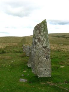
Hingston Hill (Down Tor) Standing Stone
Prehistoric Dartmoor Walks: Dartmoor Site: Down Tor Stone Row and Cairn Circle
OS Map: SX 58702 69276
HER: MDV3502
Megalithic Portal: 1901
PMD: Down Tor Standing Stone
ShortName: SS Down Tor
Butler map: 47.12
DPD page: 29
Notes: "A stone alignment and cairn, situated on a saddle 620 metres east of Down Tor. The alignment is orientated east-north-east to west-south-west, running for 316 metres and containing at least 174 stones, with the tallest at either end. The westernmost stone stands 2.8 metre high, the easternmost stone stands 1.6 metres high, and the remainder vary between 1 metre and 0.2 metres in height. The westernmost stone, and an unknown number of others, were re-erected by Baring-Gould and Burnard in 1890."
Nearby sites: SX 58702 69276
Distance: 4.25km
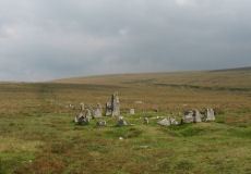
Hingston Hill (Down Tor) Stone Row
Prehistoric Dartmoor Walks: Dartmoor Site: Down Tor Stone Row and Cairn Circle
OS Map: SX 58697 69267
HER: MDV3502
Megalithic Portal: 1901
The Stone Rows of GB: Hingston Hill
PMD: Down Tor Stone Row
Alternate name: Hingston Hill Stone Row
ShortName: SR Down Tor
Butler map: 47.12
DPD page: 28
Barrow Report: 66
Notes: "A stone alignment and cairn, situated on a saddle 620 metres east of Down Tor. The alignment is orientated east-north-east to west-south-west, running for 316 metres and containing at least 174 stones, with the tallest at either end. The westernmost stone stands 2.8 metre high, the easternmost stone stands 1.6 metres high, and the remainder vary between 1 metre and 0.2 metres in height. The westernmost stone, and an unknown number of others, were re-erected by Baring-Gould and Burnard in 1894. The cairn lies 4 metres west of the western end of the alignment. The cairn mound measures 8 metres in diameter and 0.7 metres high. It is surrounded by a kerb made up of 24 orthostats, standing between 0.3 and 1 metre high, forming a ring with a diameter of 11.5 metres. A hollow in the centre of the mound suggests partial early excavation or robbing. Two tin prospecting pits lie immediately against the edge of the kerb. The alignment is in direct line with another cairn to the north-east (438589)". Lethbridge pp.27-29, diagram p.27. See also: Sea Views at Hingston Hill
Nearby sites: SX 58697 69267
Distance: 4.26km
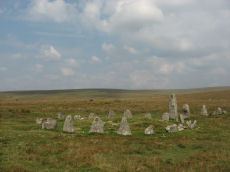
Hingston Hill (Down Tor) Encircled Cairn
Prehistoric Dartmoor Walks: Dartmoor Site: Down Tor Stone Row and Cairn Circle
OS Map: SX 58693 69270
HER: MDV3439
Megalithic Portal: 541
PMD: Down Tor Cairn Circle
Alternate name: Hingston Hill stone row Encircled Cairn
ShortName: EC Down Tor
Butler map: 47.12
DPD page: 28
Grinsell: WAL 31
Turner: F6
Barrow Report: 14
Notes: "The cairn circle consists of 26 upright stones and possibly two more now recumbent; it has an internal diameter of 11.5m. Within the circle is a cairn of 8.5m diameter and 0.6m height with a small depression in the centre which may be the site of a cist". Lethbridge pp.27-29, diagram p.27.
Nearby sites: SX 58693 69270
Distance: 4.26km
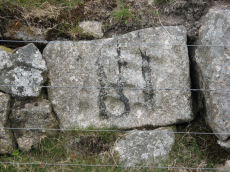
Holmingbeam Cup Stone
OS Map: SX 59488 75233
HER: MDV12807
Megalithic Portal: 10606
ShortName: CS Holmingbeam
DPD page: 107
Notes: "Mortar stone of uncertain date incorporated into the eastern boundary wall of Long Plantation. It was formerly, erroneously, recorded as a cup-marked stone." The stone is upside down in wall by road side and has the figure 18 painted on it. Lethbridge diagram and photo p.107
Nearby sites: SX 59488 75233
Distance: 1.78km
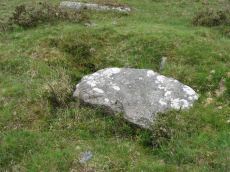
Ingra Tor Cist
Prehistoric Dartmoor Walks: Dartmoor Walk: Sharpitor area Stone Rows and Cists
OS Map: SX 55874 72093
HER: MDV4983
Megalithic Portal: 45735
PMD: Ingra Tor
Alternate name: lngra Tor Cist
ShortName: CT Ingra Tor
Butler map: 45.16
DPD page: 19
Grinsell: WAL 9
Barrow Report: 56
Notes: Butler Vol. 3. Map 45.16 (diagram p.51).
Breton (p.12): About 300 yds E. of Ingra tor is a fine kistvaen which has not been disturbed, except that a portion of the capstone has been broken off. [...] Three men from the farm near by about 1910 tried to raise the capstone with crowbars, but they failed to move it ; however, they broke off the piece that is broken.
Nearby sites: SX 55874 72093
Distance: 3.47km
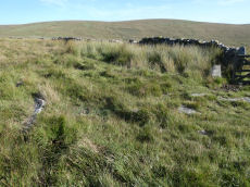
Joan Ford's Newtake Cairn Circle
OS Map: SX 63033 72172
HER: MDV6261
Megalithic Portal: 3296
Alternate name: Joan Ford's Newtake 2 Cairn Circle
ShortName: CC Joan Fords
Butler map: 63.3.2
Grinsell: LYD 91
Turner: G22
Barrow Report: 30
Notes: "A stone circle with six identifiable erect or leaning stones. One forms the E post of the gateway, the west post, 7ft high, stands outside the circumference. It is because of its small diameter, without doubt a retaining circle; any internal features such as a central hollow or possible kistvean have been obliterated by the wall builders." Turner Stone Circle G22. Bar Rep 30.
Nearby sites: SX 63033 72172
Distance: 4.14km
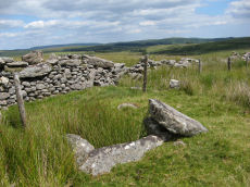
Joan Ford's Newtake Embanked Cairn Circle and Cist
OS Map: SX 63143 72168
HER: MDV6260
Megalithic Portal: 3295
PMD: Joan Ford's Newtake
Alternate name: Joan Ford's Newtake 1 Embanked Cairn Circle and Cist
ShortName: CT Joan Fords
Butler map: 63.3.1
DPD page: 99
Grinsell: LYD 92
Turner: B7
Barrow Report: 30 56
Notes: "A low kerb within the disturbed fringes of the mound is 8.7m in diameter with more or less continuous upright slabs and boulders 0.3m to 0.6m high. A dry stone newtake wall crosses the N side and overlies part of the kerb. A well-preserved cist, oriented NW-SE, is internally 1.0m long, 0.5m to 0.65m wide and up to 0.7m deep. The coverstone leans against the SE side of the cist and measures 1.35m by 1.0m by 0.2." Lethbridge diagram p.99, photo bottom p.99. Butler Joan Ford's Newtake 1 - Vol. 4. Map 63.3 (diagram p.214).
Nearby sites: SX 63143 72168
Distance: 4.32km
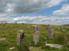
Joan Ford's Newtake Stone Row
OS Map: SX 63183 71987
HER: MDV6375
Megalithic Portal: 1985
The Stone Rows of GB: Joan Fords Newtake
PMD: Joan Ford's Newtake
Alternate name: Joan Ford's Newtake Stone Row
ShortName: SR Joan Fords
Notes: Stone Rows of Great Britain states: A probable single stone row measuring 7.27m long, including at least three large-sized upright orthostats and two recumbent slabs situated on a gentle south east facing slope. The stones stand up to between 1.55m and 1.23m high, arranged in height order with the tallest at the east. The row is orientated ENE to NSW and has restricted views of several skyline cairns and surrounding landscape. Breton (p.19) ... just above the river are 3 large monoliths in a row; do they form the end of a stone row, or are they part of a vanished linhay? Both the late Mr. Robert Burnard and Mr. R. Hansford Worth told me they did not know what they are, and neither do I. All we can say is the stones are there.
Nearby sites: SX 63183 71987
Distance: 4.42km
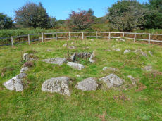
Leather Tor Platform Cairn Circle and Cist
OS Map: SX 56325 69524
HER: MDV3434
Megalithic Portal: 34457
PMD: Cross Gate
Alternate name: Leather Tor S. Platform Cairn Circle and Cist
ShortName: CT Leather Tor
Butler map: 45.17
DPD page: 23
Grinsell: WAL 25
Turner: E20
Barrow Report: 54
Notes: "A cist, consisting of two side stones and an end stone, contained within a barrow surrounded by a 16ft 6 ins diameter Kerb circle." Butler Leather Tor S. - Vol. 3. Map 45.17 (diagram p.52).
Nearby sites: SX 56325 69524
Distance: 4.82km
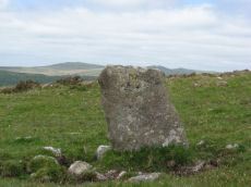
Leeden Hill Standing Stone
Prehistoric Dartmoor Walks: Dartmoor Walk: Sharpitor area Stone Rows and Cists
OS Map: SX 56015 71286
HER: MDV28499
Megalithic Portal: 45567
PMD: Leeden Hill Standing Stone
ShortName: SS Leeden Hill
Butler map: 45.
Notes: Possibly a prehistoric standing stone but may also be a much later marker since there are at least three similar stones in a line towards Ingra Tor set out at wide intervals as if to mark a boundary
Nearby sites: SX 56015 71286
Distance: 3.75km
Leeden Tor Stone Row
Prehistoric Dartmoor Walks: Dartmoor Walk: Sharpitor area Stone Rows and Cists
OS Map: SX 56522 71474
HER: MDV50223
Megalithic Portal: 2020
The Stone Rows of GB: Leeden Tor
PMD: Leeden Tor Stone Row
ShortName: SR Leeden Tor
Butler map: 45.15
DPD page: 23
Notes: "BA cairn and stone row. The scrappy remains of a single stone row now 165m long descend from a badly battered cairn on the south-east slopes of Leeden Tor. The cairn is about 6m across with a large central pit and partial retaining circle. At least 14 stones remain in a line, four only still earthfast and the rest either flat or buried. Stone pits record the loss of some of the stones". Lethbridge p23, diagram p.24. See also: Sea Views at Leeden Tor
Nearby sites: SX 56522 71474
Distance: 3.24km
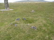
Merivale (S) Encircled Cairn
OS Map: SX 55368 74602
HER: MDV3759
Megalithic Portal: 52014
The Stone Rows of GB: Merrivale 4
PMD: Merrivale Menhir
Alternate name: Merrivale 6 (near standing stone) Encircled Cairn
ShortName: EC Merrivale 6
Butler map: 44.8.6
Grinsell: WAL 6
Turner: F19
Notes: The cairn now turf-covered with an excavation pit in the centre, has a diameter of 2.4m. and a height of 0.1m. The excavation pit can be seen in the photo. A very irregular "circle" of stones can be seen around this cairn. Turner F19.
Nearby sites: SX 55368 74602
Distance: 3.83km
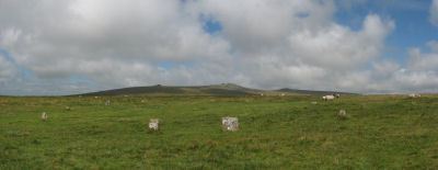
Merrivale Stone Circle
Prehistoric Dartmoor Walks: Dartmoor Site: Merrivale Ceremonial Complex [Photo Set 2]
OS Map: SX 55361 74641
HER: MDV4998
Megalithic Portal: 116
PMD: Merrivale Stone Circle
ShortName: SC Merrivale
DPD page: 17
Turner: G14
Notes: "A stone circle with a diameter of 20.0m. measured from northeast to southwest and 18.0m from northwest to southeast. It is formed by eleven stones spaced between 2.7m and 6.7m. apart and from 0.3m. to 0.5m. high. Three of the stones are of post type and eight are upright slabs. An additional stone, 7.5m. from the northeast side and 0.3m high, is angled towards the circle and may be quite unassociated". According to Breton (p.14) It formerly contained a kistvaen. No other accounts make this claim but the DEC report does mention shallow pits. Baring Gould states: Examination of some depressions in the surface of the turf found several pits dug to a depth of 12 - 18 inches in one of which was a flint flake. These had apparently been the socket holes for standing stones which had been removed to serve as gate posts or reused in the construction of a new-take wall nearby. See also Legendary Dartmoor: Merrivale Ceremonial Complex. Lethbridge pp.16-18, diagram 16.
Nearby sites: SX 55361 74641
Distance: 3.85km
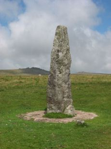
Merrivale Standing Stone
Prehistoric Dartmoor Walks: Dartmoor Site: Merrivale Ceremonial Complex [Photo Set 2]
OS Map: SX 55359 74599
HER: MDV53395
Megalithic Portal: 115
PMD: Merrivale Standing Stone
ShortName: SS Merrivale
Butler map: 44.8.4
DPD page: 17
Notes: "Two Bronze Age standing stones with a disturbed cairn and a number of small earth fast stones. Located in open generally clitter-free moorland. Only one of the two stones still stands; it is 3.2 metres high and tapers from the base which is 0.7 by 0.5 metres in section. Whether the stone was once the focus or terminus of a stone rows is uncertain. The second stone is now fallen, it is 2.2 metres long, up to 0.4 metres wide and 0.3 metres thick. An adjacent 0.3 metre deep pit may be its socket hole. "
Nearby sites: SX 55359 74599
Distance: 3.84km
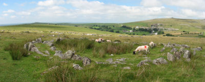
Merrivale Settlement
Prehistoric Dartmoor Walks: Dartmoor Site: Merrivale Ceremonial Complex [Photo Set 2]
OS Map: SX 555 749
HER: MDV4897
Megalithic Portal: 1520
ShortName: ST Merrivale
DPD page: 18
Notes: Merrivale Prehistoric Settlement is a partially enclosed stone hut circle settlement, including at least thirty six hut circles and four separate enclosures. Lethbridge pp.16-18, diagram p.16.
Nearby sites: SX 555 749
Distance: 3.80km
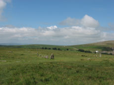
Merrivale Ceremonial Complex
Prehistoric Dartmoor Walks: Dartmoor Site: Merrivale Ceremonial Complex [Photo Set 2]
OS Map: SX 5545 7479
HER: MDV14795
Megalithic Portal: 2046
PMD: Merrivale
ShortName: CX Merrivale
DPD page: 16
Notes: The Merrivale Ceremonial Complex consists of a stone circle a large menhir and two double stone rows and burial cairns. See also: Legendary Dartmoor: Merrivale Ceremonial Complex. Lethbridge pp.16-18, diagram p.16.
Grinsell [Folklore 1976]: Formerly called the Potato Market or the Plague Market, perhaps from a time when goods were brought here for sale when the plague was raging in Tavistock. Bray 1879, letter ix; Crossing 1912/65, 94, note.
Nearby sites: SX 5545 7479
Distance: 3.81km
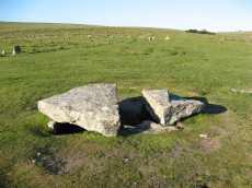
Merrivale Cist
Prehistoric Dartmoor Walks: Dartmoor Walk: Merrivale Complex
OS Map: SX 55490 74770
HER: MDV3738
Megalithic Portal: 10465
PMD: Merrivale
Alternate name: Merrivale 7 Cist
ShortName: CT Merrivale 7
Butler map: 44.8.7
DPD page: 18
Grinsell: WAL 5
Notes: HER: A very fine Bronze Age cist which measures internally 2.2 metres long by 0.9 metres wide and up to 0.8 metres deep. The triangular-shaped slab which forms the massive cover stone is up to 2.1metres wide and averages 0.4 metres thick; a central part has been removed by stone cutters revealing the water-filled cist and a broken fragment of the coverslab.
Breton (p.14): The capstone was mutilated by a farmer in 1860, who cut a gate post out of the middle of it.
See also, Legendary Dartmoor: The Merrivale Kist. Lethbridge pp.16-18, diagram p.16. Butler Vol. 3. Map 44.8.7 (diagram of location in ceremonial complex p.24, diagram of cist p.31).
Nearby sites: SX 55490 74770
Distance: 3.76km
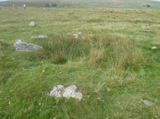
Merrivale Embanked Cairn Circle and Cist
OS Map: SX 55360 74747
HER: MDV4997
Megalithic Portal: 10503
PMD: Merrivale SW.
Alternate name: Merrivale 8 Embanked Cairn Circle and Cist
ShortName: CT Merrivale 8
Butler map: 44.8.8
Grinsell: WAL 1
Turner: B2
Notes: "The excavation of 1851 seems to have been thorough, completely destroying structural remains of both the cairn and the 'cist or inner circle',. There is now a circular turf covered area, 18.0m. in diameter, with random stones protruding through the surface. Off centre there is a hollow, 7.0m. by 4.0m. and 0.5m. deep." Butler Merrivale Vol. 3. Map 44.8.8 (pp.30-1).
Nearby sites: SX 55360 74747
Distance: 3.88km
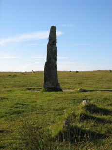
Merrivale (Menhir 1) Stone Row
Prehistoric Dartmoor Walks: Dartmoor Site: Merrivale Ceremonial Complex [Photo Set 1]
OS Map: SX 55361 74592
HER: MDV53397
Megalithic Portal: 3388
The Stone Rows of GB: Merrivale 4
PMD: Merrivale Menhir I Stone Row
Alternate name: Merrivale 4 Stone Row
ShortName: SR Mer Menhir
Butler map: 44.8.4
DPD page: 17
Notes: Butler Row 4. Prehistoric Monuments of Dartmoor website Menhir 1. "Stone row 4 is now a trivial affair [Butler] of 3 small slabs aligned towards a squarish block near the base of the standing stone. This area has suffered some damage over the past century. There were 5 stones in 1895, the missing one presumably accounted for by the pit which has appeared between the upper stones. This may well be the site of the cairn, C4, at the head of the rows recorded by Rowe but not included in the plans of Lukis or Worth. Nor is there much surviving from the circle of slabs around the menhir depicted in Bray's plan and recorded by Spence Bate in 1871, or the nearby cist which he excavated, C5. The Exploration Committee excavated at both ends of the row but no more socket holes were found and they concluded that this short alignment was complete." Lethbridge pp.16-18, diagram p.16.
Nearby sites: SX 55361 74592
Distance: 3.83km
Merrivale 5 Stone Row
OS Map: SX 55354 74592
HER: MDV53398
The Stone Rows of GB: Merrivale 5
PMD: Merrivale Menhir II
ShortName: SR:Merrivale 5
Butler map: 44.8
Notes: HER: Possible stone alignment lying to the south-west of the standing stone at Merrivale. Stones are small and identification uncertain. Gerrard: Cluster of small earthfast upright granite slabs. This feature lies within 9.0 meters west of the standing stone (PRN 53395) and includes a number of stones protruding through the turf, the largest of which stands up to 0.35 meters high. The precise nature of the feature associated with these stones is uncertain because most of it survives as a buried feature, but they may represent the site of a second cairn identified in this area by Rowe or may represent part of a stone alignment. Butler: A small slab can be seen approximately 5.5m from the standing stone which seems to have been deliberately set and Butler makes reference to the 'tops of several more which can be seen in one or two lines' between that and the standing stone, although he does not plot these stones on his plan.
Nearby sites: SX 55354 74592
Distance: 3.84km
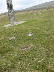
Merrivale 6 Stone Row
OS Map: SX 55344 74590
The Stone Rows of GB: Merrivale 6
ShortName: SR Merrivale 6
Butler map: 44.8
Nearby sites: SX 55344 74590
Distance: 3.85km
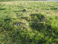
Merrivale 9 Cairn
OS Map: SX 55353 74725
HER: MDV28496
ShortName: CN Merrivale 9
Butler map: 44.8.9
Grinsell: WAL 3
Notes: "Cairn measuring 4.0 meters in diameter and standing 0.6 meters high, with a pit 1.3 meters in diameter by 0.4 meters deep in the centre of the mound."
Nearby sites: SX 55353 74725
Distance: 3.88km
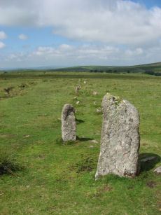
Merrivale A Stone Row
Prehistoric Dartmoor Walks: Dartmoor Site: Merrivale Ceremonial Complex [Photo Set 1]
OS Map: SX 55541 74809
HER: MDV14797
Megalithic Portal: 2044
The Stone Rows of GB: Merrivale 1
PMD: Merrivale A Stone Row
Alternate name: Merrivale 1 Stone Row
ShortName: SR MerrivaleA
Butler map: 44.8.1
DPD page: 16
Notes: Worth Merrivale A. Butler Merrivale 1. "Two Bronze Age double stone rows and associated cairns are located on open moorland. The rows are oriented roughly east to west and are almost parallel, being 25 metres between centres at their eastern ends increasing to 32 metres at the west. A leat still used to convey water to Hillside Stables separates the two monuments and flows to within 2 metres of the northern row. A single row (see SX 57 SE 115) runs roughly south-west from a small cairn at SX 55397476, some 4.75 metres south of the south row." Lethbridge pp.16-18, diagram p.16.
Nearby sites: SX 55541 74809
Distance: 3.73km
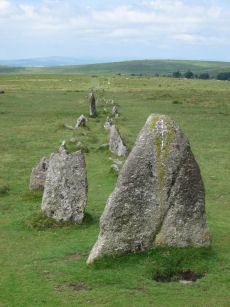
Merrivale B Stone Row
Prehistoric Dartmoor Walks: Dartmoor Site: Merrivale Ceremonial Complex [Photo Set 1]
OS Map: SX 55567 74788
HER: MDV14795
Megalithic Portal: 117
The Stone Rows of GB: Merrivale 2
PMD: Merrivale B Stone Row
Alternate name: Merrivale 2 Stone Row
ShortName: SR MerrivaleB
Butler map: 44.8.2
DPD page: 16
Notes: Butler Merrivale 2. Worth Merrivale B. For description see Merrivale A. Lethbridge pp.16-18, diagram p.16.
Nearby sites: SX 55567 74788
Distance: 3.70km
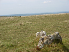
Merrivale C Stone Row
Prehistoric Dartmoor Walks: Dartmoor Site: Merrivale Ceremonial Complex [Photo Set 1]
OS Map: SX 55394 74761
HER: MDV5001
Megalithic Portal: 3391
The Stone Rows of GB: Merrivale 3
PMD: Merrivale C Stone Row
Alternate name: Merrivale 3 Stone Row
ShortName: SR MerrivaleC
Butler map: 44.8.3
DPD page: 17
Notes: Butler Merrivale 3. Worth Merrivale C. "A stone row and a small cairn lie to the south of the double stone rows in close-cropped moorland turf. The cairn located at the northern end and slightly off-centre to the row, measures 3.2m across and up to 0.5m high. An 0.3m deep central pit opens out on the southern side. There is no obvious kerb or cist but a transverse slab, the terminal slab of the row, is set within the south side of the mound. The existence of this slab suggest that the row pre-dates the mound. The stone row extends for 41.7m in a southerly direction to an upright stone (SX553774720). However, during the English Heritage 1999 survey a further stone was located on the same alignment beyond this stone indicating an overall length for the row of at least 60m. The new partially buried stone at SX55337484 is visible as a rounded stone 0.15m across; it is similar to others in the row. A total of six upright stones, six stones protruding through the turf and about ten slight depressions, now indicate this 60m long alignment. The transverse stone within the cairn is 0.5m by 0.4 and 0.15m thick. The two adjacent in line slabs are 0.6m 0.3m by 0.15m and 0.3 by 0.2 and 0.2m thick respectively. The other large stone (SX55377472) is 0.5 by 0.4 and up to 0.4m thick. The other stones are up to 0.15m high." Lethbridge pp.16-18 Row C, diagram p.16.
Nearby sites: SX 55394 74761
Distance: 3.85km
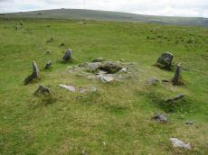
Merrivale double row B (centre) Encircled Cairn and Cist
Prehistoric Dartmoor Walks: Dartmoor Walk: Merrivale Complex
OS Map: SX 55442 74779
HER: MDV14796
Megalithic Portal: 3389
PMD: Merrivale S row
Alternate name: Merrivale double row 2 centre Encircled Cairn and Cist
ShortName: CT Merrivale 2
Butler map: 44.8.2
DPD page: 17
Grinsell: WAL 4
Turner: F20
Notes: Butler Merrivale double row 2, (centre) - Vol. 3. Map 44.8.1 (diagram p.27). Lethbridge pp.16-18, diagram p.16.
Nearby sites: SX 55442 74779
Distance: 3.81km
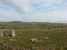
Merrivale NE Cairn Circle
Prehistoric Dartmoor Walks: Dartmoor Site: Merrivale Ceremonial Complex [Photo Set 1]
OS Map: SX 55548 74817
HER: MDV29078
Megalithic Portal: 3390
The Stone Rows of GB: Merrivale 1
PMD: Merrivale A Stone Row
Alternate name: Merrivale double row 1 (east end) Cairn Circle
ShortName: CC Merrivale 1
Butler map: 44.8.1
Notes: At the eastern end (of the northern stone row) there is a blocking stone and beyond it a number of earthfast and loose slabs which seem to represent a former kerb or circle about 5.6m. in diameter. The blocking stone is part of the circle with two or possibly three earthfast slabs on end, three recumbent slabs, and four other post or slab stones which are much displaced or entirely unconnected. The stones are spaced at about 2.0m. intervals; uprooted slabs are from 0.3m. square to 0.4m. by 0.5m., earthfast stones 0.1m. high. There is no sign of a cairn or cist.
Nearby sites: SX 55548 74817
Distance: 3.73km
Merrivale North Embanked Cairn Circle
OS Map: SX 55340 74845
HER: MDV3757
Megalithic Portal: 10502
Alternate name: Merrivale 10 Embanked Cairn Circle
ShortName: CC Merrivale10
Butler map: 44.8.10
Turner: B8
Notes: "Turner describes this site as an embanked stone circle; an annular bank of earth and/or stones with an inner edge of orthostats. Internal diameter is 8.0 meters with a bank 0.8 meters wide and 0.3 meters high. Much disturbed." Turner B8.
Nearby sites: SX 55340 74845
Distance: 3.93km
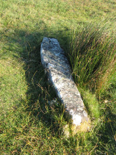
Merrivale Recumbent Slab Standing Stone
Prehistoric Dartmoor Walks: Dartmoor Site: Merrivale Ceremonial Complex [Photo Set 2]
OS Map: SX 55371 74596
HER: MDV53396
ShortName: SS-Merrivale 2
Butler map: 44.8.4
DPD page: 17
Notes: "The second stone is now fallen, it is 2.2 metres long, up to 0.4 metres wide and 0.3 metres thick. An adjacent 0.3 metre deep pit may be its socket hole." According to Butler it was "erected in 1895 in the pit alongside, toppling again a few years later". Breton (p.14) "A smaller menhir is near ..." [to the Merrivale Longstone].
Nearby sites: SX 55371 74596
Distance: 3.82km
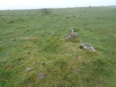
Merrivale row 3 Cairn
OS Map: SX 55399 74770
HER: MDV5000
PMD: Merrivale Short Stone Row
ShortName: CN Merrivale 3
Butler map: 44.8.3
Grinsell: WAL 2
Notes: Cairn located at the north-eastern end of the short single stone row, immediately south of the southern double stone row. It is of small stone construction, and is now turf-covered. "A small cairn that coontianed a ruined kistvaen" (Baring-Gould DEC Report No.2 1895)
Nearby sites: SX 55399 74770
Distance: 3.85km

Mis Tor Farm Embanked Cairn Circle
OS Map: SX 56927 75953
HER: MDV15372
Megalithic Portal: 45609
Alternate name: Little Mis Tor S.E. Embanked Cairn Circle
ShortName: CC:MisTor Farm
Butler map: 30.17
Butler Vol 5: p.163 & Fig.104
Grinsell: LYD 37a
Turner: B13
Notes: HER Base of ancient tumulus, about 20m in diameter, may have formed a bound of the ancient boundary between Lydford and Walkhampton (Prowse). Butler: Little Mis Tor SE cairn at SX56927595 of 22.0 metres diameter by 0.4 metres high. This large but low cairn has suffered some trenching around the eastern side. An outer bank 22 metres across surrounds a level interior rising to a small mound at the centre on which are lying several small stones. The few slabs visible within the bank show that it was built with inner and outer faces around a rubble core.
Nearby sites: SX 56927 75953
Distance: 3.23km
Muddilake Newtake Reported Cist
OS Map: SX 62654 75194
HER: MDV5893
Megalithic Portal: 45745
PMD: Muddilake Newtake
ShortName: CT:Muddilake
Grinsell: LYD 105
Turner: A21
Barrow Report: 58
Notes: NMR states "A hut circle, not a cairn circle". This is almost certainly not a cist. "The measurements do not conform to those of Prowse but nothing else can be seen in the vicinity. It is most unlikely that these stones represent the remains of a cist, but are a natural occurrence." (see also duplicate HER record 5894 and SiteID=2547). This "cist" entry was listed by Dixon, however, it seems a dubious entry. This is not listed by Butler, the relevant map is Vol. 2. Map 29.9.
Nearby sites: SX 62654 75194
Distance: 3.99km
Muddy Lakes Newtake Reported Cairn
OS Map: SX 6258 7518
HER: MDV5894
Megalithic Portal: 45745
Alternate name: Muddilake West Reported Cairn
ShortName: CT?Muddilake 3
Barrow Report: 58
Notes: Hut circle or cairn? Grinsell states "Traces of cairn with central slab, probably side-slab of cist. Diameter 6.0 meters, height is slight." Other observers say "no trace of cist". This is a duplicate of record 382 (HER 5893). Dixon #82. Bar Rep. 58 (TDA 71. 1939 illustration p.69).
Nearby sites: SX 6258 7518
Distance: 3.92km
Newleycombe Lake Head Enclosed Settlement
OS Map: SX 5959 6985
HER: MDV3427
ShortName: ES:Newleycombe
Notes: HER: Agglomerate enclosure straddling a shallow north-facing valley overlooking Newleycombe Lake. Composed of three conjoined enclosures defined by a partly faced rubble wall measuring 1.5 metres wide and up to 0.5 metres high. Interior of the southern enclosure measures 80 metres north-south by 90 metres east-west and the north-west enclosure, which is sub-triangular in shape, measures 44 metres north-south by 37 metres east-west. The original dimensions of the third enclosure are no longer discernible following later tin streamworking which has removed part of its extent. There are three gaps in the boundary which may represent original entrances, though it is possible that they may be the result of limited post-medieval stone robbing.
Three stone hut circles lie within the largest enclosure, three further examples are attached to the inner face of the boundary and one is linked to the same wall. Another hut is linked to the sub-triangular enclosure boundary wall.
Nearby sites: SX 5959 6985
Distance: 3.70km
Raddick Hill Enclosed Settlement
Prehistoric Dartmoor Walks: Dartmoor Walk: Sharpitor area Stone Rows and Cists
OS Map: SX 57636 71495
HER: MDV3748
Megalithic Portal: 36404
ShortName: ES:RaddickHill
DPD page: 26
Notes: "A Bronze Age enclosed hut circle settlement. The remains lie on a northerly hillslope and now comprise a D-shaped enclosure wall of boulders and stones containing about twelve hut circles. A small D-shaped enclosure is attached to the uphill south-east side. The northern part of the settlement has been effaced by a tinner's cliff, part of the Hart Tor Brook streamworks. This well preserved settlement now lies under low bilberry bushes."
Nearby sites: SX 57636 71495
Distance: 2.46km
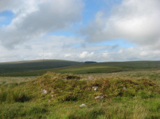
Raddick Hill Cist
Prehistoric Dartmoor Walks: Dartmoor Walk: Sharpitor area Stone Rows and Cists
OS Map: SX 57929 71157
HER: MDV4947
Megalithic Portal: 45777
PMD: Raddick Hill N.
Alternate name: Raddick Hill Summit 3 Cist
ShortName: CT RaddickSu3
Butler map: 46.6.3
DPD page: 26
Grinsell: WAL 15
Barrow Report: 18 31
Notes: One of a group of 4 cairns. Excavated by Burnard in 1899 - a small piece of corroded bronze, possibly a knife, was found. This almost perfect cist is now obscured by vegetation. Butler Raddick Hill Summit 3 - Vol. 3. Map 46.6. Grinsell Raddick Hill WALKHAMPTON 15 (listed as 14 but in the listings doubt is expressed between 14 and 15 - 15 matches the NMR account for bronze being found).
Nearby sites: SX 57929 71157
Distance: 2.60km
Round Hill E Reported Stone Row
OS Map: SX 6121 7439
HER: MDV6220
PMD: Roundhill E.
ShortName: SR:RoundHill E
Notes: Record originates with Prowse. HER: Stone alignment east of Round Hill later identified as a prehistoric field boundary
Nearby sites: SX 6121 7439
Distance: 2.34km
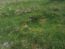
Roundhill SW (N) Cist
OS Map: SX 60916 74160
HER: MDV6248
Megalithic Portal: 45680
PMD: Roundhill SW 2
Alternate name: Round Hill S.2 Cist
ShortName: CT RoundhillS2
Butler map: 65.1.5
DPD page: 106
Grinsell: LYD 76
Barrow Report: 31
Notes: Northern of a pair of cists. Butler Round Hill S. 3. (Cairn 6) - Vol. 4. Map 65.1 (p.227-9 general plan of diagram of Round Hill cairns p.228). LYDFORD 75. "A turf-covered cairn, slightly spread on the northern side, measuring 5.0 meters by 4.8 meters and 0.5 meters in height. An almost centrally placed upright slab, 0.6 meters long and 0.13 meters wide and a large slab at the foot of the mound could both be part of a disturbed cist. There is no evidence of a kerb". Lethbridge diagram p.103, photo bottom p.106.
Nearby sites: SX 60916 74160
Distance: 1.99km
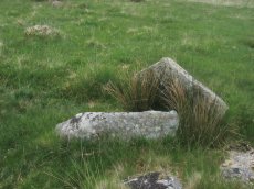
Roundhill SW (S) Cist
OS Map: SX 60910 74140
HER: MDV6249
Megalithic Portal: 52683
PMD: Roundhill SW 1
Alternate name: Round Hill S.3 Cist
ShortName: CT RoundhillS3
Butler map: 65.1.6
DPD page: 106
Grinsell: LYD 75
Barrow Report: 31 44
Notes: Southern of a pair of cists. "Small turf-covered cairn with an open cist in the centre. Diameter of cairn 4.0m. Height 0.5m. The cist is practically buried under the turf now. Internal dimensions 0.85m x 0.5m. The capstone is 1.1m x 0.8m rests on the north side of the cairn. Condition of cairn and cist - fairly good. Orientation of the long axis of the cist is WNW-ESE." Lethbridge diagram p.103, photo top p.106. Butler Round Hill S. 2. (Cairn 5) - Vol. 4. Map 65.1 (p.227-9 general plan of diagram of Round Hill cairns p.228).
Nearby sites: SX 60910 74140
Distance: 1.97km
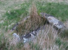
Roundhill, East of Summit Cist
OS Map: SX 61164 74413
HER: MDV6257
Megalithic Portal: 45681
PMD: Round Hill E.
Alternate name: Round Hill Summit 2 Cist
ShortName: CT Roundhill 2
Butler map: 65.1.2
DPD page: 105
Grinsell: LYD 79
Barrow Report: 31 44
Notes: "A well preserved cist, situated on a slight east-facing slope just off the crest of a rounded hilltop. It stands in isolation on a generally stone-free area of rough moorland pasture. The side slabs are each 1.2m long and up to 0.3m thick and the end slabs are 0.55m long, 0.15m wide and 0.4m long, 0.1m wide respectively. The coverstone is up to 1.6m long, 0.9m wide and 0.2m thick. There are no surface indications of either a cairn or mound around the cist." Lethbridge p.103 diagram Cist(B), photo bottom p.105. Butler Round Hill Summit 2 (Cist 2) - Vol. 4. Map 65.1 (p.227-9, diagram of Round Hill cairns p.228).
Nearby sites: SX 61164 74413
Distance: 2.31km
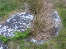
Roundhill, Near Summit Cist
OS Map: SX 61046 74428
HER: MDV6217
Megalithic Portal: 45682
PMD: Round Hill Summit W.
Alternate name: Round Hill Summit 1 Cist
ShortName: CT Roundhill 1
Butler map: 65.1.1
DPD page: 105
Grinsell: LYD 78
Barrow Report: 31 44
Notes: Butler Round Hill Summit 1 - Vol. 4. Map 65.1 (p.227-9, diagram of Round Hill cairns p.228). Lethbridge p.103 diagram Cist(A), photo top p.105.
Nearby sites: SX 61046 74428
Distance: 2.21km
Routrundle North Enclosed Settlement
Prehistoric Dartmoor Walks: Dartmoor Walk: Sharpitor area Stone Rows and Cists
OS Map: SX 55384 71860
HER: MDV105688
Megalithic Portal: 45577
ShortName: ES:Routrundl N
Notes: Routrundle North Pound: "Broadly oval enclosure, 58 by 48 metres diameter. Part of the south-west perimeter is represented by a stony scarp 0.5 metres high, elsewhere it comprises a stone spread of similar height upon which is a modern field wall."
Nearby sites: SX 55384 71860
Distance: 4.01km
Routrundle south Enclosed Settlement
Prehistoric Dartmoor Walks: Dartmoor Walk: Sharpitor area Stone Rows and Cists
OS Map: SX 55262 71735
HER: MDV3775
Megalithic Portal: 45578
ShortName: ES:Routrundl S
Notes: Routrundle South Pound: "A roughly oval field with diameters of 58.0 metres by 64.0 metres and a modern perimeter wall 1.5 metres high. There are no obvious footings of a previous wall but the plan and size (0.25 hectares) suggest that it is the fossilization of a prehistoric enclosure similar to that 250 metres to the north-east."
Nearby sites: SX 55262 71735
Distance: 4.17km

Royal Hill Cairn
OS Map: SX 61817 71957
HER: MDV6310
Megalithic Portal: 34957
Alternate name: Royal Hill E.1 Cairn
ShortName: CN:RoyalHill 1
Butler map: 65.5.1
Grinsell: LYD 93
Notes: "This impressive disturbed turf-covered cairn on the summit area of Royal Hill at 394m OD. It measures 16.4m (N-S) by 15.6m (E-W) with a maximum height of 1.8m. The flattish top has an off-centre pit 4.5m by 2.4m and 0.8m deep with some upcast material dumped around the top edge. Damage to the perimeter, reported in 1982 (8), has mostly been reinstated. The cairn is variously named Broken Barrow, Broken Barrows and Brokenborough"
Nearby sites: SX 61817 71957
Distance: 3.18km
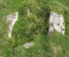
Royal Hill Summit Cist
OS Map: SX 61295 72792
HER: MDV18391
Megalithic Portal: 45798
PMD: Royal Hill Summit
ShortName: CT RoyalHill 7
Butler map: 65.5.7
Butler Vol 5: p.185 & Fig.128
DPD page: 102
Notes: Butler Royal Hill Summit Vol. 4. Map 65.2 (diagram Vol. 5. p.185). "The cairn 7.4m E to W, and 6.5m N to S, and about 0.5m high. It is turf covered, but the tops of three stones of an inner retaining circle are exposed to a height of 0.3m. The largest is 1.1m long and 0.2m thick ... The cist, oriented E to W is largely infilled; internally it measures 0.8m by 0.6m, and is 0.2m deep. The coverstone is missing as is the stone at the E end. The others take the form of irregular boulders rather than slabs". Lethbridge diagram p.102 Cist(D), photo p.102.
Nearby sites: SX 61295 72792
Distance: 2.37km
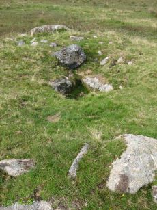
Royal Hill, Central Platform Cairn Circle and Cist
OS Map: SX 62082 72334
HER: MDV6304
Megalithic Portal: 34960
PMD: Royal Hill E.
Alternate name: Royal Hill E.4 Platform Cairn Circle and Cist
ShortName: CT RoyalHill 4
Butler map: 65.5.4
DPD page: 98
Grinsell: LYD 89
Turner: E21
Barrow Report: 27 47
Notes: "The cairn has an overall diameter of about 7.5m in diameter, and 0.6m high, with a flattish top. There are traces of an inner kerb 4.5m in diameter, and an outer one 5.7m across comprising boulders and slabs, the largest 1.5m long, 0.6m high, and 0.2m thick. The interior of the central cist is about 0.8m square with four stones up to 0.25m thick and 0.6m deep but the southern one overlaps the sides, is 1m long, and gives the cist its NW to SE alignment. This and the two end stones incline inwards; the northern one inclines slightly outwards. There is no cover stone." Lethbridge diagram p.97 Cist B, photo p.98. Turner E21 - listed as Royal Hill (N) [n.b. we have a south, central & north - N being a different cist]. Butler Royal Hill E. 4 (Cairn 4 - diagram p.233) - Vol. 4. Map 65.5. Breton p.19.
Nearby sites: SX 62082 72334
Distance: 3.26km
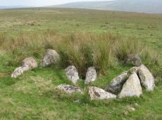
Royal Hill, North Ring Setting Cairn and Cist
OS Map: SX 62108 72434
HER: MDV6305
Megalithic Portal: 34959
PMD: Royal Hill NE.
Alternate name: Royal Hill E.5 Ring Setting Cairn and Cist
ShortName: CT RoyalHill 5
Butler map: 65.5.5
DPD page: 98
Grinsell: LYD 90
Turner: D21
Barrow Report: 27 47
Notes: "The circle is 3.1m in overall diameter, comprising nine contiguous thick slabs, up to 0.9m long and from 0.3m to 0.7m high... There is virtually no cairn material but the interior has been levelled up to a height of 0.1m on the E, downhill side. A central cist oriented WNW to ESE is represented by two side stones which protrude 0.15m above ground. They are 1.2m and 0.9m long and both about 0.2m thick and 0.4m deep. The longer, northern one leans inwards and touches the other at the W end; at the E the stones are 0.8m apart separated by two flat (packing ?) stones each about 0.35m across. An overgrown and embedded slab against the circle W if the cist may have been an end stone." Lethbridge diagram p.97 Cist C, photo p.98. Butler Royal Hill E. 5 (Cairn 5 - diagram p.233)- Vol. 4. Map 65.5. Central cist. Breton p.19.
Nearby sites: SX 62108 72434
Distance: 3.25km
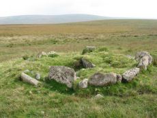
Royal Hill, South Platform Cairn Circle and Cist
OS Map: SX 62020 72091
HER: MDV6309
Megalithic Portal: 34958
PMD: Royal Hill SE.
Alternate name: Royal Hill E.3 Platform Cairn Circle and Cist
ShortName: CT RoyalHill 3
Butler map: 65.5.3
DPD page: 98
Grinsell: LYD 88
Turner: E31
Barrow Report: 27 47
Notes: "The cairn is 4.9m in diameter and 0.4m high with a flattish, platform, top. It is retained by a kerb of almost contiguous orthostats, the largest 1.1m long, 0.2m thick, and 0.6m high. A few are fallen or displaced. The central cist is oriented WNW to ESE, lacking both cover stone and N side slab. Internally it measures 1.35m by 0.75m by 0.55m deep." Lethbridge diagram p.97 Cist A, photo p.98. Butler Royal Hill E. 3 - Vol. 4. Map 65.5 (Cairn 3 - diagram p.233). Breton p.19.
Nearby sites: SX 62020 72091
Distance: 3.30km
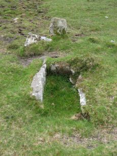
Sharpitor (N) or Peek Hill Platform Cairn Circle and Cist
Prehistoric Dartmoor Walks: Dartmoor Walk: Sharpitor area Stone Rows and Cists
OS Map: SX 55839 70693
HER: MDV3769
Megalithic Portal: 1246
PMD: Peek Hill
Alternate name: Sharpitor N. Platform Cairn Circle and Cist
ShortName: CT Peek Hill
Butler map: 45.12
DPD page: 22
Grinsell: WAL 21
Turner: E41
Barrow Report: 72
Notes: Bar Rep. 72 (TDA Vol 88 p.222). Butler Sharpitor N. - Vol. 3. Map 45.12 (diagram p.45 & photo p.84).
Copyright for photos and plans from Barrow Reports 71-73 belong to the Dixon estate. Reproduced here with kind permission.
Nearby sites: SX 55839 70693
Distance: 4.26km
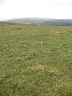
Sharpitor E. Stone Row
Prehistoric Dartmoor Walks: Dartmoor Walk: Sharpitor area Stone Rows and Cists
OS Map: SX 56171 70819
HER: MDV4991
Megalithic Portal: 2117
The Stone Rows of GB: Sharpitor North East
PMD: Sharpitor E Stone Row
Alternate name: Sharpitor NE Stone Row
ShortName: SR Sharp NE
Butler map: 45.13
DPD page: 21
Notes: Described by Worth as "Sharpitor, foot of eastern slope". Listed by Butler as Sharpitor N.E. (which can be confused with another alleged row). "A stone row, with a cairn at the west end at SX 56147078, extends almost due west for 26.0m. to SX 56167078. The cairn, mutilated and amorphous, is now approximately 6.7m in diameter and 0.3m. high at its maximum. There are nine stones in the row, including three pairs, with an additional stone which seems to be displaced, all between 0.1m. and 0.3m. high. The east end of the row is terminated by a reave (SX 67 SE 91) which has cut across and evidently destroyed any westward extension." Lethbridge pp.20-22.
Nearby sites: SX 56171 70819
Distance: 3.93km
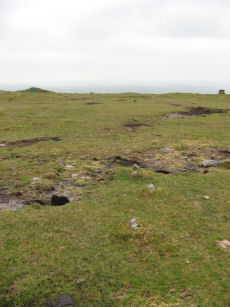
Sharpitor N.W. 1 Stone Row
Prehistoric Dartmoor Walks: Dartmoor Walk: Sharpitor area Stone Rows and Cists
OS Map: SX 55665 70617
HER: MDV3762
Megalithic Portal: 2118
The Stone Rows of GB: Sharpitor North West 1
PMD: Sharpitor Summit N Stone Row
Alternate name: Sharpitor NW 1 Stone Row
ShortName: SR Sharp NW1
Butler map: 45.12.1
DPD page: 21
Barrow Report: 66
Notes: "The double stone row is in poor shape. Both terminals have survived fixing its length at 113m from the blocking stone to the centre of the cairn. The cairn (4.5 x 0.3) has lost its retaining circle and has been dug into in the centre. The other end of the row is well defined by a pair of larger slabs in the line of the rows followed by a central cross-set blocking stone 1.2m long that has been tipped backwards and is partly overgrown. The stones seemed to have increased in size nearer the cairn. Unusually the highest point on the ground is not at the cairn end but near the centre of the rows as they cross the summit of the ridge". Lethbridge pp.20-22. See also: Sea Views at Sharpitor NW 1. Breton p.27 The stone row, which starts from a cairn, passes through the south end of the pond, and terminates some distance below in a small circle of seven stones. About 320 yds due east of the circle, and only 40 yds. from the road, is another stone row which has been mutilated. It is only about 30 yds long and starts from a ruined circle.
Nearby sites: SX 55665 70617
Distance: 4.45km

Sharpitor N.W. 2 Stone Row
Prehistoric Dartmoor Walks: Dartmoor Walk: Sharpitor area Stone Rows and Cists
OS Map: SX 55687 70600
HER: MDV3761
Megalithic Portal: 2119
The Stone Rows of GB: Sharpitor North West 2
PMD: Sharpitor Summit S Stone Row
Alternate name: Sharpitor NW 2 Stone Row
ShortName: SR:Sharp NW2
Butler map: 45.12.2
DPD page: 21
Notes: "A BA single stone row oriented NE - SW at a very slight angle to the north-east end of the adjacent double stone row. The large scale survey dated 1980 shows a total of thirty stones whilst in 1994 it was reported that only about 10 stones can be identified with certainty and half of these are either buried or just showing. The row is partially obscured by moorland grass and the area is heavily disturbed by grazing animals and walkers tracks. The extent of the row is unclear and there is no ground evidence of an associated cairn or a blocking stone. Heavy wear and tear of the fragile peat cover has caused many natural moorland stones to be exposed on the line of the row". Lethbridge pp.20-22. See also: Sea Views at Sharpitor NW 2 Breton p.27 The stone row, which starts from a cairn, passes through the south end of the pond, and terminates some distance below in a small circle of seven stones. About 320 yds due east of the circle, and only 40 yds. from the road, is another stone row which has been mutilated. It is only about 30 yds long and starts from a ruined circle.
Nearby sites: SX 55687 70600
Distance: 4.44km
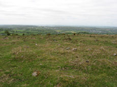
Sharpitor W. (Peek Hill) Cairn Circle
Prehistoric Dartmoor Walks: Dartmoor Walk: Sharpitor area Stone Rows and Cists
OS Map: SX 55056 70751
HER: MDV5011
Megalithic Portal: 52566
PMD: Sharpitor W Stone Row
Alternate name: Sharpitor W. stone row Cairn Circle
ShortName: CC Sharpitor W
Butler map: 45.11
DPD page: 20
Grinsell: WAL 18
Notes: "The cairn lies on a gentle sw slope ne of horseyeatt farm, with a stone row see sx57se/141 running sw from it. The cairn is about 7m in diameter and 0.6m height, partly turf-covered, with a central hollow. The visible set stones within the cairn suggest two or three underlying concentric stone circles. These stones have a maximum height of 0.2m and are predominantly set with their long axes tangential to the circle". Lethbridge pp.19-20, diagram p.19.
Nearby sites: SX 55056 70751
Distance: 4.85km
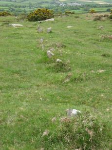
Sharpitor W. (Peek Hill) Stone Row
Prehistoric Dartmoor Walks: Dartmoor Walk: Sharpitor area Stone Rows and Cists
OS Map: SX 55058 70748
HER: MDV12831
Megalithic Portal: 2120
The Stone Rows of GB: Sharpitor West
PMD: Sharpitor W Stone Row
Alternate name: Sharpitor W Stone Row
ShortName: SR Sharpitor W
Butler map: 45.11
DPD page: 20
Notes: Butler: Sharpitor W, Worth: Peek Hill. Near Horseyeat Farm. "BA stone row and cairn. The 132m long row has 47 upright stones and the low cairn is 8.4m in diameter. Both monuments lie under dense bracken cover; gorse vegetation has obscured part of the row". Lethbridge pp.19-20, diagram p.19, photo p.20 Horseyeat Farm stone row. See also: Sea Views at Sharpitor West
Nearby sites: SX 55058 70748
Distance: 4.85km
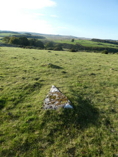
Sherberton Stone Row
OS Map: SX 63948 73349
HER: MDV6426
Megalithic Portal: 6333470
The Stone Rows of GB: Sherberton Row
PMD: Sherberton Stone Row
Alternate name: Sherberton Row Stone Row
ShortName: SR Sherberton
Butler Vol 5: p.211 & Fig.148
DPD page: 100
Notes: The Sherberton double row was discovered in 1997. It is an unimpressive double row of small stones a short distance north-west of the Sherberton Circle. For a plan see Butler Vol. 5 p. 210-12. Lethbridge pp.99-100, diagram p.99 and p.100.
Nearby sites: SX 63948 73349
Distance: 4.91km
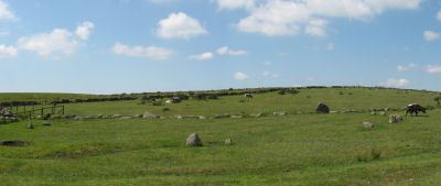
Sherberton Stone Circle
OS Map: SX 63946 73187
HER: MDV6290
Megalithic Portal: 1252
PMD: Sherberton Stone Circle
ShortName: SC Sherberton
DPD page: 101
Turner: G5
Notes: Remains of a 97 ft diameter stone circle with a stone wall passing through its western side. "Nine of the original stones are still standing, plus one larger stone which is incorporated in the remains of the old wall which bisects the western extremity of the circle. This stone appears to have been removed from the original circumference, and its height is 1.4m. The remaining nine stones range in height from 0.3m to 0.75m. The original circle appears to have been c. 30m across, although no stones appear to the west of the old wall. The length of the 2 fallen stones at the southern end is 2.6m and 2.4m". Lethbridge p.101, diagram p.99 and p.100. Breton (p.20): It was formerly a fine circle, but it has been mutilated to build the walls, and only seven stones now remain. Some of the stones are used as the gate posts, others are in the wall. The late Rev S Baring-Gould told me that he found, many years ago, the late Mr Coaker's father (of Sherberton Farm) removing the stones of this circle. Mr Baring-Gould explained to him the value of the circle and not another stone was touched.
Nearby sites: SX 63946 73187
Distance: 4.92km
Stan Lake Platform Cairn Circle
Prehistoric Dartmoor Walks: Dartmoor Walk: Sharpitor area Stone Rows and Cists
OS Map: SX 56896 70285
HER: MDV4996
Megalithic Portal: 45649
ShortName: PC:Stan Lake
Turner: E29
Notes: "much disturbed". Alleged cairn circle. NMR record states "At SX 56897029, a felled conifer currently obscures much of what appears to be a hut circle rather than a cairn, situated on a south-east slope near a valley bottom. (Identification as a cairn may have originated with H. Breton)." Idenitified as a round house in the HER. This record is marked as a duplicate as it replicates PWD record SiteID=8769.
Nearby sites: SX 56896 70285
Distance: 3.87km
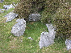
Stanlake Cist
Prehistoric Dartmoor Walks: Dartmoor Walk: Sharpitor area Stone Rows and Cists
OS Map: SX 56430 70859
HER: MDV3746
Megalithic Portal: 45755
PMD: Stanlake W.
Alternate name: Leeden Tor S.2 Cist
ShortName: CT LeedenTor 2
Butler map: 45.13.2
Grinsell: WAL 23
Barrow Report: 56 66
Notes: Butler Leeden Tor S. 2 - Vol. 3. Map 45.13 (diagram p.47).
Nearby sites: SX 56430 70859
Distance: 3.72km
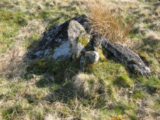
Swincombe Ford Newtake 1 Cist
OS Map: SX 63330 72988
HER: MDV54431
Megalithic Portal: 42665
PMD: Swincombe Ford Newtake
ShortName: CT Swincombe 1
Butler map: 63.5.1
DPD page: 99
Notes: Butler Vol. 4. Map 63.5 (diagram p.215). "A robbed cist within a cairn on a gently sloping NE-facing moorland hillside. A stoney cairn 6.0m N-S by 5.5m E-W and 0.3m high contains the cist, approximately 0.8m wide, 0.3m deep and of indeterminate length and orientation. The capstone, 1.4m by 1.3m largely obscures the cist, with only the ?NE end stone being visible." Lethbridge diagram p.99 photo top of p.99.
Nearby sites: SX 63330 72988
Distance: 4.32km
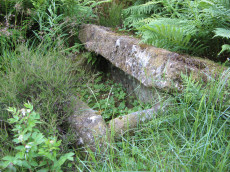
Thornworthy 2 Cist
OS Map: SX 59015 73471
HER: MDV6613
Megalithic Portal: 15453
PMD: Thornworthy
ShortName: CT Thornworth
Butler map: 35.22
Butler Vol 5: p.64 & Fig.42
DPD page: 137
Grinsell: CHA 3
Turner: E39
Barrow Report: 56
Notes: Located at the High Moorland Visitor Centre at Princetown. There were two cists at Thornworthy and both were excavated. This record refers to the second slightly smaller cist. This was removed after the excavation and given to the care of William Pengelly (see account 1880) of the Torquay Natural History Society and re-erected at Torquay Museum. The cist is now located in the Jack Wigmore Garden (also known as the Dartmoor Conservation Garden). It can be accessed by walking a very short distance down from the mini roundabout outside the centre down the Yelverton Road (Plymouth Hill). A gate on the right hand side behind the visitors centre gives access to the garden. See also: Thornworthy Cist. Butler Vol. 2. Map 35.22 p.169, see also diagram Vol. 5. p.64.
Nearby sites: SX 59015 73471
Distance: 0.05km
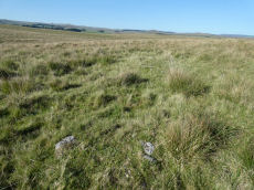
Tor Royal (newtake) Stone Ring Cairn Circle
OS Map: SX 62974 72262
HER: MDV18388
Megalithic Portal: 45831
Alternate name: Joan Ford's Newtake N.3 Stone Ring Cairn Circle
ShortName: RC JoanFd N3
Butler map: 63.3
Turner: A18
Notes: "Disturbed ring cairn consisting of a stone ring 8.0 meters in diameter internally with bank 1.0 meter wide and 0.2 meters high." This feature was previously listed here at SX 62939 72246 but that is the location of the nearby cairn to the east of this ring cairn. This record has been updated with SX 62974 72262 from a visit on 04/09/23.
Nearby sites: SX 62974 72262
Distance: 4.13km
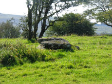
Vixen Tor Cist
OS Map: SX 54244 74404
HER: MDV3596
Megalithic Portal: 29932
PMD: Vixen Tor
Alternate name: Vixen Tor 1 Cist
ShortName: CT Vixen Tor 1
Butler map: 44.10.1
DPD page: 15
Grinsell: WHI 2
Barrow Report: 39
Notes: "Cist and possible remains of a barrow. The east and south sides of the cist lean inwards and the north end is slightly defective. The cover stone seems to have been in two parts and it leans against the south corner of the cist. There appears to be traces of a retaining circle of barrows, three stones only, in radius of 3.0m from the centre of the cist. The condition is good. The original dimensions would, however, appear to have been 1.219m x 533mm. One side stone is 1.524m in length, and the other is over 1.372m in length. The present depth below the top of the side stones is 330mm, but excavation would probably prove this to be at least twice this." Vixen Tor has been fenced off by the current landowner. Butler Vol. 3. Map 44.10.1 (diagram p.34). Plan by Butler (1993) shows the capstones to the side. The two stones forming the capstone must have been replaced since then. See also: Legendary Dartmooor: Vixen Tor and Vixen Tor Forbidden
Nearby sites: SX 54244 74404
Distance: 4.88km
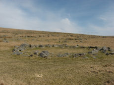
Walkhampton Enclosed Settlement
Prehistoric Dartmoor Walks: Dartmoor Site: Walkhampton and Yes Tor Bottom Settlements
OS Map: SX 56772 72867
HER: MDV4964
Megalithic Portal: 45325
ShortName: ES Walkhampton
Notes: "Hut circles 550m s of foggintor quarries. A very fine settlement, set within a well built and substantial enclosure wall, enclosing an area of some 1.0ha. Five hut circles occur within the enclosure varying between 6-10m in diam ... Outside the enclosure to the w are five further huts of similar dimensions - again one of these shows sign of alteration. Under moorland grass." The site was excavated in 1897 by Burnard and Baring-Gould.
Nearby sites: SX 56772 72867
Distance: 2.36km
Wistman's wood Settlement
OS Map: SX 6125 7750
HER: MDV5933
Megalithic Portal: 42854
Alternate name: Wistman's wood Settlement
ShortName: ST:Wistmans
Nearby sites: SX 6125 7750
Distance: 4.56km
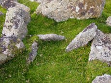
Yellowmeade Farm Cist
OS Map: SX 56350 74465
HER: MDV5002
Megalithic Portal: 45778
PMD: Yellowmeade Farm NW.
Alternate name: Yellowmeade 1 Cist
ShortName: CT Yellowm Fm1
Butler map: 44.1.1
DPD page: 18
Grinsell: WAL 7
Barrow Report: 67
Notes: Butler Yellowmeade 1 - Vol. 3. Map 44.1 (diagram p.17).
Nearby sites: SX 56350 74465
Distance: 2.85km
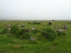
Yellowmeade Settlement Round House
OS Map: SX 56480 74420
HER: MDV4954
ShortName: CT-Yellowm Fm3
Notes: Probable hut circle. nw of the nw angle of the ends of yellowmeade farm, practically on the old tavistock-ashburton track. The cairn may contain a kistvaen. To the ne of the cairn there is a pound enclosing 3 hut circles. Large stones are used in the cairn.
This record originated from the HER and it now seems clear it is a duplicate of Yellowmeade 2 which is also of a reported cist. There is a round house at this location. This record is being retained and changed to a round house. This also reflects the current content of the linked HER record.
Nearby sites: SX 56480 74420
Distance: 2.71km