
Guide to Dartmoor Cists
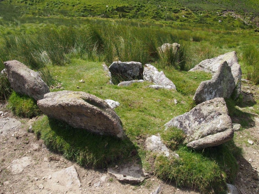
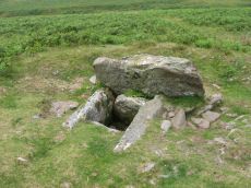
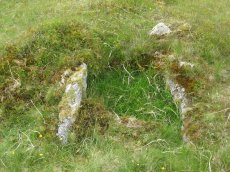
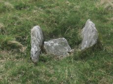
Photo: Grim's Grave Ring Setting Cairn and Cist
This listing started with the list compiled by C.E.B. Dixon when he took over writing the Barrow Committee reports following the death of R.H. Worth in 1950. It was an attempt to collate the cists listed in all the previous Barrow Committee reports largely compiled by Richard Hansford Worth and others from the Dartmoor Exploration Committee with the addition of a few that had been discovered subsequently. There were 102 cists listed in the 70th Barrow Committee report with cists numbered 103 and 106-109 added in the 72nd and 73rd reports. The original list included Corringdon Ball (26) and Cuckoo Ball (29) which are more properly classified as chambered tombs. The Dixon list was extended to 130 entries by Grinsell in his 1978 Dartmoor Barrows survey (filling the inexplicably skipped numbers 104 & 105 in the process). A number of cists discovered in more recent decades have been added including those listed by Turner in 1990 and a few taken from Butler (1991-7). The Dixon number for records after 130 merely represents the order they have been added to the database.
In total there are over 150 entries in the Prehistoric Dartmoor Walks database which covers all of the known visible cists on Dartmoor with the exception of a few that are very fragmentary. Butler lists 187 cists including the sites of cists that have been removed (Butler Vol. 5 Appendix 5. pp.279-280) and a very comprehensive listing of over 200 cists, or possible cists, can be found on Prehistoric Monuments of Dartmoor. Butler points out that cists are widespread and unknown examples were discovered in 12% of the cairns excavated by the Dartmoor Exploration committee which suggests potentially 100 or more cists remain concealed.
A table of these cists without photos and additional notes is available: Table of Dartmoor Cists
Bibliography & references
Butler, Jeremy, Dartmoor Atlas of Antiquities, vol.1: The East, (1991)
Butler, Jeremy, Dartmoor Atlas of Antiquities, vol.2: The North,(1991)
Butler, Jeremy, Dartmoor Atlas of Antiquities, vol.3: The South-West, (1994)
Butler, Jeremy, Dartmoor Atlas of Antiquities, vol.4: The South-East, (1993)
Butler, Jeremy, Dartmoor Atlas of Antiquities: Vol.5: The Second Millennium B.C. (Devon Books, 1997)
Dixon, C.E.B., Seventieth Report on Barrows, T.D.A. Vol. 84 pp.249-253 (1952)
Dixon, C.E.B., Seventy-first Report on Barrows, T.D.A. Vol. 85 pp.176-177 (1953)
Dixon, C.E.B., Seventy-second Report on Barrows, T.D.A. Vol. 88 pp.222-224 (1956)
Dixon, C.E.B., Seventy-third Report on Barrows, T.D.A. Vol. 90 pp.230-233 (1958)
Grinsell, L.V., Dartmoor Barrows, Devon Archaeological Society Proceedings No. 36 (1978)
Newman, Phil The Field Archaeology of Dartmoor (English Heritage, 2011)
Pettit, Paul. Prehistoric Dartmoor (David & Charles, 1974)
Turner, J.R., Ring Cairns, stone circles and related monuments on Dartmoor, D.A.S.P. No. 48 pp. 27-86 (1990)
Worth, R.H. Worth's Dartmoor (David & Charles, 1971)
Worth, R.H., Nineteenth Report of the Barrow Committee, T.D.A. Vol. 32 pp.46-54 (1900)
External Links & Resources
The NMRs can be searched on the English Heritage Pastscape website. The simplest method is to use a location search and reduce the range to 250m to narrow the results (increase to 500m if site not found). The Megalithic Portal is another great resource for looking up sites. A detailed listing of over 200 cists can be found on the Prehistoric Monuments of Dartmoor website.
Pastscape: National Monuments Records
Prehistoric Monuments of Dartmoor: A List of Dartmoor Cists
Megalithic Portal: Search Page
Legendary Dartmoor: Dartmoor Kistvaens
Listing of some of the Dartmoor Cists
About the Database Listings
Details of archaeological sites used to be kept in the Sites and Monuments Records (SMRs). These are now held in National Monument Records (NMRs) maintained by English Heritage although these in turn are being merged into Historic Environment Records (HERs). The NMRs contains details of the site and will often include field notes, a limited bibliography and other useful information. Another rich source of such information is Bill Radcliffe's Prehistoric Monuments of Dartmoor (PMD) website. The records below were compiled independently from books and journals and then matched to the NMR records and then cross-referenced with any corresponding PMD records to ensure accuracy. Each record has a link to corresponding NMR and PMD records, a link to the location on the Ordnance Survey map, a photo (if available) and a link to relevant coverage on Prehistoric Dartmoor Walks and a link giving a listing of nearby sites. The HER records are not included as they do not yet have much information but they can be looked up via the PMD records. The author would like to thank Bill Radcliffe for the helpful correspondence whilst checking records. See also: Database and Web Search Tools
- NMR = Pastscape National Monument Record
- HER = Historic Environment Record
- PMD = Prehistoric Monuments of Dartmoor Record
- DPD = Discover Prehistoric Dartmoor page number
- Short Name is named used in GPS listings
Default listing is by Dixon list, click here to order instead by: Site Name, OS, Dixon Number
Barn Hill Cist
OS Map: SX 53318 74558
HER: MDV14685
Megalithic Portal: 45785
PMD: Barn Hill
Alternate name: Barn Hill S. Cist
Short Name: CT Barn Hill
Butler map: 44.10.3
Grinsell: WHI 3
DPD: 15
Dimensions (m): c.5.0 x 0.1 C
Notes: "The cairn mound measures 5.7 metres in diameter and stands up to 0.2 metres high. The cist lies slightly south of the cairn's centre and survives as a 0.98 metre long by 0.6 metre wide and 0.3 metre deep stone-lined pit". Possibly described in Barrow report 39 although refers to somethign on the norterhen side of barn Hill and this is on the southern. Butler Barn Hill S. - Vol. 3. Map 44.10.3. (diagram p.34). Previously listed with an inaccurate grid reference. Now found at SX 53318 74558. The photo was taken in the heatwave of Sept 2023 unfortunately I got sunblock on the lens - a better photo will be uploaded when i next visit. The grid reference is now accurate.
Nearest Bus Stop: Tavistock Higher Longford (1.6 km) [Route: 98,171,172]
Nearby sites: SX 53318 74558
White Hill Cist
OS Map: SX 53717 84201
HER: MDV3216
Megalithic Portal: 45783
PMD: White Hill NE.
Alternate name: White Hill 10 Cist
Short Name: CT WhiteHill
Butler map: 32.22.10
Butler Vol 5: p.217 & Fig.151
Grinsell: PET 11
DPD: 11
Dimensions (m): 8.0 x 0.6 C
Notes: Butler Vol. 2. Map 32, 22.10 (Cairn 10 - diagram of cairn cemetery on White Hill on p.107, diagram Vol. 5. p.217). Lethbridge photo p11.
Nearest Bus Stop: Dartmoor Inn (1.8 km) [Route: 118]
Nearby sites: SX 53717 84201
Great Nodden Cist
Prehistoric Dartmoor Walks: Dartmoor Site: Guide to the Cairns on Great Nodden
OS Map: SX 5388 8741
HER: MDV4625
Megalithic Portal: 45796
PMD: Great Nodden
Alternate name: Great Nodden 17 Cist
Short Name: CT Great Nod17
Butler map: 43.7.17
Grinsell: BRI 7a
Barrow Report: 13 21
Notes: Butler: "recorded on the summit in 1891". This was excavated revealing a cist. No longer traceable. This cairn and cist was around 6m away from the Great Nodden cairn. The photograph accompanying this record is of the Great Nodden Cairn in the vicinity of where this cist used to exist. Butler Vol. 2. Map 43.7.17.
Nearest Bus Stop: Fox and Hounds Hotel (1.6 km) [Route: 118]
Nearby sites: SX 5388 8741
Nattor Down 5 Cist
OS Map: SX 5409 8286
HER: MDV3223
Megalithic Portal: 45784
PMD: Nattor Down 5
Short Name: CT:Nattor 5
Butler map: 32.2.5
Butler Vol 5: p.65 & Fig.43
Grinsell: PET 14
DPD: 12
Dimensions (m): 5.7 x 0.3 C
Notes: "Only the north east sidestone, which is 1.2m long and the north west endstone which is 0.5m long remain in position. The endstone leans slightly inwards. Top of sidestone is 0.4m above ground level. The depth of the kist is unknown. A possible coverstone lies 2.0m due south of the kist. The kistvaen is contained in a turf covered cairn 4.6m in diameter and approx.0.3m high.". Butler Nattor Down 5 - Vol. 2. Map 32.2 (diagram Vol. 5. p.65). 127 Lethbridge pp.11-12, photo and diagram p.12.
Nearest Bus Stop: Dartmoor Inn (3.0 km) [Route: 118]
Nearby sites: SX 5409 8286
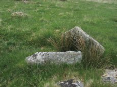
Vixen Tor Cist
OS Map: SX 54240 74391
HER: MDV3596
Megalithic Portal: 29932
PMD: Vixen Tor
Alternate name: Vixen Tor 1 Cist
Short Name: CT Vixen Tor
Butler map: 44.10.1
Grinsell: WHI 2
DPD: 15
Barrow Report: 39
Dimensions (m): 1.2 x 0.5 C
Notes: "Cist and possible remains of a barrow. The east and south sides of the cist lean inwards and the north end is slightly defective. The cover stone seems to have been in two parts and it leans against the south corner of the cist. There appears to be traces of a retaining circle of barrows, three stones only, in radius of 3.0m from the centre of the cist. The condition is good. The original dimensions would, however, appear to have been 1.219m x 533mm. One side stone is 1.524m in length, and the other is over 1.372m in length. The present depth below the top of the side stones is 330mm, but excavation would probably prove this to be at least twice this." Vixen Tor has been fenced off by the current landowner. Butler Vol. 3. Map 44.10.1 (diagram p.34). See also: Legendary Dartmooor: Vixen Tor and Vixen Tor Forbidden
Nearest Bus Stop: Merrivale Dartmoor Inn (1.0 km) [Route: 98,171,172]
Nearby sites: SX 54240 74391
Doe Tor Cist
OS Map: SX 54383 84846
HER: MDV3251
Megalithic Portal: 44223
PMD: Doe Tor
Alternate name: Doe Tor E. Cist
Short Name: CT Doe Tor
Butler map: 32.21
Butler Vol 5: p.198 & Fig.141
Grinsell: LYD 12
DPD: 10
Barrow Report: 24
Dimensions (m): 5.0 x 0.4 C
Notes: Butler Doe Tor E - Vol. 2. Map 32.21 (diagram Vol. 5. p.198).
Nearest Bus Stop: Dartmoor Inn (2.1 km) [Route: 118]
Nearby sites: SX 54383 84846
Wigford Down Platform Cairn Circle and Cist
OS Map: SX 54419 64427
HER: MDV2373
Megalithic Portal: 3536
PMD: Wigford Down S.
Alternate name: Wigford Down 1 Platform Cairn Circle and Cist
Short Name: CT:WigfordDown
Butler map: 48.1.1
Grinsell: MEA 7
Turner: E6
DPD: 33
Barrow Report: 12 19
Dimensions (m): 8.5 x 0.6 C
Notes: "A badly disturbed prehistoric cist with displaced cover stone and vestiges of a retaining circle surviving in situ. Only five slabs of the retaining circle survive approximately upright in situ, suggesting the overall diameter of the complete circle was 8.35m. The long slabs of the central cist are also in situ and the chamber measures 1.1m by 0.28m approximately by 0.3m deep. A large, flat, intact cover stone of 1.4m by 1.17m, with a rounded end, is displaced to the south. Some material from the turf covered cairn is still visible, but much disturbed and depleted." Butler Wigford Down 1 - Vol. 3. Map 48.1 (diagram p.80).
Nearest Bus Stop: Shaugh Prior White Thorn Inn (1.3 km) [Route: 59]
Nearby sites: SX 54419 64427
Langstone Moor Cist
Prehistoric Dartmoor Walks: Dartmoor Site: Langstone Moor Stone Circle, Stone Row & Settlements
OS Map: SX 54699 78695
HER: MDV4118
Megalithic Portal: 35807
PMD: White Tor E.
Alternate name: White Tor E.4 Cist
Short Name: CT Langstone
Butler map: 31.22.4
Butler Vol 5: p.174 & Fig.114
Grinsell: PET 27
DPD: 13
Barrow Report: 55
Dimensions (m): 6.3 x 0.3 C
Notes: Butler White Tor E.4. Vol. 2. Map 31.22 (diagram Vol. 5. p.174).
Nearest Bus Stop: Merrivale Dartmoor Inn (3.5 km) [Route: 98,171,172]
Nearby sites: SX 54699 78695
Standon Hill Ring Setting Cairn and Cist
OS Map: SX 54739 81371
HER: MDV20155
Megalithic Portal: 45794
PMD: Standon Down
Alternate name: Standon Hill W. Ring Setting Cairn and Cist
Short Name: CT:Standon 1
Butler map: 32.17
Butler Vol 5: p.182 & Fig.124
Grinsell: PET 15
Turner: D15
Dimensions (m): c.5.0 x 0.3 C
Notes: Doubtful cist. "A disturbed cairn measuring 5.2m N to S by 6.0m and standing a maximum of 0.3m high. Eight large upright slabs and boulders, up to 0.6m high, lie on the fringe of the mound to create a substantial retaining circle. There is no evidence to suggest the presence of a cist though is seems likely that the interior of the cairn has been used as a repository for cleared stone. A large number of relatively recent clearance cairns lie in the immediate area." Butler Standon Hill W - Vol. 2. Map 32.17 (diagram Vol. 5. p.182).
Nearest Bus Stop: Dartmoor Inn (4.6 km) [Route: 118]
Nearby sites: SX 54739 81371
Merrivale Embanked Cairn Circle and Cist
OS Map: SX 55360 74747
HER: MDV4997
Megalithic Portal: 10503
PMD: Merrivale SW.
Alternate name: Merrivale 8 Embanked Cairn Circle and Cist
Short Name: CT MerrivaleSW
Butler map: 44.8.8
Grinsell: WAL 1
Turner: B2
Dimensions (m): c.20.0
Notes: "The excavation of 1851 seems to have been thorough, completely destroying structural remains of both the cairn and the 'cist or inner circle',. There is now a circular turf covered area, 18.0m. in diameter, with random stones protruding through the surface. Off centre there is a hollow, 7.0m. by 4.0m. and 0.5m. deep." Butler Merrivale Vol. 3. Map 44.8.8 (pp.30-1).
Nearest Bus Stop: Merrivale Dartmoor Inn (0.6 km) [Route: 98,171,172]
Nearby sites: SX 55360 74747
Merrivale double row B (centre) Encircled Cairn and Cist
Prehistoric Dartmoor Walks: Dartmoor Walk: Merrivale Complex
OS Map: SX 55442 74779
HER: MDV14796
Megalithic Portal: 3389
PMD: Merrivale S row
Alternate name: Merrivale double row 2 centre Encircled Cairn and Cist
Short Name: CT MerrivaleB
Butler map: 44.8.2
Grinsell: WAL 4
Turner: F20
DPD: 17
Dimensions (m): 3.3 x 0.3 C
Notes: Butler Merrivale double row 2, (centre) - Vol. 3. Map 44.8.1 (diagram p.27). Lethbridge pp.16-18, diagram p.16.
Nearest Bus Stop: Merrivale Dartmoor Inn (0.7 km) [Route: 98,171,172]
Nearby sites: SX 55442 74779
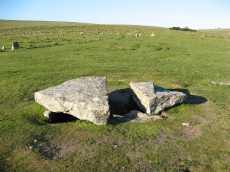
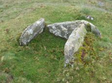
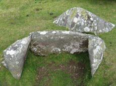
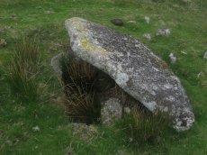
Merrivale Cist
Prehistoric Dartmoor Walks: Dartmoor Walk: Merrivale Complex
OS Map: SX 55490 74770
HER: MDV3738
Megalithic Portal: 10465
PMD: Merrivale
Alternate name: Merrivale 7 Cist
Short Name: CT Merrivale
Butler map: 44.8.7
Grinsell: WAL 5
DPD: 18
Dimensions (m): 2.2 x 0.9 C
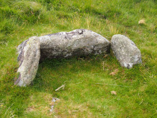
Notes: "A very fine Bronze Age cist which measures internally 2.2 metres long by 0.9 metres wide and up to 0.8 metres deep. The triangular-shaped slab which forms the massive cover stone is up to 2.1metres wide and averages 0.4 metres thick; a central part has been removed by stone cutters revealing the water-filled cist and a broken fragment of the coverslab." See also, Legendary Dartmoor: The Merrivale Kist. Lethbridge pp.16-18, diagram p.16. Butler Vol. 3. Map 44.8.7 (diagram of location in ceremonial complex p.24, diagram of cist p.31).
Nearest Bus Stop: Merrivale Dartmoor Inn (0.7 km) [Route: 98,171,172]
Nearby sites: SX 55490 74770
Langstone Moor 2 Cist
Prehistoric Dartmoor Walks: Dartmoor Site: Langstone Moor Stone Circle, Stone Row & Settlements
OS Map: SX 55736 78120
HER: MDV4593
Megalithic Portal: 45786
PMD: Near Langstone Moor Stone circle
Short Name: CT Langstone 2
Butler map: 30.10.2
Grinsell: PET 39
Dimensions (m): 5.5 x 0.3 C
Notes: The cist is now housed in the Plymouth City Museum. Butler Langstone Moor 2 - Vol. 2. Map 30.10. 129
Nearest Bus Stop: Merrivale Dartmoor Inn (3.1 km) [Route: 98,171,172]
Nearby sites: SX 55736 78120
Sharpitor (N) or Peek Hill Platform Cairn Circle and Cist
Prehistoric Dartmoor Walks: Dartmoor Walk: Sharpitor area Stone Rows and Cists
OS Map: SX 55839 70693
HER: MDV3769
Megalithic Portal: 1246
PMD: Peek Hill
Alternate name: Sharpitor N. Platform Cairn Circle and Cist
Short Name: CT Peek Hill
Butler map: 45.12
Grinsell: WAL 21
Turner: E41
DPD: 22
Barrow Report: 72
Dimensions (m): 4.0 x 0.2 C
Notes: Bar Rep. 72 (TDA Vol 88 p.222). Butler Sharpitor N. - Vol. 3. Map 45.12 (diagram p.45 & photo p.84).
Copyright for photos and plans from Barrow Reports 71-73 belong to the Dixon estate. Reproduced here with kind permission.
Nearest Bus Stop: Walkhampton Memorial (2.7 km) [Route: 55,56]
Nearby sites: SX 55839 70693
Ingra Tor Cist
Prehistoric Dartmoor Walks: Dartmoor Walk: Sharpitor area Stone Rows and Cists
OS Map: SX 55874 72093
HER: MDV4983
Megalithic Portal: 45735
PMD: Ingra Tor
Alternate name: lngra Tor Cist
Short Name: CT Ingra Tor
Butler map: 45.16
Grinsell: WAL 9
DPD: 19
Barrow Report: 56
Dimensions (m): 6.8 x 0.8 C
Notes: Butler Vol. 3. Map 45.16 (diagram p.51)
Nearest Bus Stop: Merrivale Dartmoor Inn (3.2 km) [Route: 98,171,172]
Nearby sites: SX 55874 72093
Homerton Hill N. Cist
OS Map: SX 56132 90651
HER: MDV12884
Megalithic Portal: 45808
PMD: Homerton Hill
Short Name: CT Homerton N
Butler map: 43.15
Butler Vol 5: p.177 & Fig.119
DPD: 157
Dimensions (m): 3.5 x 0.3 C
Notes: Butler Homerton Hill N. Vol. 2. Map 43.15 (diagram Vol. 5. p.177). "A small, disturbed cairn containing three edge set stones of a cist ... The turf covered cairn measures 3.5 x 3.1m and 0.3m max. height. The top and north side of the mound has been disturbed exposing the three in situ cist stones. The cist measures 0.8 x 0.6m and 0.3mdeep. It is now open to the north. A large stone lying flush with the ground lies immediately north east of the cairn and probably represents the missing endstone or the coverstone". Lethbridge diagram p.156 and photos p157.
Nearest Bus Stop: Sourton Windard Terrace (2.8 km) [Route: 118]
Nearby sites: SX 56132 90651
Leather Tor Platform Cairn Circle and Cist
OS Map: SX 56325 69524
HER: MDV3434
Megalithic Portal: 34457
PMD: Cross Gate
Alternate name: Leather Tor S. Platform Cairn Circle and Cist
Short Name: CT Leather Tor
Butler map: 45.17
Grinsell: WAL 25
Turner: E20
DPD: 23
Barrow Report: 54
Dimensions (m): 5.5 x 0.4 C
Notes: "A cist, consisting of two side stones and an end stone, contained within a barrow surrounded by a 16ft 6 ins diameter Kerb circle." Butler Leather Tor S. - Vol. 3. Map 45.17 (diagram p.52).
Nearest Bus Stop: Dousland Burrator Inn (2.7 km) [Route: 55,56,98]
Nearby sites: SX 56325 69524
Yellowmeade Farm Cist
OS Map: SX 56350 74465
HER: MDV5002
Megalithic Portal: 45778
PMD: Yellowmeade Farm NW.
Alternate name: Yellowmeade 1 Cist
Short Name: CT Yellowm Fm1
Butler map: 44.1.1
Grinsell: WAL 7
DPD: 18
Barrow Report: 67
Dimensions (m): c.6.0 x 0.8 C
Notes: Butler Yellowmeade 1 - Vol. 3. Map 44.1 (diagram p.17).
Nearest Bus Stop: Merrivale Dartmoor Inn (1.6 km) [Route: 98,171,172]
Nearby sites: SX 56350 74465
Stanlake Cist
Prehistoric Dartmoor Walks: Dartmoor Walk: Sharpitor area Stone Rows and Cists
OS Map: SX 56430 70859
HER: MDV3746
Megalithic Portal: 45755
PMD: Stanlake W.
Alternate name: Leeden Tor S.2 Cist
Short Name: CT Stanlake
Butler map: 45.13.2
Grinsell: WAL 23
Barrow Report: 56 66
Dimensions (m): 8.0 x 1.0 C
Notes: Butler Leeden Tor S. 2 - Vol. 3. Map 45.13 (diagram p.47).
Nearest Bus Stop: Dousland Merrivale View Road (3.3 km) [Route: 55,56]
Nearby sites: SX 56430 70859
Legis Lake Platform Cairn Circle and Cist
Prehistoric Dartmoor Walks: Dartmoor Site: Guide to the Monuments on Ringmoor Down
OS Map: SX 56595 65762
HER: MDV4030
Megalithic Portal: 34131
PMD: Legis Lake
Alternate name: Ringmoor Down 2 Platform Cairn Circle and Cist
Short Name: CT Legis Lake
Butler map: 49.21.2
Grinsell: SHE 20
Turner: E32
DPD: 36
Barrow Report: 29
Dimensions (m): 5.5 x 0.3 C
Notes: Lethbridge Brisworthy Cist p.34-36. Diagram p.34 site 5. Butler Ringmoor Down 2 - Vol. 3. Map 49.21 (diagram p.145).
Nearest Bus Stop: Meavy Primary School (2.6 km) [Route: 56]
Nearby sites: SX 56595 65762
Trowlesworthy Warren Platform Cairn Circle and Cist
Prehistoric Dartmoor Walks: Dartmoor Site: Trowlesworthy, Settlements, Stone Row & Cairn Circle
OS Map: SX 57146 64757
HER: MDV28570
Megalithic Portal: 45773
PMD: Trowlesworthy Warren
Short Name: CT Trowles
Butler map: 51.1
Grinsell: SHA 30a
Turner: E40
DPD: 55
Dimensions (m): 4.0 x 0.2 C
Notes: "A round cairn and cist, located 370 metres east of Trowlesworthy Warren House. The cairn mound measures 5.2 metres in diameter and stands up to 0.1 metres high. Its perimeter is defined by a kerb of at least eight stones." One side stone is missing, capstone present. Lethbridge p.54-5 Trowlesworthy Farm Cist - diagram p.54, photo p.55. Butler Vol. 3. Map 51.1 (diagram p.158).
Nearest Bus Stop: Lee Moor Clearview (2.9 km) [Route: 59]
Nearby sites: SX 57146 64757
Legis Tor, West Platform Cairn Circle and Cist
OS Map: SX 57394 65481
HER: MDV3365
Megalithic Portal: 34130
PMD: Legis Tor W.
Alternate name: Legis Tor E.2 Platform Cairn Circle and Cist
Short Name: CT Legis Tor W
Butler map: 49.2.2
Grinsell: SHE 22
Turner: E43
DPD: 37
Barrow Report: 12 20 51
Dimensions (m): 4.0 x 0.3 C
Notes: Lethbridge p.37 Cist A. The photo is thought to be the capstone of this cist. Butler Legis Tor E. 2 - Vol. 3. Map 49.2 (diagram p.114).
Nearest Bus Stop: Meavy Primary School (3.4 km) [Route: 56]
Nearby sites: SX 57394 65481
Black Down W. Platform Cairn Circle and Cist
OS Map: SX 57398 91540
HER: MDV61332
Megalithic Portal: 45801
PMD: Black Down
Short Name: CT:BlackDown W
Butler map: 42.6
Butler Vol 5: p.58 & Fig.35
Dimensions (m): 6.5 x 0.6 C
Notes: Not located at SX 57409153 on 28/08/16. Butler SX57389153. NMR SX57469153."The cairn is 6 metres in diameter and 0.7 metres in height. The cist is 0.9 metres long with 2 end stones in the original position. Remains of a kerb are visible around the north west edge of the mound". 1.6km east of Higher Bowden. nb. Not listed by Turner - assigned as "Platform Circle" type cairn due to description in NMR. "A flat-topped cairn". Butler Black Down W. Vol. 2. Map 42.6 (diagram Vol 5. p.58).
Nearest Bus Stop: Okehampton Railway Station (3.4 km) [Route: 118,306,6A]
Nearby sites: SX 57398 91540
Legis Tor, East Platform Cairn Circle and Cist
OS Map: SX 57474 65542
HER: MDV3424
Megalithic Portal: 45857
PMD: Legis Tor E.
Alternate name: Legis Tor E.1 Platform Cairn Circle and Cist
Short Name: CT Legis Tor E
Butler map: 49.2.1
Grinsell: SHE 23
Turner: E42
DPD: 38
Barrow Report: 51
Dimensions (m): 3.5 x 0.3 C
Notes: Butler Legis Tor E - Vol. 3. Map 49.2.1 (diagram p.113). Lethbridge p.37-38 Diagram p.37 Cist B.
Nearest Bus Stop: Meavy Primary School (3.5 km) [Route: 56]
Nearby sites: SX 57474 65542
Gutter Tor S. Cist
OS Map: SX 57603 66818
HER: MDV3991
Megalithic Portal: 45650
PMD: Gutter Tor summit
Alternate name: Gutter Tor 2 Cist
Short Name: CT GutterTor S
Butler map: 49.5.2
Grinsell: SHE 15
DPD: 32
Barrow Report: 19
Dimensions (m): 1.2 x 0.6 C
Notes: "situated on the flat top of Gutter Tor at about 345m OD just on the north side of the crest of the hill. Two end stones and a side stone remain upright". Lethbridge p.32 Cist A. (Previously listed as Gutter Tor No. 1) Butler Gutter Tor 2 - Vol. 3. Map 49.5 (diagram p.118 "Summit cist").Excavated by Worth in 1900.
Nearest Bus Stop: Meavy Primary School (3.2 km) [Route: 56]
Nearby sites: SX 57603 66818
Gutter Tor N. Platform Cairn Circle and Cist
OS Map: SX 57676 67137
HER: MDV4015
Megalithic Portal: 17511
PMD: Gutter Tor N.
Alternate name: Gutter Tor 3 Platform Cairn Circle and Cist
Short Name: CT GutterTor N
Butler map: 49.5.3
Grinsell: SHE 9
Turner: E38
DPD: 33
Barrow Report: 59
Dimensions (m): 4.0 x 0.3 C
Notes: "A cairn with cist and a double circle of stones situated on the north-facing slope of Gutter Tor at about 305m OD. The end-stones and side-stones of the cist are in situ but the coverstone is missing." Lethbridge p.32-33 Cist A. Duplicated by HER 4045.Note Garmin NGR. (Previously listed as Gutter Tor No.2)Butler Gutter Tor 3 - Vol. 3. Map 49.5 (diagram p.118 "North cairn and cist").
Nearest Bus Stop: Meavy Primary School (3.3 km) [Route: 56]
Nearby sites: SX 57676 67137
Raddick Hill Cist
Prehistoric Dartmoor Walks: Dartmoor Walk: Sharpitor area Stone Rows and Cists
OS Map: SX 57929 71157
HER: MDV4947
Megalithic Portal: 45777
PMD: Raddick Hill N.
Alternate name: Raddick Hill Summit 3 Cist
Short Name: CT RaddickHill
Butler map: 46.6.3
Grinsell: WAL 15
DPD: 26
Barrow Report: 18 31
Dimensions (m): 13.8 x 1.5 C
Notes: One of a group of 4 cairns. Excavated by Burnard in 1899 - a small piece of corroded bronze, possibly a knife, was found. This almost perfect cist is now obscured by vegetation. Butler Raddick Hill Summit 3 - Vol. 3. Map 46.6. Grinsell Raddick Hill WALKHAMPTON 15 (listed as 14 but in the listings doubt is expressed between 14 and 15 - 15 matches the NMR account for bronze being found).
Nearest Bus Stop: Princetown Dartmoor Visitor Centre (2.6 km) [Route: 98,171,172]
Nearby sites: SX 57929 71157
Outholme Newtake Cist
Prehistoric Dartmoor Walks: Dartmoor Walk: Yellowmead and Drizzlecombe
OS Map: SX 57993 68278
HER: MDV4024
Megalithic Portal: 45730
PMD: Outcombe
Short Name: CT OutholmeNew
Butler map: 47.10
Grinsell: SHE 2
DPD: 30
Barrow Report: 52
Dimensions (m): 0.9 x 0.9 C
Notes: "Located in an isolated pocket of closely cropped grass and surounded by tinners pits. Only three slabs survive in place surrounding a hollow and forming the sides of the cist. The fourth side is missing as is the capstone and any trace of a mound." Lethbridge Outcombe (note different spelling) Cist p.30. Butler Vol. 3. Map 47.10 (diagram p.70).
Nearest Bus Stop: Meavy Primary School (3.7 km) [Route: 56]
Nearby sites: SX 57993 68278
Down Tor Cist
OS Map: SX 58037 69293
HER: MDV3423
Megalithic Portal: 45757
PMD: Down Tor S.
Alternate name: Down Tor S. Cist
Short Name: CT Down Tor
Butler map: 47.5
Grinsell: WAL 26
DPD: 28
Barrow Report: 67
Dimensions (m): 4.0 x 0.3 C
Notes: Butler Down Tor S. Vol. 3. Map 47.5 (diagram p.67).
Nearest Bus Stop: Meavy Primary School (4.2 km) [Route: 56]
Nearby sites: SX 58037 69293
Willings Walls Warren Platform Cairn Circle and Cist
OS Map: SX 58279 65240
HER: MDV4021
Megalithic Portal: 45711
PMD: Willings Walls Warren S.
Alternate name: Willings Walls 2 Platform Cairn Circle and Cist
Short Name: CT Willings 2
Butler map: 51.6.2
Grinsell: SHA 25
Turner: E36
DPD: 53
Barrow Report: 51
Dimensions (m): 4.0 x 0.2 C
Notes: "Remains of a kerbed cairn with cist On a slight NW slope near a reave. The cairn is 4.6m in diameter and 0.6m high. Within the outer ring of stones is a second ring of boulders not shown on Worth's plan but which may represent an inner kerb. The cist is 1.8m by 0.9m and 0.5m deep with an adjacent coverstone." Lethbridge p.52-3 Willingswalls Cist 2 (E of Reave) - diagram p52, photo p.53. Butler Willings Walls 2 - Vol. 3. Map 51.6 (diagram p.165).
Nearest Bus Stop: Lee Moor Clearview (3.5 km) [Route: 59]
Nearby sites: SX 58279 65240
Lee Moor (Willings Walls) Cist
OS Map: SX 58278 65339
HER: MDV4022
Megalithic Portal: 45651
PMD: Willings Walls Warren
Alternate name: Willings Walls 3 Cist
Short Name: CT Lee Moor
Butler map: 51.6.3
Grinsell: SHA 24
DPD: 52
Barrow Report: 19
Dimensions (m): 8.0 x 0.4 C
Notes: "A cairn immediately adjacent to and west of Willings Walls Reave. The cairn mound measures 9 metres in diameter and up to 0.5 metres high. It contains a central cist with one end slab and two side slabs in place". Lethbridge p.52-3 Willingswalls Cist 1 (W of Reave) - diagram p52. Butler Willings Walls 3 (Cairn & Cist 3) - Vol. 3. Map 51.6 (diagram p.166).
Nearest Bus Stop: Lee Moor Clearview (3.6 km) [Route: 59]
Nearby sites: SX 58278 65339
Ditsworthy Circle Ring Setting Cairn and Cist
OS Map: SX 58342 65726
HER: MDV42211
Megalithic Portal: 45797
PMD: Ditsworthy Circle
Short Name: CT Ditsworthy
Butler map: 49.6
Grinsell: B:SHE 36
Dimensions (m): c.8.0 x 0.3 C?
Notes: nb. Not listed by Turner - assigned as "Ring Setting" type cairn due to description in NMR. Butler Vol. 3. Map 49.6. Remains of a ring cairn with three hollows visible within the circle of stones. Two of these probably represent the sites of the two cists recorded by Breton who referred to this cairn as the 'Ditsworthy Circle'. Nothing can be seen of the cists today.
Nearest Bus Stop: Lee Moor Clearview (4.0 km) [Route: 59]
Nearby sites: SX 58342 65726
Great Trowlesworthy Cairn Circle
OS Map: SX 5839 6459
HER: MDV28533
Short Name: CC:Trowles
Butler map: 51.5
Notes: "An incomplete circle of largely recumbent granite boulders on the gently sloping W flank of Lee Moor. The ring measures 9.9m north-south by 9.4m with a gap in the eastern side. The interior lies at the same level as the surrounding ground surface." See Butler Volume 3 pp.162-3, Map 51, Figure 51.6 'Ring of stones' shown to the west of Settlement 'B' at 'Upper Spanish Lake'. Not listed in Butler's cairn listing.
Nearest Bus Stop: Lee Moor Clearview (2.9 km) [Route: 59]
Nearby sites: SX 5839 6459
Down Tor N.E. (Western) Cist
OS Map: SX 58386 69565
HER: MDV3497
Megalithic Portal: 45766
PMD: Down Tor N 2
Alternate name: Hingston Hill N.2 Cist
Short Name: CT DownTorNE W
Butler map: 47.13.2
Grinsell: WAL 27
DPD: 27
Barrow Report: 73
Dimensions (m): 3.5 x 0.3 C
Notes: Butler Hingston Hill N.2. - Vol. 3. Map 47.13.2 (diagram p.73, OS SX58376955). Grinsell (OS SX58246950 approx - same as the HER record MDV12715). Lethbridge p.27 Cist No.2.
Copyright for photos and plans from Barrow Reports 71-73 belong to the Dixon estate. Reproduced here with kind permission.
Nearest Bus Stop: Princetown Dartmoor Visitor Centre (4.0 km) [Route: 98,171,172]
Nearby sites: SX 58386 69565
Down Tor N.E. (Northern) Cist
OS Map: SX 58388 69568
HER: MDV3498
Megalithic Portal: 52348
PMD: Down Tor N 1
Alternate name: Hingston Hill N.1 Cist
Short Name: CT DownTorNE N
Butler map: 47.13.1
Grinsell: WAL 28
DPD: 27
Barrow Report: 73
Dimensions (m): 3.0 x 0.3 C
Notes: Butler Hingston Hill N. 1. - Vol. 3. Map 47.13.1 (diagram p.73 OS SX58386956). Grinsell (OS SX58256951 approx same as HER record MDV3498). Lethbridge p.27 Cist No.3.
Copyright for photos and plans from Barrow Reports 71-73 belongs to the Dixon estate. Reproduced here with kind permission.
Nearest Bus Stop: Princetown Dartmoor Visitor Centre (4.0 km) [Route: 98,171,172]
Nearby sites: SX 58388 69568
Down Tor N.E. (Eastern) Platform Cairn Circle and Cist
OS Map: SX 58397 69562
HER: MDV3499
Megalithic Portal: 52347
PMD: Down Tor N 3
Alternate name: Hingston Hill N.3 Platform Cairn Circle and Cist
Short Name: CT DownTorNE E
Butler map: 47.13.3
Grinsell: WAL 29
Turner: E34
DPD: 27
Barrow Report: 73
Dimensions (m): 4.2 x 0.6 C
Notes: Butler Hingston Hill N. 3. - Vol. 3. Map 47.13.3 (diagram p.73 OS SX58396955). Grinsell WALKHAMPTON 29 (OS 58276949 approx - same as HER MDV3499). Lethbridge p.27 Cist No.1.
Copyright for photos and plans from Barrow Reports 71-73 belongs to the Dixon estate. Reproduced here with kind permission.
Nearest Bus Stop: Princetown Dartmoor Visitor Centre (4.0 km) [Route: 98,171,172]
Nearby sites: SX 58397 69562
Lee Moor (Upper Spanish Lake) Cist
OS Map: SX 58549 64450
HER: MDV2495
Megalithic Portal: 45753
PMD: Lee Moor
Alternate name: Upper Spanish Lake 3 Cist
Short Name: CT SpanishLake
Butler map: 51.5.3
Grinsell: SHA 31
DPD: 54
Barrow Report: 63
Dimensions (m): 5.0 x 0.5 C
Notes: Part of a group of cairns very close together, see also NMR record SX56 SE4. "A small round cairn, 5.0m. diameter and 0.5m. high, on a gentle, well drained, clitter strewn, west facing slope at 355m. above OD. It is built of small boulders, now turf covered, and a cist lies within the cairn on the south-east side. The cist comprises the side and end stones, measures internally 0.7m. by 0.6m. wide, and is aligned on a grid bearing of 130o. The cover-stone is missing". Lethbridge p.54 Spanish Lake Cist. Butler Upper Spanish Lake 3 (Cairn 3) - Vol. 3. Map 51.5 (pp.162-4 general plan of Upper Spanish Lake huts and cairns p.163, diagram of cist p.164).
Nearest Bus Stop: Lee Moor Clearview (2.9 km) [Route: 59]
Nearby sites: SX 58549 64450
Leeden Cist
OS Map: SX 58695 67845
HER: MDV3341
Megalithic Portal: 45710
PMD: Eylesburrow W.
Alternate name: Eylesbarrow S.W. Cist
Short Name: CT Leeden
Butler map: 47.11
Grinsell: SHE 7
DPD: 30
Barrow Report: 48
Dimensions (m): 6.0 x 0.4 C
Notes: Butler Eylesbarrow S.W - Vol. 3. Map 47.11 (diagram p.70).
Nearest Bus Stop: Meavy Primary School (4.3 km) [Route: 56]
Nearby sites: SX 58695 67845
Maiden Hill Cist
OS Map: SX 58831 79380
HER: MDV4216
Megalithic Portal: 45815
PMD: Maiden Hill
Alternate name: Conies Down Summit Cist
Short Name: CT:MaidenHill
Butler map: 30.11
Butler Vol 5: p.158 & Fig.28
Grinsell: LYD 32
DPD: 108
Dimensions (m): 23.0 x 1.0 C?
Notes: Maybe natural rather than a cist. "large turf-covered cairn which has been dug into from its southern edge. No stones are visible in the saucer-shape depression in the centre but a setting of three slabs near the northern edge may be the sides of a cist which contained a secondary burial inserted at a later date into the side of the mound" (Butler). Lethbridge diagram p.107, photo p.108. Butler Vol 2 30.11 p. 77. See very useful notes on Megalithic Portal.
Nearest Bus Stop: Two Bridges Hotel (4.8 km) [Route: 98,171,172]
Nearby sites: SX 58831 79380
Drizzlecombe, South Cist
Prehistoric Dartmoor Walks: Dartmoor Site: Drizzlecombe Ceremonial Complex (Photos 1)
OS Map: SX 59033 66725
HER: MDV3340
Megalithic Portal: 16933
PMD: Drizzlecombe SW.
Alternate name: Drizzlecombe 22 Cist
Short Name: CT Drizzle S
Butler map: 49.19.22
Grinsell: SHE 34
DPD: 41
Barrow Report: 19
Dimensions (m): 1.4 x 0.9 C
Notes: Lethbridge p.38-41, diagram p.38 Cist A(1) Butler Drizzlecombe - Vol. 3. Map 49.19.22 (pp.135-142, general plan of Drizzlecombe complex p.135, diagram p.141 Cist 22).
Nearest Bus Stop: Meavy Primary School (4.6 km) [Route: 56]
Nearby sites: SX 59033 66725
Hentor Farm Platform Cairn Circle and Cist
Prehistoric Dartmoor Walks: Dartmoor Site: Guide to the Hentor & Shavercombe Brook Cists
OS Map: SX 59089 65792
HER: MDV12744
Megalithic Portal: 45774
PMD: Hen Tor Meadow
Short Name: CT Hentor Farm
Grinsell: SHA 48
Turner: E45
Dimensions (m): 3 x 0.15
Notes: "A slight cairn with retaining circle, enclosing a cist aligned SSE-NNW, near the junction of Shavercombe Lake and River Plym." Turner has "central cist". Not listed by Butler (relevant map Vol. 3. Map 49.22).
Nearest Bus Stop: Lee Moor Clearview (4.3 km) [Route: 59]
Nearby sites: SX 59089 65792
Drizzlecombe, North Cist
Prehistoric Dartmoor Walks: Dartmoor Site: Drizzlecombe Ceremonial Complex (Photos 1)
OS Map: SX 59156 67215
HER: MDV3339
Megalithic Portal: 534
PMD: Drizzlecombe N 13
Alternate name: Drizzlecombe 13 Cist
Short Name: CT Drizzle N
Butler map: 49.19.13
Grinsell: SHE 25
DPD: 41
Barrow Report: 19
Dimensions (m): 13.0 x 1.2 C
Notes: Butler Drizzlecombe - Vol. 3. Map 49.19.13 (pp.135-142, general plan of Drizzlecombe complex p.135, diagram p.140 Cairn 13). Lethbridge p.38-41, diagram p.38 Cist B(2)
Nearest Bus Stop: Meavy Primary School (4.7 km) [Route: 56]
Nearby sites: SX 59156 67215
Giants Basin (near) Cist
OS Map: SX 59181 66953
HER: MDV3373
Megalithic Portal: 18464
PMD: Giants Basin Foot
Alternate name: Drizzlecombe 6 Cist
Short Name: CT GiantsBasin
Butler map: 49.19.6
Grinsell: SHE 33d
Barrow Report: 12
Dimensions (m): 1.2 x 0.76 C?
Notes: "The structure comprises a flat slab measuring 1.2m by 0.76m which rests at a slight angle on three upright slabs. These slabs, up to 0.4m high, form a 'z' shape on plan in what appears to be a slight hollow. This feature has been classified by some authorities as a cist although others reject this interpretation for either positional or structural reasons. The historical and archaeological tradition for the existence of a cist here is by no means certain. Known cists in the locality have invariably had their coverstones removed and are open. It is a scheduled ancient monument." The arrangement in the photo could well be natural.
Nearest Bus Stop: Meavy Primary School (4.8 km) [Route: 56]
Nearby sites: SX 59181 66953
Drizzlecombe Cist
Prehistoric Dartmoor Walks: Dartmoor Site: Drizzlecombe Ceremonial Complex (Photos 1)
OS Map: SX 59227 67478
HER: MDV3363
Megalithic Portal: 16934
PMD: Drizzlecombe N.
Alternate name: Drizzlecombe 21 Cist
Short Name: CT Drizzle
Butler map: 49.19.21
Grinsell: SHE 24
DPD: 41
Barrow Report: 26 34
Dimensions (m): 1.18 x 0.9 C
Notes: Butler Vol. 3. Map 49.19.21 (pp.135-142, general plan of Drizzlecombe complex p.135, diagram p.141 Cist 21). Lethbridge p.38-41, diagram p.38 Cist C(3)
Nearest Bus Stop: Meavy Primary School (4.8 km) [Route: 56]
Nearby sites: SX 59227 67478
Hentor Cist
Prehistoric Dartmoor Walks: Dartmoor Site: Guide to the Hentor & Shavercombe Brook Cists
OS Map: SX 59252 65720
HER: MDV55317
Megalithic Portal: 45790
PMD: Hen Tor Warren 1
Alternate name: Hen Tor N.1 Cist
Short Name: CT Hen Tor N1
Butler map: 49.22.1
DPD: 51
Dimensions (m): 3.5 x 0.4 C
Notes: Butler Hen Tor 1 (Cairn 1) - Vol. 3. Map 49.22 (general plan of Hen Tor with diagram of cists pp.146-7). "A low earthen barrow or cairn with cist. The barrow is 4m by 3.5m and 0.6m high. The centrally placed cist is 1.2m by 0.75m. internally and 0.2m deep. Three side stones visible, with the cist aligned north-east/south-west, but no coverstone. The overall condition is fair". Lethbridge p.50-51 Shavercombe Cist F - diagram p.49.
Nearest Bus Stop: Lee Moor Clearview (4.3 km) [Route: 59]
Nearby sites: SX 59252 65720
Hentor (Shavercombe) Platform Cairn Circle and Cist
Prehistoric Dartmoor Walks: Dartmoor Site: Guide to the Hentor & Shavercombe Brook Cists
OS Map: SX 59372 65801
HER: MDV3479
Megalithic Portal: 45661
PMD: Hen Tor Warren 2
Alternate name: Hen Tor N.2 Platform Cairn Circle and Cist
Short Name: CT Hen Tor N2
Butler map: 49.22.2
Grinsell: SHA 26
Turner: E48
DPD: 50
Barrow Report: 20
Dimensions (m): 5.0 x 0.4 C
Notes: "A cairn with circle and cist. The cairn is 5m in diameter and 0.4m high and contains at least six upright stones forming a circle that surrounds the centrally placed cist. The cist, in fair condition, is aligned north west/south east. A flat stone lying immediately south west of the cist may be the capstone." Lethbridge p.50-51 Shavercombe Cist E - diagram p.49. Shavercombe. Butler Hen Tor Cairn 2 - Vol. 3. Map 49.22 (general plan of Hen Tor with diagram of cists pp.146-7).
Nearest Bus Stop: Lee Moor Clearview (4.5 km) [Route: 59]
Nearby sites: SX 59372 65801
Giants Hill W Cist
OS Map: SX 59444 66753
HER: MDV55396
Megalithic Portal: 45813
PMD: Giants Hill
Short Name: CT GiantsHillW
DPD: 48
Dimensions (m): 1.4 x 0.7 C
Notes: "The cist is situated at the wsw end of the cairn, is 1.4m by 0.7m by 0.3m deep and is orientated ne-sw". Lethbridge p.48 Giant's Hill scheduled Cist diagram p.47.
Nearest Bus Stop: Meavy Primary School (5.0 km) [Route: 56]
Nearby sites: SX 59444 66753
Penn Beacon 1 Cairn Circle & Cist
OS Map: SX 59532 62482
HER: MDV12909
PMD: Penn Beacon 1
Alternate name: Penn Beacon 1 stone row Cairn Circle & Cist
Short Name: CT Penn Beac2
Butler map: 52.14.1
Grinsell: COR 3
DPD: 61
Dimensions (m): 17.0 x 1.2 C
Notes: A cairn on the lower slope of Penn Beacon, close to stone row (sx56se/2). Opened in 1872 by Spence Bate and Oliver: a fine cist was found, a stone implement and many pot fragments, one quite substantial. The cairn stands at the north end of a double stone row which extends for 7.0m. The cist is not visible. See also: Bate's 1872 Report
Nearest Bus Stop: Lee Moor Clearview (2.4 km) [Route: 59]
Nearby sites: SX 59532 62482
Hentor B Cist
Prehistoric Dartmoor Walks: Dartmoor Site: Guide to the Hentor & Shavercombe Brook Cists
OS Map: SX 59567 65806
HER: MDV3490
Megalithic Portal: 45727
PMD: Hen Tor Warren 3
Alternate name: Hen Tor N.3 Cist
Short Name: CT Hen Tor N3
Butler map: 49.22.3
Grinsell: SHA 28
DPD: 49
Barrow Report: 52
Dimensions (m): 3.0 x 0.3 C
Notes: "The cairn measures 4.7m in diameter and 0.5m high. The cist, aligned north west to south east, measures 0.8m by 0.4m and is 0.3m deep. A probable coverstone 2.0m to the north measures 0.9m by 0.7m". Lethbridge p.49 Shavercombe Cist B - diagram p.49. Butler Hen Tor 3 (Cairn 3) - Vol. 3. Map 49.22 (general plan of Hen Tor with diagram of cists pp.146-7).
Nearest Bus Stop: Lee Moor Clearview (4.6 km) [Route: 59]
Nearby sites: SX 59567 65806
Giants Hill E Cist
OS Map: SX 59587 66717
HER: MDV70333
Megalithic Portal: 45812
Short Name: CT GiantsHillE
DPD: 48
Dimensions (m): 0.56 x 0.56 C
Notes: "A little further to the east on giant's hill another cist was photographed in 2004. A large flat stone c0.9m x c0.9m partly covered by vegetation is the capstone of a small square cist c0.56m x 0.56m. One of the side stones is missing. (lethbridge)." Lethbridge p.48 Giant's Hill unscheduled Cist diagram p.47.
Nearest Bus Stop: Meavy Primary School (5.2 km) [Route: 56]
Nearby sites: SX 59587 66717
Hentor (Shavercombe C) Ring Setting Cairn and Cist
Prehistoric Dartmoor Walks: Dartmoor Site: Guide to the Hentor & Shavercombe Brook Cists
OS Map: SX 59606 65893
HER: MDV3503
Megalithic Portal: 45728
PMD: Hen Tor Warren 6
Alternate name: Hen Tor N.6 Ring Setting Cairn and Cist
Short Name: CT Hen Tor N6
Butler map: 49.22.6
Grinsell: SHA 27
Turner: D14
DPD: 49
Barrow Report: 52 56
Dimensions (m): 4.0 x 0.2 C
Notes: "The cairn is 5.2m in diameter and 0.7m high with the remains of a retaining circle. The cist is 1.1m by 0.6m and 0.6m deep with a stone floor; it is aligned north west/south east". Lethbridge p.49 Shavercombe Cist A - diagram 49. Butler Hen Tor 6 (Cairn 6) - Vol. 3. Map 49.22 (general plan of Hen Tor with diagram of cists pp.146-7).
Nearest Bus Stop: Lee Moor Clearview (4.7 km) [Route: 59]
Nearby sites: SX 59606 65893
Hentor Warren (Shavercombe) Platform Cairn Circle and Cist
Prehistoric Dartmoor Walks: Dartmoor Site: Guide to the Hentor & Shavercombe Brook Cists
OS Map: SX 59632 65777
HER: MDV3492
Megalithic Portal: 45662
PMD: Hen Tor Warren 4
Alternate name: Hen Tor N.4 Platform Cairn Circle and Cist
Short Name: CT Hen Tor N4
Butler map: 49.22.4
Grinsell: SHA 29
Turner: E47
DPD: 50
Barrow Report: 12 20
Dimensions (m): 4.0 x 0.4 C
Notes: "On the slope north of Hen Tor at 395.0m OD is the remains of a cairn with a cist. The cairn measures 5.6m in diameter and 0.6m in height with a few stones of a cairn circle 3.2m in diameter remaining on the west side. The cist is 1.2m by 0.4m and 0.5m deep with a coverstone 1.6m by 1.1m at its maximum." Lethbridge p.50 Shavercombe Cist C - diagram p.49. Butler Hen Tor Cairn 4- Vol. 3. Map 49.22 (general plan of Hen Tor with diagram of cists pp.146-7).
Nearest Bus Stop: Lee Moor Clearview (4.6 km) [Route: 59]
Nearby sites: SX 59632 65777
Hentor A Cist
Prehistoric Dartmoor Walks: Dartmoor Site: Guide to the Hentor & Shavercombe Brook Cists
OS Map: SX 59708 65692
HER: MDV3511
Megalithic Portal: 45712
PMD: Hen Tor Warren 5
Alternate name: Hen Tor N.5 Cist
Short Name: CT:Hen Tor N5
Butler map: 49.22.5
Grinsell: SHA 30
DPD: 50
Barrow Report: 52
Dimensions (m): 3.5 x 0.3 C
Notes: The author was unable to locate this cist at SX 59708 65692 on 13/08/17. The HER has ngr SX 5971 6570. The site is clearly difficult to find. The area is dense in bracken and according to Lethbridge the cist is very badly damaged. It is unclear how accurate the grid reference is - although it is quite possible that the problem is simply that it is overgrown and difficult to see. A cist consisting of two sidestones, one of which has fallen outwards, and an irregular shaped coverstone. Lethbridge p.50 Shavercombe Cist D - diagram p.49. Butler Hen Tor 5 (Cairn 5) - Vol. 3. Map 49.22 (general plan of Hen Tor with diagram of cists pp.146-7).
Nearest Bus Stop: Lee Moor Clearview (4.5 km) [Route: 59]
Nearby sites: SX 59708 65692
Hentor (Shavercombe) Cist
Prehistoric Dartmoor Walks: Dartmoor Site: Guide to the Hentor & Shavercombe Brook Cists
OS Map: SX 59825 65892
HER: MDV3491
Megalithic Portal: 45781
PMD: Shavercombe Brook
Alternate name: Hen Tor N.7 Cist
Short Name: CT Hen Tor N7
Butler map: 49.22.7
Grinsell: SHA 20
Dimensions (m): 5.5 x 1.0 C
Notes: "The oval cairn is 7.5m by 6.5m and 0.9m high with some kerbing. An amorphous hollow occupies the centre of the mound and a single sidestone of the cist remains in situ". Butler Hen Tor 7 (Cairn 7)- Vol. 3. Map 49.22 (general plan of Hen Tor with diagram of cists pp.146-7).
Nearest Bus Stop: Lee Moor Clearview (4.8 km) [Route: 59]
Nearby sites: SX 59825 65892
Beardown Platform Cairn Circle and Cist
OS Map: SX 60330 78092
HER: MDV14690
Megalithic Portal: 42853
PMD: Lydford Tor
Alternate name: Lydford Tor E. Platform Cairn Circle and Cist
Short Name: CT Beardown
Butler map: 29.17
Butler Vol 5: p.197 & Fig.140
Grinsell: LYD 41a
Turner: E27
DPD: 109
Dimensions (m): 4.5 x 0.4
Notes: "The cairn, 4.5 metres by 5.6 metres and 0.4 metres high has spread over the remains of a contiguous kerb 4.6 metres in diameter." ... "Three of the cist slabs lean inwards at the top, the fourth, east slab remains upright. The bottom of the cist contains several slabs. The coverstone is visible to the north west partially buried in the cairn." Lethbridge diagram p.107, photo top p.109. Butler Lydford Tor E Vol. 5. Map 29.17 (diagram Vol 5. p.197).
Nearest Bus Stop: Powder Mills (3.0 km) [Route: 171]
Nearby sites: SX 60330 78092
Langcombe Brook 7 Cist
Prehistoric Dartmoor Walks: Dartmoor Site: Guide to the Langcombe Brook & Deadman's Bottom Cists
OS Map: SX 60380 66921
HER: MDV5134
Megalithic Portal: 45765
PMD: Langcombe Brook 7
Short Name: CT Langcombe 7
Butler map: 50.3.7
Grinsell: SHA 16
DPD: 47
Dimensions (m): 5.0 x 0.3 C
Notes: "Two end stones and the western side stone are in an upright position while the eastern side stone leans inwards. Length of northern end stone 0.7m, southern end stone 0.7m, eastern side stone 1.2m and western side stone 1m. Present depth of cist 0.3m. There is a cover stone measuring 1.6m by 1m which rests on the eastern side stone and which partly covers the northern corner of the cist". Lethbridge p.47 Langcombe Cist K - diagram p.43 Butler Langcombe Brook 7 (Cairn 7) - Vol. 3. Map 50.3 (pp.148-54 general plan of Langcombe Brook cairns p.151, diagram of Langcombe cists p.153).
Nearest Bus Stop: Lee Moor Clearview (5.9 km) [Route: 59]
Nearby sites: SX 60380 66921
Beardown Farm Cist
OS Map: SX 604 754
HER: MDV5974
Megalithic Portal: 45789
PMD: Beardown Farm
Short Name: CTxBeardown Fm
Grinsell: LYD 46
Notes: The site is believed to have been destroyed many years ago Bray 1879 (included in listing as 130 in Grinsell list). Area is covered in Butler Vol 2 Map 29. "The remains of a cist surrounded by a rough pavement was examined by Mr Bray in September 1832 'two or three minutes walk north east of Beardown House' (at SX 604 754). Three stones of a four foot long cist stood six inches above ground level. A small piece of coarse pottery was found inside."
Nearest Bus Stop: Two Bridges Hotel (0.6 km) [Route: 98,171,172]
Nearby sites: SX 604 754
Plym Steps Ring Setting Cairn and Cist
Prehistoric Dartmoor Walks: Dartmoor Site: Guide to the Langcombe Brook & Deadman's Bottom Cists
OS Map: SX 60427 67110
HER: MDV5133
Megalithic Portal: 45659
PMD: Langcombe Brook 8
Alternate name: Langcombe Brook 8 Ring Setting Cairn and Cist
Short Name: CT Plym Steps
Butler map: 50.3.8
Grinsell: SHA 4
Turner: D22
DPD: 44
Barrow Report: 19
Dimensions (m): 5.0 x 0.2 C
Notes: Central cist. Butler Langcombe Brook 8 (Cairn 8)- Vol. 3. Map 50.3 (pp.148-54 general plan of Langcombe Brook cairns p.151, diagram of Langcombe cists p.153). Lethbridge p.44 Langcombe Cist B - diagram p.43
Nearest Bus Stop: Meavy Primary School (6.0 km) [Route: 56]
Nearby sites: SX 60427 67110
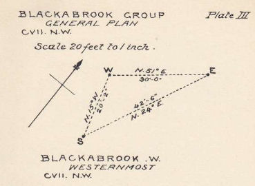
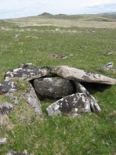
Blackabrook, South Cist
OS Map: SX 60524 73860
HER: MDV6254
Megalithic Portal: 45679
PMD: Blackabrook
Alternate name: Round Hill S.E.1 Cist
Short Name: CT Blackabrk S
Butler map: 65.3.1
Grinsell: LYD 80
DPD: 103
Barrow Report: 31 44
Dimensions (m): 1.25 x 0.55 C
Notes: "This cist with its displaced capstone lies on the edge of the river bank. Vestiges of the small surrounding cairn are now hidden under the turf. The chamber of the cist measures 1.25m by 0.55m and about 0.5m deep; the capstone is 1.5m long, 1.1m wide and 0.15m thick. The south stone has fallen outwards." Lethbridge p.103 diagram Black Brook Cist(A), photo p.103. Butler Round Hill S.E. 2. - Vol. 4. Map 65.3 (diagram of cists alongside the Blackbrook pp.230-1).
Nearest Bus Stop: Two Bridges Hotel (1.2 km) [Route: 98,171,172]
Nearby sites: SX 60524 73860
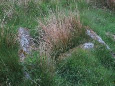
Blackabrook, West Cist
OS Map: SX 60522 73867
HER: MDV6253
Megalithic Portal: 45679
PMD: Blackabrook NW.
Alternate name: Round Hill S.E.2 Cist
Short Name: CT Blackabrk W
Butler map: 65.3.2
Grinsell: LYD 81
DPD: 104
Barrow Report: 31 44
Dimensions (m): 1.0 x 0.7 C
Notes: "The reed-filled cist is approximately 1.0m by 0.7m and about 0.2m deep. Peat has accumulated around the sides of the slabs but a few stones evident on the SW side may be part of a robbed cairn." Lethbridge p.103 diagram Black Brook Cist(B), photo p.104. Butler Round Hill S.E. 1 - Vol. 4. Map 65.3 (diagram of cists alongside the Blackbrook pp.230-1).
Nearest Bus Stop: Two Bridges Hotel (1.2 km) [Route: 98,171,172]
Nearby sites: SX 60522 73867
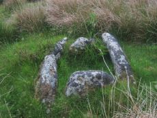
Blackabrook, East Cist
OS Map: SX 60528 73873
HER: MDV6252
Megalithic Portal: 45679
PMD: Blackabrook E.
Alternate name: Round Hill S.E.3 Cist
Short Name: CT Blackabrk E
Butler map: 65.3.3
Grinsell: LYD 82
DPD: 104
Barrow Report: 31 44
Dimensions (m): 0.95 x 0.85 C
Notes: "A well defined cist which has two stones supporting the slabs in the SE corner. The chamber measures 0.95m by 0.85m and about 0.4m deep. A turf-covered stony spread around the cist may be part of a robbed cairn." Lethbridge p.103 diagram Black Brook Cist(C), photo bottom p.104. Butler Round Hill S.E. 3 - Vol. 4. Map 65.3 (diagram of cists alongside the Blackbrook pp.230-1).

Nearest Bus Stop: Two Bridges Hotel (1.2 km) [Route: 98,171,172]
Nearby sites: SX 60528 73873
Crow Tor Platform Cairn Circle and Cist
OS Map: SX 60531 78683
HER: MDV5938
Megalithic Portal: 45775
PMD: Crow Tor
Short Name: CT Crow Tor
Butler map: 29.18
Butler Vol 5: p.196 & Fig.139
Grinsell: LYD 41
Turner: E39
DPD: 109
Dimensions (m): 4.0 x 0.4
Notes: "A kerbed cairn and cist. The cairn consists of a stony, turf-covered mound, and measures 4.5m in diameter and 0.45m in height. There are traces of a retaining kerb of leaning, granite slabs to the northeast and south. The cist is set slightly to the north of the centre of the cairn. It is trapezoidal in shape, and measures 0.65m and 0.95m in length, 0.8m in width, and 0.5m in depth. The cover-stone, which is 0.9m long, 0.5m wide and 0.2m thick, is displaced and lies just to the south east of the cist." Lethbridge diagram p.107, photo bottom p.109. Butler Vol. 2. Map 29.18 (p.63, photo on p.124, diagram Vol. 5. p.196).
Nearest Bus Stop: Powder Mills (3.2 km) [Route: 171]
Nearby sites: SX 60531 78683
Deadman's Bottom, North Cist
Prehistoric Dartmoor Walks: Dartmoor Site: Guide to the Langcombe Brook & Deadman's Bottom Cists
OS Map: SX 60782 66900
HER: MDV5120
Megalithic Portal: 3194
PMD: Deadman's Bottom N 1
Alternate name: Langcombe Brook 2 Cist
Short Name: CT Deadmans N
Butler map: 50.3.2
Grinsell: SHA 7
DPD: 44
Barrow Report: 12 19
Dimensions (m): c.1.0 x 0.4 C
Notes: "The remains of a cist lie on the northern slopes of Deadmans Bottom. The feature consists of a stone lined box, c.1m long and c. 0.4m wide, with a coverstone which has now slid to the north. The cist has collapsed in on itself. There is a turf covered stone spread to the south but little real evidence of an associated cairn." Lethbridge p.44 Langcombe Cist C - diagram p.43 Butler Langcombe Brook 2 (Cist 2) - Vol. 3. Map 50.3 (pp.148-54 general plan of Langcombe Brook cairns p.151, diagram of Deadmans Bottom cists p.149).
Nearest Bus Stop: Lee Moor Clearview (6.1 km) [Route: 59]
Nearby sites: SX 60782 66900
Foxtor Mires W. Platform Cairn Circle and Cist
OS Map: SX 60780 70484
HER: MDV12967
Megalithic Portal: 24008
PMD: Whiteworks
Short Name: CT FoxtorMireW
Butler map: 64.6
Turner: E19
DPD: 97
Dimensions (m): 5.0 x 0.5 C
Notes: "Seven large orthostats of the retaining circle remain in situ on the south and south-east side (see plan). The cist is entirely below ground level to a depth of 0.7m and measures 1.0m by 0.6m. The two endstones and two sidestones are visible; a stone which may be the coverstone lies on the ground to one side". Lethbridge diagram p.93, photos bottom p.97. Butler Foxtor Mires W. - Vol. 4. Map 64.6 (diagram p.222). Cairn with kerb circle, visible on N, E & W sides, with a central cist.
Nearest Bus Stop: Princetown Dartmoor Visitor Centre (3.5 km) [Route: 98,171,172]
Nearby sites: SX 60780 70484
Deadman's Bottom, South Ring Setting Cairn and Cist
Prehistoric Dartmoor Walks: Dartmoor Site: Guide to the Langcombe Brook & Deadman's Bottom Cists
OS Map: SX 60788 66892
HER: MDV5119
Megalithic Portal: 3194
PMD: Deadman's Bottom N 2
Alternate name: Langcombe Brook 1 Ring Setting Cairn and Cist
Short Name: CT Deadmans S
Butler map: 50.3.1
Grinsell: SHA 8
Turner: D12
DPD: 45
Barrow Report: 12 19
Dimensions (m): 5.0 x 0.2 C
Notes: "Cairn consists of a stony mound, c 6.1m in diameter and c 0.5m high, contained by granite slabs some upright some fallen. The southern quadrant of the cairn has been disturbed. The remains of a very fine cist, box dimensions c. 0.8 x 0.7m internally, survives at its centre." One side slab and the cover-stone of the cist are missing although both could be slabs nearby. The cover-stone may be the large slab which lies to the south. Lethbridge p.45 Langcombe Cist D - diagram p.43 Dixon #7. Bar Rep. 19. Butler Langcombe Brook 1 (Cist 1) Vol. 3. Map 50.3 (pp.148-54 general plan of Langcombe Brook cairns p.151, diagram of Deadmans Bottom cists p.149).
Nearest Bus Stop: Lee Moor Clearview (6.1 km) [Route: 59]
Nearby sites: SX 60788 66892
Cullever Steps Ring Setting Cairn and Cist
OS Map: SX 60787 91954
HER: MDV6867
Megalithic Portal: 17956
PMD: Cullever Steps
Short Name: CT Cullever
Butler map: 40.14
Butler Vol 5: p.181 & Fig.123
Grinsell: BEL 2
Turner: D11
Dimensions (m): c.4.5 x 0.4 C?
Notes: "A Bronze Age ring cairn situated below Belstone Tor within the valley of the East Okement River. The cairn survives as a 0.5 metre high bank surrounding a 4.1 metre diameter internal area. The bank around the southern and eastern side of the cairn is faced on both sides with edge set stones. A large flat stone lying on the south western part of the ring bank may represent a displaced cist coverstone. The overall dimensions of the cairn are 9.5 metres east to west by 8.5 metres north to south." Butler Vol. 2. Map 40.14 (diagram Vol. 5. p.181).
Nearest Bus Stop (Minor): Belstone Car Park (2.3 km) [Route: 670]
Nearest Bus Stop (Major): Okehampton Railway Station (3.0 km) [Route: 118,306,6A]
Nearby sites: SX 60787 91954
Langcombe (S) Platform Cairn Circle and Cist
Prehistoric Dartmoor Walks: Dartmoor Site: Guide to the Langcombe Brook & Deadman's Bottom Cists
OS Map: SX 60866 66155
HER: MDV5128
Megalithic Portal: 45729
PMD: Langcombe Brook 6
Alternate name: Langcombe Brook 6 Platform Cairn Circle and Cist
Short Name: CT Langcombe S
Butler map: 50.3.6
Grinsell: SHA 19
Turner: E23
DPD: 47
Barrow Report: 50 52
Dimensions (m): 5.5 x 0.3 C
Notes: "A cist, lying a little over 590 yds south west of Grim's Grave, within a flat topped cairn. Cist has two sides and the south end stone are in place and the cover stone rests in part over the cist". Lethbridge p.47 Langcombe Cist J - diagram p.43. Butler Langcombe Brook 6 (Cairn 6) - Vol. 3. Map 50.3 (pp.148-54 general plan of Langcombe Brook cairns p.151, diagram of Langcombe cists p.153).
Nearest Bus Stop: Lee Moor Clearview (5.6 km) [Route: 59]
Nearby sites: SX 60866 66155
Calveslake Cist
Prehistoric Dartmoor Walks: Dartmoor Site: Guide to the Langcombe Brook & Deadman's Bottom Cists
OS Map: SX 60874 67551
HER: MDV5085
Megalithic Portal: 45660
PMD: Calveslake Tor
Alternate name: Calveslake Tor Cist
Short Name: CT Calveslak
Butler map: 50.4
Grinsell: SHA 3
DPD: 43
Barrow Report: 12 19
Dimensions (m): 8.0 x 0.8 C
Notes: "A perfect, well constructed cist at Calveslake. Length, 3ft 7inches; width at north end,1ft 7 1/2 inches; at south end, 1ft 9inches, depth to floor, 2ft 7inches. An irregular shaped cover-stone overhangs the eastern end of the cist. The barrow in which the cist stands has a diameter of 18 feet." Lethbridge Calves Lake cist p.42-43, diagram p.42. Butler Calveslake Tor - Vol. 3. Map 50.4 (diagram p.154).
Nearest Bus Stop: Princetown Dartmoor Visitor Centre (6.2 km) [Route: 98,171,172]
Nearby sites: SX 60874 67551
Langcombe Brook 5 Cist
Prehistoric Dartmoor Walks: Dartmoor Site: Guide to the Langcombe Brook & Deadman's Bottom Cists
OS Map: SX 60878 66421
HER: MDV5129
Megalithic Portal: 45767
PMD: Langcombe Brook 5
Short Name: CT:Langcombe 5
Butler map: 50.3.5
Grinsell: SHA 17
DPD: 46
Dimensions (m): 1.4 x 0.6 C
Notes: "Two end stones and two side stones are in position but the coverstone is missing. The tops of the stones are at ground level Length of N side stone 1.4m, S side stone 1m, W end stone 0.6m, and E end stone 0.5m. Present depth of cist is 0.3m." Lethbridge p.46 Langcombe Cist I - diagram p.43. Butler Langcombe Brook 5 (Cairn 5) - Vol. 3. Map 50.3 (pp.148-54 general plan of Langcombe Brook cairns p.151, diagram of Langcombe cists p.153).
Nearest Bus Stop: Lee Moor Clearview (5.8 km) [Route: 59]
Nearby sites: SX 60878 66421
Roundhill SW (S) Cist
OS Map: SX 60910 74140
HER: MDV6249
Megalithic Portal: 52683
PMD: Roundhill SW 1
Alternate name: Round Hill S.3 Cist
Short Name: CT RoundhillS3
Butler map: 65.1.6
Grinsell: LYD 75
DPD: 106
Barrow Report: 31 44
Dimensions (m): 4.8 x 0.4 C
Notes: Southern of a pair of cists. "Small turf-covered cairn with an open cist in the centre. Diameter of cairn 4.0m. Height 0.5m. The cist is practically buried under the turf now. Internal dimensions 0.85m x 0.5m. The capstone is 1.1m x 0.8m rests on the north side of the cairn. Condition of cairn and cist - fairly good. Orientation of the long axis of the cist is WNW-ESE." Lethbridge diagram p.103, photo top p.106. Butler Round Hill S. 2. (Cairn 5) - Vol. 4. Map 65.1 (p.227-9 general plan of diagram of Round Hill cairns p.228).
Nearest Bus Stop: Two Bridges Hotel (0.9 km) [Route: 98,171,172]
Nearby sites: SX 60910 74140
Roundhill SW (N) Cist
OS Map: SX 60916 74160
HER: MDV6248
Megalithic Portal: 45680
PMD: Roundhill SW 2
Alternate name: Round Hill S.2 Cist
Short Name: CT RoundhillS2
Butler map: 65.1.5
Grinsell: LYD 76
DPD: 106
Barrow Report: 31
Dimensions (m): 4.3 x 0.4 C
Notes: Northern of a pair of cists. Butler Round Hill S. 3. (Cairn 6) - Vol. 4. Map 65.1 (p.227-9 general plan of diagram of Round Hill cairns p.228). LYDFORD 75. "A turf-covered cairn, slightly spread on the northern side, measuring 5.0 meters by 4.8 meters and 0.5 meters in height. An almost centrally placed upright slab, 0.6 meters long and 0.13 meters wide and a large slab at the foot of the mound could both be part of a disturbed cist. There is no evidence of a kerb". Lethbridge diagram p.103, photo bottom p.106.
Nearest Bus Stop: Two Bridges Hotel (0.9 km) [Route: 98,171,172]
Nearby sites: SX 60916 74160
Deadmans Bottom D Platform Cairn Circle and Cist
Prehistoric Dartmoor Walks: Dartmoor Site: Guide to the Langcombe Brook & Deadman's Bottom Cists
OS Map: SX 6096 6673
HER: MDV5086
Megalithic Portal: 45731
PMD: Deadman's Bottom S 10
Alternate name: Langcombe Brook 10 Platform Cairn Circle and Cist
Short Name: CT:Deadmans D
Butler map: 50.3.10
Grinsell: SHA 10
Turner: E44
DPD: 45
Barrow Report: 53
Dimensions (m): 0.8 x 0.7 C
Notes: "The cairn is 5m in diameter by 0.3m high with a retaining kerb on its northern side. The cist is 0.8m long b 0.7m wide." "Cist (listed as 'D' by Worth) found at Deadman's Bottom Langcombe, by Mr Button. Internal dimensions, length 3 feet 8 inches, width 2 feet. The stones are barely visible above grass level. The cover stone is missing." Lethbridge p.45 Langcombe Cist E - diagram p.43. Butler Langcombe Brook Cairn 10 - Vol. 3. Map 50.3 (pp.148-54 general plan of Langcombe Brook cairns p.151, diagram of Langcombe cists p.153).
Nearest Bus Stop: Lee Moor Clearview (6.1 km) [Route: 59]
Nearby sites: SX 6096 6673
Deadmans Bottom E Cist
Prehistoric Dartmoor Walks: Dartmoor Site: Guide to the Langcombe Brook & Deadman's Bottom Cists
OS Map: SX 60984 66714
HER: MDV5122
Megalithic Portal: 45732
PMD: Deadman's Bottom S 9
Alternate name: Langcombe Brook 9 Cist
Short Name: CT Deadmans E
Butler map: 50.3.9
Grinsell: SHA 11
DPD: 45
Barrow Report: 53
Dimensions (m): 5.0 x 0.3 C
Notes: "Cist (Listed as 'E' by Worth) found at Deadman's Bottom, Langcombe, by Mr. Button. Probable original dimensions, length 2ft 2 ins, width 1ft. 5ins. The stones barely show above the surface and the cover-stone is missing." ... "A well defined cairn 6.0m in diameter and 0.4m high with a cist in the top. This stone-lined cist measures 0.7m by 0.5m internally and 0.3 deep. Two of the side stones have fallen inwards." Lethbridge p.45 Langcombe Cist F - diagram p.43 Butler Langcombe Brook Cairn 9 - Vol. 3. Map 50.3 (pp.148-54 general plan of Langcombe Brook cairns p.151, diagram of Langcombe cists p.153).
Nearest Bus Stop: Lee Moor Clearview (6.1 km) [Route: 59]
Nearby sites: SX 60984 66714
Roundhill, Near Summit Cist
OS Map: SX 61046 74428
HER: MDV6217
Megalithic Portal: 45682
PMD: Round Hill Summit W.
Alternate name: Round Hill Summit 1 Cist
Short Name: CT Roundhill 1
Butler map: 65.1.1
Grinsell: LYD 78
DPD: 105
Barrow Report: 31 44
Dimensions (m): 7.5 x 0.3 C
Notes: Butler Round Hill Summit 1 - Vol. 4. Map 65.1 (p.227-9, diagram of Round Hill cairns p.228). Lethbridge p.103 diagram Cist(A), photo top p.105.
Nearest Bus Stop: Two Bridges Hotel (0.6 km) [Route: 98,171,172]
Nearby sites: SX 61046 74428
Winter Tor Cist
OS Map: SX 61112 91352
HER: MDV6881
Megalithic Portal: 45779
PMD: Winter Tor
Alternate name: Higher Tor S.1 Cist
Short Name: CT WinterTor
Butler map: 40.15
Butler Vol 5: p.169 & Fig.108
Grinsell: LYD 1
Dimensions (m): 8.5 x 1.0 C
Notes: [Formerly listed as Higher Tor (S), renamed after PMD] Butler Higher Tor (S) Vol. 2. Map 40.15. (diagram Vol. 5. p.169).
Nearest Bus Stop (Minor): Belstone Car Park (2.7 km) [Route: 670]
Nearest Bus Stop (Major): Okehampton Railway Station (3.6 km) [Route: 118,306,6A]
Nearby sites: SX 61112 91352
Roundhill, East of Summit Cist
OS Map: SX 61164 74413
HER: MDV6257
Megalithic Portal: 45681
PMD: Round Hill E.
Alternate name: Round Hill Summit 2 Cist
Short Name: CT Roundhill 2
Butler map: 65.1.2
Grinsell: LYD 79
DPD: 105
Barrow Report: 31 44
Dimensions (m): 1.2 x 0.55 C
Notes: "A well preserved cist, situated on a slight east-facing slope just off the crest of a rounded hilltop. It stands in isolation on a generally stone-free area of rough moorland pasture. The side slabs are each 1.2m long and up to 0.3m thick and the end slabs are 0.55m long, 0.15m wide and 0.4m long, 0.1m wide respectively. The coverstone is up to 1.6m long, 0.9m wide and 0.2m thick. There are no surface indications of either a cairn or mound around the cist." Lethbridge p.103 diagram Cist(B), photo bottom p.105. Butler Round Hill Summit 2 (Cist 2) - Vol. 4. Map 65.1 (p.227-9, diagram of Round Hill cairns p.228).
Nearest Bus Stop: Two Bridges Hotel (0.7 km) [Route: 98,171,172]
Nearby sites: SX 61164 74413
Great Gnat's Head Cist
OS Map: SX 61174 68034
HER: MDV5091
Megalithic Portal: 45675
PMD: Great Gnat's Head
Alternate name: Great Gnats' Head 1 Cist
Short Name: CT GreatGnats1
Butler map: 50.5.1
Grinsell: SHA 1
DPD: 42
Barrow Report: 20
Dimensions (m): 1.0 x 0.7 C
Notes: "Cist measures a maximum 1.0m long by 0.70m internally and 0.7m deep. Two side slabs and a fallen end slab are extant. There is no trace of a cover stone.". Lethbridge (near Abbot's Way cist) photo and diagram p.42 Butler Great Gnat's Head 1 - Vol. 3. Map 50.5 (diagram p.155).
Nearest Bus Stop: Princetown Dartmoor Visitor Centre (5.9 km) [Route: 98,171,172]
Nearby sites: SX 61174 68034
Deadmans Bottom F Platform Cairn Circle and Cist
Prehistoric Dartmoor Walks: Dartmoor Site: Guide to the Langcombe Brook & Deadman's Bottom Cists
OS Map: SX 61201 66983
HER: MDV5125
Megalithic Portal: 45733
PMD: Deadman's Bottom E.
Alternate name: Langcombe Brook 11 Platform Cairn Circle and Cist
Short Name: CT Deadmans F
Butler map: 50.3.11
Grinsell: SHA 12
DPD: 43
Barrow Report: 53
Dimensions (m): 5.5 x 0.4 C
Notes: "Cist (Listed as 'F' by Worth) found at Deadman's Bottom, Langcombe, by Mr. Button. The cover-stone is still in position but the cist appears to have been rifled, the end and side-stones having been displaced at the north-east and southwest angles. Original length would appear to have been 2 feet 10 inches, and the width 1 foot 7 inches. The greatest length of the cover-stone is 4ft 9 inches and its greatest width 3 feet 1 1/2 inches." ... "A flat-topped cairn measuring 5.4m in diameter and standing a maximum of 0.4m high. A well-preserved cist 1.3m long, 0.6m wide and 0.15m deep is largely obscured by the coverstone". Lethbridge p.43 Langcombe Cist A (Upper Deadman's Bottom) - diagram p.43. nb. Not listed by Turner - assigned as "Platform Circle" type cairn due to description in NMR. Butler Langcombe Brook Cairn 11 - Vol. 3. Map 50.3 (pp.148-54 general plan of Langcombe Brook cairns p.151, diagram of Langcombe cists p.153).
Nearest Bus Stop: Lee Moor Clearview (6.5 km) [Route: 59]
Nearby sites: SX 61201 66983
Blakey Tor (W) Cist
OS Map: SX 61240 73551
HER: MDV6244
Megalithic Portal: 45772
PMD: Blakey Tor W.
Alternate name: Blakey Tor W. Cist
Short Name: CT BlakeyTor W
Butler map: 65.4
Grinsell: LYD 84
DPD: 103
Dimensions (m): 4.0 x 0.3 C
Notes: "The incomplete cist is oriented NW-SE. It measures about 0.85m long, 0.4m to 0.55m wide and 0.25m deep internally. The upright W side slab is 0.9m by 0.2m by 0.25m and the surviving end slab is 0.4m by 0.2m by 0.25m. The E side is formed by a flat-sided boulder which is c. 1.1m long, at least 0.6m thick and 0.25m high. The SE side is open. The coverstone is 1.7m by 0.7m by 0.4m and leans against the W side of the cist." Lethbridge diagram p.102 Cist(A), photo top p.103. Butler Blakey Tor W. - Vol. 4. Map 65.4 (diagram p.232).
Nearest Bus Stop: Two Bridges Hotel (1.5 km) [Route: 98,171,172]
Nearby sites: SX 61240 73551
Grim's Grave (S) Platform Cairn Circle and Cist
Prehistoric Dartmoor Walks: Dartmoor Site: Guide to the Langcombe Brook & Deadman's Bottom Cists
OS Map: SX 61251 66313
HER: MDV5126
Megalithic Portal: 14929
PMD: Langcombe Brook S.
Alternate name: Langcombe Brook 4 Platform Cairn Circle and Cist
Short Name: CT GrimsGraveS
Butler map: 50.3.4
Butler Vol 5: p.160
Grinsell: SHA 18
Turner: E8
DPD: 46
Barrow Report: 50
Dimensions (m): 8.0 x 0.4 C
Notes: Lethbridge p.46 Langcombe Cist H - diagram p.43. Butler Langcombe Brook 4 (Cairn 4) - Vol. 3. Map 50.3 (pp.148-54 general plan of Langcombe Brook cairns p.151, diagram of Langcombe cists p.153).
Nearest Bus Stop: Lee Moor Clearview (6.0 km) [Route: 59]
Nearby sites: SX 61251 66313

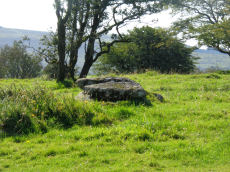
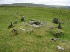
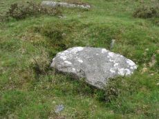
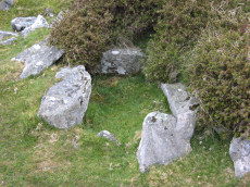
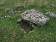
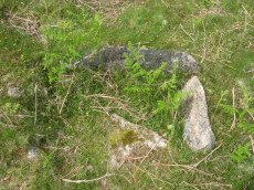
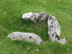
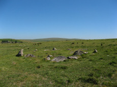
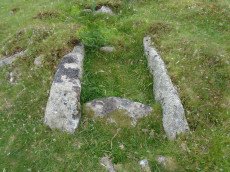
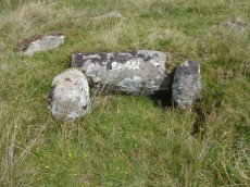
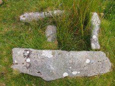
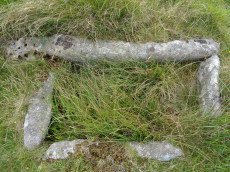
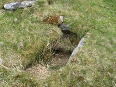
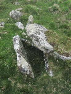
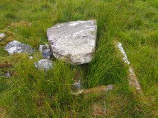
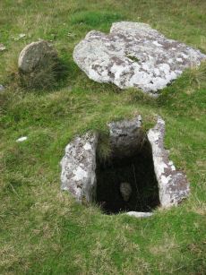
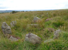
Grims Grave Ring Setting Cairn and Cist
Prehistoric Dartmoor Walks: Dartmoor Site: Guide to the Langcombe Brook & Deadman's Bottom Cists
OS Map: SX 61245 66422
HER: MDV5083
Megalithic Portal: 14930
PMD: Grim's Grave
Short Name: CT Grims Grave
Butler map: 50.3.3
Grinsell: SHA 13
Turner: D20
DPD: 46
Barrow Report: 12 20 56
Dimensions (m): 5.5 x 0.6 C
Notes: "A ring cairn set into the slope, c 4.5m in diameter, with a cist at its centre. The cairn consists of a stony, turf-covered mound contained by a ring of upright slabs, most leaning outwards, c 1m in height; the mound rises to c 0.4m at top of cist. The cist, box dimensions c 0.8m x 0.95m internally, is formed from edge-set slabs. One side slab is c 1.7m long, 0.9m wide and 0.2m thick. The monument survives in a very good condition though the cover-stone is missing - this is possibly the slab that now lies on the down-slope side." Lethbridge p.46 Langcombe Cist G (Grim's Grave) - diagram p.43. Butler Vol. 3. Map 50.3 Cairn 3 (pp.148-54 general plan of Langcombe Brook cairns p.151, diagram of Langcombe cists p.153, photo pp.94-96).
Nearest Bus Stop: Lee Moor Clearview (6.1 km) [Route: 59]
Nearby sites: SX 61245 66422
Crock of Gold Ring Setting Cairn and Cist
OS Map: SX 61286 73076
HER: MDV6308
Megalithic Portal: 14960
PMD: The Crock of Gold
Short Name: CT CrockofGold
Butler map: 65.2
Grinsell: LYD 86
Turner: D17
DPD: 101
Barrow Report: 27 47 56
Dimensions (m): 4.0 x 0.3 C
Notes: "The cairn, 7m in overall diameter and 0.3m high, has a flattish top with a retaining circle set 1m to 1.5m within the perimeter. This consists of six earthfast boulders, about 0.4m across and protruding a similar height above the cairn ... A central cist is oriented NW to SE. Internally it is 0.8m long, 0.4m wide at the NW end, 0.5m at the SE, and 0.7m deep. The side slabs are 1m long and respectively 0.15m and 0.25m thick; the end slabs, 0.5m long and 0.1m thick. The capstone, moved to the W, is 1.3m long, 1.1m wide and 0.15m thick and now rests against the kerb." Lethbridge diagram p.102 Cist(C), photo p.101. Butler Vol. 4. Map 65.2 (diagram p.229).
Nearest Bus Stop: Two Bridges Hotel (2.0 km) [Route: 98,171,172]
Nearby sites: SX 61286 73076
Royal Hill Summit Cist
OS Map: SX 61295 72792
HER: MDV18391
Megalithic Portal: 45798
PMD: Royal Hill Summit
Short Name: CT RoyalHill 7
Butler map: 65.5.7
Butler Vol 5: p.185 & Fig.128
DPD: 102
Dimensions (m): 0.8 x 0.6 C
Notes: Butler Royal Hill Summit Vol. 4. Map 65.2 (diagram Vol. 5. p.185). "The cairn 7.4m E to W, and 6.5m N to S, and about 0.5m high. It is turf covered, but the tops of three stones of an inner retaining circle are exposed to a height of 0.3m. The largest is 1.1m long and 0.2m thick ... The cist, oriented E to W is largely infilled; internally it measures 0.8m by 0.6m, and is 0.2m deep. The coverstone is missing as is the stone at the E end. The others take the form of irregular boulders rather than slabs". Lethbridge diagram p.102 Cist(D), photo p.102.
Nearest Bus Stop: Two Bridges Hotel (2.3 km) [Route: 98,171,172]
Nearby sites: SX 61295 72792
Blakey Tor (E) Cist
OS Map: SX 61312 73558
HER: MDV6245
Megalithic Portal: 28869
PMD: Blakey Tor E.
Alternate name: Blakey Tor E. Cist
Short Name: CT BlakeyTor E
Butler map: 65.4
Grinsell: LYD 85
DPD: 102
Barrow Report: 31 47
Dimensions (m): 4.0 x 0.2 C
Notes: "A reed-filled cist is set well into the cairn on a NNW-SSE axis. The intact chamber measures internally 0.95m long, a maximum 0.65m wide and 0.45m deep; the longest side slab is 1.4m by 0.3m by 0.45m and largest end slab 0.55m by 0.2m by 0.4m. The coverstone against the NW side of the cist is roughly oval in shape and measures 1.7m by 1.3m and a maximum 0.25m thick." Lethbridge diagram p.102 Cist(B), photo p.102. Butler Vol. 4. Map 65.4 (diagram p.232).
Nearest Bus Stop: Two Bridges Hotel (1.5 km) [Route: 98,171,172]
Nearby sites: SX 61312 73558
Crockern Tor Cist
OS Map: SX 61414 76055
HER: MDV57569
Megalithic Portal: 45816
PMD: Crockern Tor
Alternate name: Crockern Tor N.W. Cist
Short Name: CT CrockernTor
Butler Vol 5: p.32 & Fig.11
DPD: 110
Dimensions (m): c.6 x 4.2 and 1.2 x
Notes: "Remains of a small cairn with cist on a moderate W slope in open grassland at SX 61407604 overlooking the West Dart in Crockern Newtake. It has been robbed heavily, leaving only one cist slab and fragments of the cairn material. The slab is restangular in side view and in section, firmly embedded on edge, measuring 1.2m long 0.48m high and 0.15m thick. It is aligned NW to SE." Butler Vol 5 p. 32. Lethbridge diagram and photo p.110.
Nearest Bus Stop: Two Bridges Hotel (1.1 km) [Route: 98,171,172]
Nearby sites: SX 61414 76055
Dendles Waste Ring Setting Cairn and Cist
OS Map: SX 61535 62804
HER: MDV4276
Megalithic Portal: 45691
PMD: Dendles Waste
Alternate name: Dendles Waste S. Ring Setting Cairn and Cist
Short Name: CT Dendles 1
Butler map: 52.15
Grinsell: COR 14
Turner: D19
DPD: 64
Barrow Report: 43
Dimensions (m): 4.0 C
Notes: "The circle, consists of eight flat slabs, set on edge and has an internal diameter of approximately 3.4m. Some of the stones from the western quadrant of the circle are missing; a single earthfast stone is all that survives. The rectangular cist lies roughly centrally within the circle and is oriented E to W. It measures 1.2m long by 0.6m and 0.5m deep with slabs still in place both sides". Lethbridge diagram p.63, photo p.64. Butler Dendles Waste S. - Vol. 3. Map 52.15 (diagram p.194).
Nearest Bus Stop: Cornwood Crossways (3.4 km) [Route: 59]
Nearby sites: SX 61535 62804
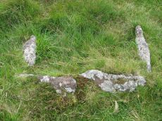
Goldsmith's Cross S. Cist
OS Map: SX 61684 69872
HER: MDV5081
Megalithic Portal: 42708
PMD: Fox Tor Mires S 5
Short Name: CT Goldsmith S
Butler map: 64.5
Grinsell: LYD 100
DPD: 97
Barrow Report: 46 56
Dimensions (m): 1.2 x 0.85 C
Notes: "The remains of a cist lie some 80m E of the Whealam streamworks at SX 61666985, on gently sloping ground 50m S of the newtake wall. The remains consist of four granite slabs set into the ground, forming three sides of a trapezoidal structure. It measures 1.2m long and a maximum of 0.85m wide. The long side, unusually formed of two granite slabs, is oriented NW to SE. The maximum height which the stones protrude above the ground is 0.2m. The SW side of the structure is missing; there are no traces of a capstone or cairn". Lethbridge diagram p.93, text p.96, photo top p.97. Butler Goldsmith's Cross S. - Vol. 4. Map 64.5. (Cairn 4 - diagram p.221).
Nearest Bus Stop: Princetown Dartmoor Visitor Centre (4.5 km) [Route: 98,171,172]
Nearby sites: SX 61684 69872
Goldsmiths Cross E.3. Cist
OS Map: SX 61741 70204
HER: MDV6343
Megalithic Portal: 45748
PMD: Goldsmith's Cross
Alternate name: Goldsmiths Cross E.3 Cist
Short Name: CT:GoldsmithE3
Butler map: 64.5.3
Grinsell: LYD 94
DPD: 95
Barrow Report: 58
Dimensions (m): 4.0 x 0.2 C
Notes: "The NW sidestone, 0.8m long by 0.2m wide and the NE endstone 0.6m long, 0.15m wide are the only recognisable cist stones though it is possible that the SW side was formed by the two small slabs still visible and depicted by Worth. There is no coverstone". Lethbridge diagram p.93, photo bottom left p.95. Butler Goldsmith's Cross E.3. - Vol. 4. Map 64.5 (Cairn 3 - diagram p.221).
Nearest Bus Stop: Princetown Dartmoor Visitor Centre (4.3 km) [Route: 98,171,172]
Nearby sites: SX 61741 70204
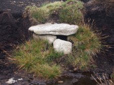
Whitehorse Hill Cist
OS Map: SX 61735 85482
HER: MDV66367
Megalithic Portal: 29778
PMD: White Horse Hill
Short Name: CT Whitehorse
DPD: 131
Dimensions (m): 0.79 x 0.66 C
Notes: This cist was excavated in August 2011. It featured on an 1892 map by John Chudleigh in An Exploration of Dartmoor's Antiquities. It was re-discovered in 2001 and recently excavated. Carbon dating suggests it is Bronze Age in date. Dates for the top of the cist gives 2800-1890BC and for the bottom of the cist 3650-3100BC. Provisional carbon dates for artifacts suggest the remains are Bronze Age (1900-1500BC). Inside the cist an animal hide bag was found containing cremation remains including a number of artefacts including amber beads (amber would have been imported from overseas), wooden ear studs, a delicate bracelet studded with tin beads, a textile fragment with detailed leather fringing and a unique coiled bag.
There is some good coverage on the Legendary Dartmoor website, see: Whitehorse Kist 1, Whitehorse Kist 2 and Whitehorse Kist 3.
See also DNPA: Update on Whitehorse Hill Cist excavation and Dartmoor tomb treasure horde uncovered by archaeologists. Not listed in Butler - relevant map of area is Vol. 2. Map 41. Lethbridge pp.131-132
Nearest Bus Stop (Minor): Wonson Telephone Box (6.9 km) [Route: 670]
Nearest Bus Stop (Major): Postbridge Post Office (7.3 km) [Route: 98,171]
Nearby sites: SX 61735 85482
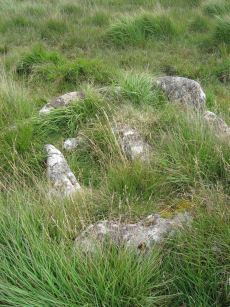
Goldsmith's Cross E.2. Ring Setting Cairn and Cist
OS Map: SX 61804 70321
HER: MDV6342
Megalithic Portal: 42707
PMD: Fox Tor Mires cairn
Alternate name: Goldsmith's Cross E.2 Ring Setting Cairn and Cist
Short Name: CT GoldsmithE2
Butler map: 64.5.2
Grinsell: LYD 95
Turner: D23
DPD: 95
Dimensions (m): 2.5 C
Notes: "West end stone of cist leans slightly inwards, otherwise a perfect cist measuring 0.75m NW-SE by 0.5m wide by 0.4m deep. Retaining circle of 7 stones averaging 0.4m high. No coverstone or barrow". Lethbridge diagram p.93, photo bottom right p.95 and on p.96. Turner D23 (Fox Tor Mire) - Proc Devon Arch Soc 48 (diagram p.45). Butler Goldsmith's Cross E. 2 - Vol. 4. Map 64.5 (Cairn 2 - diagram p.221).
Nearest Bus Stop: Princetown Dartmoor Visitor Centre (4.2 km) [Route: 98,171,172]
Nearby sites: SX 61804 70321
Goldsmiths Cross E.1. Cist
OS Map: SX 61871 70395
HER: MDV61775
Megalithic Portal: 45806
PMD: Fox Tor Mires E.
Alternate name: Goldsmiths Cross E.1 Cist
Short Name: CT:GoldsmithE1
Butler map: 64.5.1
Dimensions (m): 4.5 x 0.2
Notes: "Clear remains of cairn with cist. One side and one end stone of cist are in place. The western side stone may be beneath the turf, but the southern end stone and cover stone are missing. The internal dimensions of the cist are approximately 0.53 x 0.58 x 0.45 meters (1 foot 9 inches x 1 foot 11 inches x 1 foot 6 inches). Immediately around cist there was a backing of comparatively large flat stones.". Butler Goldsmith's Cross E. 1. Vol. 4. Map 64.5 (Cairn 1 - diagram p.221). There is no NMR for this site. There is an HER entry MDV61775 which matches precisely with the OS reference given by Butler. Butler describes: "The mound 0.1m high at best surrounds a slightly wedge-shaped cist of which only the sides, one composed of two stones, and an end are visible. The missing slab is probably buried in place".
Nearest Bus Stop: Princetown Dartmoor Visitor Centre (4.2 km) [Route: 98,171,172]
Nearby sites: SX 61871 70395
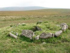
Royal Hill, South Platform Cairn Circle and Cist
OS Map: SX 62020 72091
HER: MDV6309
Megalithic Portal: 34958
PMD: Royal Hill SE.
Alternate name: Royal Hill E.3 Platform Cairn Circle and Cist
Short Name: CT RoyalHill 3
Butler map: 65.5.3
Grinsell: LYD 88
Turner: E31
DPD: 98
Barrow Report: 27 47
Dimensions (m): 4.7 x 0.5 C
Notes: "The cairn is 4.9m in diameter and 0.4m high with a flattish, platform, top. It is retained by a kerb of almost contiguous orthostats, the largest 1.1m long, 0.2m thick, and 0.6m high. A few are fallen or displaced. The central cist is oriented WNW to ESE, lacking both coverstone and N side slab. Internally it measures 1.35m by 0.75m by 0.55m deep." Lethbridge diagram p.97 Cist A, photo p.98. Butler Royal Hill E. 3 - Vol. 4. Map 65.5 (Cairn 3 - diagram p.233).
Nearest Bus Stop: Two Bridges Hotel (3.1 km) [Route: 98,171,172]
Nearby sites: SX 62020 72091
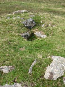
Royal Hill, Central Platform Cairn Circle and Cist
OS Map: SX 62082 72334
HER: MDV6304
Megalithic Portal: 34960
PMD: Royal Hill E.
Alternate name: Royal Hill E.4 Platform Cairn Circle and Cist
Short Name: CT RoyalHill 4
Butler map: 65.5.4
Grinsell: LYD 89
Turner: E21
DPD: 98
Barrow Report: 27 47
Dimensions (m): 5.5 x 0.6 C
Notes: "The cairn has an overall diameter of about 7.5m in diameter, and 0.6m high, with a flattish top. There are traces of an inner kerb 4.5m in diameter, and an outer one 5.7m across comprising boulders and slabs, the largest 1.5m long, 0.6m high, and 0.2m thick. The interior of the central cist is about 0.8m square with four stones up to 0.25m thick and 0.6m deep but the southern one overlaps the sides, is 1m long, and gives the cist its NW to SE alignment. This and the two end stones incline inwards; the northern one inclines slightly outwards. There is no cover stone." Lethbridge diagram p.97 Cist B, photo p.98. Turner E21 - listed as Royal Hill (N) [n.b. we have a south, central & north - N being a different cist]. Butler Royal Hill E. 4 (Cairn 4 - diagram p.233) - Vol. 4. Map 65.5.
Nearest Bus Stop: Two Bridges Hotel (2.9 km) [Route: 98,171,172]
Nearby sites: SX 62082 72334
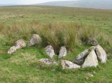
Royal Hill, North Ring Setting Cairn and Cist
OS Map: SX 62108 72434
HER: MDV6305
Megalithic Portal: 34959
PMD: Royal Hill NE.
Alternate name: Royal Hill E.5 Ring Setting Cairn and Cist
Short Name: CT RoyalHill 5
Butler map: 65.5.5
Grinsell: LYD 90
Turner: D21
DPD: 98
Barrow Report: 27 47
Dimensions (m): 3.0 x 0.3 C
Notes: "The circle is 3.1m in overall diameter, comprising nine contiguous thick slabs, up to 0.9m long and from 0.3m to 0.7m high... There is virtually no cairn material but the interior has been levelled up to a height of 0.1m on the E, downhill side. A central cist oriented WNW to ESE is represented by two side stones which protrude 0.15m above ground. They are 1.2m and 0.9m long and both about 0.2m thick and 0.4m deep. The longer, northern one leans inwards and touches the other at the W end; at the E the stones are 0.8m apart separated by two flat (packing ?) stones each about 0.35m across. An overgrown and embedded slab against the circle W if the cist may have been an end stone." Lethbridge diagram p.97 Cist C, photo p.98. Butler Royal Hill E. 5 (Cairn 5 - diagram p.233)- Vol. 4. Map 65.5. Central cist.
Nearest Bus Stop: Two Bridges Hotel (2.8 km) [Route: 98,171,172]
Nearby sites: SX 62108 72434
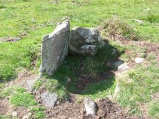
Ranny Brook (North of) Cist
OS Map: SX 62154 63547
HER: MDV4272
Megalithic Portal: 45747
PMD: Ranny Brook settlement
Alternate name: Ranny Brook N.3 Cist
Short Name: CT Ranny Brk N
Butler map: 52.9.3
Grinsell: COR 11
DPD: 65
Barrow Report: 58
Dimensions (m): 0.68 x 0.22 C
Notes: "The northern end-stone and the western side-stone survive, whilst smaller stones may represent the other sides. This agrees with Worth's survey, but in his report he has transposed north and south." Lethbridge diagram p.65 Cist 1. Butler Ranny Brook N. 3 (Cist 3) - Vol. 3. Map 52.9. (pp.184-7 general plan of Ranny Brook settlements and cairns p.184, diagram of cists p.186).
Nearest Bus Stop: Cornwood Crossways (4.3 km) [Route: 59]
Nearby sites: SX 62154 63547
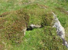
Harrowthorn (North of) Cist
OS Map: SX 62446 62645
HER: MDV4269
Megalithic Portal: 45746
PMD: Harrowthorn Plantation
Alternate name: Coombe Brook N.E. Cist
Short Name: CT Harrowthorn
Butler map: 52.11
Grinsell: COR 15
DPD: 66
Barrow Report: 58
Dimensions (m): 4.0 x 0.5 C
Notes: "A cist lies 700 yards north of Harrowthorn Plantation and a few feet west of the track from Watercombe Moorgate to Ranny Brook. Only the two side stones and the eastern end stone remain. The structure is unusual in that the southern side stone is an earth fast boulder, an approximately vertical face of which forms a side of the cist." Lethbridge p.66. diagram p.65 Ranny Brook Cist 3. Butler Coombe Brook N.E. - Vol. 3. Map 52.11. Located 200m due east up hill of the Coome Brook enclosure.
Nearest Bus Stop: Cornwood Crossways (3.6 km) [Route: 59]
Nearby sites: SX 62446 62645
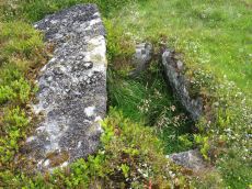
Stennen Hill No. 1 Platform Cairn Circle and Cist
OS Map: SX 62573 77905
HER: MDV5846
Megalithic Portal: 45736
PMD: Powder Mills W.
Alternate name: Stennen Hill 1 Platform Cairn Circle and Cist
Short Name: CT Stennen 1
Butler map: 29.11.1
Butler Vol 5: p.199 & Fig.142
Grinsell: LYD 47
Turner: E13
DPD: 111
Barrow Report: 57
Dimensions (m): 6.5 x 0.3 C
Notes: "Cist lies approximately in the centre of a subcircular cairn measuring 7 by 6.5m the longer axis and cist aligned nne to ssw. It is stony but almost turf-covered with 2 large kerbstones, including burnards `menhir' remaining in situ in the nw. The cist is flush with the cairn top, which is flattish and stands only 0.2m high on the nw but up to 0.7m high on the se, downhill side. This may be the cairn's original form; built into the slope as a flat platform with the cist visible (nmr citing pattison)". See also HER. Lethbridge photo top p.111. Butler Stennen Hill 1 - Vol. 2. Map 29.11 (diagram Vol. 5. p.199). NB. Worth & Grinsell name this Stennen Hill No. 1
Nearest Bus Stop: Powder Mills (1.3 km) [Route: 171]
Nearby sites: SX 62573 77905
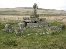
Childes Tomb Platform Cairn Circle and Cist
OS Map: SX 62577 70299
HER: MDV48907
Megalithic Portal: 15211
PMD: Childe's Tomb
Short Name: CT ChildesTomb
Butler map: 64.4
Grinsell: LYD 96
Turner: E33
DPD: 94
Dimensions (m): c.9.0 x 0.3 C
Notes: "A much disturbed cairn, 9m in diameter and 0.3m high with a modern 'kerb' of blocks and slabs, 5.8m in diameter and 0.5m high, set upon the mound. At the centre is a well built cist 1.4m long, 0.5m wide and 0.6m deep. Over this is a two tier pedestal of eight well trimmed blocks, of three different lengths; a further half buried block lies S of the monument. Upon this is a replacement socket stone and cross, cut at Holne in 1885". Lethbridge diagram p.93, photo p.94. Butler Vol. 4. Map 64.4 (diagram p.220).
Nearest Bus Stop: Princetown Dartmoor Visitor Centre (4.8 km) [Route: 98,171,172]
Nearby sites: SX 62577 70299
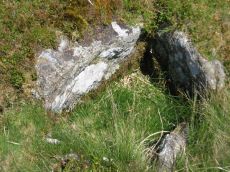
Ranny Brook Cist
OS Map: SX 62616 63543
HER: MDV4270
Megalithic Portal: 14987
PMD: Ranny Brook Head
Alternate name: Ranny Brookhead Cist
Short Name: CT Ranny Brook
Butler map: 52.10
Grinsell: COR 12
DPD: 66
Barrow Report: 64 68 69 71
Dimensions (m): 1.0 x 0.7 C
Notes: "Three sides of the grave are still in place; the third has been turned back and lies parallel to its original position. To the south of the cist, and about a foot away from the nearest point of the buried side-stone, lies the displaced coverstone. This stone has a greatest length of four feet and a greatest width of two feet six inches". Sides of cist sunken below surface. Lethbridge p.66. diagram p.65 Cist 2.Butler Ranny Brook Head - Vol. 3. Map 52.10 (diagram p.186).
Nearest Bus Stop: Cornwood Crossways (4.5 km) [Route: 59]
Nearby sites: SX 62616 63543
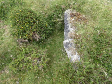
Stennen Hill No. 3 Cist
OS Map: SX 62615 77838
HER: MDV5847
Megalithic Portal: 45737
PMD: Powder Mills E.
Alternate name: Stennen Hill 2 Cist
Short Name: CT Stennen 2
Butler map: 29.11.2
Butler Vol 5: p.200 & Fig.143
Grinsell: LYD 49
DPD: 111
Barrow Report: 57
Dimensions (m): 5.0 x 0.3 C
Notes: "cist is oriented nw. - se. And is open with the south west side stone and the end stone buried beneath the turf. Internal dimensions 1.3m by 0.85m depth 0.5m. The mound, which is slight with a height of 0.3m is much disturbed. Judging by the remains of the retaining circle of which six stones can be seen the diameter of the mound was 4.5m. Condition of the cist is fair, of mound poor." Only one large stone remains in the mound of a cairn. Lethbridge photo top p.111. Butler Stennen Hill 2 - Vol. 2. Map 29.11 (diagram Vol. 5. p.200). NB. Worth & Grinsell name this Stennen Hill No. 3 (It is Butler 2)
Nearest Bus Stop: Powder Mills (1.3 km) [Route: 171]
Nearby sites: SX 62615 77838
Muddilake Newtake Cist
OS Map: SX 62654 75194
HER: MDV5893
Megalithic Portal: 45745
PMD: Muddilake Newtake
Short Name: CT:Muddilake
Grinsell: LYD 105
Turner: A21
Barrow Report: 58
Dimensions (m): 6.0
Notes: NMR states "A hut circle, not a cairn circle". This is almost certainly not a cist. "The measurements do not conform to those of Prowse but nothing else can be seen in the vicinity. It is most unlikely that these stones represent the remains of a cist, but are a natural occurrence." (see also duplicate HER record 5894 and SiteID=2547). This "cist" entry was listed by Dixon, however, it seems a dubious entry. This is not listed by Butler, the relevant map is Vol. 2. Map 29.9.
Nearest Bus Stop: Powder Mills (1.4 km) [Route: 171]
Nearby sites: SX 62654 75194
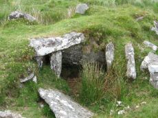
Archerton S.W. (Rowtor Brook) Ring Setting Cairn and Cist
OS Map: SX 62752 78808
HER: MDV5838
Megalithic Portal: 37604
PMD: Hollowcombe Bottom
Alternate name: Rowtor Brook 3 Ring Setting Cairn and Cist
Short Name: CT ArchertonSW
Butler map: 27.17.3
Butler Vol 5: p.55 & Fig.33
Grinsell: LYD 42
Turner: D24
DPD: 112
Barrow Report: 57
Dimensions (m): 7.0 x 1.0 C
Notes: "The cist lies within three concentric circles of stones at 10, 15 and 24 feet diameters, the inner ring being of large stones, the middle ring of smaller stones and the outer ring of even smaller stones. The cist measures internally 0.8m by 0.6m and 0.9m deep. Half of its capstone lies across its north end." For more information see: Prowse TDA 1891 and HER record. Lethbridge Hollowcombe Bottom, diagram and photo p.112. Butler Rowtor Brook 3 - Vol. 2. Map 27.17 (diagram Vol. 5. p.55).
Nearest Bus Stop: Postbridge Post Office (2.0 km) [Route: 98,171]
Nearby sites: SX 62752 78808
Stalldown (W) Platform Cairn Circle and Cist
Prehistoric Dartmoor Walks: Dartmoor Site: Stalldown Stone Row
OS Map: SX 62833 62327
HER: MDV13234
Megalithic Portal: 45791
PMD: Stall Moor W.
Alternate name: Stalldown W.11 Platform Cairn Circle and Cist
Short Name: CT Stalldown W
Butler map: 54.18.11
Grinsell: COR 11c
Turner: E30
DPD: 67
Dimensions (m): 7.0 x 0.8 C
Notes: "This small round cairn, diameter 5.7 to 6.4m, height 0.5m, is built of small boulders ... It contains a cist, the south side stone, 1.2m long, both end stones, 0.4m long ...On the south side of the cairn 3 large stones, 0.8m to 1.0m long and set on edge are the probable remains of a kerb". Lethbridge pp.65-67. diagram p.65 Cist 4, photo p.67. Butler Stalldown W. (Cairn 11) - Vol. 4. Map 54.18.11 (p.61-2 diagram p.62).
Nearest Bus Stop: Cornwood Crossways (3.6 km) [Route: 59]
Nearby sites: SX 62833 62327
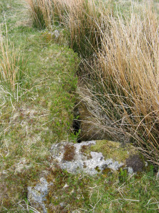
Fox Tor Newtake, South Cist
OS Map: SX 62864 70964
HER: MDV6279
Megalithic Portal: 45678
PMD: Ter Hill S.
Alternate name: Ter Hill N.W.2 Cist
Short Name: CT FoxTorNew S
Butler map: 64.3.2
Grinsell: LYD 98
DPD: 94
Barrow Report: 24 56
Dimensions (m): c.5.0 x 0.3 C
Notes: "The turf-covered cairn is, at maximum, 3.9m in diameter and 0.3m in height. The cist, oriented NW/SE, is approximately 1.3m by 0.55m, and 0.75m deep, and now almost hidden by the SW side stone which has fallen inwards. The NE end stone is not evident but an 0.7m high upright granite post retains part of the mound on this NE side. There is no trace of the coverstone". Lethbridge diagram p.93 (Cist B), top photos p.94. Butler Ter Hill N.W. 2 - Vol. 4. Map 64.3 (diagram p.219).
Nearest Bus Stop: Two Bridges Hotel (4.5 km) [Route: 98,171,172]
Nearby sites: SX 62864 70964
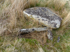
Fox Tor Newtake, North Cist
OS Map: SX 62861 71177
HER: MDV6303
Megalithic Portal: 45677
PMD: Ter Hill N.
Alternate name: Ter Hill N.W.1 Cist
Short Name: CT FoxTorNew N
Butler map: 64.3.1
Grinsell: LYD 97
DPD: 93
Barrow Report: 24 56
Dimensions (m): c.4.0 x 0.3 C
Notes: "The cist is 0.6m deep and 1.2m long, the NW end is 0.4m wide and SE end 0.6m wide; the NW end-slab, said by Burnard (1905)to be wedged in the bottom cannot be seen. The coverstone, resting on the NE side, is 1.6m by 1.3m at its extremeties". Lethbridge diagram (Cist A) and photo p.93. Butler Ter Hill N.W. 1 - Vol. 4. Map 64.3 (diagram p. 219).
Nearest Bus Stop: Two Bridges Hotel (4.3 km) [Route: 98,171,172]
Nearby sites: SX 62861 71177
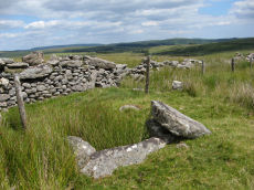
Joan Ford's Newtake Embanked Cairn Circle and Cist
OS Map: SX 63143 72168
HER: MDV6260
Megalithic Portal: 3295
PMD: Joan Ford's Newtake
Alternate name: Joan Ford's Newtake 1 Embanked Cairn Circle and Cist
Short Name: CT Joan Fords
Butler map: 63.3.1
Grinsell: LYD 92
Turner: B7
DPD: 99
Barrow Report: 30 56
Dimensions (m): 8.0 x 0.4
Notes: "A low kerb within the disturbed fringes of the mound is 8.7m in diameter with more or less continuous upright slabs and boulders 0.3m to 0.6m high. A dry stone newtake wall crosses the N side and overlies part of the kerb. A well-preserved cist, oriented NW-SE, is internally 1.0m long, 0.5m to 0.65m wide and up to 0.7m deep. The coverstone leans against the SE side of the cist and measures 1.35m by 1.0m by 0.2." Lethbridge diagram p.99, photo bottom p.99. Butler Joan Ford's Newtake 1 - Vol. 4. Map 63.3 (diagram p.214).
Nearest Bus Stop: Two Bridges Hotel (3.6 km) [Route: 98,171,172]
Nearby sites: SX 63143 72168
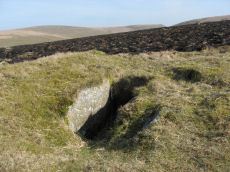
Stalldown (N) Platform Cairn Circle and Cist
Prehistoric Dartmoor Walks: Dartmoor Site: Stalldown Stone Row
OS Map: SX 63274 63239
HER: MDV4296
Megalithic Portal: 45688
PMD: Stall Moor N.
Alternate name: Stalldown N.9 Platform Cairn Circle and Cist
Short Name: CT Stalldown N
Butler map: 54.18.9
Grinsell: COR 13
Turner: E17
DPD: 69
Barrow Report: 14 37 62
Dimensions (m): 11.5 x 0.5 C
Notes: "A cist measuring 2 feet 3 inches wide at the south end, 1 foot 7 1/2 inches wide at the north and probably originally 3 feet 6 inches long. Both the coverstone and the north end stone are missing. The cist stands in a barrow which has a retaining circle, five stones of which are still erect, and one fallen. The largest stone is 3 feet 4 inches wide by 2 feet 7 inches high. The diameter of the retaining circle varies from 20 to 22 feet". Lethbridge p.69. diagram p.65 Cist 5. Butler Stalldown N. (Cairn 9) - Vol. 4. Map 54.18.9 (diagram p.62).
Nearest Bus Stop: Cornwood Crossways (4.6 km) [Route: 59]
Nearby sites: SX 63274 63239
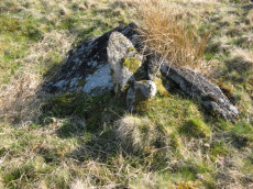
Swincombe Ford Newtake 1 Cist
OS Map: SX 63330 72988
HER: MDV54431
Megalithic Portal: 42665
PMD: Swincombe Ford Newtake
Short Name: CT Swincombe 1
Butler map: 63.5.1
DPD: 99
Dimensions (m): 7.0 x 0 C
Notes: Butler Vol. 4. Map 63.5 (diagram p.215). "A robbed cist within a cairn on a gently sloping NE-facing moorland hillside. A stoney cairn 6.0m N-S by 5.5m E-W and 0.3m high contains the cist, approximately 0.8m wide, 0.3m deep and of indeterminate length and orientation. The capstone, 1.4m by 1.3m largely obscures the cist, with only the ?NE end stone being visible." Lethbridge diagram p.99 photo top of p.99.
Nearest Bus Stop: Two Bridges Hotel (3.1 km) [Route: 98,171,172]
Nearby sites: SX 63330 72988
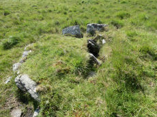
Knackersmill Gulf N. Cist
OS Map: SX 63390 65587
HER: MDV13185
Megalithic Portal: 45759
PMD: Stinger's Hill
Short Name: CT Stingers
Butler Vol 5: p.180 & Fig.122
Grinsell: COR 8
DPD: 73
Dimensions (m): 4 x 0.6
Notes: The NMR gives SX63376494 as the grid reference - this error is replicated in HER entry 28468. The author could not find a cist there. As PMD points out that is the location of Grinsell's CORNWOOD 9 cairn and not CORNWOOD 8. "A cist 1.20m. by 0.60m. with a close set retaining kerb circle 4.0m. in diameter is situated on Stinger's Hill opposite Erme Pound". Lethbridge Stingers Hill cist p.73. diagram p.71. Butler Map 55.7. (diagram Vol. 5. p.180). The author visited this site on 16/7/21 and the grid reference is confirmed as listed on this record.
Nearest Bus Stop: Cornwood Crossways (6.7 km) [Route: 59]
Nearby sites: SX 63390 65587
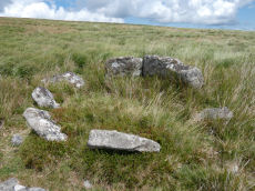
Sittaford Tor Ring Setting Cairn and Cist
OS Map: SX 63479 82641
HER: MDV21894
Megalithic Portal: 45792
PMD: Sittaford Tor
Alternate name: Sittaford Tor S. Ring Setting Cairn and Cist
Short Name: CT Sittaford
Butler map: 34.3
Butler Vol 5: p.183 & Fig.126
Turner: D25
DPD: 125
Dimensions (m): 6.0 x 0.3
Notes: "Cairn 5 metres in diameter, 0.75 metres high. Surrounded by two rings of kerb stones up to 0.75 metres high. Many stones forming the outer ring are recumbent. Mound material up to 0.2 metres high. Inner kerb is 2.8 metres diameter and the outer is 5 metres diameter. Slab in centre may be an intact cist. Grass and rushes. Animal poaching on western side of cairn.". "This mutilated kerbed cairn is situated on a peat-covered moorland slope below Sittaford Tor at 488m OD. It measures about 5m in diameter and comprises a probably (hidden) central cist set within twin concentric kerbs of granite slabs." Lethbridge photo bottom p.125. Butler Sittaford Tor S (Cairn 3) Vol. 2. Map 34.3 (p.112, also Butler Vol. 5. diagram p.183).
Nearest Bus Stop: Postbridge Post Office (4.0 km) [Route: 98,171]
Nearby sites: SX 63479 82641
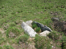
Dunnabridge Common Platform Cairn Circle and Cist
Prehistoric Dartmoor Walks: Dartmoor Site: Lakehead Hill
OS Map: SX 63585 75470
HER: MDV5952
Megalithic Portal: 37603
PMD: Smith Hill
Alternate name: Bellever Tor 9 Platform Cairn Circle and Cist
Short Name: CT Dunnabridge
Butler map: 27.20.9
Grinsell: LYD 65
Turner: E37
DPD: 120
Barrow Report: 58
Dimensions (m): 1.2 x 0.4 C
Notes: Lethbridge Cist 3 diagram p.119 and photo bottom p.120. Butler Bellever Tor (Cairn 9) - Vol. 2. Map 27.20.9 (diagram p52-3). See also: Dartmoor Explorations: Antiquities of Black Newtake and Environs
Nearest Bus Stop: Powder Mills (1.3 km) [Route: 171]
Nearby sites: SX 63585 75470
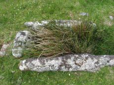
Chittaford Down Platform Cairn Circle and Cist
OS Map: SX 63687 79463
HER: MDV5932
Megalithic Portal: 52177
PMD: Chittaford Down
Alternate name: Chittaford Down 3 Platform Cairn Circle and Cist
Short Name: CT Chittaford
Butler map: 27.18.3
Butler Vol 5: p.160 & Fig.100
Grinsell: LYD 39
Turner: E28
DPD: 112
Barrow Report: 57
Dimensions (m): 7.0 x 0.5 C
Notes: "A cist about 350 yards north of Archerton House. It has an irregular shape no coverstone and stands in the centre of a 14ft. diameter ruined cairn. There are traces of an enclosing ring of stones. Excavation in 1900 recovered wood charcoal and a worked flint flake from a small pit within the cist. Under the eastern side stone an archer's polished stone wrist guard was found". Lethbridge diagram and photo bottom p.112. Butler Chittaford Down 3 - Vol. 2. Map 27.18 (diagram Vol. 5. p.160).
Nearest Bus Stop: Postbridge Post Office (1.2 km) [Route: 98,171]
Nearby sites: SX 63687 79463
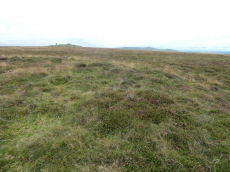
Cosdon Beacon Embanked Cairn Circle and Cist
Prehistoric Dartmoor Walks: Dartmoor Site: Cosdon Hill Triple Stone Row
OS Map: SX 63708 91593
HER: MDV6898
Megalithic Portal: 10325
PMD: Cosdon Summit S.
Alternate name: Cosdon Hill 3 Embanked Cairn Circle and Cist
Short Name: CT Cosdon 3
Butler map: 40.7.3
Butler Vol 5: p.164 & Fig.105
Grinsell: ST 2
Turner: B14
DPD: 152
Barrow Report: 21
Dimensions (m): c.18.0 x 0.4
Notes: "Ring cairn and cist on summit ridge of Cawsand Hill. Cairn forms part of a cemetery including at least 2 round cairns, 2 ring cairns and one platform cairn. Earthwork survives as a 2m wide and 0.4m high circular rubble bank, faced with close set stones around its outer edge and surrounds an internal area measuring 18m ew by 17m ns. A mound measuring 6m in diam and 0.2m high stands in the centre of the area enclosed by the circular bank and contains a stone cist with 2 slabs surviving." Turner B14(diagram p.59). Butler Cosdon Beacon 3 Vol. 2. Map 40.7.3 (diagram Vol. 5. p.164). NMR Cairn B. Possible cist? This site is difficult to photograph, the photo shows part of one side of the ring.
Nearest Bus Stop: Ramsley (2.0 km) [Route: 670,671,6A]
Nearby sites: SX 63708 91593
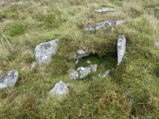
Cosdon Beacon Cairn Circle & Cist
Prehistoric Dartmoor Walks: Dartmoor Site: Cosdon Hill Triple Stone Row
OS Map: SX 63730 91654
HER: MDV6925
Megalithic Portal: 10325
Alternate name: Cosdon Hill 4 Cairn Circle & Cist
Short Name: CN Cosdon 4
Butler map: 40.7.4
Butler Vol 5: p.183 & Fig.125
Grinsell: ST 1b
DPD: 153
Dimensions (m): 6.5 x 0.6 C
Notes: "Cairn mound measures 7m in diam and stands up to 0.6m high. A central hollow, 2m by 1.8m by 1m deep, is faced on two sides with large slabs which may represent the cist described by falcon in 1905 as being 4ft long by 2ft wide. A ring of edge set stones around this cist is visible and may represent an internal kerb, which survives largely as a buried feature.". Lethbridge diagram p.152, photo bottom left p.153. Butler Cosdon Beacon 4 Vol. 2. Map 40.7.4 (diagram of Cosdon Summit cairns on p.207). Barrow Report 4 quotes Rowe (1872) and Rowe on this feature. See also Bate (1862) and Rowe's earlier account (1830). For Falcon's cist (1905) "Two stones set on edge on the eastern periphery of the mound may represent a second cist." see entry SiteID=463.
NB. The grid reference SX 63730 91654 had been assigned by the author to this feature - possibly as read from Google or a subsequent visit. Unfortunately no explanation can be found so rolling back to previous Garmin reading taken on 12/09/21.
Nearest Bus Stop: Ramsley (1.9 km) [Route: 670,671,6A]
Nearby sites: SX 63730 91654
Cosdon Beacon Cist
Prehistoric Dartmoor Walks: Dartmoor Site: Cosdon Hill Triple Stone Row
OS Map: SX 63740 91653
PMD: Cosdon Summit N.
Alternate name: Cosdon Hill 6 Cist
Short Name: CT Cosdon 6
Dimensions (m): 1 x 0.75
Notes: The cist was originally noted by Falcon as being approximately 3 1/2ft to 4ft long and 2ft wide, aligned apparently NE-SW. The SW and NE sides were fairly recognizable. This cist is very near to the Cosdon Hill 4 cairn (SiteID=419, HER MDV6925) and the details of this site have been incorporated and sometimes confused by numerous authors. Butler perhaps gives a fleeting mention as "Two slabs on the edge of the pit are probably the sides of a cist." although it is not clear whethr this is a reference to part of Cosdon Hill 4. Neither the NMR nor the HER have separate entries for this feature but it is mentioned as part of the covreage of Cosdon Hill 4 "Two stones set on edge on the eastern periphery of the mound may represent a second cist." (MDV6925)
Nearest Bus Stop: Ramsley (1.9 km) [Route: 670,671,6A]
Nearby sites: SX 63740 91653
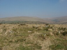
Burford Down (Tristis Rock) Platform Cairn Circle and Cist
Prehistoric Dartmoor Walks: Dartmoor Site: Burford Down stone row and cairns
OS Map: SX 6378 6016
HER: MDV4258
Megalithic Portal: 45689
PMD: Tristis Rock
Alternate name: Tristis Rock Platform Cairn Circle and Cist
Short Name: CT TristisRock
Butler map: 54.17
Grinsell: HAR 6
Turner: E22
DPD: 70
Barrow Report: 14 40
Dimensions (m): 6.4 x 0.4 C
Notes: "Retaining circle of a barrow, internal diameter between 16 and 17 feet and consisting of twelve stones which enclose the remaining south side stone of a cist. The overall length of the side stone is 4 feet 6 inches, the internal length of the cist would not have been more than 3 feet". Butler Tristis Rock - Vol. 4. Map 54.17 (p.60 diagram of Tristis Rock cairn p.59).
Nearest Bus Stop: Cornwood Crossways (3.4 km) [Route: 59]
Nearby sites: SX 6378 6016
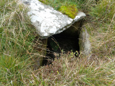
Redlake Foot (Brown Heath) Cist
OS Map: SX 63778 66069
HER: MDV5102
Megalithic Portal: 45760
PMD: Brown Heath
Alternate name: Brown Heath Cist
Short Name: CT Brown Heath
Butler map: 55.7.3
Grinsell: HAR 1
DPD: 73
Barrow Report: 60 69 71
Dimensions (m): 6.5 x 0.5 C
Notes: "A fine cist at Redlake Foot measuring internally, 0.7m. by 1.0m. and 1.0m. deep single slabs form the end-stones and the southern side-stone. The northern side is a slab resting on a horizontal 'post' type stone" Cover slab partly displaced from the sides. Lethbridge p.73, diagram p.71. Butler Brown Heath (Cairn 3) - Vol. 4. Map 55.7.3 (p.76-7 diagram p.76).
Nearest Bus Stop: Cornwood Crossways (7.3 km) [Route: 59]
Nearby sites: SX 63778 66069
Black Newtake (E) No. 5 Ring Setting Cairn and Cist
Prehistoric Dartmoor Walks: Dartmoor Site: Lakehead Hill
OS Map: SX 63853 75734
HER: MDV5950
Megalithic Portal: 45744
PMD: Black Newtake S.
Alternate name: Bellever Tor 8 Ring Setting Cairn and Cist
Short Name: CT BlackNew E5
Butler map: 27.20.8
Grinsell: LYD 64
Turner: D7
Barrow Report: 57
Dimensions (m): 6.5 x 0.9 x 0.4 ? C?
Notes: "Turf and gorse covered cairn. Approximately 6 metres in diameter with a maximum height of 0.35 metres. A depression in the top possibly marks the site of a cist with one large leaning or recumbent stone detectable under the turf at the east end" "Small orthostatic circle, diameter 6.5 metres, with central cist. Only one stone remains. Part of group with similar thin rectangular slabs, now eroded". Further coverage on Lakehead Hill page. Butler Bellever Tor - Vol. 2. Map 27.20.8 (Cairn 8 diagram pp.52-3). See also: Dartmoor Explorations: Antiquities of Black Newtake and Environs
Nearest Bus Stop: Powder Mills (1.3 km) [Route: 171]
Nearby sites: SX 63853 75734
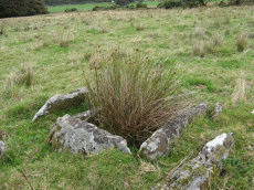
Archerton Tennis Ground Platform Cairn Circle and Cist
OS Map: SX 63852 78872
HER: MDV5839
Megalithic Portal: 37599
PMD: Archerton Tennis Court
Alternate name: Archerton Platform Cairn Circle and Cist
Short Name: CT Arch Tennis
Butler map: 27.18
Grinsell: LYD 45
Turner: E49
DPD: 114
Barrow Report: 57
Dimensions (m): 0.95 x 0.85 C
Notes: Lethbridge diagram p.112, photo top p.114. Butler Archerton - Vol. 2. Map 27.18.
Nearest Bus Stop: Postbridge Post Office (0.9 km) [Route: 98,171]
Nearby sites: SX 63852 78872
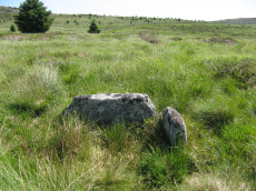
Black Newtake (C) No. 3 Ring Setting Cairn and Cist
Prehistoric Dartmoor Walks: Dartmoor Site: Lakehead Hill
OS Map: SX 63893 75869
HER: MDV5890
Megalithic Portal: 34908
PMD: Black Newtake Central
Alternate name: Bellever Tor 6 Ring Setting Cairn and Cist
Short Name: CT BlackNew C3
Butler map: 27.20.6
Grinsell: LYD 62
Turner: D4
DPD: 120
Barrow Report: 57
Dimensions (m): 7.4 x level C
Notes: Further coverage on Lakehead Hill page. Lethbridge diagram p.119 Cist 2 and photo top p.120. Butler Bellever Tor - Vol. 2. Map 27.20.6 (Cairn 6 diagram pp.52-3).
Nearest Bus Stop: Powder Mills (1.2 km) [Route: 171]
Nearby sites: SX 63893 75869
Erme Pound (Near) Cist
OS Map: SX 6392 6551
HER: MDV28585
Megalithic Portal: 45758
PMD: Erme Pound
Short Name: CT:Erme Pound
Grinsell: HAR 2
Turner: D29
Dimensions (m): 3.7 x 0.3 (?)
Notes: "A prehistoric round cairn, 300 metres west of the River Erme in an area of intense peat cutting remains. The cairn has surviving elements of a kerb and a central hollow which may have contained a cist. This probable platform cairn has a diameter of 3.8 metres and is raised above ground by 0.5 metres. The flat-topped mound is surrounded by a closely fitting, though incomplete, kerb of upright slabs, where many of the survivors remain in situ. An elongated hollow across the centre of the cairn may represent a disturbed cist, and a displaced slab within the hollow is the remains of a capstone.". "Noted by Hankin in July 1976, perhaps in a small cairn diameter 3.7m and height 0.3m. It is now filled in and Grinsell failed to locate it, 'it seems never to have been planned if it ever existed.'" This cist was listed by Dixon in 1952 70th Barrow Report (T.D.A Vol 84) with Dixon #96. It is not listed in prior Barrow Reports - and appears towards end of Dixon's list, so presumably discovered/reported late 40s to 1952. Not listed by Butler (area covered in Vol. 4. Map 55). Not listed in Hankin's 'An archaeological check-list for Harford'.
Nearest Bus Stop: Cornwood Crossways (6.9 km) [Route: 59]
Nearby sites: SX 6392 6551
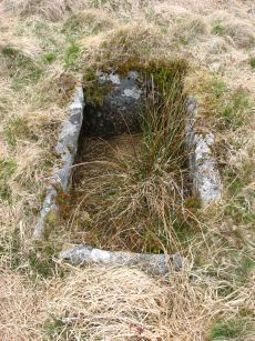
Black Newtake (N) No. 1 Ring Setting Cairn and Cist
Prehistoric Dartmoor Walks: Dartmoor Site: Lakehead Hill
OS Map: SX 63919 76067
HER: MDV5888
Megalithic Portal: 45738
PMD: Black Newtake N.
Alternate name: Bellever Tor 3 Ring Setting Cairn and Cist
Short Name: CT BlackNew N1
Butler map: 27.20.3
Grinsell: LYD 60
Turner: D5
DPD: 119
Barrow Report: 57
Dimensions (m): 8.0 x level C
Notes: Further coverage on Lakehead Hill page. Lethbridge Cist 1 diagram p.119 and photo top p.119. Butler Bellever Tor (Cairn 3) - Vol. 2. Map 27.20.3 (diagram pp.52-3). Site revisited 04/09/23 and the site is very overgrown unlike in 2010. The exact location by Garmin is SX 63919 76067 now used on this record. See also: Dartmoor Explorations: Antiquities of Black Newtake and Environs
Nearest Bus Stop: Powder Mills (1.1 km) [Route: 171]
Nearby sites: SX 63919 76067
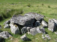
Roundy Park, Postbridge Cist
OS Map: SX 63920 79669
HER: MDV5935
Megalithic Portal: 26041
PMD: Roundy Park
Alternate name: Roundy Park Cist
Short Name: CT Roundy Park
Butler map: 27.4
Butler Vol 5: p.22 & Fig.3
Grinsell: LYD 40
DPD: 113
Barrow Report: 21
Dimensions (m): 5.5 x 0.3 C
Notes: One of the largest cists on Dartmoor. Discovered in August 1893 by Robert Burnard, who was responsible for the restoration of the grave. Lethbrdige diagram p.112, photo p.113. Butler Vol. 2. Map 27.4 (diagram of location p.41, diagram of site Vol. 5 p.22)
Nearest Bus Stop: Postbridge Post Office (1.1 km) [Route: 98,171]
Nearby sites: SX 63920 79669
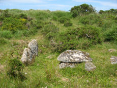
Dunnabridge Pound Farm Newtake Cist
Prehistoric Dartmoor Walks: Dartmoor Site: Lakehead Hill
OS Map: SX 64086 75691
HER: MDV5891
Megalithic Portal: 45751
PMD: Dunnabridge Newtake
Alternate name: Bellever Tor 10 Cist
Short Name: CT DunPound Fm
Butler map: 27.20.10
Butler Vol 5: p.60 & Fig.39
Grinsell: LYD 66
DPD: 121
Barrow Report: 59
Dimensions (m): 0.8 x 0.2 C
Notes: Only one side of this cist remains. Further coverage on Lakehead Hill page. Lethbridge Cist 4 diagram p.119 and photo top p.121. Butler Bellever Tor - Vol. 2. Map 27.20.10 (Cairn 10 diagram pp.52-3). See also: Dartmoor Explorations: Antiquities of Black Newtake and Environs
Nearest Bus Stop: Powder Mills (1.5 km) [Route: 171]
Nearby sites: SX 64086 75691
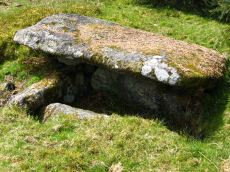
Bellever Tor 1 (W) (Newtake) Platform Cairn Circle and Cist
Prehistoric Dartmoor Walks: Dartmoor Site: Lakehead Hill
OS Map: SX 64089 76472
HER: MDV5884
Megalithic Portal: 34876
PMD: Bellever Tor W.
Alternate name: Bellever Tor 1 Platform Cairn Circle and Cist
Short Name: CT Bellever 1
Butler map: 27.20.1
Grinsell: LYD 59
Turner: E26
DPD: 119
Barrow Report: 54 56
Dimensions (m): c.6.5 x 1.0 C
Notes: Further coverage see the Lakehead Hill page. Lethbridge diagram p.119 (uppermost cist) and photo top p.119. Dixon #62. Bar Rep 54. Butler Bellever Tor (Cairn 1) - Vol. 2. Map 27.20.1 (diagram pp.52-3).
Nearest Bus Stop: Powder Mills (1.2 km) [Route: 171]
Nearby sites: SX 64089 76472
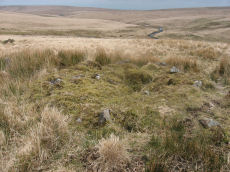
Brown Heath (Hook Lake) Encircled Cairn and Cist
OS Map: SX 64114 65327
HER: MDV5137
Megalithic Portal: 52166
The Stone Rows of GB: Hook Lake
PMD: Hook Lake Stone row
Alternate name: Hook Lake stone row Encircled Cairn and Cist
Short Name: CT Hook Lake
Butler map: 55.8
Grinsell: HAR 3
Turner: F11
DPD: 74
Barrow Report: 38
Dimensions (m): 9.2 x 0.8 C
Notes: "A double stone row, on Brown Heath, circa 540 feet in length, direction of length N 10o E. At the north end is a stone circle, diameter 31 feet, surrounding a cairn which contains the remains of a cist." Ruined and possibly no longer visible. Butler Hook Lake stone row - Vol. 4. Map 55.8 (pp.78-9).
Nearest Bus Stop: Cornwood Crossways (6.8 km) [Route: 59]
Nearby sites: SX 64114 65327
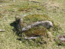
Lakehead Hill 2 Cist
Prehistoric Dartmoor Walks: Dartmoor Site: Lakehead Hill
OS Map: SX 64261 77701
HER: MDV5841
Megalithic Portal: 4612
PMD: Lakehead Hill NW.
Short Name: CT Lakehead 2
Butler map: 27.19.2
Grinsell: LYD 52
DPD: 115
Barrow Report: 17 55
Dimensions (m): 1.35 x 0.9 C
Notes: Further coverage on Lakehead Hill page. Lethbridge diagram p.114 and photos top p.115. See Seventeenth Barrow report. Butler Lakehead Hill (Cairn 2) - Vol. 2. Map 27.19.2 (diagrams pp.48-52).
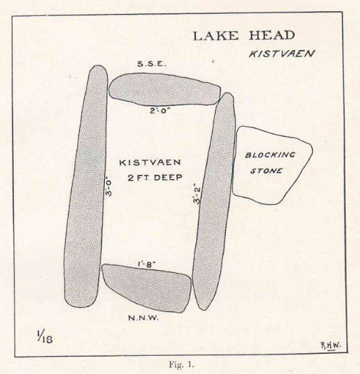
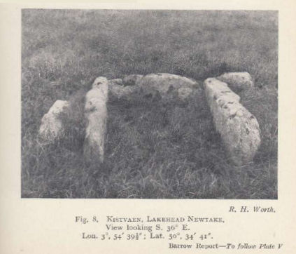
Nearest Bus Stop: Postbridge Post Office (1.3 km) [Route: 98,171]
Nearby sites: SX 64261 77701
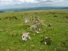
Cosdon (stone row) Platform Cairn Circle and Cist
Prehistoric Dartmoor Walks: Dartmoor Site: Cosdon Hill Triple Stone Row
OS Map: SX 64331 91597
HER: MDV48906
Megalithic Portal: 813
PMD: Cosdon Stone Row
Alternate name: Cosdon Hill Stone Row Platform Cairn Circle and Cist
Short Name: CT Cosdon Row
Butler map: 40.6
Butler Vol 5: p.234 & Fig.165
Grinsell: ST 5
Turner: E15
DPD: 152
Dimensions (m): 7.0 x 0.3 C
Notes: "The cairn associated with the Cosdon Hill triple stone row is 26 feet in diameter and contains the remains of two cists; the retaining circle is very irregular. Of the two cists, one is intact, the other has been robbed of the cover-stone and two side-stones." Lethbridge diagram p.152, cists pictured. Butler Cosdon Hill Stone Row - Vol. 2. Map 40.6 (diagram p.205).
Nearest Bus Stop: Ramsley (1.7 km) [Route: 670,671,6A]
Nearby sites: SX 64331 91597
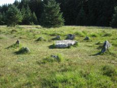
Lakehead Hill 6 (Newtake) Ring Setting Cairn and Cist
Prehistoric Dartmoor Walks: Dartmoor Site: Lakehead Hill
OS Map: SX 64363 77475
HER: MDV5842
Megalithic Portal: 24365
PMD: Lakehead Hill Central
Alternate name: Lakehead Hill 6 Ring Setting Cairn and Cist
Short Name: CT Lakehead 6
Butler map: 27.19.6
Grinsell: LYD 56
Turner: D10
DPD: 117
Barrow Report: 54 56
Dimensions (m): 5.6 C
Notes: Further coverage on Lakehead Hill page. Lethbridge diagram p.114 and photo bottom p.117. Dixon #64. Bar Rep 54. Butler Lakehead Hill (Cairn 6) - Vol. 2. Map 27.19.6 (diagrams pp.48-52).
Nearest Bus Stop: Postbridge Bellever (1.2 km) [Route: 98]
Nearby sites: SX 64363 77475
Shoveldown N.W. 5 Cist
Prehistoric Dartmoor Walks: Dartmoor Site: Shovel Down Ceremonial Complex
OS Map: SX 64389 86247
HER: MDV4394
Megalithic Portal: 45782
PMD: Stonetor Hill
Alternate name: Shoveldown N.W.1 Cist
Short Name: CT:Shovel NW5
Butler map: 37.5.1
Butler Vol 5: p.202 & Fig.145
Grinsell: GID 1
Dimensions (m): 4.5 x 0.3 C
Notes: NB. NGR from PMD is SX64398640. "The remains of a Bronze age cairn and cist which form part of a cairn cemetery on Long Ridge, known locally as Langridge, overlooking the valley of the River North Teign. The cairn has a circular mound which measures 5.2 metres in diameter and 0.5 metres high. The cist measures 0.83 metres square by up to 0.47 metres deep. The capstone, which once covered the cist, now lies 0.7 metres NNW of the cist." Butler Shoveldown N.W.1. - Vol. 2. Map 37.5. (diagram Vol. 5. p.202).
Nearest Bus Stop (Minor): Wonson Telephone Box (4.5 km) [Route: 670]
Nearest Bus Stop (Major): Chagford The Square (5.8 km) [Route: 173,178,671]
Nearby sites: SX 64389 86247
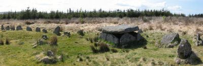
Lakehead Hill 4 (E or Summit) Ring Setting Cairn and Cist
Prehistoric Dartmoor Walks: Dartmoor Site: Lakehead Hill
OS Map: SX 64499 77611
HER: MDV5870
Megalithic Portal: 2009
PMD: Lakehead Hill Summit
Alternate name: Lakehead Hill 4 Ring Setting Cairn and Cist
Short Name: CT Lakehead 4
Butler map: 27.19.4
Butler Vol 5: p.59 & Fig.37
Grinsell: LYD 54
Turner: D6
DPD: 116
Dimensions (m): 6.7? C
Notes: A single stone row of at least 11 stones leading westward towards the cairn and cist. "The cairn measures 6.7 metres in diameter and is defined by several edge set stones, which in turn surround a large restored cist formed by five substantial upright slabs supporting a capstone measuring 2.2 metre long by 1.55 metres wide and 0.3 metres thick." Further coverage on Lakehead Hill page. Lethbridge diagram p.114 and photo top p.116. Butler Lakehead Hill (Cairn 4) - Vol. 2. Map 27.19.4 (diagrams pp.48-52).
Nearest Bus Stop: Postbridge Bellever (1.0 km) [Route: 98]
Nearby sites: SX 64499 77611
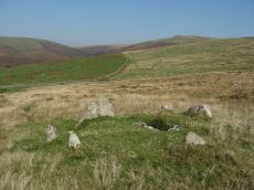
Lower Piles Ring Setting Cairn and Cist
Prehistoric Dartmoor Walks: Dartmoor Walk: The Neolithic tombs of Cuckoo Ball & Corringdon Ball
OS Map: SX 64540 60262
HER: MDV4256
Megalithic Portal: 1108
PMD: Lower Piles
Alternate name: Piles Hill S.W.15 Ring Setting Cairn and Cist
Short Name: CT Lower Piles
Butler map: 53.11.15
Grinsell: HAR 8
Turner: D13
DPD: 76
Barrow Report: 36 62
Dimensions (m): 5.4 x 0.3 C
Notes: "A cist with a retaining circle, diameter 14 to 15 feet, of which seven stones still remain, lies about 150 yds south of the south east angle of Lower Piles enclosure. The cist measures 3 feet 7 inches in length by 1 foot 4 inches wide at the south-eastern end and 2 feet wide at the north western. The present depth is from 2 feet 9 inches to 3 feet. The cover-stone and the north-western end-stone are missing." Letchfield diagram p.76. Barrow Report 36 says "To the south-east, in the direction of the length of the kistvaen, stands a single large stone, about 100 feet distant; to the north-west, with its centre 110 feet away from the centre of the kistvaen, there is a small cairn of 20 feet diameter; this also is in the line of the length of the kistvaen." The stone is at SX 64518 60236 Butler Piles Hill S.W. - Vol. 4. Map 53.11.15 (p.33 diagram of cist & plan of cairns on Piles Hill p.30).
Nearest Bus Stop: Cornwood Crossways (4.1 km) [Route: 59]
Nearby sites: SX 64540 60262
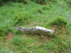
Lakehead Newtake Cist
Prehistoric Dartmoor Walks: Dartmoor Site: Lakehead Hill
OS Map: SX 64677 78385
HER: MDV5955
Megalithic Portal: 45734
PMD: Lakehead Hill NE.
Alternate name: Lakehead Hill 9 Cist
Short Name: CT Lakehead 9
Butler map: 27.19.9
Butler Vol 5: p.60 & Fig.40
Grinsell: LYD 51
Barrow Report: 55
Dimensions (m): 1.3 x 0.2 ? C
Notes: Butler Lakehead Hill - Vol. 2. Map 27.19.9 (diagrams pp.48-52). Further coverage on Lakehead Hill page.
Nearest Bus Stop: Postbridge Post Office (0.5 km) [Route: 98,171]
Nearby sites: SX 64677 78385
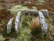
Lakehead Hill 8 Cist
Prehistoric Dartmoor Walks: Dartmoor Site: Lakehead Hill
OS Map: SX 64717 77178
HER: MDV5879
Megalithic Portal: 24377
PMD: Lakehead Hill SE.
Short Name: CT Lakehead 8
Butler map: 27.19.8
Butler Vol 5: p.61 & Fig.41
Grinsell: LYD 58
DPD: 118
Barrow Report: 33 55
Dimensions (m): 1.1 x 0.7 C
Notes: Further coverage on Lakehead Hill page. Lethbridge diagram p.114 and photo bottom p.118.Butler Lakehead Hill (Cairn 8) - Vol. 2. Map 27.19.8 (diagrams pp.48-52).
Nearest Bus Stop: Postbridge Bellever (0.8 km) [Route: 98]
Nearby sites: SX 64717 77178
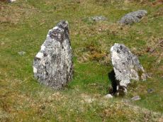
Lakehead Hill 7 (Newtake) Cist
Prehistoric Dartmoor Walks: Dartmoor Site: Lakehead Hill
OS Map: SX 64720 77395
HER: MDV5875
Megalithic Portal: 11137
PMD: Lakehead Hill E.
Alternate name: Lakehead Hill 7 Cist
Short Name: CT LakeNew 7
Butler map: 27.19.7
Butler Vol 5: p.184 & Fig.127
Grinsell: LYD 57
DPD: 118
Barrow Report: 54
Dimensions (m): c.19.0 x 0.9 C
Notes: Butler Lakehead Hill (Cairn 7) - Vol. 2. Map 27.19.7 (diagrams pp.48-52).Further coverage on Lakehead Hill page. Lethbridge diagram p.114 and photo top p.118.
Nearest Bus Stop: Postbridge Bellever (0.8 km) [Route: 98]
Nearby sites: SX 64720 77395
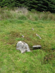
Hemstone Rocks Ring Setting Cairn and Cist
OS Map: SX 64852 83850
HER: MDV6729
Megalithic Portal: 52522
PMD: Hemstone Rocks
Alternate name: Hemstone Rocks N.2 Ring Setting Cairn and Cist
Short Name: CT Hemstone
Butler map: 35.7.2
Grinsell: LYD 17a
Turner: D9
Dimensions (m): 6.2
Notes: There are 3 cairns in the vicinity and they are according to Newman [2013] impossible to match up with the old reports. These cairns were excavated by Baring-Gould in 1900. A flint flake was found in the cist. There is also a rectangular pit in this cairn which could be from the 1900 excavation. See also: MDV48854. DNP Site 8F. Butler Hemstone Rocks N. 1 - Vol. 2. Map 35.7. Central cist. Next to Turner Platform Circle E12.
Nearest Bus Stop: Warren House Inn (3.9 km) [Route: 171]
Nearby sites: SX 64852 83850
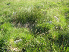
Skir Hill (Henroost) Ring Setting Cairn and Cist
OS Map: SX 65104 70686
HER: MDV6507
Megalithic Portal: 45676
PMD: Skir Hill
Alternate name: Skir Hill Ring Setting Cairn and Cist
Short Name: CT Skir Hill
Butler map: 61.8
Grinsell: LYD 102
Turner: D18
DPD: 92
Barrow Report: 24 56
Dimensions (m): 3.3 C
Notes: DM reports it is actually located at SX 65092 70684. The author has found this site at SX 65104 70691 on 28/06/18 assisted by the grid reference given by Dave Martin (DM). "A Bronze Age cairn containing a cist located on the north east facing slope of Skir Hill 590 metres south of Skir Ford. The cairn survives as a 4.1 diameter ring of edge set slabs up to 0.5 metres high. The cist is situated slightly west of the cairns centre and survives as a 0.82 metres long by 0.52 metres wide and 0.82 metres deep stone lined pit." Formerly listed as being at SX 6517 7075 (as per literature). Butler Vol. 4. Map 61.8 (diagram p.203).
Nearest Bus Stop: Dartmeet Badgers Holt (3.3 km) [Route: 172]
Nearby sites: SX 65104 70686
Stonetor Brookhead E. Cist
OS Map: SX 6527 8563
HER: MDV13023
Megalithic Portal: 45807
PMD: Stonetor Brook Head
Alternate name: Stonetor Brookhead E.2 Cist
Short Name: CT:Stonetor E2
Butler map: 37.2.2
Butler Vol 5: p.201 & Fig.144
DPD: 133
Dimensions (m): 1.1 x 0.9 C
Notes: "A mutilated cist situated amongst peat cuttings on the moderate W slope of shovel Down. Only the N endstone, 0.6m long, remains in situ on the edge of a hollow 1.1m N-S by 0.9m and 0.2m deep. An irregular slab 0.15m thick, probably the disturbed coverstone, lies propped up on the endstone. There is no trace of a covering cairn". Lethbridge diagram p.133 and photo top p.133. Butler Vol. 2. Map 37.2 (diagram Vol 5 p.201).
Nearest Bus Stop (Minor): Wonson Telephone Box (4.5 km) [Route: 670]
Nearest Bus Stop (Major): Warren House Inn (5.1 km) [Route: 171]
Nearby sites: SX 6527 8563
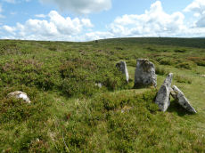
Stannon Little Newtake Ring Setting Cairn and Cist
OS Map: SX 65464 81068
HER: MDV6616
Megalithic Portal: 37598
PMD: Stannon Newtake
Alternate name: Stannon Newtake E. Ring Setting Cairn and Cist
Short Name: CT Stannon New
Butler map: 35.21.1
Grinsell: LYD 29
Turner: D16
DPD: 124
Barrow Report: 57
Dimensions (m): 3.9 x 0.3 C
Notes: "Cairn survives as a 4.5 metre diameter mound up to 0.5 metres high. The western edge is denoted by a kerb of edge set slabs up to 1.15 metres high. The eastern edge is beneath a later boundary bank. A cist in the centre is a rectangular pit 1.2 metres by 0.5 metres denoted by edge set slabs". Butler Stannon Newtake E. - Vol. 2. Map 35.21 (diagram p.168).
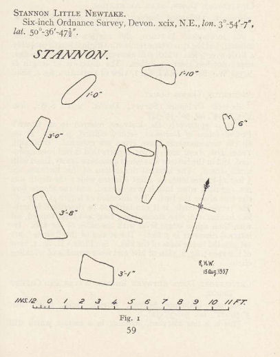
Nearest Bus Stop: Warren House Inn (2.0 km) [Route: 171]
Nearby sites: SX 65464 81068

Fernworthy Cist
Prehistoric Dartmoor Walks: Dartmoor Site: Fernworthy Stone Circle
OS Map: SX 65491 84100
HER: MDV6719
Megalithic Portal: 35826
PMD: Fernworthy
Alternate name: Fernworthy 2 Cist
Short Name: CT Fernworth
Butler map: 35.15.2
Butler Vol 5: p.36 & Fig.13
Grinsell: LYD 23
DPD: 138
Dimensions (m): 7.0 x 0.3 C
Notes: The remains of this cist are in the 6m diameter barrow at the N end of the Fernworthy S.E. stone row. The cist in the centre is represented by two stones set at right angles, 0.4m tall internally. Excavated by the Dartmoor Excavation Committee in 1898. A lot of burnt bone was found. DNP Post 6D. Butler Vol. 2. Map 35.15.2 (diagram Vol. 5. p.36 - row 2). Newman Barrow B.
Nearest Bus Stop: Warren House Inn (3.7 km) [Route: 171]
Nearby sites: SX 65491 84100
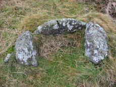
Butterdon Hill Cist
Prehistoric Dartmoor Walks: Dartmoor Walk: The Erme East stone rows
OS Map: SX 65781 59341
HER: MDV2887
Megalithic Portal: 45752
PMD: Butterdon Hill
Alternate name: Butterdon Ridge N.E. Cist
Short Name: CT Butterdon
Butler map: 53.8.3
Butler Vol 5: p.59 & Fig.38
Grinsell: UGB 16
DPD: 79
Barrow Report: 61
Dimensions (m): 0.63 x 0.5 C
Notes: "The western side stone and the two end stones are still standing, but the other side stone and the cover stone are missing. The cist measures 23 inches by 15 inches"... "no sign whatever of a mound, and the cist may have been freestanding". Lethbridge p.79 East of Hangershell Rock diagram p.77. Butler Butterdon Ridge N.E. - Vol. 4. Map 53.8.3 (p.25 general plan of Butterdon rows and cairns p.24).
Nearest Bus Stop: Ivybridge BP Garage (Stop B) (3.8 km) [Route: 38]
Nearby sites: SX 65781 59341
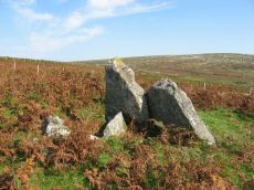
Cuckoo Ball Chambered Tomb
Prehistoric Dartmoor Walks: Dartmoor Site: Cuckoo Ball Chambered Tomb
OS Map: SX 65963 58195
HER: MDV2885
Megalithic Portal: 31700
PMD: Cuckoo Ball Chambered Cairn
Alternate name: Cuckoo Ball chambered cairn Chambered Tomb
Short Name: NT Cuckoo Ball
Butler map: 53.15
Butler Vol 5: p.155
Grinsell: A:UGB 1
DPD: 80
Barrow Report: 30 56
Dimensions (m): c.28.0 x 12.0 x 0.8
Notes: "The remains of a long cairn and burial chamber on a hill-slope at Cuckoo Ball. The cairn, which was probably robbed for newtake walls to the west and north, is 23 metres long by 12 metres wide, aligned north/south, and is 0.7 metre high at the north. The burial chamber is at the north end."
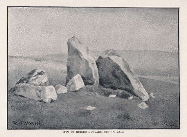
Nearest Bus Stop: Ivybridge BP Garage (Stop B) (3.1 km) [Route: 38]
Nearby sites: SX 65963 58195
Shovel Down Cist
Prehistoric Dartmoor Walks: Dartmoor Site: Shovel Down Ceremonial Complex
OS Map: SX 65993 85924
HER: MDV6182
Megalithic Portal: 28953
PMD: Shovel Down
Alternate name: Shoveldown Rows 4 Cist
Short Name: CT Shovel Down
Butler map: 36.7
Butler Vol 5: p.223 & Fig.155
Grinsell: CHA 1
Dimensions (m): 7.0 x 0.3 C
Notes: Robbed cist no longer visible. The Shovel down double row C (Worth Row C, Butler Rows 4) terminates at its southern end in a cairn - the cist has been robbed from the cairn. Visited 16/05/19 - a rectangular cist shaped hole can be clearly seen with reeds growing from it. No sign of a cist. Butler Shoveldown Rows 4 Vol. 2. Map 36.7 (diagram Vol. 5. p.223).
Nearest Bus Stop (Minor): Wonson Telephone Box (3.9 km) [Route: 670]
Nearest Bus Stop (Major): Chagford The Square (4.4 km) [Route: 173,178,671]
Nearby sites: SX 65993 85924
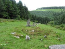
Assycombe Hill Encircled Cairn and Cist
Prehistoric Dartmoor Walks: Dartmoor Site: Assycombe Double Stone Row
OS Map: SX 66102 82650
HER: MDV6538
Megalithic Portal: 45814
PMD: Assycombe Stone Row
Alternate name: Assycombe Hill Stone Row Encircled Cairn and Cist
Short Name: CT Assycombe
Butler map: 35.19
Butler Vol 5: p.232 & Fig.164
Grinsell: LYD 26
Turner: F16
DPD: 135
Dimensions (m): 8.0 x 0.4 C
Notes: The cairn at the E end is in line with the N of the two rows. It measures 8.4m in diameter and is 0.6m high. It contains a large quantity of stone; two stones in the centre, set at right angles to each other around a hollow, suggest the remains of a cist.
Nearest Bus Stop: Warren House Inn (2.2 km) [Route: 171]
Nearby sites: SX 66102 82650
Thornworthy Corner (N) Cist
OS Map: SX 6612 8547
HER: MDV6183
Megalithic Portal: 45776
PMD: Downhill from Three Boys
Alternate name: Thornworthy Corner N. Cist
Short Name: CT:Thornwort N
Butler map: 36.7
Grinsell: CHA 2
Dimensions (m): 1.8 x ? C?
Notes: "Recorded as a cist by Worth (1932), based on the one remaining stone. 1991 survey thought it more likely the result of stone clearance for the nearby newtake wall" Butler Vol. 2. Map 36.7.
Nearest Bus Stop (Minor): Wonson Telephone Box (4.3 km) [Route: 670]
Nearest Bus Stop (Major): Chagford The Square (4.5 km) [Route: 173,178,671]
Nearby sites: SX 6612 8547
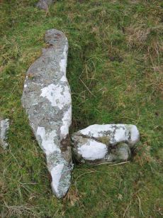
Lower Glasscombe Cist
Prehistoric Dartmoor Walks: Dartmoor Walk: The Neolithic tombs of Cuckoo Ball & Corringdon Ball
OS Map: SX 66506 60502
HER: MDV5652
Megalithic Portal: 45761
PMD: Lower Glasscombe
Alternate name: Glaze Meet Cist
Short Name: CT Lower Glass
Butler map: 56.3
Grinsell: UGB 11
DPD: 81
Barrow Report: 72
Dimensions (m): c.4.0 x 0.1 C
Notes: "There is a very slight trace of a mound and scattered rocks indicate the remains of a cairn ... Only one sidestone and one endstone now remain with the coverstone lying 11 feet away to the south-east. Overall dimensions of the coverstone are 49 inches by 24 inches". Lethbridge Scad Brook cist p.81 Butler Glaze Meet - Vol. 4. Map 56.3 (diagram p.85).
Copyright for photos and plans from Barrow Reports 71-73 belong to the Dixon estate. Reproduced here with kind permission.
Nearest Bus Stop: South Brent Pool Park (3.7 km) [Route: 38]
Nearby sites: SX 66506 60502
Hickley Ridge W Cist
OS Map: SX 6659 6203
HER: MDV13283
Megalithic Portal: 45809
PMD: Hickley Ridge W.
Alternate name: Hickley Ridge 3 Cist
Short Name: CT:HickleyW
Butler map: 56.14.4
Butler Vol 5: p.176 & Fig.118
DPD: 84
Dimensions (m): c. 0.84 x 0.8 ? C
Notes: "Cairn and cist on the East side of Brent Fore Hill. The cairn is 6.0m in diameter, merging into the slope of the hill and being about 0.5m high on the downslope side, which has a retaining kerb. There is a central cist of which two parallel slabs remain set on edge at the NW and SE sides. An upright stone 0.9m high is offset from the cist on the NW side." Lethbridge p.84 diagram and photo top left. Butler Hickley Ridge 3 56.14.4 diagram Vol 5 p.176.
Nearest Bus Stop: South Brent Pool Park (4.2 km) [Route: 38]
Nearby sites: SX 6659 6203
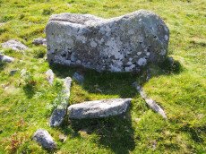
Holne Ridge N. Cist
OS Map: SX 66641 71138
HER: MDV12997
Megalithic Portal: 45800
PMD: Holne Ridge N.
Alternate name: Holne Ridge N.3 Cist
Short Name: CT HolneRidg 3
Butler map: 60.26.3
DPD: 91
Dimensions (m): 1.6 x 0.9 C
Notes: Butler Cist 3 Vol. 4. Map 60.26 (diagram p.195). "A probable but unusual cist is on steep well drained, NW facing slope. It utilizes the south east side of a massive slab, 1.6m long, 0.4m thick and 0.7m high, with smaller slabs 0.6m to 0.9m long and 0.2m thick, which barely project above ground level". NW of of Holne Ridge stone row. Lethbridge p.90-91, diagram p.90, photo bottom p.91
Nearest Bus Stop: Dartmeet Badgers Holt (2.2 km) [Route: 172]
Nearby sites: SX 66641 71138
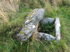
Thornworthy Cist
OS Map: SX 66746 84346
HER: MDV6613
Megalithic Portal: 15453
PMD: Thornworthy
Short Name: CT Thornworthy
Butler map: 35.22
Butler Vol 5: p.64 & Fig.42
Grinsell: CHA 3
Turner: E39
DPD: 137
Barrow Report: 16 21 56
Dimensions (m): 11.5 x 0.6 C
Notes: Butler Vol. 2. Map 35.22 (p.169, photo on p.136, diagram Vol. 5. p.64).Originally there was a second slightly smaller cist. This was removed after the excavation and re-erected at Torquay Museum. It is now at the High Moorland Visitor Centre at Princetown. See also: Thornworthy 2 Cist
Nearest Bus Stop: Warren House Inn (3.5 km) [Route: 171]
Nearby sites: SX 66746 84346
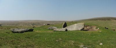
Corringdon Ball Chambered Tomb
Prehistoric Dartmoor Walks: Dartmoor Site: Corringdon Ball Chambered Tomb & Stone Rows
OS Map: SX 66956 61300
HER: MDV5750
Megalithic Portal: 4619
PMD: Corringdon Ball Chambered Cairn
Alternate name: Corringdon Ball chambered tomb Chambered Tomb
Short Name: NT Corringdon
Butler map: 56.10
Butler Vol 5: p.155
Grinsell: A:BRE 1
DPD: 83
Barrow Report: 28 56 66
Dimensions (m): 42 x 18 x 2.4
Notes: "An earthen long barrow with a ruined stone chamber at the south east end. Early excavation and mutilation has resulted in two distinct mounds, the larger one at the south east end separated from the smaller by a path or trackway. The smaller mound appears to mark the limit of the barrow on the northwest; beyond this it merges into the natural hill-side. There are no side ditches but these may be obscured by soil washed down from the hill. The length is 42.0 m; the maximum width is 18.0m and the maximum height of 2.4m."
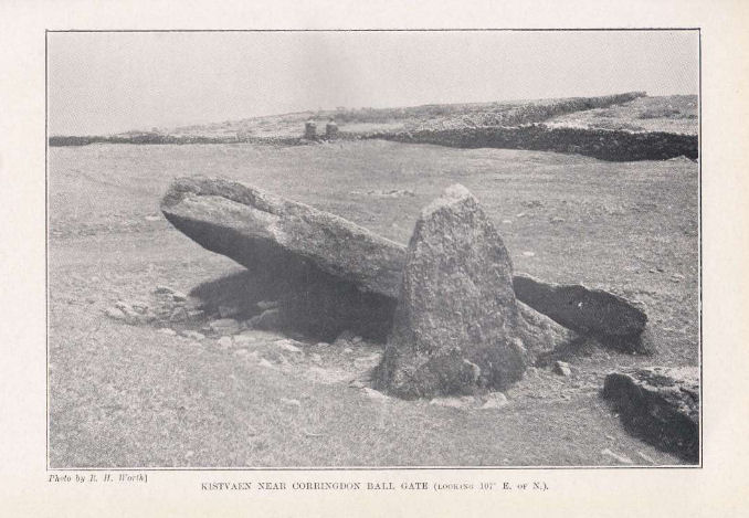
Nearest Bus Stop: South Brent Pool Park (3.5 km) [Route: 38]
Nearby sites: SX 66956 61300
Cator Common Platform Cairn Circle and Cist
OS Map: SX 67112 77513
HER: MDV5987
Megalithic Portal: 45793
PMD: Pizwell Bridge
Alternate name: Pizwell Bridge Platform Cairn Circle and Cist
Short Name: CT:CatorCommon
Butler map: 18.5
Butler Vol 5: p.171 & Fig.110
Grinsell: WID 2
Turner: E10
Dimensions (m): c.5.0 x 0.5
Notes: "Pizwell Bridge cairn of circa 5m diameter by 0.5m high is to be found about 10m below the road in an unusual position near the base of the hill. Three retaining slabs form an arc around one side with another just under the turf. The top of a slab near the centre with a pit alongside might be one side of a cist. ". Butler Pizwell Bridge Vol. 1. Map 18.5 (diagram Vol 5. p.171). Possible central cist.
Nearest Bus Stop: Postbridge Bellever (1.6 km) [Route: 98]
Nearby sites: SX 67112 77513
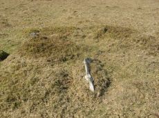
Hickley Ridge Central Cist
OS Map: SX 67224 62250
HER: MDV61772
Megalithic Portal: 45810
PMD: Hickley Ridge Central
Alternate name: Hickley Ridge 2 Cist
Short Name: CT HickleyCe
Butler map: 56.14.3
Butler Vol 5: p.175 & Fig.117
DPD: 84
Dimensions (m): 1.22 x 0.5 C
Notes: Butler Hickley Ridge Cairn and Cist 2. 56.14.3 diagram Vol 5 p.175. "Two slabs, possibly of a cist, embedded in low mound south of the leat on Hickley Ridge." Lethbridge diagram p.84, photo bottom left.
Nearest Bus Stop: South Brent Pool Park (3.8 km) [Route: 38]
Nearby sites: SX 67224 62250
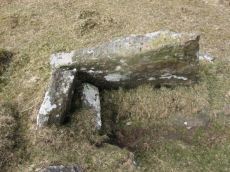
Hickley Ridge E Cist
OS Map: SX 67402 62381
HER: MDV61773
Megalithic Portal: 45811
PMD: Hickley Ridge E.
Alternate name: Hickley Ridge 1 Cist
Short Name: CT HickleyE
Butler map: 56.14.2
Butler Vol 5: p.175 & Fig.116
DPD: 84
Dimensions (m): 1.22 x 0.53 C
Notes: Butler Hickley Ridge Cist 1. 56.14.3 diagram Vol 5 p.175. "One side and one end slab of cist on Hickley Ridge, with other fallen stones in the mound. One of three badly damaged cists aligned south-west to north-east across Hickley Ridge, recognised by Butler in 1995." Lethbridge diagram and photo on right of p.84.
Nearest Bus Stop: South Brent Pool Park (3.7 km) [Route: 38]
Nearby sites: SX 67402 62381
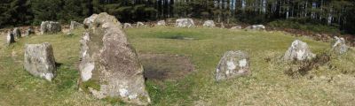
Soussons Common Ring Setting Cairn and Cist
Prehistoric Dartmoor Walks: Dartmoor Site: Soussons Cairn Circle
OS Map: SX 67516 78700
HER: MDV6013
Megalithic Portal: 1266
PMD: Soussons Plantation
Alternate name: Soussons Plantation S. Ring Setting Cairn and Cist
Short Name: CT Soussons Cm
Butler map: 24.2.6
Grinsell: MAN 9
Turner: D2
DPD: 124
Barrow Report: 22 23 45 56
Dimensions (m): 8.6 C
Notes: "A 28 feet diameter cairn circle with a central cist (plan). The tallest stone in the cairn circle is about 2 feet high." "This cist measures at least 1.3 metres long by 0.5 metres wide and when excavated in 1903 two coils of human hair were found" (Plan by RHW. Barrow Report 23. 1904). Lethbridge p.124. Butler Soussons Plantation S - Vol. 2. Map 24.2.6 (diagrams pp. 18-20). See also HER record MDV6013.
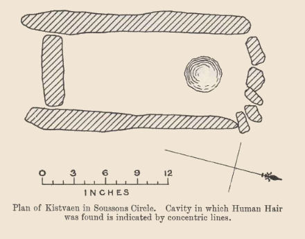
Nearest Bus Stop: Warren House Inn (2.3 km) [Route: 171]
Nearby sites: SX 67516 78700
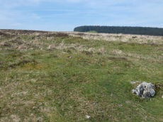
West Vitifer Cist
OS Map: SX 67573 82799
HER: MDV6615
Megalithic Portal: 34980
PMD: Chagford Common
Short Name: CT WestVitifer
Butler map: 25.11
Grinsell: CHA 4
Barrow Report: 16
Dimensions (m): 5.5 x 0.3 C
Notes: "Possible location of a Bronze Age cist, although when subject to field investigation in November 2002 the site was not found" "The cairn was partially excavated in 1897 by the Barrow Committee of the Devonshire Association. This working revealed a ring of slabs surrounding a cist which had not been previously examined. In the cist there was a complete Bronze Age beaker together with charcoal but no trace of a burial." Cairn survives, restored urn thought to be in Plymouth museum. See: Sixteenth Barrow Report 1897. Butler Vol. 2. Map 25.11 ( p.32).
The author visited this site on 10 May 2024. I took photos of a possible candidate but I was unconvinced I had located the site so a wide search was undertaken of the vicinity within approx. 100 m. My initial conclusion is that the site cannot be located. However, as a desktop exercise on 23/05/24 I'm inclined to think I had actually located it. It is the dip behind the stone which appears on the RHS of the photo. This coincides within a very short distance with the location I had previously determined using satellite and also to the location given in the scheduled monument SX 67571 82800.
Nearest Bus Stop: Warren House Inn (1.8 km) [Route: 171]
Nearby sites: SX 67573 82799
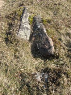
Brockhill Ford Ring Setting Cairn and Cist
OS Map: SX 67809 65702
HER: MDV5234
Megalithic Portal: 705
PMD: Brockhill Ford
Alternate name: Brockhill Ford W. Ring Setting Cairn and Cist
Short Name: CT Brockhill
Butler map: 57.18
Grinsell: DEA 2
Turner: D3
DPD: 88
Barrow Report: 68
Dimensions (m): 7.5 x 0 C
Notes: "The side stones, both 1.4m long, lean inwards and the end stones north west 0.7m long, southeast 0.8m long, are firmly set. The probable coverstone, 1.2m by 0.8m, is displaced and lies to the south east of the cist. The cist is surrounded by the remains of a stone circle, long axis 8.8m, aligned with cist, short axis 7.2m. It is constructed of large slabs, up to 1.4m long with a single upright stone, 0.5m high, set contiguously in the north west arc. There are no visible remains of a cairn." Lethbridge p.88 photo (note the diagram is not related). See also: Huntingdon cross walk. Butler Brockhill Ford W. - Vol. 4. Map 57.18 (pp.151-2 diagram p.152).
Nearest Bus Stop: Buckfast Higher Mill Lane (6.3 km) [Route: 88]
Nearby sites: SX 67809 65702
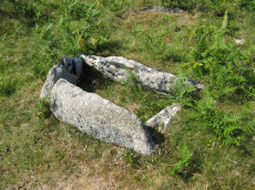
Aller Brook E Cist
OS Map: SX 67813 71682
HER: MDV20166
Megalithic Portal: 45799
PMD: Aller Brook E.
Alternate name: Aller Brook E. Cist
Short Name: CT Aller Brk E
Butler map: 60.11
DPD: 90
Dimensions (m): 1.0 x 0.5 C
Notes: Butler Vol. 4. Map 60.11 (diagram p.181). "only the four sides of the cist remain (1.0 x 0.5m), orientated WNW. Around it are two or three flat slabs of the retaining circle but the cover stone has gone as have all traces of the mound" (Butler p. 182). Lethbridge diagram and photo bottom left p.90
Nearest Bus Stop: Dartmeet Badgers Holt (1.6 km) [Route: 172]
Nearby sites: SX 67813 71682
Brent Moor House Cist
OS Map: SX 6802 6403
HER: MDV5744
Megalithic Portal: 45754
PMD: Brent Moor House
Short Name: CT:Brent Moor
Grinsell: BRE 3
Barrow Report: 65 66
Notes: "A cist lies on the right bank of the Avon, a short distance above Brent Moor House, about 175 feet below the small stream which flows south of Riders Rings ... The cist, which consists of two end stones and one side stone, stands in a small cairn." Doubtful. (grinsell) "supposed cairn of large stones, enclosing possible cist placed se-nw. The whole area is covered with clitter, and it is possible that the site may be natural. In summer it is under dense bracken. No measurements given." Butler Vol. 4. Map 57.9 (not actually covered in Butler but relevant map). " A Medieval or later tinner's cache situated opposite Woolholes on the west bank of the River Avon. Considered under the Monument Protection Programme by previous Monument Protection Programme Advisor who did not recommend it for scheduling."
Nearest Bus Stop: South Brent Pool Park (4.7 km) [Route: 38]
Nearby sites: SX 6802 6403
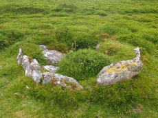
Yar Tor (Money Pit) Platform Cairn Circle and Cist
OS Map: SX 68181 73865
HER: MDV6460
Megalithic Portal: 1369
PMD: Money Pit
Alternate name: Money Pit Platform Cairn Circle and Cist
Short Name: CT Money Pit
Butler map: 14.11
Butler Vol 5: p.23 & Fig.4
Grinsell: WID 21
Turner: E51
DPD: 122
Barrow Report: 56 62
Dimensions (m): c3.2 cist 1.0 x 0.4
Notes: "The south cairn is a very spread and slight earthwork with a centrally placed cist. Only the north and west side slabs of the cist remain in situ though a misplaced slab lies to one side of the chamber. Eleven slabs forming a kerb of approximately 3m surrounding the cist remain in situ. Several additional stones survive, protruding just above the surface of the flattened cairn, which are likely to be evidence of an outer circle with a diameter of approximately 11m". Lethbridge diagram p.122 and photo bottom p.122. Butler Money Pit - Vol. 1. Map 14.11 (photo on p.92, diagram pp.125-6).
Nearest Bus Stop: Dartmeet Badgers Holt (1.1 km) [Route: 172]
Nearby sites: SX 68181 73865
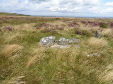
Grimslake Platform Cairn Circle and Cist
OS Map: SX 70414 81166
HER: MDV8744
Megalithic Portal: 44533
The Stone Rows of GB: Grimslake Cist
PMD: Hookney Down
Alternate name: Grimslake Mire Platform Cairn Circle and Cist
Short Name: CT Grimslake
Butler map: 20.16
Butler Vol 5: p.219 & Fig.153
Grinsell: N.BOV 3
Turner: E18
DPD: 128
Dimensions (m): 6.4 x 0.3 C
Notes: Cairn with kerb circle and central cist. Lethbridge diagram p.127 and photo top p.128. Butler Grimslake Mire - Vol. 1. Map 20.16 (diagram p.147).
Nearest Bus Stop: Warren House Inn (3.0 km) [Route: 171]
Nearby sites: SX 70414 81166
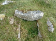
Hameldon Cist
OS Map: SX 71008 78345
HER: MDV7519
Megalithic Portal: 16636
PMD: Hamel Down S.
Alternate name: Hamel Down S. Cist
Short Name: CT Hameldon
Butler map: 20.15
Butler Vol 5: p.178 & Fig.120
Grinsell: WID 7
DPD: 129
Barrow Report: 54
Dimensions (m): c.10.0 x 0.5 C
Notes: Precise location originally unsurveyed but given approximately by Worth as SX 71257908. This may explain the large discrepancy between the NMR position and that given by Butler and in the HER. Three sides of the cist are visible with the fourth having sunken below the earth. The capstone is incomplete and only partly covers the cavity. Lethbridge diagram p129 and photo top p.129. Butler Hamel Down 15 (S) - Vol. 1. Map 20.15 (Cairn 15 p.149, diagram Vol 5. p.178).
Nearest Bus Stop (Minor): Widecombe in the Moor Car Park (1.8 km) [Route: 271]
Nearest Bus Stop (Major): Warren House Inn (4.4 km) [Route: 171]
Nearby sites: SX 71008 78345
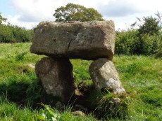
Meacombe Cist
OS Map: SX 72500 86909
HER: MDV8231
Megalithic Portal: 10518
PMD: Meacombe Chambered Cairn
Short Name: CT Meacombe
Butler Vol 5: p.155 & Fig.94
Grinsell: A:CHA 1
DPD: 148
Barrow Report: 49
Dimensions (m): 1.37 x 1.1 C
Notes: Sometimes referred to as a chambered tomb due to the enormous size of the cover slab but it is more likey a cist. Butler Meacombe Cist Vol. 5. (diagram p.155).
Nearest Bus Stop: Batworthy Miniature Pony Centre (2.3 km) [Route: 171]
Nearby sites: SX 72500 86909
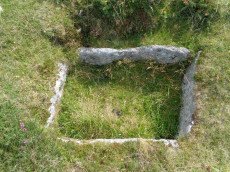
Blackslade Down Cist
OS Map: SX 73416 75519
HER: MDV7437
Megalithic Portal: 32071
PMD: Blackslade Down
Short Name: CT Blackslade
Butler map: 9.8
Butler Vol 5: p.47 & Fig.26
Grinsell: WID 14
DPD: 129
Barrow Report: 53 56
Dimensions (m): 10.0 x 0.5 C
Notes: Butler Vol. 1. Map 9.8 (photo on p.61, diagram Vol. 5. p.47). Lethbridge diagram p.129 and photo bottom p.129.
Nearest Bus Stop (Minor): Widecombe in the Moor Car Park (2.0 km) [Route: 271]
Nearest Bus Stop (Major): Poundsgate Tavistock Inn (4.5 km) [Route: 172]
Nearby sites: SX 73416 75519
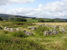
Houndtor Down Ring Setting Cairn and Cist
OS Map: SX 74106 78772
HER: MDV7398
Megalithic Portal: 24187
PMD: Hound Tor
Short Name: CT Houndtor
Butler map: 8.6
Butler Vol 5: p.179 & Fig.121
Grinsell: MAN 13
Turner: D8
DPD: 151
Barrow Report: 53 56
Dimensions (m): 6.5 x 0.3 C
Notes: "A ring cairn surviving as a mound 6.5 metres in diameter and 0.15 metres high. It is defined, except on the west side, by a ring of at least 19 close set granite stones. In the centre of the cairn is a north to south orientated cist, with both end stones and the western side stone remaining visible.". Butler Vol. 1. Map 8.6 (diagram Vol. 5. p.179).
Nearest Bus Stop (Minor): Swallerton Gate (0.4 km) [Route: 271]
Nearest Bus Stop (Major): Lustleigh Bishops Stone (5.3 km) [Route: 178]
Nearby sites: SX 74106 78772