
Guide to Dartmoor Cairn Circles
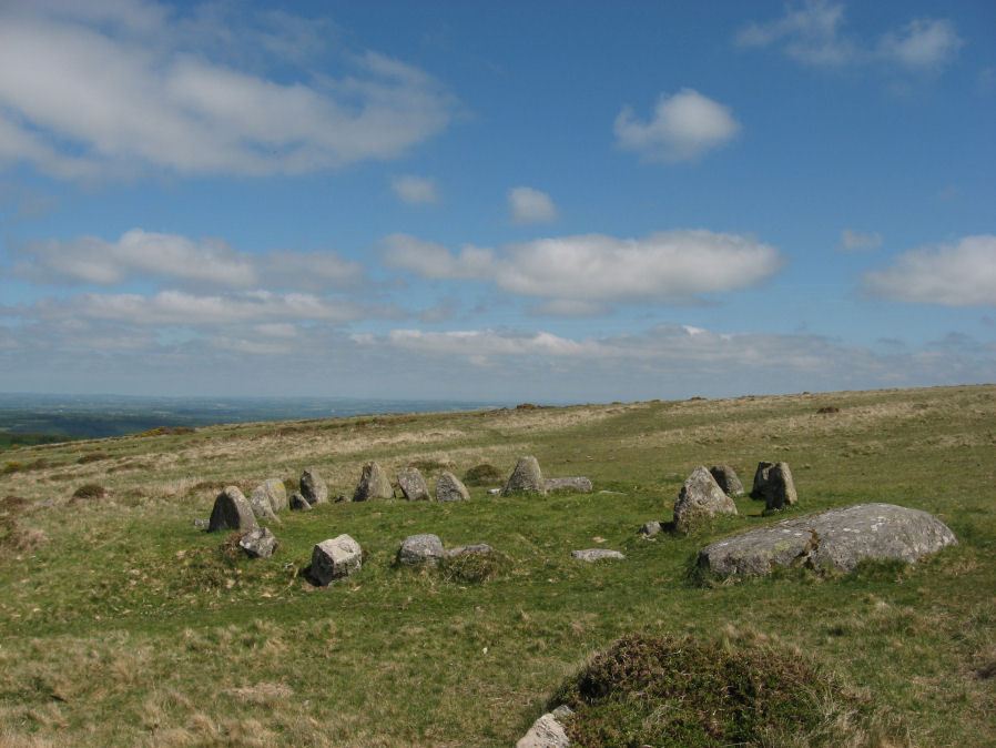
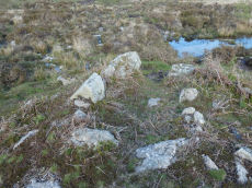
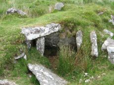
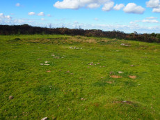
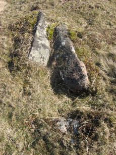
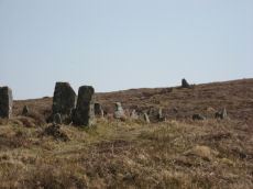
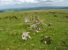
Photo: Nine Stones, Belstone Cairn Circle
Currently the listings are divided into categories using aspects of Turners 1990 system of classification. Some of the cairn circles are listed as Ring Settings and Platform Circles (with more categories such as Ring Cairns to be added later). A Ring Setting is defined by Turner as a circular ring of stones with a central feature such as a cist or a paved area or pit, but with no cairn mound. A Platform Circle is the same as a Ring Setting but with a raised interior.
There are problems with the classification system used by Turner. It is largely based on current appearance and this does not necessarily reflect original construction. The classification system used by Turner is not used by Butler and is referred to by Gerrard and used in an amended way by Newman. Simply referring to these structures as cairn circles does nothing to clarify the very diverse forms of these structures but on the other hand a too rigid attempt to classify inevitably has problems as there are very many structures that are "shades of grey" in the sense they do not neatly fit into rigid categories. What is clear is that cairns on Dartmoor have features that are regionally or even locally unique and for this reason attempts to classify in the same way as cairns throughout the country leads to a muddled picture. Turner started the process of trying to achieve a coherent classification system for cairns on Dartmoor but it appears that not all of his system has met with general acceptance. We have started here with some of Turner's suggested classifications as this section of the database is developed but this is envisioned as a temporary "fix" or "foundation" which will be refined and modernised in due course.
Bibliography & references
Butler, J. Dartmoor Atlas of Antiquities: Vol. 5. - The Second Millennium B.C. (Devon Books, 1997)
Gerrard, Sandy, English Heritage Book of Dartmoor: Landscapes Through Time, (1997)
Grinsell, L.V., Dartmoor Barrows, Devon Archaeological Society Proceedings No. 36 (1978)
Newman, Phil The Field Archaeology of Dartmoor (English Heritage, 2011)
Pettit, Paul. Prehistoric Dartmoor (David & Charles, 1974)
Turner, J.R., Ring Cairns, stone circles and related monuments on Dartmoor, D.A.S.P. No. 48 pp. 27-86 (1990)
Worth, R.H. Worth's Dartmoor (David & Charles, 1971)
External Links & Resources
The NMRs can be searched on the English Heritage Pastscape website. The simplest method is to use a location search and reduce the range to 250m to narrow the results (increase to 500m if site not found). The Megalithic Portal is another great resource for looking up sites.
Pastscape: National Monuments Records
Prehistoric Monuments of Dartmoor: A List of Dartmoor Cists
Megalithic Portal: Search Page
Listing of some of the Dartmoor Cairn Circles
About the Database Listings
Details of archaeological sites used to be kept in the Sites and Monuments Records (SMRs). These are now held in National Monument Records (NMRs) maintained by English Heritage although these in turn are being merged into Historic Environment Records (HERs). The NMRs contains details of the site and will often include field notes, a limited bibliography and other useful information. Another rich source of such information is Bill Radcliffe's Prehistoric Monuments of Dartmoor (PMD) website. The records below were compiled independently from books and journals and then matched to the NMR records and then cross-referenced with any corresponding PMD records to ensure accuracy. Each record has a link to corresponding NMR and PMD records, a link to the location on the Ordnance Survey map, a photo (if available) and a link to relevant coverage on Prehistoric Dartmoor Walks and a link giving a listing of nearby sites. The HER records are not included as they do not yet have much information but they can be looked up via the PMD records. The author would like to thank Bill Radcliffe for the helpful correspondence whilst checking records. See also: Database and Web Search Tools
- NMR = Pastscape National Monument Record
- HER = Historic Environment Record
- PMD = Prehistoric Monuments of Dartmoor Record
- DPD = Discover Prehistoric Dartmoor page number
- Short Name is named used in GPS listings
NOTE: There are hundreds of Cairns on Dartmoor. This listing is only of the cairn circles that are more notable (e.g listed by Turner) or those that have been featured on the Prehistoric Dartmoor Walks on this website.
Default listing is alphabetically by site name, click here to order instead by: Site Name, OS, Cairn Type.
Deadman's Bottom (E) Cairn
Prehistoric Dartmoor Walks: Dartmoor Site: Guide to the Langcombe Brook & Deadman's Bottom Cists
OS Map: SX 60788 66893
HER: MDV5118
Alternate name: Deadman's Bottom (E) Cairn
Short Name: CN Deadmans E
Butler map: 50.1
Grinsell: SHA 6
Turner: D28
Dimensions (m): 7.0 x 0.2
Notes: Worth considered this to be a cairn. It was excavated and it was found to be paved with reddened earth showing great fires had been present. Butler Circle 1. Butler suggests it could just have been a hut circle and the fires the consequence of domestic activity. He points out the presence of a settlement wall. However it is also very close to a pair of cists and could be a cairn. We are listing as a cairn although Butler could of course be right. This "circle" can be clearly seen in the Google satellite images. Previously listed at SX 60798 66895 (Garmin reading?), presumed SX 60788 66893 from Google.
Nearest Bus Stop: Lee Moor Clearview (6.1 km) [Route: 59]
Nearby sites: SX 60788 66893

Scorhill S.1 Platform Cairn Circle
OS Map: SX 65534 87272
HER: MDV130493
Megalithic Portal: 25238
Short Name: CN Scorhill S1
Butler map: 38.8.1
Butler Vol 5: p.249 & Fig.175
Turner: E25
Dimensions (m): c.7.5 x 0.8
Notes: "A platform circle; ring of kerb stones 4.5m internal diam, enclosing flat-topped cairn 0.45m high. Indication of a stone ring/ring cairn beneath cairn (turner)." Entry added by PDW to correct/replace Butler 38.4.1. This is cairn 1 in Fig. 175 (p.249 Vol 5). Formerly listed as PC:Scor Leat
Nearest Bus Stop (Minor): Wonson Telephone Box (2.9 km) [Route: 670]
Nearest Bus Stop (Major): Chagford The Square (4.5 km) [Route: 173,178,671]
Nearby sites: SX 65534 87272
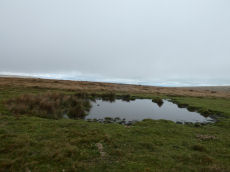
Down Pool Ancient Pool
OS Map: SX 52285 82404
HER: MDV127205
Short Name: PO:Down Pool
Dimensions (m): 23 x 24m
Notes: "Down Pool, Black Hill (Mary Tavy) measures 23 by 24m One of over 40 such 'sacred' pools identified on Dartmoor that are thought to have potentially been designed during the prehistoric period"
Nearest Bus Stop: Lydford Gorge Lower Entr (2.3 km) [Route: 118]
Nearby sites: SX 52285 82404
Yar Tor Tor Enclosure
OS Map: SX 67849 74046
HER: MDV128748
Short Name: EN Yar Tor
Butler map: 14.8
Notes: HER quoting Newman: A Tor enclosure of uncertain date on the northern outcrop of Yar Tor. This enclosure is situated in a natural avenue between two outcrops with vertical faces on the north and south sides which has been blocked off at the western and eastern ends by artificial stone walls. The western interior is approximately level but slopes away on the eastern side down to the wall. The north and south sides of the enclosure comprise natural linear crags of up to 2.0m high reinforced in places by large boulders. The wall at the western end is 2.1m thick and consists of a stone revetted bank with stone rubble behind surviving up to 0.8m high. The wall is slightly curved in plan. On the eastern wall there are vestiges of stone facing still in place but it is mostly collapsed and spread up to 3m wide and 0.7m high much of the wall surviving only as a disturbed stony spread. There is a possible entrance in the east wall adjacent to the northern outcrop, in the form of an opening. There are no discernable interior features.
The main photo is taken looking down from on top of one of the outcrops. Butler's possible round house can be seen within the main photo but see also a close up from ground level.
Acknowledgement: The author was unaware of this site until a walk with Steve Szypko on 25/09/2025. This record has been added as a result.
Nearest Bus Stop: Dartmeet Badgers Holt (1.0 km) [Route: 172]
Nearby sites: SX 67849 74046
Little Links Tor 1 Cairn
OS Map: SX 5428 8747
HER: MDV51428
Short Name: CN:LittleLink1
Dimensions (m): 2.0 x 0.4
Notes: HER: Ring cairn. Survives as a circular bank 2m wide and 0.4m high surrounding an internal area measuring 13m in diameter. A 3m wide gap in the western side of the bank may be the result of partial robbing. This ring cairn is of the unrevetted without central mound variety.
Nearest Bus Stop: Fox and Hounds Hotel (1.9 km) [Route: 118]
Nearby sites: SX 5428 8747
Leapra Rings Enclosure
OS Map: SX 700 826
HER: MDV26675
Short Name: EN:Leapra
Notes: HER: Leapra Rings consists of three possibly Prehistoric circular features on Shapeley Common
Butler: Leapra Rings on steeply sloping ground on Shapley Common consist of three roughly circular banks levelled into the hillside. They are 10 - 12 metres in daimeter and over a metre high in places. About a third of the periphery is missing from the northern ring, perhaps not an original feature as neither of the orhters now has any visible entrance and their purposes is uncertain as they are too large for huts. A few slabs set edgeways show above the truf covered banks, occasionally paired and infilled with smaller stones in typically Prehistoric fashion.
Butler continues: Another enigmatic site lies in the second field to the north, on a good settlement site just above the damp ground surrounding the Leapra Brook. The overgrown remains are almost unrecognizable but appear to be of prehistoric construction like those above, perhpas a hut with a small paddock attached.
See also entries for round houses all of which are associated with the same HER entry: Shapley Tor N (SiteID=8275), Shapley Tor N (SiteID=8276) and Shapley Tor N (SiteID=8277)
Nearest Bus Stop: Batworthy Miniature Pony Centre (2.8 km) [Route: 171]
Nearby sites: SX 700 826
Little Links Tor 2 Cairn
OS Map: SX 54291 87520
HER: MDV125847
Short Name: CN:LittleLink2
Notes: HER quoting Greeves: Apparently unrecorded prehistoric cairn in the upper reaches of the River Lyd, approximately 150 metres north of the Smallacombe valley. Located at SX 54291 87520, approximately 30 metres north-west of ring cairn MDV51428. It is a low cairn mound with a relatively level top, no more than about 0.30 metres in height, approximately 10 metres by 9.0 metres in diameter.
It lies not far north of the stone alignment MDV51434, which due to the significant amount of prehistoric activity in this area, is likely to be a prehistoric stone row.
Nearest Bus Stop: Fox and Hounds Hotel (2.0 km) [Route: 118]
Nearby sites: SX 54291 87520
White Hill S.W.11 Stone Ring Cairn Circle
OS Map: SX 5316 8377
HER: MDV103627
Short Name: RC WhiteHiSW11
Dimensions (m): 5.7 x 0.3
Nearest Bus Stop: Dartmoor Inn (1.7 km) [Route: 118]
Nearby sites: SX 5316 8377
White Hill S.W.12 Stone Ring Cairn Circle
OS Map: SX 5295 8386
HER: MDV103629
Short Name: RC WhiteHiSW12
Dimensions (m): 6.0 x 0.3
Nearest Bus Stop: Dartmoor Inn (1.6 km) [Route: 118]
Nearby sites: SX 5295 8386
Bellever Rock Shelter
OS Map: SX 644 765
HER: MDV5941
Short Name: RS Bellever
Notes: Natural crevice in Bellever Tor forming a possibly built up Rock Shelter as reported by Robert Burnard (1914). Date of shelter not known for certain but signs of ancient habitation and numerous flints found.
Nearest Bus Stop: Postbridge Bellever (1.4 km) [Route: 98]
Nearby sites: SX 644 765

Corndon Tor 1 Cairn
OS Map: SX 68588 74227
HER: MDV6387
Megalithic Portal: 22982
Short Name: CN:CorndonTor
Butler map: 15.4.1
Barrow Report: 56 62
Notes: HER: Cairn on the summit of Corndon Tor, to the north of the main outcrop, comprising a large stony mound, constructed from moorstone with a truncated cone profile and no turf cover. Remains of a possible second cairn are located to the south on the outcrop.
Nearest Bus Stop: Dartmeet Badgers Holt (1.7 km) [Route: 172]
Nearby sites: SX 68588 74227
Great Links Tor Cairn
OS Map: SX 54922 86496
HER: MDV4653
Megalithic Portal: 10043
Short Name: CN:GreatLinks
Butler map: 43.13
Grinsell: BRI 8
Dimensions (m): 16.0 x 1.4
Notes: "cairn with hollow in centre. Diam 17.5m, height 1.6m. ... (grinsell) 18.0m diameter, 1.4m high. Siting - hillspur. ... (gerrard) cairn mound measures 19m in diameter and stands up to 1.5m high. An irregular shaped hollow in the centre of the mound, measuring 4m long, 3m wide and up to 1.3m deep, suggests partial early excavation or robbing (mpp)."
Nearest Bus Stop: Fox and Hounds Hotel (2.4 km) [Route: 118]
Nearby sites: SX 54922 86496

Cox Tor Tor Cairn Stone Ring Cairn Circle
OS Map: SX 53012 76012
HER: MDV50062
Short Name: RC:CoxTor 2
Dimensions (m): 21
Notes: A well preserved Tor cairn approximately 21m in diameter encloses a small, unamed tor 180m SSW of Cox Tor. It comprises a ring of large to medium stones approximately 7m in width which are piled around a natural outcrop. The stones are of a fairly uniform size and most are not earth-fast. To the immediate NE a stretch of low turf-covered rubble walling 1.2m wide, 0.4m high and 15m in length connects two outcrops - it is probably of prehistoric origin but its function is obscure..
Nearest Bus Stop: Tavistock Higher Longford (1.8 km) [Route: 98,171,172]
Nearby sites: SX 53012 76012
Gibbet Hill 4 Cairn
OS Map: SX 496 808
HER: MDV124453
Short Name: CN:GibbetHill4
Dimensions (m): 17.5 x 0.4
Notes: Well-preserved small, low cairn, visible within a firebreak of mown vegetation. Measures approximately 9 - 10 metres in diameter and a maximum height of 0.3 - 0.4 metres. It is slightly dished in the centre. Small stones are visible as part of its make-up.
Nearest Bus Stop: Mary Tavy War Memorial (1.4 km) [Route: 118]
Nearby sites: SX 496 808
Langstone Moor S.2 Cairn
OS Map: SX 54838 77646
HER: MDV4116
Megalithic Portal: 35802
Short Name: CN Langston S2
Butler map: 31.19.2
Grinsell: PET 34
Dimensions (m): 5.8 x 0.3
Notes: "Two round barrows on Peter Tavy Great Common. (A) SX54847764 A flat topped stony mound, probably a cairn, about 12m E-W by 11m transversely and of 0.6m maximum height. There is no apparent kerb and the edges are ill-defined. It is predominantly turf-covered but a small area of stones is exposed in the NW quadrant presumably the site of the 1899 excavation.(B) SX54887765 Located 45m ENE of 'A' or probable cairn visible as a turf covered mound about 5m in diameter and 0.3m high. No kerb is evident and the centre has been disturbed. The mounds are both quite prominently situated on the summit of a gently domed ridge of rough grassland which is generally devoid of surface stone." Previously listed on HER as 4120 - presumably deleted as a duplicate of 4116.
Formerly listed here as Roos Tor N. That naming has been dropped as it appears as part of a pair with Langstone Moor S.1
Nearest Bus Stop: Merrivale Dartmoor Inn (2.5 km) [Route: 98,171,172]
Nearby sites: SX 54838 77646
White Tor S.S.W.1 Long Cairn
OS Map: SX 54023 78321
HER: MDV4179
Short Name: CN White SSW1
Butler map: 31.21.1
Grinsell: PET 29a
Dimensions (m): 13.0 x 5.7
Notes: The Dartmoor Exploration Committee (Report 6 1899) describes investigating 3 cairns in this location. The damaged remains are difficult today to interpret. Many authors suggest that the long cairn consists of two or more of these cairns. The current author visited this location on 27th May 2022 with just the knowledge that there were 3 reported cairns. I photographed a very likely cairn, namely, the long cairn (Butler 1). A semi-circular bank (Butler 3) and a faint mound around a natural rock (Butler 2). I noted at the time of the visit that both 2 and 3 are possible but doubtful cairns. I did not have the Butler account with me at the time I photographed and logged these. Looking now at Butler's account it looks like he reached the same conclusions and the entries here follow Butler with similar doubt on Butler 2 and Butler 3.
Gerrard: "cairn forming part of widely dispersed group of at least 14. Cairn mound measures 15m long by 6m wide and stands up to 1m high. A shallow hollow in the northern end of the mound measures 3m long by 1.5m wide and 0.15m deep and at the southern end another hollow measuring 1.5m long by 1m wide and 0.2m deep has been identified. These hollows are probably the result of a partial excavation carried out by the dartmoor exploration committee in 1899. This work revealed a pit containing ashes and charcoal. Grinsell has suggested that this cairn is two joined mounds, but without excavation this hypothesis cannot be tested. Two other doubtful mounds have been identified in close proximity to this cairn. These may be the remnants of two further cairns excavated by the dartmoor exploration committee, though there is not sufficient visible evidence to confirm this identification"
Nearest Bus Stop: Merrivale Dartmoor Inn (3.3 km) [Route: 98,171,172]
Nearby sites: SX 54023 78321

Eylesbarrow 2 Cairn
OS Map: SX 60001 68627
HER: MDV132199
Short Name: CN Eylesbarr 2
Butler map: 47.15.2
Dimensions (m): 5.5 x 0.5
Notes: Butler: "Not unusually smaller cairns share the peaks withhe giants and two can be found east of th larger cairn (HER 4014) approximately in line with the reave. Recently added to HER. Thanks to Steve Szypko for assistance locating this feature on 31/10/24.
Nearest Bus Stop: Princetown Dartmoor Visitor Centre (5.0 km) [Route: 98,171,172]
Nearby sites: SX 60001 68627

Eylesbarrow 3 Cairn
OS Map: SX 60061 68646
HER: MDV132200
Short Name: CN?Eylesbarr 3
Butler map: 47.15.3
Dimensions (m): 4.0 x 0.4
Notes: Butler: "Not unusually smaller cairns share the peaks withhe giants and two can be found east of th larger cairn (HER 4014) approcimately in line with the reave. Recently added to HER. Thanks to Steve Szypko for assistance locating this feature on 31/10/24.
Nearest Bus Stop: Princetown Dartmoor Visitor Centre (5.0 km) [Route: 98,171,172]
Nearby sites: SX 60061 68646
Wigford Down 3 Reported Cairn
OS Map: SX 54647 65072
HER: MDV2311
Short Name: CN:Wigford 3
Butler map: 48.1.3
Grinsell: MEA 3
Barrow Report: 21 62
Dimensions (m): 25 x 15m
Notes: Appears in Tom Greeve's list of 'sacred Pools' as Wigford Down A.
Possible ring cairn on Wigford Down damaged by stone robbing; probably for nearby road-building. Consists of a large oval depression, surrounded by a stony ring with some slabs in upright positions. Wigford Down 2 in Barrow Report 62.
Thought originally to be a damaged ring cairn, the feature consists of a large oval depression, surrounded by a stony ring with some slabs in upright positions. Feature is thought to potentially be a 'sacred' pool designed in Prehistoric times.
Nearest Bus Stop: Shaugh Prior Shaugh Bridge (2.0 km) [Route: 59]
Nearby sites: SX 54647 65072
White Hill N.E. (c.24) Cairnfield Master
OS Map: SX 535 840
HER: MDV14428
Short Name: CN:WhiteHill N
Butler map: 32.22.12
Grinsell: PET 10
Dimensions (m): 2.0-5.0 x 0.1-0.4
Notes: Cairn field. Difficult to identify relevant HER record. The HER number (14428) linked gives a listing of the HER records of cairns in this area. The HER record 51457 gives the OS grid reference and description of 13 cairns.
Nearest Bus Stop: Dartmoor Inn (1.8 km) [Route: 118]
Nearby sites: SX 535 840
Haytor Chambered Tomb
OS Map: SX 75766 76409
HER: MDV61778
Short Name: CN HaytorTomb
Butler map: 1.f
Butler Vol 5: p.158 & Fig.97
Dimensions (m): c.3.0 x 1.4 wide
Notes: Haytor chambered tomb to the west of the Haytor track. Circular mound circa 4 metres diameter surrounds a rectangular chamber, circa 3 metres by 1.4 metres, tapering slightly towards one end, partially filled with soil. One of pair of larger slabs at entrance on downhill edge of mound has collapsed inwards, the other stands c irca 1 metre above interior. Most of slabs forming sides of chamber appear in place but capstones have been removed. Entrance oriented south of east.
Nearest Bus Stop (Minor): Haytor Vale Moorlands House (1.3 km) [Route: 193,271]
Nearest Bus Stop (Major): Lemonford Caravan Park (5.3 km) [Route: 38,193]
Nearby sites: SX 75766 76409
White Hill S.W.1 Stone Ring Cairn Circle
OS Map: SX 52941 83690
HER: MDV21078
Megalithic Portal: 45821
Short Name: RC WhiteHiSW 1
Butler map: 32.22.1
Grinsell: PET 1
Turner: A8
Dimensions (m): 19.0 x 0.3
Notes: "Ring cairn 460 metres south-west of White Hill summit, forming part of the White Hill round cairn cemetery. This monument includes a ring cairn situated on a gentle west-facing slope overlooking Willsworthy Army Camp. The earthwork appears as a raised internal platform measuring 15m in diameter surrounded by a circular bank 3.5m wide and 0.5m high. A shallow hollow in the centre of the internal area suggests robbing or partial early excavation. This cairn forms part of the White Hill round cairn cemetery." NMR A. Cairn is part of an alignment of cairns, see photo.
Butler Cairns 1-6: SX52948369, SX53008367, SX53058366, SX53098365, SX53148365, SX53158366
Nearest Bus Stop: Dartmoor Inn (1.7 km) [Route: 118]
Nearby sites: SX 52941 83690
Crockern Tor 3 Reported Cist
OS Map: SX 61204 75824
HER: No record
Short Name: CT CrockernNW3
Notes: Possible cist reported by Nigel Rendle to Bill Radcliffe in 2008 NE of Crockern Farm. Bill comments Feb 2025 we were doubtful of it, as it is close to the path to Wistman's Wood, so how can it have been missed? But it looks good to me.. The author visited 25/09/2025 with Steve Szypko and these were my notes: there is an upright stone that looks like a possible displaced capstone and some other stones that could form a cist. This arrangement in itself is unconvincing but there is also a rectangular hole consistent with a cist. It is perhaps an unlikely but possible cist. NB. The grid reference has now been updated.
Nearest Bus Stop: Two Bridges Hotel (0.9 km) [Route: 98,171,172]
Nearby sites: SX 61204 75824

White Hill S.W. Cairn Alignment
OS Map: SX 52941 83690
HER: No record
Megalithic Portal: 45821
Short Name: CR WhiteHiSW
Notes: An alignment of cairns, see photo.
Butler Cairns 1-6: SX52948369, SX53008367, SX53058366, SX53098365, SX53148365, SX53158366
Nearest Bus Stop: Dartmoor Inn (1.7 km) [Route: 118]
Nearby sites: SX 52941 83690
Black Hill Stone Ring Cairn Circle
OS Map: SX 522 824
HER: MDV53274
Short Name: RC:BlackHill
Dimensions (m): 16
Notes: NGR is 6 digit from HER. HER: A very low banked ring cairn, positioned on the top of a fairly flat-topped hill, about 400 meters south of the ring cairn known as ‘Ring O’ Bells’. The cairn bank measures approximately 16 meters diameter externally and is 0.30 meters maximum in height (at the south-west segment) and is scarcely discernible at the north-east segment.
Nearest Bus Stop: Lydford Gorge Lower Entr (2.2 km) [Route: 118]
Nearby sites: SX 522 824
Arch Tor Platform Cairn Circle
OS Map: SX 63168 77843
HER: MDV21510
Megalithic Portal: 45618
Alternate name: Arch Tor 1 Platform Cairn Circle
Short Name: PC Arch Tor 1
Butler map: 27.6
Turner: E11
Dimensions (m): 8.0 x 1.2
Notes: "A round cairn which survives as an 8.7 metre diameter mound standing up to 0.9 metres high. Large edge set stones on the north western edge of the mound may suggest the presence of a kerb which survives elsewhere as a buried feature."
Nearest Bus Stop: Powder Mills (1.3 km) [Route: 171]
Nearby sites: SX 63168 77843
Archerton S.W. (Rowtor Brook) Ring Setting Cairn and Cist
OS Map: SX 62752 78808
HER: MDV5838
Megalithic Portal: 37604
PMD: Hollowcombe Bottom
Alternate name: Rowtor Brook 3 Ring Setting Cairn and Cist
Short Name: CT RowtorBr 3
Butler map: 27.17.3
Butler Vol 5: p.55 & Fig.33
Dixon Cist #: 75
Grinsell: LYD 42
Turner: D24
DPD: 112
Barrow Report: 57
Dimensions (m): 7.0 x 1.0 C
Notes: Breton: on N. side of wall is a kistvaen, around which is a triple circle, a very unusual feature..
HER: The cist lies within three concentric circles of stones at 10, 15 and 24 feet diameters, the inner ring being of large stones, the middle ring of smaller stones and the outer ring of even smaller stones. The cist measures internally 0.8m by 0.6m and 0.9m deep. Half of its capstone lies across its north end.
For more information see: Lethbridge Hollowcombe Bottom, diagram and photo p.112. Butler Rowtor Brook 3 - Vol. 2. Map 27.17 (diagram Vol. 5. p.55). Breton p.35
Nearest Bus Stop: Postbridge Post Office (2.0 km) [Route: 98,171]
Nearby sites: SX 62752 78808
Archerton Tennis Ground Platform Cairn Circle and Cist
OS Map: SX 63852 78872
HER: MDV5839
Megalithic Portal: 37599
PMD: Archerton Tennis Court
Alternate name: Archerton Platform Cairn Circle and Cist
Short Name: CT Arch Tennis
Butler map: 27.18
Dixon Cist #: 74
Grinsell: LYD 45
Turner: E49
DPD: 114
Barrow Report: 57
Dimensions (m): 0.95 x 0.85 C
Notes: Lethbridge diagram p.112, photo top p.114. Butler Archerton - Vol. 2. Map 27.18. Breton p.37 Its four sides are complete, the capstone is partially buried; it stands on a slight mound and has been enclosed by a circle of small stones which are nearly buried under the turf.
Nearest Bus Stop: Postbridge Post Office (0.9 km) [Route: 98,171]
Nearby sites: SX 63852 78872
Assycombe Hill Encircled Cairn and Cist
Prehistoric Dartmoor Walks: Dartmoor Site: Assycombe Double Stone Row
OS Map: SX 66102 82650
HER: MDV6538
Megalithic Portal: 45814
PMD: Assycombe Stone Row
Alternate name: Assycombe Hill Stone Row Encircled Cairn and Cist
Short Name: CT Assycombe
Butler map: 35.19
Butler Vol 5: p.232 & Fig.164
Dixon Cist #: 157
Grinsell: LYD 26
Turner: F16
DPD: 135
Dimensions (m): 8.0 x 0.4 C
Notes: The cairn at the E end is in line with the N of the two rows. It measures 8.4m in diameter and is 0.6m high. It contains a large quantity of stone; two stones in the centre, set at right angles to each other around a hollow, suggest the remains of a cist. Breton p.68.
Nearest Bus Stop: Warren House Inn (2.2 km) [Route: 171]
Nearby sites: SX 66102 82650
Ball Gate Stone Ring Cairn Circle
Prehistoric Dartmoor Walks: Dartmoor Walk: The Erme East stone rows
OS Map: SX 66996 61306
HER: MDV7739
Megalithic Portal: 45839
PMD: Corringdon Ball Gate cairn
Alternate name: Corringdon Ball N. Stone Ring Cairn Circle
Short Name: RC Ball Gate
Butler map: 56.10
Grinsell: BRE 9
Turner: A43
Barrow Report: 28 66
Dimensions (m): 24.0 x 0.4
Notes: "A very vague circle 21m diameter, which may be the remains of a mutilated cairn. Vis=-/4/1977 (ancient monuments) possibly rather damaged on one side. Vis=23/6/1973 (grinsell, l. V. ). Site of cairn almost levelled probably for material to build the adjoining wall. Shown on OS 6" as 'cairn circle'. Diameter 21m, height 0.4m. Vis=28/7/1977 (os) there is a gap in the rim on the southeast, probably for carts taking away the stone".
Nearest Bus Stop: South Brent Pool Park (3.5 km) [Route: 38]
Nearby sites: SX 66996 61306
Beardown Platform Cairn Circle and Cist
OS Map: SX 60330 78092
HER: MDV14690
Megalithic Portal: 42853
PMD: Lydford Tor
Alternate name: Lydford Tor E. Platform Cairn Circle and Cist
Short Name: CT Beardown
Butler map: 29.17
Butler Vol 5: p.197 & Fig.140
Dixon Cist #: 125
Grinsell: LYD 41a
Turner: E27
DPD: 109
Dimensions (m): 4.5 x 0.4
Notes: "The cairn, 4.5 metres by 5.6 metres and 0.4 metres high has spread over the remains of a contiguous kerb 4.6 metres in diameter." ... "Three of the cist slabs lean inwards at the top, the fourth, east slab remains upright. The bottom of the cist contains several slabs. The coverstone is visible to the north west partially buried in the cairn." Lethbridge diagram p.107, photo top p.109. Butler Lydford Tor E Vol. 5. Map 29.17 (diagram Vol 5. p.197).
Nearest Bus Stop: Powder Mills (3.0 km) [Route: 171]
Nearby sites: SX 60330 78092
Bellever Tor (SW) Encircled Cairn
OS Map: SX 64144 76275
HER: MDV5885
Megalithic Portal: 3056
Alternate name: Bellever Tor 2 Encircled Cairn
Short Name: EC:Bellever 2
Butler map: 27.20.2
Grinsell: LYD 59a
Turner: F18
Dimensions (m): 6.0 x 0.8
Notes: cairn, it does not appear to have been excavated, although there is a slight disturbance at the top centre where large granite stones are bared. At the north west extreme are two stones, the positions of which indicate this being part of the retaining circle, no others remain. Height 0.8m, diameter 5.0m. Turner F18. See also: Dartmoor Explorations: Antiquities of Black Newtake and Environs. NGR taken from Dartmoor Explorations (Steve Grigg).
Nearest Bus Stop: Powder Mills (1.3 km) [Route: 171]
Nearby sites: SX 64144 76275
Bellever Tor 1 (W) (Newtake) Platform Cairn Circle and Cist
Prehistoric Dartmoor Walks: Dartmoor Site: Lakehead Hill
OS Map: SX 64089 76472
HER: MDV5884
Megalithic Portal: 34876
PMD: Bellever Tor W.
Alternate name: Bellever Tor 1 Platform Cairn Circle and Cist
Short Name: CT Bellever 1
Butler map: 27.20.1
Dixon Cist #: 62
Grinsell: LYD 59
Turner: E26
DPD: 119
Barrow Report: 54 56
Dimensions (m): c.6.5 x 1.0 C
Notes: Further coverage see the Lakehead Hill page. Lethbridge diagram p.119 (uppermost cist) and photo top p.119. Dixon #62. Bar Rep 54. Butler Bellever Tor (Cairn 1) - Vol. 2. Map 27.20.1 (diagram pp.52-3).
Nearest Bus Stop: Powder Mills (1.2 km) [Route: 171]
Nearby sites: SX 64089 76472
Birch Tor Ancient Pool
OS Map: SX 68686 81656
HER: MDV127183
Short Name: PO:Birch Tor
Dimensions (m): 15.5m
Notes: "The pool at Birch Tor measures around 15.5m. One of over 40 such 'sacred' pools identified on Dartmoor that are thought to have potentially been designed during the prehistoric period."
Nearest Bus Stop: Warren House Inn (1.4 km) [Route: 171]
Nearby sites: SX 68686 81656
Birch Tor Cairn
OS Map: SX 68686 81654
HER: MDV6673
Megalithic Portal: 34981
Alternate name: Birch Tor Summit Cairn
Short Name: CN:Birch Tor
Butler map: 24.4
Grinsell: N.BOV 1
Barrow Report: 56
Dimensions (m): 17.0 x 2.0
Notes: "The heavily disturbed remains of a large, flat-topped cairn lie on the ridge crest 230 metres north of Birch Tor. The centre and south margin of this feature have apparently suffered from an unrecorded excavation with spoil dumped to the south and on the east fringe of the mound. Two large upright slabs are embedded in the unexcavated interior of the cairn and may have previously been interpreted as elements of a kerb even though they lie several metres in from the actual edge of the feature. 10m to the north-west of the cairn is a warren boundary stone inscribed with the letters`WB'on its eastern side."
Nearest Bus Stop: Warren House Inn (1.4 km) [Route: 171]
Nearby sites: SX 68686 81654
Black Down W. Platform Cairn Circle and Cist
OS Map: SX 57398 91540
HER: MDV61332
Megalithic Portal: 45801
PMD: Black Down
Short Name: CT:BlackDown W
Butler map: 42.6
Butler Vol 5: p.58 & Fig.35
Dixon Cist #: 147
Dimensions (m): 6.5 x 0.6 C
Notes: Not located at SX 57409153 on 28/08/16. Butler SX57389153. NMR SX57469153."The cairn is 6 metres in diameter and 0.7 metres in height. The cist is 0.9 metres long with 2 end stones in the original position. Remains of a kerb are visible around the north west edge of the mound". 1.6km east of Higher Bowden. nb. Not listed by Turner - assigned as "Platform Circle" type cairn due to description in NMR. "A flat-topped cairn". Butler Black Down W. Vol. 2. Map 42.6 (diagram Vol 5. p.58).
Nearest Bus Stop: Okehampton Railway Station (3.4 km) [Route: 118,306,6A]
Nearby sites: SX 57398 91540
Black Hill 4 Cairn
OS Map: SX 76281 78963
HER: MDV8045
Megalithic Portal: 26733
Short Name: CN:BlackHill 4
Butler map: 2.5.4
Grinsell: MAN 16
Dimensions (m): 16.5 x 0.8
Notes: "One of five cairns on Black Hill, all in a damaged condition." "Cairn with modern stoneheap at north end. Diameter 17.0 meters, height 0.7 meters."
Nearest Bus Stop (Minor): Manaton Becky Falls (1.2 km) [Route: 271,671]
Nearest Bus Stop (Major): Lustleigh Bishops Stone (3.5 km) [Route: 178]
Nearby sites: SX 76281 78963
Black Hill A (Manaton) Ancient Pool
OS Map: SX 76188 78885
HER: MDV127184
Short Name: PO:BlackHillA
Dimensions (m): 10-11m
Notes: "The pool at Black Hill measures 10-11m. One of over 40 such 'sacred' pools identified on Dartmoor that are thought to have potentially been designed during the prehistoric period."
Nearest Bus Stop (Minor): Manaton Becky Falls (1.2 km) [Route: 271,671]
Nearest Bus Stop (Major): Lustleigh Bishops Stone (3.6 km) [Route: 178]
Nearby sites: SX 76188 78885
Black Hill B (Manaton) Ancient Pool
OS Map: SX 76171 78465
HER: MDV127185
Short Name: PO:BlackHillB
Dimensions (m): 10m
Notes: "The second pool at Black Hill (B) is interesting as it possesses a double ring bank enclosing a distinct sunken hollow. Externally the feature is about 20 metres in diameter, and the pool hollow about 10 metres. Compared with the King’s Stables pool and earthwork at Navan, County Armagh which is about 25 metres in diameter x 3.5 metres deep, dating to around 1000 BC (although this feature has a shallower form). One of over 40 such 'sacred' pools identified on Dartmoor that are thought to have potentially been designed during the prehistoric period, and may have been used to deposit votive items, although these Dartmoor examples may have alternative significance as designed prehistoric elements in the landscape. Many are located on ridge tops and in conjunction with cairns, stone rows and other prehistoric features. Further research may well reveal more about these interesting features."
Nearest Bus Stop (Minor): Haytor Vale Moorlands House (1.3 km) [Route: 193,271]
Nearest Bus Stop (Major): Lustleigh Bishops Stone (3.9 km) [Route: 178]
Nearby sites: SX 76171 78465
Black Newtake (b) Stone Ring Cairn Circle
Prehistoric Dartmoor Walks: Dartmoor Site: Lakehead Hill
OS Map: SX 63863 76038
HER: MDV5889
Megalithic Portal: 45841
Alternate name: Bellever Tor 4 Stone Ring Cairn Circle
Short Name: RC Bellever 4
Butler map: 27.20.4
Grinsell: LYD 61
Turner: A50
DPD: 119
Barrow Report: 57
Dimensions (m): 6.0 x 1.0
Notes: "Cairn visible as unbroken circular bank 11.5 metres in external diameter with a bank 2.4 to 3.7 metres wide by 0.75 metres high enclosing a flat platform circa 6 metres diameter and 0.5 metres above ground surface. Some small stones appear in the north and east margins, and several larger stones are visible on the platform." Lethbridge diagram p.119 (Cairn near Cist 1) - no photo.
NB. Butler cairns 4 and 5 had previously been transposed in the listings here. The original records for both have been retained and the Butler number corrected and the grid references corrected. This was previously listed as Butler cairn 5 and is now correctly identiifed as Cairn 4. See also: Dartmoor Explorations: Antiquities of Black Newtake and Environs
Nearest Bus Stop: Powder Mills (1.1 km) [Route: 171]
Nearby sites: SX 63863 76038
Black Newtake (C) No. 3 Ring Setting Cairn and Cist
Prehistoric Dartmoor Walks: Dartmoor Site: Lakehead Hill
OS Map: SX 63893 75869
HER: MDV5890
Megalithic Portal: 34908
PMD: Black Newtake Central
Alternate name: Bellever Tor 6 Ring Setting Cairn and Cist
Short Name: CT Bellever 6
Butler map: 27.20.6
Dixon Cist #: 79
Grinsell: LYD 62
Turner: D4
DPD: 120
Barrow Report: 57
Dimensions (m): 7.4 x level C
Notes: Further coverage on Lakehead Hill page. Lethbridge diagram p.119 Cist 2 and photo top p.120. Butler Bellever Tor - Vol. 2. Map 27.20.6 (Cairn 6 diagram pp.52-3).
Nearest Bus Stop: Powder Mills (1.2 km) [Route: 171]
Nearby sites: SX 63893 75869
Black Newtake (E) No. 5 Ring Setting Cairn and Cist
Prehistoric Dartmoor Walks: Dartmoor Site: Lakehead Hill
OS Map: SX 63853 75734
HER: MDV5950
Megalithic Portal: 45744
PMD: Black Newtake S.
Alternate name: Bellever Tor 8 Ring Setting Cairn and Cist
Short Name: CT Bellever 8
Butler map: 27.20.8
Dixon Cist #: 80
Grinsell: LYD 64
Turner: D7
Barrow Report: 57
Dimensions (m): 6.5 x 0.9 x 0.4 ? C?
Notes: "Turf and gorse covered cairn. Approximately 6 metres in diameter with a maximum height of 0.35 metres. A depression in the top possibly marks the site of a cist with one large leaning or recumbent stone detectable under the turf at the east end" "Small orthostatic circle, diameter 6.5 metres, with central cist. Only one stone remains. Part of group with similar thin rectangular slabs, now eroded". Further coverage on Lakehead Hill page. Butler Bellever Tor - Vol. 2. Map 27.20.8 (Cairn 8 diagram pp.52-3). See also: Dartmoor Explorations: Antiquities of Black Newtake and Environs
Nearest Bus Stop: Powder Mills (1.3 km) [Route: 171]
Nearby sites: SX 63853 75734
Black Newtake (N) No. 1 Ring Setting Cairn and Cist
Prehistoric Dartmoor Walks: Dartmoor Site: Lakehead Hill
OS Map: SX 63919 76067
HER: MDV5888
Megalithic Portal: 45738
PMD: Black Newtake N.
Alternate name: Bellever Tor 3 Ring Setting Cairn and Cist
Short Name: CT Bellever 3
Butler map: 27.20.3
Dixon Cist #: 78
Grinsell: LYD 60
Turner: D5
DPD: 119
Barrow Report: 57
Dimensions (m): 8.0 x level C
Notes: Further coverage on Lakehead Hill page. Lethbridge Cist 1 diagram p.119 and photo top p.119. Butler Bellever Tor (Cairn 3) - Vol. 2. Map 27.20.3 (diagram pp.52-3). Site revisited 04/09/23 and the site is very overgrown unlike in 2010. The exact location by Garmin is SX 63919 76067 now used on this record. See also: Dartmoor Explorations: Antiquities of Black Newtake and Environs
Nearest Bus Stop: Powder Mills (1.1 km) [Route: 171]
Nearby sites: SX 63919 76067
Black Pool (Western Beacon) Ancient Pool
OS Map: SX 65501 58131
HER: MDV127193
Short Name: PO:Black Pool
Dimensions (m): 31 x 21m
Notes: "One of over 40 such 'sacred' pools identified on Dartmoor that are thought to have potentially been designed during the prehistoric period. Livestock watering pond, 30 metres by 20 metres and 0.6 metres deep. Pool has been modified by peat cutting."
Nearest Bus Stop: Ivybridge BP Garage (Stop B) (2.7 km) [Route: 38]
Nearby sites: SX 65501 58131
Blackaton Down N. Cairn
OS Map: SX 70683 79094
HER: MDV7413
Megalithic Portal: 16633
Short Name: CN Blackaton N
Butler map: 20.12.1
Butler Vol 5: p.193 & Fig.137
Grinsell: WID 4
Dimensions (m): 13.0 x 1.0
Notes: The earthwork remains of two Bronze Age cairns. 'B' is a cairn 42 feet in diameter and 3 feet high. Cairn with small hollow towards centre. Butler Volume 1 Map 20.12.
Nearest Bus Stop (Minor): Widecombe in the Moor Car Park (2.6 km) [Route: 271]
Nearest Bus Stop (Major): Warren House Inn (3.7 km) [Route: 171]
Nearby sites: SX 70683 79094
Blackaton Down S. Cairn
OS Map: SX 70732 79047
HER: MDV7412
Megalithic Portal: 16634
Short Name: CN:Blackaton S
Butler map: 20.12.2
Butler Vol 5: p.192 & Fig.136
Grinsell: WID 5
Dimensions (m): 19.5 x 0.6
Notes: ['A' SX 7073 7904]. Tumuli on saddle, 'A' is 40 feet in diameter with a rim 1 ft. high. One of pair of cairns, this one is concave or "saucer" shaped. Butler Volume 1 Map 20.12.
Nearest Bus Stop (Minor): Widecombe in the Moor Car Park (2.5 km) [Route: 271]
Nearest Bus Stop (Major): Warren House Inn (3.8 km) [Route: 171]
Nearby sites: SX 70732 79047
Blackaton Newtake (Hameldown) Ancient Pool
OS Map: SX 70785 78973
HER: MDV7527
Short Name: PO:Hameldown
Dimensions (m): 13 x 10m
Notes: Previously recorded as a possible cairn (was listed here as Hameldown 2 Reported Cairn), although identification noted later as 'doubtful' - water filled depression with a few surface stones. Identified as one of the 40+ 'sacred pool' sites on the moor, possibly dating from the Prehistoric period.
Nearest Bus Stop (Minor): Widecombe in the Moor Car Park (2.4 km) [Route: 271]
Nearest Bus Stop (Major): Warren House Inn (3.9 km) [Route: 171]
Nearby sites: SX 70785 78973
Blackpool (Mardon) Ancient Pool
Prehistoric Dartmoor Walks: Dartmoor Site: Mardon Down Stone Circle & Cairns
OS Map: SX 76757 87350
HER: MDV19004
Short Name: PO Blackpool
Dimensions (m): 25 x 20m
Notes: "Marked as an enclosure on historic mapping, this is actually a seasonal pond. Surveyed in 2017, its outline shape is unevenly rounded on the western end. Its appearance, with small scarped edges, suggest it was hand dug and large boulders around the edge have been left in situ. The hollow measures 22 metres by 17 metres but is only 0.5 metres deep. An alignment of small stones in the base of the hollow may be a more recent addition. There is no indication as to where material removed from the hollow was dumped. Cannot be confirmed for certain as a dewpond and no evidence was found for this ever having been the site of a ring cairn, as previously suggested. Recorded as Black Pool in 1912. Included in Greeves' list (2019) of 'sacred pools', with potentially prehistoric origins."
Nearest Bus Stop: Moretonhampstead Court Street Car Park (2.1 km) [Route: 171,173]
Nearby sites: SX 76757 87350
Bloody Pool (S. Brent) Ancient Pool
OS Map: SX 70302 62639
HER: MDV7955
Short Name: PO:BloodyPool
Notes: "Bloody Pool is one of over 40 such pool sites on Dartmoor which may date to the Prehistoric period and may have had a sacred function. This pool was noted in 1960 as having been filled in and its site now forms part of a roadside verge. In 1854, a hoard of Bronze Age metalwork was recovered from the pool, including four bronze ferrules, with three barbed bronze spearheads. All items were broken and are thought to have been votive deposits; the only pool on the moor where such items have been found."
"A legend of a battle is attached to the area of Bloody Pool. The name Bloody Pool pre-dates the finds of Bronze spears etc. in 1855. Recorded in South Brent Tithe Map 1843." See also find spot HER MDV39436 - Possible location of Bloody Pool and also Legendary Dartmoor: Bloody Pool
Nearest Bus Stop: South Brent Pool Park (2.7 km) [Route: 38]
Nearby sites: SX 70302 62639
Bonehill Down Ancient Pool
OS Map: SX 73282 77812
HER: MDV127194
Short Name: PO:BonehillDn
Dimensions (m): 12 x 6m
Notes: "The pool on Bonehill Down measures 12 by 6m. One of over 40 such 'sacred' pools identified on Dartmoor that are thought to have potentially been designed during the prehistoric period."
Nearest Bus Stop (Minor): Swallerton Gate (1.5 km) [Route: 271]
Nearest Bus Stop (Major): Poundsgate Tavistock Inn (6.3 km) [Route: 172]
Nearby sites: SX 73282 77812
Branscombe's Loaf Stone Ring Cairn Circle
OS Map: SX 55305 89126
HER: MDV48863
Megalithic Portal: 45843
Alternate name: Branscombe's Loaf Stone Ring Cairn Circle
Short Name: RC Branscomb 6
Turner: A57
Dimensions (m): 18.5
Notes: One of 4 cairns on Corn Ridge - see Turner "Ring Cairns, Stone Circles and Related Monuments on Dartmoor" DASP No. 48 p59 for diagram of the 4 cairns. This one is a "tor cairn" - a circular bank enclosing a rocky outcrop. The circle can be seen clearly on Google Earth satellite imagery.
Nearest Bus Stop: Sourton Windard Terrace (2.2 km) [Route: 118]
Nearby sites: SX 55305 89126
Brent Forehill Encircled Cairn
Prehistoric Dartmoor Walks: Dartmoor Walk: The Neolithic tombs of Cuckoo Ball & Corringdon Ball
OS Map: SX 66854 61356
HER: MDV13282
Megalithic Portal: 1777
PMD: Brent Fore Hill Stone Row
Alternate name: Brent Fore Hill stone row Encircled Cairn
Short Name: EC BrentForeSR
Butler map: 56.10
Grinsell: BRE 8
Turner: F23
Barrow Report: 66
Dimensions (m): 13.5 x 0.4
Notes: The remains of a stone row and cairn on Brent Fore Hill. The row is crossed by two leats, one of which is now disused. The cairn is visible as a low mound of turf-covered stones of 13.5 metres in diameter and 0.3 metres high. Photo shows 2 or 3 stones of the cairn - it is not very photogenic! Turner F23.
Nearest Bus Stop: South Brent Pool Park (3.6 km) [Route: 38]
Nearby sites: SX 66854 61356
Brent Tor A Ancient Pool
OS Map: SX 46543 80335
HER: MDV127195
Short Name: PO:Brent Tor A
Dimensions (m): 40 x 30m
Notes: Greeves: Brent Tor pool A measures around 40 by 30m. One of over 40 such 'sacred' pools identified on Dartmoor (or just outside the boundary of the National Park) that are thought to have potentially been designed during the prehistoric period
Nearest Bus Stop: North Brentor War Memorial (1.9 km) [Route: 118]
Nearby sites: SX 46543 80335
Brent Tor B Ancient Pool
OS Map: SX 46610 80291
HER: MDV127199
Short Name: PO:Brent Tor B
Dimensions (m): 50 x 40m
Notes: Greeves: Brent Tor pool B measures around 50 by 40m. One of over 40 such 'sacred' pools identified on Dartmoor (or just outside the boundary of the National Park) that are thought to have potentially been designed during the prehistoric period
Nearest Bus Stop: North Brentor War Memorial (1.9 km) [Route: 118]
Nearby sites: SX 46610 80291
Brent Tor C Ancient Pool
OS Map: SX 46648 80267
HER: MDV127200
Short Name: PO:Brent Tor C
Dimensions (m): 40 x 35m
Notes: Greeves: Brent Tor pool C measures around 40 by 35m. One of over 40 such 'sacred' pools identified on Dartmoor (or just outside the boundary of the National Park) that are thought to have potentially been designed during the prehistoric period
Nearest Bus Stop: North Brentor War Memorial (1.9 km) [Route: 118]
Nearby sites: SX 46648 80267
Brent Tor D Ancient Pool
OS Map: SX 46679 80226
HER: MDV127201
Short Name: PO:Brent Tor D
Dimensions (m): 28 x 25m
Notes: Greeves: Brent Tor pool D measures around 28 by 25m. One of over 40 such 'sacred' pools identified on Dartmoor (or just outside the boundary of the National Park) that are thought to have potentially been designed during the prehistoric period
Nearest Bus Stop: North Brentor War Memorial (1.9 km) [Route: 118]
Nearby sites: SX 46679 80226
Broad Barrow Stone Ring Cairn Circle
OS Map: SX 70577 79908
HER: MDV20787
Megalithic Portal: 16630
Alternate name: Broad Burrow Stone Ring Cairn Circle
Short Name: RC BroadBarrow
Butler map: 20.9
Butler Vol 5: p.166 & Fig.106
Grinsell: MAN 10
Turner: A46
Dimensions (m): 38 x 2.6
Notes: "Infilled ring cairn. Stone ring 14 metres diameter internally with bank 2.5 metres wide and 0.4 metres high. Infilled to 0.25 metres below bank top." Butler Volume 1 Map 20.9.
Nearest Bus Stop: Warren House Inn (3.3 km) [Route: 171]
Nearby sites: SX 70577 79908
Brockhill Ford Ring Setting Cairn and Cist
OS Map: SX 67809 65702
HER: MDV5234
Megalithic Portal: 705
PMD: Brockhill Ford
Alternate name: Brockhill Ford W. Ring Setting Cairn and Cist
Short Name: CT Brockhill
Butler map: 57.18
Dixon Cist #: 101
Grinsell: DEA 2
Turner: D3
DPD: 88
Barrow Report: 68
Dimensions (m): 7.5 x 0 C
Notes: "The side stones, both 1.4m long, lean inwards and the end stones north west 0.7m long, southeast 0.8m long, are firmly set. The probable coverstone, 1.2m by 0.8m, is displaced and lies to the south east of the cist. The cist is surrounded by the remains of a stone circle, long axis 8.8m, aligned with cist, short axis 7.2m. It is constructed of large slabs, up to 1.4m long with a single upright stone, 0.5m high, set contiguously in the north west arc. There are no visible remains of a cairn." Lethbridge p.88 photo (note the diagram is not related). See also: Huntingdon cross walk. Butler Brockhill Ford W. - Vol. 4. Map 57.18 (pp.151-2 diagram p.152).
Nearest Bus Stop: Buckfast Higher Mill Lane (6.3 km) [Route: 88]
Nearby sites: SX 67809 65702
Brown Heath (Hook Lake) Encircled Cairn and Cist
OS Map: SX 64114 65327
HER: MDV5137
Megalithic Portal: 52166
The Stone Rows of GB: Hook Lake
PMD: Hook Lake Stone row
Alternate name: Hook Lake stone row Encircled Cairn and Cist
Short Name: CT Hook Lake
Butler map: 55.8
Dixon Cist #: 40
Grinsell: HAR 3
Turner: F11
DPD: 74
Barrow Report: 38
Dimensions (m): 9.2 x 0.8 C
Notes: "A double stone row, on Brown Heath, circa 540 feet in length, direction of length N 10o E. At the north end is a stone circle, diameter 31 feet, surrounding a cairn which contains the remains of a cist." Ruined and possibly no longer visible. Butler Hook Lake stone row - Vol. 4. Map 55.8 (pp.78-9).
Nearest Bus Stop: Cornwood Crossways (6.8 km) [Route: 59]
Nearby sites: SX 64114 65327
Buckland Beacon Ancient Pool
OS Map: SX 73558 73260
HER: MDV127202
Short Name: PO:BuckBeacon
Dimensions (m): 10.5 x 9.5m
Notes: "A pool measuring 10.5 by 9.5m. One of over 40 such 'sacred' pools identified on Dartmoor that are thought to have potentially been designed during the prehistoric period. Lies near a cairn." NB. Nearby is Turner A13 ring cairn.
Nearest Bus Stop: Poundsgate Tavistock Inn (3.3 km) [Route: 172]
Nearby sites: SX 73558 73260
Buckland Ford Cairn Circle
OS Map: SX 6574 6604
HER: MDV5187
Megalithic Portal: 717
Short Name: CC:Buckland Fd
Butler map: 57.23
Grinsell: LYD 107
Turner: G19
DPD: 87
Barrow Report: 65
Dimensions (m): c.9.0 x 0
Notes: Probable cairn circle. "A small, probably sepulchral, stone circle. It consists of 14 stones arranged in an 'egg' shape. The long axis is 9.9 metres aligned due east by 8.2m transversely. A further 7 stones are in close proximity but may not be associated. There is no trace of a cist or cairn." "It is largely obscured by long tussocky grass and the absence of a discernible cairn or cist makes it an unusual site by Dartmoor standards".
Nearest Bus Stop: Dartmeet Badgers Holt (7.3 km) [Route: 172]
Nearby sites: SX 6574 6604
Buckland Ridge (S) Stone Ring Cairn Circle
OS Map: SX 7357 7324
HER: MDV30630
Megalithic Portal: 45827
Alternate name: Buckland Common 5 Stone Ring Cairn Circle
Short Name: RC:BucklandRid
Butler map: 10.9
Turner: A13
Dimensions (m): 19.0
Notes: Linear arrangement of mounds incorporated into boundary. Could be prehistoric cairns. Turner A13. No NMR record. "Robbed cairn. Stone ring is 13m inside diameter bank 1.80m wide and 50cms high, much of the bank on the eastern side has been destroyed. The central area has been disturbed, modern stone wall running north to south through the eastern section of the stone ring."
Nearest Bus Stop: Poundsgate Tavistock Inn (3.3 km) [Route: 172]
Nearby sites: SX 7357 7324
Burford Down Encircled Cairn
Prehistoric Dartmoor Walks: Dartmoor Site: Burford Down stone row and cairns
OS Map: SX 63704 60178
HER: MDV4257
Megalithic Portal: 719
PMD: Burford Down Stone Row
Alternate name: Burford Down stone row Encircled Cairn
Short Name: EC BurfordDown
Butler map: 54.17
Grinsell: HAR 5
Turner: F10
DPD: 70
Barrow Report: 14 40
Dimensions (m): 9.5 x 0.3
Notes: "The south terminal cairn, 9.0m diameter and 0.6m high, has a central depression, about 2.5m diameter and 0.4m deep, and is edged by 3 upright and 2 fallen orthostats, average 0.7m by 0.2m and up to 0.9m high, the remains of a retaining circle or peristalith."
Nearest Bus Stop: Cornwood Crossways (3.3 km) [Route: 59]
Nearby sites: SX 63704 60178
Burford Down (Tristis Rock) Platform Cairn Circle and Cist
Prehistoric Dartmoor Walks: Dartmoor Site: Burford Down stone row and cairns
OS Map: SX 6378 6016
HER: MDV4258
Megalithic Portal: 45689
PMD: Tristis Rock
Alternate name: Tristis Rock Platform Cairn Circle and Cist
Short Name: CT TristisRock
Butler map: 54.17
Dixon Cist #: 42
Grinsell: HAR 6
Turner: E22
DPD: 70
Barrow Report: 14 40
Dimensions (m): 6.4 x 0.4 C
Notes: "Retaining circle of a barrow, internal diameter between 16 and 17 feet and consisting of twelve stones which enclose the remaining south side stone of a cist. The overall length of the side stone is 4 feet 6 inches, the internal length of the cist would not have been more than 3 feet". Butler Tristis Rock - Vol. 4. Map 54.17 (p.60 diagram of Tristis Rock cairn p.59).
Nearest Bus Stop: Cornwood Crossways (3.4 km) [Route: 59]
Nearby sites: SX 6378 6016
Butterdon (ENE) Ancient Pool
OS Map: SX 65733 58969
HER: MDV127203
Short Name: PO:Butterdon
Dimensions (m): 15 x 14.5m
Notes: "A pool east-north-east of Butterdon. One of over 40 such 'sacred' pools identified on Dartmoor that are thought to have potentially been designed during the prehistoric period. Lies near group of features including a stone row and cairns. Sub-rectangular shallow pit 15 metres by 19 metres and 0.4 metres deep. The edges show the remains of peat cutting"
Nearest Bus Stop: Ivybridge BP Garage (Stop B) (3.5 km) [Route: 38]
Nearby sites: SX 65733 58969
Butterdon Hill Chambered Tomb
Prehistoric Dartmoor Walks: Dartmoor Walk: The Neolithic tombs of Cuckoo Ball & Corringdon Ball
OS Map: SX 66012 58573
HER: MDV2886
Megalithic Portal: 31698
PMD: Butterdon Long Cairn
Alternate name: Butterdon Hill chambered cairn Chambered Tomb
Short Name: NT Butterdon
Butler map: 53.15
Butler Vol 5: p.155
Grinsell: A:UGB 2
Dimensions (m): 25.0 x 13.0 x 0.9
Notes: "The mound is situated on a slight south-east slope at 1050 ft O.D. It is 25 metres long, orientated north-south, is 16.0 metres wide and 0.9 metre high at the north end and 10.0 metres wide and 0.7 metre high at the south end. There are no visible side ditches. The construction is of earth and small stones but extensive pillaging and/or excavation has exposed a number of large upright and some displaced stones. The mound is certainly a long barrow."
Nearest Bus Stop: Ivybridge BP Garage (Stop B) (3.4 km) [Route: 38]
Nearby sites: SX 66012 58573
Butterdon Hill Cairn
OS Map: SX 65601 58766
HER: MDV2895
Megalithic Portal: 10002
Alternate name: Butterdon Hill Summit 5 Cairn
Short Name: CN Butterdon 5
Butler map: 53.9.5
Butler Vol 5: p.160
Grinsell: HAR 17
Dimensions (m): 30.0 x 4.0
Notes: "The northernmost of several cairns near the summit of Butterdon Hill lies approximately 200 feet south-south-east (sic) from the retaining circle at the end of the stone row (SX 65 NE 17). There are clear remains of a marginal wall on the eastern circumference of this cairn; whether it is an original feature is not known but there is no apparent reason why it should have been added later. A large cairn, 27 metres in diameter, 3.3 metres high. The barrow has an apparent berm, but this may not have been an original characteristic."
Nearest Bus Stop: Ivybridge BP Garage (Stop B) (3.3 km) [Route: 38]
Nearby sites: SX 65601 58766
Butterdon Hill Encircled Cairn
Prehistoric Dartmoor Walks: Dartmoor Walk: The Erme East stone rows
OS Map: SX 65634 58816
HER: MDV2897
Megalithic Portal: 722
PMD: Butterdon Row
Alternate name: Butterdon Hill stone row Encircled Cairn
Short Name: EC Butterdon 1
Butler map: 53.8.1
Grinsell: HAR 16
Turner: F8
DPD: 78
Dimensions (m): c.11.0 x 0.6
Notes: A low cairn within a retaining circle of stones is situated at SX65635881, at the south end of the Butterdon stone row (SX 65 NE 17), with which it is associated. The circle is 11 metres in diameter, and consists of twelve stones, all now recumbent, although when Worth wrote in 1941, one was erect and three were leaning. Some of the stones are unusually large. The cairn is 9 metres in diameter by 0.3 metre high, with a hollow in the centre. Radcliffe reports: Mike Brown says the row "terminates in a small kistvaen" at its southern end. Hemery says the cist "has been removed". Lethbridge p.78 Row 1 diagram p.77.
Nearest Bus Stop: Ivybridge BP Garage (Stop B) (3.3 km) [Route: 38]
Nearby sites: SX 65634 58816
Cator Common Embanked Cairn Circle
Prehistoric Dartmoor Walks: Dartmoor Site: Cator Pound
OS Map: SX 67426 78001
HER: MDV5978
Megalithic Portal: 52173
Short Name: CC CatorCommon
Butler map: 18.4
Grinsell: WID 1
Turner: B3
Dimensions (m): 18
Notes: HER: Cairn, hollow towards centre. Retaining circle of c.28 upright slabs, mostly turned inwards. Diameter 18.0m, height 0.6m. Breton p.41
Nearest Bus Stop: Postbridge Bellever (2.0 km) [Route: 98]
Nearby sites: SX 67426 78001

Cator Common Platform Cairn Circle and Cist
OS Map: SX 67118 77510
HER: MDV5987
Megalithic Portal: 45793
PMD: Pizwell Bridge
Alternate name: Pizwell Bridge Platform Cairn Circle and Cist
Short Name: CT Pizwell 1
Butler map: 18.5
Butler Vol 5: p.171 & Fig.110
Dixon Cist #: 136
Grinsell: WID 2
Turner: E10
Dimensions (m): c.5.0 x 0.5
Notes: "Pizwell Bridge cairn of circa 5m diameter by 0.5m high is to be found about 10m below the road in an unusual position near the base of the hill. Three retaining slabs form an arc around one side with another just under the turf. The top of a slab near the centre with a pit alongside might be one side of a cist. ". Butler Pizwell Bridge Vol. 1. Map 18.5 (diagram Vol 5. p.171). Possible central cist.
This feature can be seen from the road in the distance by a small tree but it is not on public access land and the area has a high fence surrounding it. The photo above was taken by Steve Szykpo and is reproduced with his kind permission.
Nearest Bus Stop: Postbridge Bellever (1.6 km) [Route: 98]
Nearby sites: SX 67118 77510
Challacombe Down Cairn Circle
Prehistoric Dartmoor Walks: Dartmoor Site: Challacombe Down Triple Stone Row
OS Map: SX 6898 8084
HER: MDV49462
Megalithic Portal: 1819
PMD: Challacombe Down Stone Row
Short Name: CC Challacombe
Butler map: 24.3
Butler Vol 5: p.239 & Fig.169
Turner: G20
Dimensions (m): 8
Notes: Dubious site - the current arrangement relates to stones placed during restoration of the stone row. See Worth (1953) p. 226 on how "nothing coherent" came of attempts to re-erect stones scattered to the west of the north end of the row which gave the appearance of a stone circle.
Nearest Bus Stop: Warren House Inn (1.5 km) [Route: 171]
Nearby sites: SX 6898 8084
Childes Tomb Platform Cairn Circle and Cist
OS Map: SX 62577 70299
HER: MDV48907
Megalithic Portal: 15211
PMD: Childe's Tomb
Short Name: CT ChildesTomb
Butler map: 64.4
Dixon Cist #: 94
Grinsell: LYD 96
Turner: E33
DPD: 94
Dimensions (m): c.9.0 x 0.3 C
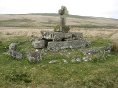
Notes: "A much disturbed cairn, 9m in diameter and 0.3m high with a modern 'kerb' of blocks and slabs, 5.8m in diameter and 0.5m high, set upon the mound. At the centre is a well built cist 1.4m long, 0.5m wide and 0.6m deep. Over this is a two tier pedestal of eight well trimmed blocks, of three different lengths; a further half buried block lies S of the monument. Upon this is a replacement socket stone and cross, cut at Holne in 1885". Lethbridge diagram p.93, photo p.94. Butler Vol. 4. Map 64.4 (diagram p.220). Breton p.22-23
Nearest Bus Stop: Princetown Dartmoor Visitor Centre (4.8 km) [Route: 98,171,172]
Nearby sites: SX 62577 70299
Chittaford Down Platform Cairn Circle
OS Map: SX 63502 79203
HER: MDV5832
Megalithic Portal: 42726
PMD: Archerton
Alternate name: Chittaford Down 1 Platform Cairn Circle
Short Name: PC Chittaford1
Butler map: 27.18.1
Butler Vol 5: p.170 & Fig.109
Grinsell: LYD 38
Turner: E14
Dimensions (m): c.7.0 x 0.3
Notes: "Remains of a cairn, visible as a turf covered stony mound. The NE quadrant is robbed out but around the rest of the periphery are parts of a kerb of small boulders, some set on edge, giving a diameter of 6.5m NW-SE. Maximum height 0.6m in the SW quadrant, but elsewhere the interior is badly robbed." Butler says there is a possible end slab of a cist.
Nearest Bus Stop: Postbridge Post Office (1.3 km) [Route: 98,171]
Nearby sites: SX 63502 79203
Chittaford Down Platform Cairn Circle and Cist
OS Map: SX 63687 79463
HER: MDV5932
Megalithic Portal: 52177
PMD: Chittaford Down
Alternate name: Chittaford Down 3 Platform Cairn Circle and Cist
Short Name: CT Chittaford3
Butler map: 27.18.3
Butler Vol 5: p.160 & Fig.100
Dixon Cist #: 73
Grinsell: LYD 39
Turner: E28
DPD: 112
Barrow Report: 57
Dimensions (m): 7.0 x 0.5 C
Notes: "A cist about 350 yards north of Archerton House. It has an irregular shape no coverstone and stands in the centre of a 14ft. diameter ruined cairn. There are traces of an enclosing ring of stones. Excavation in 1900 recovered wood charcoal and a worked flint flake from a small pit within the cist. Under the eastern side stone an archer's polished stone wrist guard was found". Lethbridge diagram and photo bottom p.112. Butler Chittaford Down 3 - Vol. 2. Map 27.18 (diagram Vol. 5. p.160).
Nearest Bus Stop: Postbridge Post Office (1.2 km) [Route: 98,171]
Nearby sites: SX 63687 79463
Collard Tor Encircled Cairn
OS Map: SX 5584 6203
HER: MDV14793
Megalithic Portal: 794
PMD: Collard Tor
Alternate name: Collard Tor stone row 1 Encircled Cairn
Short Name: EC Collard Tor
Butler map: 48.6.1
Grinsell: SHA 46
Turner: F17
DPD: 57
Barrow Report: 22
Dimensions (m): 9.0 x 0.3 C?
Notes: Cairn heading the easterly of the two Collard Tor rows. "The easterly cairn at SX 55846203 measures 8.1m. in diameter and 0.6m. high. The centre has been excavated, but apart from a large prone slab there is nothing to suggest a former cist. The mound is surrounded by a peristalith of boulders each of which is 0.9m. high and roughly 0.5m square. The row is similar to the other row and can be traced for 79.6m."
Nearest Bus Stop: Wotter Methodist Church (0.2 km) [Route: 59]
Nearby sites: SX 5584 6203
Corn Ridge Stone Ring Cairn Circle
OS Map: SX 55138 89153
HER: MDV3172
Megalithic Portal: 52276
Alternate name: Branscombe's Loaf 2 Stone Ring Cairn Circle
Short Name: RC Branscomb 2
Butler map: 43.12.2
Grinsell: BRI 10
Turner: A14
Dimensions (m): 14.5 x 0.3
Notes: This ring cairn can just about be seen in the photograph that accompanies this record, it is a bit difficult to capture in a photograph. It is a bit of an indistinct circular bank. It is perhaps easier to see in the Google Earth satellite imagery - which can help to then make sense of the photograph. One of 4 cairns on Corn Ridge - see Turner "Ring Cairns, Stone Circles and Related Monuments on Dartmoor" DASP No. 48 p59 for diagram of the 4 cairns.
Nearest Bus Stop: Sourton Windard Terrace (2.1 km) [Route: 118]
Nearby sites: SX 55138 89153
Corn Ridge Encircled Cairn
OS Map: SX 55175 89119
HER: MDV3171
Megalithic Portal: 3158
Alternate name: Branscombe's Loaf 1 Encircled Cairn
Short Name: EC Branscomb 1
Butler map: 43.12.1
Grinsell: BRI 9
Turner: F2
Dimensions (m): 15.5 x 1.8
Notes: One of 4 cairns on Corn Ridge - see Turner "Ring Cairns, Stone Circles and Related Monuments on Dartmoor" DASP No. 48 p59 for diagram of the 4 cairns.
Nearest Bus Stop: Sourton Windard Terrace (2.1 km) [Route: 118]
Nearby sites: SX 55175 89119
Corn Ridge N.W.1 Cairn
OS Map: SX 54603 89454
HER: MDV4627
Megalithic Portal: 10022
Short Name: CN CornRg NW1
Butler map: 43.10.1
Grinsell: BRI 1
Dimensions (m): 11.0 x 0.3
Notes: Butler Corn Ridge NW1. Southern most of pair of cairns near stone circle. "The remains of a cairn, SX 54608942, which has been disturbed in the past - now heather covered. Diameter 10.5m, height 0.5m. One or two stones of the retaining circle are still visible but there is no trace of a cist to be seen." Previously listed as Sourton Tors S.E. - changed to the Butler name as less confusing given part of a pair of cairns
Nearest Bus Stop: Sourton Windard Terrace (1.5 km) [Route: 118]
Nearby sites: SX 54603 89454
Corn Ridge Rock Stone Ring Cairn Circle
OS Map: SX 55219 89145
HER: MDV48864
Megalithic Portal: 45850
Alternate name: Branscombe's Loaf 3 Stone Ring Cairn Circle
Short Name: RC Branscomb 3
Butler map: 43.12.3
Turner: A66
Dimensions (m): c.10.0
Notes: "Tor cairn on summit of Corn Ridge. Two banks of small to medium stones associated with large outcrop. Outer bank survives as 12 metres long, 1.2 metres wide, 0.3 metres high curving rubble spread following s + w edges of the outcrop. Inner ring measures 1.3m wide, 0.3m high and corresponds with the n edge of the outcrop, but also extends over the rock itself, which stands 3m high. Area enclosed by ring banks measures 15m ns by 12m ew" One of 4 cairns on Corn Ridge - see Turner "Ring Cairns, Stone Circles and Related Monuments on Dartmoor" DASP No. 48 p59 for diagram of the 4 cairns.
Nearest Bus Stop: Sourton Windard Terrace (2.1 km) [Route: 118]
Nearby sites: SX 55219 89145
Corringdon Ball Chambered Tomb
Prehistoric Dartmoor Walks: Dartmoor Site: Corringdon Ball Chambered Tomb & Stone Rows
OS Map: SX 66956 61300
HER: MDV5750
Megalithic Portal: 4619
PMD: Corringdon Ball Chambered Cairn
Alternate name: Corringdon Ball chambered tomb Chambered Tomb
Short Name: NT Corringdon
Butler map: 56.10
Butler Vol 5: p.155
Grinsell: A:BRE 1
DPD: 83
Barrow Report: 28 56 66
Dimensions (m): 42 x 18 x 2.4
Notes: "An earthen long barrow with a ruined stone chamber at the south east end. Early excavation and mutilation has resulted in two distinct mounds, the larger one at the south east end separated from the smaller by a path or trackway. The smaller mound appears to mark the limit of the barrow on the northwest; beyond this it merges into the natural hill-side. There are no side ditches but these may be obscured by soil washed down from the hill. The length is 42.0 m; the maximum width is 18.0m and the maximum height of 2.4m."
Nearest Bus Stop: South Brent Pool Park (3.5 km) [Route: 38]
Nearby sites: SX 66956 61300
Corringdon Ball Multiple Cairn Circle
Prehistoric Dartmoor Walks: Dartmoor Site: Corringdon Ball Chambered Tomb & Stone Rows
OS Map: SX 66665 61215
HER: MDV15960
Megalithic Portal: 52282
PMD: Corringdon Ball B
Alternate name: Corringdon Ball 5 Cairn Circle
Short Name: CC Corringdo5
Butler map: 56.8.5
DPD: 82
Dimensions (m): 23.0
Notes: Five monuments noted by robinson and greeves at the ne end of the stone rows. Many have multiple concentric circles of small stones. Includes 3 cairns. See also entries for Corringdon Ball Stone Rows and East Glazebrook Encircled Cairn. Lethbridge p.82-3.
Nearest Bus Stop: South Brent Pool Park (3.8 km) [Route: 38]
Nearby sites: SX 66665 61215
Cosdon (stone row) Platform Cairn Circle and Cist
Prehistoric Dartmoor Walks: Dartmoor Site: Cosdon Hill Triple Stone Row
OS Map: SX 64331 91597
HER: MDV48906
Megalithic Portal: 813
PMD: Cosdon Stone Row
Alternate name: Cosdon Hill Stone Row Platform Cairn Circle and Cist
Short Name: CT Cosdon Row
Butler map: 40.6
Butler Vol 5: p.234 & Fig.165
Dixon Cist #: 95
Grinsell: ST 5
Turner: E15
DPD: 152
Dimensions (m): 7.0 x 0.3 C
Notes: "The cairn associated with the Cosdon Hill triple stone row is 26 feet in diameter and contains the remains of two cists; the retaining circle is very irregular. Of the two cists, one is intact, the other has been robbed of the cover-stone and two side-stones." Lethbridge diagram p.152, cists pictured. Butler Cosdon Hill Stone Row - Vol. 2. Map 40.6 (diagram p.205).
Nearest Bus Stop: Ramsley (1.7 km) [Route: 670,671,6A]
Nearby sites: SX 64331 91597
Cosdon Beacon Platform Cairn Circle
Prehistoric Dartmoor Walks: Dartmoor Site: Cosdon Hill Triple Stone Row
OS Map: SX 63717 91719
HER: MDV6924
Megalithic Portal: 10325
Alternate name: Cosdon Beacon 5 Platform Cairn Circle
Short Name: PC Cosdon 5
Butler map: 40.7.5
Grinsell: ST 1
Turner: E1
DPD: 153
Dimensions (m): 16.0 x 1.5
Notes: Cairn 13.5m diameter with signs of retaining circle. Crowned by modern stone heap. HER MDV6894. See also: NMR 444167. Lethbridge diagram p.152, photo bottom right p.153. Turner E1 (diagram p.59). Butler Cosdon Beacon 5 Vol. 2. Map 40.7.5. (diagram of Cosdon Summit cairns on p.207).
Nearest Bus Stop: Ramsley (1.9 km) [Route: 670,671,6A]
Nearby sites: SX 63717 91719
Cosdon Beacon Cairn
Prehistoric Dartmoor Walks: Dartmoor Site: Cosdon Hill Triple Stone Row
OS Map: SX 63611 91502
HER: MDV6885
Megalithic Portal: 10325
Alternate name: Cosdon Beacon 1 Cairn
Short Name: CN Cosdon 1
Butler map: 40.7.1
Grinsell: ST 3
DPD: 153
Dimensions (m): 27.0 x 3.0
Notes: Cairn 27m diameter, height 1.8m, crowned by modern stone heap and OS trig pillar. Large hollows in the top, from robbing, would have protected beacon fires. Butler Cosdon Beacon 1 Vol. 2. Map 40.7.1. (diagram of Cosdon Summit cairns on p.207). See also MDV6883.
Nearest Bus Stop: Ramsley (2.1 km) [Route: 670,671,6A]
Nearby sites: SX 63611 91502
Cosdon Beacon Cairn Circle & Cist
Prehistoric Dartmoor Walks: Dartmoor Site: Cosdon Hill Triple Stone Row
OS Map: SX 63730 91654
HER: MDV6925
Megalithic Portal: 10325
Alternate name: Cosdon Hill 4 Cairn Circle & Cist
Short Name: CN Cosdon 4
Butler map: 40.7.4
Butler Vol 5: p.183 & Fig.125
Dixon Cist #: 119
Grinsell: ST 1b
DPD: 153
Dimensions (m): 6.5 x 0.6 C
Notes: "Cairn mound measures 7m in diam and stands up to 0.6m high. A central hollow, 2m by 1.8m by 1m deep, is faced on two sides with large slabs which may represent the cist described by falcon in 1905 as being 4ft long by 2ft wide. A ring of edge set stones around this cist is visible and may represent an internal kerb, which survives largely as a buried feature.". Lethbridge diagram p.152, photo bottom left p.153. Butler Cosdon Beacon 4 Vol. 2. Map 40.7.4 (diagram of Cosdon Summit cairns on p.207). Barrow Report 4 quotes Rowe (1872) and Rowe on this feature. See also Bate (1862) and Rowe's earlier account (1830). For Falcon's cist (1905) "Two stones set on edge on the eastern periphery of the mound may represent a second cist." see entry SiteID=463.
NB. The grid reference SX 63730 91654 had been assigned by the author to this feature - possibly as read from Google or a subsequent visit. Unfortunately no explanation can be found so rolling back to previous Garmin reading taken on 12/09/21.
Nearest Bus Stop: Ramsley (1.9 km) [Route: 670,671,6A]
Nearby sites: SX 63730 91654
Cosdon Beacon Embanked Cairn Circle and Cist
Prehistoric Dartmoor Walks: Dartmoor Site: Cosdon Hill Triple Stone Row
OS Map: SX 63708 91593
HER: MDV6898
Megalithic Portal: 10325
PMD: Cosdon Summit S.
Alternate name: Cosdon Hill 3 Embanked Cairn Circle and Cist
Short Name: CT Cosdon 3
Butler map: 40.7.3
Butler Vol 5: p.164 & Fig.105
Dixon Cist #: 120
Grinsell: ST 2
Turner: B14
DPD: 152
Barrow Report: 21
Dimensions (m): c.18.0 x 0.4
Notes: "Ring cairn and cist on summit ridge of Cawsand Hill. Cairn forms part of a cemetery including at least 2 round cairns, 2 ring cairns and one platform cairn. Earthwork survives as a 2m wide and 0.4m high circular rubble bank, faced with close set stones around its outer edge and surrounds an internal area measuring 18m ew by 17m ns. A mound measuring 6m in diam and 0.2m high stands in the centre of the area enclosed by the circular bank and contains a stone cist with 2 slabs surviving." Turner B14(diagram p.59). Butler Cosdon Beacon 3 Vol. 2. Map 40.7.3 (diagram Vol. 5. p.164). NMR Cairn B. Possible cist? This site is difficult to photograph, the photo shows part of one side of the ring.
Nearest Bus Stop: Ramsley (2.0 km) [Route: 670,671,6A]
Nearby sites: SX 63708 91593
Cosdon Beacon Reported Cairn
Prehistoric Dartmoor Walks: Dartmoor Site: Cosdon Hill Triple Stone Row
OS Map: SX 63716 91666
HER: No record
Alternate name: Cosdon Hill 7 Reported Cairn
Short Name: CN Cosdon 7
Dixon Cist #: 119
DPD: 153
Dimensions (m): 5.5 x 0.6 C
Notes: An arrangement a few paces north of cosdon Hill 4 and of a very similiar appearance. Might be a modern arrangement, perhaps the work of stone cutters? There is a notable cist shaped hole within this feature. Lethbridge diagram p.152, photo bottom right p.153. This feature appears not to be mentioned anywhere else.
Nearest Bus Stop: Ramsley (1.9 km) [Route: 670,671,6A]
Nearby sites: SX 63716 91666
Cosdon Beacon East Stone Ring Cairn Circle
Prehistoric Dartmoor Walks: Dartmoor Site: Cosdon Hill Triple Stone Row
OS Map: SX 63663 91492
HER: MDV6928
Megalithic Portal: 10325
Alternate name: Cosdon Beacon 2 Stone Ring Cairn Circle
Short Name: RC Cosdon 2
Butler map: 40.7.2
Grinsell: ST 4
Turner: A6
DPD: 152
Dimensions (m): c.25.0 x 0.6
Notes: Located 25m to east of Cosdon Beacon. A near circular bank 1.6m wide of double slab construction and about 21m across. Turner A6 (diagram p.59). NMR Cairn A. Butler Cosdon Beacon 2 Vol. 2. Map 40.7.2. (diagram of Cosdon Summit cairns on p.207).
Nearest Bus Stop: Ramsley (2.1 km) [Route: 670,671,6A]
Nearby sites: SX 63663 91492
Cosdon Hill Encircled Cairn
OS Map: SX 63350 92479
HER: MDV13064
Megalithic Portal: 22695
Alternate name: Cosdon Hill N.4 Encircled Cairn
Short Name: EC Cosdon N4
Butler map: 40.9
Grinsell: ST 10
Dimensions (m): c.7.0 x 0.4
Notes: Cairn at the junction of two Bronze Age reaves. "Round cairn on Cosdon Hill, measuring 7.3 metres in diameter and standing up to 0.8 metres high. A number of edge set stones visible around the southern side of the cairn mound suggests the existence of a kerb. There is a hollow in the north side of the mound, probably the result of partial robbing or an early excavation."
Nearest Bus Stop: Ramsley (1.7 km) [Route: 670,671,6A]
Nearby sites: SX 63350 92479
Cox Tor Stone Ring Cairn Circle
OS Map: SX 53060 76190
HER: MDV4151
Megalithic Portal: 32104
Alternate name: Cox Tor Summit Stone Ring Cairn Circle
Short Name: RC CoxTor 3
Butler map: 31.1.3
Grinsell: PET 37a
Turner: A59
Dimensions (m): 17
Notes: "Cox tor, ring cairn. The outcrop of granite on the summit is surrounded by an ancient wall, enclosing a space of about 21m in diameter, built of small stones. Pillaged and part used in erection of the cairn for the 1887 jubilee."
NB. The NMR listings had two entries for this feature. The entry SiteID=3229 referred to NMR entry SX 57 NW 132 (Monument Number 919075) which was a duplicate. As the NMR listings are no longer public our entry SiteID=3229 has been deleted.
Nearest Bus Stop: Tavistock Higher Longford (2.0 km) [Route: 98,171,172]
Nearby sites: SX 53060 76190

Cox Tor Ancient Pool
OS Map: SX 53635 76205
HER: MDV26281
Short Name: PO:Cox Tor
Dimensions (m): 35 x 25m
Notes: "Previously recorded from aerial photographs as a possible quarry. Marked as 'pond' on modern mapping and is one of the examples suggested by Greeves (2019) to potentially have Prehistoric origins."
Nearest Bus Stop: Merrivale Dartmoor Inn (1.6 km) [Route: 98,171,172]
Nearby sites: SX 53635 76205
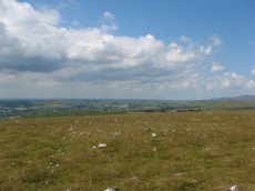
Cox Tor (NE) Stone Ring Cairn Circle
OS Map: SX 53047 76430
HER: MDV4127
Megalithic Portal: 32104
Alternate name: Cox Tor N.6 Stone Ring Cairn Circle
Short Name: RC CoxTor 6
Butler map: 31.1.6
Grinsell: PET 36
Turner: A51
Dimensions (m): 10.0 x 0.7
Notes: "Narrow ridge of north-south outcropping rock measuring 10 metres in diameter, surrounded by circular stoney bank 4 metres wide, 0.8 metres high. 1890 excavation showed it to consist of an outer bank with central infill of loose stones and earth. No trace of burials or artefacts." "Cox Tor. Smaller of two adjacent cairns. Lies 12.5 metres south-east of larger one (see related record). Similar in shape, though smaller; diameter 8.23 metres. Construction of centre was loose, much earth being mingled with the stone. Nothing found and no pit in the "calm". (Baring-Gould - fifth report of the DEC) Breton p.16 Two very curious ring cairns; one has a diameter of 55ft and the other 27ft.
Nearest Bus Stop: Tavistock Higher Longford (2.1 km) [Route: 98,171,172]
Nearby sites: SX 53047 76430
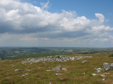
Cox Tor (NW) Stone Ring Cairn Circle
OS Map: SX 53024 76424
HER: MDV4128
Megalithic Portal: 32104
Alternate name: Cox Tor N.5 Stone Ring Cairn Circle
Short Name: RC CoxTor 5
Butler map: 31.1.5
Grinsell: PET 35
Turner: A48
Dimensions (m): 17.0 x 0.8
Notes: Breton p.16 Two very curious ring cairns; one has a diameter of 55ft and the other 27ft.
Nearest Bus Stop: Tavistock Higher Longford (2.1 km) [Route: 98,171,172]
Nearby sites: SX 53024 76424
Cranmere Pool Ancient Pool
OS Map: SX 60323 85829
HER: MDV4381
Short Name: PO:Cranmere
Dimensions (m): 1 acre (0.4ha)
Notes: "Recorded in the early 20th century as a possible holy well, it is one of the examples suggested by Greeves (2019) to potentially have Prehistoric origins."
Nearest Bus Stop: Fox and Hounds Hotel (7.9 km) [Route: 118]
Nearby sites: SX 60323 85829
Cripdon Ancient Pool
OS Map: SX 73345 80335
HER: MDV127204
Short Name: PO:Cripdon
Dimensions (m): 24 x 14m
Notes: "The pool at Cripdon measures 24 by 14m One of over 40 such 'sacred' pools identified on Dartmoor that are thought to have potentially been designed during the prehistoric period"
Nearest Bus Stop (Minor): Swallerton Gate (1.3 km) [Route: 271]
Nearest Bus Stop (Major): Batworthy Miniature Pony Centre (4.7 km) [Route: 171]
Nearby sites: SX 73345 80335
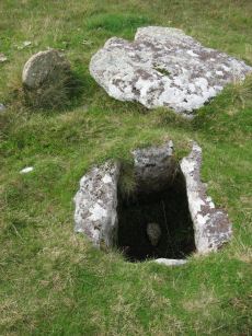
Crock of Gold Ring Setting Cairn and Cist
OS Map: SX 61286 73076
HER: MDV6308
Megalithic Portal: 14960
PMD: The Crock of Gold
Short Name: CT CrockofGold
Butler map: 65.2
Dixon Cist #: 25
Grinsell: LYD 86
Turner: D17
DPD: 101
Barrow Report: 27 47 56
Dimensions (m): 4.0 x 0.3 C
Notes: "The cairn, 7m in overall diameter and 0.3m high, has a flattish top with a retaining circle set 1m to 1.5m within the perimeter. This consists of six earthfast boulders, about 0.4m across and protruding a similar height above the cairn ... A central cist is oriented NW to SE. Internally it is 0.8m long, 0.4m wide at the NW end, 0.5m at the SE, and 0.7m deep. The side slabs are 1m long and respectively 0.15m and 0.25m thick; the end slabs, 0.5m long and 0.1m thick. The capstone, moved to the W, is 1.3m long, 1.1m wide and 0.15m thick and now rests against the kerb." Lethbridge diagram p.102 Cist(C), photo p.101. Butler Vol. 4. Map 65.2 (diagram p.229).
Nearest Bus Stop: Two Bridges Hotel (2.0 km) [Route: 98,171,172]
Nearby sites: SX 61286 73076
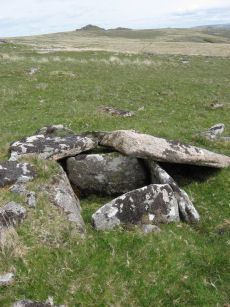
Crow Tor Platform Cairn Circle and Cist
OS Map: SX 60531 78683
HER: MDV5938
Megalithic Portal: 45775
PMD: Crow Tor
Short Name: CT Crow Tor
Butler map: 29.18
Butler Vol 5: p.196 & Fig.139
Dixon Cist #: 115
Grinsell: LYD 41
Turner: E39
DPD: 109
Dimensions (m): 4.0 x 0.4
Notes: "A kerbed cairn and cist. The cairn consists of a stony, turf-covered mound, and measures 4.5m in diameter and 0.45m in height. There are traces of a retaining kerb of leaning, granite slabs to the northeast and south. The cist is set slightly to the north of the centre of the cairn. It is trapezoidal in shape, and measures 0.65m and 0.95m in length, 0.8m in width, and 0.5m in depth. The cover-stone, which is 0.9m long, 0.5m wide and 0.2m thick, is displaced and lies just to the south east of the cist." Lethbridge diagram p.107, photo bottom p.109. Butler Vol. 2. Map 29.18 (p.63, photo on p.124, diagram Vol. 5. p.196).
Nearest Bus Stop: Powder Mills (3.2 km) [Route: 171]
Nearby sites: SX 60531 78683
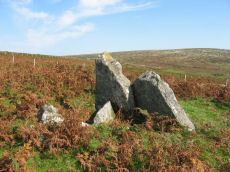
Cuckoo Ball Chambered Tomb
Prehistoric Dartmoor Walks: Dartmoor Site: Cuckoo Ball Chambered Tomb
OS Map: SX 65963 58195
HER: MDV2885
Megalithic Portal: 31700
PMD: Cuckoo Ball Chambered Cairn
Alternate name: Cuckoo Ball chambered cairn Chambered Tomb
Short Name: NT Cuckoo Ball
Butler map: 53.15
Butler Vol 5: p.155
Grinsell: A:UGB 1
DPD: 80
Barrow Report: 30 56
Dimensions (m): c.28.0 x 12.0 x 0.8
Notes: "The remains of a long cairn and burial chamber on a hill-slope at Cuckoo Ball. The cairn, which was probably robbed for newtake walls to the west and north, is 23 metres long by 12 metres wide, aligned north/south, and is 0.7 metre high at the north. The burial chamber is at the north end."
Nearest Bus Stop: Ivybridge BP Garage (Stop B) (3.1 km) [Route: 38]
Nearby sites: SX 65963 58195
Cudlipptown Down Embanked Cairn Circle
OS Map: SX 53732 78949
HER: MDV13252
Megalithic Portal: 45608
Alternate name: White Tor N.W.2 Embanked Cairn Circle
Short Name: CC White NW2
Butler map: 31.23.2
Butler Vol 5: p.188 & Fig.130
Grinsell: PET 21
Turner: B5
Dimensions (m): 16.0 x 0.3
Notes: "A ring cairn set at the eastern end of a natural gently sloping plateau of rough grassland generally devoid of stones. It measures about 11m diameter inside a turf-covered bank, composed generally of smallish stones, which is about 2.2m wide and has a maximum height of 0.4m on the E. It has been mutilated and spread in the south-east and the west. Several stones, are evident, two probably set in the inner face but the rest are apparently part of the bank of even part of the outer face. Two in the east on the uphill side appear to form an entrance but this is possibly due to mutilation. The interior appears to have been levelled and is 0.2m above the ground to the W. There is no evidence of any internal features or a ditch"
Nearest Bus Stop: Mary Tavy War Memorial (3.5 km) [Route: 118]
Nearby sites: SX 53732 78949
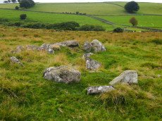
Cullever Steps Ring Setting Cairn and Cist
OS Map: SX 60787 91954
HER: MDV6867
Megalithic Portal: 17956
PMD: Cullever Steps
Short Name: CT Cullever
Butler map: 40.14
Butler Vol 5: p.181 & Fig.123
Dixon Cist #: 138
Grinsell: BEL 2
Turner: D11
Dimensions (m): c.4.5 x 0.4 C?
Notes: "A Bronze Age ring cairn situated below Belstone Tor within the valley of the East Okement River. The cairn survives as a 0.5 metre high bank surrounding a 4.1 metre diameter internal area. The bank around the southern and eastern side of the cairn is faced on both sides with edge set stones. A large flat stone lying on the south western part of the ring bank may represent a displaced cist coverstone. The overall dimensions of the cairn are 9.5 metres east to west by 8.5 metres north to south." Butler Vol. 2. Map 40.14 (diagram Vol. 5. p.181).
Nearest Bus Stop (Minor): Belstone Car Park (2.3 km) [Route: 670]
Nearest Bus Stop (Major): Okehampton Railway Station (3.0 km) [Route: 118,306,6A]
Nearby sites: SX 60787 91954

Cut Hill Cairn
OS Map: SX 59823 82745
HER: MDV69603
Megalithic Portal: 47078
PMD: Cut Hill
Short Name: CN Cut Hill
DPD: 130
Notes: "Barrow c20m overall diameter on the top of 'Cut Hill' at 603m OD was observed during a field visit by Tom Greeves in 2004. The 1.5m high circular mound has a military range pole set in it & surface erosion has exposed a turf/peat core with a few stones. The surrounding ditch is over 1m wide & nearly filled with waterlogged vegetation." For more information, see: Prehistoric Society - Past No. 47 and Prehistoric Society - Past No. 47. The date and context of a stone row:Cut Hill, Dartmoor, south-west England. The HER gives the OS grid reference as SX 5992 8275 which is almost 100 metres to the east. The photo here shows a modern walkers cairn on top of the feature. This did not exist in 2013 when the author last visited.
Nearest Bus Stop: Postbridge Post Office (6.3 km) [Route: 98,171]
Nearby sites: SX 59823 82745
Deadman's Bottom Embanked Cairn Circle
Prehistoric Dartmoor Walks: Dartmoor Site: Guide to the Langcombe Brook & Deadman's Bottom Cists
OS Map: SX 60711 67027
HER: MDV12420
Megalithic Portal: 3194
Alternate name: Deadman's Bottom 1 Embanked Cairn Circle
Short Name: CC Deadmans 1
Turner: B1
Dimensions (m): 16
Notes: "Turner identifies this site as an embanked stone circle; an annular bank of earth and/or stones with an inner edge of orthostats. Internal diam 16m with bank 0.8m wide and 0.3m high. The bank has been pushed out on the sse side and the stones lean outward (turner)." Turner B1.
Nearest Bus Stop: Lee Moor Clearview (6.2 km) [Route: 59]
Nearby sites: SX 60711 67027
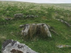
Deadman's Bottom, South Ring Setting Cairn and Cist
Prehistoric Dartmoor Walks: Dartmoor Site: Guide to the Langcombe Brook & Deadman's Bottom Cists
OS Map: SX 60788 66892
HER: MDV5119
Megalithic Portal: 3194
PMD: Deadman's Bottom N 2
Alternate name: Langcombe Brook 1 Ring Setting Cairn and Cist
Short Name: CT Deadmans S
Butler map: 50.3.1
Dixon Cist #: 7
Grinsell: SHA 8
Turner: D12
DPD: 45
Barrow Report: 12 19
Dimensions (m): 5.0 x 0.2 C
Notes: "Cairn consists of a stony mound, c 6.1m in diameter and c 0.5m high, contained by granite slabs some upright some fallen. The southern quadrant of the cairn has been disturbed. The remains of a very fine cist, box dimensions c. 0.8 x 0.7m internally, survives at its centre." One side slab and the cover-stone of the cist are missing although both could be slabs nearby. The cover-stone may be the large slab which lies to the south. Lethbridge p.45 Langcombe Cist D - diagram p.43 Dixon #7. Bar Rep. 19. Butler Langcombe Brook 1 (Cist 1) Vol. 3. Map 50.3 (pp.148-54 general plan of Langcombe Brook cairns p.151, diagram of Deadmans Bottom cists p.149).
Nearest Bus Stop: Lee Moor Clearview (6.1 km) [Route: 59]
Nearby sites: SX 60788 66892
Deadmans Bottom D Platform Cairn Circle and Cist
Prehistoric Dartmoor Walks: Dartmoor Site: Guide to the Langcombe Brook & Deadman's Bottom Cists
OS Map: SX 6096 6673
HER: MDV5086
Megalithic Portal: 45731
PMD: Deadman's Bottom S 10
Alternate name: Langcombe Brook 10 Platform Cairn Circle and Cist
Short Name: CT:Deadmans D
Butler map: 50.3.10
Dixon Cist #: 55
Grinsell: SHA 10
Turner: E44
DPD: 45
Barrow Report: 53
Dimensions (m): 0.8 x 0.7 C
Notes: "The cairn is 5m in diameter by 0.3m high with a retaining kerb on its northern side. The cist is 0.8m long b 0.7m wide." "Cist (listed as 'D' by Worth) found at Deadman's Bottom Langcombe, by Mr Button. Internal dimensions, length 3 feet 8 inches, width 2 feet. The stones are barely visible above grass level. The cover stone is missing." Lethbridge p.45 Langcombe Cist E - diagram p.43. Butler Langcombe Brook Cairn 10 - Vol. 3. Map 50.3 (pp.148-54 general plan of Langcombe Brook cairns p.151, diagram of Langcombe cists p.153).
Nearest Bus Stop: Lee Moor Clearview (6.1 km) [Route: 59]
Nearby sites: SX 6096 6673
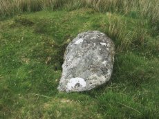
Deadmans Bottom F Platform Cairn Circle and Cist
Prehistoric Dartmoor Walks: Dartmoor Site: Guide to the Langcombe Brook & Deadman's Bottom Cists
OS Map: SX 61201 66983
HER: MDV5125
Megalithic Portal: 45733
PMD: Deadman's Bottom E.
Alternate name: Langcombe Brook 11 Platform Cairn Circle and Cist
Short Name: CT Deadmans F
Butler map: 50.3.11
Dixon Cist #: 57
Grinsell: SHA 12
DPD: 43
Barrow Report: 53
Dimensions (m): 5.5 x 0.4 C
Notes: "Cist (Listed as 'F' by Worth) found at Deadman's Bottom, Langcombe, by Mr. Button. The cover-stone is still in position but the cist appears to have been rifled, the end and side-stones having been displaced at the north-east and southwest angles. Original length would appear to have been 2 feet 10 inches, and the width 1 foot 7 inches. The greatest length of the cover-stone is 4ft 9 inches and its greatest width 3 feet 1 1/2 inches." ... "A flat-topped cairn measuring 5.4m in diameter and standing a maximum of 0.4m high. A well-preserved cist 1.3m long, 0.6m wide and 0.15m deep is largely obscured by the coverstone". Lethbridge p.43 Langcombe Cist A (Upper Deadman's Bottom) - diagram p.43. nb. Not listed by Turner - assigned as "Platform Circle" type cairn due to description in NMR. Butler Langcombe Brook Cairn 11 - Vol. 3. Map 50.3 (pp.148-54 general plan of Langcombe Brook cairns p.151, diagram of Langcombe cists p.153).
Nearest Bus Stop: Lee Moor Clearview (6.5 km) [Route: 59]
Nearby sites: SX 61201 66983
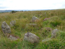
Dendles Waste Ring Setting Cairn and Cist
OS Map: SX 61535 62804
HER: MDV4276
Megalithic Portal: 45691
PMD: Dendles Waste
Alternate name: Dendles Waste S. Ring Setting Cairn and Cist
Short Name: CT Dendles 1
Butler map: 52.15
Dixon Cist #: 43
Grinsell: COR 14
Turner: D19
DPD: 64
Barrow Report: 43
Dimensions (m): 4.0 C
Notes: "The circle, consists of eight flat slabs, set on edge and has an internal diameter of approximately 3.4m. Some of the stones from the western quadrant of the circle are missing; a single earthfast stone is all that survives. The rectangular cist lies roughly centrally within the circle and is oriented E to W. It measures 1.2m long by 0.6m and 0.5m deep with slabs still in place both sides". Lethbridge diagram p.63, photo p.64. Butler Dendles Waste S. - Vol. 3. Map 52.15 (diagram p.194).
Nearest Bus Stop: Cornwood Crossways (3.4 km) [Route: 59]
Nearby sites: SX 61535 62804
Devil's Elbow Platform Cairn Circle
OS Map: SX 58192 72708
HER: MDV14310
Megalithic Portal: 36761
PMD: Devil's Bridge
Alternate name: Hart Tor N. Platform Cairn Circle
Short Name: PC:DevilsElbow
Butler map: 46.1
Butler Vol 5: p.168 & Fig.107
Grinsell: WAL 10
Turner: E5
Dimensions (m): 8.0 x 0.4 C
Notes: Ring cairn consisting of a circle of close set stones: almost a kerb circle, interior flat and no sign of cist. Diameter 8m, height 0.3m.
Nearest Bus Stop: Princetown Dartmoor Visitor Centre (1.2 km) [Route: 98,171,172]
Nearby sites: SX 58192 72708
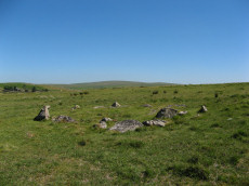
Ditsworthy Circle Ring Setting Cairn and Cist
OS Map: SX 58342 65726
HER: MDV42211
Megalithic Portal: 45797
PMD: Ditsworthy Circle
Short Name: CT Ditsworthy
Butler map: 49.6
Dixon Cist #: 141
Grinsell: B:SHE 36
Dimensions (m): c.8.0 x 0.3 C?
Notes: nb. Not listed by Turner - assigned as "Ring Setting" type cairn due to description in NMR. Butler Vol. 3. Map 49.6. Remains of a ring cairn with three hollows visible within the circle of stones. Two of these probably represent the sites of the two cists recorded by Breton who referred to this cairn as the 'Ditsworthy Circle'. Nothing can be seen of the cists today.
Nearest Bus Stop: Lee Moor Clearview (4.0 km) [Route: 59]
Nearby sites: SX 58342 65726
Down Tor Cairn
OS Map: SX 58642 69315
HER: MDV3440
Megalithic Portal: 27903
Alternate name: Hingston Hill Summit 1 Cairn
Short Name: CN Hingston 1
Butler map: 47.12.1
Grinsell: WAL 30
Dimensions (m): 14.0 x 1.3
Notes: "cairn mound measures 15.5m in diam and stands up to 1.5m high. A t-shaped trench cutting into the centre of the mound suggests partial early excavation, though the results of the investigation are not known. This cairn forms part of a ritual complex of monuments including 3 cairns, a stone alignment and enclosure". Approx 70 m NW of the cairn circle at the end of the Down Tor stone row.
Nearest Bus Stop: Princetown Dartmoor Visitor Centre (4.2 km) [Route: 98,171,172]
Nearby sites: SX 58642 69315
Down Tor N.E. (Eastern) Platform Cairn Circle and Cist
OS Map: SX 58397 69562
HER: MDV3499
Megalithic Portal: 52347
PMD: Down Tor N 3
Alternate name: Hingston Hill N.3 Platform Cairn Circle and Cist
Short Name: CT DownTorNE E
Butler map: 47.13.3
Dixon Cist #: 109
Grinsell: WAL 29
Turner: E34
DPD: 27
Barrow Report: 73
Dimensions (m): 4.2 x 0.6 C
Notes: Butler Hingston Hill N. 3. - Vol. 3. Map 47.13.3 (diagram p.73 OS SX58396955). Grinsell WALKHAMPTON 29 (OS 58276949 approx - same as HER MDV3499). Lethbridge p.27 Cist No.1.
Copyright for photos and plans from Barrow Reports 71-73 belongs to the Dixon estate. Reproduced here with kind permission.
Nearest Bus Stop: Princetown Dartmoor Visitor Centre (4.0 km) [Route: 98,171,172]
Nearby sites: SX 58397 69562
Drizzlecombe Platform Cairn Circle
Prehistoric Dartmoor Walks: Dartmoor Site: Drizzlecombe Ceremonial Complex (Photos 1)
OS Map: SX 59135 67134
HER: MDV3374
Megalithic Portal: 16932
PMD: Drizzlecombe N 14
Alternate name: Drizzlecombe 14 Platform Cairn Circle
Short Name: PC Drizzle 14
Butler map: 49.19.14
Grinsell: SHE 25a
Turner: E35
Barrow Report: 34 56
Dimensions (m): 3.5 x 0.2
Notes: "stone circle" marked on os 6" 1906. This site was almost totally excavated in 1914. Half an 11 foot diameter kerb circle and the slight remains of a cairn were found.3 flint flakes and a "well finished" scraper were found. The 34th Barrow Report includes a photo of the flints and the excavated and exposed kerb.
Nearest Bus Stop: Meavy Primary School (4.7 km) [Route: 56]
Nearby sites: SX 59135 67134
Drizzlecombe (Central) Encircled Cairn
Prehistoric Dartmoor Walks: Dartmoor Site: Drizzlecombe Ceremonial Complex (Photos 1)
OS Map: SX 59253 67081
HER: MDV14772
Megalithic Portal: 3206
PMD: Drizzlecombe B
Alternate name: Drizzlecombe stone row 3 Encircled Cairn
Short Name: EC Drizzle Ce
Butler map: 49.19.3
Grinsell: SHE 29
Turner: F13
Barrow Report: 56
Dimensions (m): 8.6 x 1.0
Notes: Central in alignment of 3 cairns. Cairn heads the NW Drizzlecombe row. See diagram in coverage on Prehistoric Dartmoor Walks, marked as C3.
Nearest Bus Stop: Meavy Primary School (4.8 km) [Route: 56]
Nearby sites: SX 59253 67081
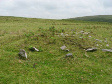
Drizzlecombe (W) Encircled Cairn
Prehistoric Dartmoor Walks: Dartmoor Site: Drizzlecombe Ceremonial Complex (Photos 1)
OS Map: SX 59236 67101
HER: MDV3329
Megalithic Portal: 10499
PMD: Drizzlecombe N Row
Alternate name: Drizzlecombe 4 Encircled Cairn
Short Name: EC Drizzle W
Butler map: 49.19.4
Grinsell: SHE 28
Turner: F24
Dimensions (m): 8.8 x 0.9
Notes: Western most in alignment of 3 cairns. The other two cairns head Drizzlecombe rows. See diagram in coverage on Prehistoric Dartmoor Walks, marked as C4. Turner F24
Nearest Bus Stop: Meavy Primary School (4.8 km) [Route: 56]
Nearby sites: SX 59236 67101
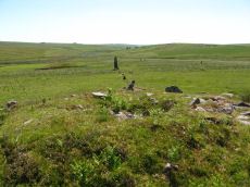
Drizzlecombe E. Encircled Cairn
Prehistoric Dartmoor Walks: Dartmoor Site: Drizzlecombe Ceremonial Complex (Photos 1)
OS Map: SX 59267 67065
HER: MDV4047
Megalithic Portal: 3207
PMD: Drizzlecombe C
Alternate name: Drizzlecombe stone row 2 Encircled Cairn
Short Name: EC Drizzle E
Butler map: 49.19.2
Grinsell: SHE 30
Turner: F7
DPD: 39
Dimensions (m): 9.2 x 1.0
Notes: Eastern most in alignment of 3 cairns. Cairn heads the NE Drizzlecombe row. See diagram in coverage on Prehistoric Dartmoor Walks, marked as C2. Lethbridge Row B. pp.38-42. Diagram p.38. See also 14780
Nearest Bus Stop: Meavy Primary School (4.8 km) [Route: 56]
Nearby sites: SX 59267 67065
Drizzlecombe S Row Encircled Cairn
Prehistoric Dartmoor Walks: Dartmoor Site: Drizzlecombe Ceremonial Complex (Photos 1)
OS Map: SX 59170 66964
HER: MDV14779
Megalithic Portal: 16937
PMD: Drizzlecombe SW Row
Alternate name: Drizzlecombe stone row 1 Encircled Cairn
Short Name: EC Drizzle S
Butler map: 49.19.1
Grinsell: SHE 32
Dimensions (m): 7.0 x 0.8
Notes: "Cairn lies at the north-east end of Row A (South Row)of the Drizzlecombe group. Cairn measures 6.7 metres in diameter, up to 0.8 metres high, with central hollow 2.3 metres by 1.5 metres by 0.25 metres deep." "Small number of edge stones around the periphery represent a kerb. Large flat stone, 1.7m by 1m by 0.3m thick, situated immediately s of the mound may be the displaced coverstone from a cist"
Nearest Bus Stop: Meavy Primary School (4.8 km) [Route: 56]
Nearby sites: SX 59170 66964
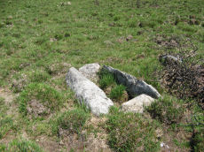
Dunnabridge Common Platform Cairn Circle and Cist
Prehistoric Dartmoor Walks: Dartmoor Site: Lakehead Hill
OS Map: SX 63585 75470
HER: MDV5952
Megalithic Portal: 37603
PMD: Smith Hill
Alternate name: Bellever Tor 9 Platform Cairn Circle and Cist
Short Name: CT Bellever 9
Butler map: 27.20.9
Dixon Cist #: 81
Grinsell: LYD 65
Turner: E37
DPD: 120
Barrow Report: 58
Dimensions (m): 1.2 x 0.4 C
Notes: Lethbridge Cist 3 diagram p.119 and photo bottom p.120. Butler Bellever Tor (Cairn 9) - Vol. 2. Map 27.20.9 (diagram p52-3). See also: Dartmoor Explorations: Antiquities of Black Newtake and Environs
Nearest Bus Stop: Powder Mills (1.3 km) [Route: 171]
Nearby sites: SX 63585 75470
Easdon A Ancient Pool
OS Map: SX 73212 82349
HER: MDV127207
Short Name: PO:Easdon A
Dimensions (m): 12.5 x 10m
Notes: "Easdon A measures 12.5 by 10m One of over 40 such 'sacred' pools identified on Dartmoor that are thought to have potentially been designed during the prehistoric period"
Nearest Bus Stop (Minor): Manaton Bus Shelter (2.1 km) [Route: 271,671]
Nearest Bus Stop (Major): Batworthy Miniature Pony Centre (2.8 km) [Route: 171]
Nearby sites: SX 73212 82349
Easdon B Ancient Pool
OS Map: SX 73222 82334
HER: MDV127208
Short Name: PO:Easdon B
Dimensions (m): 9 x 6.5m
Notes: "A pool measuring 9 by 6.5m. One of over 40 such 'sacred' pools identified on Dartmoor that are thought to have potentially been designed during the prehistoric period. Lies near a reave."
Nearest Bus Stop (Minor): Manaton Bus Shelter (2.1 km) [Route: 271,671]
Nearest Bus Stop (Major): Batworthy Miniature Pony Centre (2.8 km) [Route: 171]
Nearby sites: SX 73222 82334
Easdon Hill Stone Ring Cairn Circle
OS Map: SX 7335 8230
HER: MDV8767
Megalithic Portal: 45848
PMD: Easdon Tor
Short Name: RC:Easdon Hill
Butler map: 22.3
Grinsell: MAN 1
Turner: A61
Dimensions (m): 15.5
Notes: "A cairn with a large centrally placed rock which is possibly the capstone of a kist. Robbers have excavated around and about this giving a rock strewn central hollow to the cairn. There is no encircling ditch. The capstone is approximately square. Touching its base at the east is a triangular shaped orthostat. The cairn is situated on the very summit of a hill."
Nearest Bus Stop (Minor): Manaton Bus Shelter (2.0 km) [Route: 271,671]
Nearest Bus Stop (Major): Batworthy Miniature Pony Centre (2.9 km) [Route: 171]
Nearby sites: SX 7335 8230
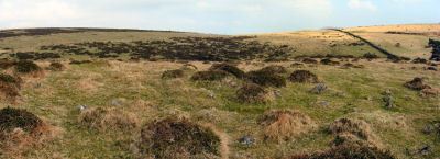
East Glazebrook Platform Cairn Circle
Prehistoric Dartmoor Walks: Dartmoor Walk: The Neolithic tombs of Cuckoo Ball & Corringdon Ball
OS Map: SX 66623 61237
HER: MDV15960
Megalithic Portal: 808
Alternate name: Corringdon Ball 6 Platform Cairn Circle
Short Name: PC Corringdo6
Butler map: 56.8.6
Grinsell: UGB 3a
Turner: E50
Barrow Report: 68
Dimensions (m): 14.0 x 0.4
Notes: Platform Cairn with Outer Stone Circles. "A ruined cairn with a very stony centre and the remains of multiple concentric rings of small stones visible on the south side. A substantial bank survives on the north side." Lethbridge p.82
Nearest Bus Stop: South Brent Pool Park (3.8 km) [Route: 38]
Nearby sites: SX 66623 61237
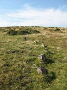
East Glazebrook Encircled Cairn
Prehistoric Dartmoor Walks: Dartmoor Site: Corringdon Ball Chambered Tomb & Stone Rows
OS Map: SX 66679 61215
HER: MDV129970
Megalithic Portal: 3160
PMD: Corringdon Ball C Stone Row
Alternate name: Corringdon Ball stone rows 1 Encircled Cairn
Short Name: EC East Glaze
Butler map: 56.8.1
Grinsell: UGB 4
Turner: F14
DPD: 82
Barrow Report: 66 68
Dimensions (m): 14.5
Notes: Cairn at east end of the Corringdon Ball group of multiple stone rows . Six pillars of the retaining circle are clearly visible. For more detail see entries for the Corringdon Ball rows.
Nearest Bus Stop: South Brent Pool Park (3.8 km) [Route: 38]
Nearby sites: SX 66679 61215
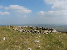
Eastern beacon (S) Platform Cairn Circle
OS Map: SX 66755 58770
HER: MDV3106
Megalithic Portal: 17583
Alternate name: Ugborough Beacon 4 Platform Cairn Circle
Short Name: PC Ugborough 4
Butler map: 53.16.6
Grinsell: UGB 20
Turner: E52
Barrow Report: 62
Dimensions (m): 20.0 x 2.2
Notes: Flat top turf-covered cairn. 20.5m. diameter, 1.7m. high. Possible remains of retaining circle. Large hollow in centre
Nearest Bus Stop: South Brent Pool Park (3.6 km) [Route: 38]
Nearby sites: SX 66755 58770
Eastern White Barrow (The Submarine) Cairn
OS Map: SX 66550 65168
HER: MDV5184
Megalithic Portal: 45572
Alternate name: Eastern White Barrow Cairn
Short Name: CN:E White Bar
Butler map: 57.27
Grinsell: BRE 1
DPD: 86
Dimensions (m): 28.0 x 4.0
Notes: Also known as the Eastern Whittabarrow or Whittaburrow. "A large, round, flat topped cairn measuring 26m in diameter and 3.5m high. It is surmounted by a modern, drum-shaped, marker cairn of 4.5m diameter and 2m high. Known as The Submarine due to its appearance in profile on the horizon. See also Legendary Dartmoor: The Submarine
Nearest Bus Stop: South Brent Pool Park (6.4 km) [Route: 38]
Nearby sites: SX 66550 65168
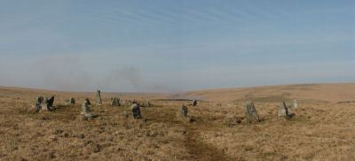
Erme Cairn Circle
Prehistoric Dartmoor Walks: Dartmoor Site: Upper Erme Stone Row & Cairn Circle
OS Map: SX 63517 64442
HER: MDV4310
Megalithic Portal: 533
Alternate name: Upper Erme stone row Cairn Circle
Short Name: CC The Dancers
Butler map: 55.7.1
Grinsell: COR 10
Turner: G16
DPD: 71
Dimensions (m): 15.8 x 0.3
Notes: An impressive cairn circle (often referred to as a stone circle) on Stall Moor which is also known as The Dancers, Kiss in the Ring or Stall Moor Circle. "Round barrow with retaining circle at south end of longest Dartmoor stone row. Diameter 16m, height of mound 0.3m." Lethbridge pp.70-71, diagram p.71
Nearest Bus Stop: Cornwood Crossways (5.7 km) [Route: 59]
Nearby sites: SX 63517 64442
Fernworthy (SW) Encircled Cairn
Prehistoric Dartmoor Walks: Dartmoor Site: Fernworthy Ceremonial Complex
OS Map: SX 65483 84101
HER: MDV14885
Megalithic Portal: 35827
Alternate name: Fernworthy 3 Encircled Cairn
Short Name: EC Fernworth 3
Butler map: 35.15.3
Butler Vol 5: p.36 & Fig.14
Grinsell: LYD 21
Turner: F25
Dimensions (m): 6.0 x 0.3
Notes: Newman Barrow A. Small turf-covered cairn at the northern end of the western double stone row south of Fernworthy stone circle forming part of the Froggymead ceremonial complex. It measures 6.5 metres in diameter and has a central hollow resulting from excavation in 1898. Two rings of orthostats, 7m and 5m diameter, around cairn 4.5m diameter and 0.2m high (Turner). It once had a retaining circle of small stones but only three were visible in 2013. DNP Post 2D. Turner F25.
Nearest Bus Stop: Warren House Inn (3.7 km) [Route: 171]
Nearby sites: SX 65483 84101

Fernworthy Barrow C Cairn
OS Map: SX 65485 84047
HER: MDV14887
Megalithic Portal: 35829
Alternate name: Fernworthy 4 Cairn
Short Name: CN:Fernworth 4
Butler map: 35.15.4
Grinsell: LYD 22
Dimensions (m): 8.0 x 0.3
Notes: Newman Barrow C.Cairn forming part of the cermonial complex at Froggymeade. Sitated at the southern end of the eastern stone row to the south of Fernworthy stone circle. It was excavated in 1898 but had previously been disturbed. Only one small flint flake was found.
Nearest Bus Stop: Warren House Inn (3.7 km) [Route: 171]
Nearby sites: SX 65485 84047

Fernworthy E. Encircled Cairn
Prehistoric Dartmoor Walks: Dartmoor Site: Fernworthy Ceremonial Complex
OS Map: SX 65561 84090
HER: MDV6560
Megalithic Portal: 3234
Alternate name: Fernworthy 5 Encircled Cairn
Short Name: EC:Fernworth 5
Butler map: 35.15.5
Grinsell: LYD 24
Turner: F4
DPD: 138
Dimensions (m): c.6.0 x 0.6
Notes: Newman Barrow D. "5.8m diameter. Has 3 stones spaced on the east side. A beaker, flint knife, dress fastener and a piece of bronze were discovered when the cairn was excavated in 1898". The crushed beaker. When reconstructed it became one of Dartmoor's most important Bronze Age finds and is now on display in Plymouth City Museum along with the other artifacts retrieved. DNP Post 7D.
Nearest Bus Stop: Warren House Inn (3.7 km) [Route: 171]
Nearby sites: SX 65561 84090
Fernworthy N. Cairn
OS Map: SX 65539 84333
HER: MDV6563
Megalithic Portal: 35828
The Stone Rows of GB: Fernworthy 1
PMD: Fernworthy N Row
Alternate name: Fernworthy 1 Cairn
Short Name: CN Fernworth 1
Butler map: 35.15.1
Grinsell: LYD 20
Notes: Newman Barrow E. Remains of a small cairn at the northern terminus of the double stone row north of the Fernworthy stone circle. The cairn has been damaged by past tree planting and the feature can be hard to identify as the remains are low to the ground and spread far beyond its original form. Radcliffe quotes Butler and also refers to HER/SMR number 6556 or 6562. "The 1898 plan shows a mound with a stone alongside as its northern terminus, probably a cairn, 1, with a retaining circle. This stone is still visible together with another at an angle, perhaps one side of a cist ..." (Butler Vol 2 pp. 164-5)
Nearest Bus Stop: Warren House Inn (3.9 km) [Route: 171]
Nearby sites: SX 65539 84333
Fordsland Ledge Chambered Cairn
OS Map: SX 57581 88897
HER: MDV3169
Megalithic Portal: 36418
PMD: Fordsland Ledge
Short Name: CN Fordsland
Butler map: 42.3
Butler Vol 5: p.160 & Fig.98
Grinsell: OKE 4
Dimensions (m): 10 x 0.4
Notes: " In a crest position on Fordsland Ledge at 581.0m OD is the disturbed remains of a turf-and-heather-covered cairn. It measures 12.2m by 13.9m in diameter and is 1.1m high. In a hollow in the centre are a number of large stones suggesting the possibility of a former cist or even a chamber, utilizing the natural outcrop as its base." "The large stones visible in the centre of the feature are somewhat unusual and not typical of a cist-like structure. The presence of a chamber is very doubtful and it is more likely that the interior of the cairn has, at some point, been remodelled to create a small shelter."
Nearest Bus Stop: Sourton Windard Terrace (4.4 km) [Route: 118]
Nearby sites: SX 57581 88897
Foxtor Mires W. Platform Cairn Circle and Cist
OS Map: SX 60780 70484
HER: MDV12967
Megalithic Portal: 24008
PMD: Whiteworks
Short Name: CT FoxTorMireW
Butler map: 64.6
Dixon Cist #: 135
Turner: E19
DPD: 97
Dimensions (m): 5.0 x 0.5 C
Notes: "Seven large orthostats of the retaining circle remain in situ on the south and south-east side (see plan). The cist is entirely below ground level to a depth of 0.7m and measures 1.0m by 0.6m. The two endstones and two sidestones are visible; a stone which may be the coverstone lies on the ground to one side". Lethbridge diagram p.93, photos bottom p.97. Butler Foxtor Mires W. - Vol. 4. Map 64.6 (diagram p.222). Cairn with kerb circle, visible on N, E & W sides, with a central cist.
Nearest Bus Stop: Princetown Dartmoor Visitor Centre (3.5 km) [Route: 98,171,172]
Nearby sites: SX 60780 70484
Ger Tor Platform Cairn Circle
OS Map: SX 54627 83330
HER: MDV11809
Megalithic Portal: 45645
Alternate name: Ger Tor Summit Platform Cairn Circle
Short Name: PC:Ger Tor 1
Butler map: 32.4
Turner: E24
Dimensions (m): 6.0 x 0.4
Notes: "Cairn on ger tor, n side. Platform circle with ring of kerb stones 4.6m internal diam, enclosing flat-topped cairn 0.2m high. Much disturbed (turner)."
UPDATE 31/12/2022. HER link changed from the now deleted MDV48908. NGRs updated accordingly to match MDV11809.
Nearest Bus Stop: Dartmoor Inn (3.0 km) [Route: 118]
Nearby sites: SX 54627 83330
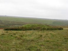
Giant's Basin Cairn
Prehistoric Dartmoor Walks: Dartmoor Site: Drizzlecombe Ceremonial Complex (Photos 1)
OS Map: SX 59202 66945
HER: MDV3372
Megalithic Portal: 538
Alternate name: Giant's Basin Cairn
Short Name: CN GiantsBasin
Butler map: 49.19.5
Grinsell: SHE 33
DPD: 40
Dimensions (m): 22.0 x 3.5
Notes: The Giant's Basin is an impressive but heavily disturbed cairn lying adjacent to the Drizzlecombe Stone Rows. It measures approximately 22 metres in diameter, a maximum of 3 metres high and is partially turf-covered. An approximately 2.5 metre wide reed-covered slight depression around its circumference suggests a silted ditch. Much of the central part of the cairn has been removed to a depth of 1.65m and most of excavated material in the form of fist-sized stones and small boulders has been deposited around the rim of the mound. Lethbridge pp.38-42, diagram p.38.
Grinsell [Folklore 1976]: This is named from the large crater in the top where it has been opened.
Nearest Bus Stop: Meavy Primary School (4.8 km) [Route: 56]
Nearby sites: SX 59202 66945
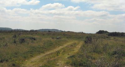
Giant's Grave Cairn
Prehistoric Dartmoor Walks: Dartmoor Site: Mardon Down Stone Circle & Cairns
OS Map: SX 76768 87459
HER: MDV8309
Megalithic Portal: 22314
Alternate name: Mardon Down 4 Cairn
Short Name: CN Mardon 4
Butler Vol 5: p.147 & Fig.89
Grinsell: MOR 3
DPD: 149
Dimensions (m): 20.5 x 0.6
Notes: Remains of a cairn which was largely destroyed in the early 19th century when material from it was removed for road building. Now a turf-covered mound 20.5 metres diameter and 0.6 metres high.
Grinsell [Folklore 1976]: Remains of an oval cairn with retaining kerb, on Mardon Down. The name dates from before 1823. Jones 1823, 3.
Nearest Bus Stop: Moretonhampstead Court Street Car Park (2.1 km) [Route: 171,173]
Nearby sites: SX 76768 87459

Gibbet Hill 1 Stone Ring Cairn Circle
OS Map: SX 49975 80875
HER: MDV22751
Megalithic Portal: 45828
Short Name: RC:GibbetHill1
Grinsell: MAR 1
Dimensions (m): 22
Notes: "A stone ring, probably the remains of a ring cairn, 430 metres south-west of Gibbet Hill summit. This site is on the local list of Nationally Important Dartmoor sites. Dimensions noted by Greeves as approximately 22 metres in external diameter with the ring bank being a maximum of approximately 7.0 metres wide by approximately 0.5 metres in height."
Photo and annotated photo reproduced with kind permision by Steve Grigg. Copyright remains with Steve. See also coverage on Dartmoor Explorations: Gibbet Hill Mine.
Nearest Bus Stop: Mary Tavy War Memorial (1.3 km) [Route: 118]
Nearby sites: SX 49975 80875

Gibbet Hill 2 Stone Ring Cairn Circle
OS Map: SX 50298 81148
HER: MDV3202
Short Name: RC:GibbetHill2
Dimensions (m): 17.5 x 0.4
Notes: "A barrow was recorded somewhere near the summit of Gibbet Hill in 1891. Greeves recorded two ring cairns here in 1993 one of which is likely to be the same feature. This ring cairn lies around 20 metres west of the trig point. The cairn has a disturbed ring bank and measures about 18 metres in diameter."
This record was missing and added after correspondence from Steve Grigg on 22/11/2024. Photo and annotated photo reproduced with kind permision by Steve Grigg. Copyright remains with Steve. See also coverage on Dartmoor Explorations: Gibbet Hill Mine.
Nearest Bus Stop: Mary Tavy War Memorial (1.6 km) [Route: 118]
Nearby sites: SX 50298 81148

Gibbet Hill 3 Stone Ring Cairn Circle
OS Map: SX 50349 81183
HER: MDV124454
Alternate name: Gibbet Hill 3 Stone Ring Cairn Circle
Short Name: RC:GibbetHill3
Dimensions (m): 15
Notes: "Recorded in 1993 by Greeves around 40 metres north-east of the trig point at the summit of the hill. A cairn in the form of a very slight sunken ring about 15 metres in diameter."
This record was missing and added after correspondence from Steve Grigg 22/11/2024. Photo and annotated photo reproduced with kind permision by Steve Grigg. Copyright remains with Steve. See also coverage on Dartmoor Explorations: Gibbet Hill Mine.
Nearest Bus Stop: Mary Tavy War Memorial (1.6 km) [Route: 118]
Nearby sites: SX 50349 81183
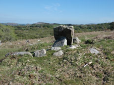
Gidleigh - North Chambered Tomb
OS Map: SX 65867 88956
HER: MDV6212
Megalithic Portal: 45581
PMD: Gidleigh North Chambered Cairn
Alternate name: Buttern Hill 2 Chambered Tomb
Short Name: NT Gidleigh N
Butler map: 38.7.2
Butler Vol 5: p.157
Grinsell: A:GID 1
Notes: "A chambered cairn located on an east facing slope of Buttern Hill. The cairn mound measures 26 metres long and 9 metres wide and stands up to 1 metre high. Several set stones at the western end of the mound represent the remains of a passage leading towards a chamber."
Nearest Bus Stop (Minor): Wonson Telephone Box (1.6 km) [Route: 670]
Nearest Bus Stop (Major): Ramsley (4.4 km) [Route: 670,671,6A]
Nearby sites: SX 65867 88956

Gidleigh - South Chambered Cairn
OS Map: SX 65534 88378
HER: MDV20318
Alternate name: Buttern Hill 3 Chambered Cairn
Short Name: CN Gidleigh S2
Dimensions (m): 14 x 5.8 x 0.9
Notes: HER quoting Turner: Possible chambered cairn recorded at SX 6554 8837 on Gidleigh Common. A simple chamber cairn with evidence of a chamber (two fallen large stones at south, south-west end). Although many large boulders still remain in position, cairn has obviously been heavily robbed for later enclosure lying to the north.
Measurements: length 15.5m, width 3.5 to 5.5m, height 0.8m. This features differs from the other Gidleigh chamber tombs (North and South) as there is no evidence for a passage. It appears to be on the same axis and similar to the Corringdon ball example. Orientation south, south-west by north, north-east.
Nearest Bus Stop (Minor): Wonson Telephone Box (2.2 km) [Route: 670]
Nearest Bus Stop (Major): Chagford The Square (4.6 km) [Route: 173,178,671]
Nearby sites: SX 65534 88378
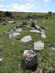
Gidleigh - South Chambered Tomb
OS Map: SX 6567 8855
HER: MDV6213
Megalithic Portal: 10040
PMD: Gidleigh South Chambered Cairn
Alternate name: Buttern Hill 1 Chambered Tomb
Short Name: NT Gidleigh S
Butler map: 38.7.1
Butler Vol 5: p.157
DPD: 147
Dimensions (m): 8.0 x 6.0 x 0.5
Notes: "The remains of a Neolithic chambered cairn on Buttern Hill. The cairn survives as a mound standing up to 0.6 metres high. The chamber and associated entrance passage include seven orthostats, two of which form a portaled entrance. A leat runs to the west of the cairn."
Nearest Bus Stop (Minor): Wonson Telephone Box (2.0 km) [Route: 670]
Nearest Bus Stop (Major): Chagford The Square (4.5 km) [Route: 173,178,671]
Nearby sites: SX 6567 8855
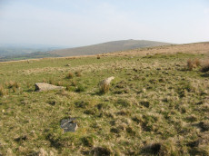
Glasscombe Corner Cairn Circle
Prehistoric Dartmoor Walks: Dartmoor Walk: The Erme East stone rows
OS Map: SX 66100 60802
HER: MDV49561
Megalithic Portal: 1951
PMD: Glasscombe Corner Stone Row
Alternate name: Glasscombe Corner stone row Cairn Circle
Short Name: CN GlasscombW1
Butler map: 56.12
Grinsell: UGB 5
Turner: G28
Dimensions (m): 3.5
Notes: Lower end of stone row. "A stone row, 300 yds S 41o W from Glasscombe Corner. The southern 368 feet are a double row and the northern 212 feet 6 inches a single row. The northern part has lost no stones and the change from double to single is abrupt and complete. At the S.W. end are the remains of a cairn and at the NE. end is a retaining circle with many of the stones fallen. It would appear thus that there was a grave at either end of the row. "
Nearest Bus Stop: South Brent Pool Park (4.2 km) [Route: 38]
Nearby sites: SX 66100 60802

Goadstone Pond Ancient Pool
OS Map: SX 55706 70663
HER: MDV28232
Short Name: PO:GoadsStone
Dimensions (m): 30 x 28m
Notes: "Pool on the summit of the hill near a stone row. Some of the stones from the double stone row appear to have been lost in the pool. Previously incorrectly identified from aerial photograph as an enclosure. One of over 40 pools on Dartmoor thought to have originated in the Prehistoric period."
Worth and Butler refer to this as Goatstone Pool. There is a very interesting discussion of both the origin of the name and of the cairns and stone rows on DartmoorCam: Sharpitor. See also Legendary Dartmoor: Dartmoor's Goadstone
Nearest Bus Stop: Walkhampton Memorial (2.6 km) [Route: 55,56]
Nearby sites: SX 55706 70663
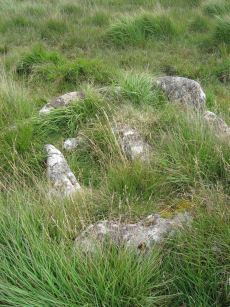
Goldsmith's Cross E.2. Ring Setting Cairn and Cist
OS Map: SX 61804 70321
HER: MDV6342
Megalithic Portal: 42707
PMD: Fox Tor Mires cairn
Alternate name: Goldsmith's Cross E.2 Ring Setting Cairn and Cist
Short Name: CT GoldsmithE2
Butler map: 64.5.2
Dixon Cist #: 113
Grinsell: LYD 95
Turner: D23
DPD: 95
Dimensions (m): 2.5 C
Notes: "West end stone of cist leans slightly inwards, otherwise a perfect cist measuring 0.75m NW-SE by 0.5m wide by 0.4m deep. Retaining circle of 7 stones averaging 0.4m high. No coverstone or barrow". Lethbridge diagram p.93, photo bottom right p.95 and on p.96. Turner D23 (Fox Tor Mire) - Proc Devon Arch Soc 48 (diagram p.45). Butler Goldsmith's Cross E. 2 - Vol. 4. Map 64.5 (Cairn 2 - diagram p.221).
Nearest Bus Stop: Princetown Dartmoor Visitor Centre (4.2 km) [Route: 98,171,172]
Nearby sites: SX 61804 70321
Great Gnats Head Cairn
OS Map: SX 61657 67908
HER: MDV13177
Megalithic Portal: 45861
Alternate name: Great Gnats Head Summit 4 Cairn
Short Name: CN GreatGnats4
Butler map: 50.5.4
Grinsell: SHA 2
Dimensions (m): 10.0 x 0.5
Notes: "A Bronze Age summit cairn, now badly disturbed by a conical walkers cairn built in the SW quadrant. It measures 8.5m in diameter, the outer slope is 0.3m high and the interior is scooped to a depth of 0.3m -small boulders and upright slabs are visible. The conical cairn is 2.6m in diameter and 1.5m high." Butler Volume 3 Map 50.5.
Nearest Bus Stop: Princetown Dartmoor Visitor Centre (6.2 km) [Route: 98,171,172]
Nearby sites: SX 61657 67908
Great Trowlesworthy Cairn Circle
OS Map: SX 5839 6459
HER: MDV28533
Short Name: CC:Trowles
Butler map: 51.5
Notes: "An incomplete circle of largely recumbent granite boulders on the gently sloping W flank of Lee Moor. The ring measures 9.9m north-south by 9.4m with a gap in the eastern side. The interior lies at the same level as the surrounding ground surface." See Butler Volume 3 pp.162-3, Map 51, Figure 51.6 'Ring of stones' shown to the west of Settlement 'B' at 'Upper Spanish Lake'. Not listed in Butler's cairn listing.
Nearest Bus Stop: Lee Moor Clearview (2.9 km) [Route: 59]
Nearby sites: SX 5839 6459
Green Hill Cairn
OS Map: SX 63665 67796
HER: MDV5106
Megalithic Portal: 2143
PMD: Green Hill
Short Name: CN GreenHill
Butler map: 55.7.4
Grinsell: LYD 101
DPD: 72
Barrow Report: 14
Dimensions (m): 9.0 x 0.4
Notes: "Cairn on the summit of Green Hill is the northern terminal of the stone row (SX 66 NW 20 but see also SX 66 NW 101 for cairn which may extend the row). Diameter 9m, height 0.7m. The possible remains of a central cist are indicated by a group of large stone slabs".
Nearest Bus Stop: Dartmeet Badgers Holt (6.5 km) [Route: 172]
Nearby sites: SX 63665 67796
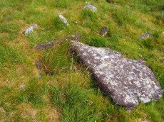
Grim's Grave (S) Platform Cairn Circle and Cist
Prehistoric Dartmoor Walks: Dartmoor Site: Guide to the Langcombe Brook & Deadman's Bottom Cists
OS Map: SX 61251 66313
HER: MDV5126
Megalithic Portal: 14929
PMD: Langcombe Brook S.
Alternate name: Langcombe Brook 4 Platform Cairn Circle and Cist
Short Name: CT GrimsGraveS
Butler map: 50.3.4
Butler Vol 5: p.160
Dixon Cist #: 47
Grinsell: SHA 18
Turner: E8
DPD: 46
Barrow Report: 50
Dimensions (m): 8.0 x 0.4 C
Notes: Lethbridge p.46 Langcombe Cist H - diagram p.43. Butler Langcombe Brook 4 (Cairn 4) - Vol. 3. Map 50.3 (pp.148-54 general plan of Langcombe Brook cairns p.151, diagram of Langcombe cists p.153).
Nearest Bus Stop: Lee Moor Clearview (6.0 km) [Route: 59]
Nearby sites: SX 61251 66313
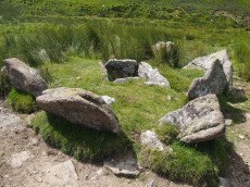
Grims Grave Ring Setting Cairn and Cist
Prehistoric Dartmoor Walks: Dartmoor Site: Guide to the Langcombe Brook & Deadman's Bottom Cists
OS Map: SX 61245 66422
HER: MDV5083
Megalithic Portal: 14930
PMD: Grim's Grave
Short Name: CT Grims Grave
Butler map: 50.3.3
Dixon Cist #: 14
Grinsell: SHA 13
Turner: D20
DPD: 46
Barrow Report: 12 20 56
Dimensions (m): 5.5 x 0.6 C
Notes: "A ring cairn set into the slope, c 4.5m in diameter, with a cist at its centre. The cairn consists of a stony, turf-covered mound contained by a ring of upright slabs, most leaning outwards, c 1m in height; the mound rises to c 0.4m at top of cist. The cist, box dimensions c 0.8m x 0.95m internally, is formed from edge-set slabs. One side slab is c 1.7m long, 0.9m wide and 0.2m thick. The monument survives in a very good condition though the cover-stone is missing - this is possibly the slab that now lies on the down-slope side." Lethbridge p.46 Langcombe Cist G (Grim's Grave) - diagram p.43. Butler Vol. 3. Map 50.3 Cairn 3 (pp.148-54 general plan of Langcombe Brook cairns p.151, diagram of Langcombe cists p.153, photo pp.94-96).
Grinsell [Folklore 1976]: The name Grim's Grove, or Grim's Grave, is shown near here on the surveys of Dartmoor Forest of 1240 and 1609, and was identified as this site by C. Spence Bate, an identification which has had supporters and critics. Bate 1872, 531-2; Crossing 1912/1965, 408.
Nearest Bus Stop: Lee Moor Clearview (6.1 km) [Route: 59]
Nearby sites: SX 61245 66422
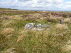
Grimslake Platform Cairn Circle and Cist
OS Map: SX 70414 81166
HER: MDV8744
Megalithic Portal: 44533
The Stone Rows of GB: Grimslake Cist
PMD: Hookney Down
Alternate name: Grimslake Mire Platform Cairn Circle and Cist
Short Name: CT Grimslake
Butler map: 20.16
Butler Vol 5: p.219 & Fig.153
Dixon Cist #: 100
Grinsell: N.BOV 3
Turner: E18
DPD: 128
Dimensions (m): 6.4 x 0.3 C
Notes: Cairn with kerb circle and central cist. Lethbridge diagram p.127 and photo top p.128. Butler Grimslake Mire - Vol. 1. Map 20.16 (diagram p.147).
Nearest Bus Stop: Warren House Inn (3.0 km) [Route: 171]
Nearby sites: SX 70414 81166
Gripper's Hill Stone Ring Cairn Circle
OS Map: SX 68650 65503
HER: MDV5224
Megalithic Portal: 45822
Alternate name: Gripper's Hill Summit 1 Stone Ring Cairn Circle
Short Name: RC Grippers 1
Butler map: 57.31.1
Grinsell: DEA 4
Turner: A9
Dimensions (m): 11.0 x 0.7
Notes: "Ring cairn on Gripper's Hill; stone ring 14.0 metres in diameter internally, with bank 1.2 meters wide and 0.3 meters high." NMR A
Nearest Bus Stop: Buckfast Higher Mill Lane (5.5 km) [Route: 88]
Nearby sites: SX 68650 65503

Gutter Tor N. Platform Cairn Circle and Cist
OS Map: SX 57676 67137
HER: MDV4015
Megalithic Portal: 17511
PMD: Gutter Tor N.
Alternate name: Gutter Tor 3 Platform Cairn Circle and Cist
Short Name: CT GutterTor 3
Butler map: 49.5.3
Dixon Cist #: 86
Grinsell: SHE 9
Turner: E38
DPD: 33
Barrow Report: 59
Dimensions (m): 4.0 x 0.3 C
Notes: "A cairn with cist and a double circle of stones situated on the north-facing slope of Gutter Tor at about 305m OD. The end-stones and side-stones of the cist are in situ but the coverstone is missing." Lethbridge p.32-33 Cist A. Duplicated by HER 4045.Note Garmin NGR. (Previously listed as Gutter Tor No.2)Butler Gutter Tor 3 - Vol. 3. Map 49.5 (diagram p.118 "North cairn and cist").
Nearest Bus Stop: Meavy Primary School (3.3 km) [Route: 56]
Nearby sites: SX 57676 67137
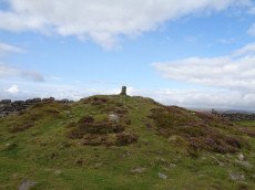
Hameldown Beacon Cairn
OS Map: SX 70830 78922
HER: MDV7435
Megalithic Portal: 16635
Alternate name: Hamel Down Beacon Cairn
Short Name: CN HamelBeacon
Butler map: 20.13
Butler Vol 5: p.166 & Fig.106
Grinsell: WID 6
Dimensions (m): 17.0 x 1.4
Notes: A grass covered cairn which was alleged to have been used as a beacon in medieval period. Butler Volume 1 Map 20.13
Nearest Bus Stop (Minor): Widecombe in the Moor Car Park (2.3 km) [Route: 271]
Nearest Bus Stop (Major): Warren House Inn (3.9 km) [Route: 171]
Nearby sites: SX 70830 78922
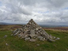
Hameldown Tor Cairn
OS Map: SX 70318 80574
HER: MDV8768
Megalithic Portal: 16628
Short Name: CN HameldonTor
Butler map: 20.8
Butler Vol 5: p.166 & Fig.106
Grinsell: MAN 2
Turner: E54
Dimensions (m): c.13.0 x 0.4
Notes: Cairn on hameldown tor.(diam 14m. Heig 700mm)a denuded cairn with kerb of large stones on northern half only. Pillar and conical mound of small stones of evidently modern date. Remainder of kerb visible (11 stones). Remainder of cairn largely grassed over but head sized granite boulders visible (os trig. Point and recent mound of stones on top). Butler Volume 1 Map 20.8.
Nearest Bus Stop: Warren House Inn (2.9 km) [Route: 171]
Nearby sites: SX 70318 80574
Hangershell Ancient Pool
OS Map: SX 65824 59588
HER: MDV127209
Short Name: PO:Hangershell
Dimensions (m): 13 x 9.3m
Notes: "A pool, one of over 40 such 'sacred' pools identified on Dartmoor that are thought to have potentially been designed during the prehistoric period. Lies near a prehistoric cairn. Sub-rectangular shallow pit of 12 metres by 16 metres and 0. 5 metres deep. Drained to west and east edges which show the remains of peat cutting"
Nearest Bus Stop: Ivybridge BP Garage (Stop B) (4.1 km) [Route: 38]
Nearby sites: SX 65824 59588
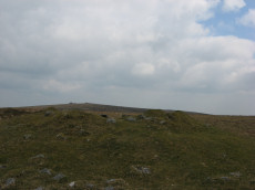
Hangershell Rock (East of) Cairn
OS Map: SX 65662 59404
HER: MDV3124
Megalithic Portal: 4615
Alternate name: Butterdon Ridge N. Cairn
Short Name: CN Butterdon 2
Butler map: 53.8.2
Grinsell: UGB 15
Barrow Report: 61
Dimensions (m): 18.0 x 1.5
Notes: East of hangershell rock large cairn with hollow centre. Diameter 17m, height 1.2m.
Nearest Bus Stop: Ivybridge BP Garage (Stop B) (3.8 km) [Route: 38]
Nearby sites: SX 65662 59404
Hangingstone Hill Cairn
OS Map: SX 61704 86136
HER: MDV4377
Megalithic Portal: 45858
Alternate name: Hangingstone Hill 1 Cairn
Short Name: CN:Hangingst 1
Butler map: 41.5
Grinsell: LYD 6
Dimensions (m): c.18.0 x 1.8
Notes: "A low, flat-topped cairn located on the summit of Hangingstone Hill. It measures 17.5m north to south by 15.0m at base and is maximum 1.4m high. It is apparently composed of medium sized granite slabs and boulders with a thin and patchy covering of turf. An ovoid hollow, 3.1m north to south by 2.0m and 0.3m deep, containing the stump of the flag pole (noted in the Devon SMR) lies slightly east of centre. A Range Wardens' hut encroaches on the southern side of the cairn. A considerable amount of peat has built up or has been deposited on the eastern side elongating the mound by some 10m in this direction." Partially excavated and repaired in 2016, see HER record. Butler Map 41.5 (Vol 2).
Nearest Bus Stop (Minor): Wonson Telephone Box (6.6 km) [Route: 670]
Nearest Bus Stop (Major): Warren House Inn (7.7 km) [Route: 171]
Nearby sites: SX 61704 86136
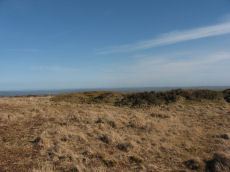
Harbourne Head A Stone Ring Cairn Circle
OS Map: SX 69119 65039
HER: MDV5802
Megalithic Portal: 42628
Alternate name: Parnell's Hill 1 Stone Ring Cairn Circle
Short Name: RC Harbourne A
Butler map: 57.31.6
Grinsell: DEA 8
Turner: A55
Dimensions (m): 24.0 x 1.2
Notes: "One of a pair of cairns on Gripper's Hill." " A ring cairn, Harbourne Head consisting of a stone ring 17.0 metres in diameter internally, with bank 1.8 metres wide and 0.4 metres high. Cairn contains a central mound, 12.0 metres in diameter, 0.8 metres high. This type of cairn is referred to as a Dartmoor version of the Wessex bell barrows."
Nearest Bus Stop: Buckfast Higher Mill Lane (5.2 km) [Route: 88]
Nearby sites: SX 69119 65039
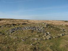
Harbourne Head B Embanked Cairn Circle
OS Map: SX 69147 65009
HER: MDV5803
Megalithic Portal: 3279
Alternate name: Parnell's Hill 2 Embanked Cairn Circle
Short Name: CC Harbourne B
Butler map: 57.31.7
Grinsell: DEA 10
Turner: B12
Dimensions (m): 23.0 x 1.5
Notes: "Embanked stone circle; annular bank of earth and/or stones with inner kerb of orthostats. Measures 15.0 metres in diameter internally with bank 2.0 metres wide and 0.5 meters high with a cairn in the centre, 9.0 metres in diameter and 1.1 metres in height. The west and south sides have been disturbed."
Nearest Bus Stop: South Brent Pool Park (5.2 km) [Route: 38]
Nearby sites: SX 69147 65009
Harford Gate Encircled Cairn
Prehistoric Dartmoor Walks: Dartmoor Walk: The Neolithic tombs of Cuckoo Ball & Corringdon Ball
OS Map: SX 64494 59677
HER: MDV13092
Megalithic Portal: 3281
Alternate name: Piles Hill S.W.9 Encircled Cairn
Short Name: EC HarfordGate
Butler map: 53.11.9
Grinsell: HAR 26
Turner: F3
Dimensions (m): 6.5 x 0.3
Notes: "This cairn occupies a prominent position on the brow of a hill and is one of two north-west of Harford Moor Gate. Measures 13 metres in diameter and 0.3 metres in height, it is turf-covered and has a retaining kerb." Visited by the author 20/04/19. Garmin gives location as SX 64495 59682 but a Lidar source gives location as SX 64494 59677 - which matches closely the HER NGR.
Nearest Bus Stop: Ivybridge BP Garage (Stop B) (3.7 km) [Route: 38]
Nearby sites: SX 64494 59677

Hart Tor North Encircled Cairn
Prehistoric Dartmoor Walks: Dartmoor Site: Hart Tor Stone Row & Cairn Circle
OS Map: SX 57718 71716
HER: MDV49460
Megalithic Portal: 978
PMD: Harter N Stone Row
Alternate name: Hart Tor double stone row Encircled Cairn
Short Name: EC Hart Tor N
Butler map: 46.5
Butler Vol 5: p.39 & Fig.16
Grinsell: WAL 12
Turner: F12
DPD: 25
Dimensions (m): 9.3 x 0.8
Notes: The cairn circle is 9.3m across and consists of 14 tall slabs some of which have fallen. Wilkinson noticed concentric stone circles - which can't be seen today although there is clearly an inner circular mound. NMR A.
Nearest Bus Stop: Princetown Dartmoor Visitor Centre (2.2 km) [Route: 98,171,172]
Nearby sites: SX 57718 71716
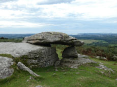
Hawk's Tor Rock Shelter
OS Map: SX 55348 62514
HER: MDV2504
Megalithic Portal: 45856
PMD: Hawk's Tor - Possible Chambered Tomb
Alternate name: Hawk's Tor Rock Shelter
Short Name: RS HawksTor
Grinsell: A:SHA 2
DPD: 56
Barrow Report: 60
Notes: Natural feature Hawk's Tor rock shelter - resembles tomb. "At the summit stands a rock shelter, v shaped in plan with a coverstone. Rowe referred to it as a cromlech. R. N. Worth called it a natural grouping of rocks. Mr. Beckerlegge on examining the coverstone, found a similar vein of quartz in the coverstone as in the rocks of the v shaped shelter, but running in a different direction. The coverstone must have been levered or swung in an anti-clockwise direction through an angle of 90 degrees to make a shelter of what was previously an opening between two vertical walls of rock". Might be prehistoric, could be from Roman period or later. Lethbridge p.54-6 Hawk's Tor Cromlech / Rock Shelter - diagram p.55, photo p.56. See also: The Modern Antiquarian.
Nearest Bus Stop: Wotter Methodist Church (0.8 km) [Route: 59]
Nearby sites: SX 55348 62514
Haytor Down Stone Ring Cairn Circle
OS Map: SX 7670 7811
HER: MDV48849
Megalithic Portal: 45820
Alternate name: Haytor Down N.1 Stone Ring Cairn Circle
Short Name: RC:Haytor N1
Butler map: 2.6.1
Butler Vol 5: p.190 & Fig.132
Turner: A7
Dimensions (m): 17
Notes: "Ring cairn on Haytor Down. Stone ring 21.0 meters internal diameter, with bank 1.5 meters wide and 0.4 meters high. Modern entrance." One of group of 4 cairns - see Butler for diagram in Vol 1 and 5.
Nearest Bus Stop (Minor): Haytor Vale Moorlands House (0.8 km) [Route: 193,271]
Nearest Bus Stop (Major): Lustleigh Bishops Stone (3.9 km) [Route: 178]
Nearby sites: SX 7670 7811
Haytor Down North A Ancient Pool
OS Map: SX 76269 78331
HER: MDV127210
Short Name: PO:HaytorDownA
Dimensions (m): 18 x 14m
Notes: "A pool measuring 18 by 14m. One of over 40 such 'sacred' pools identified on Dartmoor that are thought to have potentially been designed during the prehistoric period. Lies near a prehistoric reave and cairn."
Nearest Bus Stop (Minor): Haytor Vale Moorlands House (1.1 km) [Route: 193,271]
Nearest Bus Stop (Major): Lustleigh Bishops Stone (4.0 km) [Route: 178]
Nearby sites: SX 76269 78331
Haytor Down North B Ancient Pool
OS Map: SX 76493 78182
HER: MDV127211
Short Name: PO:HaytorDownB
Dimensions (m): 5m
Notes: "A pool measuring around 5m. One of over 40 such 'sacred' pools identified on Dartmoor that are thought to have potentially been designed during the prehistoric period. Lies near a prehistoric cairn and enclosure."
Nearest Bus Stop (Minor): Haytor Vale Moorlands House (0.9 km) [Route: 193,271]
Nearest Bus Stop (Major): Lustleigh Bishops Stone (4.0 km) [Route: 178]
Nearby sites: SX 76493 78182
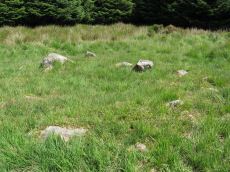
Hemstone Rocks Platform Cairn Circle
OS Map: SX 64856 83806
HER: MDV6730
Megalithic Portal: 45619
PMD: Hemstone Rocks
Alternate name: Hemstone Rocks N.3 Platform Cairn Circle
Short Name: PC Hemstone N3
Butler map: 35.7.3
Grinsell: LYD 17b
Turner: E12
Notes: Next to Turner ring cairn D9. "Remains of a cairn 8.0 metres diameter and up to 0.2 metres high to the north of the hut settlement. There are two pits cut into it, probably the result of work carried out by the Dartmoor Exploration Committee in 1901." DNP Site 9F.
Nearest Bus Stop: Warren House Inn (3.8 km) [Route: 171]
Nearby sites: SX 64856 83806
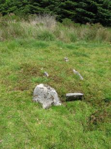
Hemstone Rocks Ring Setting Cairn and Cist
OS Map: SX 64852 83850
HER: MDV6729
Megalithic Portal: 52522
PMD: Hemstone Rocks
Alternate name: Hemstone Rocks N.2 Ring Setting Cairn and Cist
Short Name: CT Hemstone N2
Butler map: 35.7.2
Dixon Cist #: 148
Grinsell: LYD 17a
Turner: D9
Dimensions (m): 6.2
Notes: There are 3 cairns in the vicinity and they are according to Newman [2013] impossible to match up with the old reports. These cairns were excavated by Baring-Gould in 1900. A flint flake was found in the cist. There is also a rectangular pit in this cairn which could be from the 1900 excavation. See also: MDV48854. DNP Site 8F. Butler Hemstone Rocks N. 1 - Vol. 2. Map 35.7. Central cist. Next to Turner Platform Circle E12.
Nearest Bus Stop: Warren House Inn (3.9 km) [Route: 171]
Nearby sites: SX 64852 83850
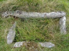
Hentor (Shavercombe C) Ring Setting Cairn and Cist
Prehistoric Dartmoor Walks: Dartmoor Site: Guide to the Hentor & Shavercombe Brook Cists
OS Map: SX 59606 65893
HER: MDV3503
Megalithic Portal: 45728
PMD: Hen Tor Warren 6
Alternate name: Hen Tor N.6 Ring Setting Cairn and Cist
Short Name: CT Hen Tor N 6
Butler map: 49.22.6
Dixon Cist #: 52
Grinsell: SHA 27
Turner: D14
DPD: 49
Barrow Report: 52 56
Dimensions (m): 4.0 x 0.2 C
Notes: "The cairn is 5.2m in diameter and 0.7m high with the remains of a retaining circle. The cist is 1.1m by 0.6m and 0.6m deep with a stone floor; it is aligned north west/south east". Lethbridge p.49 Shavercombe Cist A - diagram 49. Butler Hen Tor 6 (Cairn 6) - Vol. 3. Map 49.22 (general plan of Hen Tor with diagram of cists pp.146-7).
Nearest Bus Stop: Lee Moor Clearview (4.7 km) [Route: 59]
Nearby sites: SX 59606 65893
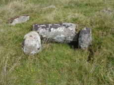
Hentor (Shavercombe) Platform Cairn Circle and Cist
Prehistoric Dartmoor Walks: Dartmoor Site: Guide to the Hentor & Shavercombe Brook Cists
OS Map: SX 59372 65801
HER: MDV3479
Megalithic Portal: 45661
PMD: Hen Tor Warren 2
Alternate name: Hen Tor N.2 Platform Cairn Circle and Cist
Short Name: CT Hen Tor N 2
Butler map: 49.22.2
Dixon Cist #: 11
Grinsell: SHA 26
Turner: E48
DPD: 50
Barrow Report: 20
Dimensions (m): 5.0 x 0.4 C
Notes: "A cairn with circle and cist. The cairn is 5m in diameter and 0.4m high and contains at least six upright stones forming a circle that surrounds the centrally placed cist. The cist, in fair condition, is aligned north west/south east. A flat stone lying immediately south west of the cist may be the capstone." Lethbridge p.50-51 Shavercombe Cist E - diagram p.49. Shavercombe. Butler Hen Tor Cairn 2 - Vol. 3. Map 49.22 (general plan of Hen Tor with diagram of cists pp.146-7).
Nearest Bus Stop: Lee Moor Clearview (4.5 km) [Route: 59]
Nearby sites: SX 59372 65801
Hentor Farm Platform Cairn Circle and Cist
Prehistoric Dartmoor Walks: Dartmoor Site: Guide to the Hentor & Shavercombe Brook Cists
OS Map: SX 59089 65792
HER: MDV12744
Megalithic Portal: 45774
PMD: Hen Tor Meadow
Short Name: CT Hentor Farm
Dixon Cist #: 114
Grinsell: SHA 48
Turner: E45
Dimensions (m): 3 x 0.15
Notes: "A slight cairn with retaining circle, enclosing a cist aligned SSE-NNW, near the junction of Shavercombe Lake and River Plym." Turner has "central cist". Not listed by Butler (relevant map Vol. 3. Map 49.22).
Nearest Bus Stop: Lee Moor Clearview (4.3 km) [Route: 59]
Nearby sites: SX 59089 65792
Hentor Warren (Shavercombe) Platform Cairn Circle and Cist
Prehistoric Dartmoor Walks: Dartmoor Site: Guide to the Hentor & Shavercombe Brook Cists
OS Map: SX 59632 65777
HER: MDV3492
Megalithic Portal: 45662
PMD: Hen Tor Warren 4
Alternate name: Hen Tor N.4 Platform Cairn Circle and Cist
Short Name: CT Hen Tor N 4
Butler map: 49.22.4
Dixon Cist #: 12
Grinsell: SHA 29
Turner: E47
DPD: 50
Barrow Report: 12 20
Dimensions (m): 4.0 x 0.4 C
Notes: "On the slope north of Hen Tor at 395.0m OD is the remains of a cairn with a cist. The cairn measures 5.6m in diameter and 0.6m in height with a few stones of a cairn circle 3.2m in diameter remaining on the west side. The cist is 1.2m by 0.4m and 0.5m deep with a coverstone 1.6m by 1.1m at its maximum." Lethbridge p.50 Shavercombe Cist C - diagram p.49. Butler Hen Tor Cairn 4- Vol. 3. Map 49.22 (general plan of Hen Tor with diagram of cists pp.146-7).
Nearest Bus Stop: Lee Moor Clearview (4.6 km) [Route: 59]
Nearby sites: SX 59632 65777
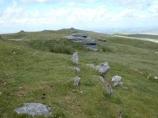
High Willhays Stone Ring Cairn Circle
OS Map: SX 58032 89224
HER: MDV21296
Megalithic Portal: 36417
Short Name: RC HighWill
Butler map: 42.2
Turner: A65
Dimensions (m): 10 x 0.6
Notes: "Higher willhayes ring cairn. Irregular segment of stone ring set against rock outcrop.10m wide n-s and 5.5m radius to outcrop, with bank 1m wide and 0.2m high. Also contains segment of stone setting 7.5m wide n-s, 2.5m radius to outcrop"
Nearest Bus Stop: Sourton Windard Terrace (4.8 km) [Route: 118]
Nearby sites: SX 58032 89224
High Willhays (N) Stone Ring Cairn Circle
OS Map: SX 58020 89440
HER: MDV20152
Megalithic Portal: 45849
Short Name: RC:HighWill N
Grinsell: OKE 5
Turner: A64
Dimensions (m): 22
Notes: "A revetted mound adjoins the south side of one of the granite outcrops at High Willhays. Measuring 19 metres east to west by 18 metres overall it stands around 0.8 metres high. The sides of the mound are formed by coursed granite slabs and boulders and the top is largely flat though a hollow has formed in the southern half."
Nearest Bus Stop: Sourton Windard Terrace (4.7 km) [Route: 118]
Nearby sites: SX 58020 89440
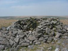
Hillson's House Cairn
Prehistoric Dartmoor Walks: Dartmoor Site: Stalldown Stone Row [Photo Set 2]
OS Map: SX 63668 62292
HER: MDV4302
Megalithic Portal: 45592
Alternate name: Hillson's House Cairn
Short Name: CN Hillson Hse
Butler map: 54.18.7
Grinsell: COR 22
DPD: 69
Dimensions (m): 20.0 x 2.0
Notes: Butler Cairn 7 (Vol 3 54.18). On the summit of Stalldown barrow is a large flat-toped cairn around 17.5m across. The cairn has been damaged by the construction of shelters within it - hence it is known as Hillson's House.
Nearest Bus Stop: Cornwood Crossways (4.2 km) [Route: 59]
Nearby sites: SX 63668 62292

Hingston Hill Chambered Cairn
Prehistoric Dartmoor Walks: Dartmoor Site: Down Tor Stone Row and Cairn Circle
OS Map: SX 59201 69453
HER: MDV3375
Megalithic Portal: 27900
PMD: Narrator Brookhead N.
Alternate name: Narrator Brookhead 1 Chambered Cairn
Short Name: CN Narrator 1
Butler map: 47.7.1
Butler Vol 5: p.158
Grinsell: WAL 32
Dimensions (m): 19.0 x 1.6
Notes: The large cairn to NW of Down Tor (Hingston Hill) stone row has been claimed to contain a cist or "elements of chambering" (Burnard via PMD). A stony round cairn located on the flatish sadle of Hingston Hill. The cairn mound measures 17 metres in diameter and stands up to 1.5 metres high. A hollow in the centre of the mound measures 4 metres long, 3 metres wide and 1.2 metres deep, and is probably the result of partial robbing or early excavation. The edges of the mound are steep-sided, indicating the existence of a kerb, which now survives mainly as a buried feature. A quarry ditch surrounds the mound, visible as a 1.5 metre wide band of rushes on the northern side of the mound, the result of increased moisture in the buried ditch. This cairn is in direct line with the two terminal stones at either end of a stone alignment to the south-west.
Nearest Bus Stop: Princetown Dartmoor Visitor Centre (4.1 km) [Route: 98,171,172]
Nearby sites: SX 59201 69453
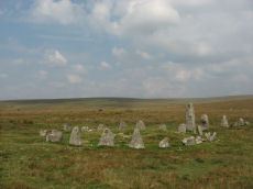
Hingston Hill (Down Tor) Encircled Cairn
Prehistoric Dartmoor Walks: Dartmoor Site: Down Tor Stone Row and Cairn Circle
OS Map: SX 58693 69270
HER: MDV3439
Megalithic Portal: 541
PMD: Down Tor Cairn Circle
Alternate name: Hingston Hill stone row Encircled Cairn
Short Name: EC Down Tor
Butler map: 47.12
Grinsell: WAL 31
Turner: F6
DPD: 28
Barrow Report: 14
Dimensions (m): 12.0 x 0.5 C?
Notes: "The cairn circle consists of 26 upright stones and possibly two more now recumbent; it has an internal diameter of 11.5m. Within the circle is a cairn of 8.5m diameter and 0.6m height with a small depression in the centre which may be the site of a cist". Lethbridge pp.27-29, diagram p.27.
Nearest Bus Stop: Princetown Dartmoor Visitor Centre (4.3 km) [Route: 98,171,172]
Nearby sites: SX 58693 69270
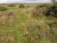
Holne Lee Stone Ring Cairn Circle
OS Map: SX 68656 69919
HER: MDV5199
Megalithic Portal: 45836
Alternate name: Holne Lee 7 Stone Ring Cairn Circle
Short Name: RC Holne Lee 7
Butler map: 58.11.7
Grinsell: HOL 17
Turner: A32
Dimensions (m): 18.0 x 0.8
Notes: HER: One of two cairns of probable Bronze Age date on Holne Lee. Cairn is 21 metres in diameter and is constructed of small boulders, and consists of a platform 14 metres diameter and about 0.2m high, with a perimeter rim average thickness 3.5m and 0.5m high. There is a gap, 4.3m wide, facing north north-east.
Nearest Bus Stop: Poundsgate Tavistock Inn (2.9 km) [Route: 172]
Nearby sites: SX 68656 69919
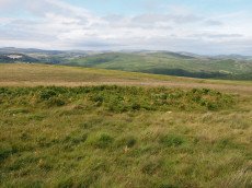
Holne Moor Stone Ring Cairn Circle
OS Map: SX 66919 70785
HER: MDV6474
Megalithic Portal: 27342
Alternate name: Holne Ridge N.9 Stone Ring Cairn Circle
Short Name: RC HolneRidg 9
Butler map: 60.26.9
Grinsell: HOL 5
Turner: A12
Dimensions (m): 22.0 x 0.8
Notes: "One of four cairns 310 metres south of Horn's Cross forming part of a cairn cemetery on Holne Ridge. Ring cairn measuring 19.9 metres in diameter, height 0.9 metres. Has a 4 metre wide bank standing up to 0.9 metres high surrounding an 11.9 metre diameter internal area. A stone on the inner face of the east side of the cairn has been cut by tear and feather."
Nearest Bus Stop: Dartmeet Badgers Holt (2.4 km) [Route: 172]
Nearby sites: SX 66919 70785
Holne Moor (N) Stone Ring Cairn Circle
OS Map: SX 6809 7162
HER: MDV26266
Megalithic Portal: 45830
Short Name: RC:HolneMoor N
Turner: A16
Dimensions (m): 9.5
Notes: "Possible cairn in corner of a field." "Stone ring 9.5m diam internally, with bank 1.2m wide and 0.4m high. Joined on w side by reave (turner)." No NMR record.
Nearest Bus Stop: Dartmeet Badgers Holt (1.8 km) [Route: 172]
Nearby sites: SX 6809 7162
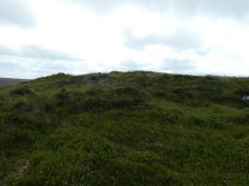
Hookney Tor Cairn
OS Map: SX 69905 81314
HER: MDV6611
Megalithic Portal: 34982
Alternate name: Hookney Tor summit Cairn
Short Name: CN HookneyTor
Butler map: 20.7
Grinsell: N.BOV 2
Notes: Tor cairn north of Hookney Tor and resembling a barrow in shape. Enough of the topsoil has been removed to show that the mound is a natural outcrop feature covered with turf and heather, enclosed on three sides by a broken turf and stone bank. A footpath approaching the west side has probably effaced the remainder of the circuit.
Nearest Bus Stop: Warren House Inn (2.5 km) [Route: 171]
Nearby sites: SX 69905 81314

Hookney Tor North A Ancient Pool
OS Map: SX 69843 81721
HER: MDV127212
Short Name: PO HookneyTorA
Dimensions (m): 15 x 9.5m
Notes: "A pool measuring 15 by 9.5m. One of over 40 such 'sacred' pools identified on Dartmoor that are thought to have potentially been designed during the prehistoric period. Lies near a prehistoric cairn."
Nearest Bus Stop: Warren House Inn (2.5 km) [Route: 171]
Nearby sites: SX 69843 81721
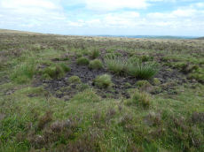
Hookney Tor North B Ancient Pool
OS Map: SX 69838 81605
HER: MDV127213
Short Name: PO HookneyTorB
Dimensions (m): 7.5m
Notes: "A pool measuring 7.5m. One of over 40 such 'sacred' pools identified on Dartmoor that are thought to have potentially been designed during the prehistoric period."
Nearest Bus Stop: Warren House Inn (2.5 km) [Route: 171]
Nearby sites: SX 69838 81605
Horns Cross Stone Ring Cairn Circle
OS Map: SX 66921 71125
HER: MDV6475
Megalithic Portal: 27342
Alternate name: Holne Ridge N.6 Stone Ring Cairn Circle
Short Name: RC:HolneRidg 6
Butler map: 60.26.6
Grinsell: HOL 3
Turner: A35
DPD: 90
Dimensions (m): 15.5 x 0.3
Notes: "Remains of cairn; one of eight cairns forming part of a cairn cemetery on Holne Ridge. Truncated cairn, or ring cairn, gap in north-east. Diameter 14 metres, height 0.3 metres."
Nearest Bus Stop: Dartmeet Badgers Holt (2.1 km) [Route: 172]
Nearby sites: SX 66921 71125
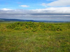
Horns Cross N. Cairn
OS Map: SX 66941 71187
HER: MDV26276
Megalithic Portal: 27342
Alternate name: Holne Ridge N.5 Cairn
Short Name: CN HolneRidg 5
Butler map: 60.26.5
Grinsell: HOL 2
Dimensions (m): 13.0 X 1.4
Notes: "A turf and bracken covered Bronze Age cairn forming part of a cairn cemetery on Holne Ridge. The mound measures 14 metres by 14.4 metres in diameter and standing to a height of 1.4 metres. " Butler cairn 5 map 60.15. UPDATE 03/01/2023 This record formerly linked with MDV12975 which has been deleted.
It is unclear but this record now realte to MDV26276 which is a "tin-working spoil dump".
Nearest Bus Stop: Dartmeet Badgers Holt (2.0 km) [Route: 172]
Nearby sites: SX 66941 71187
Houndtor Down Ancient Pool
OS Map: SX 74193 78601
HER: MDV127214
Short Name: PO:Houndtor
Dimensions (m): 50 x 17m
Notes: "A pool measuring around 50 by 17m. One of over 40 such 'sacred' pools identified on Dartmoor that are thought to have potentially been designed during the prehistoric period. Lies south of a prehistoric cairn."
Nearest Bus Stop (Minor): Swallerton Gate (0.6 km) [Route: 271]
Nearest Bus Stop (Major): Lustleigh Bishops Stone (5.3 km) [Route: 178]
Nearby sites: SX 74193 78601
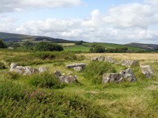
Houndtor Down Ring Setting Cairn and Cist
OS Map: SX 74106 78772
HER: MDV7398
Megalithic Portal: 24187
PMD: Hound Tor
Short Name: CT Houndtor
Butler map: 8.6
Butler Vol 5: p.179 & Fig.121
Dixon Cist #: 58
Grinsell: MAN 13
Turner: D8
DPD: 151
Barrow Report: 53 56
Dimensions (m): 6.5 x 0.3 C
Notes: "A ring cairn surviving as a mound 6.5 metres in diameter and 0.15 metres high. It is defined, except on the west side, by a ring of at least 19 close set granite stones. In the centre of the cairn is a north to south orientated cist, with both end stones and the western side stone remaining visible.". Butler Vol. 1. Map 8.6 (diagram Vol. 5. p.179).
Nearest Bus Stop (Minor): Swallerton Gate (0.4 km) [Route: 271]
Nearest Bus Stop (Major): Lustleigh Bishops Stone (5.3 km) [Route: 178]
Nearby sites: SX 74106 78772
Huntingdon Barrow Cairn
OS Map: SX 66217 66912
HER: MDV5235
Megalithic Portal: 45571
Alternate name: Heap of Sinners Cairn
Short Name: CN:Huntingdon
Butler map: 58.14
Grinsell: LYD 103
DPD: 87
Barrow Report: 65
Dimensions (m): 24.0 x 2.5
Notes: HER: 'Huntingdon Barrow' or 'Heap of Sinners' cairn north of Huntingdon Warren. A large cairn measuring 22 metres in diameter with an average height of 1.4 metres. It is constructed of large boulders but has been mutilated by the erection of marker cairns and shelters on it
Nearest Bus Stop: Dartmeet Badgers Holt (6.4 km) [Route: 172]
Nearby sites: SX 66217 66912
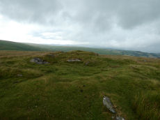
Inner Pupers Stone Ring Cairn Circle
OS Map: SX 67566 67421
HER: MDV13205
Megalithic Portal: 45847
PMD: Inner Pupers
Short Name: RC InnerPupers
Butler map: 58.9
Grinsell: BUC 6
Turner: A60
DPD: 89
Dimensions (m): 21.5 x 1.0
Notes: HER: The rock outcrop known as Inner Pupers is encompassed by a cairn of 13.0 meters overall diameter. It takes the shape of a platform 0.4 meters high around the rock, with a rim 1.5 meters wide and a further 0.4 meters high. Of small stones, with further 'natural' slabs protrude through. NB. This feature is very visible on Google Satellite.
Nearest Bus Stop: Poundsgate Tavistock Inn (5.5 km) [Route: 172]
Nearby sites: SX 67566 67421
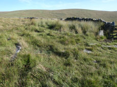
Joan Ford's Newtake Cairn Circle
OS Map: SX 63033 72172
HER: MDV6261
Megalithic Portal: 3296
Alternate name: Joan Ford's Newtake 2 Cairn Circle
Short Name: CC Joan Fords
Butler map: 63.3.2
Grinsell: LYD 91
Turner: G22
Barrow Report: 30
Dimensions (m): 6.0 x 0.3
Notes: "A stone circle with six identifiable erect or leaning stones. One forms the E post of the gateway, the west post, 7ft high, stands outside the circumference. It is because of its small diameter, without doubt a retaining circle; any internal features such as a central hollow or possible kistvean have been obliterated by the wall builders." Turner Stone Circle G22. Bar Rep 30.
Nearest Bus Stop: Two Bridges Hotel (3.4 km) [Route: 98,171,172]
Nearby sites: SX 63033 72172
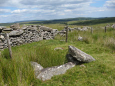
Joan Ford's Newtake Embanked Cairn Circle and Cist
OS Map: SX 63143 72168
HER: MDV6260
Megalithic Portal: 3295
PMD: Joan Ford's Newtake
Alternate name: Joan Ford's Newtake 1 Embanked Cairn Circle and Cist
Short Name: CT Joan Fords
Butler map: 63.3.1
Dixon Cist #: 28
Grinsell: LYD 92
Turner: B7
DPD: 99
Barrow Report: 30 56
Dimensions (m): 8.0 x 0.4
Notes: "A low kerb within the disturbed fringes of the mound is 8.7m in diameter with more or less continuous upright slabs and boulders 0.3m to 0.6m high. A dry stone newtake wall crosses the N side and overlies part of the kerb. A well-preserved cist, oriented NW-SE, is internally 1.0m long, 0.5m to 0.65m wide and up to 0.7m deep. The coverstone leans against the SE side of the cist and measures 1.35m by 1.0m by 0.2." Lethbridge diagram p.99, photo bottom p.99. Butler Joan Ford's Newtake 1 - Vol. 4. Map 63.3 (diagram p.214).
Nearest Bus Stop: Two Bridges Hotel (3.6 km) [Route: 98,171,172]
Nearby sites: SX 63143 72168
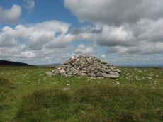
King's Oven (Water Hill) Cairn
OS Map: SX 67158 81299
HER: MDV6674
Megalithic Portal: 34690
PMD: Water Hill Possible Chambered Cairn
Alternate name: Water Hill 1 Cairn
Short Name: CN WaterHill 1
Butler map: 26.5.1
Butler Vol 5: p.156 & Fig.95
Grinsell: CHA 6
Dimensions (m): 18.0 x 1.3
Notes: Situated at SX 67158129 on the rounded summit of Water Hill is the remains of a substantial round cairn 18.0 metres in diameter and up to 1.4 metres high in the east and 0.9 metres in the west. The whole of the central area of the cairn has been robbed to construct a superimposed modern boundary cairn 4.0 metres in diam and 2.1 metres high. This has given a 'dished' appearance to the cairn proper. Several large slabs averging 0.8 metres by 0.7 metres scattered around the base of the boundary cairn may be the remains of a destroyed cist.
The southern flat topped cairn measures 18 metres in diameter and 1.5 metres in height and is surmounted by a modern stone pile. A large slab situated to the south of this pile may have been part of a cist.
Nearest Bus Stop: Warren House Inn (0.4 km) [Route: 171]
Nearby sites: SX 67158 81299
Knatta Barrow Stone Ring Cairn Circle
OS Map: SX 65970 64212
HER: MDV5717
Megalithic Portal: 45842
Short Name: RC:Knatta Bar
Butler map: 57.29
Butler Vol 5: p.160 & Fig.102
Grinsell: BRE 2
Turner: A54
Dimensions (m): 14.0 x 0.7
Notes: "This large cairn (24m diameter, 1.7m height) composed of loose granite boulders. It is unusual among summit cairns in having a well defined outer bank about 1m wide and 0.5m high. This is partly turf covered but where eroded can be seen to be built of loose stone like the central cairn which touches it. It shows best on the north and east sides, while on the south west side it tends to merge into the body of the cairn."
Nearest Bus Stop: South Brent Pool Park (6.0 km) [Route: 38]
Nearby sites: SX 65970 64212
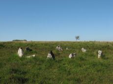
Lakehead Hill Cairn Circle
Prehistoric Dartmoor Walks: Dartmoor Site: Lakehead Hill
OS Map: SX 64351 77493
HER: MDV52762
Megalithic Portal: 24365
Alternate name: Lakehead Hill 5 Cairn Circle
Short Name: CC Lakehead 5
Butler map: 27.19.5
Grinsell: LYD 55
Turner: G24
DPD: 117
Barrow Report: 54
Dimensions (m): 6.8
Notes: Butler Cairn 5. Tuner lists this as G24 Stone Circle. However, it is clear from its size and location near other Ring Settings that it is in fact better described as a Ring Setting despite having no visible internal structure. In these listings we will leave it as a cairn circle. HER: A ring cairn lying on a gentle slope near the summit of Lakehead Hill. The cairn is defined by a circle of edge set stones which measure 7.8 metres in diameter and stand up to 0.9 metres high. DEC Report 3: A second small kistvaen within a circle exists on the west side of Lake Head Hill, and was examined, but nothing was found in it. The circle about it is tolerably complete and the stone chest has lost only one of the side-stones ; but it is very small. Apparently a small stone row led from it. Near the kistvaen is a circle of stones enclosing a cairn, but no kistvaen. From the circle perhaps a stone row led away east, but only three stones remain in line. Lethbridge diagram p.114 and photo top p.117.
Nearest Bus Stop: Postbridge Bellever (1.2 km) [Route: 98]
Nearby sites: SX 64351 77493
Lakehead Hill Platform Cairn Circle
Prehistoric Dartmoor Walks: Dartmoor Site: Lakehead Hill
OS Map: SX 64358 77773
HER: MDV5869
Megalithic Portal: 1057
Alternate name: Lakehead Hill 1 Platform Cairn Circle
Short Name: PC Lakehead 1
Butler map: 27.19.1
Grinsell: LYD 53
Turner: E16
DPD: 114
Barrow Report: 55
Dimensions (m): 6.0
Notes: HER: A ring cairn lying on a gentle slope near the summit of Lakehead Hill. The cairn survives as a 6 metre diameter circle of upright slabs standing up to 0.4 metres high surrounding a slightly raised area. In the centre of the circle is a small 0.15 metre high mound. Lethbridge diagram p.114 and photo bottom p.114.
Nearest Bus Stop: Postbridge Post Office (1.2 km) [Route: 98,171]
Nearby sites: SX 64358 77773
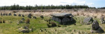
Lakehead Hill 4 (E or Summit) Ring Setting Cairn and Cist
Prehistoric Dartmoor Walks: Dartmoor Site: Lakehead Hill
OS Map: SX 64499 77611
HER: MDV5870
Megalithic Portal: 2009
PMD: Lakehead Hill Summit
Alternate name: Lakehead Hill 4 Ring Setting Cairn and Cist
Short Name: CT Lakehead 4
Butler map: 27.19.4
Butler Vol 5: p.59 & Fig.37
Dixon Cist #: 68
Grinsell: LYD 54
Turner: D6
DPD: 116
Dimensions (m): 6.7? C
Notes: A single stone row of at least 11 stones leading westward towards the cairn and cist. HER: The cairn measures 6.7 metres in diameter and is defined by several edge set stones, which in turn surround a large restored cist formed by five substantial upright slabs supporting a capstone measuring 2.2 metre long by 1.55 metres wide and 0.3 metres thick. Further coverage on Lakehead Hill page. Lethbridge diagram p.114 and photo top p.116. Butler Lakehead Hill (Cairn 4) - Vol. 2. Map 27.19.4 (diagrams pp.48-52). Breton p.35-36
Nearest Bus Stop: Postbridge Bellever (1.0 km) [Route: 98]
Nearby sites: SX 64499 77611
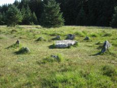
Lakehead Hill 6 (Newtake) Ring Setting Cairn and Cist
Prehistoric Dartmoor Walks: Dartmoor Site: Lakehead Hill
OS Map: SX 64363 77475
HER: MDV5842
Megalithic Portal: 24365
PMD: Lakehead Hill Central
Alternate name: Lakehead Hill 6 Ring Setting Cairn and Cist
Short Name: CT Lakehead 6
Butler map: 27.19.6
Dixon Cist #: 64
Grinsell: LYD 56
Turner: D10
DPD: 117
Barrow Report: 54 56
Dimensions (m): 5.6 C
Notes: Further coverage on Lakehead Hill page. Lethbridge diagram p.114 and photo bottom p.117. Dixon #64. Bar Rep 54. Butler Lakehead Hill (Cairn 6) - Vol. 2. Map 27.19.6 (diagrams pp.48-52). HER: On a gentle slope near the summit of Lakehead Hill is a ring cairn and cist. The cairn measures 6.9 metres in diameter and contains a central cist. The cist protrudes 0.4 metres above the surrounding ground surface and is covered by a capstone measuring 1.7 metres long, 1.28 metres wide and 0.15 metre thick. DEC Report 3: A second small kistvaen within a circle exists on the west side of Lake Head Hill, and was examined, but nothing was found in it. The circle about it is tolerably complete and the stone chest has lost only one of the side-stones ; but it is very small. Apparently a small stone row led from it. Near the kistvaen is a circle of stones enclosing a cairn, but no kistvaen. From the circle perhaps a stone row led away east, but only three stones remain in line.
Nearest Bus Stop: Postbridge Bellever (1.2 km) [Route: 98]
Nearby sites: SX 64363 77475
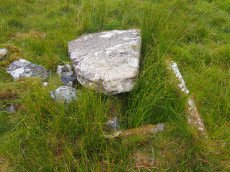
Langcombe (S) Platform Cairn Circle and Cist
Prehistoric Dartmoor Walks: Dartmoor Site: Guide to the Langcombe Brook & Deadman's Bottom Cists
OS Map: SX 60866 66155
HER: MDV5128
Megalithic Portal: 45729
PMD: Langcombe Brook 6
Alternate name: Langcombe Brook 6 Platform Cairn Circle and Cist
Short Name: CT Langcombe 6
Butler map: 50.3.6
Dixon Cist #: 53
Grinsell: SHA 19
Turner: E23
DPD: 47
Barrow Report: 50 52
Dimensions (m): 5.5 x 0.3 C
Notes: "A cist, lying a little over 590 yds south west of Grim's Grave, within a flat topped cairn. Cist has two sides and the south end stone are in place and the cover stone rests in part over the cist". Lethbridge p.47 Langcombe Cist J - diagram p.43. Butler Langcombe Brook 6 (Cairn 6) - Vol. 3. Map 50.3 (pp.148-54 general plan of Langcombe Brook cairns p.151, diagram of Langcombe cists p.153).
Nearest Bus Stop: Lee Moor Clearview (5.6 km) [Route: 59]
Nearby sites: SX 60866 66155
Langstone Moor Stone Ring Cairn Circle
Prehistoric Dartmoor Walks: Dartmoor Site: Langstone Moor Stone Circle, Stone Row & Settlements
OS Map: SX 54843 77922
HER: MDV48862
Megalithic Portal: 45833
Short Name: RC Langstone
Turner: A22
Dimensions (m): 6.9
Notes: HER: A semi-circular bank, possibly the remains of a ring cairn.1.4 to 2m wide, 0.4m high. Composed of small + medium sized stones now largely turf-covered. It fades at each end of a near-perfect semi-circle of 14.9m internal diam. There is a low stone pile, 0.2m high, in se quadrant.
The author visited this site on 25/06/2018. A semi circular group of periglacial mounds can indeed be seen. The author on that occasion concluded that what appears to be a ring cairn is in fact simply the natural arrangement of the mounds. Re-visited on 13/08/2025 and the appearance looked very much like a ring cairn. This feature is also listed by some authors Mortar Emplacement 12
Nearest Bus Stop: Merrivale Dartmoor Inn (2.7 km) [Route: 98,171,172]
Nearby sites: SX 54843 77922
Langstone Moor Ancient Pool
OS Map: SX 55026 78879
HER: MDV127215
Short Name: PO:Langstone
Dimensions (m): 28 x 24m
Notes: HER: A pool measuring 28 by 24 metres. One of over 40 such 'sacred' pools identified on Dartmoor that are thought to have potentially been designed during the prehistoric period. Lies at the northern end of a stone row. May be on the site of a cairn
NB. HER entry implies this could be the same as the Butler reported cairn at the end of the stone row. On this website this is currently listed as a separate entry SiteID=1164 (no HER entry). The diagram page 77 (fig 30.8) shows both a mound and a pit. Could this be the pit distinct from the cairn? Breton (p.17): The Langstone was formerly the end of a stone row, composed of quite small stones, running in a direction N. and S. from a pool that occupies the site of a destroyed cairn.
Nearest Bus Stop: Merrivale Dartmoor Inn (3.7 km) [Route: 98,171,172]
Nearby sites: SX 55026 78879
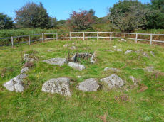
Leather Tor Platform Cairn Circle and Cist
OS Map: SX 56325 69524
HER: MDV3434
Megalithic Portal: 34457
PMD: Cross Gate
Alternate name: Leather Tor S. Platform Cairn Circle and Cist
Short Name: CT Leather Tor
Butler map: 45.17
Dixon Cist #: 61
Grinsell: WAL 25
Turner: E20
DPD: 23
Barrow Report: 54
Dimensions (m): 5.5 x 0.4 C
Notes: "A cist, consisting of two side stones and an end stone, contained within a barrow surrounded by a 16ft 6 ins diameter Kerb circle." Butler Leather Tor S. - Vol. 3. Map 45.17 (diagram p.52).
Nearest Bus Stop: Dousland Burrator Inn (2.7 km) [Route: 55,56,98]
Nearby sites: SX 56325 69524
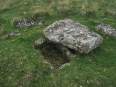
Legis Lake Platform Cairn Circle and Cist
OS Map: SX 56595 65762
HER: MDV4030
Megalithic Portal: 34131
PMD: Legis Lake
Alternate name: Ringmoor Down 2 Platform Cairn Circle and Cist
Short Name: CT Ringmoor 2
Butler map: 49.21.2
Dixon Cist #: 27
Grinsell: SHE 20
Turner: E32
DPD: 36
Barrow Report: 29
Dimensions (m): 5.5 x 0.3 C
Notes: Lethbridge Brisworthy Cist p.34-36. Diagram p.34 site 5. Butler Ringmoor Down 2 - Vol. 3. Map 49.21 (diagram p.145).
Nearest Bus Stop: Meavy Primary School (2.6 km) [Route: 56]
Nearby sites: SX 56595 65762
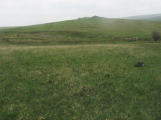
Legis Lake Encircled Cairn
OS Map: SX 56563 65513
HER: MDV3360
Megalithic Portal: 34135
Alternate name: Ringmoor Down 1 Encircled Cairn
Short Name: EC Ringmoor 1
Butler map: 49.21.1
Grinsell: SHE 21
Turner: F15
Barrow Report: 29 35
Dimensions (m): 10.0 x 0.3
Notes: "cairn with retaining circle of which 5 stones protrude and there are indications of others. Diameter 8.2m, height 0.2m. Excavated by r. H. Worth: just n of centre, a pit containing charcoal mixed with earth."
Nearest Bus Stop: Meavy Primary School (2.7 km) [Route: 56]
Nearby sites: SX 56563 65513
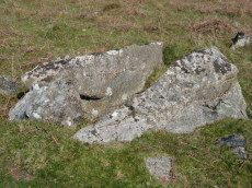
Legis Tor Ossuary
OS Map: SX 57573 65470
HER: No record
Megalithic Portal: 45857
Short Name: OS Legis Tor
DPD: 37
Notes: An intriguing structure consisting of two very large parallel slabs on Legis Tor. Site discovered by Lethbridge who suggests it might be an ossuary. This is quite clearly a man made structure. The two very large parallel slabs look very much like they are an artificial construction rather than natural. One end has a clearly built up wall to form a structure. There is one larger end slab, very small in comparison to the side slabs - but it rests on a bunch of other slabs that look very much like they have been artificially placed. This is undoubtedly a prehistoric construction - a large cist or "ossuary" (receptacle for burials or cremations - a sort of tomb). No entries in HER or NMR. see Lethbridge p.37 diagram and photo.
Nearest Bus Stop: Meavy Primary School (3.6 km) [Route: 56]
Nearby sites: SX 57573 65470
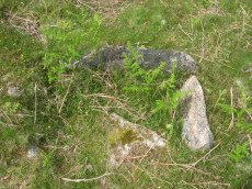
Legis Tor, East Platform Cairn Circle and Cist
OS Map: SX 57474 65542
HER: MDV3424
Megalithic Portal: 45857
PMD: Legis Tor E.
Alternate name: Legis Tor E.1 Platform Cairn Circle and Cist
Short Name: CT LegisTor E1
Butler map: 49.2.1
Dixon Cist #: 49
Grinsell: SHE 23
Turner: E42
DPD: 38
Barrow Report: 51
Dimensions (m): 3.5 x 0.3 C
Notes: Butler Legis Tor E - Vol. 3. Map 49.2.1 (diagram p.113). Lethbridge p.37-38 Diagram p.37 Cist B.
Nearest Bus Stop: Meavy Primary School (3.5 km) [Route: 56]
Nearby sites: SX 57474 65542
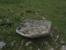
Legis Tor, West Platform Cairn Circle and Cist
OS Map: SX 57394 65481
HER: MDV3365
Megalithic Portal: 34130
PMD: Legis Tor W.
Alternate name: Legis Tor E.2 Platform Cairn Circle and Cist
Short Name: CT LegisTor E2
Butler map: 49.2.2
Dixon Cist #: 10
Grinsell: SHE 22
Turner: E43
DPD: 37
Barrow Report: 12 20 51
Dimensions (m): 4.0 x 0.3 C
Notes: Lethbridge p.37 Cist A. The photo is thought to be the capstone of this cist. Butler Legis Tor E. 2 - Vol. 3. Map 49.2 (diagram p.114).
Nearest Bus Stop: Meavy Primary School (3.4 km) [Route: 56]
Nearby sites: SX 57394 65481
Limsboro Cairn
OS Map: SX 56567 80550
HER: MDV3299
Megalithic Portal: 45851
Short Name: CN:Limsboro
Butler map: 32.18
Grinsell: LYD 14
Dimensions (m): 15.0 x 2.5
Notes: A prehistoric Tor cairn with a diameter of approximately 14.3m.
Nearest Bus Stop: Merrivale Dartmoor Inn (5.6 km) [Route: 98,171,172]
Nearby sites: SX 56567 80550
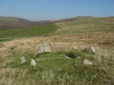
Lower Piles Ring Setting Cairn and Cist
Prehistoric Dartmoor Walks: Dartmoor Walk: The Neolithic tombs of Cuckoo Ball & Corringdon Ball
OS Map: SX 64540 60262
HER: MDV4256
Megalithic Portal: 1108
PMD: Lower Piles
Alternate name: Piles Hill S.W.15 Ring Setting Cairn and Cist
Short Name: CT Lower Piles
Butler map: 53.11.15
Dixon Cist #: 38
Grinsell: HAR 8
Turner: D13
DPD: 76
Barrow Report: 36 62
Dimensions (m): 5.4 x 0.3 C
Notes: "A cist with a retaining circle, diameter 14 to 15 feet, of which seven stones still remain, lies about 150 yds south of the south east angle of Lower Piles enclosure. The cist measures 3 feet 7 inches in length by 1 foot 4 inches wide at the south-eastern end and 2 feet wide at the north western. The present depth is from 2 feet 9 inches to 3 feet. The cover-stone and the north-western end-stone are missing." Letchfield diagram p.76. Barrow Report 36 says "To the south-east, in the direction of the length of the kistvaen, stands a single large stone, about 100 feet distant; to the north-west, with its centre 110 feet away from the centre of the kistvaen, there is a small cairn of 20 feet diameter; this also is in the line of the length of the kistvaen." The stone is at SX 64518 60236 Butler Piles Hill S.W. - Vol. 4. Map 53.11.15 (p.33 diagram of cist & plan of cairns on Piles Hill p.30).
Nearest Bus Stop: Cornwood Crossways (4.1 km) [Route: 59]
Nearby sites: SX 64540 60262
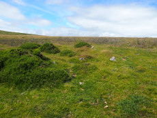
Mardle Embanked Cairn Circle
OS Map: SX 67526 69359
HER: MDV5308
Megalithic Portal: 3374
Alternate name: Mardle Valley 1 Embanked Cairn Circle
Short Name: CC Mardle 1
Butler map: 58.12.1
Turner: B11
Dimensions (m): 12.0 x 0.3
Notes: Turner: Embanked stone circle; an annular bank of earth and/or stone with an inner edge of orthostats. Much disturbed. Internal diam 6.5m with bank 1.2m wide and 0.4m high. This cairn has a very interesting structure appearing to be multiple circles of stones similar to the cairns at Corringdon Ball. This structure is difficult to capture in a photograph as the stones are small and the site much disturbed.
HER: A flat-topped cairn with a disturbed bank around its crest lies on a moderate south-west slope above the left bank of the River Mardle. The feature is circular, 11.8 metres in diameter, and stands a maximum of 0.8 metres high. The stoney ring measures 1.2 metres wide and 0.3 metres high and there are no traces of a cist or kerb in the main structure. The source of the disturbance is unclear though there does not appear to have been an excavation.
This cairn has been cleared of vegetation by the DPA in September 2025 and the author visited shortly afterwards on 02/10/2025. The main photo is from 15/07/2016 and the secondary photo was taken after the recent clearance work. The grid reference taken on 02/10/2025 was SX 67524 69358 which is a close match to the retained one from 2016.
Nearest Bus Stop: Dartmeet Badgers Holt (3.9 km) [Route: 172]
Nearby sites: SX 67526 69359

Mardon Down Stone Ring Cairn Circle
Prehistoric Dartmoor Walks: Dartmoor Site: Mardon Down Stone Circle & Cairns
OS Map: SX 76729 87264
HER: MDV19003
Megalithic Portal: 22313
PMD: Mardon Down Cairn 1
Alternate name: Mardon Down 2 Stone Ring Cairn Circle
Short Name: RC Mardon 2
Turner: A36
DPD: 149
Dimensions (m): 12
Notes: "Stone ring with central cairn. Outer ring measures 12.0 metres in diameter with bank 1.5 metres wide and 0.3 metres high. Central cairn 5.0 metres in diameter and 0.4 metres high with disturbance on its western side. Outer ring has 2.5 metre wide entrance on the east."
Nearest Bus Stop: Moretonhampstead Court Street Car Park (2.0 km) [Route: 171,173]
Nearby sites: SX 76729 87264
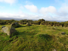
Mardon Down Platform Cairn Circle
Prehistoric Dartmoor Walks: Dartmoor Site: Mardon Down Stone Circle & Cairns
OS Map: SX 76759 87172
HER: MDV15158
Megalithic Portal: 22312
PMD: Mardon Down Cairn 1
Alternate name: Mardon Down 1 Platform Cairn Circle
Short Name: PC Mardon 1
Butler Vol 5: p.149 & Fig.91
Grinsell: MOR 5
Turner: E9
DPD: 149
Dimensions (m): 8.6 / 6.2 x 0.6
Notes: Platform circle consisting of a ring of kerb stones, measuring 7.0 metres in internal diameter, enclosing a flat-topped cairn 0.3 metres high, with boulder incorporated into perimeter.
Nearest Bus Stop: Moretonhampstead Court Street Car Park (2.0 km) [Route: 171,173]
Nearby sites: SX 76759 87172
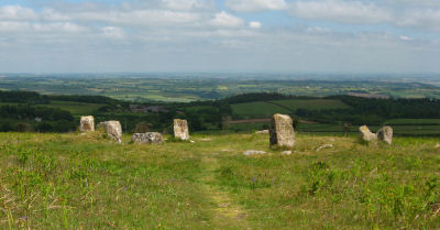
Mardon Down Embanked Cairn Circle
Prehistoric Dartmoor Walks: Dartmoor Site: Mardon Down Stone Circle & Cairns
OS Map: SX 76744 87691
HER: MDV8308
Megalithic Portal: 3375
Alternate name: Mardon Down Pillared Circle 5 Embanked Cairn Circle
Short Name: CC Mardon 5
Butler Vol 5: p.150 & Fig.92
Grinsell: MOR 1
Turner: B6
DPD: 149
Dimensions (m): 10 x 0.7
Notes: Impressive cairn circle with a well preserved ring of large pillars surrounded by an outer kerb ring of smaller slabs on their edges. The cairn is 11m. in diameter and 0.5m. high, with a well preserved cairn circle comprising a 9.0m. diameter circle of spaced uprights averaging 0.8m. high, with kerbing between. Unlike the stone circle it is marked on the OS Okehampton and North Dartmoor Landranger map (Sheet 191). It is easy to confuse this cairn with the less well preserved stone circle which is a few hundred metres to the south. Turner B6.
Nearest Bus Stop: Moretonhampstead Court Street Car Park (2.3 km) [Route: 171,173]
Nearby sites: SX 76744 87691
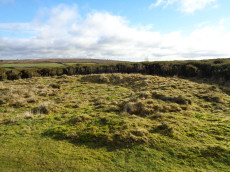
Mardon Down (E) Stone Ring Cairn Circle
Prehistoric Dartmoor Walks: Dartmoor Site: Mardon Down Stone Circle & Cairns
OS Map: SX 76894 87602
HER: MDV12771
Megalithic Portal: 45824
Short Name: RC Mardon East
Butler Vol 5: p.147 & Fig.89
Turner: A10
DPD: 149
Dimensions (m): 13.3
Notes: HER: Earthwork lying 150 metres east of the summit ridge, probably a robbed cairn or enclosure, comprising a curving stony bank forming the outline suggestive of an approximate circle. Badly damaged on the north and north-east sides and mostly effaced on the west by a path.
Nearest Bus Stop: Moretonhampstead Court Street Car Park (2.3 km) [Route: 171,173]
Nearby sites: SX 76894 87602
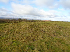
Mardon Down S.E. of Giants Grave Cairn Circle
Prehistoric Dartmoor Walks: Dartmoor Site: Mardon Down Stone Circle & Cairns
OS Map: SX 76774 87432
HER: MDV8310
Megalithic Portal: 22315
Alternate name: Mardon Down 3 Cairn Circle
Short Name: CC Mardon 3
Butler Vol 5: p.147 & Fig.89
Grinsell: MOR 4
Dimensions (m): 11.0 x 0.7
Notes: NMR C. Cairn 32.0 metres south-east of Giant's Grave. 11.0 metres diameter, 0.7 metres high with traces of a retaining circle on the south-west side.
Nearest Bus Stop: Moretonhampstead Court Street Car Park (2.1 km) [Route: 171,173]
Nearby sites: SX 76774 87432
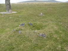
Merivale (S) Encircled Cairn
OS Map: SX 55368 74602
HER: MDV3759
Megalithic Portal: 52014
The Stone Rows of GB: Merrivale 4
PMD: Merrivale Menhir
Alternate name: Merrivale 6 (near standing stone) Encircled Cairn
Short Name: EC Merrivale 6
Butler map: 44.8.6
Grinsell: WAL 6
Turner: F19
Dimensions (m): 3.0 x 0.2
Notes: The cairn now turf-covered with an excavation pit in the centre, has a diameter of 2.4m. and a height of 0.1m. The excavation pit can be seen in the photo. A very irregular "circle" of stones can be seen around this cairn. Turner F19.
Nearest Bus Stop: Merrivale Dartmoor Inn (0.8 km) [Route: 98,171,172]
Nearby sites: SX 55368 74602
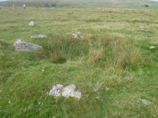
Merrivale Embanked Cairn Circle and Cist
OS Map: SX 55360 74747
HER: MDV4997
Megalithic Portal: 10503
PMD: Merrivale SW.
Alternate name: Merrivale 8 Embanked Cairn Circle and Cist
Short Name: CT Merrivale 8
Butler map: 44.8.8
Dixon Cist #: 139
Grinsell: WAL 1
Turner: B2
Dimensions (m): c.20.0
Notes: "The excavation of 1851 seems to have been thorough, completely destroying structural remains of both the cairn and the 'cist or inner circle',. There is now a circular turf covered area, 18.0m. in diameter, with random stones protruding through the surface. Off centre there is a hollow, 7.0m. by 4.0m. and 0.5m. deep." Butler Merrivale Vol. 3. Map 44.8.8 (pp.30-1).
Nearest Bus Stop: Merrivale Dartmoor Inn (0.6 km) [Route: 98,171,172]
Nearby sites: SX 55360 74747
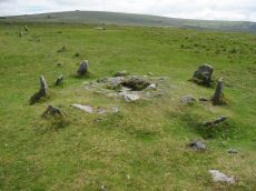
Merrivale double row B (centre) Encircled Cairn and Cist
Prehistoric Dartmoor Walks: Dartmoor Walk: Merrivale Complex
OS Map: SX 55442 74779
HER: MDV14796
Megalithic Portal: 3389
PMD: Merrivale S row
Alternate name: Merrivale double row 2 centre Encircled Cairn and Cist
Short Name: CT Merrivale 2
Butler map: 44.8.2
Dixon Cist #: 142
Grinsell: WAL 4
Turner: F20
DPD: 17
Dimensions (m): 3.3 x 0.3 C
Notes: Butler Merrivale double row 2, (centre) - Vol. 3. Map 44.8.1 (diagram p.27). Lethbridge pp.16-18, diagram p.16.
Nearest Bus Stop: Merrivale Dartmoor Inn (0.7 km) [Route: 98,171,172]
Nearby sites: SX 55442 74779
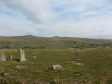
Merrivale NE Cairn Circle
Prehistoric Dartmoor Walks: Dartmoor Site: Merrivale Ceremonial Complex [Photo Set 1]
OS Map: SX 55548 74817
HER: MDV29078
Megalithic Portal: 3390
The Stone Rows of GB: Merrivale 1
PMD: Merrivale A Stone Row
Alternate name: Merrivale double row 1 (east end) Cairn Circle
Short Name: CC Merrivale 1
Butler map: 44.8.1
Dimensions (m): c.5.0
Notes: At the eastern end (of the northern stone row) there is a blocking stone and beyond it a number of earthfast and loose slabs which seem to represent a former kerb or circle about 5.6m. in diameter. The blocking stone is part of the circle with two or possibly three earthfast slabs on end, three recumbent slabs, and four other post or slab stones which are much displaced or entirely unconnected. The stones are spaced at about 2.0m. intervals; uprooted slabs are from 0.3m. square to 0.4m. by 0.5m., earthfast stones 0.1m. high. There is no sign of a cairn or cist.
Nearest Bus Stop: Merrivale Dartmoor Inn (0.8 km) [Route: 98,171,172]
Nearby sites: SX 55548 74817
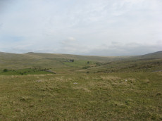
Merrivale North Embanked Cairn Circle
OS Map: SX 55340 74845
HER: MDV3757
Megalithic Portal: 10502
Alternate name: Merrivale 10 Embanked Cairn Circle
Short Name: CC Merrivale10
Butler map: 44.8.10
Turner: B8
Dimensions (m): 9
Notes: "Turner describes this site as an embanked stone circle; an annular bank of earth and/or stones with an inner edge of orthostats. Internal diameter is 8.0 meters with a bank 0.8 meters wide and 0.3 meters high. Much disturbed." Turner B8.
Nearest Bus Stop: Merrivale Dartmoor Inn (0.6 km) [Route: 98,171,172]
Nearby sites: SX 55340 74845

Mis Tor Farm Embanked Cairn Circle
OS Map: SX 56927 75953
HER: MDV15372
Megalithic Portal: 45609
Alternate name: Little Mis Tor S.E. Embanked Cairn Circle
Short Name: CC:MisTor Farm
Butler map: 30.17
Butler Vol 5: p.163 & Fig.104
Grinsell: LYD 37a
Turner: B13
Dimensions (m): 22.0 x 0.4
Notes: HER Base of ancient tumulus, about 20m in diameter, may have formed a bound of the ancient boundary between Lydford and Walkhampton (Prowse). Butler: Little Mis Tor SE cairn at SX56927595 of 22.0 metres diameter by 0.4 metres high. This large but low cairn has suffered some trenching around the eastern side. An outer bank 22 metres across surrounds a level interior rising to a small mound at the centre on which are lying several small stones. The few slabs visible within the bank show that it was built with inner and outer faces around a rubble core.
Nearest Bus Stop: Merrivale Dartmoor Inn (2.2 km) [Route: 98,171,172]
Nearby sites: SX 56927 75953
Muddilake Newtake Reported Cist
OS Map: SX 62654 75194
HER: MDV5893
Megalithic Portal: 45745
PMD: Muddilake Newtake
Short Name: CT:Muddilake
Grinsell: LYD 105
Turner: A21
Barrow Report: 58
Dimensions (m): 6.0
Notes: NMR states "A hut circle, not a cairn circle". This is almost certainly not a cist. "The measurements do not conform to those of Prowse but nothing else can be seen in the vicinity. It is most unlikely that these stones represent the remains of a cist, but are a natural occurrence." (see also duplicate HER record 5894 and SiteID=2547). This "cist" entry was listed by Dixon, however, it seems a dubious entry. This is not listed by Butler, the relevant map is Vol. 2. Map 29.9.
Nearest Bus Stop: Powder Mills (1.4 km) [Route: 171]
Nearby sites: SX 62654 75194
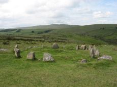
Nine Stones, Belstone Cairn Circle
Prehistoric Dartmoor Walks: Dartmoor Site: Nine Maidens Cairn Circle, Belstone Tor
OS Map: SX 61232 92849
HER: MDV6865
Megalithic Portal: 535
PMD: The Nine Stones
Alternate name: Nine Stones Cairn Circle
Short Name: CC Nine Stones
Butler map: 40.13
Grinsell: BEL 1
Turner: G23
DPD: 156
Barrow Report: 21 42
Dimensions (m): 7.2 x 0.6
Notes: The "Nine Stones" cairn circle "survives as a ring of at least 16 upright stones, standing up to 0.7 metres high, surrounding a slightly raised 7 metre diameter internal area". "A loose granite boulder in the centre of the circle may cover a cist; and there are vestiges of a mound around it. Well preserved." See also, Legendary Dartmoor: The Nine Maidens
Grinsell [Folklore 1976]: The retaining circle of a cairn, of which seventeen stones are now visible. Maidens turned into stone for dancing on the Sabbath, they still dance at noon. King 1850; Cresswell 1924,58; St Leger Gordon 1972, 70. There is a poetic version in Eden Phillpotts, Book of Avis .
Nearest Bus Stop (Minor): Belstone Car Park (1.3 km) [Route: 670]
Nearest Bus Stop (Major): Belstone Tongue End Cross (2.3 km) [Route: 178,670,671,6A]
Nearby sites: SX 61232 92849
Penn Beacon Platform Cairn Circle
OS Map: SX 59827 62268
HER: MDV2402
Megalithic Portal: 45617
PMD: Penn Beacon 2
Alternate name: Penn Beacon S.2 Platform Cairn Circle
Short Name: PC:Penn Beac 2
Butler map: 52.14.2
Grinsell: COR 4
Turner: E7
Dimensions (m): 13.0 x 0.5
Notes: A tumulus with a retaining circle, in poor condition. Diameter 12m, height 0.5m. "A cairn, about forty feet in diameter, from which almost all the stones have been removed and the central cist destroyed. It was surrounded by a circle of upright stones from one to three feet high, and to the west a row of two pairs of stones."
Nearest Bus Stop: Lee Moor Clearview (2.6 km) [Route: 59]
Nearby sites: SX 59827 62268
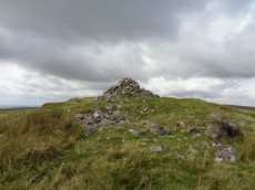
Penn Beacon Cairn
OS Map: SX 59924 62928
HER: MDV2404
Megalithic Portal: 45853
Alternate name: Penn Beacon Summit Cairn
Short Name: CN PennBeacon
Butler map: 52.14
Butler Vol 5: p.157 & Fig.96
Grinsell: COR 2
Barrow Report: 14
Dimensions (m): 24.0 x 2.0
Notes: "A round cairn, 22 metres in diameter and 1.7 metres high, lies on the summit of Penn Beacon, at 430 metres above O.D. It is of small boulders and has been much disturbed, with a central hollow, 8 metres in diameter and 0.8 metres deep, and a modern marker cairn, 1 metre high, on the south side". Lethbridge p.62-3 suggests possible ruins of chambered cairn (diagram p.59).
Nearest Bus Stop: Lee Moor Clearview (2.9 km) [Route: 59]
Nearby sites: SX 59924 62928
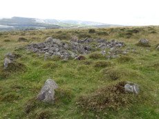
Penn Beacon 1 Cairn Circle & Cist
OS Map: SX 59532 62482
HER: MDV12909
PMD: Penn Beacon 1
Alternate name: Penn Beacon 1 stone row Cairn Circle & Cist
Short Name: CT Penn Beac 1
Butler map: 52.14.1
Grinsell: COR 3
DPD: 61
Dimensions (m): 17.0 x 1.2 C
Notes: A cairn on the lower slope of Penn Beacon, close to stone row (sx56se/2). Opened in 1872 by Spence Bate and Oliver: a fine cist was found, a stone implement and many pot fragments, one quite substantial. The cairn stands at the north end of a double stone row which extends for 7.0m. The cist is not visible. See also: Bate's 1872 Report
Nearest Bus Stop: Lee Moor Clearview (2.4 km) [Route: 59]
Nearby sites: SX 59532 62482

Pew Tor (N side) Ancient Pool
OS Map: SX 53354 73597
HER: MDV127216
Short Name: PO Pew Tor
Dimensions (m): 28 x 14m
Notes: "A pool measuring 28 by 14m. One of over 40 such 'sacred' pools identified on Dartmoor that are thought to have potentially been designed during the prehistoric period."
Nearest Bus Stop: Tavistock Higher Longford (2.0 km) [Route: 98,171,172]
Nearby sites: SX 53354 73597
Piles Hill Stone Ring Cairn Circle
OS Map: SX 65334 60849
HER: MDV5763
Megalithic Portal: 10030
Alternate name: Piles Hill Summit Stone Ring Cairn Circle
Short Name: RC:Piles Hill
Butler map: 54.19
Butler Vol 5: p.162 & Fig.103
Grinsell: HAR 12
Turner: A53
Dimensions (m): 30.0 x 1.2
Notes: Bell cairn of Wessex type. "Cairn on piles hill. An unusual monument, the equivalent of a bell barrow in stone. Cairn (diam 17.8m, heig 1.37m), berm(widt 3.05m), stone circle (diam 2.1m, heig 457mm)vis=12/4/1950 (os). Cairn with bell disc features. Slight hollow in the centre of the tump (mound), otherwise in good condition. No distinct outer bank could be found, but the berm and central tump were quite evident."
Nearest Bus Stop: South Brent Pool Park (5.0 km) [Route: 38]
Nearby sites: SX 65334 60849
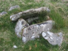
Plym Steps Ring Setting Cairn and Cist
Prehistoric Dartmoor Walks: Dartmoor Site: Guide to the Langcombe Brook & Deadman's Bottom Cists
OS Map: SX 60427 67110
HER: MDV5133
Megalithic Portal: 45659
PMD: Langcombe Brook 8
Alternate name: Langcombe Brook 8 Ring Setting Cairn and Cist
Short Name: CT Plym Steps
Butler map: 50.3.8
Dixon Cist #: 6
Grinsell: SHA 4
Turner: D22
DPD: 44
Barrow Report: 19
Dimensions (m): 5.0 x 0.2 C
Notes: Central cist. Butler Langcombe Brook 8 (Cairn 8)- Vol. 3. Map 50.3 (pp.148-54 general plan of Langcombe Brook cairns p.151, diagram of Langcombe cists p.153). Lethbridge p.44 Langcombe Cist B - diagram p.43
Nearest Bus Stop: Meavy Primary School (6.0 km) [Route: 56]
Nearby sites: SX 60427 67110
Pupers Rock Stone Ring Cairn Circle
OS Map: SX 67281 67376
HER: MDV5219
Megalithic Portal: 45845
Alternate name: Pupers Hill Summit Stone Ring Cairn Circle
Short Name: RC:Pupers Rock
Butler map: 58.9
Grinsell: DEA 1
Turner: A58
DPD: 89
Dimensions (m): 27.0 x 1.0
Notes: HER: A natural outcrop some 10.0m across and 2.0m high, encompassed by a mass of small stones. Most are piled to the west of the outcrop but overall they form a cairn 16.0m in diameter and 1.0m high. On the southern side the precise perimeter is difficult to determine since a spread of stone on the surface extends for a further 8.0 metres. This site is on the local list of Nationally Important Dartmoor sites.. Turner: Ring cairn incorporating a large flat-topped granite outcrop. The stone ring measures 17 meters in diameter internally with 2.5 meter wide bank 0.6 meters high. There are the remains of a stone circle, around 1.0 meter high within the outcrop.
Nearest Bus Stop: Poundsgate Tavistock Inn (5.7 km) [Route: 172]
Nearby sites: SX 67281 67376
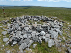
Quintins Man Cairn
OS Map: SX 62101 83873
HER: MDV6765
Megalithic Portal: 45860
PMD: Quintins Man
Short Name: SSxQuintinsMan
Butler map: 34.1
Notes: "A cairn. The name implies a standing stone, but there is no knowledge of one in living memory." [worth] See also, Legendary Dartmoor: Dartmoor's Quintin's Man
Nearest Bus Stop: Postbridge Post Office (5.7 km) [Route: 98,171]
Nearby sites: SX 62101 83873
Quintins Man A Ancient Pool
OS Map: SX 62102 83952
HER: MDV27278
Short Name: PO Quintins A
Dimensions (m): 13m
Notes: "Previously identified as a prehistoric barrow, survey work in 1995 suggested this to be a natural feature. One of over 40 'sacred' pools identified by Greeves (2019) that may have prehistoric origin. Lies north of the Quintin's Man cairn."
Nearest Bus Stop: Postbridge Post Office (5.7 km) [Route: 98,171]
Nearby sites: SX 62102 83952
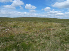
Quintins Man B Ancient Pool
OS Map: SX 62053 84056
HER: MDV127217
Short Name: PO Quintins B
Dimensions (m): 20 x 16m
Notes: "A pool measuring 20 by 16m. One of over 40 such 'sacred' pools identified on Dartmoor that are thought to have potentially been designed during the prehistoric period."
Nearest Bus Stop: Postbridge Post Office (5.8 km) [Route: 98,171]
Nearby sites: SX 62053 84056
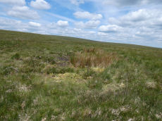
Quintins Man C Ancient Pool
OS Map: SX 61972 84365
HER: MDV127218
Short Name: PO Quintins C
Dimensions (m): 12 x 8m
Notes: "Pool north of Quintin's Man measures 12 by 8m. One of over 40 such 'sacred' pools identified on Dartmoor that are thought to have potentially been designed during the prehistoric period"
Nearest Bus Stop: Postbridge Post Office (6.2 km) [Route: 98,171]
Nearby sites: SX 61972 84365
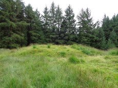
Red Barrows Cairn
Prehistoric Dartmoor Walks: Dartmoor Site: Soussons Cairn Circle
OS Map: SX 67718 79650
HER: MDV6007
Megalithic Portal: 34986
PMD: Red Barrows
Alternate name: Red Barrows 1 Cairn
Short Name: CN RedBar 1
Butler map: 24.2.1
Grinsell: MAN 5
Dimensions (m): 20.0 x 2.0
Notes: Four Bronze Age round barrows between 10 and 20 meters in diameter and 0.5 to 2.2 meters high. One barrow was excavated in 1902, finds included pottery and flints. See also HER records, 6004, 6005, 6006, 6007.
Nearest Bus Stop: Warren House Inn (1.3 km) [Route: 171]
Nearby sites: SX 67718 79650
Ring of Bells Stone Ring Cairn Circle
OS Map: SX 5214 8287
HER: MDV3221
Megalithic Portal: 45837
Short Name: RC:RingofBells
Grinsell: MAR 2
Turner: A34
Dimensions (m): 17 x 0.3
Notes: "Ring cairn with entrance. Stone ring 13m internal diam, with bank 1.5m wide and 0.3m high.3m wide entrance on ese side. Flag pole has been sited here"
Nearest Bus Stop: Lydford Gorge Lower Entr (2.0 km) [Route: 118]
Nearby sites: SX 5214 8287
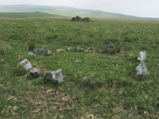
Ringmoor Down Cairn Circle
OS Map: SX 56157 65947
HER: MDV4029
Megalithic Portal: 22947
Alternate name: Ringmoor Down 3 Cairn Circle
Short Name: CC Ringmoor 3
Butler map: 49.21.3
Grinsell: SHE 18
Turner: G29
DPD: 36
Barrow Report: 63
Dimensions (m): 3.5
Notes: Located about 230m NW of the cairn circle that terminates the Ringmoor Down stone row. "An 11ft 2ins diameter cairn circle composed of fourteen stones of which four have fallen over. Stones of quartz-schorl, not granite." "This feature has the semblance of having been recently created. The stones are mostly loose and irregularly spaced. As a monument type it appears to be unique on Dartmoor. It should not be considered of great antiquity." For a photo, see: Stone-Circles.org.uk: Ringmoor Cairn. Lethbridge kerb circle p.34-36. Diagram 34 site 4.
Nearest Bus Stop: Meavy Primary School (2.1 km) [Route: 56]
Nearby sites: SX 56157 65947
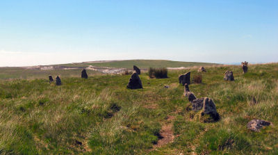
Ringmoor Down Encircled Cairn
OS Map: SX 56334 65807
HER: MDV3987
Megalithic Portal: 1233
PMD: Ringmoor Down Stone Row
Alternate name: Ringmoor Down stone row Encircled Cairn
Short Name: EC Ringmoor S
Butler map: 49.20
Grinsell: SHE 19
Turner: F5
DPD: 35
Dimensions (m): 12.7 x 0.1
Notes: "The cairn circle measures approximately 12.6m. in diameter and has eleven stones averaging 0.7m. high. The disturbed central cairn is 9.5m. in diameter and 0.4m. in height." "1909 the circle was restored and five of the present stones were introduced from elsewhere. Prior to restoration one stone was standing, four had fallen and the presumed sites of six other stones were represented by pits." Lethbridge Brisworthy cairn circle p.34-35. Diagram p. 34 site 2.
Nearest Bus Stop: Meavy Primary School (2.3 km) [Route: 56]
Nearby sites: SX 56334 65807
Ringmoor Down Stone Ring Cairn Circle
OS Map: SX 56113 65922
HER: MDV19760
Megalithic Portal: 34142
Alternate name: Ringmoor Down 4 Stone Ring Cairn Circle
Short Name: CC Ringmoor 4
Butler map: 49.21.4
Turner: A2
Dimensions (m): 35.0 x 0.1
Notes: HER: A low, disturbed circular earthwork on the upper ridge of Ringmoor Down is a probable ring cairn. The bank is low and spread being up to 4.6m wide by 0.1m high and forms a slightly irregular circle with an internal diameter of between 28 and 30m and overall diameter of 37m. Two lines of tin prospecting pits which traverse the monument, of probable medieval or post medieval date, have caused some damage on the southern arc of the bank and its interior.
Nearest Bus Stop: Meavy Primary School (2.1 km) [Route: 56]
Nearby sites: SX 56113 65922
Rippon Tor Stone Ring Cairn Circle
OS Map: SX 74664 75581
HER: MDV7539
Megalithic Portal: 17833
PMD: Rippon Tor Summit
Alternate name: Rippon Tor 1 Stone Ring Cairn Circle
Short Name: RC RipponTor 1
Butler map: 5.5.1
Grinsell: ILS 1
Dimensions (m): 28.0 x 4.0
Notes: "Cairn built around tor. Diameter 25 metres, height 4.0 metres." "Ring cairn, internal diameter 4.5 metres, with bank 1.0 metre wide and 0.4 metres high. In the centre is a boulder 3.0 metres wide, 2.0 metres thick, 2.5 metres high." NMR D
Nearest Bus Stop (Minor): Haytor Vale Moorlands House (2.7 km) [Route: 193,271]
Nearest Bus Stop (Major): Poundsgate Tavistock Inn (5.4 km) [Route: 172]
Nearby sites: SX 74664 75581
Rook Tor Cairn Circle
OS Map: SX 6023 6153
HER: MDV132245
Megalithic Portal: 3445
Alternate name: Rook Tor 2 Cairn Circle
Short Name: CC:Rook Tor 2
Butler map: 52.8
Dimensions (m): 7.5
Notes: Butler refers to a possible cairn at SX 6023 6153 a semi-circle of slabs amongst the rocks of Rook Tor are obviously artificially set - remains suggest the site of a cairn, entirely demolished but for the retaining circle. (Butler Vol. 3. p.182).
Turner lists a Rook Tor site (G21) 1km away at SX 6127 6148: 10 stones standing, one a boulder. Are there two seprate features or does one auth have the wrong grid reference? See also: Rook Tor 1
Nearest Bus Stop: Cornwood Crossways (2.0 km) [Route: 59]
Nearby sites: SX 6023 6153
Rook Tor 1 Cairn Circle
OS Map: SX 6127 6148
HER: MDV49463
Megalithic Portal: 3445
Short Name: CC:Rook Tor 1
Turner: G21
Dimensions (m): 7.5
Notes: Turner G21: 10 stones standing, one a boulder (Turner). The closest possible NMR entry that could fit refers to natural boulders. Butler refers to a possible cairn at SX60236153 a semi-circle of slabs amongst the rocks of Rook Tor are obviously artificially set - remains suggest the site of a cairn, entirely demolished but for the retaining circle. (Butler Vol. 3. p.182). Are there two features separated by 1 km or is there an error in one of these grid references? See also: Rook Tor 2
Nearest Bus Stop: Cornwood Crossways (2.1 km) [Route: 59]
Nearby sites: SX 6127 6148

Royal Hill Cairn
OS Map: SX 61817 71957
HER: MDV6310
Megalithic Portal: 34957
Alternate name: Royal Hill E.1 Cairn
Short Name: CN:RoyalHill 1
Butler map: 65.5.1
Grinsell: LYD 93
Dimensions (m): 15.5 x 2.0
Notes: "This impressive disturbed turf-covered cairn on the summit area of Royal Hill at 394m OD. It measures 16.4m (N-S) by 15.6m (E-W) with a maximum height of 1.8m. The flattish top has an off-centre pit 4.5m by 2.4m and 0.8m deep with some upcast material dumped around the top edge. Damage to the perimeter, reported in 1982 (8), has mostly been reinstated. The cairn is variously named Broken Barrow, Broken Barrows and Brokenborough"
Nearest Bus Stop: Princetown Dartmoor Visitor Centre (3.2 km) [Route: 98,171,172]
Nearby sites: SX 61817 71957
Royal Hill, Central Platform Cairn Circle and Cist
OS Map: SX 62082 72334
HER: MDV6304
Megalithic Portal: 34960
PMD: Royal Hill E.
Alternate name: Royal Hill E.4 Platform Cairn Circle and Cist
Short Name: CT RoyalHill 4
Butler map: 65.5.4
Dixon Cist #: 23
Grinsell: LYD 89
Turner: E21
DPD: 98
Barrow Report: 27 47
Dimensions (m): 5.5 x 0.6 C
Notes: "The cairn has an overall diameter of about 7.5m in diameter, and 0.6m high, with a flattish top. There are traces of an inner kerb 4.5m in diameter, and an outer one 5.7m across comprising boulders and slabs, the largest 1.5m long, 0.6m high, and 0.2m thick. The interior of the central cist is about 0.8m square with four stones up to 0.25m thick and 0.6m deep but the southern one overlaps the sides, is 1m long, and gives the cist its NW to SE alignment. This and the two end stones incline inwards; the northern one inclines slightly outwards. There is no cover stone." Lethbridge diagram p.97 Cist B, photo p.98. Turner E21 - listed as Royal Hill (N) [n.b. we have a south, central & north - N being a different cist]. Butler Royal Hill E. 4 (Cairn 4 - diagram p.233) - Vol. 4. Map 65.5. Breton p.19.
Nearest Bus Stop: Two Bridges Hotel (2.9 km) [Route: 98,171,172]
Nearby sites: SX 62082 72334
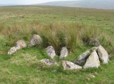
Royal Hill, North Ring Setting Cairn and Cist
OS Map: SX 62108 72434
HER: MDV6305
Megalithic Portal: 34959
PMD: Royal Hill NE.
Alternate name: Royal Hill E.5 Ring Setting Cairn and Cist
Short Name: CT RoyalHill 5
Butler map: 65.5.5
Dixon Cist #: 24
Grinsell: LYD 90
Turner: D21
DPD: 98
Barrow Report: 27 47
Dimensions (m): 3.0 x 0.3 C
Notes: "The circle is 3.1m in overall diameter, comprising nine contiguous thick slabs, up to 0.9m long and from 0.3m to 0.7m high... There is virtually no cairn material but the interior has been levelled up to a height of 0.1m on the E, downhill side. A central cist oriented WNW to ESE is represented by two side stones which protrude 0.15m above ground. They are 1.2m and 0.9m long and both about 0.2m thick and 0.4m deep. The longer, northern one leans inwards and touches the other at the W end; at the E the stones are 0.8m apart separated by two flat (packing ?) stones each about 0.35m across. An overgrown and embedded slab against the circle W if the cist may have been an end stone." Lethbridge diagram p.97 Cist C, photo p.98. Butler Royal Hill E. 5 (Cairn 5 - diagram p.233)- Vol. 4. Map 65.5. Central cist. Breton p.19.
Nearest Bus Stop: Two Bridges Hotel (2.8 km) [Route: 98,171,172]
Nearby sites: SX 62108 72434
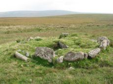
Royal Hill, South Platform Cairn Circle and Cist
OS Map: SX 62020 72091
HER: MDV6309
Megalithic Portal: 34958
PMD: Royal Hill SE.
Alternate name: Royal Hill E.3 Platform Cairn Circle and Cist
Short Name: CT RoyalHill 3
Butler map: 65.5.3
Dixon Cist #: 22
Grinsell: LYD 88
Turner: E31
DPD: 98
Barrow Report: 27 47
Dimensions (m): 4.7 x 0.5 C
Notes: "The cairn is 4.9m in diameter and 0.4m high with a flattish, platform, top. It is retained by a kerb of almost contiguous orthostats, the largest 1.1m long, 0.2m thick, and 0.6m high. A few are fallen or displaced. The central cist is oriented WNW to ESE, lacking both cover stone and N side slab. Internally it measures 1.35m by 0.75m by 0.55m deep." Lethbridge diagram p.97 Cist A, photo p.98. Butler Royal Hill E. 3 - Vol. 4. Map 65.5 (Cairn 3 - diagram p.233). Breton p.19.
Nearest Bus Stop: Two Bridges Hotel (3.1 km) [Route: 98,171,172]
Nearby sites: SX 62020 72091
Saddle Tor A Ancient Pool
OS Map: SX 75135 76534
HER: MDV127219
Short Name: PO:SaddleTorA
Dimensions (m): 20m
Notes: "A pool measuring 20m. One of over 40 such 'sacred' pools identified on Dartmoor that are thought to have potentially been designed during the prehistoric period. One of a group of three pools north-east of saddle Tor."
Nearest Bus Stop (Minor): Haytor Vale Moorlands House (1.8 km) [Route: 193,271]
Nearest Bus Stop (Major): Lemonford Caravan Park (5.9 km) [Route: 38,193]
Nearby sites: SX 75135 76534
Saddle Tor B Ancient Pool
OS Map: SX 75172 76553
HER: MDV127220
Short Name: PO:SaddleTorB
Dimensions (m): 16.5 x 14.5m
Notes: "A pool measuring 16.5 by 14.5m. One of over 40 such 'sacred' pools identified on Dartmoor that are thought to have potentially been designed during the prehistoric period. One of a group of three pools north-east of saddle Tor."
Nearest Bus Stop (Minor): Haytor Vale Moorlands House (1.7 km) [Route: 193,271]
Nearest Bus Stop (Major): Lemonford Caravan Park (5.9 km) [Route: 38,193]
Nearby sites: SX 75172 76553
Saddle Tor C Ancient Pool
OS Map: SX 75273 76526
HER: MDV127222
Short Name: PO:SaddleTorC
Dimensions (m): 14 x 10m
Notes: "A pool measuring 14 by 10m. One of over 40 such 'sacred' pools identified on Dartmoor that are thought to have potentially been designed during the prehistoric period. One of a group of three pools north-east of saddle Tor."
Nearest Bus Stop (Minor): Haytor Vale Moorlands House (1.7 km) [Route: 193,271]
Nearest Bus Stop (Major): Lemonford Caravan Park (5.8 km) [Route: 38,193]
Nearby sites: SX 75273 76526
Saddlesborough Stone Ring Cairn Circle
OS Map: SX 5587 6321
HER: MDV2433
Megalithic Portal: 45840
Alternate name: Saddlesborough Summit Stone Ring Cairn Circle
Short Name: RC Saddlesboro
Butler map: 48.3
Turner: A45
Dimensions (m): 19.0 x 0.3
Notes: "Stone ring with an annular bank. The interior is part infilled with small stones and boulders to 0.3 meters or less below the bank top. This cairn measures 15.5 meters in diameter, with a bank 1.3 meters wide and 0.4 meters high. The interior has been dug into. Situated on a level summit."
The two entries SiteID=545 and SiteID=1472 are probably correct but the area is disturbed by tin workings and further confirmation is required that the correct features have been identified in the field (in terms of photos - visit 12 Sep 2022). Grid references not updated due to doubt about ID.
Nearest Bus Stop: Wotter Methodist Church (1.3 km) [Route: 59]
Nearby sites: SX 5587 6321

Scorhill Reported Stone Row
Prehistoric Dartmoor Walks: Dartmoor Site: Scorhill Stone Circle
OS Map: SX 65485 87207
HER: MDV130497
Megalithic Portal: 25238
PMD: Scorhill Stone Row
Short Name: SR Scorhill
Butler map: 38.8
Butler Vol 5: p.172 & Fig.112
DPD: 146
Dimensions (m): 5
Notes: N. Teign. Claimed by Butler.See also Butler Vol 5 p. 249 fig. 175. Possible stone row near long cairn south-east of the Scorhill stone circle recorded by Butler (1991), although Gerrard was not convinced during Monument Protection Programme visit in 1998 and was not included in scheduling. Site visit in 2021 recorded potential row.. Visited by author on 06/02/2025 and the feature can be seen but currently looks like stones that may have been disturbed, tumbled, from the cairn that happen to form a short linear features. Changed entry from stone row to reported stone row as I'm inclined to agree with Gerrard.
Nearest Bus Stop (Minor): Wonson Telephone Box (3.0 km) [Route: 670]
Nearest Bus Stop (Major): Chagford The Square (4.6 km) [Route: 173,178,671]
Nearby sites: SX 65485 87207
Scorhill N Reported Stone Row
OS Map: SX 6574 8782
HER: MDV6189
Megalithic Portal: 25238
Short Name: SR:ScorhillN
Notes: HER: (1950) Stone row. SX 65628794 to SX 65748782. (09/07/1974) There is no alignment of stones in this area of moorland which can be considered other than natural. It is doubtful if the alleged stone row was ever seen by Crawford. The information most probably came from H H Breton, an unreliable correspondent of c 1925.
Nearest Bus Stop (Minor): Wonson Telephone Box (2.6 km) [Route: 670]
Nearest Bus Stop (Major): Chagford The Square (4.6 km) [Route: 173,178,671]
Nearby sites: SX 6574 8782

Seven Lords' Lands Encircled Cairn
OS Map: SX 74127 76237
HER: MDV7396
Megalithic Portal: 3454
PMD: Seven Lord's Lands
Alternate name: Sevon Lords Lands Encircled Cairn
Short Name: EC 7LordsLands
Butler map: 9.10
Butler Vol 5: p.51 & Fig.29
Grinsell: WID 13
Turner: F1
Barrow Report: 53
Dimensions (m): 10.0 x 0.6
Notes: A cairn from 0.8m. to 1.2m. high, with a minor central excavation 0.5m. deep. The kerb retaining circle extends round the west and north quadrants.
Nearest Bus Stop (Minor): Widecombe in the Moor Car Park (2.3 km) [Route: 271]
Nearest Bus Stop (Major): Poundsgate Tavistock Inn (5.5 km) [Route: 172]
Nearby sites: SX 74127 76237
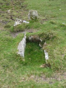
Sharpitor (N) or Peek Hill Platform Cairn Circle and Cist
Prehistoric Dartmoor Walks: Dartmoor Walk: Sharpitor area Stone Rows and Cists
OS Map: SX 55839 70693
HER: MDV3769
Megalithic Portal: 1246
PMD: Peek Hill
Alternate name: Sharpitor N. Platform Cairn Circle and Cist
Short Name: CT Peek Hill
Butler map: 45.12
Dixon Cist #: 103
Grinsell: WAL 21
Turner: E41
DPD: 22
Barrow Report: 72
Dimensions (m): 4.0 x 0.2 C
Notes: Bar Rep. 72 (TDA Vol 88 p.222). Butler Sharpitor N. - Vol. 3. Map 45.12 (diagram p.45 & photo p.84).
Copyright for photos and plans from Barrow Reports 71-73 belong to the Dixon estate. Reproduced here with kind permission.
Nearest Bus Stop: Walkhampton Memorial (2.7 km) [Route: 55,56]
Nearby sites: SX 55839 70693
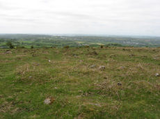
Sharpitor W. (Peek Hill) Cairn Circle
Prehistoric Dartmoor Walks: Dartmoor Walk: Sharpitor area Stone Rows and Cists
OS Map: SX 55056 70751
HER: MDV5011
Megalithic Portal: 52566
PMD: Sharpitor W Stone Row
Alternate name: Sharpitor W. stone row Cairn Circle
Short Name: CC Sharpitor W
Butler map: 45.11
Grinsell: WAL 18
DPD: 20
Dimensions (m): 8.9 x 0.3
Notes: "The cairn lies on a gentle sw slope ne of horseyeatt farm, with a stone row see sx57se/141 running sw from it. The cairn is about 7m in diameter and 0.6m height, partly turf-covered, with a central hollow. The visible set stones within the cairn suggest two or three underlying concentric stone circles. These stones have a maximum height of 0.2m and are predominantly set with their long axes tangential to the circle". Lethbridge pp.19-20, diagram p.19.
Nearest Bus Stop: Walkhampton Memorial (2.0 km) [Route: 55,56]
Nearby sites: SX 55056 70751
Shaugh Cross Platform Cairn Circle
OS Map: SX 5532 6346
HER: MDV2524
Megalithic Portal: 17513
Alternate name: Saddlesborough reave Platform Cairn Circle
Short Name: PC:ShaughCross
Butler map: 48.5
Grinsell: SHA 40
Turner: E2
Dimensions (m): 11.0 x 1.4
Notes: A barrow lies 109.7m west from the retaining circle (sx56se/24) of the stone row on shaugh moor. There is a kerb of stones visible and a wider spread of material up to 12.19m (worth). Barrow diam 12.19m, height 1.524m.
Nearest Bus Stop: Shaugh Prior White Thorn Inn (1.2 km) [Route: 59]
Nearby sites: SX 5532 6346
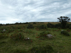
Shaugh Moor Platform Cairn Circle
OS Map: SX 55476 63479
HER: MDV2572
Megalithic Portal: 52699
Alternate name: Saddlesborough N.W. Platform Cairn Circle
Short Name: PC Shaugh Moor
Butler map: 48.5
Grinsell: SHA 41b
Turner: E3
Dimensions (m): 10.5 x 0.3
Notes: Ring cairn or traces of cairn with retaining circle, found by plymouth archaeological group 1959. Diameter 11.5m, height 0.3m. No.416. Vis=-/7/1959 (ancient monuments). Cairn, height 2ft, diameter 30ft, east of and close to stone row. Distinct stone kerb with low flat mound within.
Nearest Bus Stop: Shaugh Prior White Thorn Inn (1.3 km) [Route: 59]
Nearby sites: SX 55476 63479
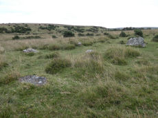
Shaugh Moor (N) Cairn Circle
OS Map: SX 55419 63496
HER: MDV5596
Megalithic Portal: 3458
Alternate name: Shaugh Moor N.1 Cairn Circle
Short Name: CC ShaughMo N1
Turner: G18
Dimensions (m): 8.2
Notes: "Whether the stones represent the remnants of a stone circle, a cairn circle, or even a hut is debateable". "The remains of a circle of stones lie on a north-west facing hill slope at 256m above OD on unenclosed moorland. It survives as a partial ring of five boulder and stones with an off-centre earthfast boulder; the overall diameter was approximately 10.0m to 10.6m across. The largest of the two slabs which remain upright is 0.8m high, 1.7m wide and 0.3m thick."
Nearest Bus Stop: Shaugh Prior White Thorn Inn (1.3 km) [Route: 59]
Nearby sites: SX 55419 63496
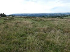
Shaugh Moor (S) Cairn Circle
OS Map: SX 55419 63427
HER: MDV49564
Megalithic Portal: 52567
PMD: Shaugh Moor Stone Row
Alternate name: Shaugh Moor stone row Cairn Circle
Short Name: CC ShaughMoorS
Butler map: 48.5
Grinsell: SHA 41
Turner: G17
DPD: 55
Dimensions (m): 13.0 or 18.0
Notes: Cairn circle at the southern end of the Shaugh Moor stone row. "An egg-shaped ring of stone uprights". "Only an arc of four clearly identifiable stones survive in the circle; they are a maximum 0.3m high and suggest an approximate circle diameter of 15.0m. There are a number of buried and semi-buried stones traceable but their relationship to the circle is unclear". Lethbridge p.54-55, diagram p.55
Nearest Bus Stop: Shaugh Prior White Thorn Inn (1.3 km) [Route: 59]
Nearby sites: SX 55419 63427
Shell Top Stone Ring Cairn Circle
OS Map: SX 59835 63835
HER: MDV12790
Megalithic Portal: 1250
Alternate name: Shell Top Summit 3 Stone Ring Cairn Circle
Short Name: RC:ShellTopSu3
Butler map: 51.10.3
Grinsell: COR 1a
Turner: A44
Dimensions (m): 20.0 x 0.2
Notes: "A stone ring 20.5m overall diameter, comprising small, heather covered stones, 0.8m wide and 0.2m high. It lies on the broad level summit of shell top at 475m above sea level. There is a wide 3m wide gap on the north side and the interior is slightly domed, about 0.4m high, possibly a natural rise since it is off-centre. The term 'stone circle' is rather a mis-nomer since only half a dozen stones protrude from the turf and in appearance it is simply a low circular bank."
Nearest Bus Stop: Lee Moor Clearview (3.2 km) [Route: 59]
Nearby sites: SX 59835 63835
Shell Top Platform Cairn Circle
OS Map: SX 59766 63805
HER: MDV12905
Megalithic Portal: 45646
PMD: Shell Top
Alternate name: Shell Top Summit 1 Platform Cairn Circle
Short Name: PC:ShellTopSu1
Butler map: 51.10.1
Grinsell: COR 1
Turner: E53
Dimensions (m): 16.0 x 2.0
Notes: Cairn 9.5m in diameter with boulder of tor. Butler Vol 3 map 51.10 p.174.
Nearest Bus Stop: Lee Moor Clearview (3.2 km) [Route: 59]
Nearby sites: SX 59766 63805
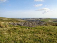
Shell Top Chambered Cairn
OS Map: SX 58690 63517
HER: MDV2411
Megalithic Portal: 45852
Alternate name: Tory Brookhead 3 Chambered Cairn
Short Name: CN ToryBrook 3
Butler map: 51.7.3
Grinsell: SHA 39
DPD: 59
Dimensions (m): 25 x 18 x 1.4
Notes: "A Bronze Age round cairn on a well drained south west facing slope. The cairn mound measures 26 metres by 24 metres and stands up to 1.2 metres high. The centre is much disturbed, with many hollows, up to 1m deep, which have been interpreted as chambers, but are most probably modern windbreak shelters. Two small satellite cairns lie immediately to the north west." Lethbridge suggests a chambered cairn, see photos Lethbridge p.59-60 Chambered Cairn - diagram p.59
Nearest Bus Stop: Lee Moor Clearview (2.2 km) [Route: 59]
Nearby sites: SX 58690 63517
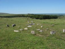
Shovel Down Fourfold Cairn Circle
Prehistoric Dartmoor Walks: Dartmoor Site: Shovel Down Ceremonial Complex
OS Map: SX 65958 86025
HER: MDV6158
Megalithic Portal: 3464
PMD: Fourfold Circle
Alternate name: Fourfold Circle Cairn Circle
Short Name: CC Shovel4Fold
Butler map: 36.7
Grinsell: GID 3
Turner: G31
DPD: 143
Barrow Report: 56
Dimensions (m): c.9.0
Notes: "Fourfold Circle a sub-circular configuration of four apparently concentric stone rings. The outer ring has a diameter of 9m, the others have diameters of 6.4m, 4.7m and 2.4m respectively. The monument comprises 29 visible stones. Most are approximately 0.3m in height although they vary from 0.1-0.55m. The middle two rings define the bottom and top of the scarp of a small earthern cairn apparently an integral part of the monument. It is most pronounced on the E (downslope side). In the centre is a roughly sub-circular pit measuring 1.3m by 0.7m and 0.45m deep; it is probably the remains of a badly robbed cist. On the N side are two large fallen stones. When upright they may have served as a focal point for the end of the stone row " Lethbridge 139-145, diagram p.139.
Nearest Bus Stop (Minor): Wonson Telephone Box (3.8 km) [Route: 670]
Nearest Bus Stop (Major): Chagford The Square (4.4 km) [Route: 173,178,671]
Nearby sites: SX 65958 86025
Shoveldown D Reported Stone Row
Prehistoric Dartmoor Walks: Dartmoor Site: Shovel Down Ceremonial Complex
OS Map: SX 66040 85680
HER: MDV6145
Megalithic Portal: 2128
The Stone Rows of GB: Shoveldown 1
PMD: Shovel Down H-K Stone Row
Short Name: SR:ShovelRow D
Butler map: 36.7.1
DPD: 139
Notes: Worth Row D, Butler Row 1. This row is considered to be one long partially robbed row - previously listed as four separate rows.
Nearest Bus Stop (Minor): Wonson Telephone Box (4.1 km) [Route: 670]
Nearest Bus Stop (Major): Chagford The Square (4.4 km) [Route: 173,178,671]
Nearby sites: SX 66040 85680
Shoveldown H Reported Stone Row
Prehistoric Dartmoor Walks: Dartmoor Site: Shovel Down Ceremonial Complex
OS Map: SX 65990 85950
HER: MDV14881
Megalithic Portal: 2128
The Stone Rows of GB: Shoveldown 1
PMD: Shovel Down H-K Stone Row
Short Name: SR:ShovelRow H
Butler map: 36.7.1
DPD: 139
Notes: Worth Row H, Butler Row 1. This row is considered to be one long partially robbed row - previously listed as four separate rows.
Nearest Bus Stop (Minor): Wonson Telephone Box (3.9 km) [Route: 670]
Nearest Bus Stop (Major): Chagford The Square (4.4 km) [Route: 173,178,671]
Nearby sites: SX 65990 85950
Shoveldown J Reported Stone Row
Prehistoric Dartmoor Walks: Dartmoor Site: Shovel Down Ceremonial Complex
OS Map: SX 65980 86030
HER: MDV14882
Megalithic Portal: 2128
The Stone Rows of GB: Shoveldown 1
PMD: Shovel Down H-K Stone Row
Short Name: SR:ShovelRow J
Butler map: 36.7.1
DPD: 139
Notes: Worth Row D, Butler Row 1. This row is considered to be one long partially robbed row - previously listed as four separate rows.
Nearest Bus Stop (Minor): Wonson Telephone Box (3.8 km) [Route: 670]
Nearest Bus Stop (Major): Chagford The Square (4.4 km) [Route: 173,178,671]
Nearby sites: SX 65980 86030
Single Barrow Cairn
OS Map: SX 70576 79538
HER: MDV7487
Megalithic Portal: 16631
Short Name: CN SingleBarro
Butler map: 20.10
Butler Vol 5: p.23 & Fig.106
Grinsell: MAN 11
Dimensions (m): 21.5 x c.1.0
Notes: Round barrow, crowned by boundary stone dated 1854, and inscribed single burrow. Excavated 1873. Diameter 23 metres, height 1.0 metres. Butler Volume 1 Map 20.10.
Nearest Bus Stop (Minor): Widecombe in the Moor Car Park (3.0 km) [Route: 271]
Nearest Bus Stop (Major): Warren House Inn (3.4 km) [Route: 171]
Nearby sites: SX 70576 79538
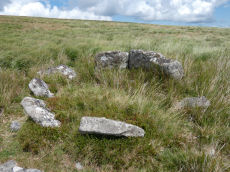
Sittaford Tor Ring Setting Cairn and Cist
OS Map: SX 63479 82641
HER: MDV21894
Megalithic Portal: 45792
PMD: Sittaford Tor
Alternate name: Sittaford Tor S. Ring Setting Cairn and Cist
Short Name: CT Sittaford
Butler map: 34.3
Butler Vol 5: p.183 & Fig.126
Dixon Cist #: 134
Turner: D25
DPD: 125
Dimensions (m): 6.0 x 0.3
Notes: "Cairn 5 metres in diameter, 0.75 metres high. Surrounded by two rings of kerb stones up to 0.75 metres high. Many stones forming the outer ring are recumbent. Mound material up to 0.2 metres high. Inner kerb is 2.8 metres diameter and the outer is 5 metres diameter. Slab in centre may be an intact cist. Grass and rushes. Animal poaching on western side of cairn.". "This mutilated kerbed cairn is situated on a peat-covered moorland slope below Sittaford Tor at 488m OD. It measures about 5m in diameter and comprises a probably (hidden) central cist set within twin concentric kerbs of granite slabs." Lethbridge photo bottom p.125. Butler Sittaford Tor S (Cairn 3) Vol. 2. Map 34.3 (p.112, also Butler Vol. 5. diagram p.183).
Nearest Bus Stop: Postbridge Post Office (4.0 km) [Route: 98,171]
Nearby sites: SX 63479 82641
Skir Hill (Henroost) Ring Setting Cairn and Cist
OS Map: SX 65104 70686
HER: MDV6507
Megalithic Portal: 45676
PMD: Skir Hill
Alternate name: Skir Hill Ring Setting Cairn and Cist
Short Name: CT Skir Hill
Butler map: 61.8
Dixon Cist #: 18
Grinsell: LYD 102
Turner: D18
DPD: 92
Barrow Report: 24 56
Dimensions (m): 3.3 C
Notes: DM reports it is actually located at SX 65092 70684. The author has found this site at SX 65104 70691 on 28/06/18 assisted by the grid reference given by Dave Martin (DM). "A Bronze Age cairn containing a cist located on the north east facing slope of Skir Hill 590 metres south of Skir Ford. The cairn survives as a 4.1 diameter ring of edge set slabs up to 0.5 metres high. The cist is situated slightly west of the cairns centre and survives as a 0.82 metres long by 0.52 metres wide and 0.82 metres deep stone lined pit." Formerly listed as being at SX 6517 7075 (as per literature). Butler Vol. 4. Map 61.8 (diagram p.203).
Nearest Bus Stop: Dartmeet Badgers Holt (3.3 km) [Route: 172]
Nearby sites: SX 65104 70686
Sourton Common Stone Ring Cairn Circle
OS Map: SX 54418 88858
HER: MDV4674
Megalithic Portal: 10023
Alternate name: Corn Ridge W.1 Stone Ring Cairn Circle
Short Name: RC CornRg W1
Butler map: 43.8.1
Grinsell: BRI 3
Turner: A33
Dimensions (m): 21.0 x 0.3
Notes: "Ring cairn surviving as a circular bank 4m wide and 0.7m high surrounding an internal area measuring 12m in diam. Four small hollows in the ring bank suggest partial early excavation or robbing" NMR B.
Nearest Bus Stop: Sourton Windard Terrace (1.7 km) [Route: 118]
Nearby sites: SX 54418 88858
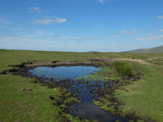
Sourton Tors Ancient Pool
OS Map: SX 54596 89607
HER: MDV127223
Short Name: PO Sourton Tor
Dimensions (m): 12 x 10.5 m
Notes: Pool measures 12 by 10.5m. One of over 40 such 'sacred' pools identified on Dartmoor that are thought to have potentially been designed during the prehistoric period, and may have been used to deposit votive items, although these Dartmoor examples may have alternative significance as designed prehistoric elements in the landscape. Many are located on ridge tops and in conjunction with cairns, stone rows and other prehistoric features. Further research may well reveal more about these interesting features.
Nearest Bus Stop: Sourton Windard Terrace (1.4 km) [Route: 118]
Nearby sites: SX 54596 89607
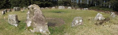
Soussons Common Ring Setting Cairn and Cist
Prehistoric Dartmoor Walks: Dartmoor Site: Soussons Cairn Circle
OS Map: SX 67516 78700
HER: MDV6013
Megalithic Portal: 1266
PMD: Soussons Plantation
Alternate name: Soussons Plantation S. Ring Setting Cairn and Cist
Short Name: CT Soussons Cm
Butler map: 24.2.6
Dixon Cist #: 16
Grinsell: MAN 9
Turner: D2
DPD: 124
Barrow Report: 22 23 45 56
Dimensions (m): 8.6 C
Notes: "A 28 feet diameter cairn circle with a central cist (plan). The tallest stone in the cairn circle is about 2 feet high." "This cist measures at least 1.3 metres long by 0.5 metres wide and when excavated in 1903 two coils of human hair were found". Lethbridge p.124. Butler Soussons Plantation S - Vol. 2. Map 24.2.6 (diagrams pp. 18-20). Breton p.41.
Nearest Bus Stop: Warren House Inn (2.3 km) [Route: 171]
Nearby sites: SX 67516 78700
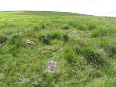
South Teignhead Platform Cairn Circle
OS Map: SX 64084 82827
HER: MDV20908
Megalithic Portal: 45611
PMD: South Teignhead
Short Name: PC S Teignhead
Butler map: 35.17
Butler Vol 5: p.157
Turner: E4
Dimensions (m): 8.0 x 14.0 x 0.5
Notes: Oval cairn measuring 12.0m x 8.0m. It is flat-topped apart from a slight hollow in the centre. It appears to have multiple concentric rings of spaced small stones set on edge, with at least six rings being visible on its north side. To the south-east some stones are set at right angles to the rings. Butler in Volume 5 p.157 refers to a 14 x 6 m long cairn on the southern slopes of White Ridge. Presumably he refers to this site.
Nearest Bus Stop: Warren House Inn (3.9 km) [Route: 171]
Nearby sites: SX 64084 82827

South Teignhead / White Ridge Stone Ring Cairn Circle
OS Map: SX 64168 82656
HER: MDV6771
Megalithic Portal: 35830
PMD: Teignhead Henge
Alternate name: South Teignhead Pound Stone Ring Cairn Circle
Short Name: RC White Ridge
Butler map: 35.18
Turner: A5
Dimensions (m): 21
Notes: A small circular 'pound' about 0.5km SE of Grey Wethers. It measures 75ft (N-S) by 66ft; the bank composed of small stone and earth is 6-8ft wide and 3ft high. An entrance on the W has one door jamb standing. Turner listed this as a ring cairn A5 but also suggested it as a possible henge monument.
The author revisited this site with Steve Szypko on 16/05/25. It is hard to find so the photo has been annotated with a red highlight to bring out the feature, Steve stands to the side giving scale.
Nearest Bus Stop: Warren House Inn (3.7 km) [Route: 171]
Nearby sites: SX 64168 82656
Spinsters Rock Chambered Tomb
Prehistoric Dartmoor Walks: Dartmoor Site: Spinsters' Rock
OS Map: SX 70098 90789
HER: MDV8440
Megalithic Portal: 149
PMD: Spinsters Rock
Short Name: NT Spinsters
Butler Vol 5: p.155
Grinsell: A:DREW 1
DPD: 150
Barrow Report: 56
Notes: Chambered tomb restored in 1862. No evidence to confirm or deny the existence of an original mound survives. The remains of the chamber consist of three granite orthostats 6 to 9 1/2 feet high which support a large capstone 14 1/2 feet long by 10 feet wide. No trace of any mound survives. It is associated with the nearby stones thought to have been circles and alignments (SX 69 SE 25) (see Shilstone Common & Spinster's Rock page).
Nearest Bus Stop: Chagford Sandy Park Inn (1.6 km) [Route: 173,178,671]
Nearby sites: SX 70098 90789
Spurrells Ancient Pool
OS Map: SX 65810 60059
HER: MDV127224
Short Name: PO:Spurrells
Dimensions (m): 18m
Notes: "A pool measuring around 18m. One of over 40 such 'sacred' pools identified on Dartmoor that are thought to have potentially been designed during the prehistoric period. Lies to the north of a stone row. Livestock watering pond modified by peat cutting of 25 metres by 16 metres and 0.4 metres deep. The edges show the remains of peat cutting"
Nearest Bus Stop: South Brent Pool Park (4.4 km) [Route: 38]
Nearby sites: SX 65810 60059
Spurrells Cross Encircled Cairn
Prehistoric Dartmoor Walks: Dartmoor Walk: The Erme East stone rows
OS Map: SX 65858 59864
HER: MDV2891
Megalithic Portal: 1273
PMD: Spurrell's Cross Stone Row
Alternate name: Spurrell's cross stone row Encircled Cairn
Short Name: EC:Spurrells X
Butler map: 53.10
Grinsell: UGB 12
Turner: F9
Barrow Report: 56
Dimensions (m): 10.5 x 0.3
Notes: Cairn at SX 65855985, 12 metres in diameter by 0.4 metres high, with two stones of retaining circle, from which double stone row descends to north north west. This cairn is located about 125 metres from Spurrells Cross.
Nearest Bus Stop: Ivybridge BP Garage (Stop B) (4.3 km) [Route: 38]
Nearby sites: SX 65858 59864
Staldon Row Ancient Pool
OS Map: SX 63293 62442
HER: MDV127226
Short Name: PO:Staldon Row
Dimensions (m): 6.5m
Notes: "A pool measuring around 6.5 metres. One of over 40 such 'sacred' pools identified on Dartmoor that are thought to have potentially been designed during the prehistoric period. Lies to the north of a stone row."
Nearest Bus Stop: Cornwood Crossways (4.0 km) [Route: 59]
Nearby sites: SX 63293 62442
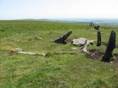
Stalldown Cairn Circle
Prehistoric Dartmoor Walks: Dartmoor Site: Stalldown Stone Row
OS Map: SX 63244 62423
HER: MDV4300
Megalithic Portal: 3474
PMD: Staldon Stone Row
Alternate name: Stalldown stone row Cairn Circle
Short Name: CC Staldon 1
Butler map: 54.18.1
Grinsell: COR 21
Turner: D26
DPD: 68
Dimensions (m): 5.0 x 0
Notes: Cairn in middle of length of stone row. "The northern part of the row is aligned precisely in the centre of the cairn circle, both of which would therefore seem part of the original design. The cairn is not visible from the south end of the southern extension of the row. This extension consists of four general alignments more of which focus on the cairn circle, and the northern end of the extension is tangential to the west side of the circle. These factors, and the larger size of the stones in the northern extension of the row, suggest two phases of construction." Butler Cairn 1 (Vol 3 54.18). Turner Type Diii 'Ring Setting with Central reduced to subsoil level or paved'.
Nearest Bus Stop: Cornwood Crossways (4.0 km) [Route: 59]
Nearby sites: SX 63244 62423
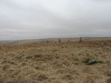
Stalldown Encircled Cairn
Prehistoric Dartmoor Walks: Dartmoor Site: Stalldown Stone Row [Photo Set 2]
OS Map: SX 63208 62489
HER: MDV4298
Megalithic Portal: 531
Alternate name: Stalldown Summit 3 Encircled Cairn
Short Name: EC Staldon 3
Butler map: 54.18.3
Grinsell: COR 19
Turner: F22
Dimensions (m): 14.5 x 0.5
Notes: Cairn with double or multiple ring. Butler Cairn 3 just to the west of the stone row, Butler Cairn 4 is just to the east. A flat topped turf-covered cairn 9.0m in diameter and 0.7m high, in good condition. Settings of Stones in and around the structure suggests a complex cairn circle. The author counted 17 stones in the circle around this cairn. This is difficult to see in the photo as most are concealed under vegetatio, the stone row can be seen in the background. Also visible towards the centre of the circle is a rectangular pit which is probably evidence of excavation. Turner F22, Type Fii
Nearest Bus Stop: Cornwood Crossways (4.0 km) [Route: 59]
Nearby sites: SX 63208 62489
Stalldown Stone Ring Cairn Circle
Prehistoric Dartmoor Walks: Dartmoor Site: Stalldown Stone Row [Photo Set 2]
OS Map: SX 63529 62310
HER: MDV4301
Megalithic Portal: 45819
Alternate name: Stalldown Summit 6 Stone Ring Cairn Circle
Short Name: RC Staldon 6
Butler map: 54.18.6
Turner: A4
Dimensions (m): 29.0 x 0.3
Notes: A circular turf-covered stone ring on the summit of Stalldown Barrow hill. It is 25.5m in diameter, comprising a bank of small stones, 2.0m to 3.0m wide and 0.2m to 0.7m high. There is a 5.0m gap in the south-west but no evidence of disturbance to the interior or of a surrounding ditch. Not far to the east is Hillson's House. Butler Cairn 6 (Vol 3 54.18).
Nearest Bus Stop: Cornwood Crossways (4.1 km) [Route: 59]
Nearby sites: SX 63529 62310
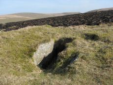
Stalldown (N) Platform Cairn Circle and Cist
Prehistoric Dartmoor Walks: Dartmoor Site: Stalldown Stone Row
OS Map: SX 63274 63239
HER: MDV4296
Megalithic Portal: 45688
PMD: Stall Moor N.
Alternate name: Stalldown N.9 Platform Cairn Circle and Cist
Short Name: CT Staldon 9
Butler map: 54.18.9
Dixon Cist #: 39
Grinsell: COR 13
Turner: E17
DPD: 69
Barrow Report: 14 37 62
Dimensions (m): 11.5 x 0.5 C
Notes: "A cist measuring 2 feet 3 inches wide at the south end, 1 foot 7 1/2 inches wide at the north and probably originally 3 feet 6 inches long. Both the coverstone and the north end stone are missing. The cist stands in a barrow which has a retaining circle, five stones of which are still erect, and one fallen. The largest stone is 3 feet 4 inches wide by 2 feet 7 inches high. The diameter of the retaining circle varies from 20 to 22 feet". Lethbridge p.69. diagram p.65 Cist 5. Butler Stalldown N. (Cairn 9) - Vol. 4. Map 54.18.9 (diagram p.62).
Nearest Bus Stop: Cornwood Crossways (4.6 km) [Route: 59]
Nearby sites: SX 63274 63239
Stalldown (W) Platform Cairn Circle and Cist
Prehistoric Dartmoor Walks: Dartmoor Site: Stalldown Stone Row
OS Map: SX 62833 62327
HER: MDV13234
Megalithic Portal: 45791
PMD: Stall Moor W.
Alternate name: Stalldown W.11 Platform Cairn Circle and Cist
Short Name: CT Stalldown W
Butler map: 54.18.11
Dixon Cist #: 133
Grinsell: COR 11c
Turner: E30
DPD: 67
Dimensions (m): 7.0 x 0.8 C
Notes: "This small round cairn, diameter 5.7 to 6.4m, height 0.5m, is built of small boulders ... It contains a cist, the south side stone, 1.2m long, both end stones, 0.4m long ...On the south side of the cairn 3 large stones, 0.8m to 1.0m long and set on edge are the probable remains of a kerb". Lethbridge pp.65-67. diagram p.65 Cist 4, photo p.67. Butler Stalldown W. (Cairn 11) - Vol. 4. Map 54.18.11 (p.61-2 diagram p.62).
Nearest Bus Stop: Cornwood Crossways (3.6 km) [Route: 59]
Nearby sites: SX 62833 62327
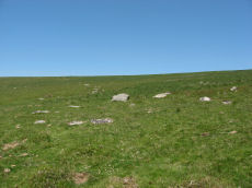
Stalldown Row Terminal Cairn Circle
Prehistoric Dartmoor Walks: Dartmoor Site: Stalldown Stone Row
OS Map: SX 63176 61737
HER: No record
Megalithic Portal: 531
PMD: Staldon Stone Row
Short Name: CC StallTermin
Butler Vol 5: p.20 & Fig.2
Notes: Unconfirmed terminal cairn. Not listed on HER or NMR
Nearest Bus Stop: Cornwood Crossways (3.5 km) [Route: 59]
Nearby sites: SX 63176 61737
Stan Lake Platform Cairn Circle
Prehistoric Dartmoor Walks: Dartmoor Walk: Sharpitor area Stone Rows and Cists
OS Map: SX 56896 70285
HER: MDV4996
Megalithic Portal: 45649
Short Name: PC:Stan Lake
Turner: E29
Dimensions (m): 4.2
Notes: "much disturbed". Alleged cairn circle. NMR record states "At SX 56897029, a felled conifer currently obscures much of what appears to be a hut circle rather than a cairn, situated on a south-east slope near a valley bottom. (Identification as a cairn may have originated with H. Breton)." Idenitified as a round house in the HER. This record is marked as a duplicate as it replicates PWD record SiteID=8769.
Nearest Bus Stop: Dousland Merrivale View Road (3.4 km) [Route: 55,56]
Nearby sites: SX 56896 70285
Standon Hill Ring Setting Cairn and Cist
OS Map: SX 54739 81371
HER: MDV20155
Megalithic Portal: 45794
PMD: Standon Down
Alternate name: Standon Hill W. Ring Setting Cairn and Cist
Short Name: CT:StandonW 1
Butler map: 32.17
Butler Vol 5: p.182 & Fig.124
Dixon Cist #: 137
Grinsell: PET 15
Turner: D15
Dimensions (m): c.5.0 x 0.3 C
Notes: Doubtful cist. "A disturbed cairn measuring 5.2m N to S by 6.0m and standing a maximum of 0.3m high. Eight large upright slabs and boulders, up to 0.6m high, lie on the fringe of the mound to create a substantial retaining circle. There is no evidence to suggest the presence of a cist though is seems likely that the interior of the cairn has been used as a repository for cleared stone. A large number of relatively recent clearance cairns lie in the immediate area." Butler Standon Hill W - Vol. 2. Map 32.17 (diagram Vol. 5. p.182).
Nearest Bus Stop: Dartmoor Inn (4.6 km) [Route: 118]
Nearby sites: SX 54739 81371
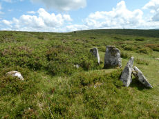
Stannon Little Newtake Ring Setting Cairn and Cist
OS Map: SX 65464 81068
HER: MDV6616
Megalithic Portal: 37598
PMD: Stannon Newtake
Alternate name: Stannon Newtake E. Ring Setting Cairn and Cist
Short Name: CT Stannon 1
Butler map: 35.21.1
Dixon Cist #: 72
Grinsell: LYD 29
Turner: D16
DPD: 124
Barrow Report: 57
Dimensions (m): 3.9 x 0.3 C
Notes: "Cairn survives as a 4.5 metre diameter mound up to 0.5 metres high. The western edge is denoted by a kerb of edge set slabs up to 1.15 metres high. The eastern edge is beneath a later boundary bank. A cist in the centre is a rectangular pit 1.2 metres by 0.5 metres denoted by edge set slabs". Butler Stannon Newtake E. - Vol. 2. Map 35.21 (diagram p.168). Visited again by the author 18/07/2025 and quite overgrown - the outer kerb can be seen but the cist is covered by vegetation. Breton p.45.
Nearest Bus Stop: Warren House Inn (2.0 km) [Route: 171]
Nearby sites: SX 65464 81068
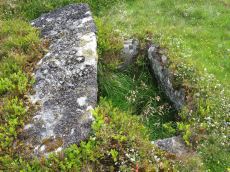
Stennen Hill No. 1 Platform Cairn Circle and Cist
OS Map: SX 62573 77905
HER: MDV5846
Megalithic Portal: 45736
PMD: Powder Mills W.
Alternate name: Stennen Hill 1 Platform Cairn Circle and Cist
Short Name: CT Stennen 1
Butler map: 29.11.1
Butler Vol 5: p.199 & Fig.142
Dixon Cist #: 76
Grinsell: LYD 47
Turner: E13
DPD: 111
Barrow Report: 57
Dimensions (m): 6.5 x 0.3 C
Notes: "Cist lies approximately in the centre of a subcircular cairn measuring 7 by 6.5m the longer axis and cist aligned nne to ssw. It is stony but almost turf-covered with 2 large kerbstones, including burnards `menhir' remaining in situ in the nw. The cist is flush with the cairn top, which is flattish and stands only 0.2m high on the nw but up to 0.7m high on the se, downhill side. This may be the cairn's original form; built into the slope as a flat platform with the cist visible (nmr citing pattison)". See also HER. Lethbridge photo top p.111. Butler Stennen Hill 1 - Vol. 2. Map 29.11 (diagram Vol. 5. p.199). NB. Worth & Grinsell name this Stennen Hill No. 1. Breton p.34.
Nearest Bus Stop: Powder Mills (1.3 km) [Route: 171]
Nearby sites: SX 62573 77905

Stonetor Hill Cairn Circle
OS Map: SX 65244 85468
HER: MDV49461
Megalithic Portal: 52273
Alternate name: Stonetor Hill 1 Cairn Circle
Short Name: CC Stonetor 1
Turner: G12
DPD: 133
Dimensions (m): 20
Notes: Dubious site. "Two upright slabs situated in the shallow valley bottom above the headmire of the E arm of the Stonetor Brook. The slabs, 1.2m high, are positioned in line 1.0m apart and lie on the boundary of Gidleigh Parish and the Forest of Dartmoor, now Dartmoor Forest parish. The N face of the E stone has the letters 'GP' (Gidleigh parish). The S face is lichen covered. A deep water filled erosion hollow lies on the N side of these stones". Possibly site listed as Stone Circle G12 by Turner. For a photo of this site, see Boundary stone on Stonetor Hill
Nearest Bus Stop (Minor): Wonson Telephone Box (4.6 km) [Route: 670]
Nearest Bus Stop (Major): Warren House Inn (5.0 km) [Route: 171]
Nearby sites: SX 65244 85468
Stonetor Hill Stone Ring Cairn Circle
OS Map: SX 6520 8536
HER: MDV48856
Megalithic Portal: 3478
Alternate name: Stonetor Hill 4 Stone Ring Cairn Circle
Short Name: RC:Stonetor 4
Turner: A3
DPD: 133
Dimensions (m): 25
Notes: Possible pound? "The feature consists of a sub-circular earthern bank 25m in diameter and up to 0.4m in height. It is best preserved on the North side where the bank is well defined, flat topped and has a plan width of about 4.0m On the South side the bank has been spread and flattened but still survives to 0.5m in height as a prominent outward-facing scarp, where the natural ground surface falls away from the enclsure. There is no entrance through the bank."
Nearest Bus Stop (Minor): Wonson Telephone Box (4.7 km) [Route: 670]
Nearest Bus Stop (Major): Warren House Inn (4.9 km) [Route: 171]
Nearby sites: SX 6520 8536
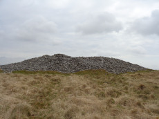
Three Barrows Cairn
Prehistoric Dartmoor Walks: Dartmoor Walk: The Erme East stone rows
OS Map: SX 65315 62601
HER: MDV5666
Megalithic Portal: 45593
PMD: Three Barrows NW
Alternate name: Three Barrows Central Cairn
Short Name: CN 3 Barrows
Butler map: 54.20
Butler Vol 5: p.53
Grinsell: BRE 6
Barrow Report: 1 56 63
Dimensions (m): 43.0 x 3.5
Notes: "Three very large cairns known as the Three Barrows (see SX 66 SE 54, 56), one of which, being about 50 yards in diameter, and 8 feet high, is reputed to be perhaps the largest on Dartmoor". See also HER Southern cairn 5830 and HER Northern cairn 5746
Nearest Bus Stop: South Brent Pool Park (5.6 km) [Route: 38]
Nearby sites: SX 65315 62601
Top Tor Cairn
OS Map: SX 73574 76472
HER: MDV7455
Megalithic Portal: 32049
Alternate name: Top Tor 1 Cairn
Short Name: CN:Top Tor 1
Butler map: 9.7.1
Grinsell: WID 11
Dimensions (m): 10.5 x 0.5
Notes: NMR C. "Cairns on Top Tor. Two inconspicuous cairns lie about 80 metres apart beside the track which follows the crest of the ridge on the north side of Top Tor. The cairn to the south is smaller at circa 7.5 metres diameter by 0.2 metres high and has a circle of ten slabs showing above the turf around the edge. This cairn has been reported to have a stone row running downhill to the north but the few earthfast slabs in this direction are no more numerous than elsewhere on the hillside and this seems unconvincing. Nearly 100 metres east of the southern cairn is an arc of three standing and two flat slabs representing about a quarter of a circle. The interior is quite flat except for a shallow trench but possibly the stones originally surrounded a cairn which has been completely removed. Other details: Map 9, Site 7."
Nearest Bus Stop (Minor): Widecombe in the Moor Car Park (1.7 km) [Route: 271]
Nearest Bus Stop (Major): Poundsgate Tavistock Inn (5.3 km) [Route: 172]
Nearby sites: SX 73574 76472
Tor Royal (newtake) Stone Ring Cairn Circle
OS Map: SX 62974 72262
HER: MDV18388
Megalithic Portal: 45831
Alternate name: Joan Ford's Newtake N.3 Stone Ring Cairn Circle
Short Name: RC JoanFd N3
Butler map: 63.3
Turner: A18
Dimensions (m): 11.0 x 0.3
Notes: "Disturbed ring cairn consisting of a stone ring 8.0 meters in diameter internally with bank 1.0 meter wide and 0.2 meters high." This feature was previously listed here at SX 62939 72246 but that is the location of the nearby cairn to the east of this ring cairn. This record has been updated with SX 62974 72262 from a visit on 04/09/23.
Nearest Bus Stop: Two Bridges Hotel (3.4 km) [Route: 98,171,172]
Nearby sites: SX 62974 72262
Tottiford Reservoir Mound Cairn
OS Map: SX 81121 83132
HER: MDV102544
Short Name: CN Tottiford
Notes: "A total of 156 pieces of worked flint were recovered from the excavation, with the majority of the material found consisting of debitage from flint working, most of which is small enough to qualify as chips. The small size of much of the material, the indications of blade and bladelet technology and one triangular platform rejuvenation flake, suggest a date in the (probably later) Meolithic for most of the material."
"A number of tools were recovered, including a neat end scraper of probable late Neolithic date, a notched flake of probable Meolithic date, an unstratified piercer and a crude end scraper from an unstratified location."
"The 2010 excavation of test pits on the mound confirmed the presence of worked flint and concluded the mound was a natural feature and also suggested that the presence of the flint could be the result of selective deposition by water originating upstream."
Nearest Bus Stop: Lustleigh Turn (2.4 km) [Route: 178]
Nearby sites: SX 81121 83132
Trendlebere Row S. Cairn
OS Map: SX 7662 7923
HER: MDV8077
Megalithic Portal: 4625
Alternate name: Trendlebere Stone Row S Cairn
Short Name: CN TrendleberS
Butler map: 2.7
Grinsell: MAN 14
Dimensions (m): 16.0 x 0.6
Notes: HER: Cairn at southern end of stone row MDV8076 on Trendlebere Down north-east slope of Black Hill. The cairn at the southern end of the row is centred at SX 7662 7923. Its perimeter can be traced on the ground but only a grass covered crescent of stones survives in the eastern half.
Nearest Bus Stop (Minor): Manaton Becky Falls (1.1 km) [Route: 271,671]
Nearest Bus Stop (Major): Lustleigh Bishops Stone (3.0 km) [Route: 178]
Nearby sites: SX 7662 7923
Trowlesworthy Warren Platform Cairn Circle and Cist
Prehistoric Dartmoor Walks: Dartmoor Site: Trowlesworthy, Settlements, Stone Row & Cairn Circle
OS Map: SX 57146 64757
HER: MDV28570
Megalithic Portal: 45773
PMD: Trowlesworthy Warren
Short Name: CT Trowles
Butler map: 51.1
Dixon Cist #: 112
Grinsell: SHA 30a
Turner: E40
DPD: 55
Dimensions (m): 4.0 x 0.2 C
Notes: "A round cairn and cist, located 370 metres east of Trowlesworthy Warren House. The cairn mound measures 5.2 metres in diameter and stands up to 0.1 metres high. Its perimeter is defined by a kerb of at least eight stones." One side stone is missing, capstone present. Lethbridge p.54-5 Trowlesworthy Farm Cist - diagram p.54, photo p.55. Butler Vol. 3. Map 51.1 (diagram p.158).
Nearest Bus Stop: Lee Moor Clearview (2.9 km) [Route: 59]
Nearby sites: SX 57146 64757
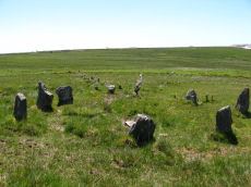
Trowlesworthy Warren (E) Cairn Circle
Prehistoric Dartmoor Walks: Dartmoor Site: Trowlesworthy, Settlements, Stone Row & Cairn Circle
OS Map: SX 57651 63983
HER: MDV49511
Megalithic Portal: 529
PMD: Trowlesworthy E Stone Row
Alternate name: Trowlesworthy stone row 1 Cairn Circle
Short Name: CC Trowles E
Butler map: 51.8.1
Butler Vol 5: p.229 & Fig.163
Grinsell: SHA 44
Turner: G25
DPD: 58
Dimensions (m): 6.6 x 0
Notes: Cairn circle at head of stone row. "The circle 6.5m. in diameter comprises eight orthostats from 0.7m. to 1.5m. high. In some cases the 'trig' stones are visible." "The alleged cairn at the head of the row comprises a ring of eight stones a maximum of 1.2m high with no evidence of a cist and very little to suggest the former presence of a cairn. It would seem more likely to represent the remains of a small stone circle albeit only 6.0 to 6.5m in diameter." See also, Legendary Dartmoor: The Pulpit. Lethbridge p.57-8, diagram p.58.
Nearest Bus Stop: Lee Moor Clearview (2.2 km) [Route: 59]
Nearby sites: SX 57651 63983
Trowlesworthy Warren (W) Cairn Circle
Prehistoric Dartmoor Walks: Dartmoor Site: Trowlesworthy, Settlements, Stone Row & Cairn Circle
OS Map: SX 57544 63986
HER: MDV49509
Megalithic Portal: 3517
PMD: Trowlesworthy W Stone Row
Alternate name: Trowlesworthy stone row 2 Cairn Circle
Short Name: CC Trowles W
Butler map: 51.8.2
Grinsell: SHA 43
Turner: G26
Dimensions (m): 5.5 x 0.3
Notes: This is a cairn circle at the east end of the Trowlesworthy Warren (W) stone row. "At the east is a 4.5m. diameter circle of 10 stones; average height 0.4m. There is no visible cairn or cist in the centre. Two upright stones immediately to the north west of the circle are probably associated. "
Nearest Bus Stop: Lee Moor Clearview (2.1 km) [Route: 59]
Nearby sites: SX 57544 63986
Two Barrows Stone Ring Cairn Circle
OS Map: SX 70654 79219
HER: MDV7409
Megalithic Portal: 16632
Alternate name: Two Barrows 1 Stone Ring Cairn Circle
Short Name: RC TwoBarrows1
Butler map: 20.11.1
Butler Vol 5: p.23 & Fig.106
Grinsell: MAN 12
Barrow Report: 21 56
Dimensions (m): 17.0 x 1.4
Notes: "The northern barrow was excavated in 1872. It measures 40 feet in diameter and 4 1/2 feet high. A ring of stones encircled the barrow and in the centre was a small cairn. A cremation burial was found to the SE of the centre covered by five flat stones. With the cremation was the blade of a bronze dagger and a pommel made from amber with a decoration consisting of rows of gold pins" See: Bate, C Spence, Researches into Some Antient Tumuli on Dartmoor, T.D.A. Vol. 5 pp.549-58 (1872). Relevant Butler map Vol. 1. Map 20. Butler Volume 1 Map 20.11 Two Barrows 1. [N.b. Treated as Turner type Stone Ring Cairn circle from the description].
Nearest Bus Stop (Minor): Widecombe in the Moor Car Park (2.7 km) [Route: 271]
Nearest Bus Stop (Major): Warren House Inn (3.6 km) [Route: 171]
Nearby sites: SX 70654 79219
Two Barrows S Cairn
OS Map: SX 70663 79203
HER: MDV7411
Megalithic Portal: 16632
Alternate name: Two Barrows 2 Cairn
Short Name: CN TwoBarrows2
Butler map: 20.11.2
Butler Vol 5: p.23 & Fig.106
Grinsell: WID 3
Dimensions (m): 11.5 x 1.0
Notes: Two Barrows 2. An oval, stony mound measuring 15.5m E-W and 10.5m N-S. It stands up to 1.1m high and was probably originally bowl-profiled. The N slope is spit by a narrow path and a N-S slope across the top of the barrow has caused minor damage. It appears to be unexcavated. The mounds is crossed by a maintained drystone field wall, approaching from the SE and turning W on the barrow. The wall is built over the mound and does not seem to have caused much damage. This barrow appears to have been a target point for a reave, Fleming's Hameldon South, approaching from the E and stopping 3.5m short of the mound. The reave line is continued W by the modern wall beyond the barrow. See also: Bate, C Spence, Researches into Some Antient Tumuli on Dartmoor, T.D.A. Vol. 5 pp.549-58 (1872). Butler Volume 1 Map 20.11
Nearest Bus Stop (Minor): Widecombe in the Moor Car Park (2.7 km) [Route: 271]
Nearest Bus Stop (Major): Warren House Inn (3.7 km) [Route: 171]
Nearby sites: SX 70663 79203
Tynacombe Stone Ring Cairn Circle
OS Map: SX 7037 6328
HER: MDV13638
Megalithic Portal: 45832
Short Name: RC:Tynacombe
Turner: A20
Dimensions (m): 7.5
Notes: "Ring cairn. Thynacombe stone ring 7.5 meters in diameter internally, with bank 1.5 meters wide and 0.2 meters high, damaged on the east side."
Nearest Bus Stop: South Brent Pool Park (3.4 km) [Route: 38]
Nearby sites: SX 7037 6328
Tynacombe 2 Clearance Cairn
OS Map: SX 703 633
HER: MDV13636
Megalithic Portal: 45832
Short Name: CN:Tynacombe2
Dimensions (m): 16 x 4
Notes: HER: Remains of barrow. Thinacombes. Possible field clearance cairn. Vis=-/5/1968? (robinson, r. ). A long narrow heap of stones, partly turfed over in the nw corner of field os no 1863, tithe apportionment no.206(1843) 'cold east field'. It measures 16m x 4m lying roughly e-w with the w end about 26m from the west field boundary. It has well defined edge to the s giving a height of about 0.5m but on the n or uphill side it merges into the slope. This may well represent field clearance. There is another possible ring cairn in the same field. The area is slate and the stones comprising the heap, where visible are small pieces of slate. This has been inspected by mr. T. Greeves who considered the site a very doubtful barrow or the result of field clearance. Vis=not visible on raf 1948 aph (rchm aph 1985).
Nearest Bus Stop: South Brent Pool Park (3.4 km) [Route: 38]
Nearby sites: SX 703 633
Upper Erme Cairn
OS Map: SX 63522 64958
HER: MDV4366
Megalithic Portal: 15210
Alternate name: Erme Plains Cairn
Short Name: CN Upper Erme
Butler map: 55.7.2
Grinsell: COR 9
Dimensions (m): 16.0 x 1.5
Notes: "A round cairn, measuring 13.8 to 14.6m diameter and 1.0m high. It lies on a false crest, adjacent to a stone row, SX 66 NW 20, and just above the River Erme, at 380m above OD, is constructed of small boulders, and has a central hollow, 0.7m deep. In fair condition, though a small shelter has been built on its north side." The photo used here was taken in 2011 and attached to this record retrospectively in 2020 - identification is most probable but not 100% certain.
Nearest Bus Stop: Cornwood Crossways (6.2 km) [Route: 59]
Nearby sites: SX 63522 64958
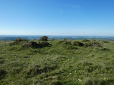
Watchet Hill Cairn
OS Map: SX 61477 93055
HER: MDV13049
Megalithic Portal: 23222
Short Name: CN WatchetHill
Butler map: 40.12
Grinsell: BEL 3
Dimensions (m): c.14.0 x 0.8
Notes: "A Bronze Age round cairn situated on the summit of Watchet Hill. The cairn survives as a 0.8 metre high oval mound measuring 16.6 metres long north to south by 13.8 metres wide east to west. A T-shaped trench, the consequence of a partial early excavation, cuts through the central part of the mound. Adjacent to the south eastern side of the mound there is a 2.3 metre wide and 0.2 metre deep ditch. This represents the remains of the quarry ditch from which material was derived during the construction of the cairn. The ditch would have originally surrounded the mound but now survives largely as a buried feature."
Nearest Bus Stop (Minor): Belstone Car Park (1.0 km) [Route: 670]
Nearest Bus Stop (Major): Belstone Tongue End Cross (2.0 km) [Route: 178,670,671,6A]
Nearby sites: SX 61477 93055
Weatherdon Hill Stone Ring Cairn Circle
OS Map: SX 6516 5889
HER: MDV13165
Megalithic Portal: 45835
Alternate name: Wetherdon Hill 20 Stone Ring Cairn Circle
Short Name: RC:Wetherdon20
Butler map: 53.9.20
Grinsell: HAR 14a
Turner: A28
Dimensions (m): 6.0
Notes: "Weatherdon hill (4): diameter approx.5.6m ht. Approx 0.15m. Alt. C.335-340m." "Mr. L. V. Grinsell noted a small cairn-circle or ring-cairn a short distance south of cairn 2 on weatherdon hill."
Nearest Bus Stop: Ivybridge BP Garage (Stop B) (3.1 km) [Route: 38]
Nearby sites: SX 6516 5889
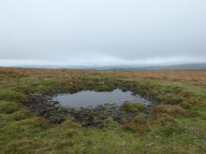
Weatherdon Hill Ancient Pool
OS Map: SX 65619 58948
HER: MDV127227
Alternate name: Wetherdon Hill Ancient Pool
Short Name: PO:Wetherdon
Dimensions (m): 13 x 10.5m
Notes: "A pool, one of over 40 such 'sacred' pools identified on Dartmoor that are thought to have potentially been designed during the prehistoric period. Lies adjacent to the Butterdon Hill stone row. Sub-rectangular shallow pit of 11 metres by 15 metres and 0.5 metres deep. Part of disused peat cutting in the area to the south end of the stone row."
Nearest Bus Stop: Ivybridge BP Garage (Stop B) (3.4 km) [Route: 38]
Nearby sites: SX 65619 58948
Western White Barrow Cairn
OS Map: SX 65363 65487
HER: MDV5193
Megalithic Portal: 28710
Short Name: CN:W White Bar
Butler map: 57.28
Grinsell: LYD 104
DPD: 86
Dimensions (m): 24.0 x 1.5
Notes: Western Whittabarrow or Whittaburrow. "A large cairn measuring 21 by 17.5 metres wide with a maximum height of 1.7 metres. It has been badly mutilated by the construction of a two room building within it."
Nearest Bus Stop: South Brent Pool Park (7.4 km) [Route: 38]
Nearby sites: SX 65363 65487
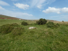
Whitchurch Common (N) Stone Ring Cairn Circle
OS Map: SX 53020 75005
HER: MDV4115
Megalithic Portal: 3535
Alternate name: Whitchurch Common N. Stone Ring Cairn Circle
Short Name: RC Whitchurch1
Turner: A41
Dimensions (m): 5.5
Notes: Hut Circle or ring cairn? "Ring cairn with entrance. Stone ring 5.5m internal diam, with bank 1.5m wide and 0.4m high.2.5m wide entrance on ssw side" " A hut with an internal diam of 5.8m and walling 1.5m wide and 0.4m high; there is an entrance gap in the sw. This is evidently grinsell's cairn and worth's barrow.(broadly it is on the n slope of barn hill as stated by worth, but locally on the sw slope). While the structure might in isolation be construed as a cairn, the lack of any internal stone, the consistently smooth angle of the inner face of the wall and the presence of other huts and a field system militate against the worth and grinsell classifications"
Nearest Bus Stop: Tavistock Higher Longford (1.4 km) [Route: 98,171,172]
Nearby sites: SX 53020 75005
Whitchurch Down (Warrens Cross) Ancient Pool
OS Map: SX 51153 73688
HER: MDV127230
Short Name: PO:Whitchurch
Dimensions (m): 38 x 18m
Notes: "A pool measuring 38 by 18m. One of over 40 such 'sacred' pools identified on Dartmoor that are thought to have potentially been designed during the prehistoric period."
Nearest Bus Stop: Tavistock Higher Longford (1.2 km) [Route: 98,171,172]
Nearby sites: SX 51153 73688
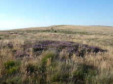
White Moor Cairn
OS Map: SX 63299 89545
HER: MDV4372
Megalithic Portal: 10327
Alternate name: White Moor Stone (NW of) Cairn
Short Name: CN White Moor
Butler map: 40.5
Grinsell: ST 7
Dimensions (m): 8.5 x 0.8
Notes: "Cairn, nw of white moor stone … turf and heather covered, in good condition … small cairn 64m nw of whitmoor stone, … (grinsell) cairn, slightly hollowed towards centre. Diameter 7.0m, height 0.6m"
Nearest Bus Stop (Minor): Throwleigh Cross (3.8 km) [Route: 670]
Nearest Bus Stop (Major): Ramsley (4.0 km) [Route: 670,671,6A]
Nearby sites: SX 63299 89545
White Tor Stone Ring Cairn Circle
OS Map: SX 54597 78701
HER: MDV4164
Megalithic Portal: 35804
Alternate name: White Tor E.1 Stone Ring Cairn Circle
Short Name: RC White E1
Butler map: 31.22.1
Grinsell: PET 24
Turner: A26
Dimensions (m): 7.8 x 0.2
Notes: See also duplicate 439800. Turner A26. Butler White Tor E.1. "Round cairn 340 metres east of White Tor summit. This monument includes a round cairn situated on a gentle south-east facing slope overlooking the valley of the River Walkham. The cairn mound measures 6m in diameter and stands up to 0.4m high. A hollow in the centre of the mound measuring 3m in diameter and 0.3m deep is the result of a partial excavation carried out by the Dartmoor Exploration Committee in 1899. This work recovered a perforated stone. A kerb of small stones defines the outer edge of the mound."
Nearest Bus Stop: Merrivale Dartmoor Inn (3.5 km) [Route: 98,171,172]
Nearby sites: SX 54597 78701
Wigford Down Stone Ring Cairn Circle
OS Map: SX 5469 6505
HER: MDV48904
Megalithic Portal: 3536
Alternate name: Wigford Down 9 Stone Ring Cairn Circle
Short Name: RC:Wigford 9
Butler map: 48.1.9
Grinsell: MEA 3a
Turner: A31
Dimensions (m): 6.0 x 0.3
Notes: "Ring cairn, wigford down. Internal diam 2.7m, with bank 1m wide and 0.2m high. Smallest ring cairn (diam) on dartmoor. Turner suggests a link between the construction of this, small, ring cairn, with the larger cairn sx56nw/11 to its nw."
Nearest Bus Stop: Shaugh Prior White Thorn Inn (2.0 km) [Route: 59]
Nearby sites: SX 5469 6505
Wigford Down Platform Cairn Circle and Cist
OS Map: SX 54419 64427
HER: MDV2373
Megalithic Portal: 3536
PMD: Wigford Down S.
Alternate name: Wigford Down 1 Platform Cairn Circle and Cist
Short Name: CT:Wigford 1
Butler map: 48.1.1
Dixon Cist #: 1
Grinsell: MEA 7
Turner: E6
DPD: 33
Barrow Report: 12 19
Dimensions (m): 8.5 x 0.6 C
Notes: "A badly disturbed prehistoric cist with displaced cover stone and vestiges of a retaining circle surviving in situ. Only five slabs of the retaining circle survive approximately upright in situ, suggesting the overall diameter of the complete circle was 8.35m. The long slabs of the central cist are also in situ and the chamber measures 1.1m by 0.28m approximately by 0.3m deep. A large, flat, intact cover stone of 1.4m by 1.17m, with a rounded end, is displaced to the south. Some material from the turf covered cairn is still visible, but much disturbed and depleted." Butler Wigford Down 1 - Vol. 3. Map 48.1 (diagram p.80).
Nearest Bus Stop: Shaugh Prior White Thorn Inn (1.3 km) [Route: 59]
Nearby sites: SX 54419 64427
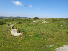
Wigford Down Cairn Circle
OS Map: SX 54172 65243
HER: MDV2300
Alternate name: Wigford Down 12 Cairn Circle
Short Name: CN Wigford12
Grinsell: MEA 2a
Dimensions (m): 8 x 0.6
Notes: Retaining circle on nw slope of wigford down a little way to north of a green track which leads from the salient point of the enclosure wall between Urgles and Higher Bellever to the high road near durance.183m away lies a pound with two hut circles associated. Southern circumference of circle has been robbed and stones of cairn removed. The stones of the circle are small, only one exceeding 1.22m
Nearest Bus Stop: Shaugh Prior Shaugh Bridge (1.9 km) [Route: 59]
Nearby sites: SX 54172 65243
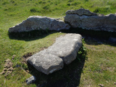
Wigford Down (S) Stone Ring Cairn Circle
OS Map: SX 54702 64962
HER: MDV2367
Megalithic Portal: 3536
PMD: Wigford Down Summit
Alternate name: Wigford Down 5 Stone Ring Cairn Circle
Short Name: RC Wigford 5
Butler map: 48.1.5
Grinsell: MEA 7b
Turner: B9
Barrow Report: 62
Dimensions (m): 7.62
Notes: "One of two cairn circles, both in a raised platform. Ring of large stones. Cist cover in centre. Diam 7.62m.". This site could also be a hut circle - it is unclear whether the large slab is a cist cover or not. See Butler Vol 3 p.97 fig. 48.1.2 Wigford Down 4 in Barrow Report 62. NMR A.
Nearest Bus Stop: Shaugh Prior White Thorn Inn (1.9 km) [Route: 59]
Nearby sites: SX 54702 64962
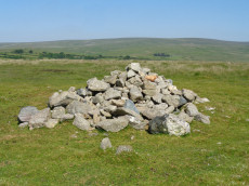
Wigford Down 2 Cairn
OS Map: SX 54675 65110
HER: MDV2312
Short Name: CN Wigford 2
Butler map: 48.1.2
Grinsell: MEA 2
Barrow Report: 62
Dimensions (m): 26.0 x 0.4
Notes: The remains of a disturbed prehistoric cairn. It was re-used as an observation post during World War Two. Wigford Down 1 in Barrow Report 62.
Nearest Bus Stop: Shaugh Prior Shaugh Bridge (2.0 km) [Route: 59]
Nearby sites: SX 54675 65110
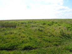
Wigford Down 4 Embanked Cairn Circle
OS Map: SX 54694 64972
HER: MDV2368
Megalithic Portal: 3536
Short Name: CC Wigford 4
Butler map: 48.1.4
Grinsell: MEA 7a
Turner: A39
Barrow Report: 12 62
Dimensions (m): 10.0 x 0.5
Notes: Listed as Wigford Down B on Tom Greeves list of potential 'Sacred' Pools.
NMR B. "Stone ring, diam 10.5m, with bank 2.5m wide and 0.5m high.3m wide entrance on s side" See Butler Vol 3 p.97 fig. 48.1.2. Wigford Down 3 in Barrow Report 62.
This ring cairn survives as a circular bank measuring up to 3.5 metres wide and 0.75 metres high which surrounds a flat interior up to 17.5 metres in diameter. There is evidence for partial early excavation or robbing on the south west side. Noted in 2019 as a possible 'sacred' pool.
Nearest Bus Stop: Shaugh Prior White Thorn Inn (1.9 km) [Route: 59]
Nearby sites: SX 54694 64972
Wigford Down C Ancient Pool
OS Map: SX 54733 64981
HER: MDV127231
Short Name: PO:WigfordC
Dimensions (m): 22 x 17.5m
Notes: "A pool measuring 22 by 17.5m. One of over 40 such 'sacred' pools identified on Dartmoor that are thought to have potentially been designed during the prehistoric period. Lies near two cairns"
Nearest Bus Stop: Shaugh Prior White Thorn Inn (1.9 km) [Route: 59]
Nearby sites: SX 54733 64981
Willings Walls Reave Stone Ring Cairn Circle
OS Map: SX 5822 6520
HER: MDV56777
Megalithic Portal: 45834
Alternate name: Willings Walls 1 Stone Ring Cairn Circle
Short Name: RC:Willings 1
Butler map: 51.6.1
Turner: A23
Dimensions (m): 5.0 x 3.0 x 0.3
Notes: "Ring cairn willings walls reave. Stone ring with internal diam 6.8m, bank 1.5m wide and 0.5m high. Just outside a break in the reave"
Nearest Bus Stop: Lee Moor Clearview (3.5 km) [Route: 59]
Nearby sites: SX 5822 6520
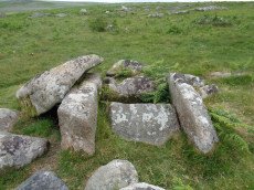
Willings Walls Warren Platform Cairn Circle and Cist
OS Map: SX 58279 65240
HER: MDV4021
Megalithic Portal: 45711
PMD: Willings Walls Warren S.
Alternate name: Willings Walls 2 Platform Cairn Circle and Cist
Short Name: CT Willings 2
Butler map: 51.6.2
Dixon Cist #: 48
Grinsell: SHA 25
Turner: E36
DPD: 53
Barrow Report: 51
Dimensions (m): 4.0 x 0.2 C
Notes: "Remains of a kerbed cairn with cist On a slight NW slope near a reave. The cairn is 4.6m in diameter and 0.6m high. Within the outer ring of stones is a second ring of boulders not shown on Worth's plan but which may represent an inner kerb. The cist is 1.8m by 0.9m and 0.5m deep with an adjacent coverstone." Lethbridge p.52-3 Willingswalls Cist 2 (E of Reave) - diagram p52, photo p.53. Butler Willings Walls 2 - Vol. 3. Map 51.6 (diagram p.165).
Nearest Bus Stop: Lee Moor Clearview (3.5 km) [Route: 59]
Nearby sites: SX 58279 65240
Willings Walls Warren Stone Ring Cairn Circle
OS Map: SX 5818 6517
HER: MDV3438
Megalithic Portal: 1358
PMD: Willings Walls Warren Stone Circle
Alternate name: Willings Walls 5 Stone Ring Cairn Circle
Short Name: RC:Willings 5
Turner: A1
Dimensions (m): 41
Notes: "Willings walls warren, lee moor. Unusual stone circle. Two kists nearby. Plan. A reave interferes with the circumference of the circle. Four groups of stones are in the circle. No trace of barrow within the circle; and no evidence to show that the stones were ever cists (worth)." A 40m diameter circle consisting of 5 groups of stones. It touches and is incorporated into the Willings Walls Reave. Lethbridge p.52-3 Willingswalls Stone Circle - diagram p52.
Nearest Bus Stop: Lee Moor Clearview (3.4 km) [Route: 59]
Nearby sites: SX 5818 6517
Wittaburrow Cairn
OS Map: SX 73353 75214
HER: MDV7537
Megalithic Portal: 32069
Alternate name: Wittaburrow 1 Cairn
Short Name: CN:Wittaburr 1
Butler map: 9.9.1
Grinsell: WID 15
Dimensions (m): 22.0
Notes: "A large stony round cairn, south of Wittaburrow. The mound has a 25 metre diameter at base, but the structure has been much altered, probably robbed, and is now quite low in places. A ‘bite-shaped’ section is missing from the main mound on the south-eastern side where a smaller cairn, which is unlikely to be an original feature, stands within the original spread of the monument. Two large hollows have been dug into the main mound which, overall, survives in a very uneven state."
Nearest Bus Stop (Minor): Widecombe in the Moor Car Park (2.2 km) [Route: 271]
Nearest Bus Stop (Major): Poundsgate Tavistock Inn (4.2 km) [Route: 172]
Nearby sites: SX 73353 75214

Yar Tor (Money Pit) Platform Cairn Circle and Cist
OS Map: SX 68181 73865
HER: MDV6460
Megalithic Portal: 1369
PMD: Money Pit
Alternate name: Money Pit Platform Cairn Circle and Cist
Short Name: CT Money Pit
Butler map: 14.11
Butler Vol 5: p.23 & Fig.4
Dixon Cist #: 69
Grinsell: WID 21
Turner: E51
DPD: 122
Barrow Report: 56 62
Dimensions (m): c3.2 cist 1.0 x 0.4
Notes: "The south cairn is a very spread and slight earthwork with a centrally placed cist. Only the north and west side slabs of the cist remain in situ though a misplaced slab lies to one side of the chamber. Eleven slabs forming a kerb of approximately 3m surrounding the cist remain in situ. Several additional stones survive, protruding just above the surface of the flattened cairn, which are likely to be evidence of an outer circle with a diameter of approximately 11m". Lethbridge diagram p.122 and photo bottom p.122. Butler Money Pit - Vol. 1. Map 14.11 (photo on p.92, diagram pp.125-6).
Nearest Bus Stop: Dartmeet Badgers Holt (1.1 km) [Route: 172]
Nearby sites: SX 68181 73865

Yar Tor Summit Cairn
OS Map: SX 67865 73943
HER: MDV6434
Megalithic Portal: 11065
Alternate name: Yar Tor summit Cairn
Short Name: CN:Yar Tor Sum
Butler map: 14.8
Grinsell: WID 20
Barrow Report: 56
Dimensions (m): c.18.0
Notes: "Large cairn (approximately 18.0 metres) built on the summit of Yar Tor; the stones have been rearranged to form a shelter. This cairn is aligned with a reave; part of the Dartmeet parallel reave system."
Nearest Bus Stop: Dartmeet Badgers Holt (1.0 km) [Route: 172]
Nearby sites: SX 67865 73943
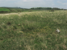
Yellowmead Down Encircled Cairn
Prehistoric Dartmoor Walks: Dartmoor Site: Yellowmead 4-fold Cairn Circle
OS Map: SX 57535 67861
HER: MDV4025
Megalithic Portal: 31040
Alternate name: Yellowmead Down 1 Encircled Cairn
Short Name: EC Yellowmd 1
Butler map: 47.14.1
Grinsell: SHE 5
Turner: F21
DPD: 31
Barrow Report: 41
Dimensions (m): 3.5 x 0.2
Notes: Cairn around 50 meters north-east of the Yellowmead stone circles, consisting of an earth and stone mound approximately 4 meters in diameter and up to 0.3 meters high. Four stones of a retaining kerb on its west and south sides. Turner F21.
Nearest Bus Stop: Meavy Primary School (3.2 km) [Route: 56]
Nearby sites: SX 57535 67861
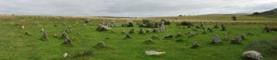
Yellowmead Fourfold Cairn Circle
Prehistoric Dartmoor Walks: Dartmoor Site: Yellowmead 4-fold Cairn Circle
OS Map: SX 57488 67846
HER: MDV3338
Megalithic Portal: 1371
PMD: Yellowmead Stone Circles
Alternate name: Yellowmead fourfold circle Cairn Circle
Short Name: CC Fourfold
Butler map: 47.14
Grinsell: SHE 4
Turner: G30
DPD: 31
Barrow Report: 41 56
Dimensions (m): 19.0 x 0
Notes: "A group of four concentric stone circles of which the innermost one is considered to be a cairn circle. Three stones were standing in 1921 when all the fallen stones were raised during restoration. There also appears to have been a stone row leading away from the stone circles." See also, Legendary Dartmoor: Yellowmead Stone Circle. Breton, see Megalithic circles on Yellowmead Down, Sheepstor (Heart of Dartmoor pp.89-91).
Nearest Bus Stop: Meavy Primary School (3.1 km) [Route: 56]
Nearby sites: SX 57488 67846
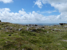
Yes Tor E Cairn
OS Map: SX 58044 90185
HER: MDV4814
Megalithic Portal: 36416
Alternate name: Yes Tor 2 Cairn
Short Name: CN Yes Tor E
Butler map: 42.1.2
Grinsell: OKE 2
Dimensions (m): 20+
Notes: One of two cairns on Yes Tor. On the top of the flat outcrop of Yes Tor and piled against the west side is an amorphous mass of stones representing a ruined cairn. The patch of stones on the top is more or less 14.0m across and 0.3 m high and the piling against the outcrop is 2.3m high. It is possible that this has resulted from bulldozing the cairn over the side of the outcrop but the stones appear quite stable and compacted.
The central excavation is approximately 12.0m across and extends to 0.5m below the natural ground level. In the base of the hollow and on its south side are three partly buried slabs each about 1.7m long, 0.2m thick and more than 0.5m wide, which look like the displaced remains of a former cist.
Nearest Bus Stop: Okehampton Railway Station (4.4 km) [Route: 118,306,6A]
Nearby sites: SX 58044 90185
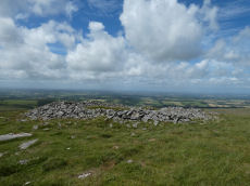
Yes Tor W Cairn
OS Map: SX 57955 90210
HER: MDV4813
Megalithic Portal: 36416
Alternate name: Yes Tor 1 Cairn
Short Name: CN Yes Tor W
Butler map: 42.1.1
Grinsell: OKE 1
Dimensions (m): 29
Notes: Western of two round barrows on the summit of yes tor. About 36.6m nw of flag staff on the top of yes tor is an incomplete ring of rough granite boulders varying in size but generally 0.3m - 0.9m. Long. The ring is about 6.1m long and is defective on the north east side where there is evidence of a slightly sunken trackway. In the interior of this ring the ground is slightly irregular and contains blocks of granite. At the south western part of the circle a smaller circle of stones abuts on the previous circle. Butler Volume 2 Map 42.1.
Nearest Bus Stop: Okehampton Railway Station (4.4 km) [Route: 118,306,6A]
Nearby sites: SX 57955 90210